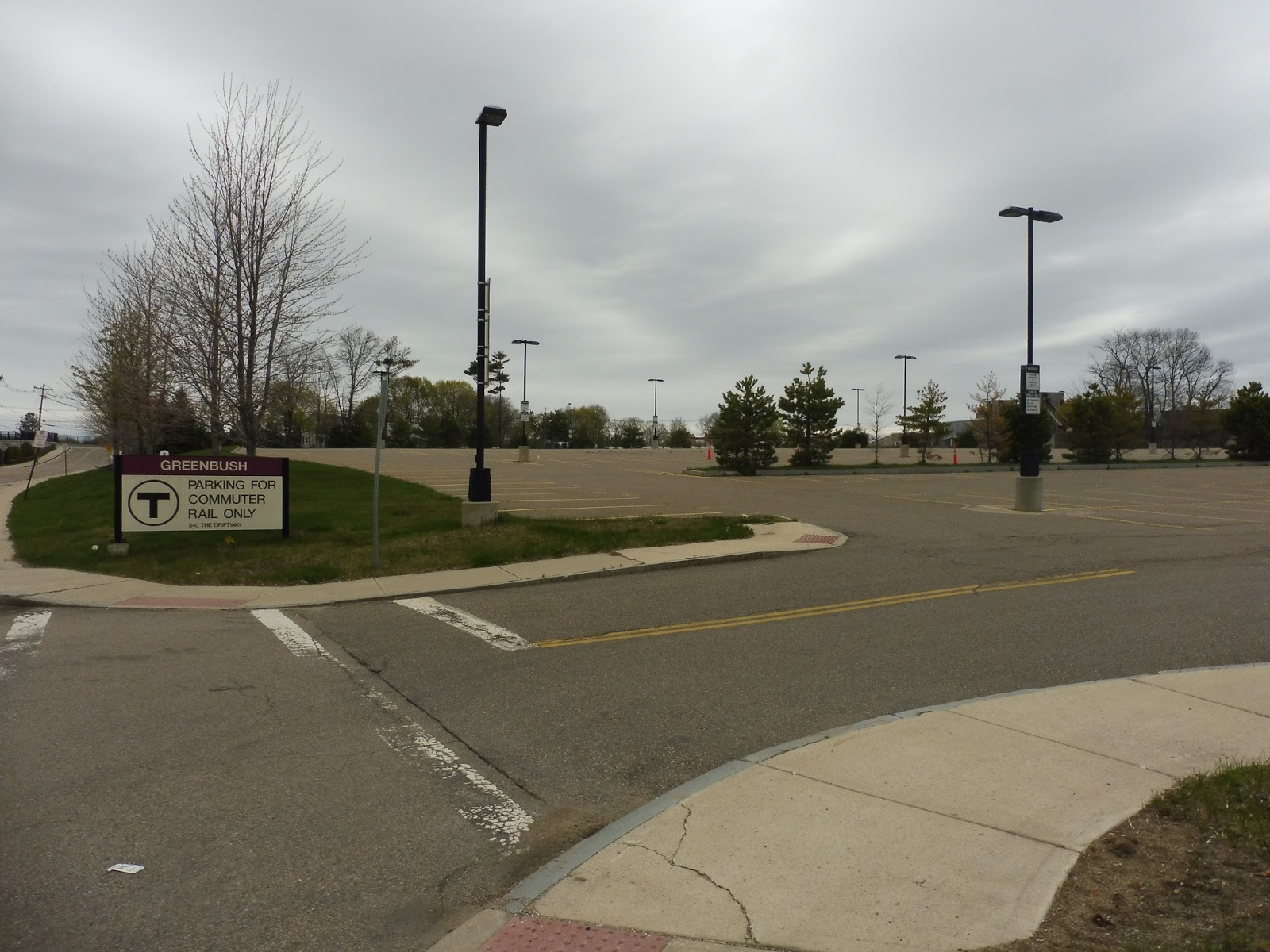
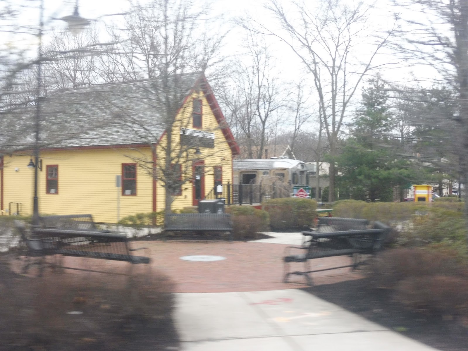
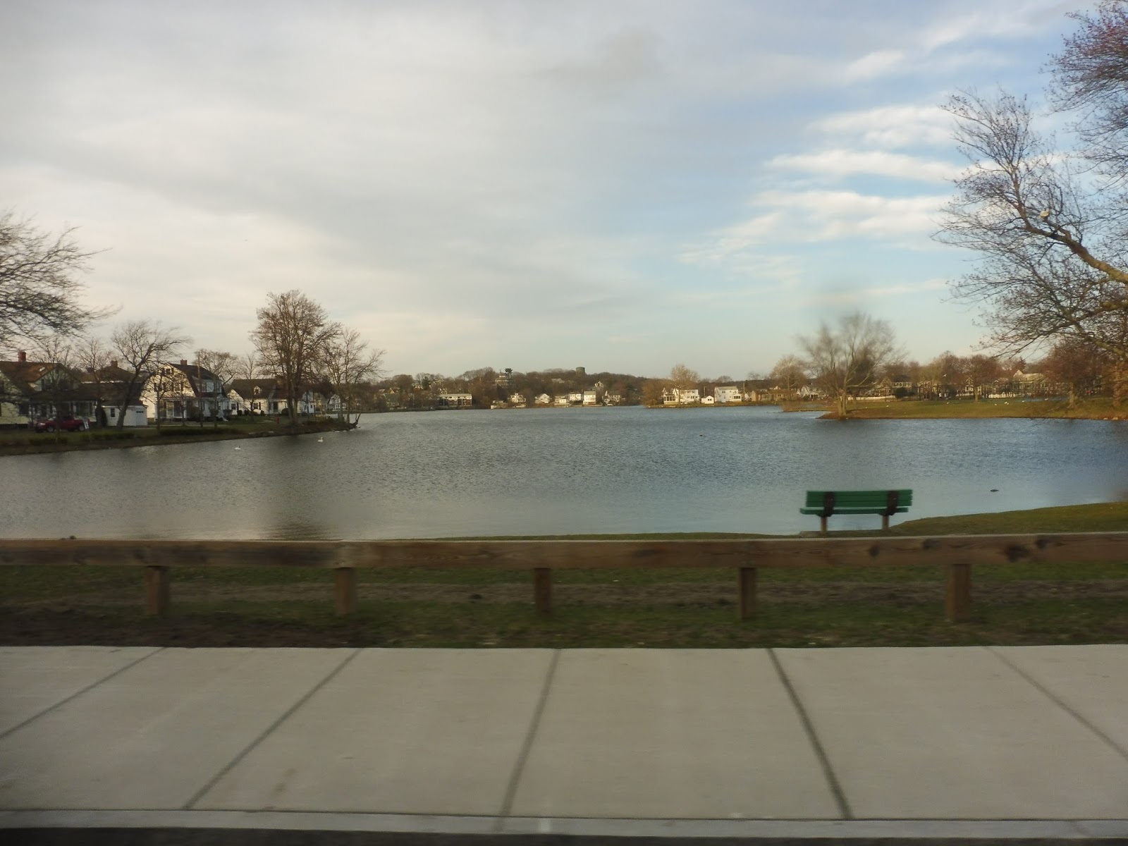
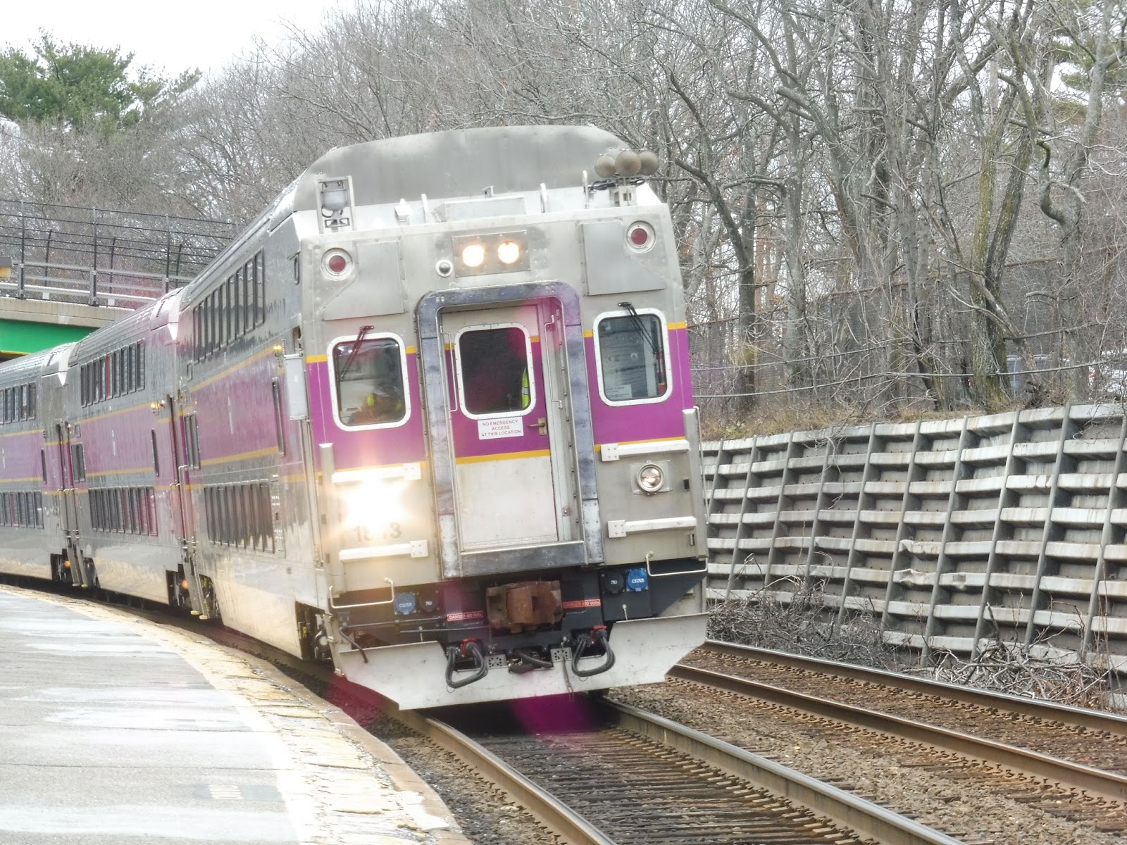
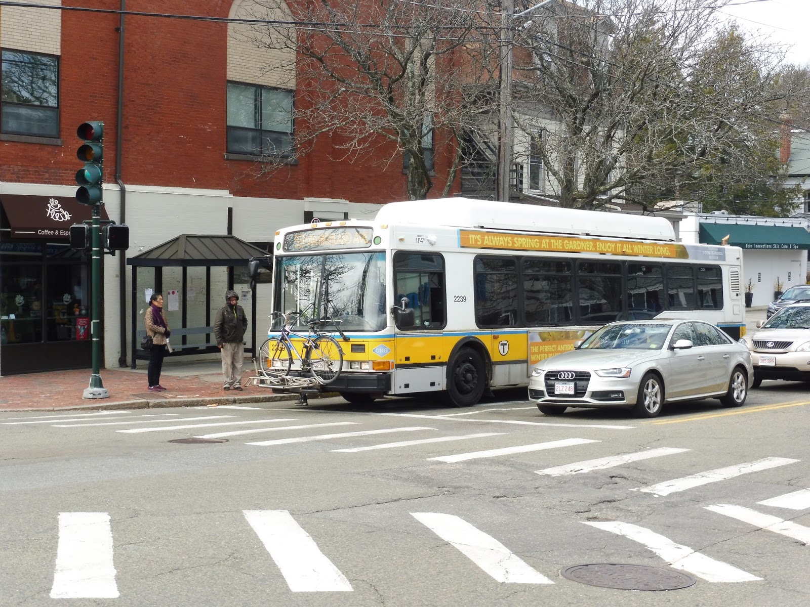
Greenbush
Greenbush doesn’t really have the same end-of-the-line feel that many Commuter Rail termini have. After all, this station is effectively in the middle of nowhere, whereas a lot of the Commuter Rail’s biggest terminals are right in downtowns of cities. Still, despite not being a huge station with a bunch of amenities, Greenbush still has a good amount of charm and tranquility.
 |
| Wooooooo… |
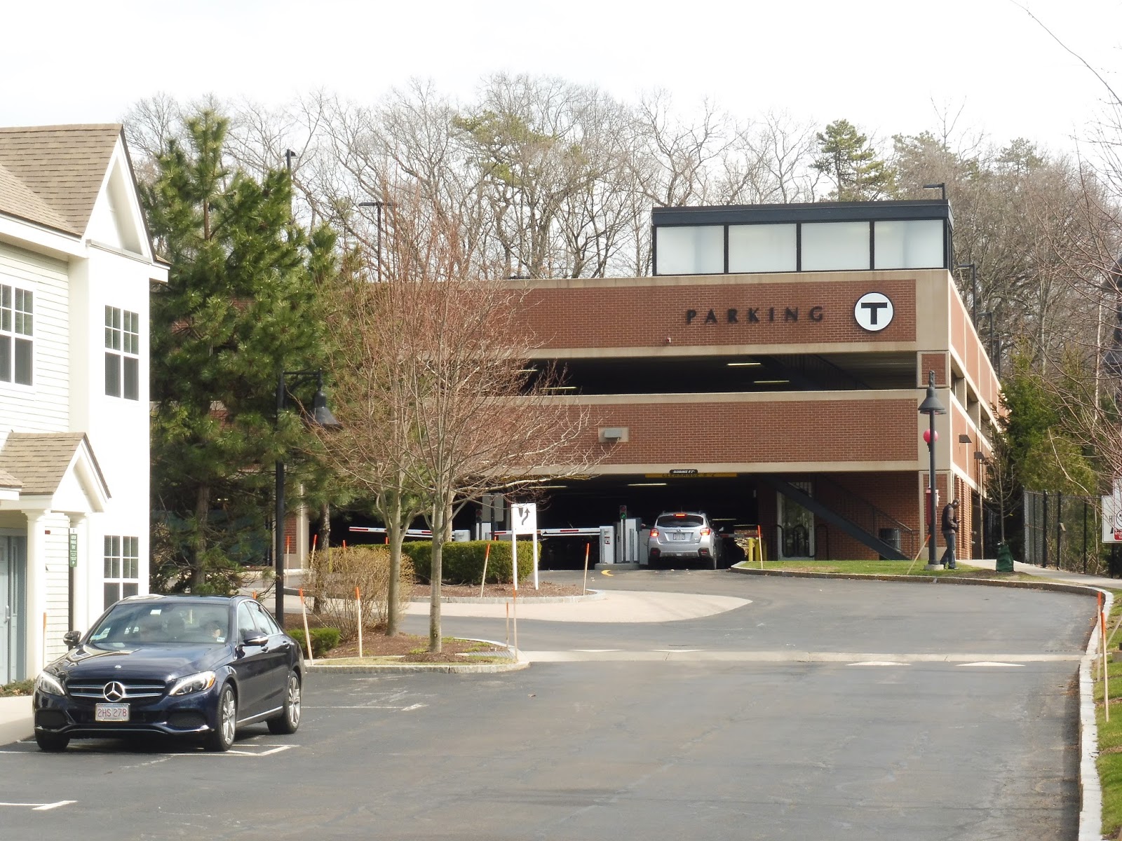
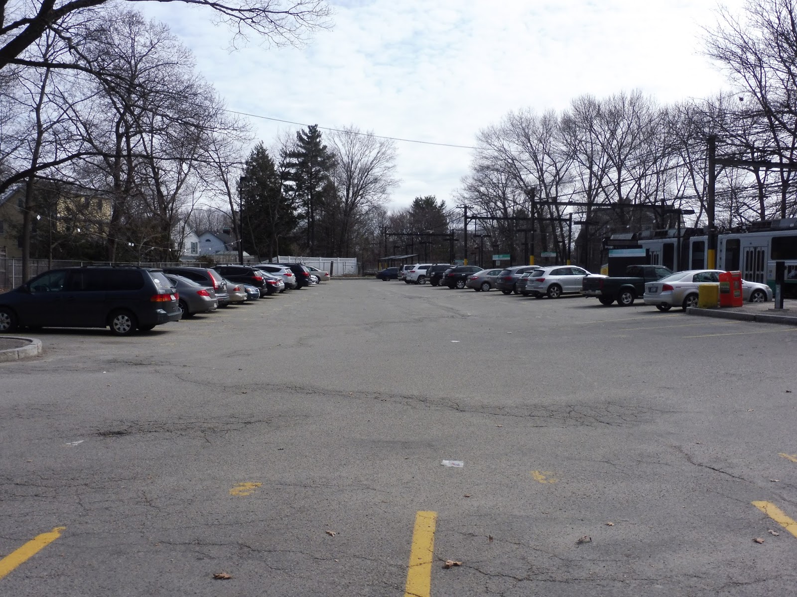
Okay, so maybe the parking lot doesn’t have it. Still, this station does feature a lot of parking – 1,000 spaces, contained within two gigantic lots! This is an Old Colony station, after all. I sincerely doubt the amount of space provided is necessary, but if Greenbush experiences a sudden population boost, the lots are there!
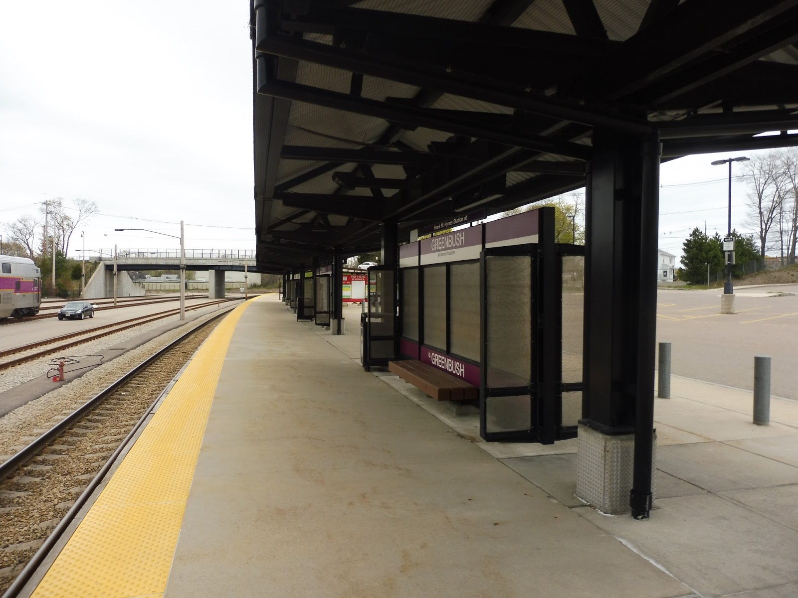 |
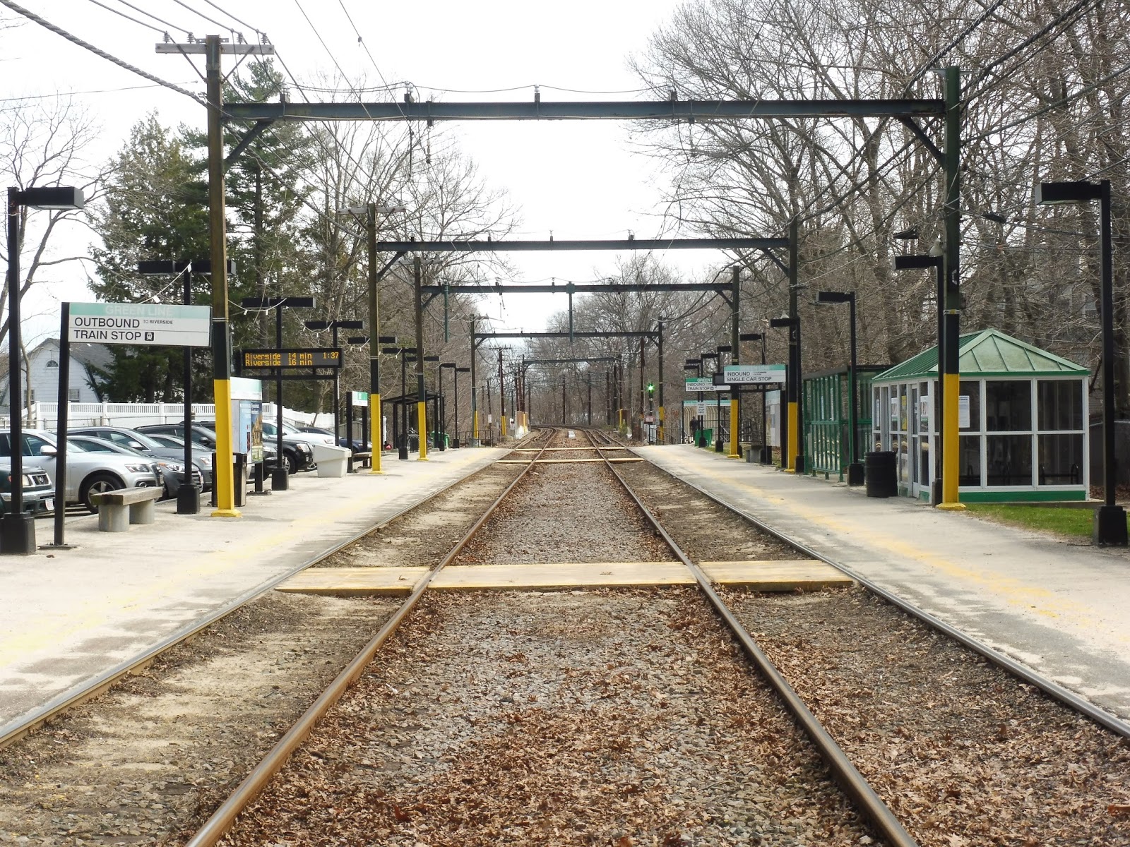
| The platform. |
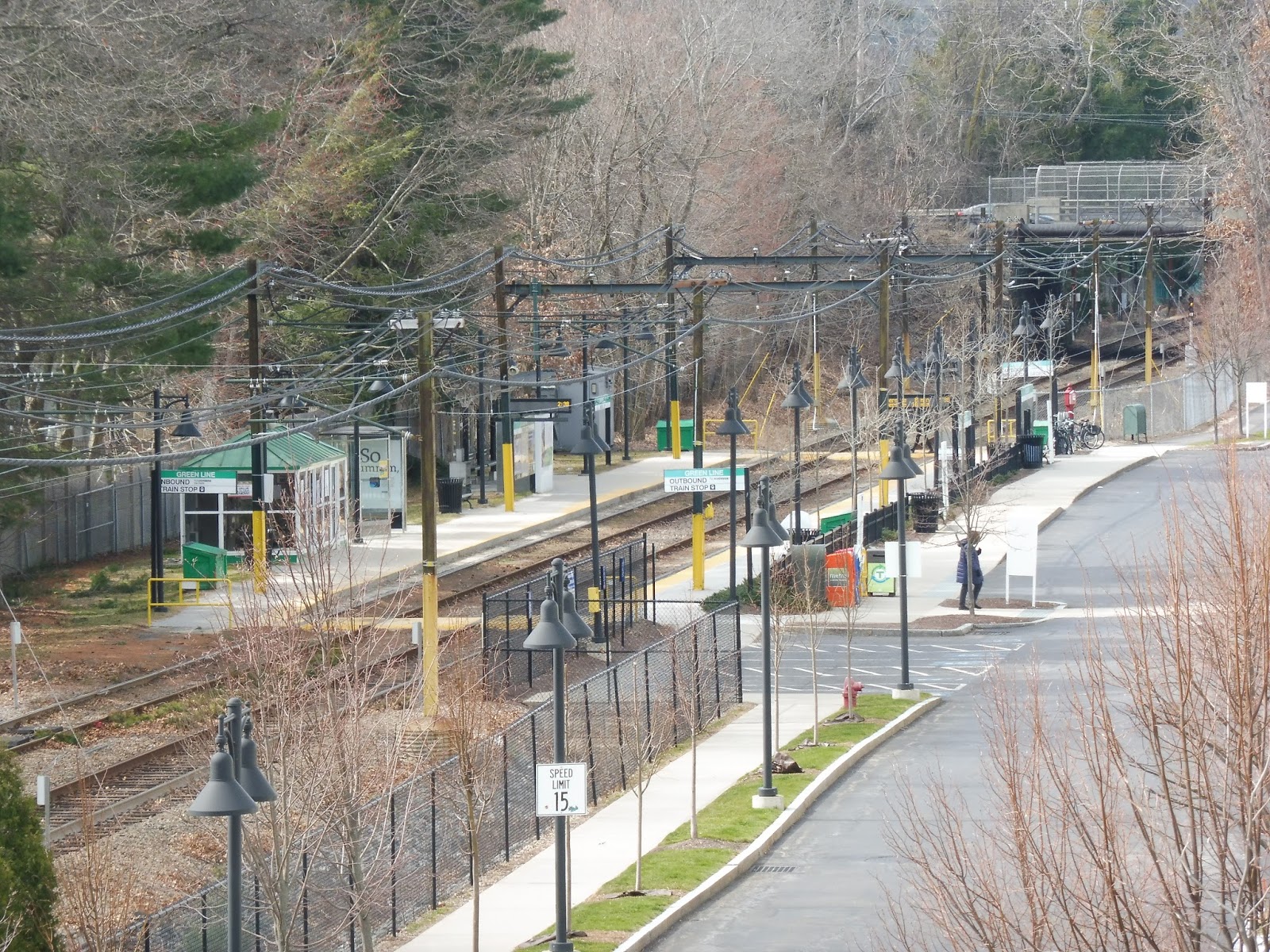
The station features a typical Old Colony platform. It’s fully high-level, with a pretty generic shelter running along most of its length. The many benches are simple, though a few of them feature historical information about Scituate and the Greenbush Line’s history. There are also wastebaskets, probably way more than necessary.
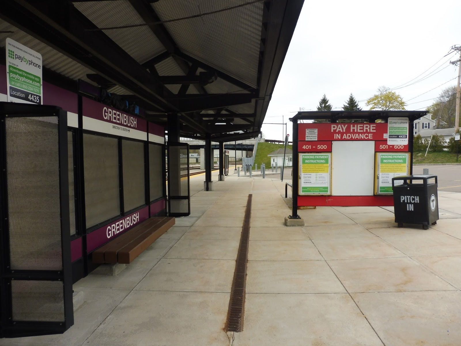 |
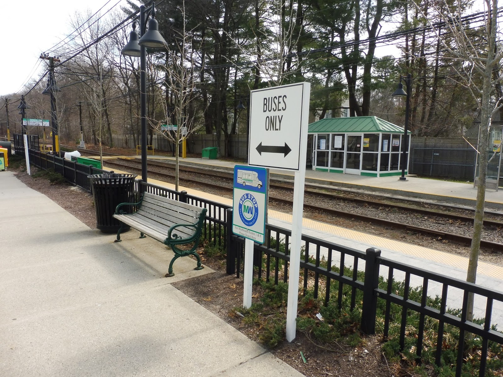
| A drop-off area. |
The other side of the platform doubles as a drop-off area, with a few benches facing toward the parking lot. There’s a single bus connection here, and it’s the GATRA’s SLOOP route! However, it gets no signage, and I’m sure many people don’t know it exists, but we’ll be talking about that in a later review. In the meantime, the station is rounded out by a few old “honor boxes” and newspaper boxes, as well as some bike spaces.
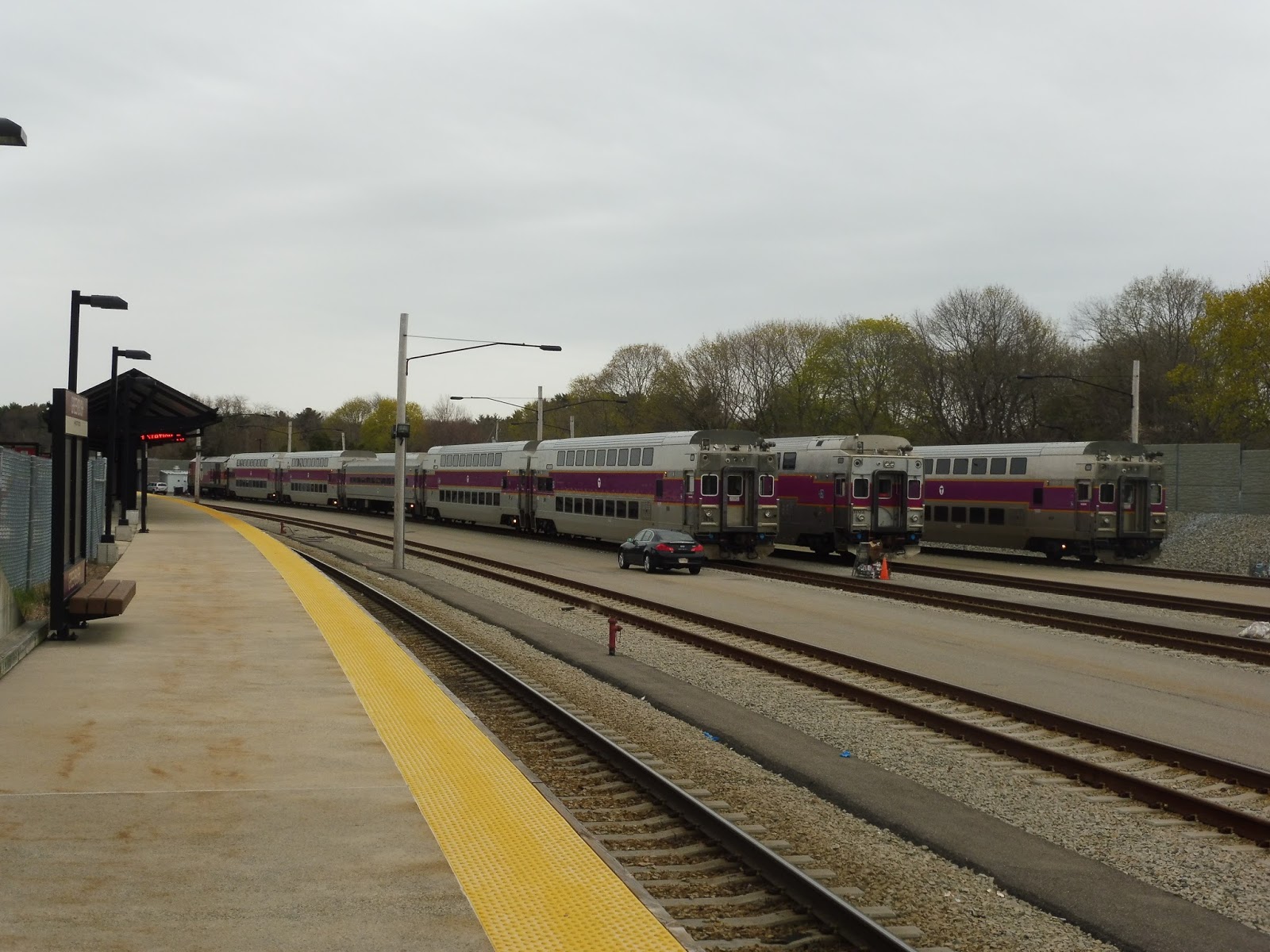 |
| Oh yeah, there’s also a yard here! |
Station: Greenbush
Ridership: It’s the busiest station on the Greenbush Line, but that’s not saying much. It’s not exactly the most well-used line on the system, after all. Still, Greenbush gets 527 inbound riders per weekday, and I assume most of them come in and park in the parking lots. I mean, just look how big they are!
Pros: This is just a nice little station. Sure, it’s generic, but did you expect anything else from an Old Colony Line? Even though it doesn’t look like it in the pictures, Greenbush is surprisingly tranquil. It’s mostly quiet with just the hum of the trains in the yard as background noise. It’s a nice place to wait.
Cons: Okay, 1,000 spaces is seriously overkill, but that’s not much to complain about, is it? I guess it’s a pretty boring station overall, though.
Nearby and Noteworthy: Gosh, if only there was some way to get to Scituate Harbor from here. Hmm…stay tuned!
Final Verdict: 8/10
Yeah, I figured this would be a quick review. There’s just not that much to say about Greenbush. It’s a good station, even if it’s rather boring and generic, and it’s the busiest station on its line. There really isn’t much to say other than “it’s good.”
Latest MBTA News: Service Updates
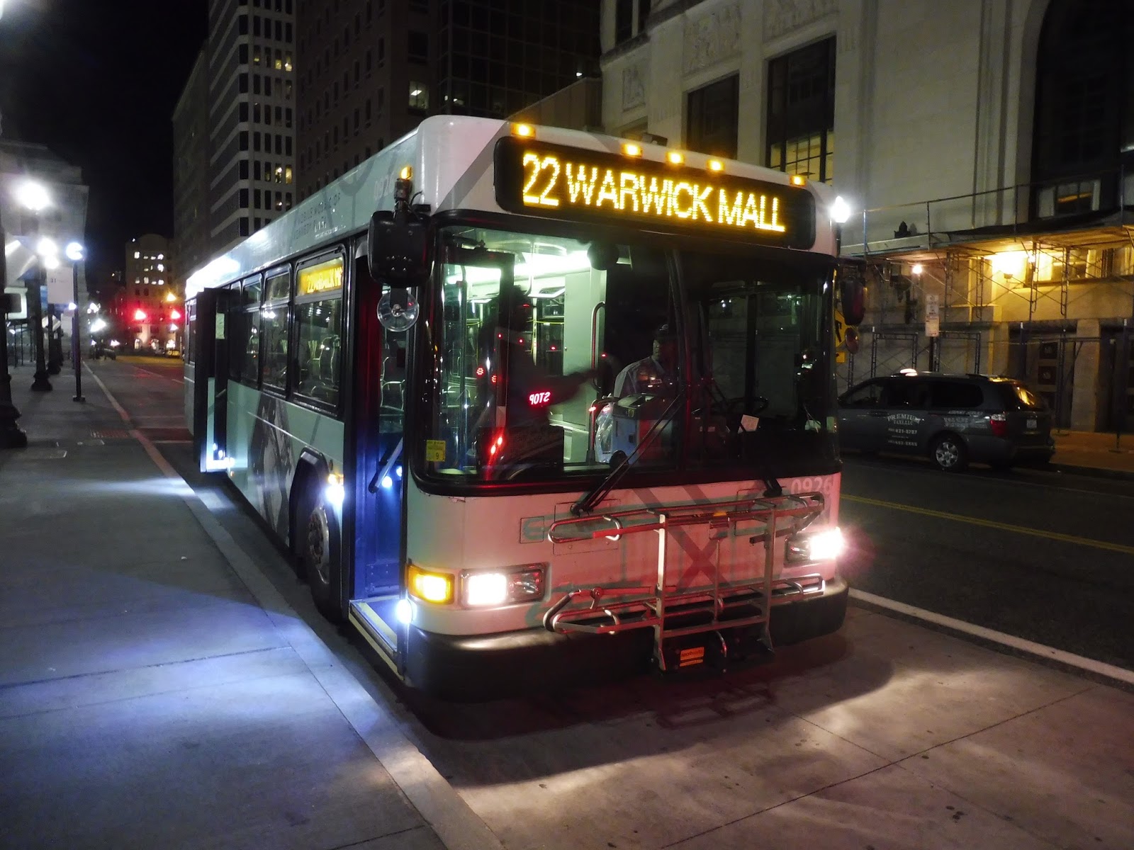
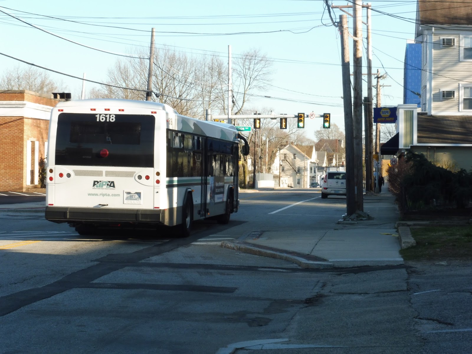
RIPTA: 22 (Pontiac Ave)
The area around the Warwick Mall is not a suitable place for pedestrians – especially not at night. Cars speeding along big wide roads with intermittent sidewalks, huge parking lots everywhere, and an absence of crosswalks all contribute to a nerve racking experience. It didn’t help that I had no idea where the Warwick Mall stop actually was – turns out it’s way on the other side of the complex! It’s also really sketchy at night…
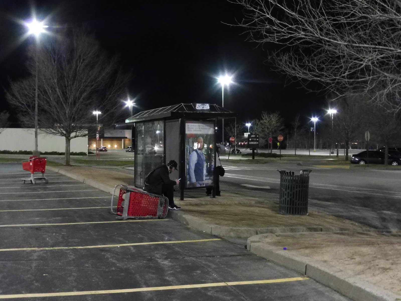 |
| This is a hub? |
Seeing as the Warwick Mall is considered a “transit hub” served by five routes, you’d think it would have some proper facilities. Admittedly, a shelter is better than what malls usually get, but first of all, this place needs some signage! There’s none from outside the mall building, and maps inside don’t give any information either. Secondly…gosh, I mean, you can see from the picture, the stop is a bit of a mess. This isn’t necessarily RIPTA’s fault, but geez, it’s a pretty uncomfortable place to wait at night.
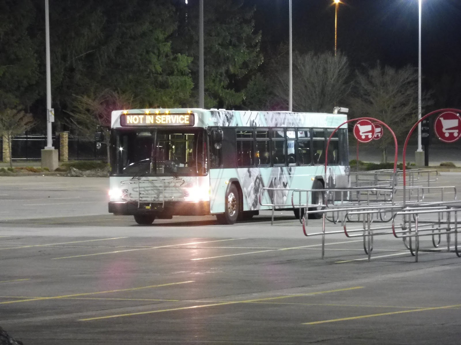 |
| It took so many tries to get a decent picture of the bus laying over in the parking lot. |
Okay, so the 22! This is one of three RIPTA routes from the Warwick Mall to Providence, and it’s the only one without an express portion. The whole route runs local, and the areas it serves are mostly pretty dense. Unfortunately, since it was nighttime, I didn’t get to see much, so I’m gonna be relying a lot on good ol’ Google Maps for this one. Figured I’d give the full disclosure there…
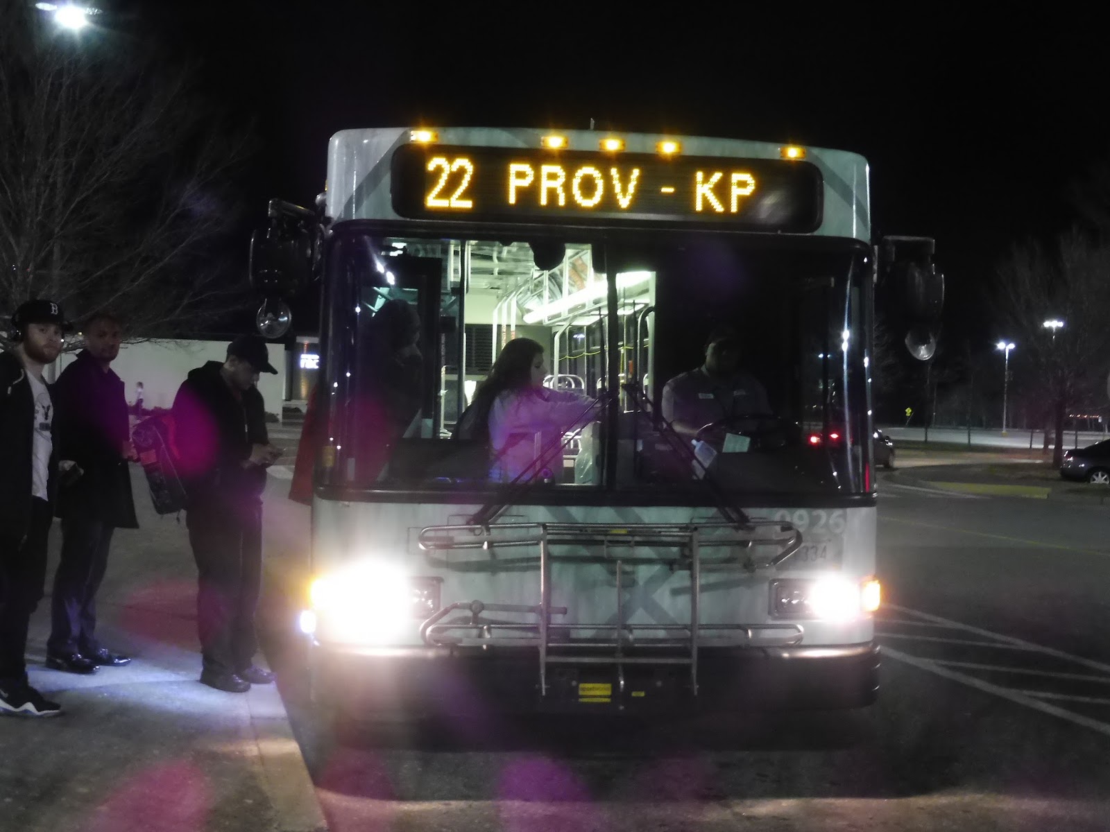 |
| The bus boarding. |
We navigated out of the mall, which took a while since it’s so huge. Once out of the parking lot, we made our way onto Oaklawn Street, which had even more lots in front of businesses and offices. Luckily, we soon turned onto the narrower Mayfield Ave, which was residential, mostly in the form of developments.
The road became East Street for a bit as we passed a prison, and then it turned into the route’s namesake, Pontiac Ave. The surroundings got industrial from there, with big warehouses set off from the road, including a Pepsi bottling plant! We went under the Lincoln Ave Freeway, and then, once more, there were lots of businesses with parking lots out front. Gosh, maybe it’s a good thing it was dark…
Eventually, it became a mix of houses and businesses. We went by an apartment complex and a school, then the street was mostly lined with sizeable houses. However, we eventually reached Rolfe Square, where there was retail on both sides of the street. It would’ve felt like a nice downtown, except that a lot of the buildings were unoccupied.
We came close to Cranston city hall and Cranston High School East, but they were on a side street. Pontiac Ave, meanwhile, became all houses again, with a brief break as the road went over the Huntington Expressway. Soon after that, we entered Providence and merged onto Reservoir Ave, which was lined with businesses and parking lots for just a little bit. It soon became dense houses, though.
There was a short industrial section near the Commuter Rail tracks, then we merged onto Elmwood Ave, joining the 20. After a cemetery, the street became lined with a mix of businesses and houses. We went by a second cemetery, then it became Broad Street, with the surroundings becoming entirely retail. Going by the Providence Central High School, we crossed over I-95 and entered downtown Providence.
 |
| This is the ONE time I tried to take a picture out of the bus. As you can see, it didn’t go so well. |
The buildings were much taller now, ranging from apartments to offices. The street became Weybosset Street, lined with businesses with apartments on top. We also passed a theater, which was very nicely lit-up in the dark. The street eventually curved around, and we were now surrounded by office buildings. We soon turned onto Kennedy Plaza, and the bus got ready to make its final trip back to Warwick.
 |
| Okay, this one isn’t bad, actually. |
RIPTA Route: 22 (Pontiac Ave)
Ridership: Back when RIPTA did its reports in 2012, this bus had great ridership, with 1,923 passengers per weekday, 944 per Saturday, and 923 per Sunday. It was the 11th highest weekday route, while weekend service was strong (Saturday and Sunday ridership was about the same, interestingly). Since the report was conducted, I’d imagine ridership is still strong, since the route’s headways are about the same as they were then (with more frequent service on Saturdays now).
Pros: Of the three main Cranston routes (the 21 and the 30 being the others), this one is the furthest east, and it serves quite a lot of the city (not to mention Providence). It also runs…kind of frequently? Well, it does on weekdays, at least, with consistent half-hour service.
Cons: Okay, every 45 minutes at night makes sense, since my night ride only had about 15 people on it. However, the 22 has those exact same headways on weekends, which could definitely be improved – I think every half hour service on both Saturdays and Sundays would be great. This is further proven by a little tidbit at the end of RIPTA’s detailed analysis of the route: “This route had a 20 minute frequency and was a top five route, we think it could be again.” Ignoring the comma splice, I completely agree with that statement! I assume it’s talking about weekdays, but increasing weekend service is also very important.
Nearby and Noteworthy: Well, certainly not the Warwick Mall! Actually, there didn’t seem to be many noteworthy places along the 22, but I guess Rolfe Square in Cranston is the closest you’ll get to one.
Final Verdict: 6/10
I mean, it has to be said that this route has pretty standard headways for the RIPTA. Plus, the route itself is great, making a direct path through Cranston and Providence. However, I really think that it has the ridership to run more frequently. The note in RIPTA’s analysis about every 20 minute service on weekdays is a start, but based on the urban nature of this corridor, every half hour on weekends would be great! As it is currently, it’s just an average route that gets the job done fine.
Latest MBTA News: Service Updates
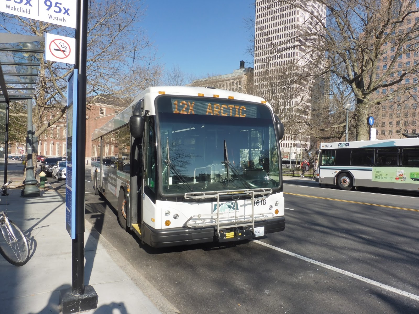
RIPTA: 12x (Arctic/Route 117 Express Park and Ride)
There’s a place called “Arctic” in Rhode Island? “That sounds like the most amazing place ever!” was my initial thought when I discovered the 12x while poking around the RIPTA website. Always looking for an excuse to visit Rhode Island, I rushed to the 3:30 Commuter Rail after school and jumped on the 12x at Kennedy Plaza. Turns out Arctic was not the most amazing place ever, although here’s a review of the 12x, anyway.
 |
| The bus with the Providence skyline in the background. |
Considering the amount of people waiting at Kennedy Plaza’s express stop, it was kinda sad to see only a few of them get on the 12x. At 5:05 on the nose, we headed down Exchange Terrace, paralleling a park on one side and Providence’s old Union Station on the other. We then merged onto Sabin Street, passing the modern Rhode Island Convention Center.
 |
| “I don’t know what this is a picture of, but I’m going to take it” was my mindset here. |
We turned onto Empire Street, which had an office-y feel to it, and then Weybosset Street, passing a big, fancy theater. After going by a park, the street got narrower and lined with multistory brick buildings. We went by some more office buildings as it curved around and became Exchange Street, running perpendicular to Kennedy Plaza.
 |
| A park along Exchange Street. |
We then turned onto Memorial Boulevard, which paralleled the Providence River. Alongside the Providence Place Mall, the street became a highway ramp, and we navigated a huge interchange to get onto I-95. The highway was slightly below ground level, but many apartments and buildings were in view on either side.
 |
| You gotta admire intricate interchanges like this. |
The surroundings soon got more industrial, with big vats to the east. There was a view of the Rhode Island Hospital, then the highway curved southwest with dense houses in view. However, we also passed a big industrial yard at one point, so it wasn’t fully residential. It eventually became a mix of both, with houses on one side and factories on the other.
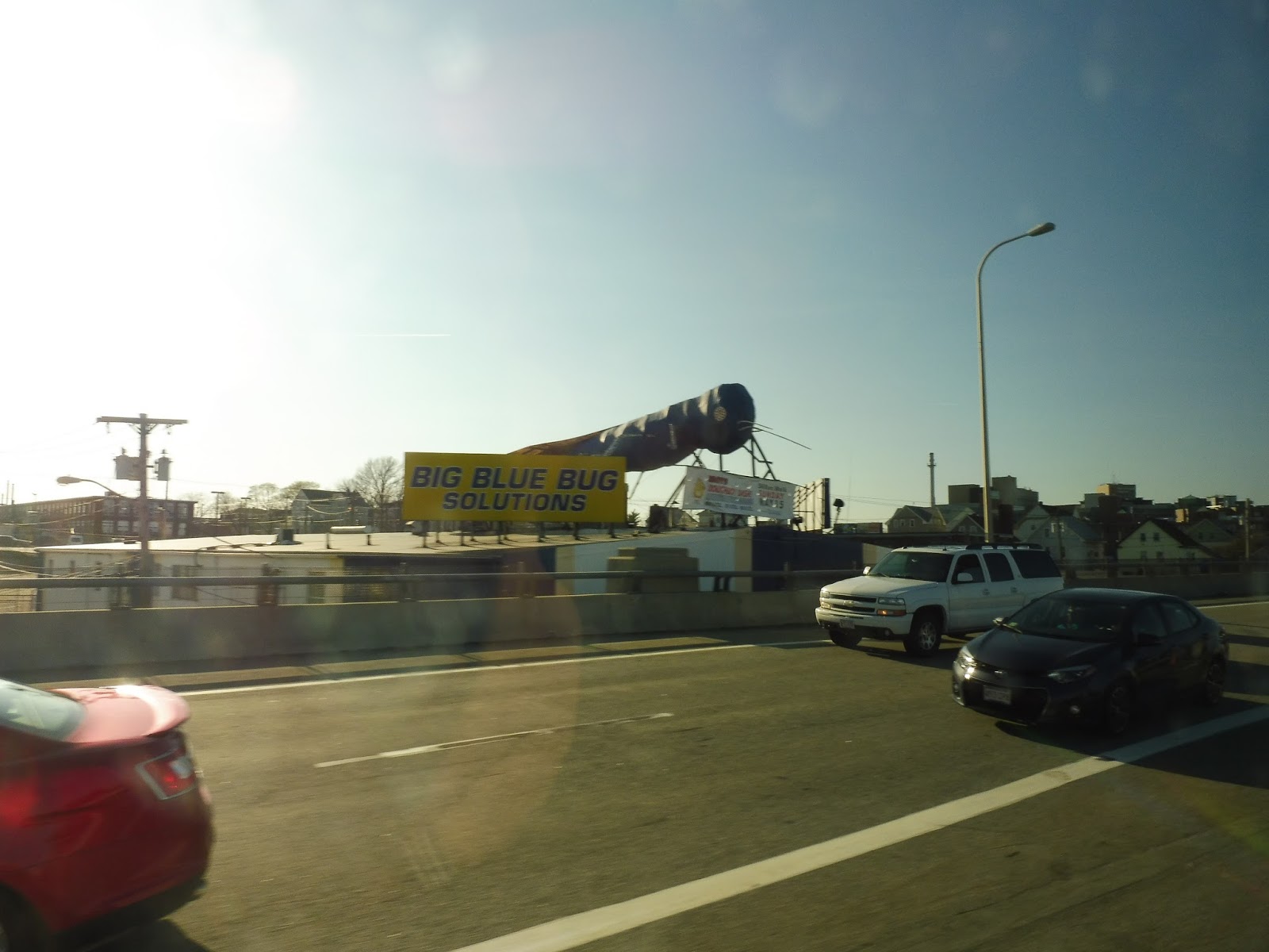 |
| I’m obliged to include this bug, because it’s fantastic. |
There was a short woodsey section where we crossed over the Pawtuxet River, and then it was pure industry. The scenery was swapping between forest and industry for a while after that, right up until our exit – 10A. We navigated around the highway ramp onto Centerville Road, and at the Route 117 Park and Ride, many passengers got off to go to their cars.
 |
| The parking lot. |
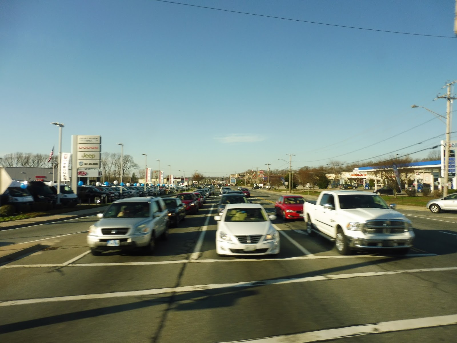
We soon turned onto Toll Gate Road, which was a strange mix of houses and offices. We went under I-95, then passed the huge Kent County Hospital. There was a short forested section, but as we crossed the incredibly wide Bald Hill Road, auto shops populated the intersection. From there, the street became a mix of residential, commercial, and industrial, continuing as we merged onto Providence Street, going by an apartment building.
 |
| Crossing Bald Hill Road. |
We went over the Pawtuxet River again, with an old mill converted to apartments spanning the water. There was a small rotary where we merged onto East Main Street, lined mostly with houses. We then turned onto Main Street, ascending a hill. Going by an apartment tower, the street was lined with residences but also a few industrial buildings. These became businesses as Main Street entered Arctic Center – the unassuming last stop was just a sign.
 |
| Goodbye, bus! |
RIPTA Route: 12x (Arctic/Route 117 Express Park and Ride)
Ridership: The RIPTA’s ridership data is a few years old, and for the 12x, it dates back to when the route was called the 90A. It didn’t have very much ridership then, with only 62 passengers per weekday, and if my ride is to judge, the ridership still isn’t high. My trip got a total of around 10 people, which is pretty darn shabby, even for an express bus. Around half of those people got off at the Route 117 Park and Ride lot, while the other half disembarked at Arctic Center.
Pros: This is a niche express route, giving West Warwick peak hour service up to Providence. Its schedule is the standard for RIPTA expresses, with three trips in the morning and three trips in the evening.
Cons: But it’s really niche. I mean, the 12x serves a small park-and-ride lot and a small town center already covered by two local routes. I suppose there’s a market for express service from West Warwick during rush hour, but it’s certainly not a very big one. It’s also worth noting that the local section of this route operates in a strange loop, with AM service running via Centerville Road and PM service running via Toll Gate Road. This is because the Route 117 Park and Ride is on one side of a divided highway, so it’s effectively on a one-way. However, the loop formation means that anyone commuting along a one-way section only gets service in the morning or evening.
Nearby and Noteworthy: I gotta say, Arctic Center is a pretty boring place, despite its cool name. However, there is one restaurant there that is a fantastic experience: Boneheads Wing Bar. Right in the center of town, the food is pretty good, but the whole place is themed around rock music, which is awesome. For a music geek like myself, it was incredibly fun reading the menu items, most of which are named after bands or songs. I’m not sure if it’s worth a trip all the way down to Arctic, but this place is pretty cool.
Final Verdict: 6/10
I guess the 12x does its job fine as an express, and provides peak service from West Warwick to Providence. Its ridership group is a small one, but it would be bad to cut them off and force them into cars. However, I wonder if that group could be made larger if there was a solution to that one-way service issue. What if the route ran the whole loop in both the morning and the evening, with the Park and Ride acting as the official start/end point instead of Arctic Center? In the morning, it could start at the lot, go around the loop via Arctic Center, serve the lot again, and then go up to Providence – vice versa in the evening. I’m not sure how much ridership that would draw from residents living along the loop, but it could be an interesting experiment.
Latest MBTA News: Service Updates
I’m going to Bermuda over April Break, so I won’t be posting until after I get back on Saturday. Goodbye until then!
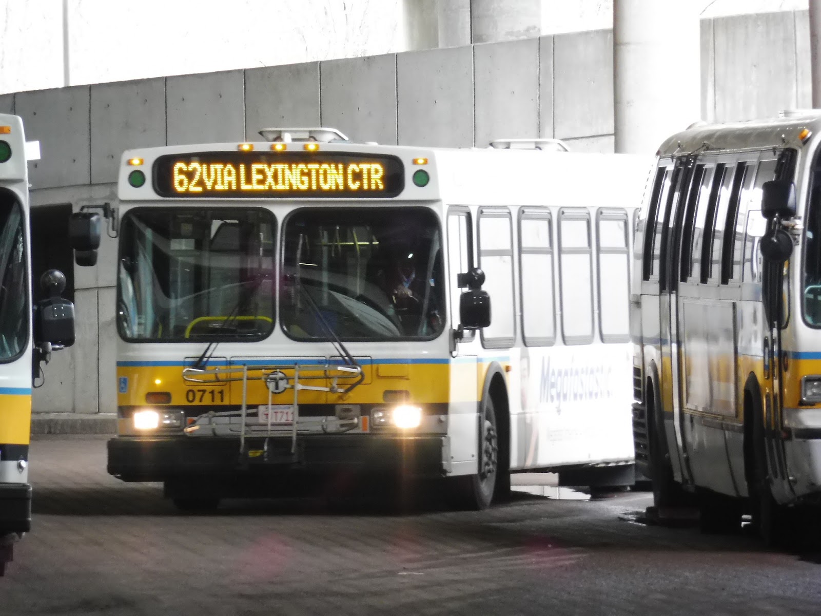
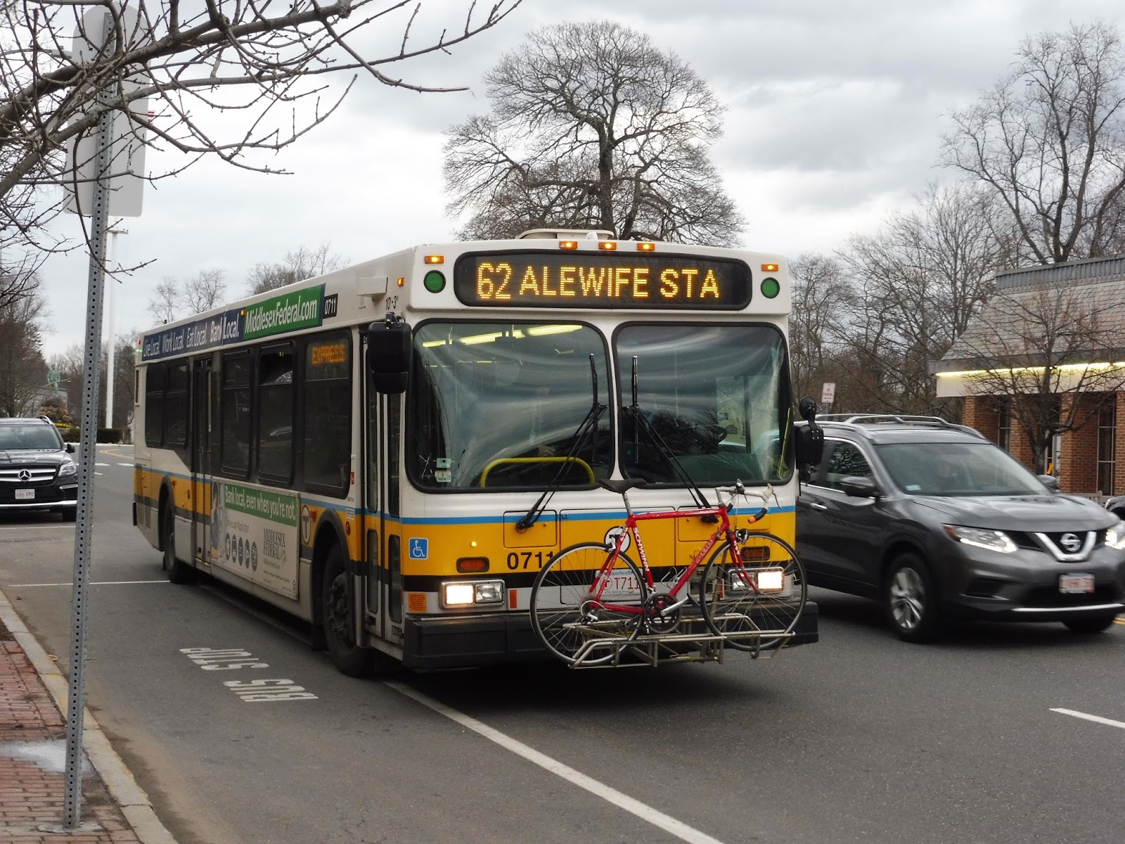
62 (Bedford VA Hospital – Alewife Station via Lexington Center and Arlington Heights)
Alright! The final Alewife review! You know, most of Alewife’s buses fall into the same mold: weekday-only routes serving northwestern towns that only get riders during rush hour. Although the 62 doesn’t satisfy the weekday-only requirement, the rest basically holds true. This is a long route, so let’s get started.
 |
| It’s hard to get good pictures in the Alewife busway… |
Being around 5:00 PM, my trip was a rush hour one, so there was a throng of people who all tried to get onto the bus first. Once everyone was in, we navigated through the dark Alewife busway before reaching daylight, turning onto Alewife Brook Parkway. The road went up onto a bridge over the Alewife facilities, and then we made our way through a dreadfully slow intersection onto Route 2.
 |
| Huh…never noticed that marsh before. |
Speeding down the highway, we went past a marsh and a soccer field, while the “Route 2 Westbound Pedestrian Bridge” stop that no one ever uses served the office parks and apartments on the other side of the road. However, as all local buses do, we took the first exit, but no one got off at Lake Street. Thus, we returned to the highway, and no one left at the second exit, either.
 |
| Spy Pond, seen from Route 2! |
From there, we merged onto the “Route 2 Service Road”, which ran parallel to the highway. Rising up on a hill over it, the bus made frequent stops for commuters returning to their houses in the quiet residential areas beyond the highway. Eventually, we turned onto Park Ave, which was entirely residential. Ascending a hill, we passed the Park Circle Water Tower, and then lots of houses as we descended it.
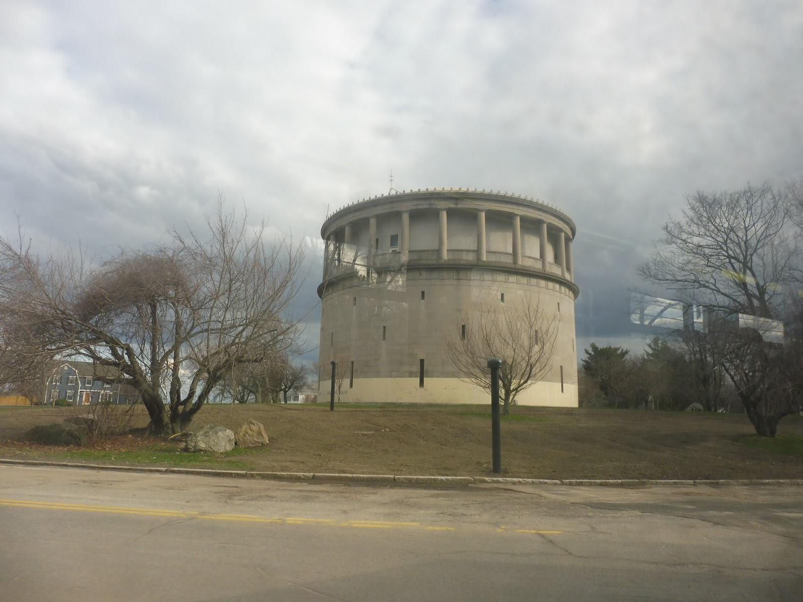 |
| I love that tower! |
We soon reached a steep downward slope, and past the traffic waiting for the light to change was Mass Ave. Finally reaching the intersection, we turned onto it and it was lined with businesses. However, the Arlington Heights Busway was very close. We looped around it, picking up a few passengers, and then we returned to Mass Ave, continuing past the 77 and 79‘s terminus.
 |
| More front view experimentation! You can see how crazy the hills are around here. |
There was still a lot of retail along the street, but it was predominantly lined with houses. We entered Lexington along this section, getting joined by the 76 at a small rotary. From there, it was basically all residential, up until the National Heritage Museum. We passed through a park, and after some more houses, we entered Lexington Center.
 |
| I got off the bus at Lexington Center coming back, but I figured I’d put the picture here. |
Ah, how I love Lexington Center. It has such big sidewalks with lots of benches along them, it’s leafy, it has a bunch of great small businesses, and its buildings are historic. Not only that, but we passed the wonderful facades of places such as Lexington Town Hall and the Post Office. As we were leaving the downtown, we went by the incredibly important Lexington Battle Green as a final send-off from this great little town.
 |
| Yes! Good ol’ Lexington Center. |
Of course, you can’t make an omelette without breaking a few eggs. Soon after leaving Lexington Center on Bedford Street (leaving the 76 to stay on Mass Ave), there was an intersection with malls and businesses, all with big parking lots out front. It didn’t last long, luckily, and the surroundings soon returned to houses.
 |
| A side street. |
The neighborhoods were mostly residential, but we also passed the occasional office or industrial building. We also crossed the Minuteman Bikeway at one point. The road widened soon after that in order to get over I-95, then we went by some typical highway development: an ugly office park and a really gross-looking inn.
 |
| The bridge over the interstate. |
The development continued for just a bit longer with pylons, a Boston Sports Club, and a hospital, before returning to houses. The street became Great Road as we entered Bedford, but soon after we passed through another pitty area (fast food restaurants, auto shops, and a huge mall, all with enormous parking lots). We also went over the tiny Shawsheen River along this section.
 |
| No parking lot pictures, but how about these McMansions? |
There were more houses from there, and just before another shopping plaza, we turned onto the narrower Loomis Street. This was in order to serve Depot Square, the terminus of the Minuteman Bikeway. To be honest, it was a mostly industrial area, but it did have an old train next to the historic Bedford Depot.
 |
| Hey, I tried my best… |
It was at Depot Square that we turned onto South Road, a narrow street lined with houses. However, we soon came across some history. The tiny Bedford Center featured a few little businesses, a common, the “Old Town Hall”, and the magnificent First Parish In Bedford – a really great-looking old church.
 |
| Going past the common in Bedford Center. |
We were now on Springs Road, another narrow residential street. The houses went on for a while until the stop names started getting weird – they became “building numbers”. Yes, we had entered into the larger-than-expected VA Hospital complex! And…also a golf course. Anyway, we made a loop around Avenue D to get to a simple shelter on Spring Road, with brick buildings in view. It was an interesting place for a terminus, but this was it.
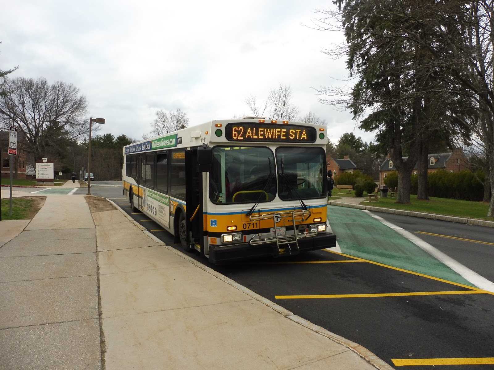 |
| The bus at the hospital. |
Route: 62 (Bedford VA Hospital – Alewife Station via Lexington Center and Arlington Heights)
Ridership: This is the second-busiest Alewife route, just below the 350 on weekdays, with 1,644 riders. Of course, as this is an Alewife commuter route, it gets packed during rush hour and is pretty quiet all other times. My ride got 40 people, and it wasn’t even the true peak period yet! Also, the Saturday 62/76 combined route gets surprisingly decent ridership for its frequency, with 662 riders.
Pros: The 62 serves so much. This is mainly because of its insane length, cutting right through Bedford, Lexington, and Arlington, and linking them all up to Alewife just on the edge of Cambridge. A bunch of commuters use this route to get to the Red Line, which is why it runs so often during rush hour. Although the headways aren’t consistent during that time, there are three trips 10 minutes apart in the morning (among others), and a similarly close schedule in the evening. It’s more regular during the day, with constant every hour service – same on the weekends, running every 60-70 minutes.
Cons: The 62 doesn’t have much of a night schedule, with only two or three trips after the evening rush – the last one leaves for Alewife a little before 9. Still, it probably doesn’t get much ridership past there, so I guess it’s okay. I understand the lack of Sunday service, although maybe a cut-back route on those days that runs as far as Lexington could be an interesting experiment.
Nearby and Noteworthy: Basically the town centers are the places worth checking out here: Lexington Center and Bedford Center. The former is definitely worth taking a visit to, especially if you haven’t been before.
Final Verdict: 8/10
This is certainly one of the best Alewife routes, both due to its length and the fact that it has Saturday service. The 350 is in a league of its own (honestly, it probably deserves an 8 or even a 9, rather than the 7 I gave it in that review), but I would say the 62 is slightly better than Alewife’s other premiere route, the 76. The 62 serves more since it’s straighter, and it has a better schedule during rush hour. Overall, this is a pretty darn good route.
Latest MBTA News: Service Updates
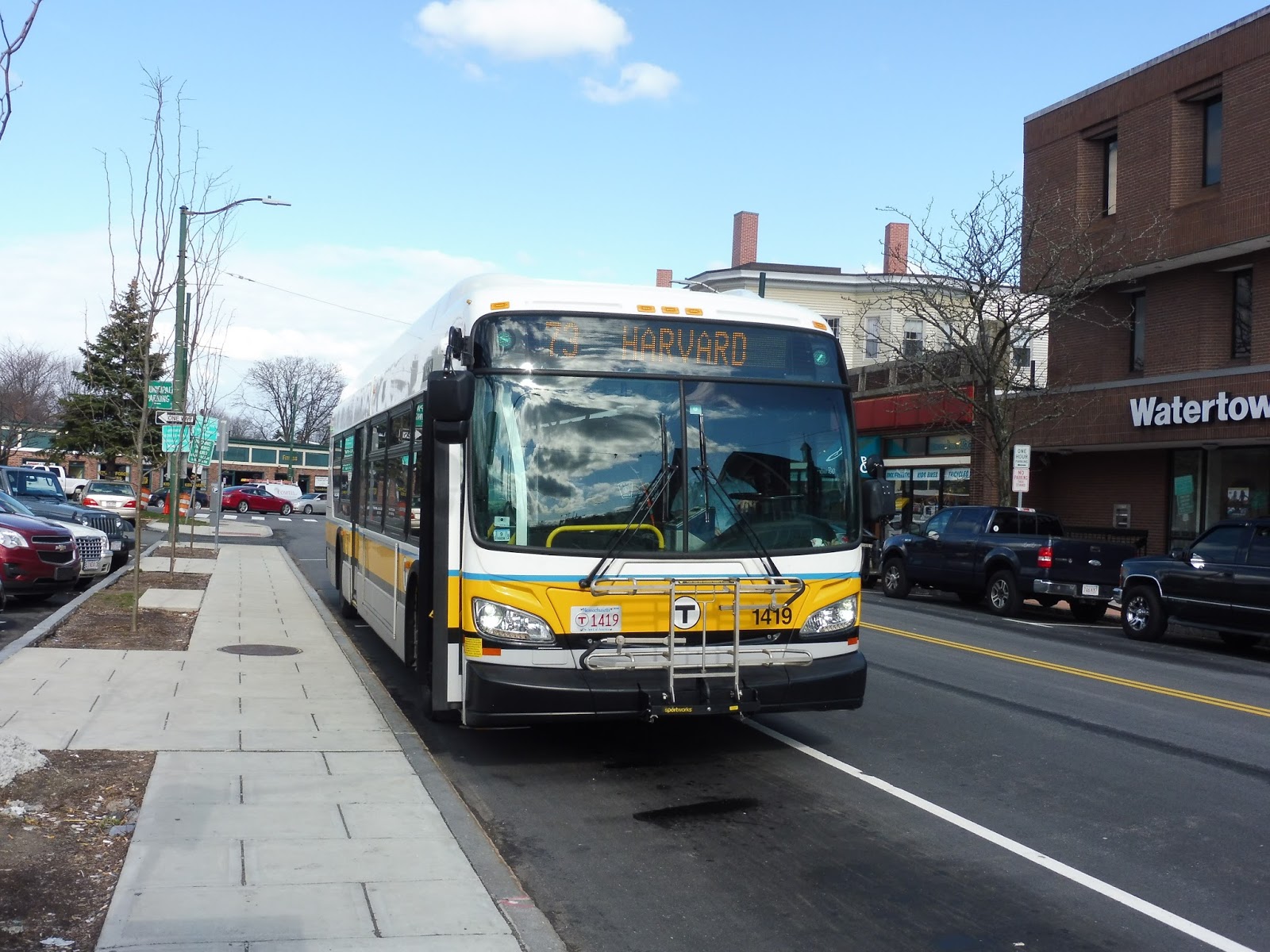
73 (Waverley Square – Harvard Station via Trapelo Road)
Yes! Finally! My actual last Key Bus Route to review! It’s a good one, too. I was originally holding off on the 73 because I wanted to wait until it switched back to trackless trolleys, but honestly, that’s not gonna happen anytime soon. Thus, I shan’t dilly-dally any more! Let’s take a ride on the quick and serene 73!
 |
| A non-blurry picture in the Harvard busway? This is a miracle! Too bad this wasn’t actually the bus I rode… |
The 73 boards in the Harvard Lower Busway, which could be confusing to newcomers, but signage points this out pretty well. Something that is confusing to newcomers, however, is the fare system. Despite the fact that it doesn’t use trackless trolleys with left-hand doors anymore, the 73 still has passengers pay when they leave. It’s a bit odd, but it does speed up boarding at Harvard.
 |
| The bus I took. This picture looks surprisingly okay… |
We popped out of the tunnel onto Mount Auburn Street on the edge of Harvard Square, and for the moment the road was lined with multi-story buildings. After the first stop outside a post office, though, it got much more leafy and quiet. We passed by a cute business block, but the street was mostly lined with dense houses.
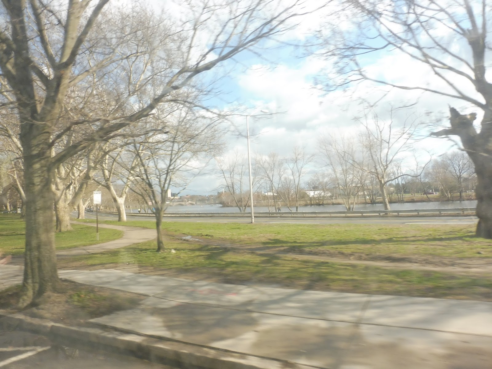 |
| A shot of the Charles River from my ride back. |
Once we reached Memorial Drive, we ran parallel to it for a bit, with a nice park between us and the river. I was focusing on that side since it was quite scenic, but on the other side of the street, there was a big condominium. As Memorial Drive curved away from us, we went by another apartment building, then the huge Mount Auburn Hospital.
 |
| A residential side street. |
Mount Auburn Street curved a bit as it had an intersection with the massive Fresh Pond Parkway. After crossing that, the Mount Auburn Cemetery was on one side while houses, apartments, and a small pediatrics office were on the other. There were businesses at the intersection with Aberdeen Ave, including a big Star Market that got its own stop announcement.
 |
| Ahh…I love that median on Aberdeen Ave. |
We split off of the 71 after the miniscule Mount Auburn Bridge, where we merged onto Belmont Street. There were small businesses for a bit, then it became lined with dense houses. However, the street soon became this lovely mix of houses interspersed with really cute business blocks. It was so nice!
 |
| Another street lined with houses. |
Eventually, one side of the street became occupied by a golf course while the other side featured bigger houses. There was a small bus loop at Benton Square, where certain 73 trips begin. It’s also worth noting that this part of Belmont Street is up on a hill, and going inbound, there’s a great view of Boston for a few seconds.
 |
| I was experimenting with shots out the front of the bus on this ride. |
The street was now called Trapelo Road, and it went by lots of businesses at Cushing Square soon after the bus loop. We also passed an apartment building, then the street became lined with houses and started heading back down the hill. Eventually, though, it once more became that great mix of houses and small businesses.
 |
| Another frontwards shot. |
Soon the surroundings became entirely retail, and here we turned onto Church Street, entering Waverley Square. I got off, paying as I did so, and then the bus did a short loop via Lexington Street and returned to Trapelo Road. After picking up a few more people at a stop on the loop, the bus started back towards Harvard.
 |
| The bus at Waverley Square. |
Route: 73 (Waverley Square – Harvard Station via Trapelo Road)
Ridership: The 73 is a Key Bus Route, so of course it gets high ridership, However, it’s generally on the lower end of the Key Bus Route spectrum, with 6,424 riders per weekday, 3,207 riders per Saturday, and 1,974 riders per Sunday (it does get more ridership than its 71 companion, though). Despite its more serene nature on weekends, the 73 can get packed during rush hour – even my trip around 3:30 got a good 30 passengers heading out of Harvard, though it can get to be much more as the evening progresses.
Pros: Ah, there’s so much to love about this route. For one thing, its schedule is great. To accommodate its rush hour crowds, the 73 runs as often as every 5 minutes during those times. Otherwise, it goes every 15 minutes during the day and on Saturdays, every 20 minutes on Sundays, and every 25 minutes at night. These are all perfectly timed based on the route’s ridership. Additionally, it’s a lovely ride through some great neighborhoods, and the route itself is quick, straight, and serves a large chunk of West Cambridge, Watertown, and Belmont. Finally, the strange exit fare system is neither a pro nor a con, so I’m just gonna mention it here to make the “pros” section longer because this is such a great route.
Cons: No trackless trolleys, unfortunately, but that has advantages and drawbacks all on its own. However, the 73 does have a bit of a bunching problem, although I will say that that’s very hard to avoid with every 5 minute service. Besides, it’s nothing compared to the 1 or the 77, neither of which run as frequently as the 73! Finally, I know that Aria A. suggested that the 73 gets merged with the 72 because of its redundancy with the 71, although I personally disagree there. Honestly, the Mount Auburn Street corridor in Cambridge is a very busy one with the hospital being a major ridership draw – it would lose a lot of service with the merger, plus it would lengthen the ride for 73 passengers. Merging the 72 and the 75, on the other hand? Yeah, that should happen.
Nearby and Noteworthy: I don’t know any specific places the route goes by, but they all look so interesting! The 73 passes so many small businesses along its route, running the gamut from restaurants and little stores to even a tiny movie theater!
Final Verdict: 10/10
Okay, as you may know, 10s are rare occurrences on this blog. Let me explain my reasoning: the 73 is the best run Key Bus Route on the system. It operates very frequently during rush hours to accommodate the unavoidable crowding, and still has a great schedule other times, contributing to its higher ridership. And yet this is also one of the most serene bus routes on the MBTA, both because of the lovely neighborhoods it runs through and the fact that you’re pretty much guaranteed to get a seat outside of rush hour. Frequent service, good ridership, and tranquility? It’s like the 71, except it runs more often (though I do love the 71, too)! And sure, it may experience a bit of bunching here and there, but only on weekdays during its times with really close headways. Seriously, this is hands down the best Key Bus Route, and one of the best regular bus routes, on the MBTA. If it ever switches back to trackless trolleys, it might as well be an 11!
Latest MBTA News: Service Updates
GUEST POST: 73 (Waverley Square – Harvard Station via Trapelo Road)
I got this great review from Aria A. reviewing the 73! It’s incredibly well-timed, since I have finally ridden in myself, and have my own post in the works. That’ll probably come out tomorrow, but for now, here’s an alternate review of the route. Thanks, Aria!
I had never ridden the 73 before today. Strangely enough, I took the 71 into Watertown (which is where I live) instead of the 73 on the way back from Harvard. I live in the West End, so I’m not that far from Waverley Square’s terminal. I also like walking, but I originally thought that it would’ve been a bit unnecessarily time consuming (according to Google Maps, it would’ve taken me between 25-30 minutes to get home by walking). I didn’t feel like walking home today, though, since it was kinda cold, so I just took a 70A home. But anyway, here’s the ride.
At Waverley Square, the only people that got off were a married couple and their two kids. The driver also stalled the bus and went to go get a coffee from a Dunkin’ Donuts across the street. He was a nice guy as well, side note; he greeted each passenger and was quite polite. Once he got back, only three others got onto the bus alongside myself. This might’ve been normal since it was a Saturday, but I hope the weekdays have more people at the terminal. Departing the terminal, the bus commenced on a loop onto Trapelo Road. Afterward, it simply continued along the road. Trapelo Road is mainly a mixture of residential and small business. A few people got on and one or two got off on the way to Benton Square, the junction between Trapelo Road and Belmont Street. Once the road turned into Belmont Street, it became a lot more residential. It stayed like this until the road ends into Mount Auburn Street. Wait, this seems familiar….
Of course! It’s where the 71 goes! Now why do both routes continue on Mount Auburn Street into Cambridge? Whoever made these routes may not have known what they were doing. There’s a simple alternative for the 73, which is to merge both the 73 and 72 together. The 72, as you know, is practically useless as a standalone route. Everything is within walking distance of either the West Cambridge or Harvard Square areas. But if they merged, it’d get rid of the useless 72 route and the 73 would make a bit more sense. Anyway, the rest of the route is the exact same as the 71, so there really isn’t much need to talk about what’s to see on Mount Auburn Street. A kinda funny part of the trip I want to mention is when I stayed on the bus when everybody else got off at the Harvard busway. This is because I wanted to get off at Cambridge Common instead, so I had to ask the driver if I could stay on until the bus got there since he asked for where I was going. Being the nice guy that he was, he allowed it. I wouldn’t see why he wouldn’t, but whatever.
(A link to Aria’s picture of the 73 on Flickr)
Route: 73 (Waverley Square – Harvard Station via Trapelo Road)
Ridership: Like I said, I took this on a Saturday. Regardless, a total of about 15 people got on the bus on the way to Harvard. Not sure how many usually get on for the Waverley-bound trip on weekends, but I’d assume it’d be either the same or slightly less.
Pros: The Belmont portion of the 73’s route is great, as it goes all throughout the town via Trapelo Road and Belmont Street, serving a lot of people. It’s a Key Bus Route, so it runs VERY often on weekdays. On Saturdays, one bus comes every 15 minutes, which is actually quite good, and one comes every 20 minutes on Sundays. I’ve been on both Trapelo and Belmont during weekdays and I rarely see any buses bunching, although there have been a few instances of it. Nothing too bad, though.
Cons: The Cambridge portion of the route. It’s the exact same as the 71’s portion! Who thought that was a good idea? Why does the 72, a route which is completely within walking range for anybody in West Cambridge, get its own standalone route when it can be merged with the 73? “But why merge the two if the 72’s route is all within walking distance?” Because the 73 would just make more sense. As narrow as Mount Auburn Street is in Cambridge, a second bus route running on it wouldn’t be such a good idea.
Final verdict: 8/10
To recap, it serves a lot of people in Belmont, it’s a Key Bus Route, it rarely bunches, and it’s also just a nice ride. But again, I can’t let go of the fact that the 73 has the same Cambridge portion as the 71. It doesn’t make any sense, and that’s why I had to lower the score. Aside from that, there isn’t really anything else wrong with the route.
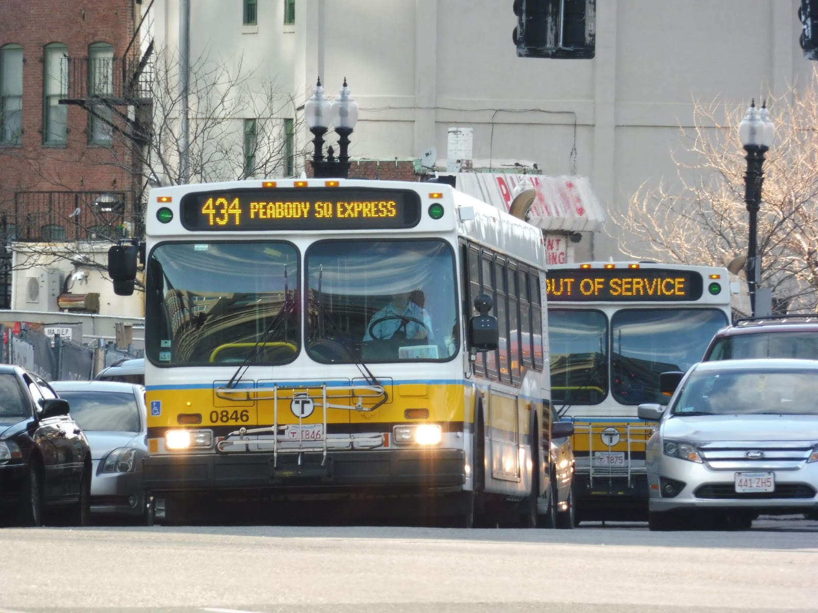
434 (Peabody – Haymarket EXPRESS via Goodwins Circle)
Well, this is officially the least frequent route on the MBTA – every 24 hours! In other words, the 434 only runs once a day in each direction, with one trip inbound in the morning and one outbound in the evening. I took the latter one, although things didn’t exactly go as expected on the trip…
 |
| The bus coming into Haymarket. |
After about 50 million 111s, the 434 finally arrived at Haymarket Station. I was expecting it to have more people, but with few on board, we headed up onto North Washington Street. And then…continued down North Washington Street? And…uh…over the Charlestown Bridge? And then…onto the on-ramp for the Tobin Bridge? What madness was this? The 434 is supposed to use the Callahan Tunnel!
 |
| Still, though, can’t get enough of that view! |
We continued on Route 1 through Chelsea, curving through the city on the elevated highway. Eventually it returned to ground level, and after that, we took the exit for Revere Beach Parkway. I have to be honest, I had never been on this exit before, and had no idea it existed. You learn something new every day, I guess!
 |
| What is this mysterious land??? |
Revere Beach Parkway was sort of a pseudo-highway, with a few proper interchanges but also some level intersections. Oh yeah, and it was wall-to-wall traffic. After a miserably long amount of time stuck behind other cars, we finally got to Bell Circle, rejoining the ACTUAL route.
 |
| A pond and a wind turbine seen from Revere Beach Parkway. |
Now on American Legion Highway, we passed various motels, businesses, houses, parks, churches, industrial buildings – it was pretty varied. However, things got primarily industrial at another rotary, and once we merged onto the Salem Turnpike, it was just marshland. We started going fast at this point, with pretty much nothing on either side of us.
 |
| Well, there are those buildings wayyyyyy in the distance. |
Eventually, the street curved onto a bridge and became Western Ave – we were in Lynn now. The surroundings were still industrial, but we did manage to go by West Lynn Garage without a driver switch, which was a relief. It was urban after that, the street becoming lined with houses and businesses.
 |
| An abandoned piece of land. |
Market Square branched off the road heading toward downtown Lynn, but we were having none of that. Remaining on Western Ave, it got more residential, with dense houses and apartments lining the street. There were still plenty of businesses, though, including a huge Stop and Shop at the intersection with Washington Street.
 |
| A hilly dead end street. |
We soon reached Chestnut Street, onto which we turned, joining the 436. After going by a corner of Flax Pond, the street became Broadway, and was lined with houses. However, the retail came back in the form of Wyoma Square, which featured a block of small businesses.
 |
| The lovely Flax Pond. |
The street was now called Lynnfield Street, and it was once again residential, coming close to Sluice Pond. After that, there was a cemetery on one side, then the street made a few curves in an “s” formation. By this point the houses weren’t as tall or close together, and it generally felt more suburban.
 |
| A hilly residential road. |
We passed a hospital, then the street went under some pylons. We then arrived at Goodwins Circle, straddling the border between Lynn and Lynnfield. The bus would normally go all the way around the massive rotary in order to serve the Goodwins Circle stop, but no one was going there when the driver asked, so we merged right onto Salem Street instead. This became a different Lynnfield Street as we entered Peabody.
 |
| Oh gosh…worst pylon picture ever. |
It was residential for a while, though there was a YMCA at one point. We also passed some office parks at the intersection with 1st Ave, where the 436 goes – I believe that route goes by many more of those on its way to the Liberty Tree Mall. However, we stayed on Lynnfield Street, now on the 434’s only independent section.
 |
| That’s a big field. |
Not that it was a very interesting section. It was just a bunch of houses, and there weren’t any stops along there, not even at the occasional shopping plaza or school! We soon merged onto Washington Street, though, joining the 435 and making stops once more. After passing a factory, the houses got denser and eventually gave way to the businesses of Peabody Square. However, the 434 didn’t go into the square itself, with the last stop at the intersection of Washington Street and Main Street. The bus went “out of service” after letting me out and headed back towards Lynn.
 |
| Goodbye, 434! |
Route: 434 (Peabody – Haymarket EXPRESS via Goodwins Circle)
Ridership: Considering it only runs once a day, one can expect the 434’s ridership to be quite low. It is the third least-used MBTA bus route behind the 431 and 171, with only 60 riders per weekday. Still, though, that averages out to 30 per trip, which is pretty much optimal for an express. My ride had fewer people, though, with only about 20 passengers. Perhaps it’s because it was on a Friday, or maybe the inbound trips just get more ridership.
Pros: Well, the main pro is that it serves a lot. The 434 is the only express service that runs to Peabody, and it serves a good amount in the process. In fact, only three or four people went as far as Peabody, with the others getting off before that. Also, I know once a day seems like an awful schedule, but considering its ridership and the fact that it’s a niche route, I think it’s suitable for the 434.
Cons: HOWEVER, what was the deal with that Tobin Bridge fiasco? I would imagine going over the bridge and cutting across Revere takes longer than just heading through the Callahan Tunnel like the route is supposed to do. Perhaps there was traffic in the tunnel and the driver was aware of that? I mean, we still hit traffic on Revere Beach Parkway. Also, why are there no outbound stops on the 434’s independent section? Sure, it’s a short part of the route, but it has stops on the inbound side (though not too many)! Why give people a way of getting into Boston with no means of getting out?
Nearby and Noteworthy: Peabody Square is definitely the most interesting locale the 434 serves. With a surprisingly eclectic selection of small businesses, (including a model train place!) I can easily see myself spending a few hours here. When you’re hungry, Downtown Pizza offers cheap slices and very friendly service, especially for a pizza joint.
Final Verdict: 5/10
This is not one of the better North Shore express routes. Sure, it does serve a large area that no other expresses serve, but why doesn’t it make any outbound stops on its independent section? Plus, I don’t know what the deal was with the Tobin Bridge routing. It may have been a nice view, but it was A) a complete deviation from the regular route, which isn’t good, and B) a longer trip! I guess the 434 does its job fine, but it could really use some improvements with stops and consistency (i.e. not making random deviations for seemingly no reason).
Latest MBTA News: Service Updates
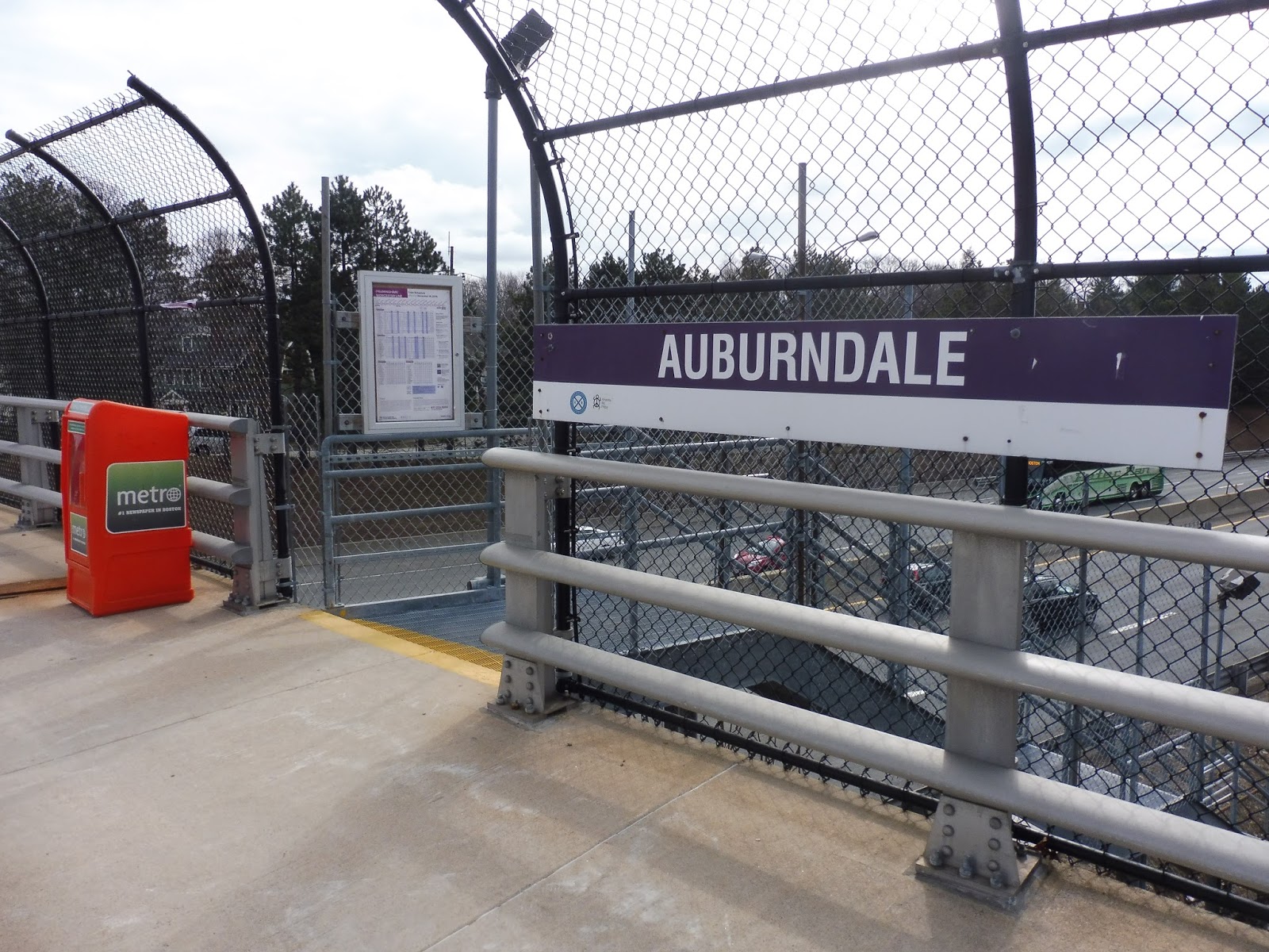
Auburndale
Once upon a time, Auburndale was a commuter station on the Boston and Worcester Railroad. A building was built for it by the acclaimed architect H.H. Richardson, and it was considered by some to be the best he ever built. But then came I-90, which forced the beautiful depot to be demolished. Is the station as good as it was before? Ha! Nope.
 |
| Truly a grand entrance right here. |
Auburndale is one of the Worcester Line’s Newton stations, where the train tracks run right alongside I-90. These stations are rather infamous for being terrible, and Auburndale is no exception. One of its entrances is on Woodland Road, over the highway. It’s a staircase and a schedule card. Moving on…
 |
| Wow! |
Oh man, but the other entrance is decked out. It’s on Auburn Street, and not only does it feature a staircase and a schedule card, but also a station sign and a newspaper box! The fun never stops at Auburndale!
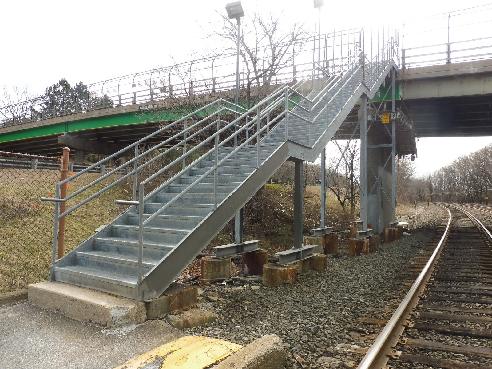 |
| Back on the Woodland Road side. Hoooo, boy. |
The stairs to get down to the station are…something. For one thing, take a look at the staircase in the picture above. Does that look safe to you? Oh, and don’t look down when you’re traversing it, because then you can see right down to the gravelly ground below! Hope you’re not afraid of heights!
 |
| The station…viewed from above. |
Okay, so let’s talk about this platform. It’s right next to the highway. As in right next to the highway. As in when you’re waiting for the train, there’s a never-ending barrage of noise from cars speeding down the road. Plus, random highway trash gets tossed down around the station, making it feel incredibly dingy.
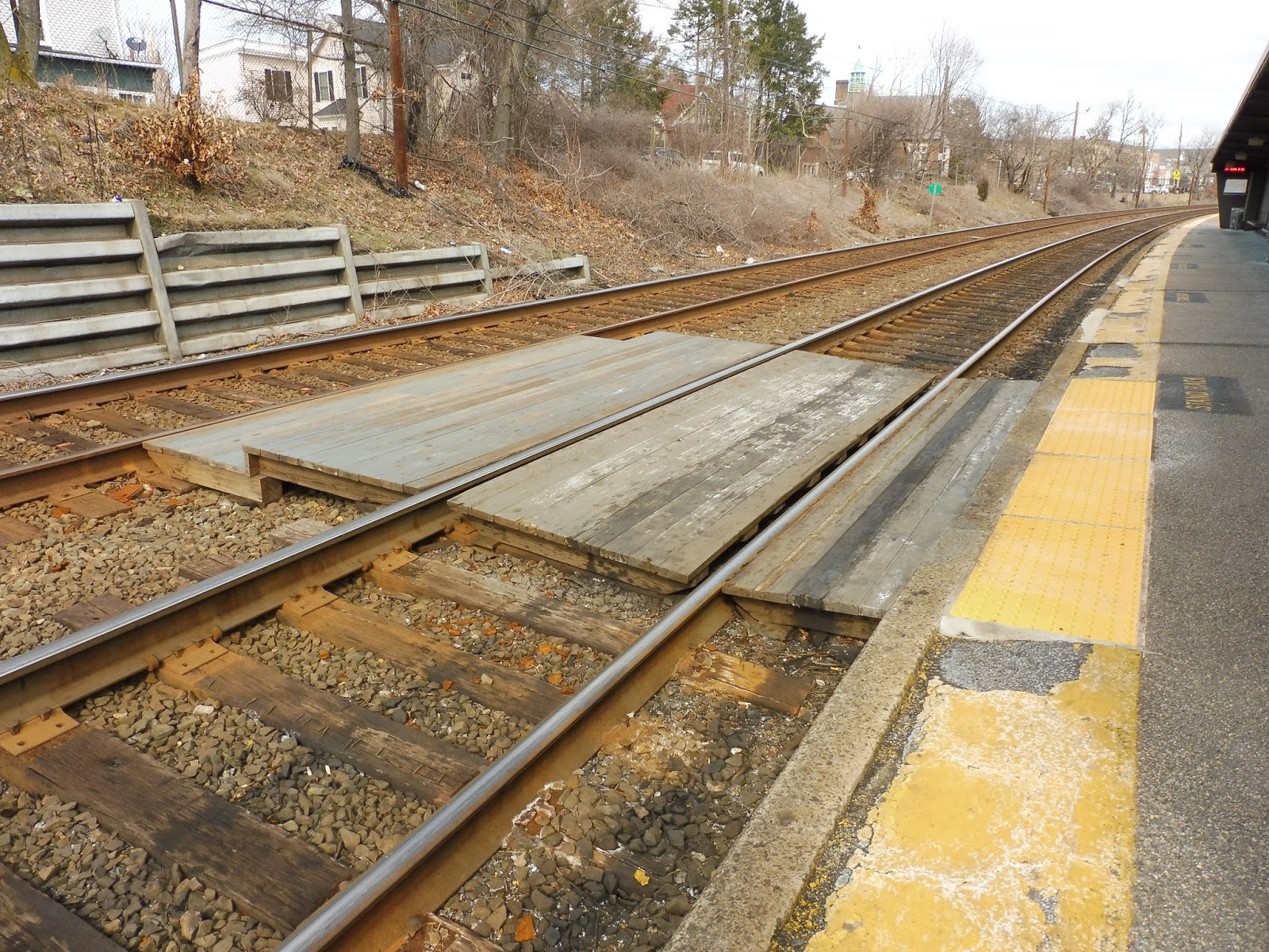 |
| Ohhh, this is a good one. |
Hey, wouldn’t it be funny if they built a two track Commuter Rail station with only one platform? That would be hilarious! Oh wait…Auburndale has this setup and it’s not at all funny! Although haphazard boardwalks are set up to the other track, I don’t believe any trains are scheduled to board from there. Still, the lack of a second platform just creates problems with scheduling on the Worcester Line.
 |
| The simply beautiful shelter. |
Okay, so the shelter. The rotting, bland shelter. It has benches, ads, and wastebaskets that desperately need to be emptied. The ceiling has chipping paint, the windows are made out of the dirtiest glass ever, and the lights are surely incandescent. Lovely place to wait!
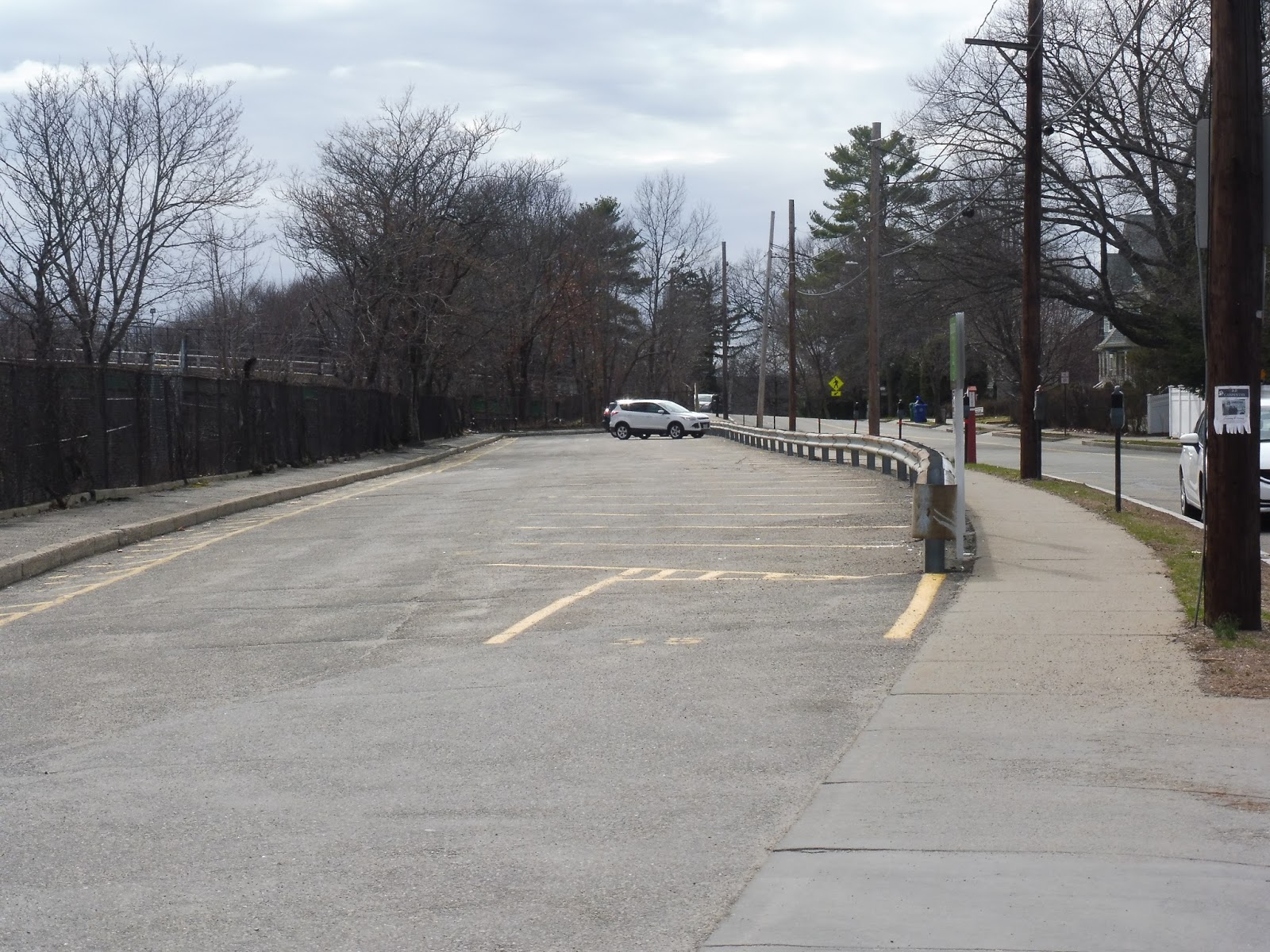 |
| At least there’s parking… |
Well, at least Auburndale has a parking lot. A whole 35 spaces, in fact! Okay, Auburndale has the smallest parking lot out of the Newton stations, and there aren’t even any signs leading to it! I have no idea if it gets filled up on weekdays or not, since the MBTA website doesn’t give information, but…some parking is better than no parking, I guess?
 |
| A train leaning around the curve. |
Station: Auburndale
Ridership: Well…in terms of inbound ridership, it’s the busiest of the three Newton stations. 325 passengers per weekday really isn’t that much, though. On the Saturday I was here, though, a whole one other person was going inbound! Crazy.
Pros: Well…it exists…that’s good…
Cons: Hmm…the horrible staircases? The bare asphalt platform? The fact that there’s only one? The bland, dirty shelter? The overflowing wastebaskets? The proximity to the highway? The noise? The trash everywhere? The meager parking lot? ALL OF IT.
Nearby and Noteworthy: Okay, there is a business block nearby. But it only fits half the equation, since it doesn’t seem particularly noteworthy.
Final Verdict: 1/10
This station is sooooooooo bad. It doesn’t have any redeeming values except for the fact that it’s there. It has the lowest amount of parking of the Newton stations, especially considering that Riverside is right down the road with its huge lot. Oh, and also, the station itself is dingy, bland, and overall horrible! Yup, Auburndale clearly deserves to be this blog’s first recipient of a 1/10. Congratulations?
Latest MBTA News: Service Updates
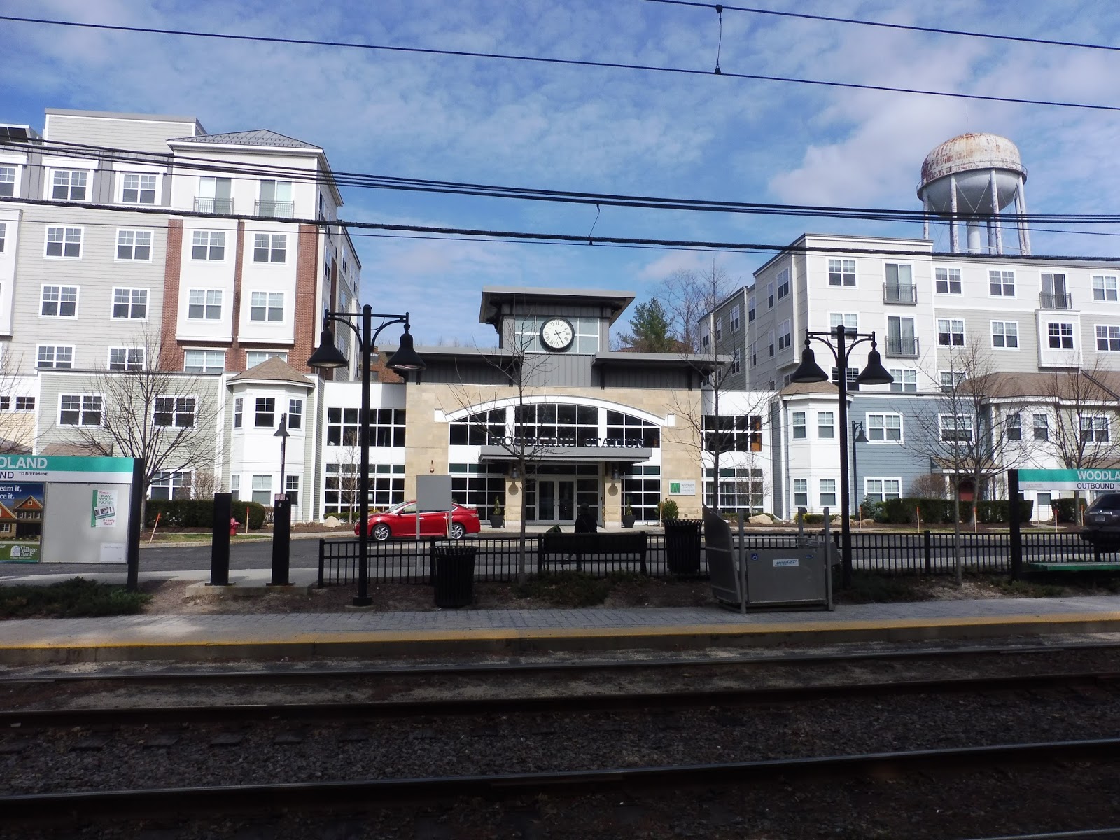
Woodland
Okay, you guys know how much I talk about the tranquility of the D Line. Of course, some stations are more peaceful then others, but you would think that the second-to-last stop on the line would be quite nice. Nope…Woodland throws tranquility out the window.
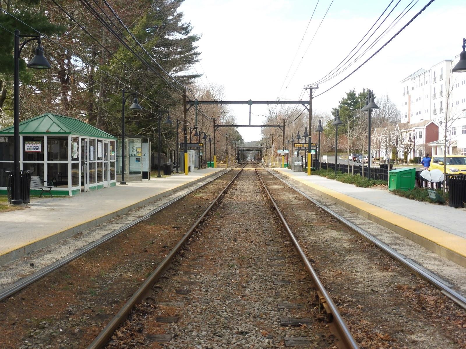 |
| The platform. |
Even ignoring the window through which the tranquility was thrown (which we will get to), the platform has a more modern and unnatural feel than others on the line. It features a heated shelter, of course, but also…glass ones? And…evenly-spaced bushes planted by humans? It all looks way too perfect. Sure, it functions well, but it all feels so…gross.
 |
| Ew… |
And there’s that tranquility-dumping window! Yes, Woodland has a modern generic apartment complex right next to it literally called “Woodland Station”. Now, on the one hand, it makes for a very easy commute for its residents. On the other hand…it kinda ruins the station’s aesthetics by having this huge honking building right next to it.
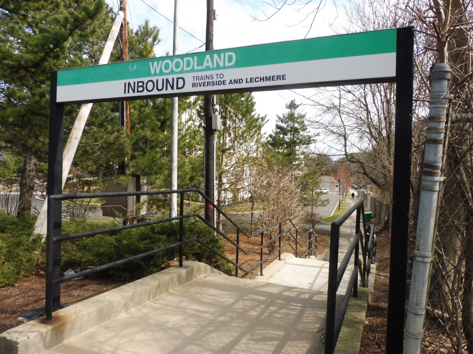 |
| An entrance to the station. |
Aside from the many openings leading to the apartment development, there is one more entrance that goes up to Washington Street. It’s a simple one, basically just a staircase with a sign on the road. From the station, this is considered to be the “hospital” exit, since the Newton Wellesley Hospital is within walking distance from the staircase.
 |
| The station’s bus stop. |
Although no MBTA buses serve Woodland, the MWRTA runs two weekday-only routes here from Natick. As such, there is a small bus stop along the road paralleling the station, a little past the drop-off area. The stop is basically just a sign, a bench, and a wastebasket. I honestly have no idea how crowded it gets, though – probably not very, since this is the MWRTA we’re talking about.
 |
| The parking garage! |
Strangely, Woodland has a full-on parking garage. With 548 spaces, it may not rival the vast lot at Riverside, but this is a good place to go if the latter is full. The station doesn’t offer quite as much in terms of bike spaces, though – in fact, it only has 16.
 |
| The station…viewed from above. |
Okay, since it’s only a three-story garage, I wasn’t expecting much of a view, and I didn’t get much of a view. Most of what you can see is just the nearby golf course, which isn’t the most interesting of locales. You do get a nice look at the station, but it’s not enough to justify the rooftop trip.
 |
| A train heading to Park Street (this was the day before Government Center would open). |
Station: Woodland
Ridership: This is the third least-used station on the D Line, with 957 riders per weekday. This is probably due to the fact that the station has golf courses on two sides and suburban houses on the other two. I imagine that the Woodland Station Apartments contribute good ridership, though.
Pros: Woodland certainly functions well as a station, and the apartment building does provide an easy commute for its residents. Plus, the fact that it has a parking garage is great, and makes the station an alternative to Riverside. Finally, it’s great the MWRTA provides commuter service here, so people can ride to their jobs in the Metrowest area.
Cons: Oh…only the aesthetics. It’s, um, too modern. Compared to the rest of the D. Gosh, do I have a flimsy argument here.
Nearby and Noteworthy: Unless you like to get to get your putt on at the golf course, there isn’t much around Woodland. Also, it seems like it would be hard to lug all of your golf clubs onto the Green Line.
Final Verdict: 8/10
Okay, I’ve had to throw my traditionalist views out the window for this one – perhaps the same window through which Woodland’s tranquility was thrown. Yes, it may not have that classic D Line peacefulness, and it may look overly modern and fake, but…well, the place still functions well. And ultimately, that’s the most important aspect of any station.
Latest MBTA News: Service Updates
354 (Woburn Express – Boston via Woburn Square and I-93)
Hey, guys! It’s me, Kilometers on the MBTA! Miles is sick, so I’ll be taking over for this post. And luckily for me, it’s a bus that serves office parks! I do love office parks. Thus, the 354 was quite a good bus for me. Well, except that all buses are terrible. Plus, I had to go to – ugh – downtown Boston first to get the bus, then travel through – blech – residential areas before getting to the lovely, lovely office parks.
 |
| The bus downtown. |
The bus starts right outside the Old State House and its subway station, on State Street. Gosh…I can’t believe we still have historic buildings like the Old State House around. Why can’t we bulldoze them and replace them with great new buildings? You know, stuff like Boston City Hall! Speaking of which, we passed that, as well as that new Government Center monstrosity, as we headed down Court Street.
 |
| What’s this? A pedestrian walkway? Just put a road in! Everyone knows that pedestrians don’t matter in cities! |
The street became Cambridge Street, then we turned onto Sudbury Street, the buildings getting slightly less tall as we headed toward Haymarket. When we crossed over the Greenway, I thought, “Why did they tear the elevated highway down in the first place? I liked it.” We entered into the I-93 tunnel and then burst out onto the Zakim Bridge. You know, a lot of people talk about how impressive of a bridge it is…I don’t really see the appeal.
 |
| Boston has an alright skyline, but I would prefer a proper skyline. Like Fresno. |
Soon after joining the highway, it stacked up and we hit traffic. Personally, I like to see traffic, since it reaffirms the fact that cars are still the dominant form of transportation in America. I don’t understand why cities are investing in public transportation when highways are clearly way better for everyone. The bridge we were on offered a view of the surrounding areas, but it unstacked and lowered once we passed Sullivan Station.
 |
| Near Assembly Square. |
We passed Assembly Square on one side, which in my opinion would be a good mall if it had more high-end fashion stores. After going along the Mystic River for a bit, we crossed it later on, then went by Medford Square on the left (reverse peak 354 trips take the exit to serve the square, but we sped right past). We entered the Middlesex Fells Reservation after that, which just seems like a big waste of space to me. Why not cut down all the trees and replace the reservation with a parking lot? The world needs more parking lots.
 |
| Now this is my kind of neighborhood. |
We eventually left the reservation, taking the first exit after it. Turning onto Montvale Ave, we passed lots of lovely businesses with parking lots out front. I do love parking lots. Near a school, we turned onto Central Street, then Pine Street. This was a somewhat narrow road lined with houses. Now, my question is, why the heck do they bother to build narrow streets? There needs to be lots of room for cars to go through. Narrow streets disgust me.
 |
| Does that house have solar power??? Gosh, just use fossil fuels like everyone NORMAL. |
The road merged into Salem Street, and for a disappointingly short time we went through an industrial area. We then turned onto Bow Street, going by an elementary school, and returned to Montvale Ave, passing the huge Woburn Memorial High School. Okay, what’s with all these schools? Education isn’t that important! I educated myself in urban theory, and just look how innovative and forward-thinking it’s made me!
 |
| Ugh…what the heck is this? |
We passed a little apartment building, and soon after we entered…Woburn Square. Now, lemme tell ya, this was a horrible place. There were so many businesses, and yet no parking lots! What’s more, this place had sidewalks! They could easily be destroyed to make room for more cars. These urban planners need to step up their game.
 |
| Some more houses. |
We went through the square past a common (which could be replaced with parking), and then we zoomed by a disgusting old library. Can we please update old architecture to keep with the times? We need more buildings like Boston City Hall everywhere. It got residential after that, with houses lining the street that started out dense but got more spread out.
 |
| Ah, beautiful pylons. |
We merged onto Lexington Street, with no break from the houses until we went under the pylons. And after that…ah, gorgeous parking lots! Oh my, the intersection with Cambridge Street had so many fast food restaurants with such large, luscious parking lots! Gosh, I would marry a parking lot if I could. Oh…whoops, I just typed that. So anyway, we turned onto Cambridge Street, joining the 350!
 |
| Ah, yes, this is a beautiful lot. Her name is “Brenda”. |
Alas, it was back to boring old houses after a little while. Luckily, these soon became housing developments. Now, I personally love housing developments. Too much variation in houses looks inconsistent; they all need to look exactly the same in order to be pretty. Additionally, housing developments encourage car use, which means my precious parking lots can be filled. Yes!!!!!
 |
| Apartment developments? I like ’em! They usually have big parking lots! |
Speaking of parking lots, we were all of a sudden surrounded by office parks! Malls! Car dealerships! All with huge, beautiful parking lots! The streets were all so wide, and cars were everywhere! It was heaven! We turned onto Wayside Road, going by a pulchritudinous shopping mall, and then the street became Van de Graaff Drive. We passed a corporate business hotel, (YAY!!!!) and arrived at our terminus, right outside of a huge office park. I got off the bus to explore this sacred land…
 |
| I wanted to do more parking lot pictures, but Miles made me do this stupid bus one instead. |
Route: 354 (Woburn Express – Boston via Woburn Square and I-93)
Ridership: Ugh, do I really have to do this? Miles made me find “ridership data” for this route…let’s see, um…683 riders per weekday? Oh wait, that’s the 236. I hate lists. Um…ah, okay, 728 riders per weekday. Not really sure what that means, but okay. Miles says that “most of those riders are probably residents of Woburn getting home or to work, with some reverse commuters coming from or going to office parks”. I think there’s a third, even larger ridership group, though: the ones who take joyrides to parking lots! You know, for those people who want to see lots of parking lots, but don’t have cars.
Pros: Well, that’s basically it, isn’t it? This “bus” allows people to go up to Burlington and enjoy its breathtaking parking lots! Um…oh, Miles wanted me to add that “it’s a good express route to Woburn and (to a lesser extent) Burlington that has a good amount of trips for an express bus. It runs as often as every 15 minutes in the evening rush! I also like how it takes over Chestnut Avenue service from the 352 once that stops running in the evening. It even provides reverse commute express service to Medford Square, serving it in the non-peak direction.” Okay, I have no idea what any of that means, but I guess Miles seems to like it.
Cons: Yes, there’s a very big con here: since it’s a bus, it takes cars off the road! There are 728 people who could be in cars that instead take this so-called “354”! That’s simply despicable. Miles also wanted to add that “Van de Graaff Drive is an odd place to end the route, though there aren’t many other termini that would make sense. There could probably be more reverse commuting if it was extended to the Burlington Mall, though, as it would pass more offices along that route.” Thanks for the “insight”, Miles.
Nearby and Noteworthy: Parking lots! Office parks! Malls! Yes!!!! Can you believe that Miles wanted me to add “Woburn Square” to that list? Geez, Louise, who does he think he is? He must’ve been joking. All I can say is that if someone takes this bus to visit a parking lot, Brenda is MINE!
Final Verdict: -50/10 (8/10 from Miles)
The 354 is a bus. Therefore, it’s horrible. I know I said that it can be useful for people wishing to visit parking lots, but seriously, guys, just get a car! These buses are clogging up our city streets and highways and making them inhospitable! Have you ever driven behind a bus? It’s awful! Buses need to be burned and destroyed. Same with trains – they should be replaced with highways. There, all the country’s transportation problems are solved!
Latest MBTA News: Eh.
Oh wait, Miles left one more note for me here…”April Fools”. Huh. Not really sure what that’s supposed to mean.
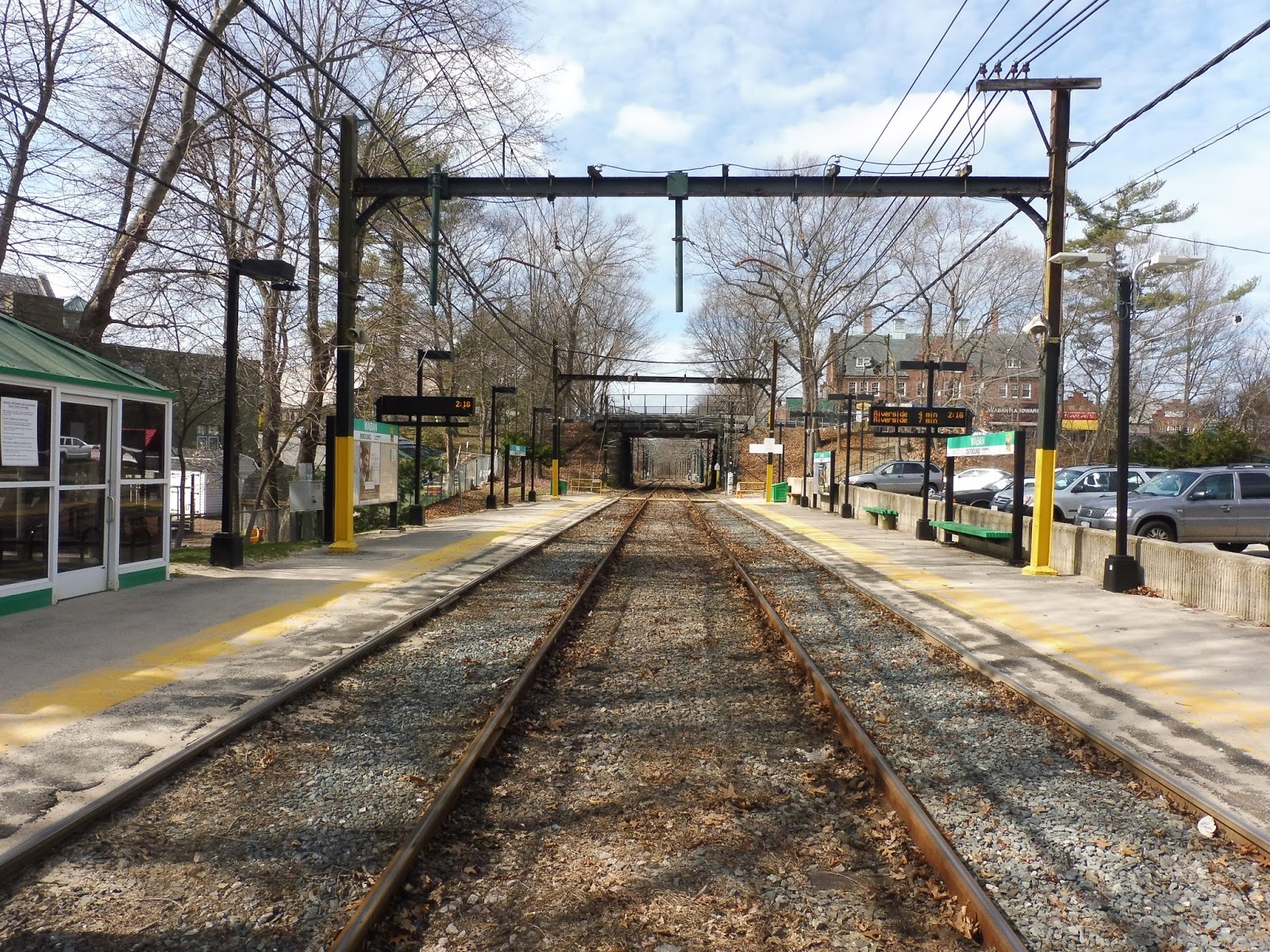
Waban
Yes! I’ve always thought that Waban has an absolutely hilarious name. I mean…Waban! Isn’t that funny? Wow, I love stations with funny names. Okay, if you can’t tell, I don’t have anything else noteworthy to say about Waban.
 |
| Oh man, these “middle of the tracks” shots are starting to blend together in my mind… |
Surprisingly, Waban’s outbound platform has three benches, which seems like a lot, considering it’s the third-to-last station on the line. The inbound side, conversely, features only a heated shelter, with no other benches. That said, the heated shelter is basically all you need. Most of Waban’s platform is bare asphalt, to be honest.
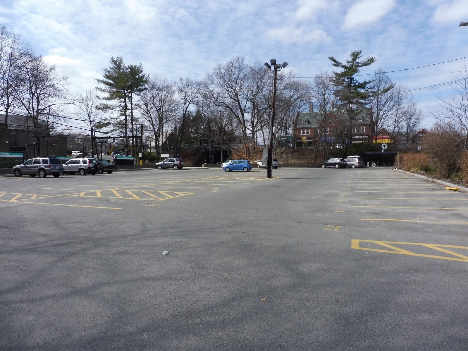 |
| The biggish parking lot. |
For the D Line, Waban’s parking lot is pretty big, with 74 spaces. The station also features bike parking, with 12 sheltered spaces on the edge of the lot. Strangely, on the other side of the lot, there’s an old “honor box”, as well as two random newspaper boxes! I don’t think any of those are gonna get any form of patronage…
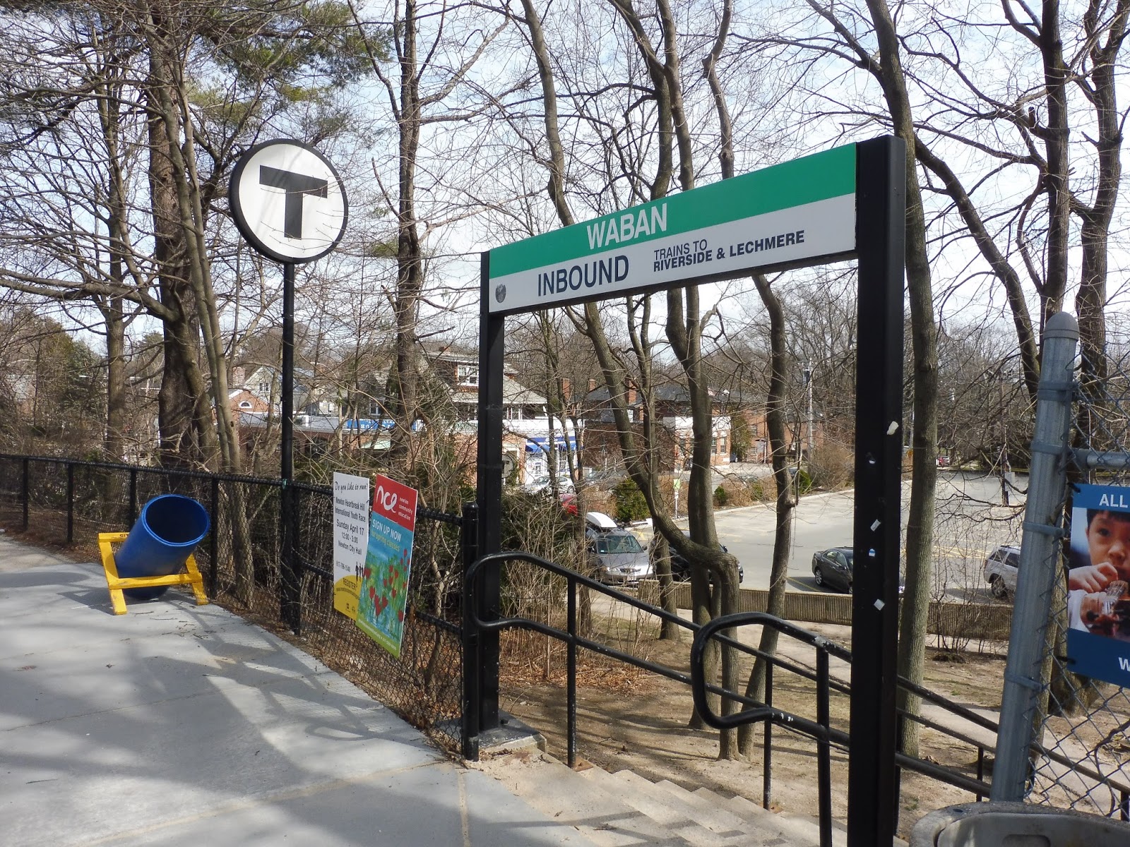 |
| One of the station’s entrances. |
The only exit from the platforms is a pedestrian path from the outbound side. It runs up along the parking lot, with one way leading out toward Wyman Street and the other being a staircase up to Beacon Street. The latter could effectively be considered the “main entrance”, as it features a station sign and a T symbol. It also takes you to a really nice little business block – the square after which the station is named.
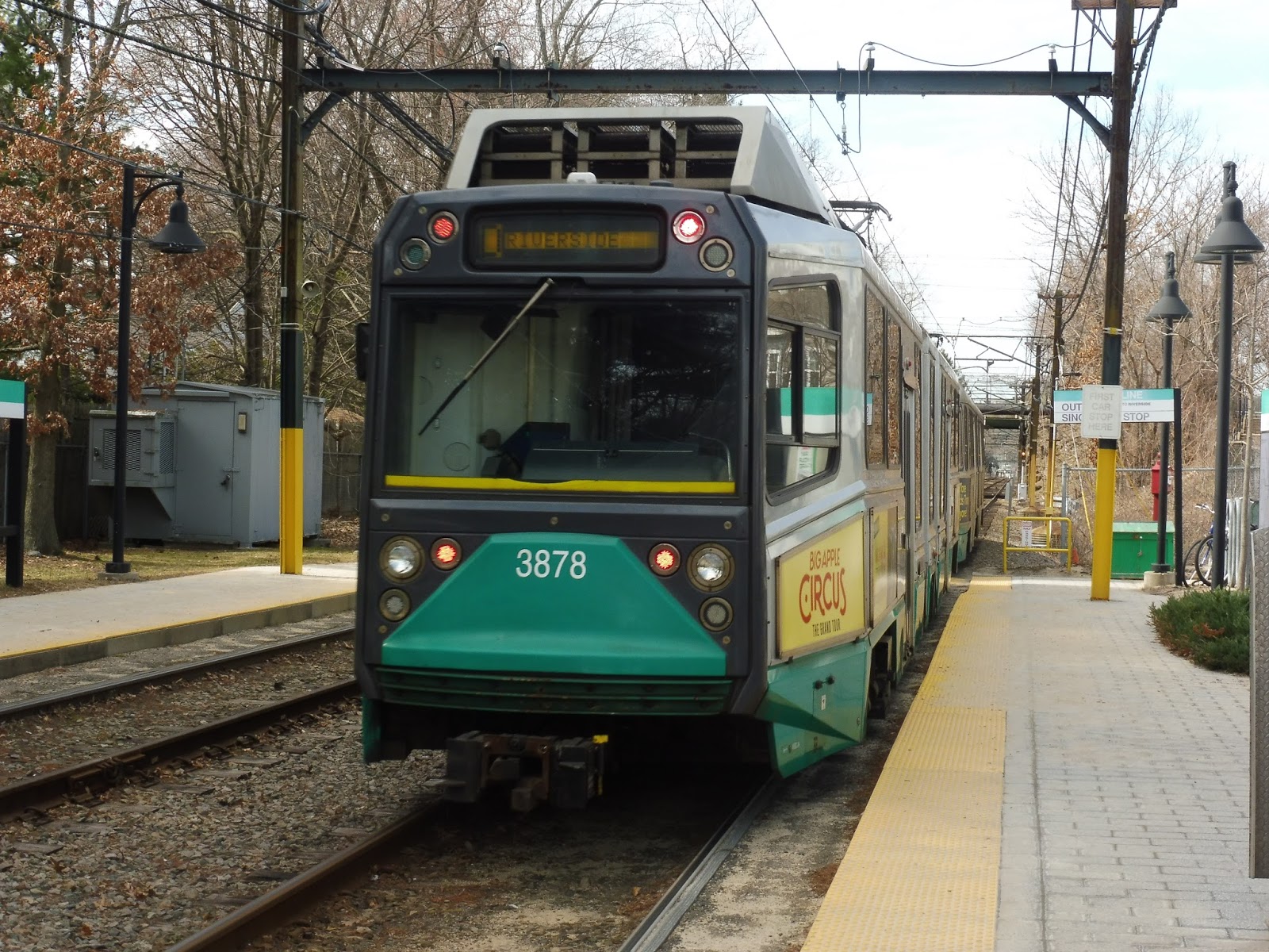 |
| A train leaving the station. |
Station: Waban
Ridership: Waban has the lowest ridership on the D Line, and by a pretty high degree. With 545 riders per weekday, it’s almost 300 passengers less than the second-lowest station, Eliot. I’m not entirely sure why Waban gets such low ridership, but the surrounding areas are generally less dense than other stations along the line.
Pros: Wanna know what Waban is? Why, it’s tranquil! Yes, this is a lovely quiet station, and despite not having much in the shelter department, it still manages to have that D Line charm. Plus, with such low ridership, the heated shelter is basically all you need. Waban also offers lots of parking considering its ridership.
Cons: My main issue here is with the entrances, or lack thereof. The problem is that the only way of getting in is from the north, forcing people coming from the south to double back. Still, we’re talking about three minutes extra of walking, if that, so this is quite a nitpick.
Nearby and Noteworthy: Although it doesn’t offer too much in quantity, Waban’s “downtown” has to be the cutest business block I’ve ever seen. Really great old architecture, too.
Final Verdict: 8/10
Oooooh, I really wanted to go for the 9. I just reaaaaaaaally wish the station had a wooden shelter to truly make it a quintessential D Line station…and then some! Seriously, Waban has so much going for it. The only functional problem with it is the whole entrance thing, but it would never get fixed, and it really doesn’t need to be. A three minute walk is nothing. Argh, I just wish it had a wooden shelter, dang it! Yes, I’m overly picky with my D Line stations. So what? Waban is still great! Oh wait…it’s not accessible? Okay, that’s an actual issue. 8/10 it is!
Latest MBTA News: Service Updates
Eliot
Last year I wrote an MBTA rap for a school project. It was…interesting. And I don’t really mean good-interesting. One of the lines in the rap went “Eliot Station is right by Route 9/The middle of nowhere, on the D Line”. However, I had never actually visited the station when I wrote that. Well, when I finally went there, I had the startling realization that…well, I wasn’t too far off the mark, as it turns out.
 |
| The station’s parking lot. |
I came to this station on Lincoln Street, which has a nice T symbol at the end of it to let everyone know that’s where Eliot is. The street ends with an entrance into the station’s parking lot – it’s official MBTA parking this time, with a whole 55 spaces! Okay, so that’s not nearly enough. At least the station also has 16 bike spaces next to the parking lot, and 22 sheltered ones on the inbound platform. Another pedestrian entrance leads from Meredith Ave, on the other side of Eliot.
 |
| Um…I’m not sure if this complies with ADA standards… |
The station is, as I said, “right by Route 9”, and it has a few entrances from it. The first one leads to the inbound platform, and it’s a very narrow path that goes right up a hill. Sure, it has a railing to help people get down, but I can’t imagine someone like a senior using this entrance.
 |
| The footbridge over Route 9. |
The outbound side has a staircase entrance down to the highway, but also, Eliot has a footbridge that actually goes over it. Paralleling the train tracks, the footbridge allows pedestrians to get over the massive road that would be impossible to cross otherwise. On the other side, people can descend a ramp to get to Route 9.
 |
| Looking down the platform. |
Considering that the outbound platform is just a few benches, there’s not much point in talking about it. The inbound side, on the other hand, has the classic D Line heated shelter, as well as…a glass shelter? Wait, no wooden one? But this glass one is so ugly! It’s all scuffed up and has an awful metal bench inside! Well…that’s a disappointment.
 |
| Woah! A double! |
Station: Eliot
Ridership: It’s certainly on the low end of the D Line’s ridership spectrum, coming in at second-worst. Eliot’s 814 riders per weekday almost certainly all go inbound, and fan in from the surrounding residential areas. And…I guess 55 of those people drive to the station, too.
Pros: Like many other D Line stations, Eliot has lots of entrances going everywhere, with the footbridge over Route 9 being especially useful. In terms of tranquility, Eliot gets a “somewhat” – although the platform is quite leafy, the highway nearby makes some unwelcome noise. Finally, the heated shelter on the inbound side is great, as always.
Cons: But the metal one is awful. For one thing, it’s ugly, and for another, the bench must be so cold in the winter! (I wish I had sat on it to find out…) In addition, though not much can be done about this, the station doesn’t seem to have enough parking. Perhaps more bike spaces could be added to encourage cycle commuters?
Nearby and Noteworthy: No, nothing much. The best thing you’ll get is the nearby Sudbury Aqueduct, which people can walk along.
Final Verdict: 6/10
Noooooo! I thought all of the further-out D Line stations would have character, but this one has none! It’s hardly even tranquil! Sure, it performs its duty as a station well, and I like the bridge over Route 9 a lot, but Eliot needs to step it up in the aesthetics department. Come on, Eliot, this is the D Line we’re talking about!
Latest MBTA News: Service Updates
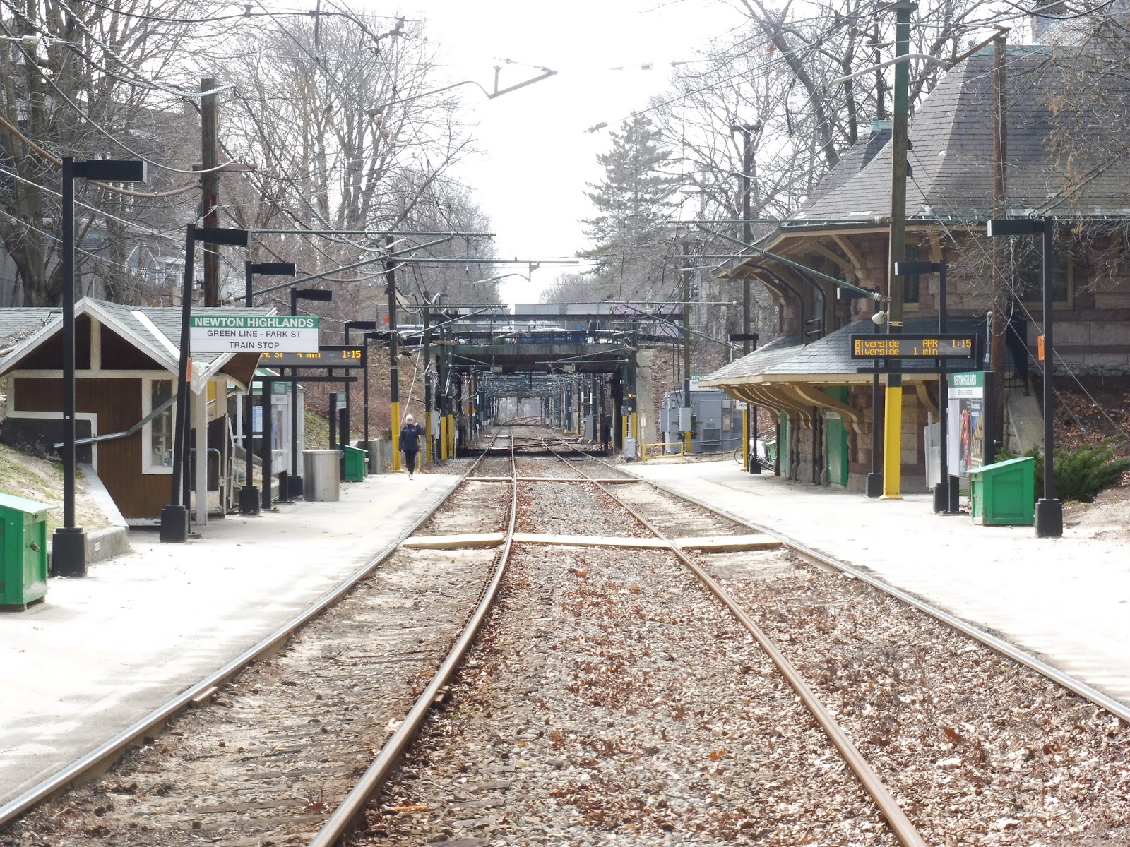
Newton Highlands
Newton Centre and Newton Highlands are the two D Line stations with old buildings, and thus they’re definitely among my favorites. They even both have small villages around them, though Newton Highlands’ is smaller. Still, that’s certainly not enough to detriment this place, so let’s take a look!
 |
| Argh, this station is so nice! |
Newton Highlands has a typical D Line platform, including wooden and heated shelters on the inbound side. The station also features benches on both platforms, and a few places where one can cross between the two. In terms of amenities, the outbound side is pretty bare…
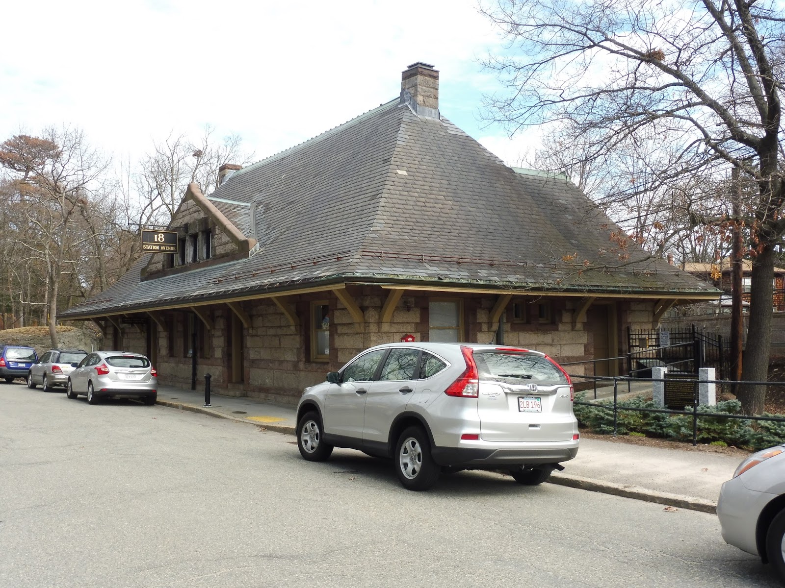 |
| Oh wait! |
Right, except for the station building! Now, to be honest, I think the Newton Centre one is better, with its vintage signs and generally more interesting architecture. Plus, that one has a diner in it! The Newton Highlands building is a bit more boring, and it only houses some lame offices. Still, though…an old building is an old building.
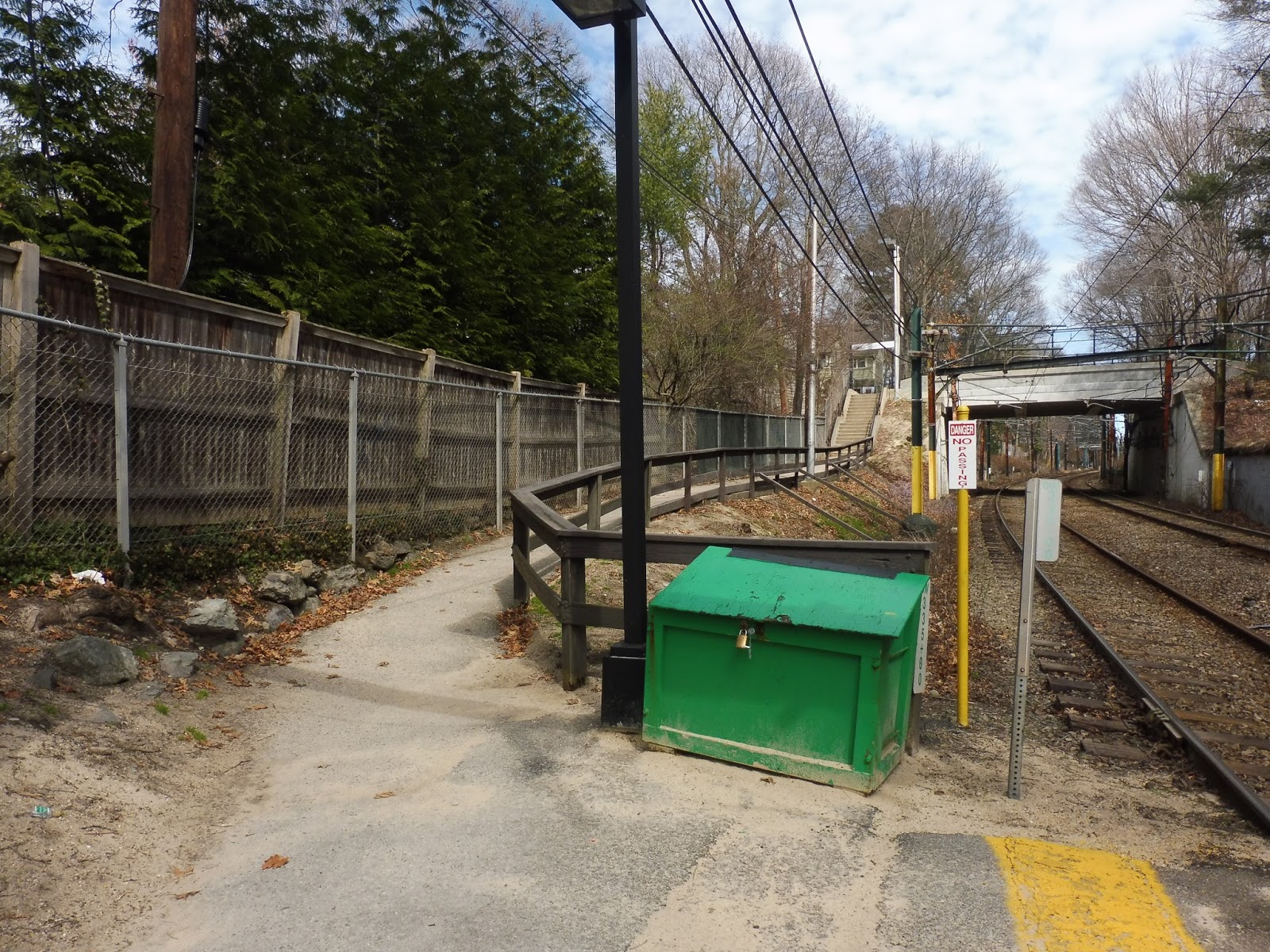 |
| The path to one of the entrances. |
One of the station entrances leads to a more residential area. It starts on the outbound platform, and is a path that parallels the tracks for a bit. Eventually, it becomes a staircase that runs up to Hyde Street, within a leafy neighborhood that’s entirely houses. This entrance features a T symbol and the station name. A similar entrance can be accessed from Station Ave – this one is a simple path to the outbound side.
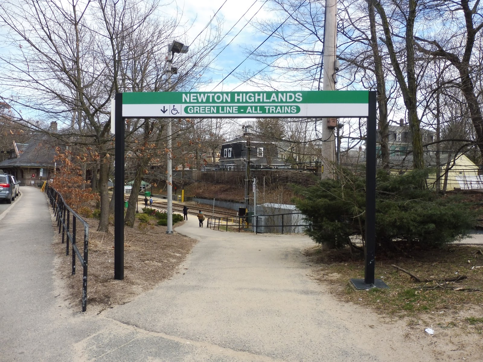 |
| The station’s primary entrance. |
However, Newton Highlands’ main entrance leads right into the village. Once again, it’s a path that goes from the outbound platform, this time to the intersection of Lincoln and Walnut Streets. Outside the entrance, there are newspaper boxes, a wastebasket, and a bench – not sure why they’re there, but why not?
 |
| A 59 boarding at the station bus stop. |
 |
| A train coming into the station. |
Reservoir (and Cleveland Circle)
I’ll probably never review the Green Line street-running stops, since most of them are just…bad. And they’re all bad in the exact same way. But since Reservoir and Cleveland Circle are basically considered one station, I figured I’d give them both a chance in the spotlight.
 |
| Cleveland Circle’s “platform”. |
It had been a while since I had gone out on one of the street-running Green Line branches, but hooooo, boy – I had forgotten how simple these stops were. And Cleveland Circle is one of the better ones! It has a ticket validation machine, some newspaper boxes, and a shelter further down the platform. Such great amenities…
 |
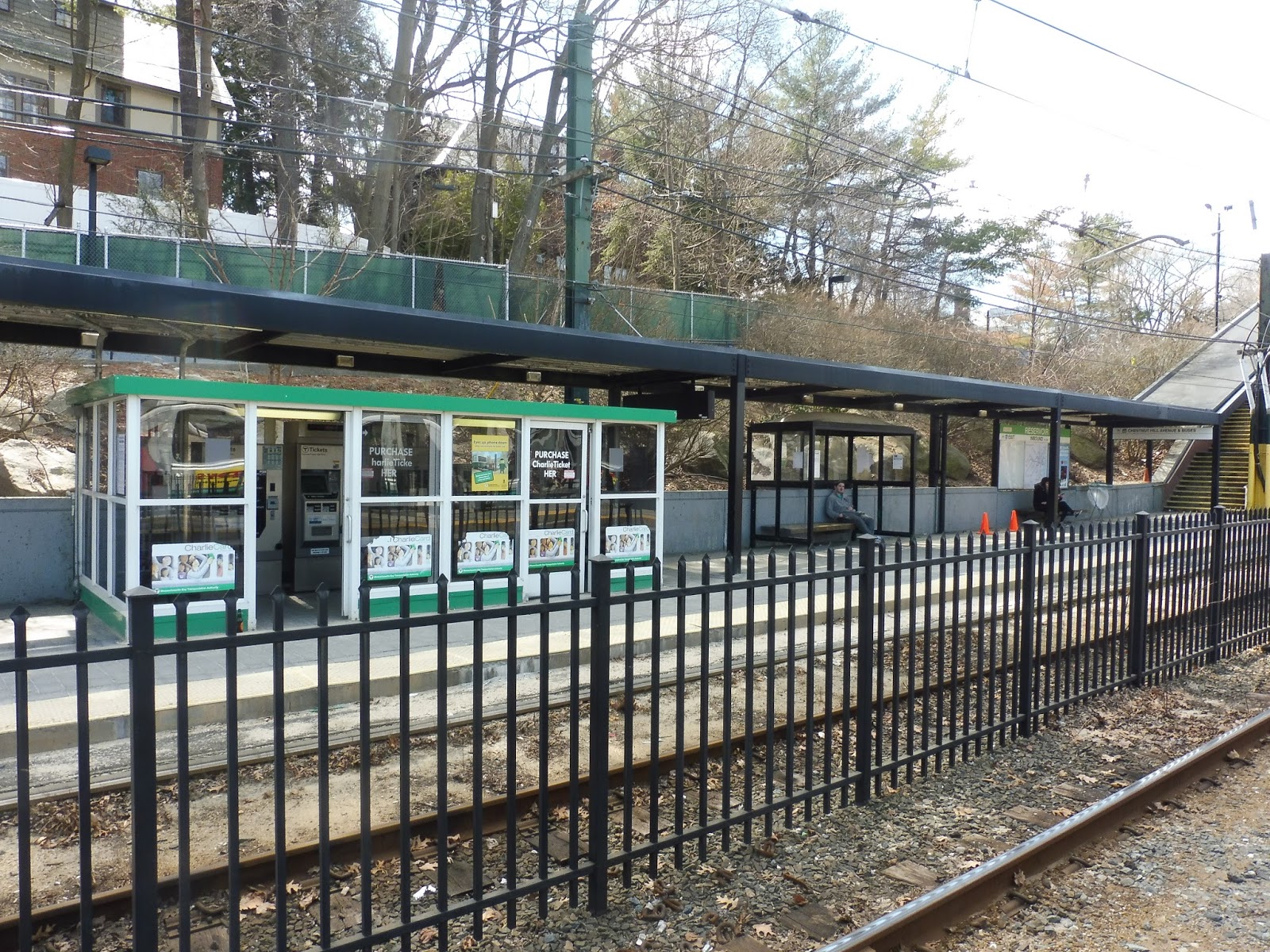
| The station’s busway. |
Moving into Brookline, there’s a busway and drop-off area right outside of Reservoir Station. Admittedly, it’s only served by two routes, the 51 and the 86, but that’s better than nothing. This area also features sheltered bike spaces. Although there’s no official parking, Cleveland Circle has street parking along Beacon Street, which has to count for something, right?
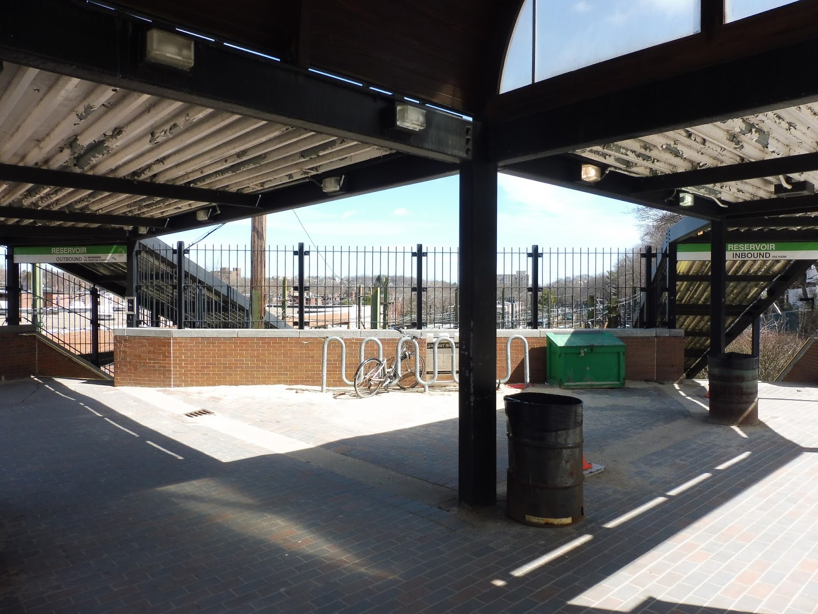 |
| The entrance into the station. |
The entrance to Reservoir also forms a little sheltered plaza. The plaza features more bike spaces, a wastebasket, some benches for buses or pick-ups, and one of those “Charlie on the MTA” plaques about the song (seems like an odd place to put one, but okay). Unfortunately, the shelter has some rather nasty paint chipping along its metal roof.
 |
| Looking down the platform. |
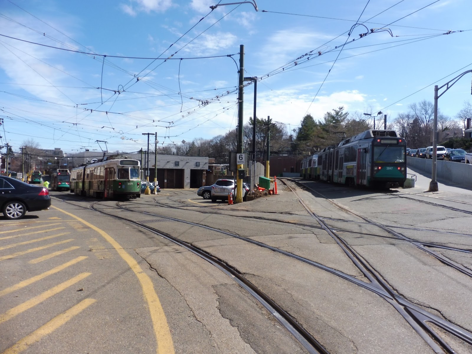
You know how most D Line stations have…mmm…character? Yeah, Reservoir has none of that. Most of the platform is sheltered, which should be a good thing, but it’s with those ugly metal paint-chipping structures. And though Reservoir Yard is right next to the station, which is pretty cool, it does ruin any tranquility Reservoir might’ve had.
 |
| The inbound side. |
Still, the platforms certainly don’t lack in amenities. The inbound side has a regular shelter (a bit pointless, since there’s a roof right over it), as well as a heated one. At the end of the station, there’s a ramp which curves around to the busway, giving it “accessible” status.
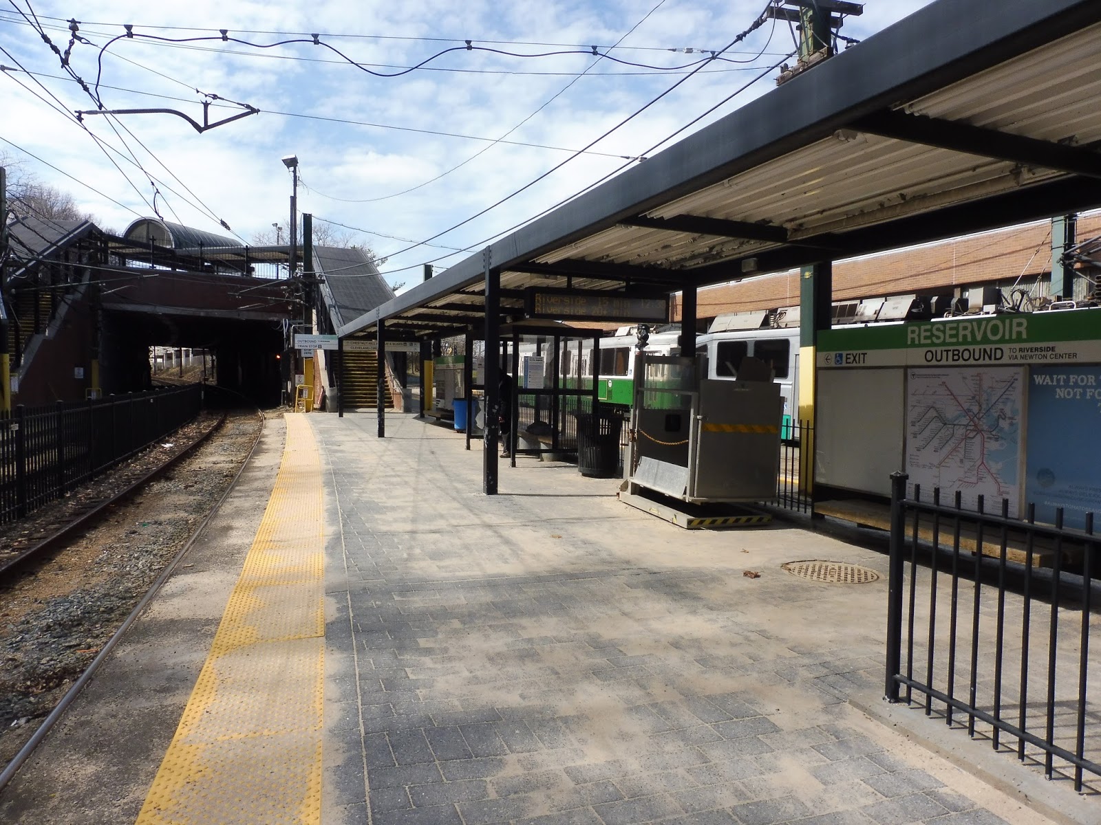 |
| And the outbound side. |
The outbound platform is, as you would expect, more basic than the inbound one, although I would imagine this station still gets traffic heading towards Newton. This platform has only the normal shelter (no heat, unfortunately), and a few other benches. Its accessible ramp leads right alongside the yard, and it drops you off a little further north down Chestnut Hill Ave.
 |
| Instead of just one train, how about a bunch of trains? |
Stations: Reservoir and Cleveland Circle
Ridership: Because the D is infinitely faster than the C, Reservoir gets more than twice the ridership of Cleveland Circle – 3,404 riders per weekday versus 1,457 for the latter. Cleveland Circle was basically empty when I was here, while Reservoir was full of people dressed in green heading for the Saint Patrick’s Day Parade.
Pros: The only pros I can really give Cleveland Circle are its location and the fact that it’s better than other Green Line street stops. Reservoir, on the other hand, is entirely sheltered, and features many more amenities than its C Line cousin.
Cons: Cleveland Circle has all the problems that Green Line street stops have: it’s too narrow, too basic, and the ride is too slow. Reservoir’s problems, on the other hand, are mostly aesthetic. The shelter running along the whole station looks awful, and the modern architecture makes the station lose any character it might’ve had.
Nearby and Noteworthy: Cleveland Circle has lots of businesses, mostly convenience stores and restaurants. I suppose the station of the same name is closer, but honestly, just use Reservoir. It’s a faster ride, and only a slightly longer walk. That said, if you’re not in a rush, the C is a pleasant ride, it has to be said.
Final Verdict: 6/10
Why is the score so high? Well, I was originally going to average out my opinions of the two stations, which would’ve resulted in a much lower score. However, Reservoir does perform well functionally, and I haven’t factored in the busway yet. Also, there’s a key point I haven’t brought up: the fact that the stations are so close. Having essentially a transfer on the outskirts of the Green Line can be incredibly useful, like if you’re coming from Newton and are trying to get somewhere along Beacon Street. I still dislike both of these stations, but they do have their perks.
Latest MBTA News: Service Updates
Okay, writing the review for Cleveland Circle made me think: can I really try to review every MBTA station without doing the street stops? To be honest, I think that’s a no. Thus, I’m adding Green Line street stops to my to-do list! They’ll probably just get bite-sized reviews since there isn’t much to them, and I’m not sure when I’ll get around to visiting them, but look out for street stops in the future!
Happy Easter, by the way.
Beaconsfield
I love how quickly the neighborhoods of Brookline can change. Beaconsfield is in a very quiet, leafy residential area, yet it’s only a block away from busy, urban Beacon Street. We will be covering the latter once we review Reservoir, but for now, let’s take a look at Beaconsfield.
| One of the station entrances. |
The more obvious entrance to the station is from Beaconsfield Road, which is lined with apartments. A T symbol marks where the station is, and from there, a quiet side street leads into it. It also goes to the station’s parking lot, which is once again not official MBTA parking. They just have an electronic meter where people pay.
| Well, this is…unassuming. |
The other entrance is on Clark Road, which consists of houses rather than apartments. Honestly, if I had been walking down this street, I would’ve never noticed the small path that leads to the station! The only indication that it even leads anywhere is a little sign that says “Beaconsfield Path”. Perhaps a T symbol would be helpful?
| The two platforms. |
Unlike Brookline Hills, Beaconsfield actually has a wooden shelter! Woooooo! This is the primary place to wait on the inbound platform, though it also has an outdoor bench. The wooden shelter even has a couple of cat silhouettes painted on it, which is a really nice (if slightly random) touch.
| The station…viewed from above. |
Meanwhile, the outbound side features a heated shelter, of course, with fare machines and benches inside. It also has a lone outdoor bench, but come on – just use the shelter. It’s heated, for heaven’s sake! The station’s third and final entrance leads to the outbound platform, as well. It’s a staircase that comes from Dean Road with some actual signage telling pedestrians it’s a train station.
| A train on the station’s curve. |
Station: Beaconsfield
Ridership: Since I called Brookline Hills “average” for the D, Beaconsfield is probably “below average”. It gets 1,075 riders per weekday, and I think the lower number can be attributed to the C being nearby – although its closest station, Dean Road, only has around 400 riders per weekday, to be fair.
Pros: It’s tranquil! Yes, the wooden shelter combined with the quiet neighborhood definitely gives Beaconsfield some good ol’ D Line peacefulness. Aside from that, the heated shelter is always a plus, and the station features bike spaces and parking (albeit not official parking). Finally, the fact that the station has three entrances is great, making it easier for people in the surrounding areas to get there.
Cons: Well, firstly, there’s the lack of official parking – paying by meter is certainly not optimal when commuting to Boston for the day. Also, the absence of signage on the Beaconsfield Path along Clark Road is annoying. Admittedly, the neighborhood is so local that residents probably just know where it goes, but a small T symbol would still be nice.
Nearby and Noteworthy: The surrounding areas are mostly residential, so I doubt you’ll find anything interesting around here. Even nearby Beacon Street is just lined with apartments rather than any retail.
Final Verdict: 7/10
Okay, Beaconsfield is your true quintessential D Line station. From the wooden shelter to the heated one to the quiet platform to even the lack of signage…yeah, it’s all there. Of course, the quintessential D Line station always earns a 7, so…there you go!
Latest MBTA News: Service Updates