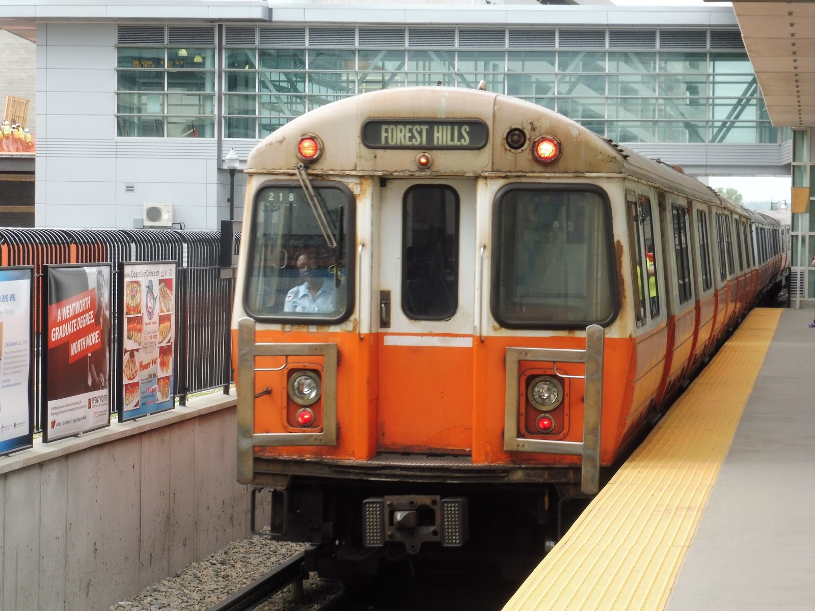
Kendal Green
Kendal Green, Kendal Green, Kendal Green…yup, this is a station, all right. I think I’ve exceeded the number of interesting words I can possibly say in this intro…
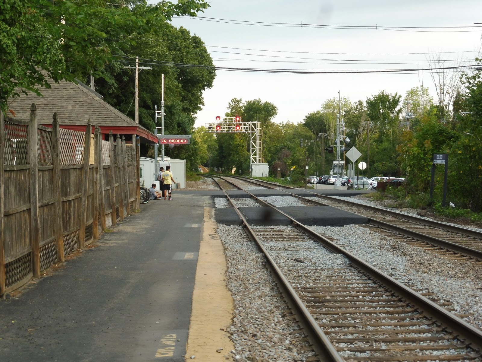 |
| Looking down the platform. By the way, that speck is an unfortunate presence on my camera lens…I really need to get that fixed. |
Okay, the first thing to note about Kendal Green is that it’s a pretty small station. In fact, when my friend Nathan and I got out here, we were let off in the middle of the grade crossing! Another thing to note about this place is the fact that in order to board inbound trains, you have to cross the outbound track. They have pavement on the tracks to make it easier, but it’s certainly not an optimal setup.
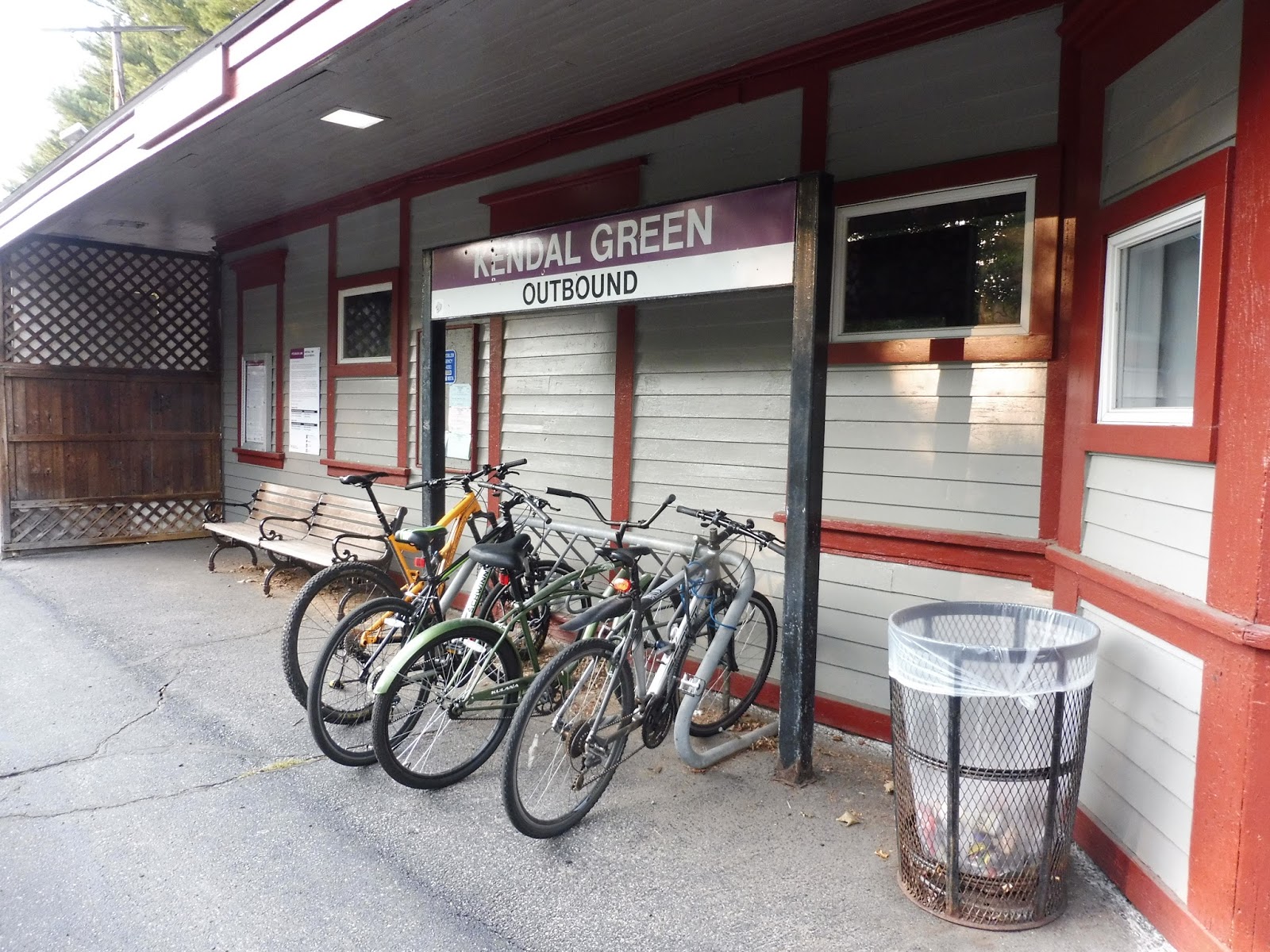 |
| Underneath the shelter. |
This station has a rather charming building that provides a bit of shelter. Underneath it is a bench, a wastebasket, a bike rack (very convenient), a schedule, and…polls? Yes, for some reason there were election polls hung up on the wall. Is this really a place where people come to vote?
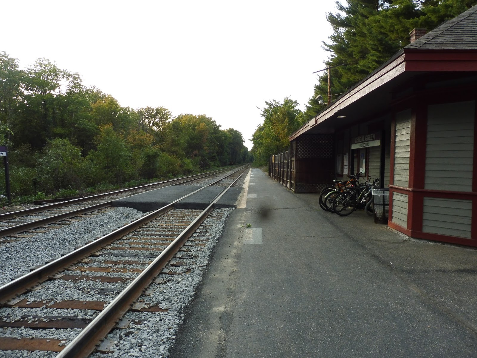 |
| Looking the other way down the platform. |
The rest of the tiny platform isn’t particularly noteworthy, and thus we move on to parking. Now, I actually didn’t know this place had a lot when I was here, so I’m basically relying on Google Street View and the MBTA website for my information. But yes, Kendal Green has a small lot with 57 spaces. It seems like it gets pretty full on weekdays, which could be bad if people can’t get in, but at least the parking’s free!
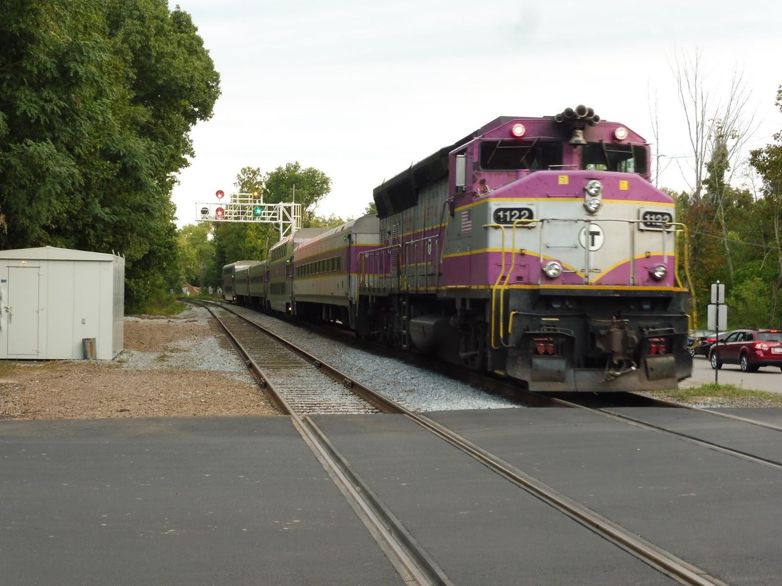 |
| A train heading into Boston. |
Station: Kendal Green
Ridership: Oh dear, not much at all…Kendal Green only gets 162 inbound riders per weekday. It’s the fourth least-used station on the Fitchburg Line.
Pros: This station definitely has charm to it, especially with that building. Its amenities are fine considering its ridership, and the free parking is nice, as well as the bike rack. Finally, I like the way this station is scheduled – outside of the peak, it’s always a flag stop. This is a good way of letting people get on if they’re there, but not having to hinder other passengers on the train if the platform is empty.
Cons: It’s just a very basic station. The platform is tiny, and there isn’t even one on the inbound side! That being said, I guess it does match the ridership.
Nearby and Noteworthy: No, the surrounding area is basically all houses. It’s only a mile to the closest 70 stop, though!
Final Verdict: 5/10
I dunno, it’s just…Kendal Green. I certainly see its charm, and it has a good amount of it, but the lack of an inbound platform is really bad. Even then, giving this a 6 would mean it’s better than Concord, which it most certainly isn’t. Kendal Green does its job fine, but it definitely has its fare share of problems.
Latest MBTA News: Service Updates
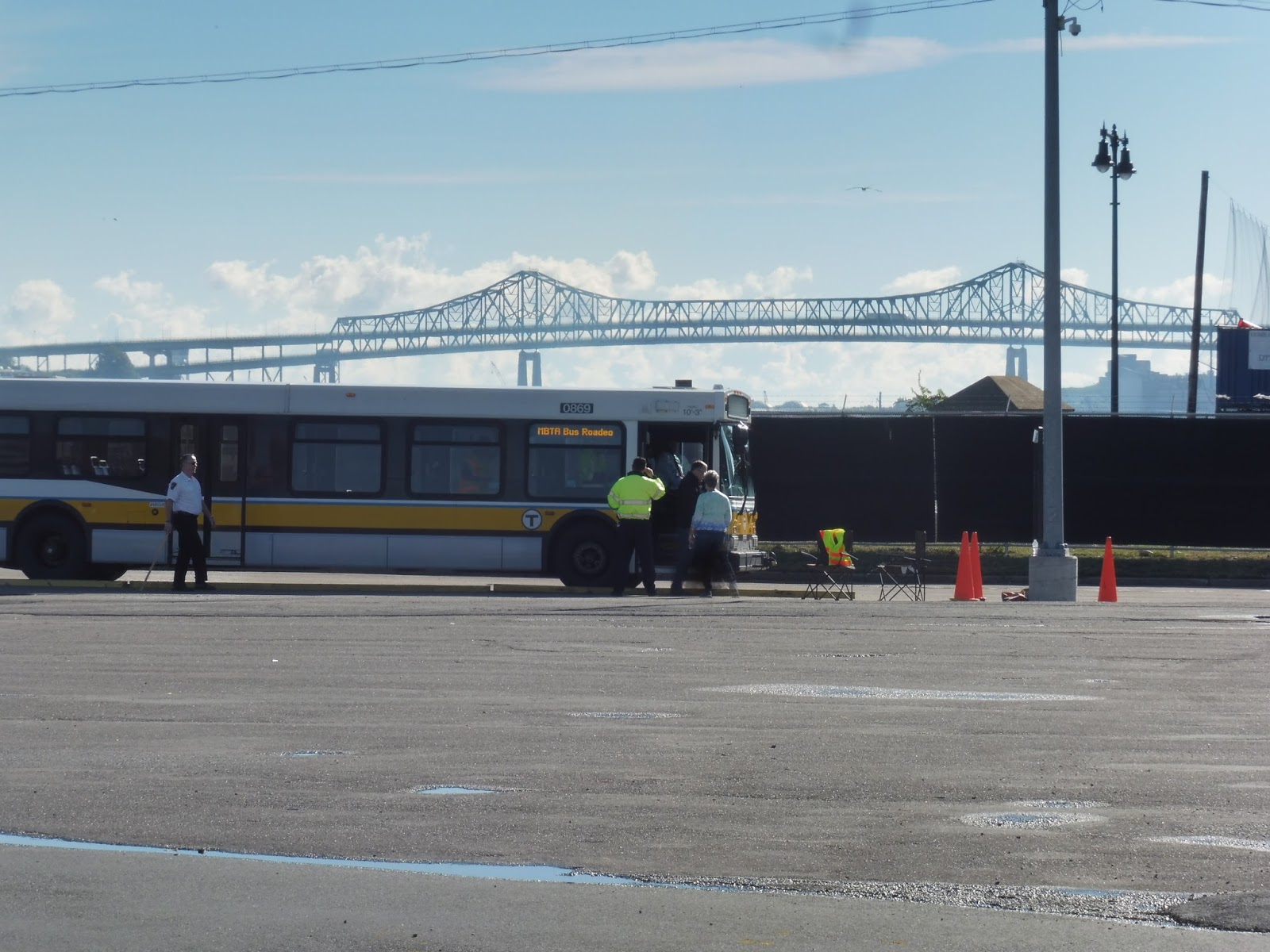
MBTA Bus Roadeo!
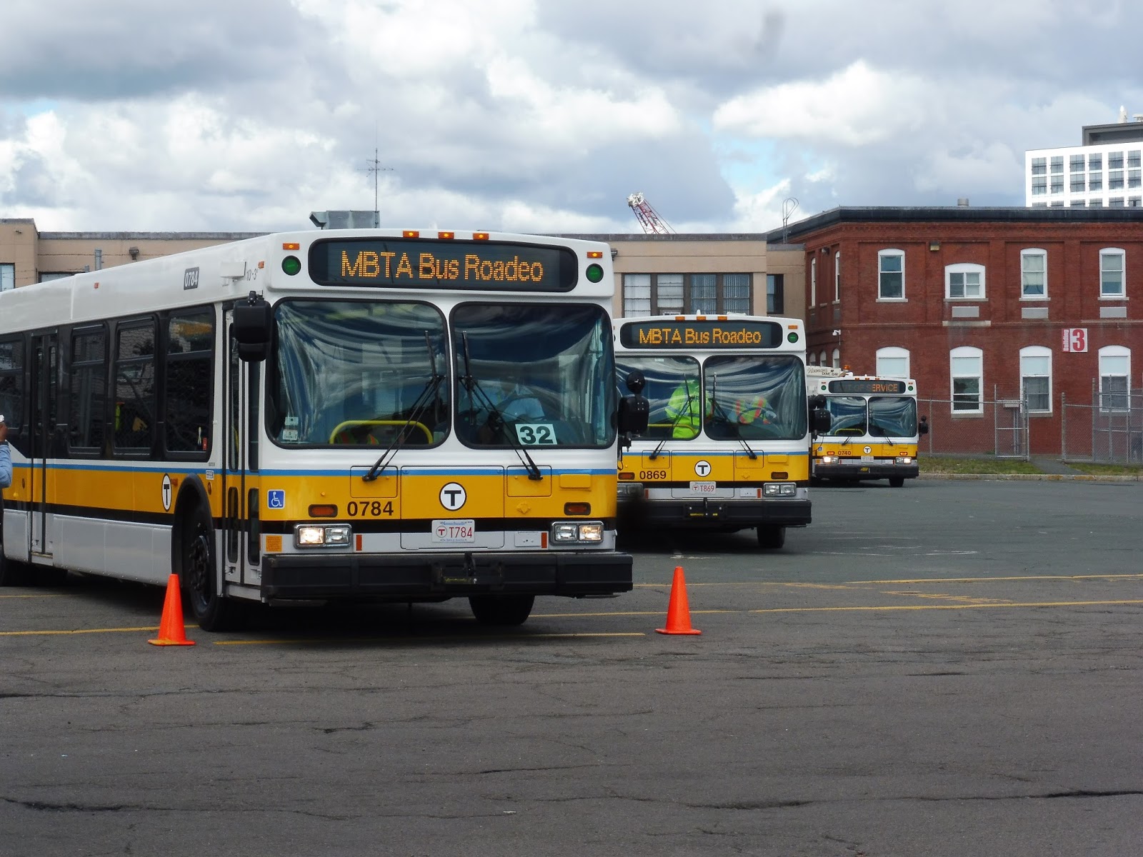
This year, I got the chance to attend the 40th Annual MBTA Bus Roadeo, and it was an absolute blast! My friends Jordan, Nathan, Nick, Sam, and I met up at Sullivan at around 6:30, and then we walked over to Charlestown Garage where the Roadeo was taking place. When we got there, breakfast sandwiches and coffee were available, and people could go inside buses 1459 (an Xcelsior that’s barely been in service), 291 (an RTS converted to a work bus with trolley wires), and 2600 (an ancient GMC from 1957!).
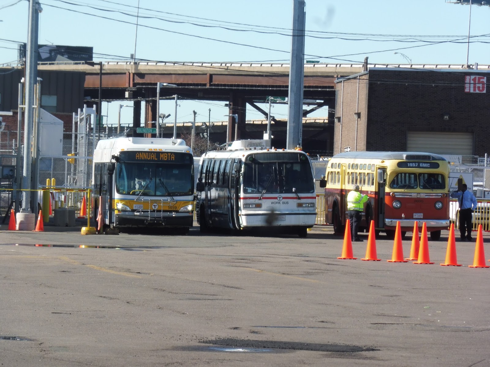 |
| The view of all three buses from across the yard. |
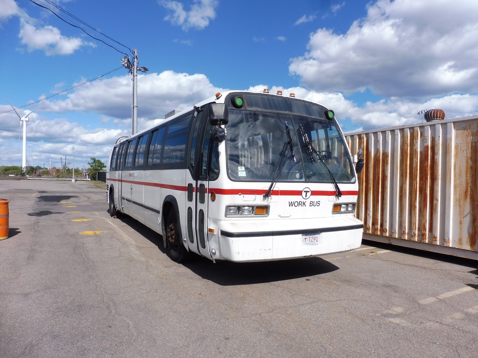 |
| A shot of 291 after it had been moved. |
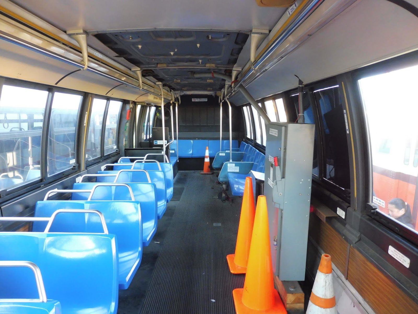 |
| The inside! Slightly different from a regular RTS, eh? |
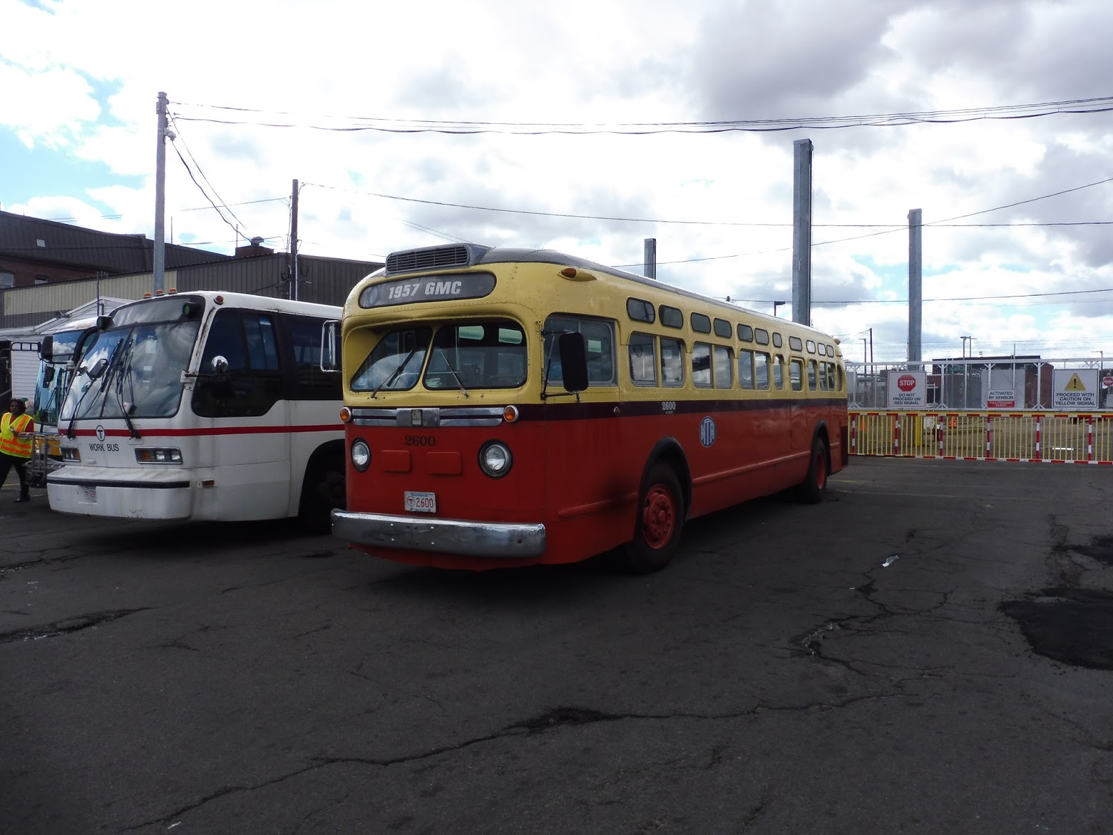 |
| A better view of 2600. |
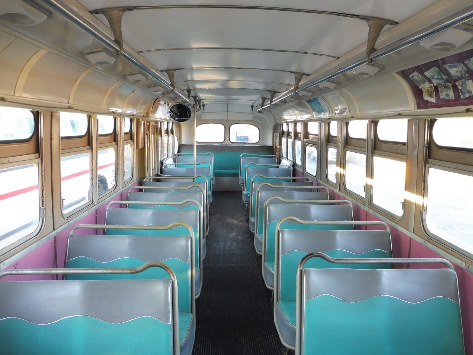 |
| The inside! Those seats were comfy. |
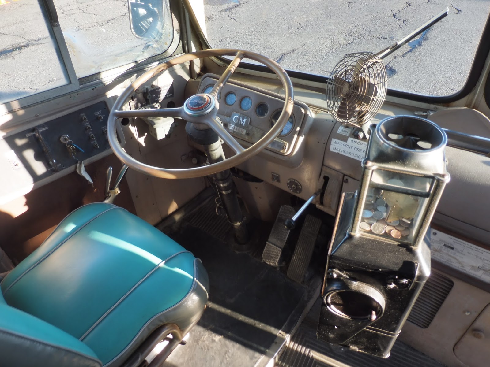 |
| A look at the driving area. |
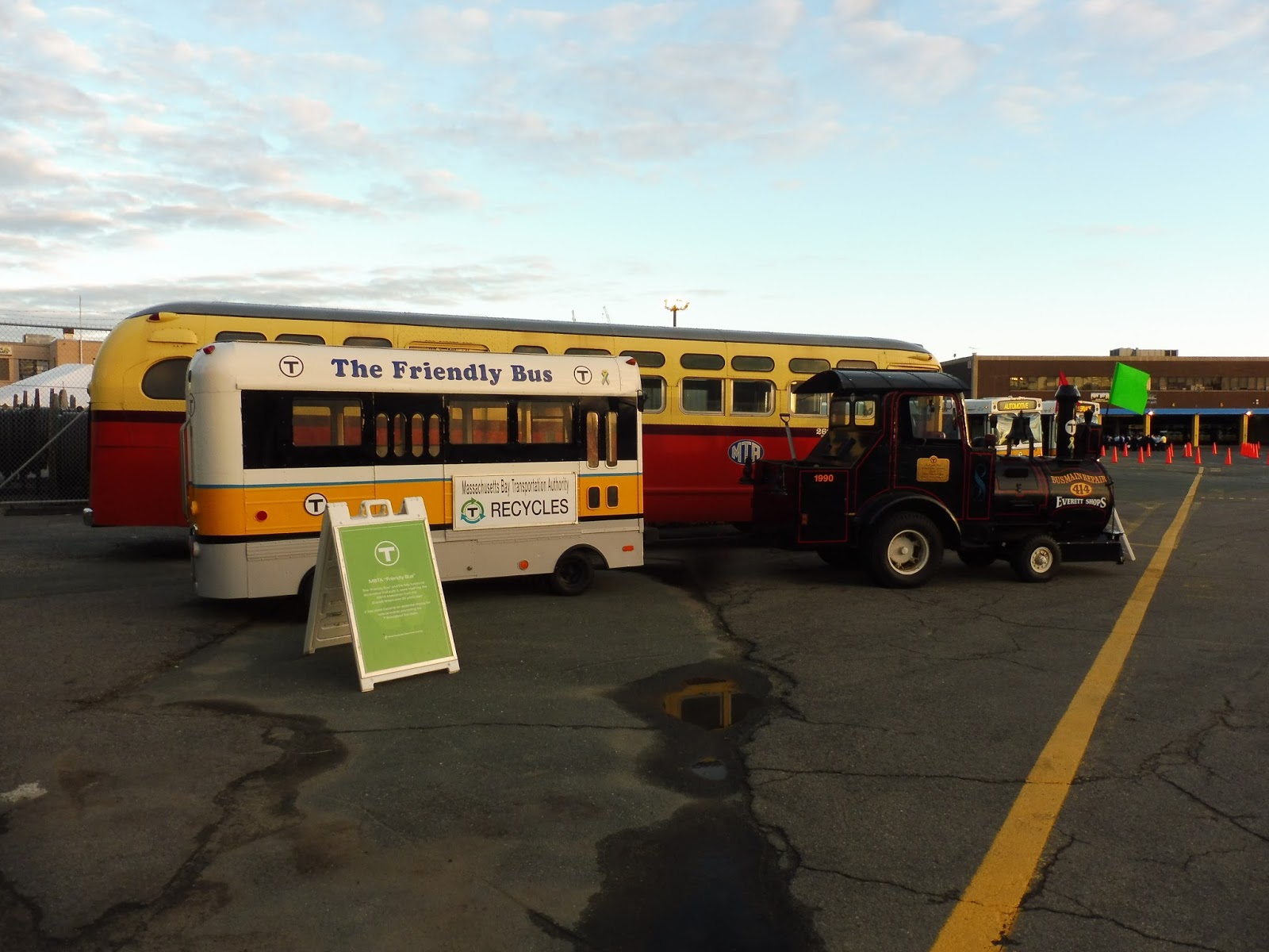 |
| Oh yes, they also had this tiny train-bus thing on display! |
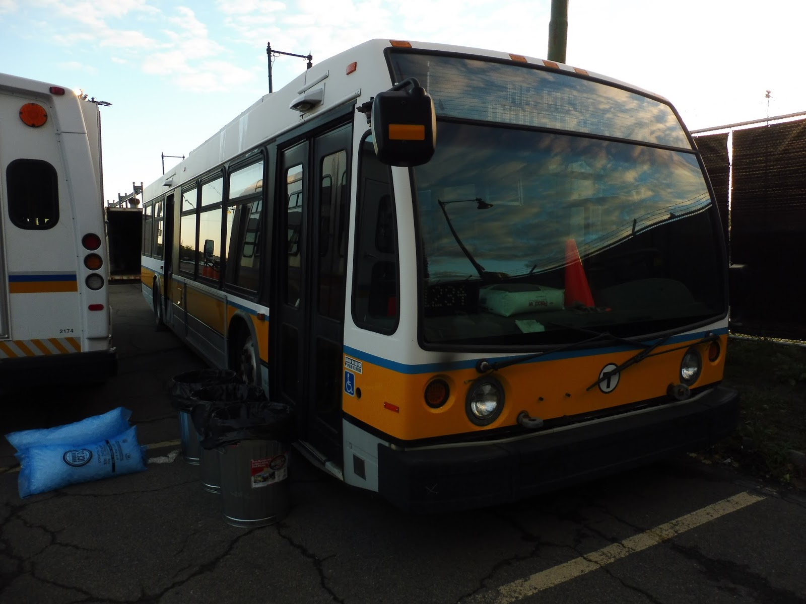 |
| Ah, the MBTA’s failed Nova Bus prototype… |
At around 7:30, the main event began. The Roadeo is a competition between the best drivers on the MBTA – there are a bunch of requirements just to be eligible to enter. It involves a course through Charlestown Yard, where drivers are tested on a variety of different criteria. Additionally, they are tested on uniform and posture, as well as being able to find defects on a bus.
 |
| Operator 68014 at the start of the course. |
Also, I ended up volunteering as a “runner”. This meant that as the buses went around the course, I would go to each judging station and collect the scoresheets to bring back to the scorers. It was a really fun job, and I’m really glad I was able to help out!
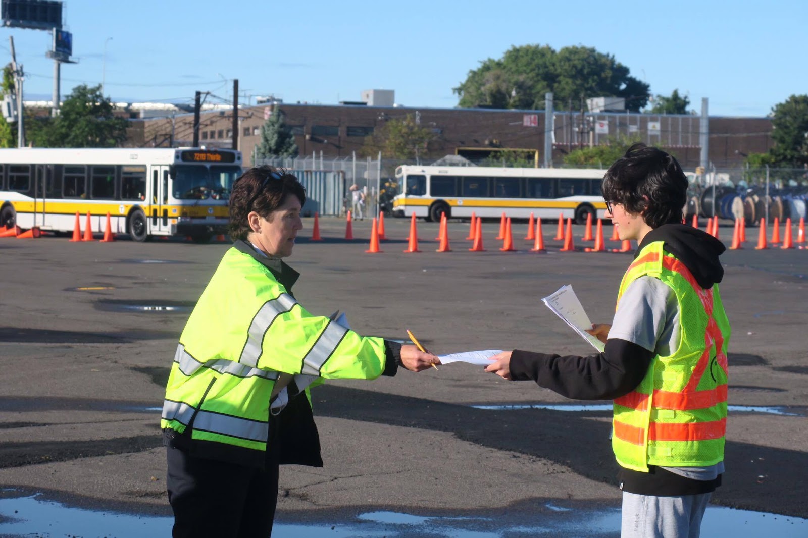 |
| Getting the handoff from judge Lorraine Landsburg! Photo credit to Sam. |
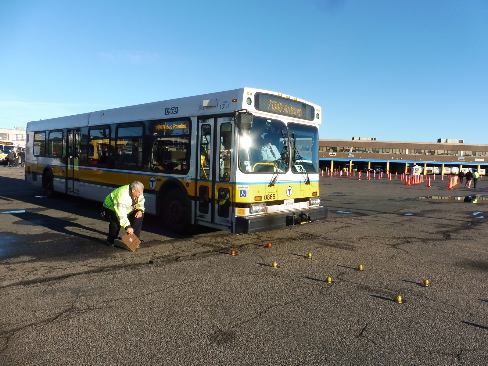
But you guys want to hear about the course itself, don’t you? With humorous and energetic commentary blasting over the speakers, buses had to traverse 11 challenges in the course (there were also three more that I’ll discuss at the end). The first vehicle challenge was getting the bus’s wheels through tennis balls without knocking them over. They got closer as it went along, and they were already tight to begin with!
 |
| Operator 71340 about to head through the tennis balls, with judge Jay Orlando looking on. |
After that, buses had to take a left-hand turn. This one was incredibly difficult, since the cones on either side were so tight! Each challenge was graded on a scale of 50 points, and with this one, 25 were lost from hitting one of the entrance cones leading into the turn. Buses also lost points for shifting into reverse.
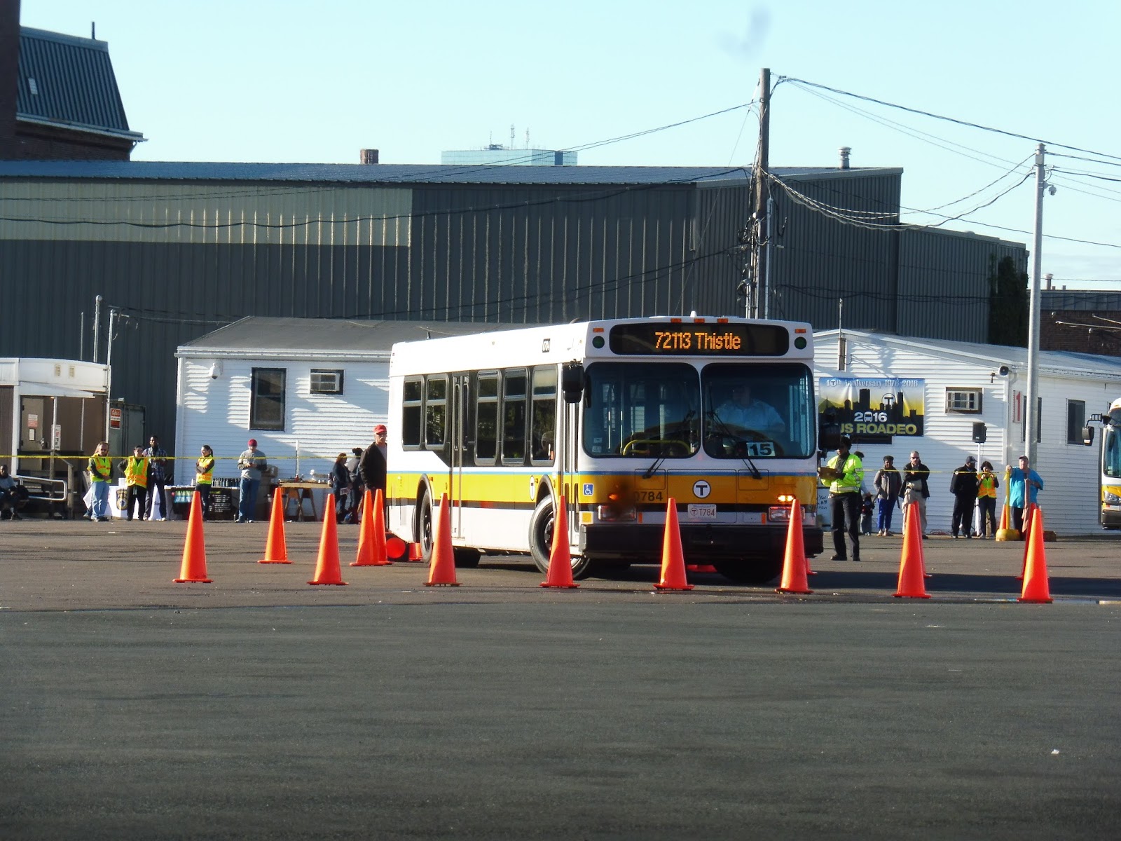 |
| 72113 making the turn. |
The next challenge was also a tough one, where buses had to reverse leftward into a narrow alley of cones, then come out again. It was hard to get through without hitting at least one! After that, buses would do the same thing but on the right, and then make a right-hand turn with more narrow cones.
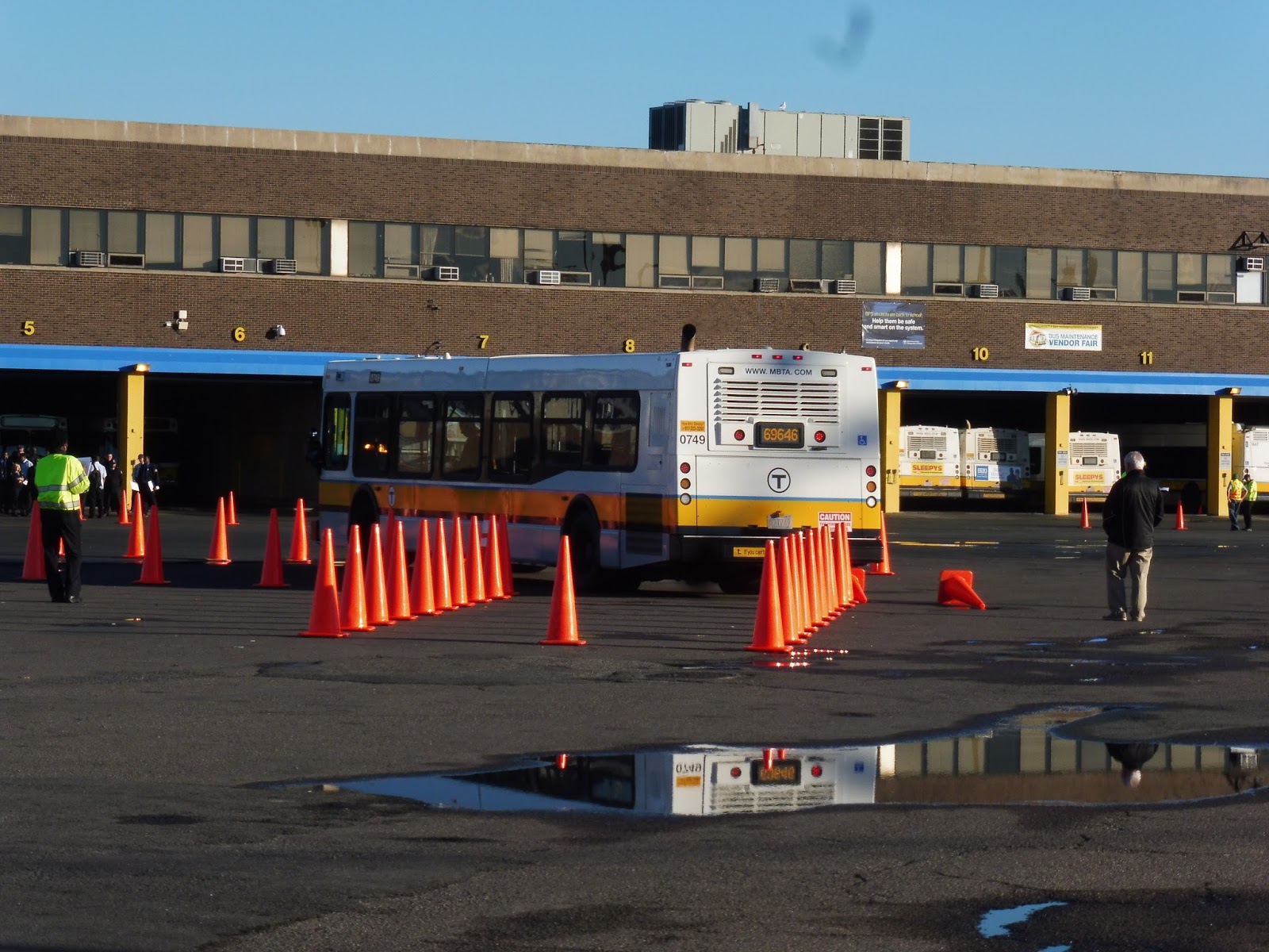 |
| 69646 backing up. |
Buses had to make a “stop” after that, judged by how far they were from the curb and whether they made ADA announcements or not. From there, the next challenge was a slalom, where vehicles had to navigate their way around a set of cones. They had to face the “Offset Street” challenge next, which involved running through a straight set of cones, then doing an s-curve to another set of cones.
 |
| A bus (not sure about the operator number) making a stop. |
Buses had to make a second stop after the Offset Street, and then we got to the most exciting part of the course: the “Diminishing Clearance” challenge. Here, buses had to go at least 20 MPH while not hitting any barrels – then they had to stop as quickly as possible to avoid hitting one final cone. It was exhilarating seeing buses speed through, and cheers from the crowd and commentator would erupt every time a barrel was sent flying.
 |
| 72019 about to barrel through the barrels! That’s a pun or something. |
Another aspect of the Roadeo that was just as important as the course was finding bus defects. These were more behind-the-scenes, taking place at the garage, and involved drivers having to find eight defects on a vehicle. There was even a “bomb” on board! Drivers were also scored on their uniform -every aspect had to be absolutely perfect.
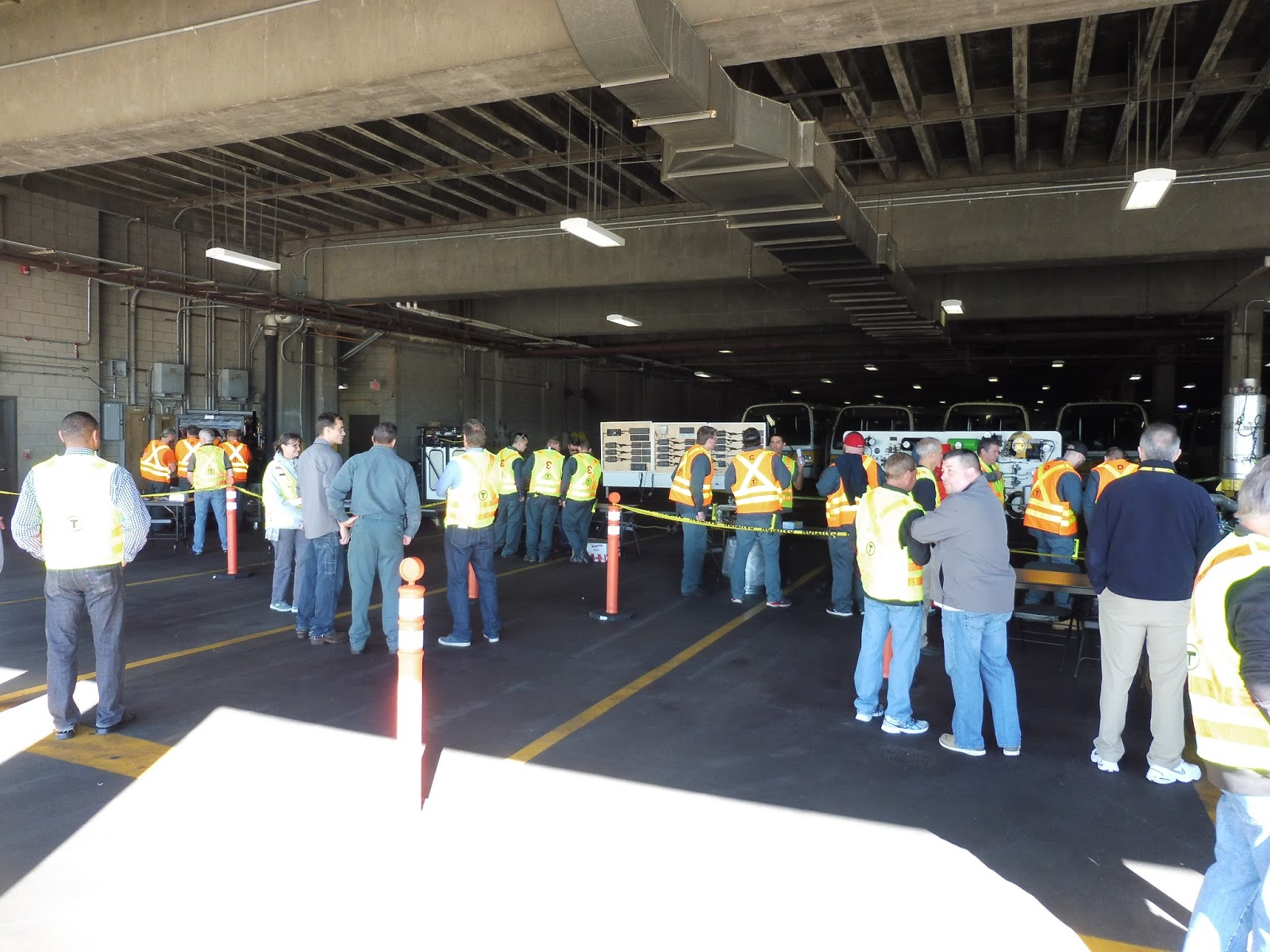 |
| The Maintenance Roadeo. |
Also happening in the garage was the Maintenance Roadeo. This was where members of maintenance teams would have to perform challenges on various bus parts, such as starting up an engine. Unfortunately I wasn’t able to spend a lot of time back there due to my “running” duties, but it seemed pretty cool!
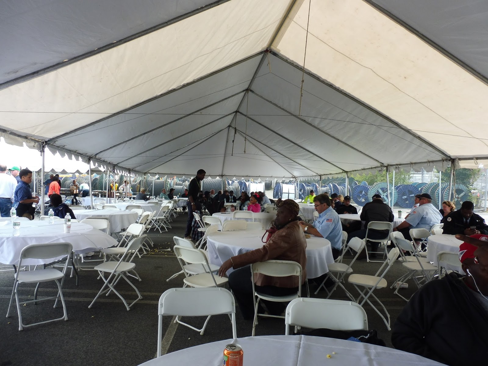 |
| Inside the big dining tent. |
Once the events were over, it was time to eat! There was some absolutely fantastic barbeque at the Roadeo, and more than enough for everyone to dig in. They also had popcorn and cotton candy, a DJ, and a bounce house for the kids. Finally, the results were announced: in 1st Place was Reynaldo Beato right from Charlestown Garage!
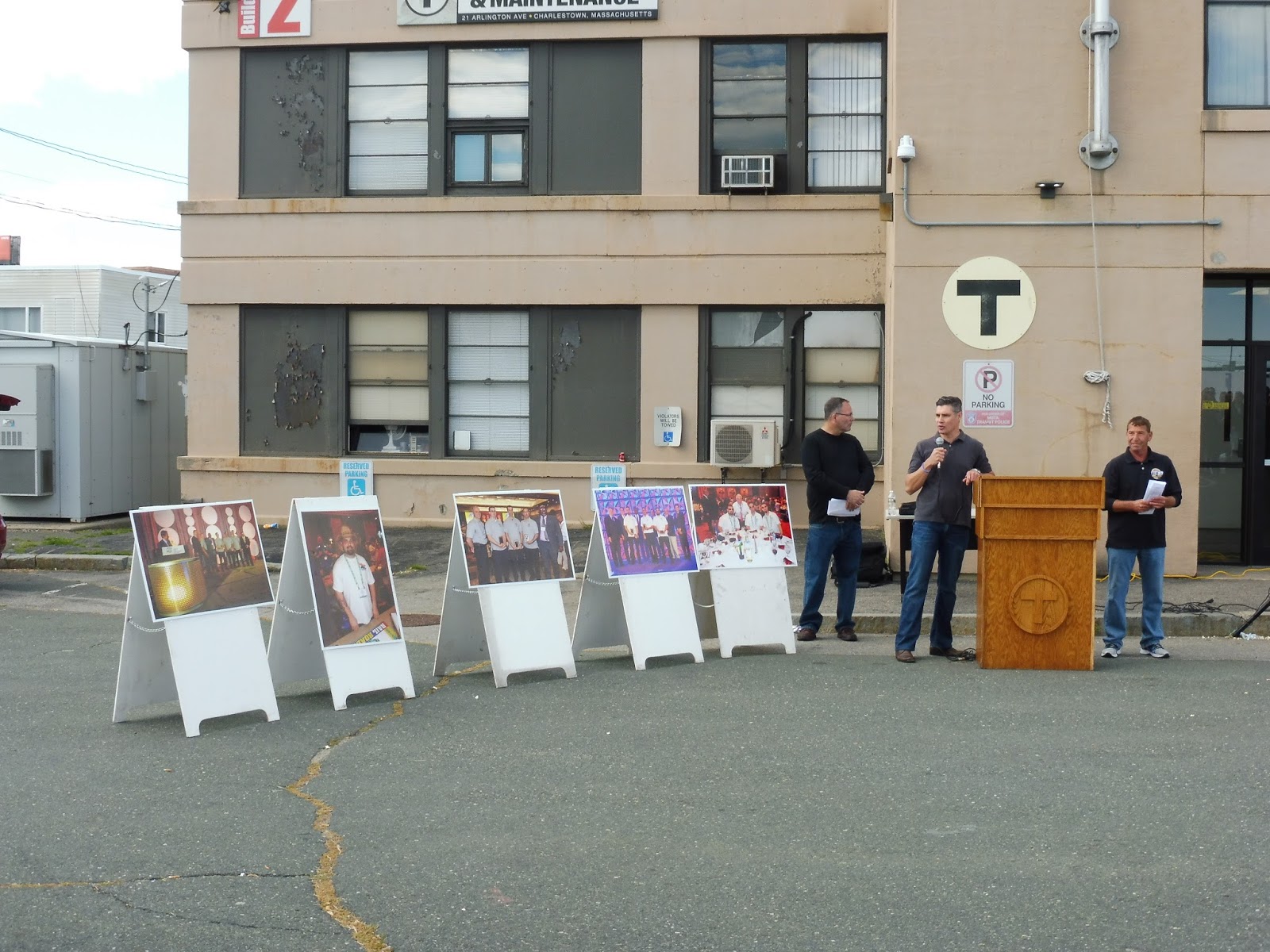 |
| Announcing the results. |
Overall, the Roadeo was super fun! It was great to see the buses navigate around the course, and meeting a bunch of instructors while collecting sheets was a blast. Finally, I want to give a huge thanks to Justin Grizy and Lorraine Landsburg for inviting us in the first place and making this all possible. Hope to come back again next year!
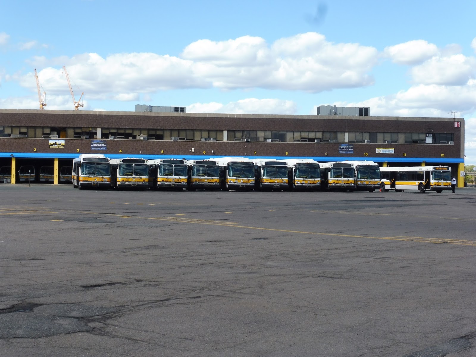
 |
| Some buses lined up. |
 |
| And with the Roadeo over, the Charlestown buses came back to pull out! |
GUEST POST: Service Change: Transit in Madrid
Here is Part 2 of Gabe W’s international transit journey. Great job as usual, Gabe!
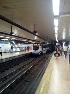
Gabe here again! When I was last with you guys I was leaving Israel. Now, for the second part of the journey, we stayed in Madrid for five days! So, of course, our plane landed at Madrid-Barajas Airport, which is the main international airport serving Madrid (which is the capital of Spain). Now, all of the international departures and arrivals went through the HUGE Terminal 4 (there are other terminals). The reason the terminal is so big is because it is actually two terminals (T4 and T4S), which are connected by a two and a half kilometer long underground driverless people mover, aptly called the Airport People Mover. The system was built a lot like a subway shuttle line, so I counted it as a public transport system and took some pictures.
 |
| A map of the shuttle system. Terminal 4S contained “terminals” M, R, S, and U, while T4 contained H, J, and K. |
 |
|
This is what the front of each shuttle car looked like. It looks pretty similar to the Madrid Metro cars we’ll see in a little bit.
|
 |
| The interior of the car in front of us, packed with people. Also, if you look to the top of the picture, you can see a reflection of the car we were in. Of course, after we left the main terminal we just called a taxi to get to the new apartment. |
 |
| The main entrance to Legazpi, with the escalator entrance showing. |
 |
| One of the ticket machines within the mezzanine. It looked quite similar to the ones in Boston. |
 |
| A picture of some of the Metro tickets, taken the following day. The tickets cost more the further you go, so you have to enter your destination. You could go further than what the tickets “allow” you too, but we didn’t risk it. |
 |
| Some information on the namesake of the station probably meant for visitors to Madrid and tourists. Too bad it was in Spanish… |
 |
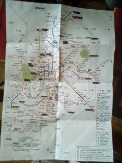
| A map of Line 3, with one side showing the station name and the other showing the connections. |
 |
|
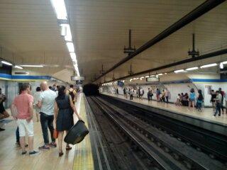
The platforms for Line 3.
|
 |
| A Line 3 train on the outbound side. In the picture, you can see the ramp leading up to fare control and one of the escalators down to the exchange level. This type of train was used on both of the lines I rode upon, so I can assume it’s standard with the Metro system (not the light rail trains, of course). |
 |
| The inside of the train that we rode inbound. Like the London subsurface trains, it was a continuous car, with 5 pivot points (so it was the length of a six car train). |
 |
| One of the main hallways located within Sol. As you can see, there’s a busker within it, and the hallway leads to the escalators to the main room. |
 |
| A view of fare control and the mezzanine from down the hall. Behind us is the exit to the Line 3 stairs, and way behind us is the Line 1 entrance seen in the previous image. |
 |
| A picture of one of the entrances to Sol, in the NYC style. The banner states that the elevators are being fixed, and that there is no accessible service at the moment. |
 |
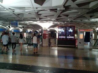
| Here’s the main mezzanine, taken from within fare control. The mezzanine is clean, modern, and efficient, with ample fare gates and ticket machines. We exited both through this area and came through it later in the day, as we headed home. |
 |
| Here’s a view of fare control past the main mezzanine. The escalators lead down to the bottom floor of the main room. You can see some of the ads within the station from here, as well as a sign directing the foot traffic. |
 |
| A view of the main room, from atop the second floor (I took it from the area seen in the last picture). If you go to the right, you end up in the Line 3 hallway. If you go to the left, you head to Line 2. The entrance to line 1 is also to the right, but it comes up immediately after turning. The large black object hanging from the roof is actually a sculpture. |
 |
| One of the entrances to Callao. This one was built like the standard NYC subway entrance, so the elevators were elsewhere in the square. |
 |
| A picture of Callao’s main mezzanine, showing the escalator from the more modern entrance (it had the elevator) and the fare gates. Unlike the other stations I visited, the pillars here were metal and reflective, and not just painted white. |
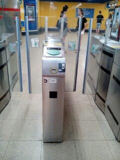 |
| A close-up on one of the fare gates (standard throughout the system). The slit at the front is for the tickets, and the green circle at the top is where you place the smart cards for the system (think CharlieCard). |
 |
| The Line 3 platform at Callao, looking quite similar to every single platform on Line 3 I had already seen. |
 |
| One of the countdown clocks located at Callao. It was working perfectly, though my (phone) camera caught it at a weird moment. As you can see, it tells you the destination of the next train, the time till the next train, and some other fast-moving information. |
 |
| Retiro’s small mezzanine and fare control area. The ticket machines were located behind my current position to the right. I quite like how they put a countdown clock right at the entrance, so you would know if you had to run for the train. |
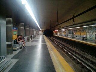 |
| Retiro’s platforms, not in the top condition. The concrete was faded and the walls were stained. At least there was no water dripping on the floor (I’m looking at you, Haymarket). |
 |
| Both Line 2 and Line 3 (and probably the rest of the lines, due to a standard trainset) ran on overhead lines, which weren’t even wires! They were a third rail suspended above the train. |
 |
| A route 135 approaching from the distance. |
 |
| A route 86, heading to “Vill. Alto”, which is the terminus for Line 3. |
 |
| Did you know that the SL1 had countdown clocks at the airport? Well now you do, and they’re pretty accurate! The bus ended up coming two minutes late, but that’s pretty minimal. |
 |
| I couldn’t get a picture of the front of the bus, so here’s the side. |
GUEST POST: Service Change: Transit in Israel
Hello fellow MBTA riders! I’m Gabe W., a random reader of Miles’s fantastic blog. Recently, I took a two week international trip to Israel, with a stop in Spain. And while I did not do as much public transit riding as I wanted to, I do have many transit tales to share.
 |
| A picture of the Israel Railways ticket, taken the following morning. |
 |
| The bus sign, in not-perfect condition (note that all the routes with the owl sticker were both day and night routes). |
 |
| The countdown clock, which is obviously turned off. |
 |
| The bus stop itself. The yellow papers posted on the side of the stop indicate which minibus routes stop at the station. |
 |
| A minibus itself. These buses will not stop if they are full, and run their own routes. Being smaller and more quiet (and run by a different group), they cost an extra NIS (New Israeli Shekel). |
 |
| A random bus I saw while walking to our stop. |
 |
| A view of the larger stop, showing the three shelters and a bench (it had a bike rack too). |
 |
| The inside of the bus, showing the seating, AC, and scroll board up front. |
 |
| The bus (so, us) pulled up next to a couple other routes at the next stop. |
 |
| Some skyscrapers I saw on the route. Pretty cool looking. |
 |
| A skyscraper in progress, I guess. |
 |
| An advertisement for the up and coming Tel Aviv Light Rail, which looks to be very extensive. |
 |
| A view of the bus level serving our route. On the closest sign, the symbol to the left is the Dan bus symbol. |
 |
| The inside of the bus, looking pretty normal. |
 |
| What a nice modern building! It reminds me of the MIT Media Lab in Cambridge. |
| Goodbye bus! Also, note the very quiet street. |
 |
| A picture of the Jerusalem Light Rail system, which I snapped as our car was at a traffic light. When I asked, mom said that we didn’t ride the system because we had a rental car. Also, the system ran through the new, developed sections of the city, and we were staying in the historic Old City. |

 |
| Note: Both pictures were taken from a moving car. |
Poll: What do you like seeing on Miles on the MBTA?
This is just a little poll about what you guys like seeing on this blog – it’ll help influence the direction I go in with it.
Assembly
Oh yeahhhhh…this station exists! Ever since my insanely excited post from when Assembly first opened, this place has just disappeared from my mindset. I dunno…I don’t find Assembly Row particularly interesting, and the station never gets as many riders as the other ones on the Orange Line. But still, with the south entrance finally open, I can properly review this thing once and for all! Welcome to the newest station on the MBTA.
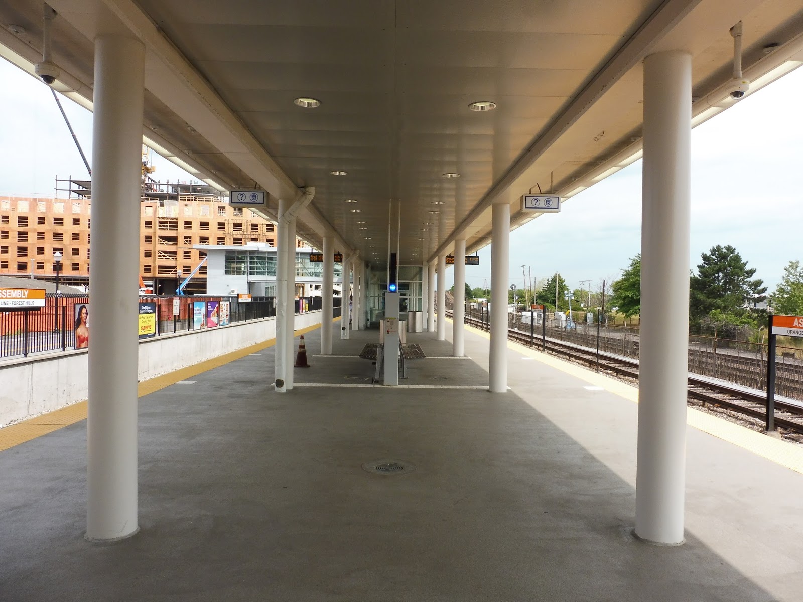 |
| The platform. |
Assembly’s platform is like any other station on the northern Orange Line, except more modern. The concrete is brighter, and some nice metal is used for the ceiling. The station has numerous benches, including a few in those classic pointless Orange Line bench shelters. Good to know they still decided to include those! Finally, wastebaskets, help points, and historical information about the area are dotted around the platform.
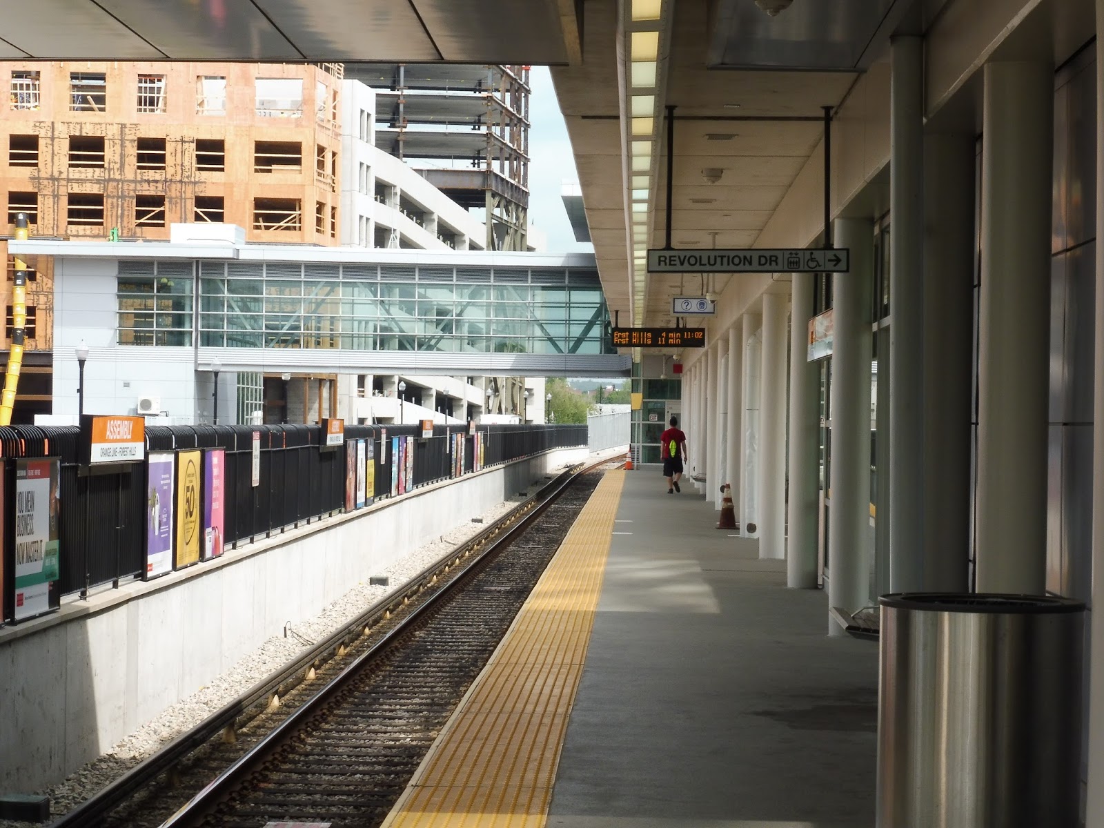 |
| Looking down towards the northern entrance. |
It’s also worth noting that the platform has a little bus shelter for Customer Service Agents – two, to be exact. Now, what’s the point of a CSA, exactly? To help out customers, of course. The problem with having them at Assembly is that it doesn’t get that many customers! So you basically have two CSAs just hanging out in their shelter talking to each other. What an excellent use of resources.
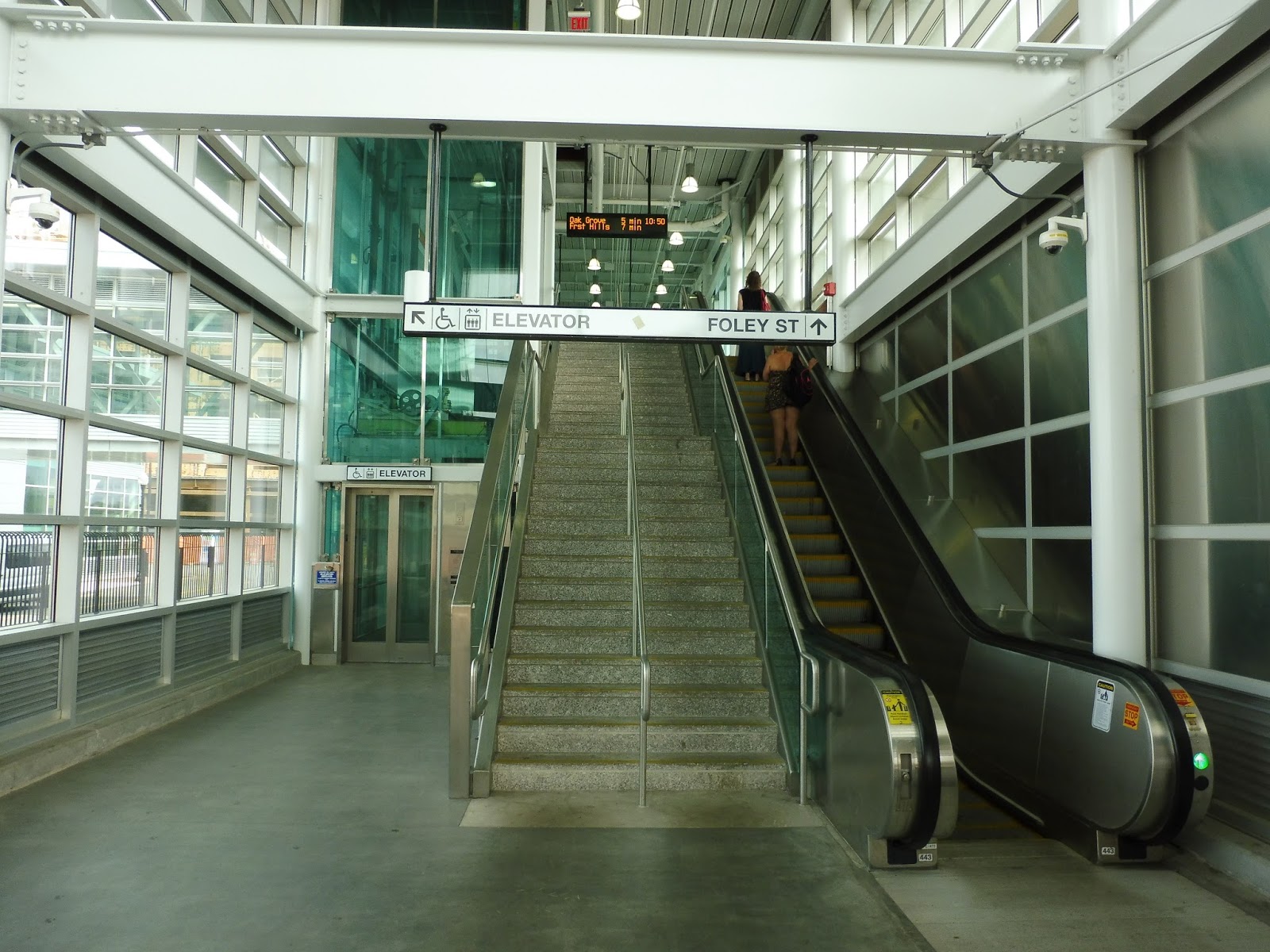 |
| Heading up to the main entrance. |
Going towards the main entrance to the north, we have another typical Orange Line setup. Yes, it’s that classic elevator-stairs-escalator exit! Still, I have nothing to complain about – it works pretty well, and this one looks way better than other Orange Line stations because of the glass and generally nicer-looking materials used.
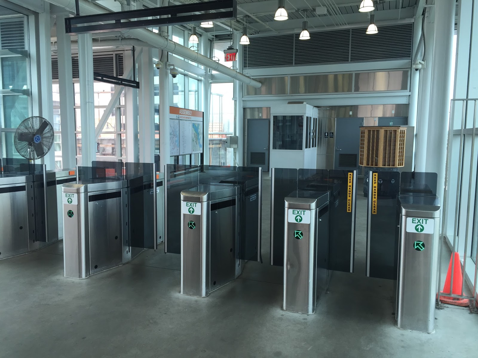 |
| Fancy fare gates! |
Of course, we can’t talk about Assembly’s mezzanine without bringing up the awesome new fare gates! Although this isn’t the only place on the system where they exist anymore (Government Center uses them, too), Assembly is where they originally came into service. As for the rest of the mezzanine, it’s pretty small, but it’s well-designed for handling lots of people.
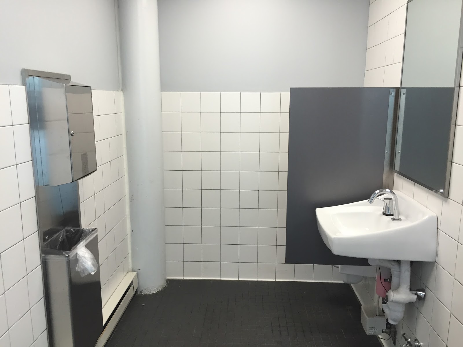 |
| I had to do it, I couldn’t resist! |
However, the mezzanine also features bathrooms! I simply had to check one of them out, and I was fearing the worst. However, it ended up being pretty nice. They’re only one stall each, but they (the men’s room, at least) were pretty clean overall. Great job, Assembly!
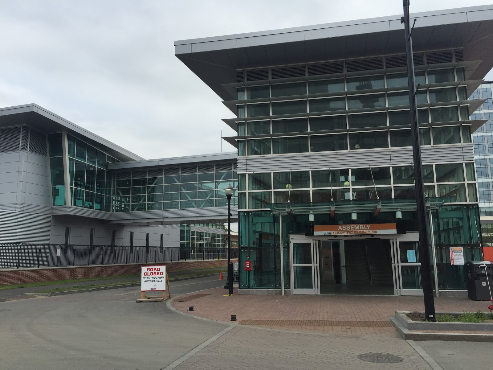 |
| The entrance. |
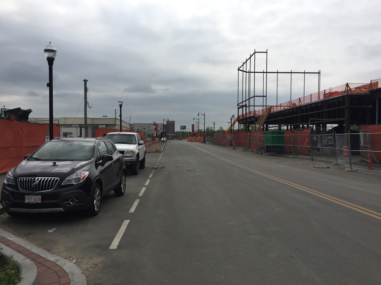
From the mezzanine, a footbridge leads over one of the Orange Line tracks, and then we’ve got another classic Orange Line setup to the ground – elevator, stairs, escalator. The main entrance is pretty nice and modern, with lots of glass. Of course, the area to which it leads hasn’t really developed yet, so you have to walk through a bunch of construction to actually get to Assembly Row.
 |
| This is incredibly bleak. |
The parking at Assembly is a little dubious. There’s no mention of anything on the MBTA website, but that’s because it doesn’t actually own any lots here. However, Assembly Row does have a parking lot for commuters. It’s not too big, but it’s an alternative to Wellington or Sullivan if those places are full. The fee is $6.00 per day, just like Assembly’s neighboring stations.
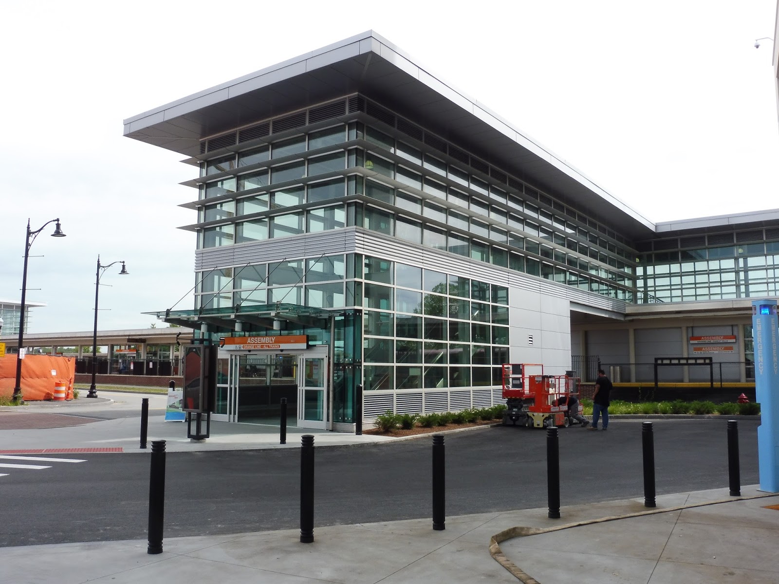 |
| Meanwhile, on the other side of the station… |
With the completion of the Partners Healthcare building in Assembly Square, the other entrance to the station is now open! It’s…uh…basically the main entrance, except smaller. Oh well, it still provides an easier way for people working at Partners to get onto the train. This was the main reason I was waiting to review this place, but it, uh, didn’t seem to be too worth it. Oh well.
 |
| Two trains at the station. |
Station: Assembly
Ridership: According to this document, Assembly got 1,864 riders per day in 2015 – that makes it one of the least-used stations on the system. Now, I understand that it’s new and maybe people aren’t using it too much, so let’s check out its predicted ridership: 5,000 people per day by 2030. Welllllllllllll…that puts it at around a Community College level. That’s not really saying much.
Pros: For an Orange Line station, Assembly is definitely pretty in the aesthetics department. Serving a rapidly developing neighborhood, it has a simple, straightforward design that allows for the transport of lots of people…not that it’ll ever have to.
Cons: Yeah, Assembly isn’t the best for ridership…but it certainly has helped the development of the surrounding area. Also, I wish the station had a bit more character to make it stand out, but that’s ultimately not too important, and the historical information does the job just fine.
Nearby and Noteworthy: Assemblyyyyyyyyyy Rowwwwwwwwww…yeah, okay, I don’t like it as much as other people do. I’m sorry, but I find high-end clothing stores boring!
Final Verdict: 8/10
Even though I continue to forget this station exists (“Alright, next stop Wellington! Oh wait…”), it has to be said that Assembly is a pretty good one. It’s clean, straightforward, and modern, and it’s certainly a great way for all you shoppers out there to get to Assembly Row. That said, I don’t think I’ll be using it any time soon…
Latest MBTA News: Service Updates
Sam’s Operational Oculi- Lynn Garage
Lynn Garage is definitely one of the more unique garages in the system. I mean, where else do you get a last train express bus? Lynn has many quirks, and I definitely wouldn’t say it’s my favorite garage in the system, or the best planned garage either. However considering the service area it’s given, it does do an adequate job of interconnecting the North Shore. I will probably be back in the very near future with a look at another quirky garage, Southampton. I also might have a completely different operational post coming soon, so stay tuned!
Miles on the Internet: mbta.com
Here’s something I’ve realized during my explorations of RTAs: transit websites are often terrible and I love to rant about them. Then I realized that instead of ranting to friends, why not rant about them on the blog? Welcome to Miles on the Internet, where we’ll be reviewing various transit websites! Now, it has to be said that not all transit websites are awful – for example, the one we’ll be looking at today, the MBTA website!
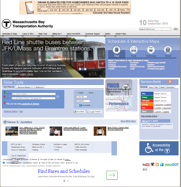 |
| I’m sure almost all of you will recognize this home page! |
There’s a lot of information packed into the MBTA’s homepage, and for a newcomer, it can seem pretty overwhelming. Having used the website so many times, I have it down pat and know where to go, but I can definitely see someone getting confused here. Still, there’s a lot of important stuff in here – you can find any schedule, plan a trip, and get service updates, all within the same page.
 |
| What the heck?? |
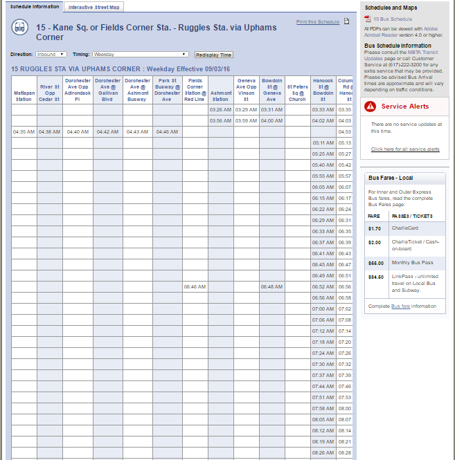
Don’t get me wrong, I like the overall structure of the MBTA’s schedule pages. While subway pages will only give you line diagrams (and basic headways if you click on the PDFs), the other ones display a full schedule with links to PDF files and service updates for the route on the right. There are annoying quirks with these pages, though: for one thing, they set to weekday by default, even if it’s a weekend; for another, bus routes with extended early morning or late night variants end up looking like the schedule above. You have to scroll way over to the right to get any proper information, and I usually end up just clicking on the PDF. The “Interactive Street Maps” of the routes are also functional, although for some reason they default to early morning variants of certain buses, which is very misleading.
 |
| The fares page. |
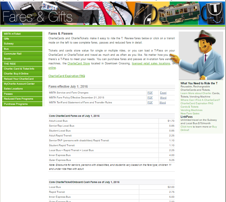
Clicking on the “Fares and Gifts” section gives you a rather daunting page of every possible MBTA fare. For the record, it’s a heck of a lot easier just to click on an individual mode to narrow down your search. Also…uh, Charlie? Could you move your finger a bit? You’re, uh, blocking a few words…Charlie? Oh, never mind…
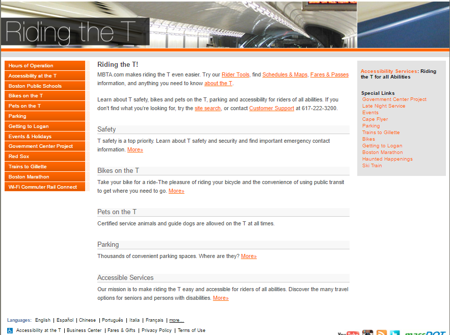 |
| The “Riding the T” section. |
The “Riding the T” part of the website is basically the place to go for miscellaneous rider information. It has pages about rules for bikes and pets, information on accessibility and parking, and directions to Logan Airport. The presence of a “Government Center Project” page is pretty outdated, though – the station’s been open for quite a while now!
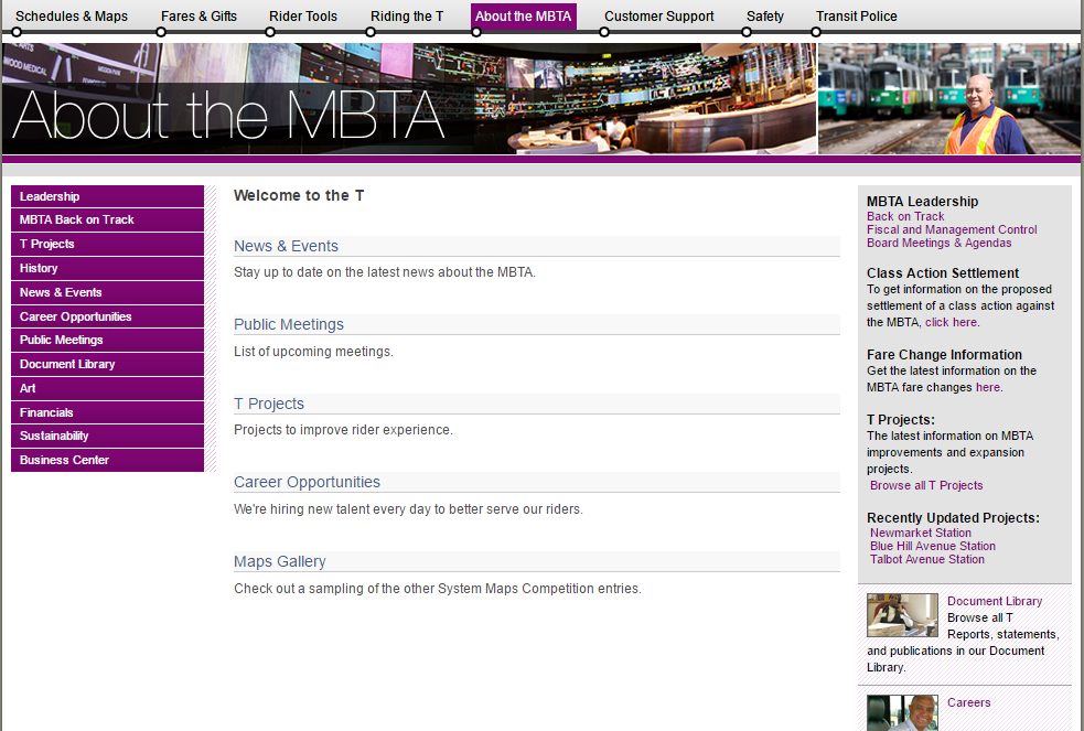 |
| “Welcome to the T”! |
“About the MBTA” essentially covers the “behind the scenes” aspects of the system. It includes pages about the MassDOT Board, the T’s history, MBTA news, and a rather scary-looking page about finances. Their “T Projects” page could use a bit of updating, though – isn’t everyone excited for the Salem Station upgrade, currently in “planning”? Try “it’s been open for two years”!
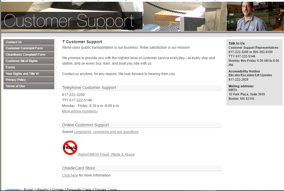 |
| In case you’re in need of support. |
The last three tabs on the website aren’t particularly interesting or useful to the average rider. “Customer Support” mostly covers complaints, as well as a heck of a lot of forms. “Safety” is what you would expect, and it’s only noteworthy for including the wonderfully bad “Safety Bounce” video, which I implore you to watch if you haven’t seen it already. Finally, the “Transit Police” page is all about fighting crime on the system.
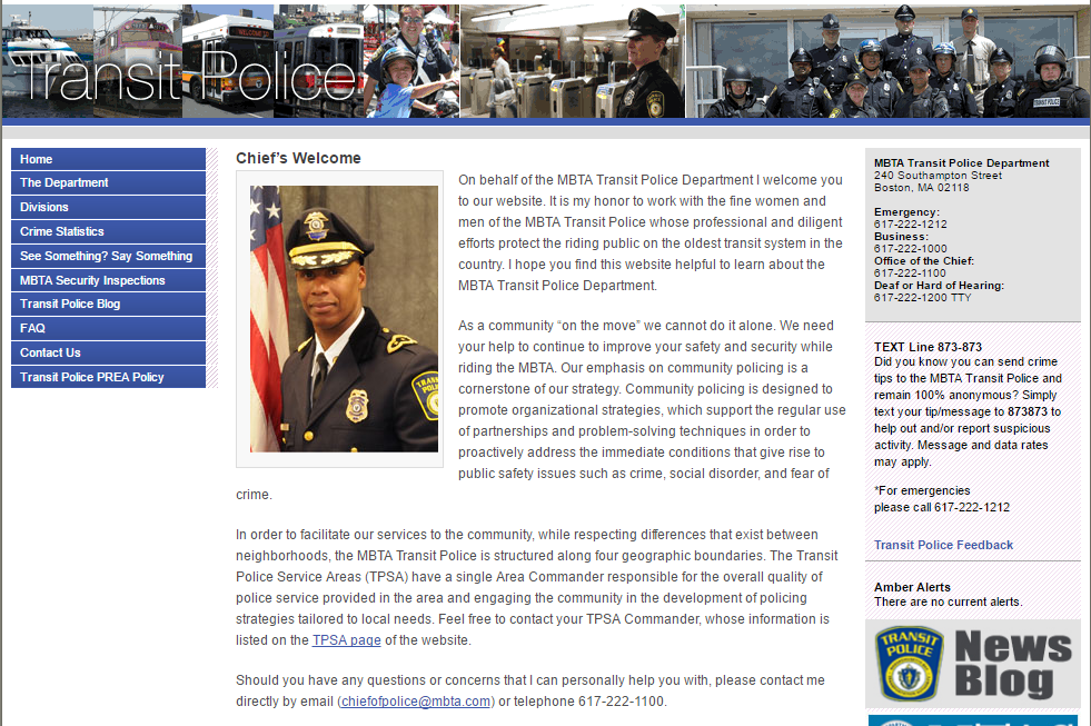 |
| The Transit Police page. |
Bloom Bus Lines (Taunton, Raynham, Easton, and West Bridgewater – Boston)
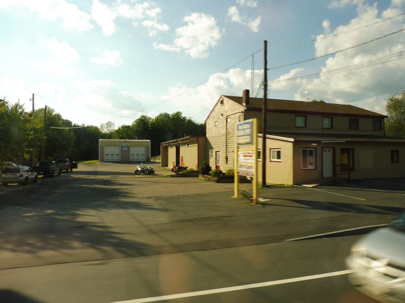
Ooooh, now this is a very interesting one indeed! I had no idea this service even existed until my friend Sam and I took a trip down to Taunton and discovered its schedule hanging on the wall! Well, we had to give it a ride, didn’t we?
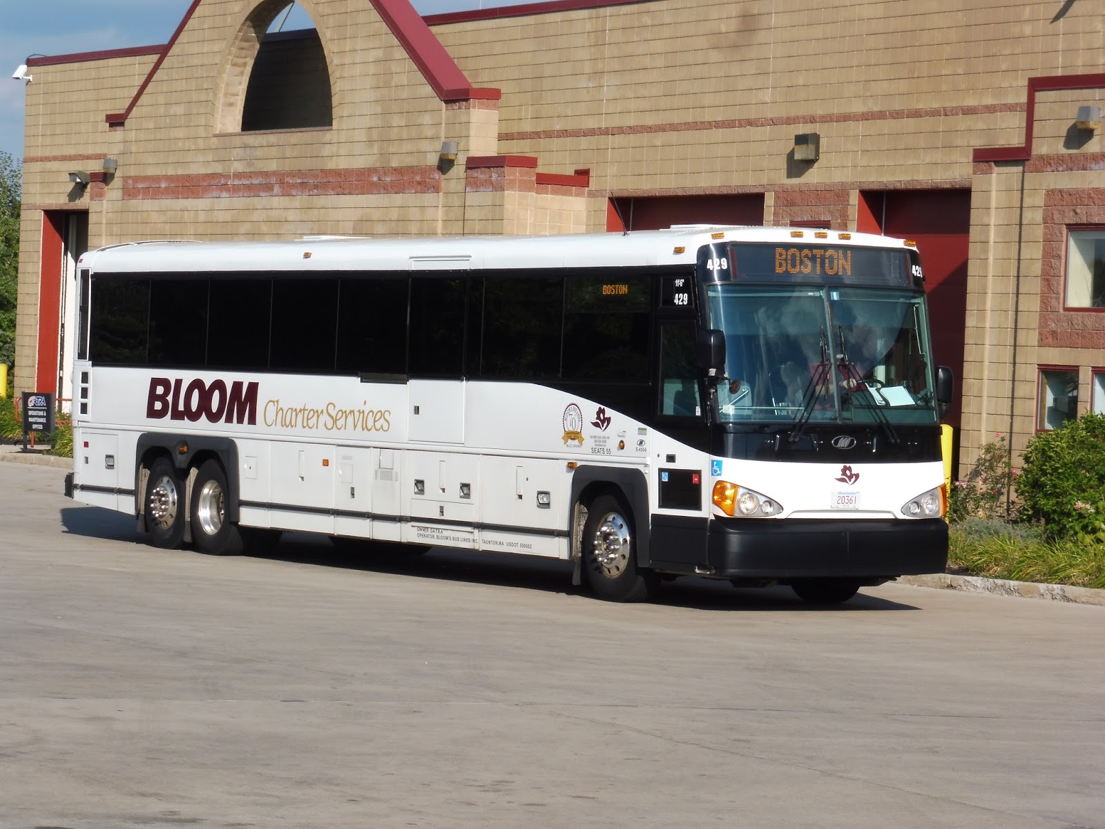 |
| The bus coming into the Bloom Terminal. |
So what the heck is the Bloom Bus? Well, it’s a coach bus line that runs local with stops at Taunton, Raynham, Easton, and West Bridgewater, then express right into Boston! Its fare is a flat $11.00 to get from any of those four stops into the city, and it uses pretty standard coaches to run the route.
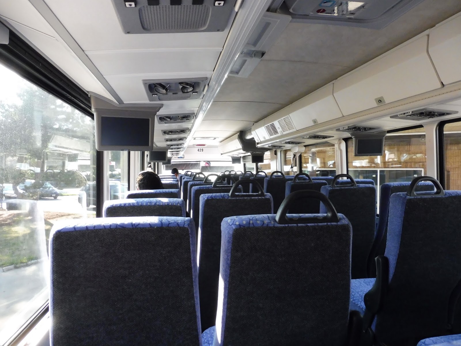 |
| The inside of the bus. |
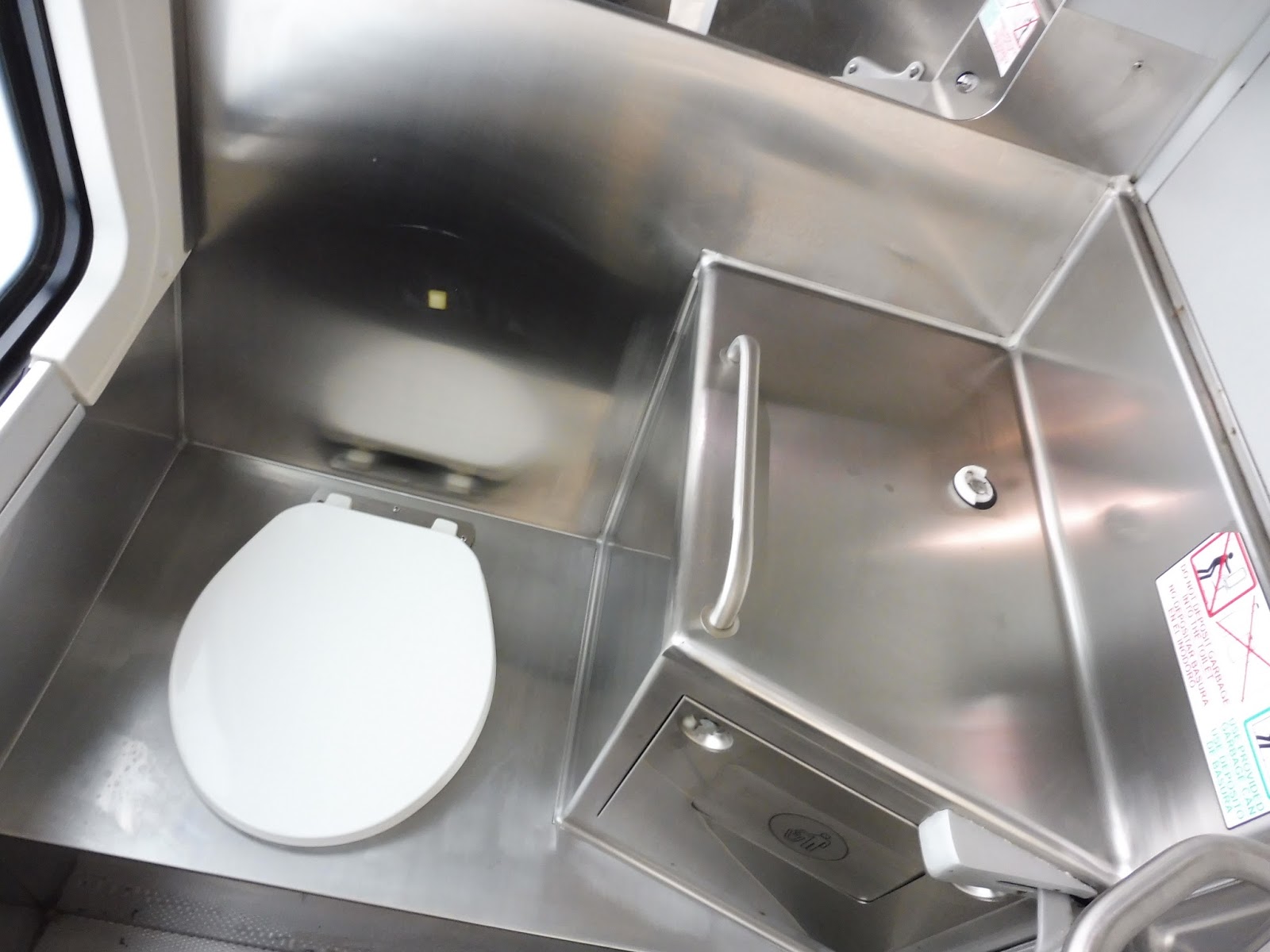
Of course, I would be remiss to talk about this bus without mentioning its bathroom! The inside is decent enough for a coach bus bathroom (it’s not like you can expect much), but keep in mind that the door is really narrow. It can be a tight squeeze to get in.
 |
| It’s beautiful! |
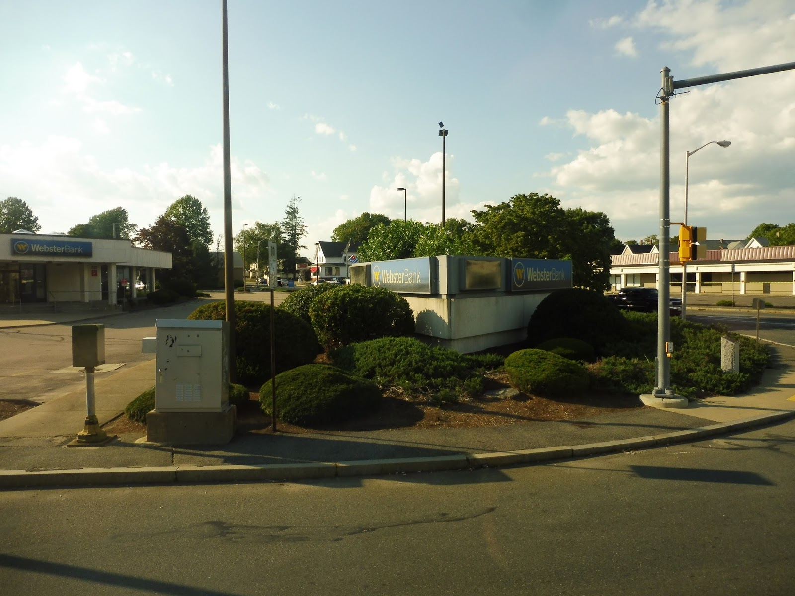 |
| A street corner. |
We then merged onto Broadway, which was mostly lined with houses, and also a cemetery. Occasionally, an industrial or retail building would pop up, and we also passed another graveyard. Actually, after that second cemetery, Broadway became way more industrial. Auto shops, anyone?
 |
| Some random industrial building. |
We eventually got a break from the industry (having entered Raynham) with…oh great, a Walmart. If GATRA were up here, I’m sure it would’ve made a deviation! Luckily, we still made no stops as we continued up Broadway, which was now residential. Did it last long? Not really – we started seeing businesses again soon.
 |
| A pretty major intersection. |
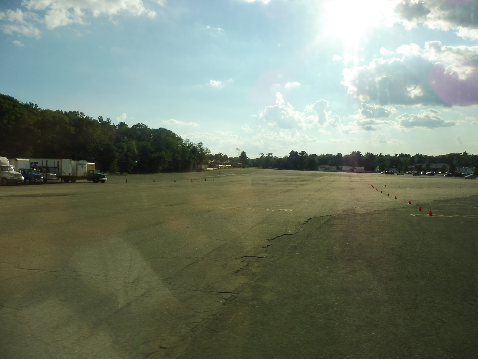
We crossed over I-495, and the street got more woodsey after that. Still, there was a bit of retail and industry that showed up, as well as a trailer park and an ice skating rink. And then…we arrived at one of the largest, most empty parking lots I’ve ever seen. Turns out this was our first stop, as we pulled into the lot (primarily for a dog track, but there’s plenty of space to park for the bus) and looped around. No one was waiting to get on at the small shelter, so we continued up Broadway.
 |
| Oh my oh my… |
It was pure forest after that, and no buildings broke the trees as we came into Easton. Eventually, we went under some telephone wires, then passed a variety of buildings in a short amount of time – houses, residential developments, an industrial building, and a golf driving range (along with a mini-golf course). At the next intersection, we turned onto Route 106 (Foundry Street), where there were a few businesses.
 |
| A pretty generic intersection. |
We went by a couple of housing developments, crossed over a small river, and then some more development – residential and retail. We then made a loop around another park-and-ride, and this one had no riders, either. Thus, we rounded a cloverleaf interchange and headed onto Route 24 – next stop, Boston!
 |
| Highway pictures are hard… |
The view from the highway started out as trees…and that’s about it. We were able to see lots of industrial development in Brockton, however. After that, there were houses pretty close to the freeway, but they were hard to see through the trees. We symbolically passed the Westgate Mall (I sure as heck couldn’t see it), where two trips per day deviate on request to serve Brockton, but this was not one of those trips – we sailed right through.
 |
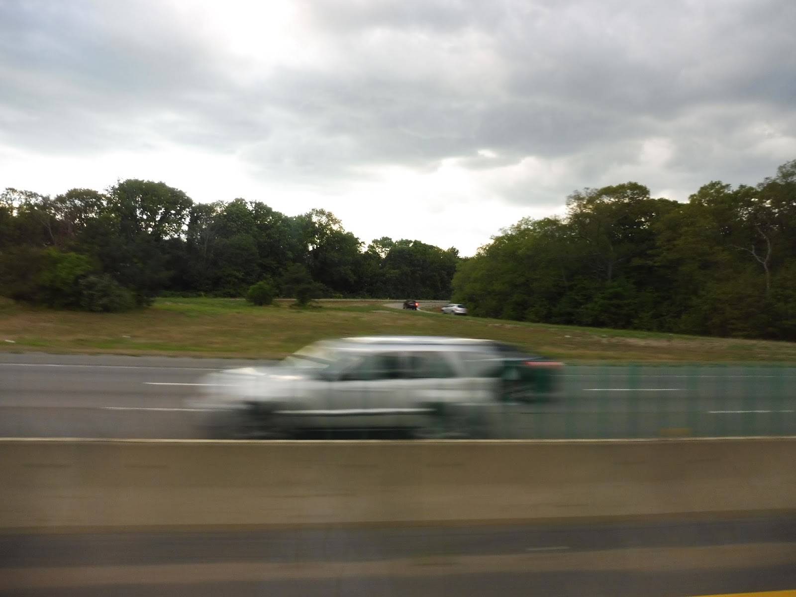
| Is it a bird? Is it a plane? No, it’s…a plane. |
We got some more woods from there, interspersed with random highway development on neighboring streets. Eventually, we reached Route 24’s final interchange, curving north onto I-93. This part of the interstate was forested, but we reached development in Braintree very soon.
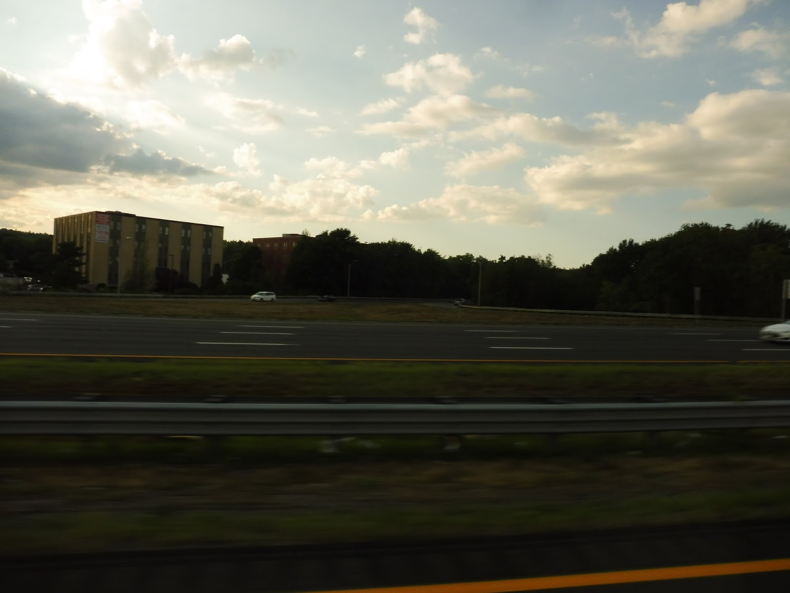 |
| Some random office building. |
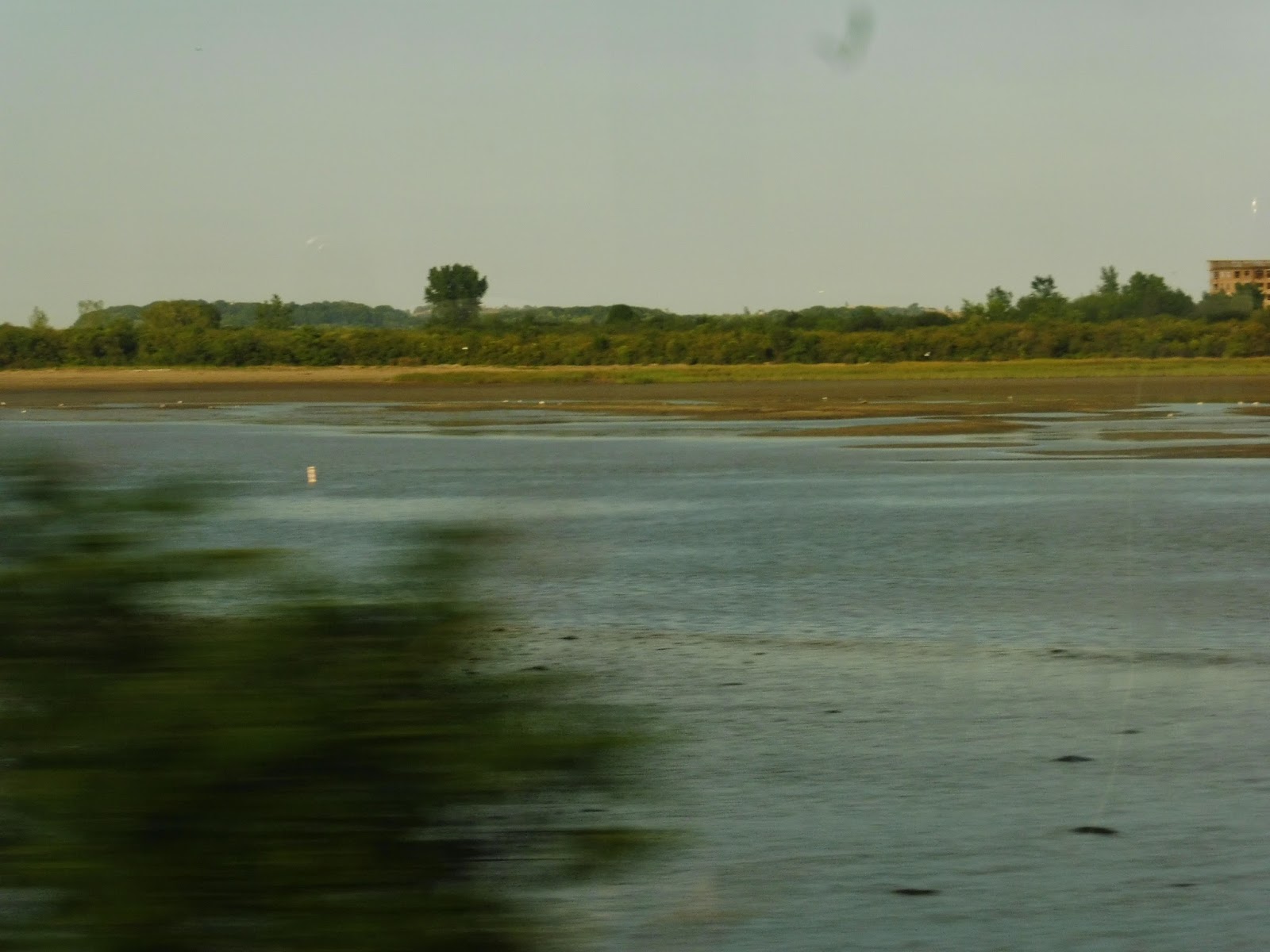
It started to get much denser past Braintree, and we could actually see…stuff! The highway went into its short tunnel at East Milton Square, and we passed through a marsh, then went over the Neponset River. We went by the famous Keystone Apartments, (201 and 202, woooo!) and the road came alongside the water, with a view of that classic rainbow gas tank.
 |
| This came out…better than expected! |
The highway came up along the Red Line, and we went by Savin Hill Station. We curved over the tracks near JFK/UMASS Station, and passed the South Bay Center soon after. It was industrial from there as we passed Southampton Garage (both Amtrak and MBTA), then the freeway went elevated over Albany Street.
 |
| Nice view! |
We took the South Station exit, and I assumed we would run on that connector road that leads to the bus terminal. Instead, we just took the normal exit onto Lincoln Street. At this point, the driver turned around and shouted “Is anyone going to South Station?” No one on the bus was, although the “South Station” stop really isn’t at South Station – we’ll discuss that later. Anyway, since no one was going there, we turned onto Kneeland Street.
 |
| Kneeland Street is busy! |
We headed through Chinatown, then the Theatre District. After that, Stuart Street became one-way in the opposite direction, so we had to turn onto Charles Street South, then Park Plaza. This led us past some tall buildings (apartments, perhaps), and then we looped onto Stuart Street via Arlington Street. And…this was the last stop. Just some random block with no signage at all. Huh.
 |
| The bus at its “stop”. |
Route: Bloom Bus Lines (Taunton, Raynham, Easton, and West Bridgewater – Boston)
Ridership: My trip was practically empty, with only two other people riding – however, this was a reverse-peak trip, so of course it wasn’t going to get that many people. In terms of overall ridership, the best statistics I can find are from this article, published at the beginning of 2014. (on my birthday!) Ignoring that fact that it’s from a Beverly-based news site (a town which the Bloom Bus doesn’t go anywhere near), it said that the route got 350-400 riders per day at the time. The route had 13 round trips per day, then, which means about 10-15 people per trip. Not a bad average, considering that most reverse peak trips won’t get anyone.
Pros: Taunton has no Commuter Rail service as of yet (we’ll see if South Coast Rail will change that), so this bus is incredibly useful for commuters in that area. All of the route’s suburban stops offer parking, so people can drive in and grab the Bloom to get into Boston. The buses the route uses are comfortable, and the schedule is pretty darn good – the route runs every half hour in the peak direction, and service is provided consistently throughout the day (minus a bit of a gap in the late morning). It even runs on Saturdays and Sundays, with two morning and two evening round trips.
Cons: The fare system for the route is rather wonky – yes, $11.00 from Taunton to Boston is essentially the same price as Commuter Rail, which is great. But since it’s a flat fare, it would also cost $11.00 to go from Taunton to Raynham, for example. I’m not saying anyone would do this, but they could maybe encourage local travel by having cheaper “interzone” fares in the suburbs. The other problem with the route is its stops in Boston – they could really use some signage. How is anyone supposed to know where the bus boards when it just stops on random city blocks? Also, the “South Station” stop is actually two blocks from the station itself, but I’ll let it slide.
Nearby and Noteworthy: Taunton doesn’t have a reputation for being the best town ever, but if you’re going there for whatever reason, this is the route to use.
Final Verdict: 8/10
This is by far the best way of getting from Boston to Taunton (sorry, GATRA). It’s comfortable, it’s cheap, and it’s reasonably fast if traffic cooperates. Just make sure you check their boarding locations in Boston before heading out – they can be hard to find. Also, don’t plan on taking this thing locally in the suburbs, since it’s way too expensive. But still, this bus is awesome! I know I’ll definitely use it again next time I ride some GATRA routes down in Taunton.
Latest MBTA News: Service Updates
MBTA Excuse Generator
I’m sorry for not being able to post much – work coming into the first week of school has been tough. Here’s a fun little website I found, though, called MBTA Excuse Generator. Many of you have probably already heard of it as it’s been circling around the internet, but if you haven’t, it generates fake MBTA Tweets about delays. Some of them are hilarious! Check it out here.

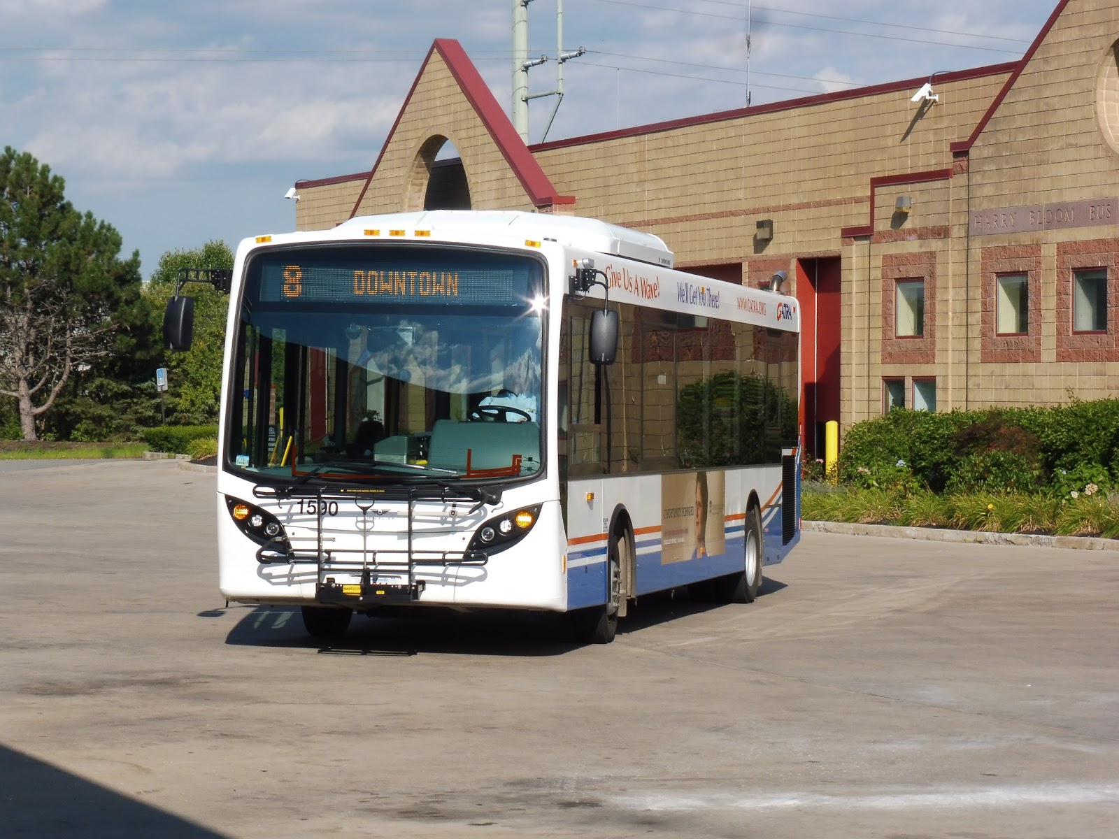
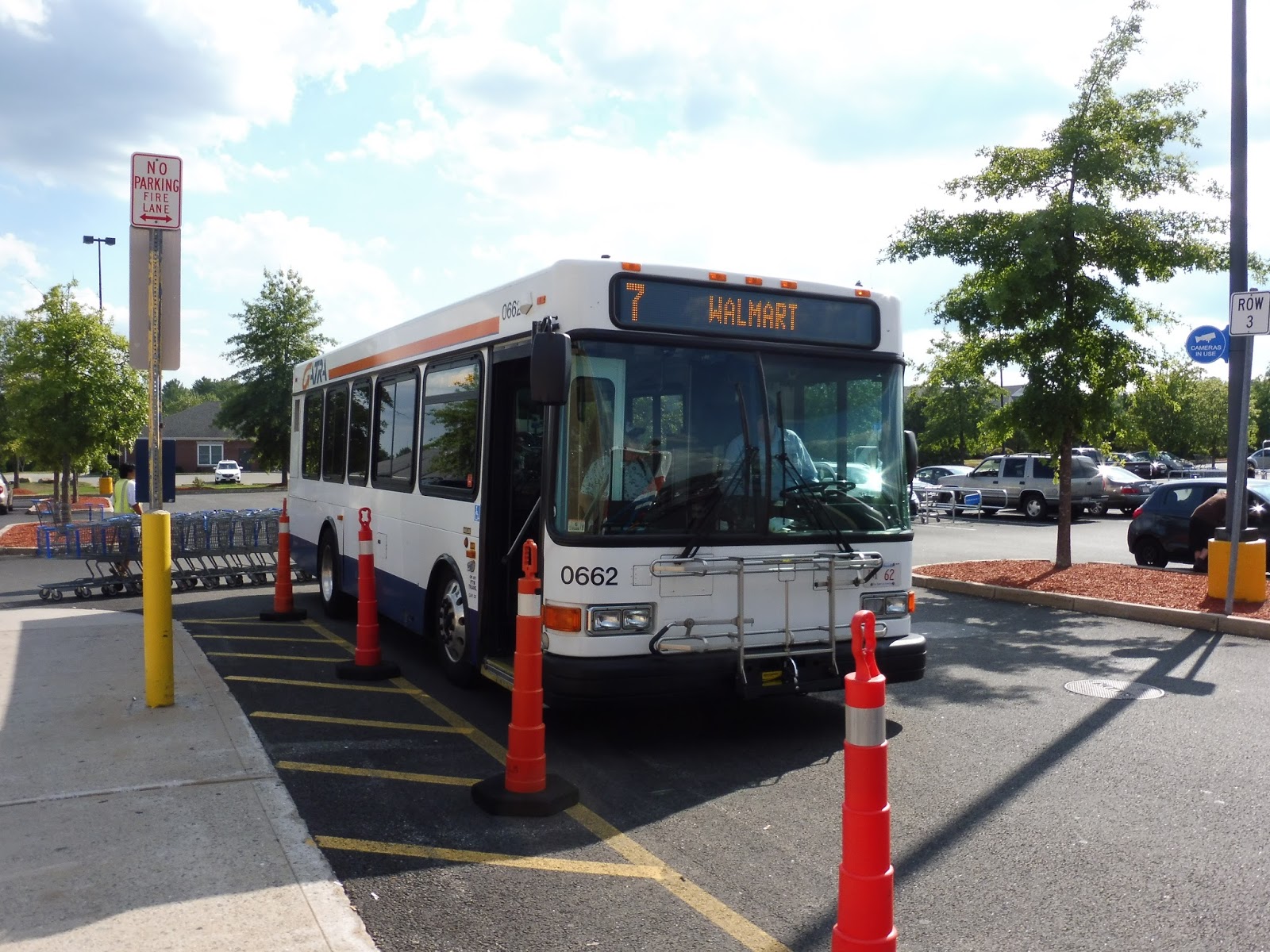
GATRA: 8 (East Taunton/Raynham Walmart)
*TRUMPET BLASTS* WELCOME…TO THE BUSIEST ROUTE ON THE GATRA! BOW BEFORE ITS GREATNESS! GAZE IN AWE UPON ITS MANY DEVIATIONS! I INTRODUCE TO YOU…THE 8!
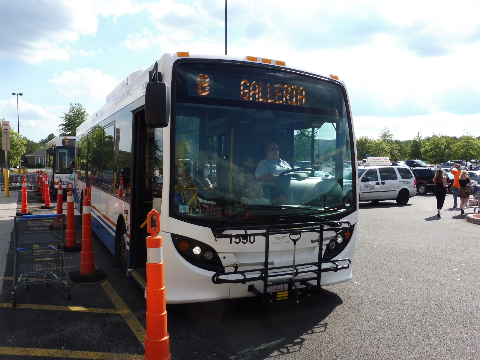 |
| The bus at Walmart. |
What’s more, the bus it was using was a shiny new New Flyer MiDi, which was great to see! On board this beautiful bus, we left Walmart, already with a good amount of people on board, and headed down Paramount Drive. It was office park land until we made our way to South Street East, which was more residential (although we also went by a gigantic Buddhist temple).
 |
| Leaving onto Paramount Drive. |
As we crossed the Taunton River, we passed an old factory converted into condominiums, then went over a railroad crossing. It was at this point that the street became Old Colony Ave and the houses got denser – we were in Taunton. There were some businesses as we turned onto Middleboro Ave, but it soon went back to being residential.
 |
| A little pizza shop. |
After passing a lot of identical houses as part of a development, we reached the intersection with Caswell Street, which housed a few businesses. Middleboro Ave curved north, and we crossed another level crossing with a train track. After that, we turned onto Stevens Street, which went over the train track on a bridge.
 |
| A residential side street. |
The street was lined with houses, although we also passed a church at one point. Eventually, though, the road widened and there were office parks on both sides. Next, we turned onto County Street, entering the ridiculously long Silver City Galleria deviation. It required looping around the whole complex, with stops at Bertucci’s, the main entrance, and Bristol Community College.
 |
| A view of the mall. |
From there, we headed onto…the highway? Yes, the 8 actually has a short express portion on Route 140! However, after the next exit, it became a regular road, and we turned onto Mozzone Boulevard after another railroad level crossing. The scenery? Businesses with parking lots and office parks.
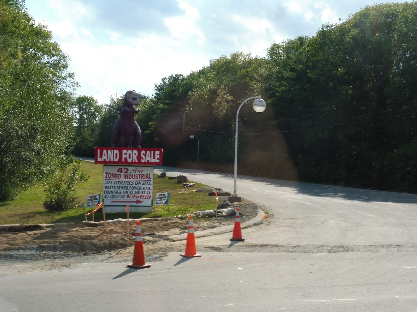 |
| NO ONE TOLD ME ABOUT THE T-REX! |
Next, we turned onto Allison Ave, which led us to a deviation into a small shopping plaza, Taunton Depot. After that, we made our way back onto Route 140 (County Street), going by some housing developments. There were a few businesses at “Hart’s Four Corners”, which is considered a major stop on the route. Here, we turned onto Hart Street.
 |
| A liquor shop. |
At this point, the route got interesting. You see, our trip was scheduled to be a school trip, running up to the Taunton High School. But school wasn’t in session during my ride, so of course GATRA wouldn’t deviate to serve it right? Right? HAHAHAHA, NOPE. WE TURNED ONTO JOHNSON STREET, HEADIN’ UP ON TOWARDS THE SCHOOL!
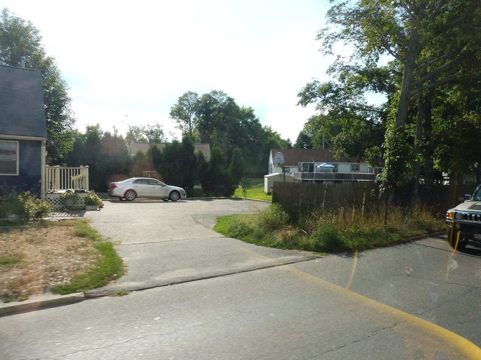 |
| Some houses. |
Johnson Street was mostly residential, but we did see some retail as we crossed County Street. We went under some telephone wires, then merged back into County Street, which was also residential by this point. From there, we left the road and headed up towards the high school. Wanna guess how many people we picked up? ZERO. NO REALLY, I’M NOT LYING! PRETTY HARD TO BELIEVE, BUT IT’S TRUE.
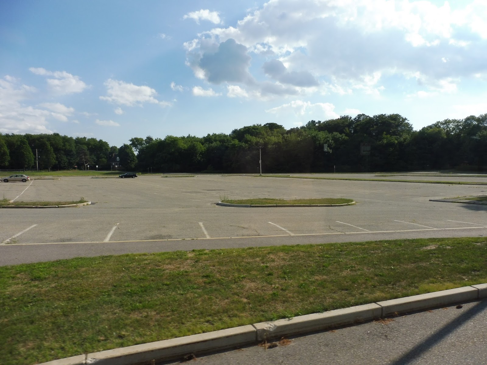 |
| What’s this? The empty parking lot for the school? Gee, if cars have the sense not to come here in the summer, why not GATRA? |
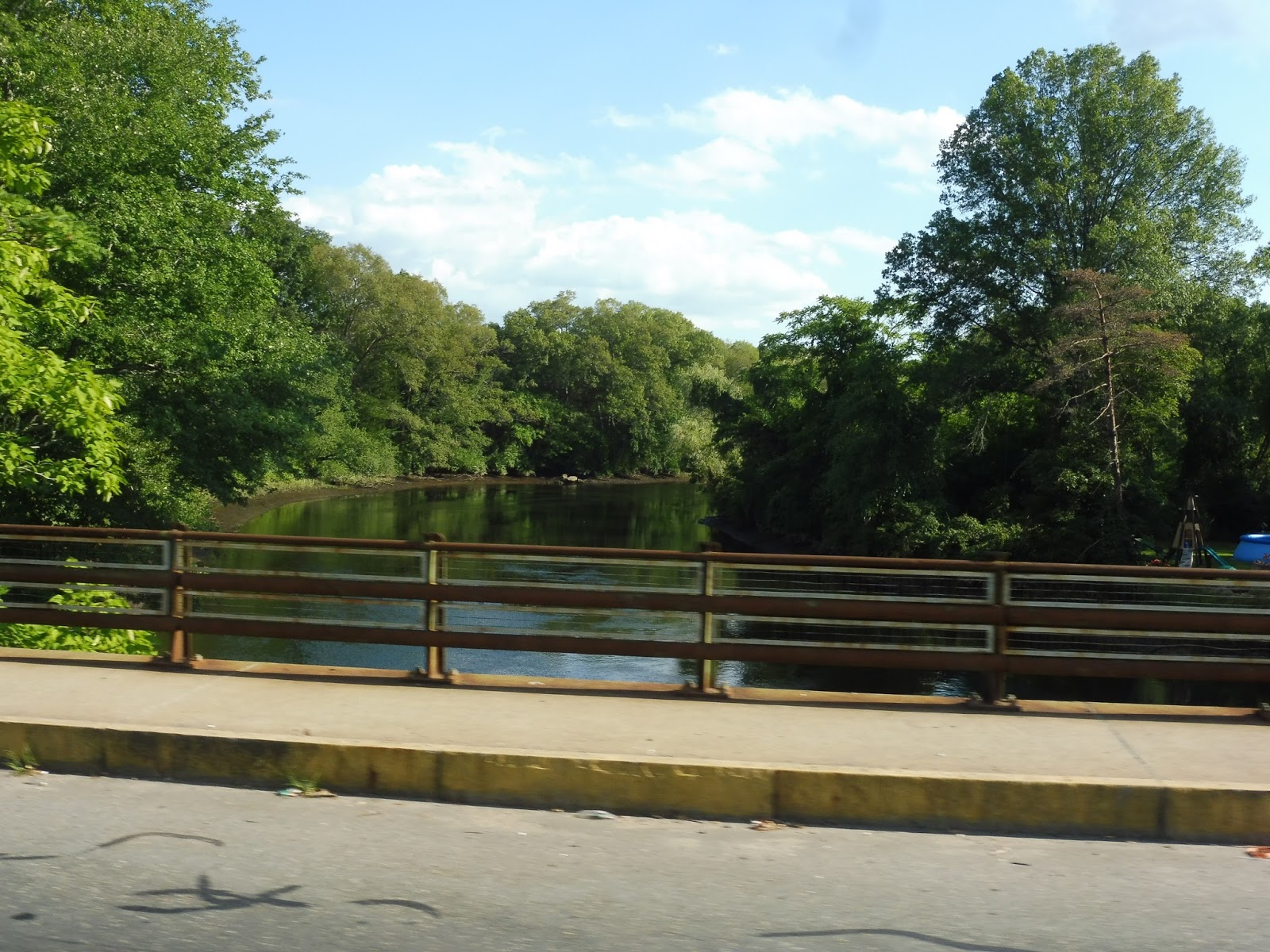 |
| Going over the Taunton River. |
 |
| What a lovely…um…lot. |
 |
| The bus setting out on another outbound journey. |
GATRA: 7 (School Street/Raynham)
The 7 is a bit odd for GATRA. For one thing, it has a completely different map style from any other GATRA route. Also, it leaves Taunton at different times than most other routes from there. And finally, it’s really good about not making deviations! Well, we’re off to a good start in that regard.
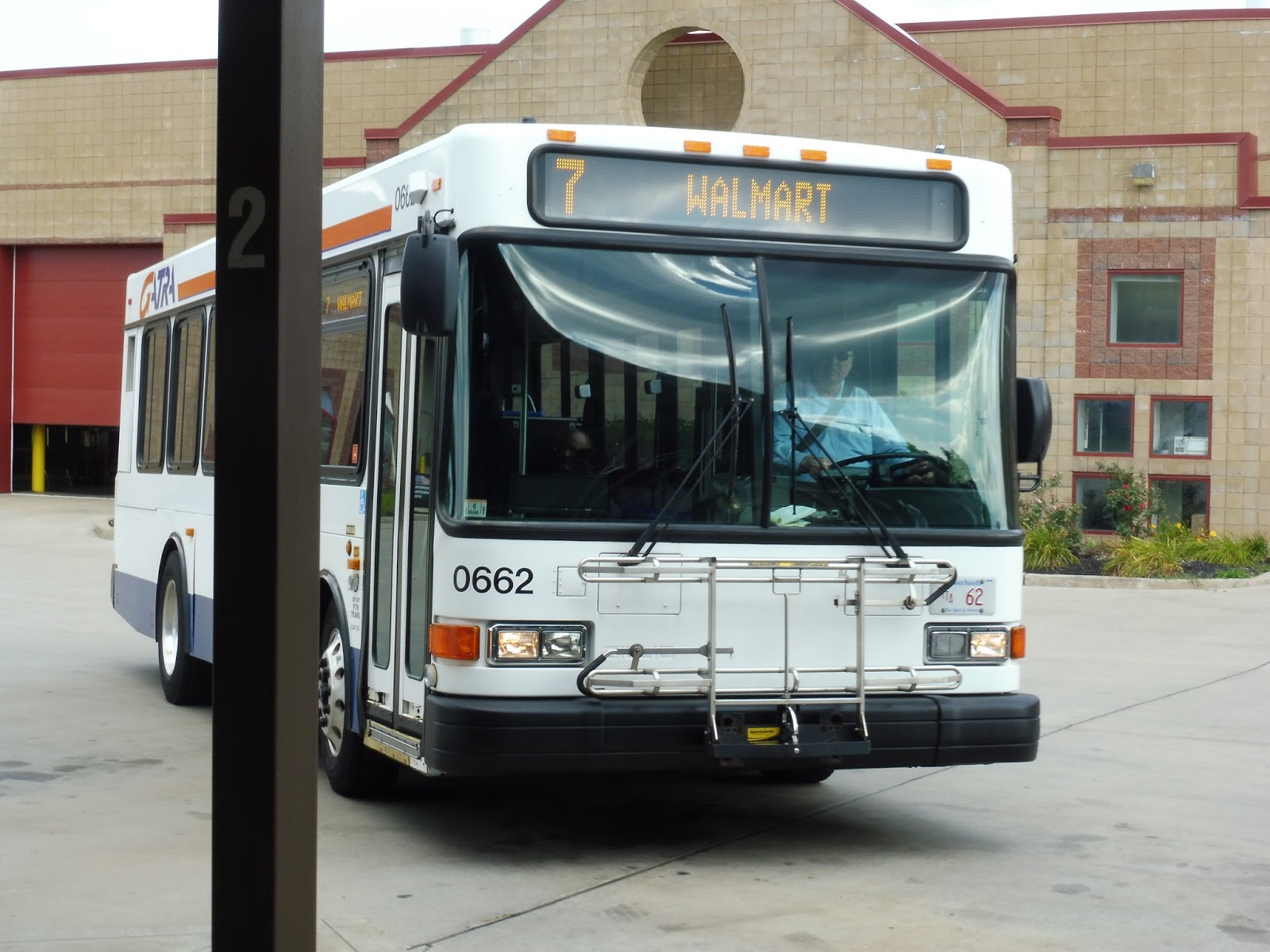 |
| The bus at Taunton. |
We left the Bloom Terminal and headed down Oak Street, going over a railroad track. We passed a few suburban businesses, then turned onto Court Street and entered downtown Taunton. Heading around the Taunton Green, we went by some businesses and municipal buildings, then turned onto School Street.
 |
| Downtown Taunton. |
The somewhat narrow road soon became lined with mostly dense, multi-story houses. We passed a development by the name of Thomas Apartments, and though it was a major stop, we luckily didn’t deviate to serve it. The houses became single-family from there, unlike the majority of the ones back towards town.
 |
| These houses were closer to downtown. |
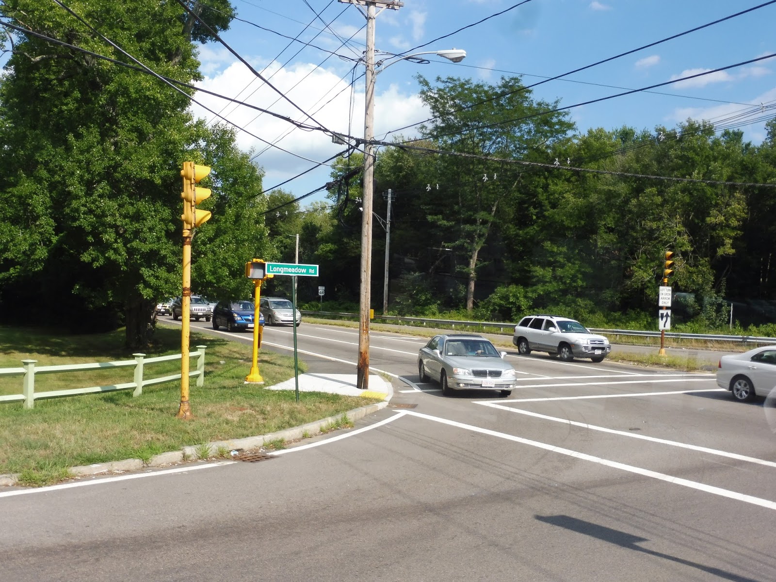
There was a little corner store at the intersection with Winter Street, onto which we turned. As we passed mostly industrial buildings, the street became Longmeadow Road. Next, we turned onto the wide Dean Street, going by a social security office and some other office buildings, as well as the Taunton River.
 |
| Turning onto Dean Street. |
It’s at this point that the 7 makes a rather odd routing. The main drag of this area is Route 44, which is lined with a bunch of different malls and parking lots. However, probably for safety reasons pertaining to picking people up on a highway, the 7 runs down the narrow South Street West, serving the backs of malls instead. We didn’t even deviate to the fronts, and ironically, someone in a wheelchair got on along this section!
 |
| The other side of South Street was mostly sparse houses. |
Eventually we merged back onto Route 44, crossing over the Route 24 freeway. There was a mixture of office parks and businesses with parking lots on the other side of the crossing. Next, we turned onto Paramount Drive, then into the parking lot for a Walmart. This was where my friend Sam and I got off in order to transfer to the 8, but the 7 does extend slightly further past Walmart – it runs to a trailer park called Pinehill Estates.
 |
| The bus at Walmart. |
GATRA Route: 7 (School Street/Raynham)
Ridership: I’m surprised to see that the 7 only gets about average ridership for GATRA’s weekday Attleboro/Taunton routes, with approximately 130 riders, and below average on Saturdays – 60 people. My weekday trip was actually quite busy (for GATRA), with over 10 riders!
Pros: This is the fastest way of getting to Walmart from Taunton, making the trip in about 20 minutes (the alternative, the 8, takes 45 minutes to get there). It also serves other businesses along South Street West, and houses on the School Street section. The 7’s schedule is standard for GATRA, with every hour headways Mondays through Saturdays.
Cons: You know, I thought the 7’s ridership was pretty good before, but in all honesty, very few people use this thing on Saturdays – it averages out to about 3 people per trip. This shows that service could probably be reduced, or perhaps start later or end earlier. Weekday ridership seems good, though.
Nearby and Noteworthy: If you’re trying to get from Taunton to Walmart, the 7 is the way to go. There are a few other businesses along South Street West, as well.
Final Verdict: 7/10
Ayyyy, the 7 gets a 7! No, but seriously, this is a good route that seems to get a good amount of people on weekdays. On Saturdays, though, it might be beneficial to shave off a trip each in the morning and evening – the every hour schedule works well, but ridership is probably higher midday on the route.
Latest MBTA News: Service Updates
I’m back from Portland, Oregon! I’m finishing up the GATRA posts I hadn’t written yet first, and then I have a slew of posts in store about the public transit system over there, the TriMet. I also want to give a huge thanks to my friend Sam Hegg for managing the blog while I was gone – check out his Operational Oculi if you haven’t already!
Sam’s Operational Oculi: Quincy Garage


So in short, Quincy Garage is a suburban operation, serving the South Shore. It could definitely stand to be slightly less confusing with its variants, but it gets the job done. I hope to write about Lynn Garage, on the north shore of Boston, in the near future. Before that, look for more posts from Miles about GATRA, and his recent trip to Portland! Stay tuned.
Sam’s Operational Oculi: The MBTA’s 10 garages
| Garage | Communities Served | Routes |
|
Albany
|
Newton, Brighton, Waltham
|
04, 57, 59, 60, 65, 170, 193, 501, 502, 503, 504, 505, 553, 554, 556, 558, 701(CT1), 708(CT3), 747(CT2)
|
|
Arborway
|
Boston, Dedham, Norwood, Walpole
|
14, 21, 24, 26, 27, 29, 30, 31, 32, 33, 34, 34E, 35, 36, 37, 38, 40, 41, 42, 50, 51, 52, 195
|
|
Bennett (North Cambridge)
|
Cambridge, Watertown
|
71
|
|
Cabot
|
Boston
|
01, 05, 07, 08, 09, 10, 11, 15, 16, 17, 18, 19, 22, 23, 43, 44, 45, 47, 55, 57, 59, 65, 66, 171, 193,, 504, 553, 9701, 9702, 9703
|
|
Charlestown
|
Charlestown, Chelsea, Everett, Medford, Malden, Melrose, Somerville
|
89, 91, 92, 93, 101, 104, 106, 108, 109, 110, 111, 112, 325, 326, 352
|
|
Fellsway
|
Chelsea, Everett, Medford, Malden, Melrose, Reading, Wakefield, Woburn
|
94, 95, 96, 97, 99, 100, 105, 108, 131, 132, 134, 136, 137, 354, 411, 430
|
|
Lynn
|
Chelsea, Revere, Lynn, Swampscott, Marblehead, Salem, Danvers, Peabody
|
114, 116, 117, 119, 120, 121, 424, 426, 428, 429, 431, 434, 435, 436, 439, 441, 442, 448, 449, 450, 451, 455, 456, 459, 465
|
|
Quincy
|
Quincy, Milton, Weymouth, Hingham, Randolph, Braintree
|
201, 202, 210, 211, 212, 214, 215, 216, 217, 220, 221, 222, 225, 230, 236, 238, 240, 245
|
|
Somerville
|
Cambridge, Somerville, Watertown, Belmont, Arlington, Burlington, Waltham, Lexington, Bedford
|
62, 64, 67, 68, 69, 70, 70A, 71, 72, 73, 74, 75, 76, 77, 78, 79, 80, 83, 84, 85, 86, 87, 88, 350, 351
|
|
Southampton
|
Boston
|
Silver Line, 28, 39
|
A more comprehensive list of all of this can be found here: http://www.transithistory.org/roster/ (scroll down to buses)
I plan on writing about each garage in it’s own post later down the road. In particular, I hope to have Quincy Garage’s post up by tomorrow, so please stay tuned for that. Finally, If you have any topics that you want me to try and touch on, please let Miles and I know by using the “ask me anything” feature!
GUEST POST: The CapeFLYER
This guest post by Adam Parise takes us onboard the CapeFLYER to Hyannis. Good job, Adam!
I never thought I’d be reviewing something I only rode twice ever but here I am reviewing this wonderful passenger rail service. The CapeFlyer is a must ride for all railfans which runs every year from Memorial Day weekend to Labor Day. Let’s see what the CapeFlyer has to offer!
 |
| A view of the Bourne Bridge. |
 |
| A gazebo in Buzzards Bay. |
 |
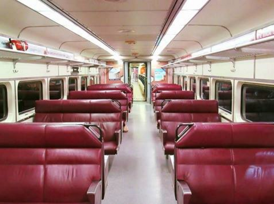
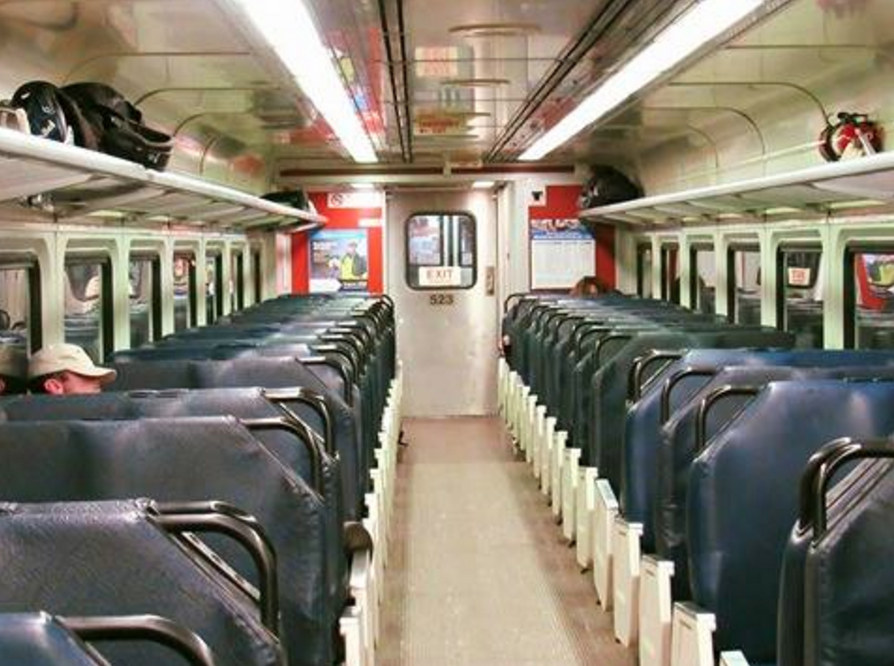
| Interior shots of the Café car. |
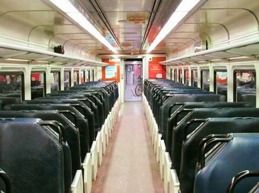 |
| The passenger seating area. |
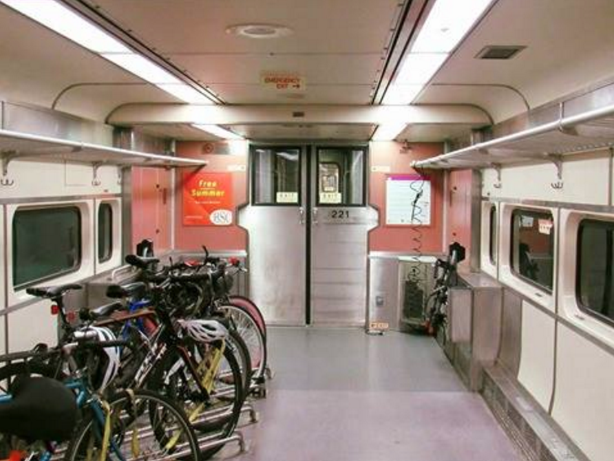 |
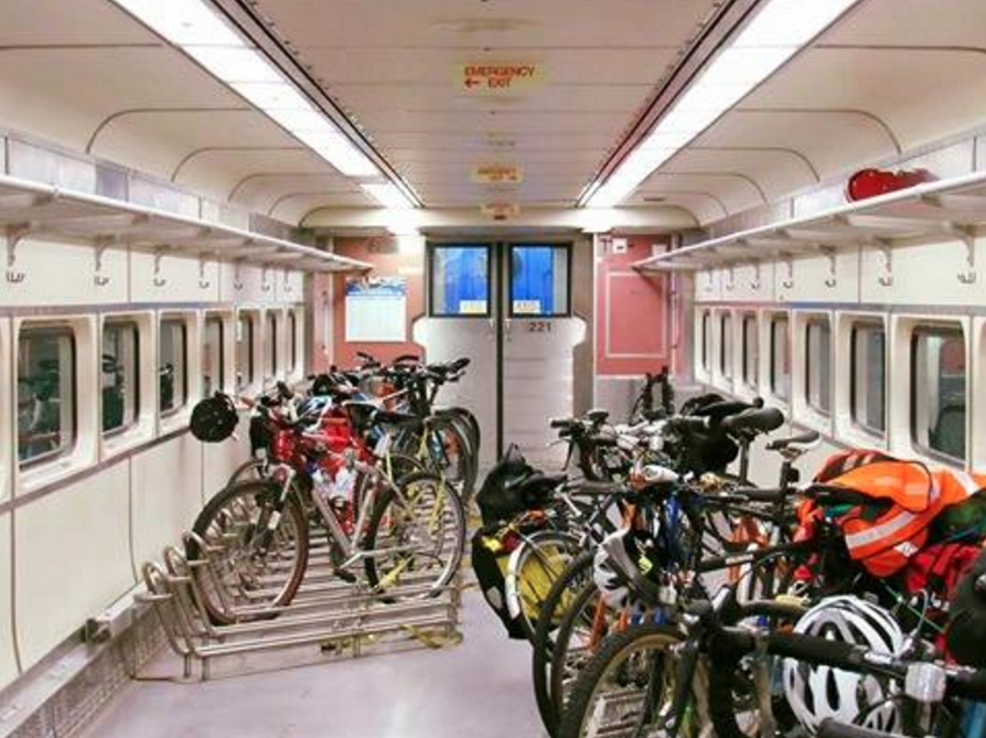
| A very cool bike car! |
 |
| The train at Hyannis Transportation Center. |