Random Photos: Portal of Power, Part 2
 |
| Looking at a Silver Line bus leaving the portal. Photo credit to my friend Chloé Gilligan. |
Random Photos: There’s a Bathroom at Wonderland?
You may know that I loved Wonderland as a station. Well, I just found another reason why it’s awesome. I was waiting on the platform for an inbound train, and I saw these two women go through a door that said “Ladies room.” “Wow,” I thought, “Is there a men’s room, too?” Turns out there was! And both bathrooms were right on the platform! It was kind of stinky in there, but overall it was clean (not that I checked any of the stalls). This was a genuine surprise for me.
 |
| They really need to make this more obvious. It just looks like a random door until you look up close. |
 |
| Yes, I took a panorama. I couldn’t fit the whole bathroom in one shot! |
Random Photos: View From the Salem Parking Garage
As you may know, I love going on parking lots. So, I had to check out the roof of the new one in Salem. It was really awkward because there was a guy working up there, who didn’t respond to my “Hi!” or “I’m just checking out the view.” But the view was pretty fantastic, even if there weren’t any skylines.
 |
| They didn’t even bother to clear the snow out! |
 |
| Looking into downtown Salem. |
 |
| And then to the west. |
 |
| And a panorama looking north. |
Random Photos: Vandalism Already?
The new Salem Station isn’t even fully done yet, and someone’s already defaced one of the maps there. I’m speechless.
 |
| What is this thing actually supposed to be? |
Random Photos: Old Signal Box at Salem
 |
| At least, I think that’s what it is. Leave a comment if you know. |
Random Photos: Contradicting Signs at Salem
 |
| I don’t know where to go! |
Random Photos: Pigeon at Alewife
You see pigeons fairly frequently near Alewife (so much, in fact, that there’s a “Do not feed the pigeons” sign outside), but they never come down to the platform. Well, that all changed yesterday…
 |
| The pigeon started to run away when I took the picture. |
 |
| And then he started hopping up the stairs. |
 |
| Bye! |
Random Photos: Just Hangin’ Around Boston
I had a half hour to kill until the 450 arrived at Haymarket, so I decided to walk to Long Wharf. These pictures don’t have anything to do with public transportation, but skylines and seagulls are good, right?
 |
| A snowy view from the Greenway. |
 |
| A panorama from Long Wharf. |
 |
| This seagull walked right up to me. |
 |
| I don’t have food, get away! |
 |
| Another panorama. |
 |
| Going back inland. |
Haymarket
Let’s talk about North Station for a second. This modern hub has a cross-platform transfer between the inbound Green and Orange Lines, and a very straightforward transfer between outbound lines. Yes, this is probably the easiest and most convenient transfer station on the MBTA. Now what about Haymarket? What about Haymarket with its numerous staircases, misleading signage, and overall ugly aesthetics? Simply put, Haymarket is the lesser of the two Green-to-Orange transfers.
 |
| The main entrance of Haymarket, along with the busway. |
The main entrance is certainly striking. Housed in a massive non-MBTA parking garage, the busway features a massive glass slab cutting through concrete at an angle. I’m not really sure if I like it or not, but it’s definitely interesting. The fact that Haymarket has a proper busway gives it an edge, being right in Boston. However, there are actually two busways here, and the other one is much less exciting. It hasn’t even got benches, so passengers are forced to just lean against the wall.
 |
| What’s more, it’s right on the street! |
There are quite a few bus connections here, but as many of them are weekdays only, the station’s quiet on weekends. The three weekend buses are the 92, 93, and 111, the last of which is a Key Bus Route and gets very heavy ridership. The other (weekday-only) buses here are the 4, the 325 and 326, and a whole bunch of 400-series routes that go up north. Oh, and I suppose there’s also the 608. Blech. But the fact that the new hybrid buses run from here makes the station worth a look.
The main entrance just has steps going down from the busway. The mezzanine they lead into is pretty nice and modern, with a fair amount of fare gates and machines. It’s very clean and well-lit as well. The only problem with it is that the ceiling’s kinda meh, but at least it doesn’t have random pipes like other parts of the station. Spoiler alert.
 |
| The mezzanine. |
I didn’t visit the other entrance on my recent trip, but I have a picture from when I took the 326. The mezzanine seems well-lit, and it seems to have a good amount of fare gates. Honestly, though, I don’t remember anything from that trip. I’m basing everything on the picture.
 |
| Looks pretty nice… |
The Orange Line platforms are pretty disgusting. Although they’re right next to each other this time (unlike State), the divider between the two sides is really grimy and dirty. The walls are made of these old red bricks and there are a whole bunch of massive metal pillars along the platform. The latter may look good in a more modern station, but they just look bad and out of place here. And this station also has a case of the random pipes, as there are quite a few of them running down the length of the ceiling.
 |
| There’s also that random traffic cone in the middle… |
 |
| That destination board is…interesting. |
I then wanted to see the Green Line platforms, so I followed the signs to them. One of them pointed up some stairs – once up there, another sign said to continue down the platform. This ended up being a dead end, so I went back up the stairs and this lead to the Green Line. It’s always annoying when signage contradicts itself.
 |
| This mezzanine is kind of nice, though. |
Unfortunately, the Green Line platforms were just as bad as the Orange Line ones. It’s technically just one island platform, but they’re split most of the way down by a wall. I wish that wasn’t the case, since it makes the platform feel smaller than if they were to just get rid of the wall. And alas, the walls are again very grimy and the ceiling again has random pipes all over it. At least it’s clean, I suppose.
 |
| Looking down both platforms, with the wall in the way. |
 |
| A train at the station. |
Station: Haymarket
Ridership: North Station is definitely the more-used station for Green Line to Orange Line transfers. Haymarket is a much bigger bus hub, though, and a whole bunch of people use the 111 alone. Also, this is the closest station to the North End, so that spurs a whole other source of ridership. The station as a whole gets about 11,500 riders per day, making it the 15th busiest station on the system.
Pros: On weekdays, this is a pretty good bus hub, with a whole bunch of express routes to the North Shore. And the non-platform parts of the station are actually pretty nice.
Cons: But the platform-platform parts of the station are disgusting. Also, the fact that there are two busways, both of which serve different routes, can be confusing. Not to mention the one on Congress Street can hardly be considered a “busway” when it has no shelters or even benches. The signage within the station seems to be really misleading, and according to Wikipedia, the Green and Orange Line platforms are on the same level – shouldn’t going between them be so much easier, then?
Nearby and Noteworthy: The North End is simply exploding with history, and has a whole bunch of awesome restaurants. I know none of these, but this website seems pretty informative.
Final Verdict: 5/10
This station is pretty confusing, with both the misleading signage and the two busways (the second of which is pretty much just a stop). Also, both platforms are really dingy, and the transfer between them seems like it could be so much simpler. However, I will say that the non-platform parts of the station are nice, and there are a lot of bus connections (on weekdays, anyway). This is also the closest station to the North End, so that’s something.
Latest MBTA News: Service Updates
I’m late on this, but two Mattapan High Speed Line trolleys collided in Dorchester. Driver error is apparently the culprit.
Transit Tales: The Worst Shuttle Bus Ever
It’s no secret that I, or indeed anyone, dislikes shuttle buses. When I’m trying to get somewhere for fun, planned weekend shuttles can be a minor annoyance. But when I’m trying to get to school during rush hour, it can be devastating. When my friend Leo and I reached the smaller entrance at Alewife, the doors were locked. Annoyed, we assumed that entrance was locked for one reason or another so we headed to the main entrance. This was open, and there were people in the mezzanine. Good.
As soon as we walked in, we heard one of the employees below mention shuttle buses. Oh, no. We didn’t even know why they were running buses (turns out a maintenance vehicle got stuck on the tracks), but we had to walk into the busway. Upon getting there, there was another surprise: they were running the buses from Cambridge Park Drive. And what’s more, there were a few CNG buses in the mix, something you never see at Alewife. Still, they can’t fit in the busway, so I guess that’s why they weren’t using it. But the other buses could’ve still boarded from it.
We were the first people to get onto the second bus (the one ahead was too crowded), and the driver asked where we were going. “Harvard,” I replied. “Hmm,” the driver replied, “Is that what it says on the outside? I don’t know where I’m going.” Pause. “But get on.” Well, this driver certainly knew what he was doing.
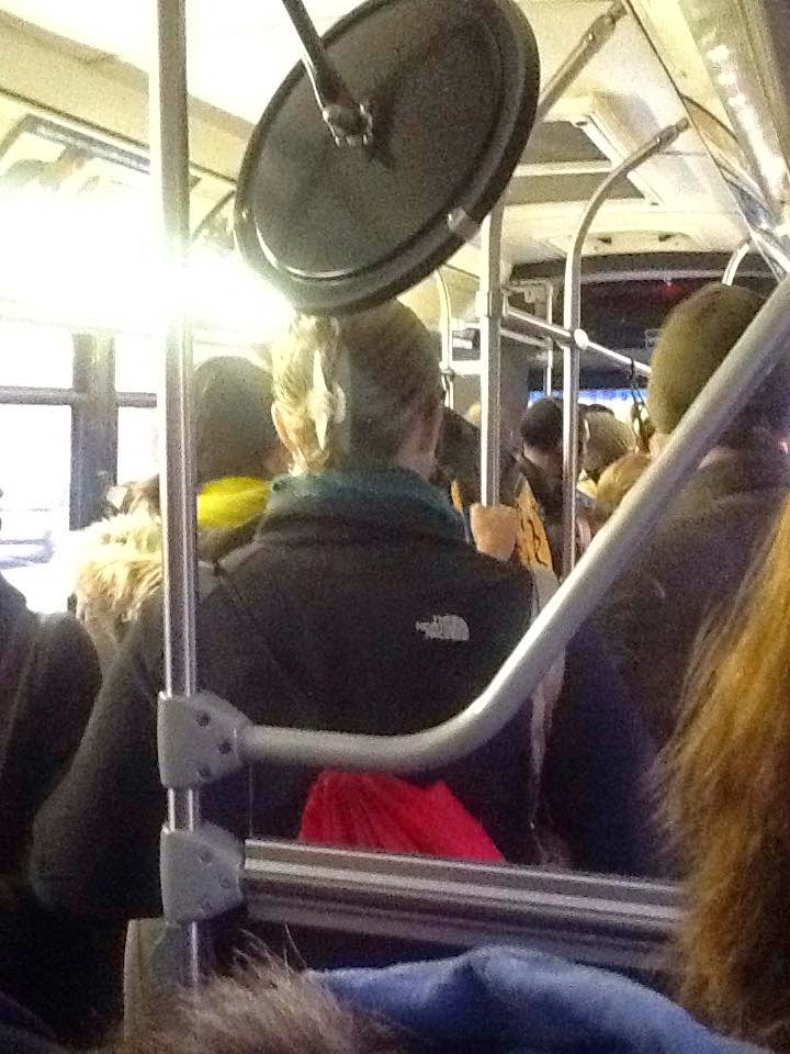 |
| Typical shuttle bus crowd (photo credits to Leo and his iPad). |
The whole line of buses then proceeded down Cambridge Park Drive (away from Harvard, mind), going by a bunch of offices. We went all the way down until the end, when we turned around and headed back the way we came. This involved some reversing, and it took about five minutes to get back to where we started.
So we finally made our way up Route 16, which was moving at a pace a snail would scoff at. After what seemed like forever, we turned onto Broadway, then Holland Street at Teele Square. Coming into Davis, the buses slowed to a crawl. A massive crowd was denied entrance onto our bus for some reason, and so we headed on towards Porter. We moved pretty quickly through downtown Davis Square, and Mass Ave was fast, too.
 |
| Massive crowd at Davis. |
During the ride, I could see how the MBTA was throwing anything and everything it had at this service. There were regular diesels, CNGs, articulated buses, and even Silver Line dual modes! It was pretty cool seeing all these different buses in neighborhoods that usually just see the diesels. Anyway, we ended up not going into the Harvard Square bus tunnel, opting for the square instead. This meant a few more minutes of heavy traffic, then we finally got let off. Looking at the long line of buses behind us, I knew that this was certainly the most haphazard shuttle bus service I’ve ever taken. Yet surprisingly, we were only 15 minutes late for school!
 |
| A line of shuttle buses at Harvard. |
Random Photos: The Old Government Center
There are often stations that I visit and take pictures of, but ultimately end up not reviewing. Turns out this happened with Government Center before its closure! I found some pictures from about a year and a half ago, and though the station’s not getting its review, at least these old photos will finally get released to the public.
 |
| On the end of the Blue Line platform they had a remnant from the original original station. |
 |
| I always wondered why this Green Line loop was so well-lit. |
 |
| On the Green Line platform. |
 |
| A blurry picture of the entrance. |
 |
| I love these murals! |
116/117 (Wonderland Station – Maverick Station via Revere Street or Beach Street)
In my review of the 31 about a year and a half ago, I remarked upon how good the bus’s schedule is for a non-Key Bus Route. One of the things I said was that it’s “better than the 116 and 117, and those are both Key Bus Routes!” Something I don’t think I realized at the time was that the 116 and 117 may have subpar schedules individually, but as a combined, coordinated unit they’re as good as any other Key Bus Route. With that said, let’s take a ride on both the 116 and 117 routes! (Oh, and as long as we’re giving confessions from early blog posts, I’d like to apologize for saying that the sharp turn after Harvard is only on the inbound side. Not sure what I was thinking…)
 |
| The 116 in Bellingham Square. That destination board seems a bit askew… |
I got on the 116 in Bellingham Square heading towards Wonderland. I’m going to save this part of the route for the ride back, and skip ahead to the 116’s unique portion. After the 117 turns off onto Central Ave up in Revere, the 116 continues up Broadway, going by a mixture of apartments and businesses. Eventually, we turned onto Revere Street, joining the 411’s route.
 |
| Sunset falls over some parking lots near Wonderland. |
Revere Street was much more residential, though there were a few dodgy-looking businesses when we crossed American Legion Highway (upon which a plethora of 400-series buses toward Lynn and Salem go). The street curved north for a bit, and we went by the “Friendly Garden Co-op” – how I love names of residential developments. It then curved east again, where there were apartments and some businesses, as well as a school. Crossing over the Commuter Rail tracks, we turned onto North Shore Road (along with another bunch of 400s), went around a rotary, and came into the Wonderland busway.
 |
| The 117 in the well-lit busway. |
Unfortunately, the 116 was a few minutes late, and I had just missed the 117 going back to Maverick. I had to wait 20 minutes for the next one, and though I could’ve gotten the 116 that arrived in half that time, I wanted to do both buses for one review. So after the wait that felt much too long, we headed down North Shore Road, following the 110 route.
We came pretty close to Revere Beach Station, but rather than directly serving it, we turned onto Beach Street. There were some nice apartments along here, then we went over the Commuter Rail tracks, past a plaza, and around Bell Circle. Continuing down Beach Street, the apartments became houses until we turned onto Broadway, rejoining the 116.
Broadway had a bunch of small businesses, and was well-lit thanks to some fantastic old-fashioned streetlights (night had fallen by this point). We passed Revere City Hall, then went under Revere Beach Parkway and over a small creek. It then became more residential, with apartments lining the street.
 |
| Nice view. |
After crossing the Commuter Rail tracks yet again, the buildings got more dense as we entered Bellingham Square. We turned onto City Hall Ave, then Washington Ave, and then Broadway again. We stayed on it for about three blocks before turning onto Cross Street, which had a very back-alley feel to it. Almost immediately after, we turned again onto Pearl Street, which went on a bridge over the Chelsea River. The view was pretty nice, even at night, with Boston partly visible and the massively high Tobin Bridge dominating the scene. Unfortunately, pictures from lit-up buses don’t come out well at night, so…no pictures. Sorry.
Now on Meridian Street in East Boston, we went by a bunch of cute apartments. These soon turned to businesses as we went through Central Square, then we crossed over the Callahan Tunnel portal. We turned onto Chelsea Street, and were let out right outside Maverick Station. The bus then looped around the entrance, changed its destination board to 116, and shut off, presumably for a short layover.
 |
| A nice night shot at Maverick. |
Routes: 116/117 (Wonderland Station – Maverick Station via Revere Street or Beach Street)
Ridership: It’s a Key Bus Route, so heavy. The 116 from Bellingham Square to Wonderland only saw about 25 passengers, but the 117 back to Maverick had almost 50. Bellingham Square was a major stop, but for the most part people got on at local stops and fed into Maverick. There were surprisingly few people that got on at Wonderland.
Pros: These buses serve a lot, including transit-starved Chelsea. And the schedule, with both buses coordinated, is great. It’s every 10 minutes during rush hour with additional short-turn service from Bellingham to Maverick, about every 10 minutes during the day, every 20 minutes at night (with service running until 2:30 on Fridays and Saturdays), about every 15 minutes Saturdays, and about every 20 minutes Sundays.
Cons: First of all, I noticed some bunching with buses going the other way – there was a 117 running right behind a 116. Also, you may have noticed that I said “about” a lot in the schedule description above. That’s because 116 and 117 buses seem to leave at totally random times rather than following consistent headways. It can make following the schedule very hard. And finally, I’m not sure if we need two separate routes here. Based on the ridership I saw, the MBTA could probably combine them into one.
Nearby and Noteworthy: There were lots of small businesses along the route, with Bellingham Square being the largest commercial area. Bellingham isn’t very nice, though…
Final Verdict: 7/10
I wasn’t sure whether to do a six or a seven, but thinking about it, these buses do serve a lot. Chelsea may not have a subway service (they’re getting a Silver Line, though), but at least the bus routes that run through it are frequent. That said, I feel like the 116 and 117 don’t have to be two different routes. Turning all the buses into 116’s would make things much less confusing for passengers. Still, they could also just run buses at consistent headways instead of the current craziness to cut down on confusion.
Latest MBTA News: Service Updates
State
Okay, whose bright idea was it to put a subway entrance into the Old State House? Seriously, imagine if the MBTA tried to do that now! I’m sure there’d be a heck of a lot of opposition! But for some reason it was okay back in 1904, and the entrance is still there. On that note, let’s take a look at State, the first transfer station to be reviewed on Miles on the MBTA!
 |
| It’s not technically the station, but I love this picture. |
Annoyingly, the Old State House entrance has no signage at all. There are just some orange doors that lead into a mezzanine. And they’re pretty well hidden, too. To a tourist, they just look like random doors, and you’d have to take a good look inside to realize it’s a subway station.
 |
| The Old State House Entrance |
The mezzanine has character, though it’s kind of dingy. There are a few fare machines and a few fare gates, and though it’s kind of small it does its job. I like the brick walls, but the ceiling is pretty low and contrasts with the bricks. There are a few random pipes, but it’s not as bad as in other stations (cough, Prudential, cough). Annoyingly, there are only countdown clocks for the Blue Line on this level, so if you want to know when your Orange Line train is coming, you’re out of luck.
 |
| I feel like I can’t escape these stupid Foodler ads. |
There’s also a second entrance, which is more like a standard subway entrance and has much better signage. Right next to a Bank of America, I’d imagine this is the one most people use since there’s actually a “State” sign above the doors. How convenient.
 |
| The second entrance, as seen in a terrible picture. |
With this entrance, you go underground before paying your fare. This mezzanine was much more modern and sleek. Perhaps it has less character than the other one (and it lacks the novelty of going into the Old State House to take the subway), but it feels much less dingy.
 |
| The second mezzanine. |
Before talking about the platforms, I just want to mention the bus connections. For downtown, they’re not bad. You’ve got the 4, 92, and 93 stopping on Congress Street and the 352, 354, and (sigh) 608 stopping on State Street. The 92 and 93 actually terminate here now, having previously gone to Park Street. But unfortunately there are no shelters for any of the bus stops.
The Orange Line platforms for this station are…weird. They built the downtown Orange Line stations diagonal to each other, for some reason, but State is the oddest because they’re also stacked. This means that to get from one Orange Line platform to the other, you have to climb up some stairs and walk down a big, long walkway. It’s especially annoying if you know the train’s arriving so you have to run down the walkway. I learned that the hard way. I like how the wall is painted in a whole bunch of different colors as you get further down the walkway.
 |
| It starts out dingy… |
 |
| …but gets much nicer. |
The Orange Line platforms are really ugly. The walls are really grimy, the ceiling feels very low, and it’s overall just not a nice place to wait for a train. And let’s not even get started on the woman who was yelling at someone at the phone extremely loudly, causing half the platform to be vacated. Also of note is that when you’re waiting at Downtown Crossing for an outbound train, you can look down the tunnel and see it stopped at State. They say it’s approaching before it’s even left State!
 |
| Ew… |
 |
| I couldn’t get a picture of the train coming in, so this is the best I could do. |
The Blue Line platforms, on the other hand, are really, really nice! They’re modern, well-lit, and clean. And they’re even right next to each other! How convenient…I wonder who thought that up? However, they used to be even more dingy than the Orange Line platforms, but were renovated in 2011. My question, then, is why didn’t they also renovate the Orange Line ones during this time? They certainly couldn’t do it now, since one closed downtown station is bad enough (Government Center).
 |
| Much better! |
 |
| I don’t know why there are spots all over the camera… |
Station: State
Ridership: Being a transfer station, of course it’s going to be busy. It gets about 13,000 passengers per weekday according to the 2014 Blue Book. (I finally got with the times!) I think this station probably gets a lot of ridership from Blue to Red Line passengers, especially with the closure of Government Center.
Pros: For one thing, one of the entrances is in the Old State House! That’s worth noting just for the novelty. The mezzanine for the non-Old State House entrance is nice, as is the walkway between Orange Line platforms. And the Blue Line platforms are, as seems to be the norm for the line, really good.
Cons: Well, the mezzanine for the Old State House entrance is kinda dingy, but not terrible. It would be nice if there was a shelter for the 92/93 stop, though I think most of those passengers just use Haymarket. No, the real problem with State is the Orange Line platforms. For one thing, they’re so far away from each other, which both makes things confusing and lengthens travel times. And for another, they’re just really ugly and dirty.
Nearby and Noteworthy: Um, how about the Old State House? This station is also close to Faneuil Hall, where there’s an exhibit I really want to see.
Final Verdict: 7/10
I tried to think about this score as averaging everything out. If we were just talking about the platforms, then the Orange Line ones would drag the score down to a five. But there are also the two entrances, both of which are pretty good overall. So those would bring it back up to an 8. But the lack of a bus shelter or even a bench takes the score down again. So, it’s a 7. Seems fair.
Latest MBTA News: Service Updates
The MBTA operations center has gotten a $6 million upgrade! This will improve the “brain” behind the system quite a lot.
Bonus Review: 608 (Government Center Loop)
This bus does not need to exist. There is no reason why it should exist. The 608 is a shuttle that runs from Haymarket to State, Government Center, and Bowdoin, before heading back up to Haymarket. It’s totally free to ride, and runs every 20 minutes. But…why? It’s a five minute walk from Haymarket to Government Center! Do we really need a bus that does the trip in eight? Sigh.
 |
| A sign at Haymarket. |
 |
| The 608 on a standard bus sign. |
 |
| The bus at Haymarket. |
Random Photos: State to Aquarium
I didn’t realize how close these two stations actually were, but it turns out you can see Aquarium from State. You learn something new every day…
 |
| You can see how much deeper Aquarium is than State. |