Washington Street
Aha! We’ve finally hit a gold mine, people! Well…more like a mine of gold that’s really kinda lame and low quality, but better than what’s in the other mines surrounding it. Yes, we’ve arrived at Washington Street, and it’s…passable?
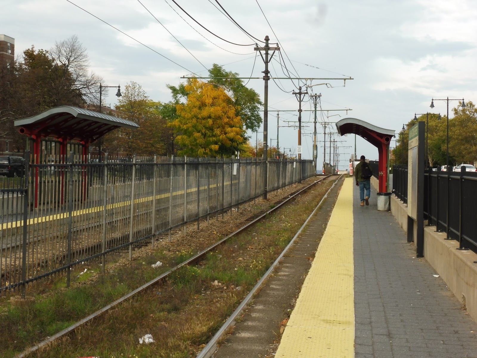 |
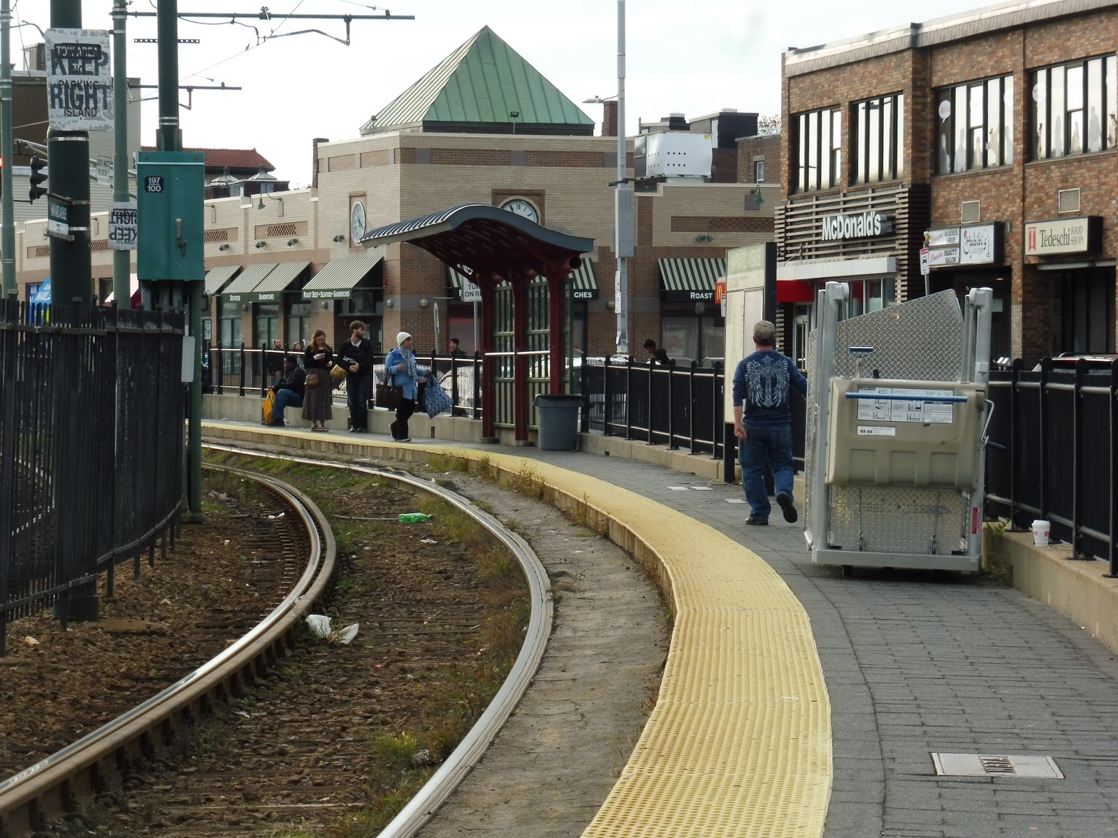
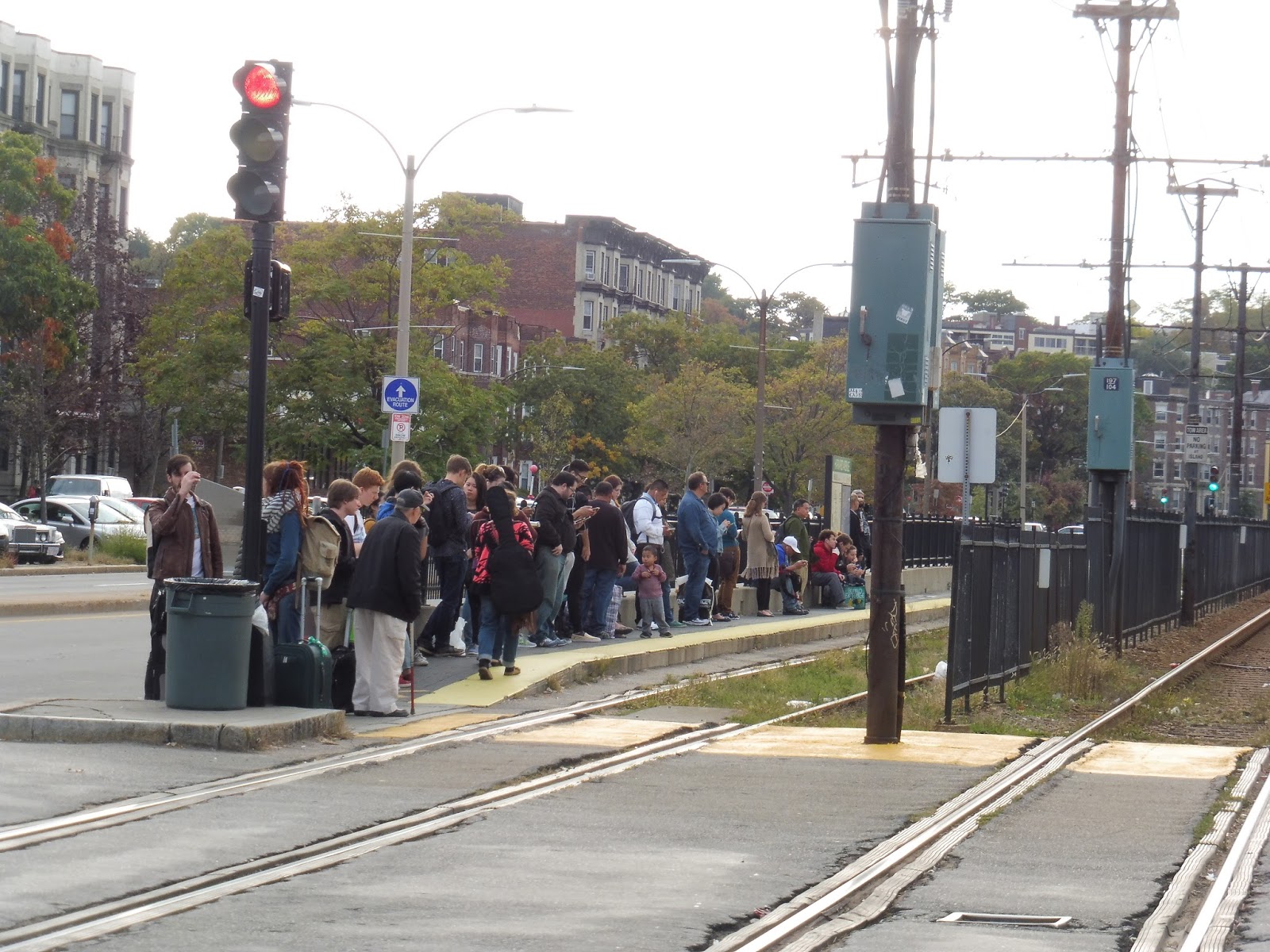
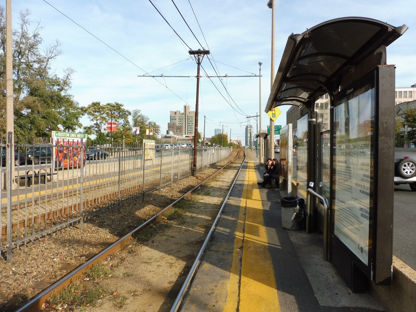
| The platform! |
Yes, Washington Street has ADA platforms! And proper barriers protecting passengers from traffic! And wheelchair ramps at the ends of the platforms! And a modern shelter on each side! And…no benches under them. Oh come on, really? Why can’t the B ever get this right?? Darn it…
 |
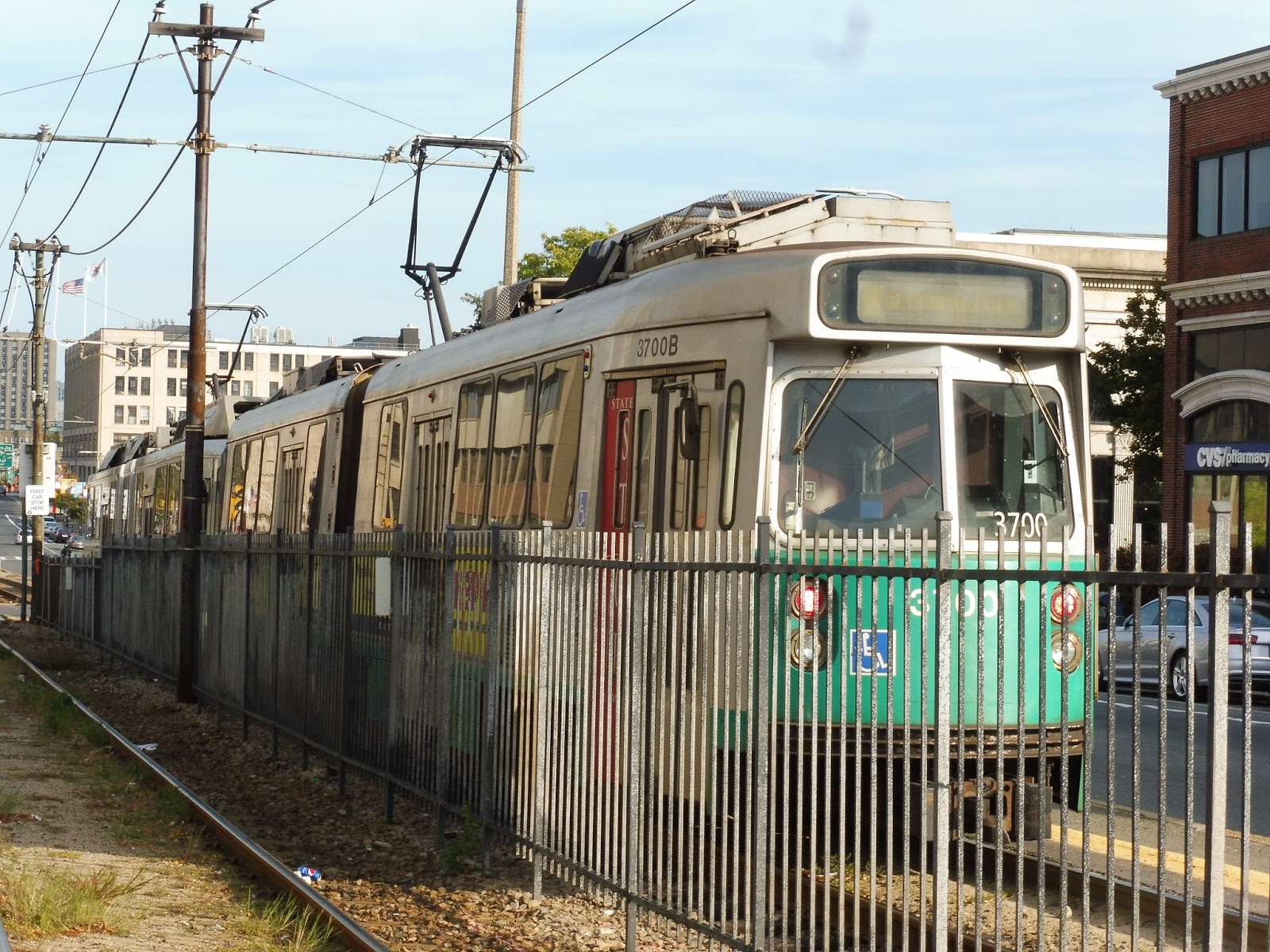
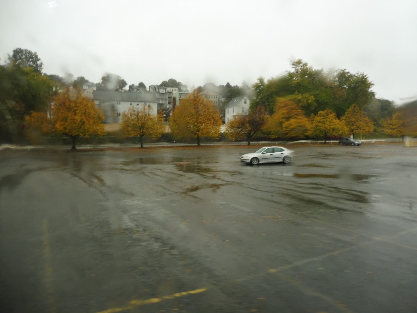
| I’m kinda cheating a bit, but here’s a train en route between Sutherland Road and Washington Street. |
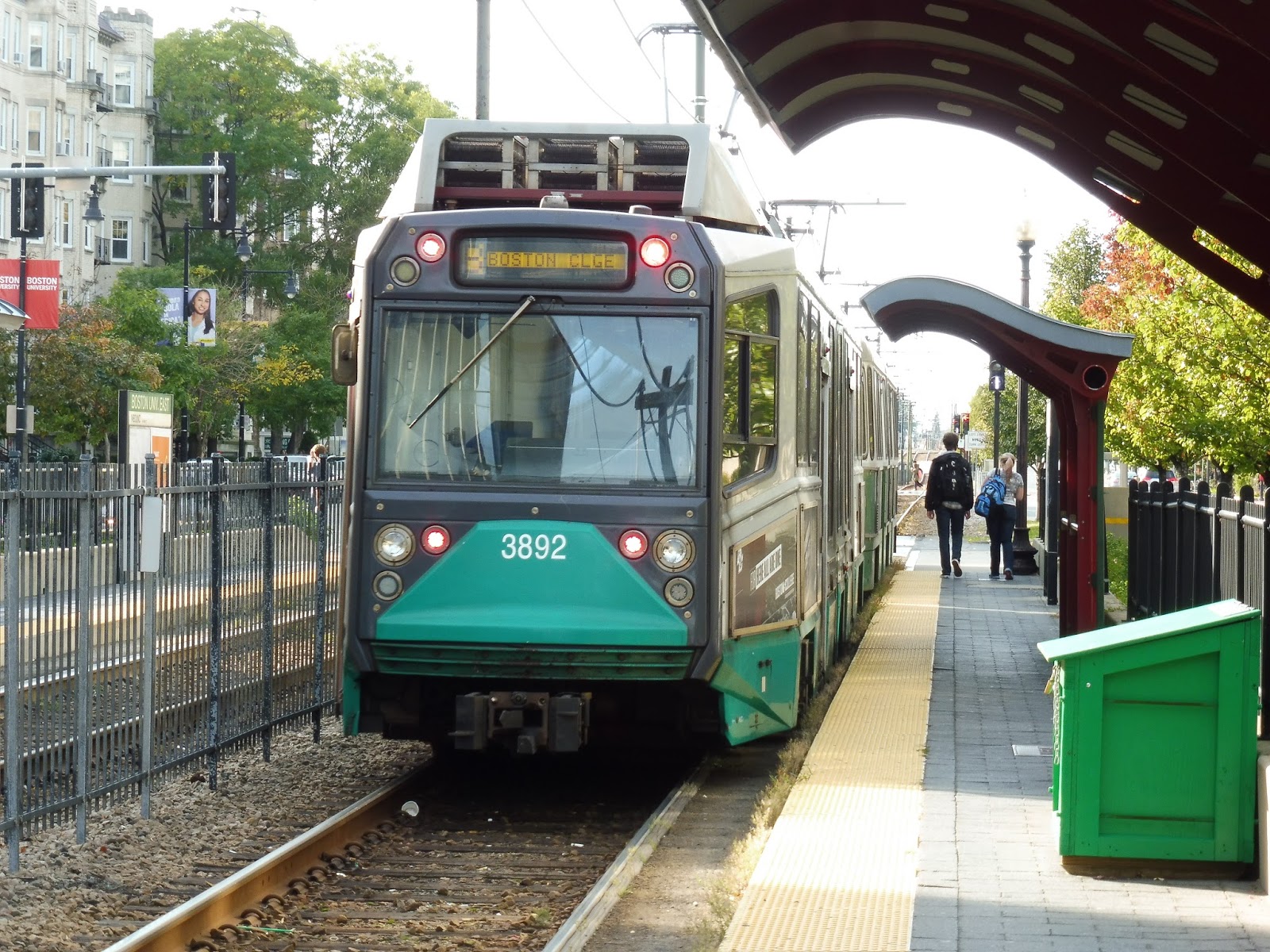
Station: Washington Street
Ridership: This is a major station on the B, and it has the fifth-highest ridership on the line, with 1,885 people per weekday. It’s kinda funny that nearby Warren Street actually gets more people, though, despite not being as major of a station in the T’s eyes.
Pros: We have proper platforms again! We have proper barriers again! We have proper shelters again!
Cons: But still no darn benches! The B gets so crowded that many people aren’t able to sit on the train, so why not let them sit at the station, at least?
Nearby and Noteworthy: There are some businesses here, but you’re not gonna find too much of note unless you walk (or take the 65) to Brighton Center, a little over a mile away.
Final Verdict: 6/10
Well, we’re basically at the level of the Boston University stations again. And honestly, Washington Street is slightly worse than those stations (it only has one shelter on each side, for example), but it’s a lot better than what’s around it. And as we head further west? Abandon all hope ye who enter…
Latest MBTA News: Service Updates
Griggs Street/Long Avenue, Allston Street, and Warren Street
Harvard Ave is a horrible station because it deserves so much better, what with its accessibility and high ridership. That’s why I got into an all-caps rant in that review. However, with the trio of Griggs Street/Long Avenue, Allston Street, and Warren Street, we’re back to typical B Line badness – nothing to get too worked up about.
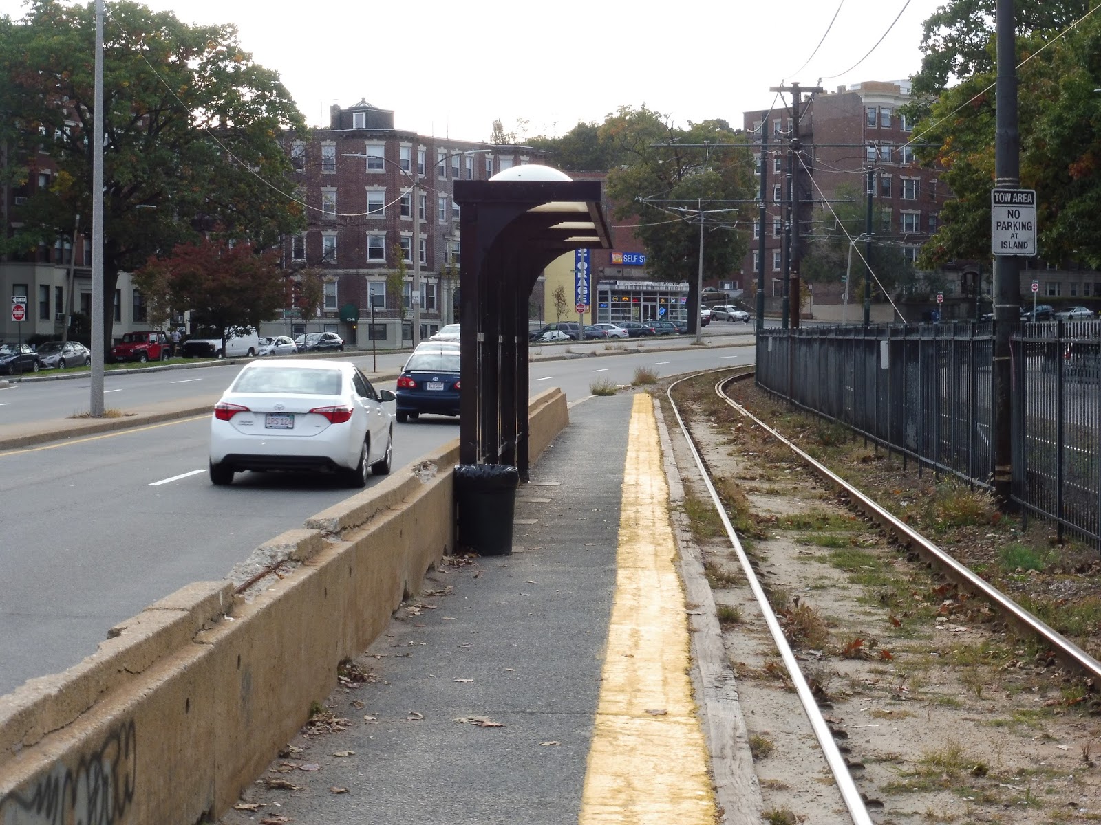 |
| Well then… |
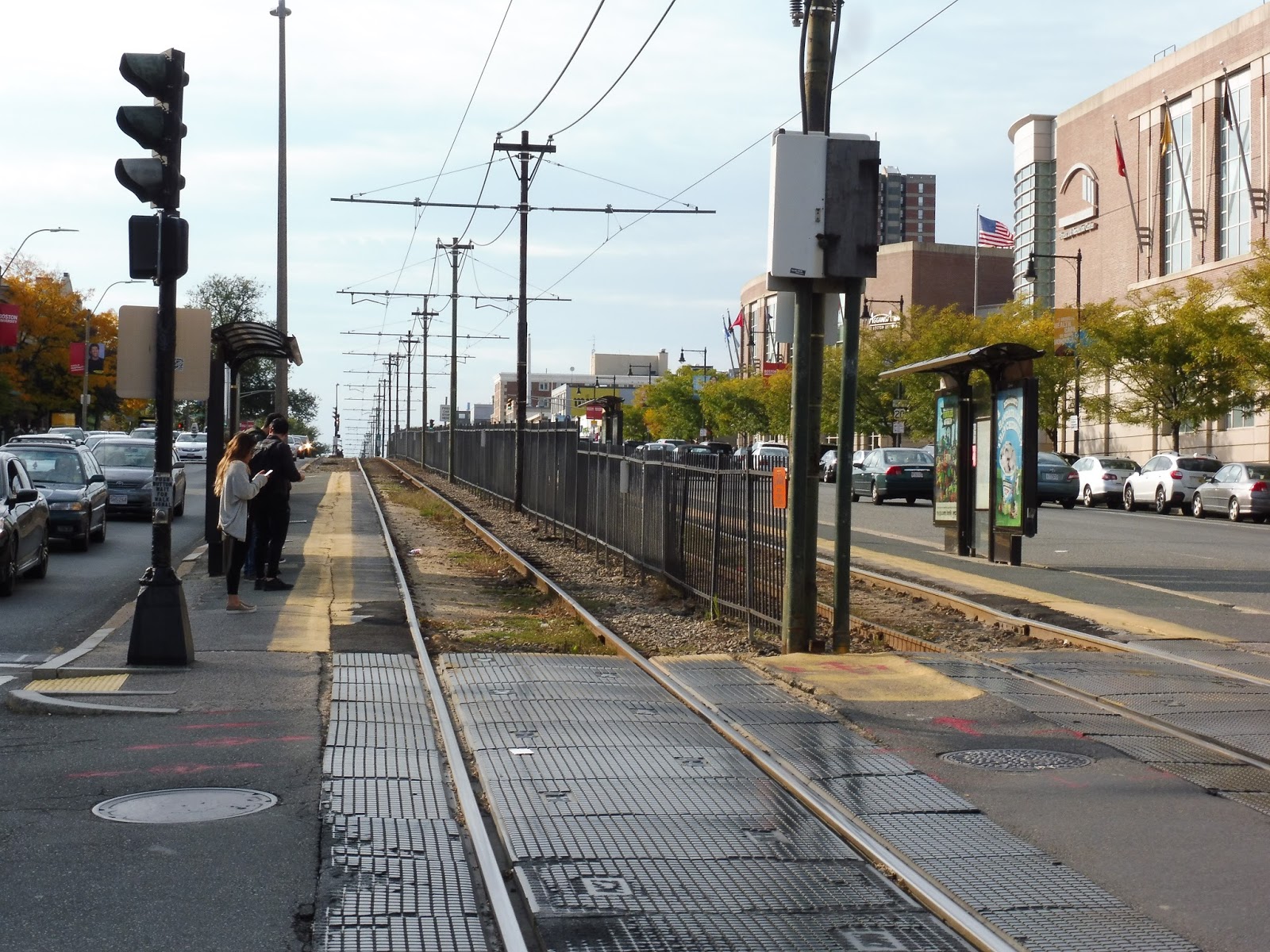
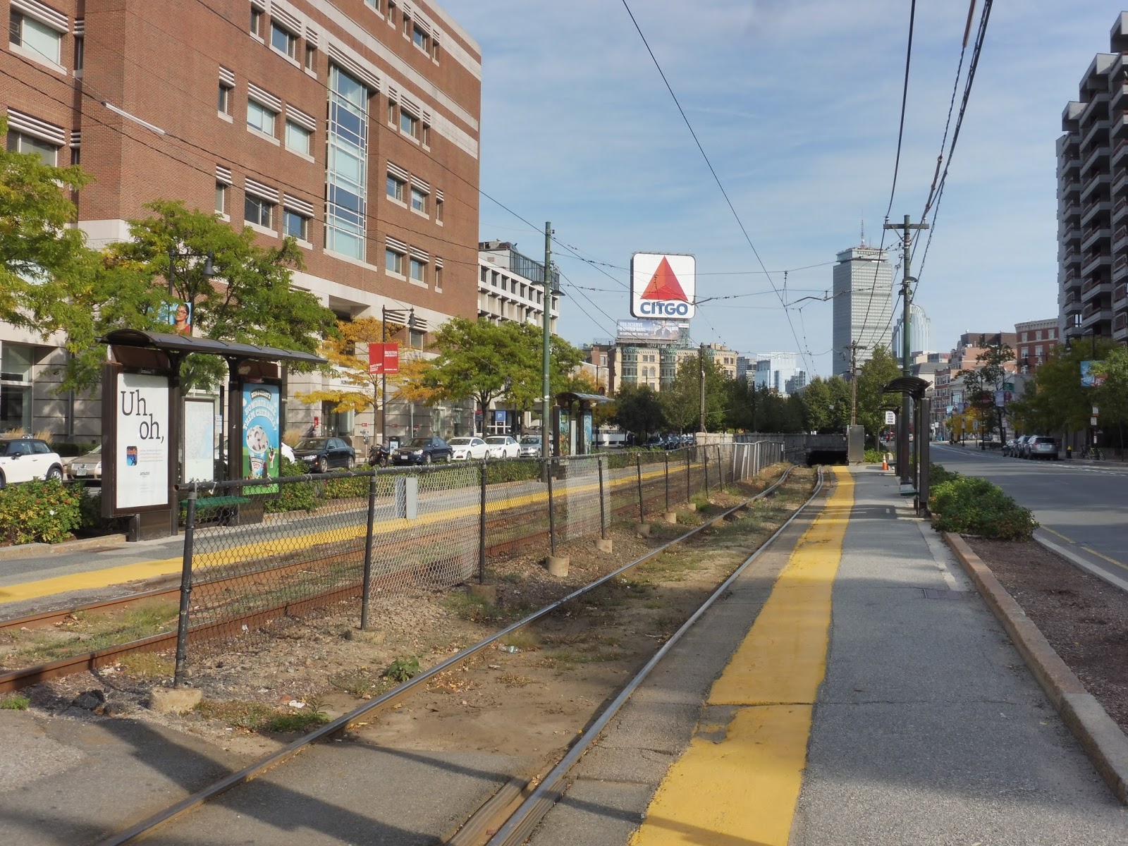
Yeah, of course, “typical B Line badness” does mean “incredibly terrible”. Here we see the inbound platform at Griggs Street/Long Avenue, which is a ridiculously long name for a station, incidentally. All three stations have similar inbound platforms, with an ugly, benchless shelter and crumbling concrete barrier.
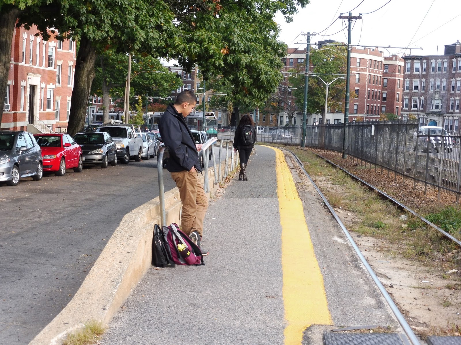 |
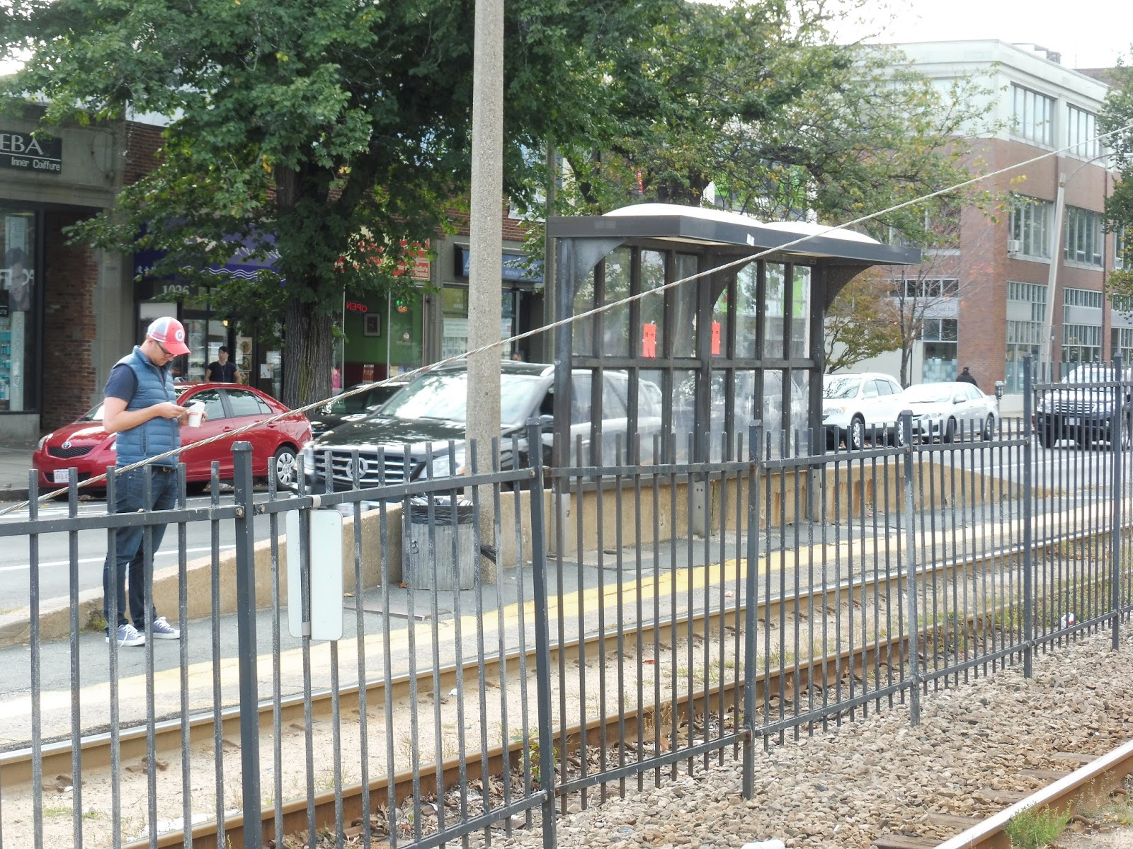
| The outbound platform at Allston Street. |
Okay, it has to be said that Allston Street’s outbound platform is slightly better than the other two. Yes, they’re all completely bare, which I guess can be excused this far out on the line – although based on the picture above, there are still some people that travel outbound even out here. Allston Street one-ups the other two stations with a somewhat proper barrier, however; Griggs Street and Warren Street are merely curbs.
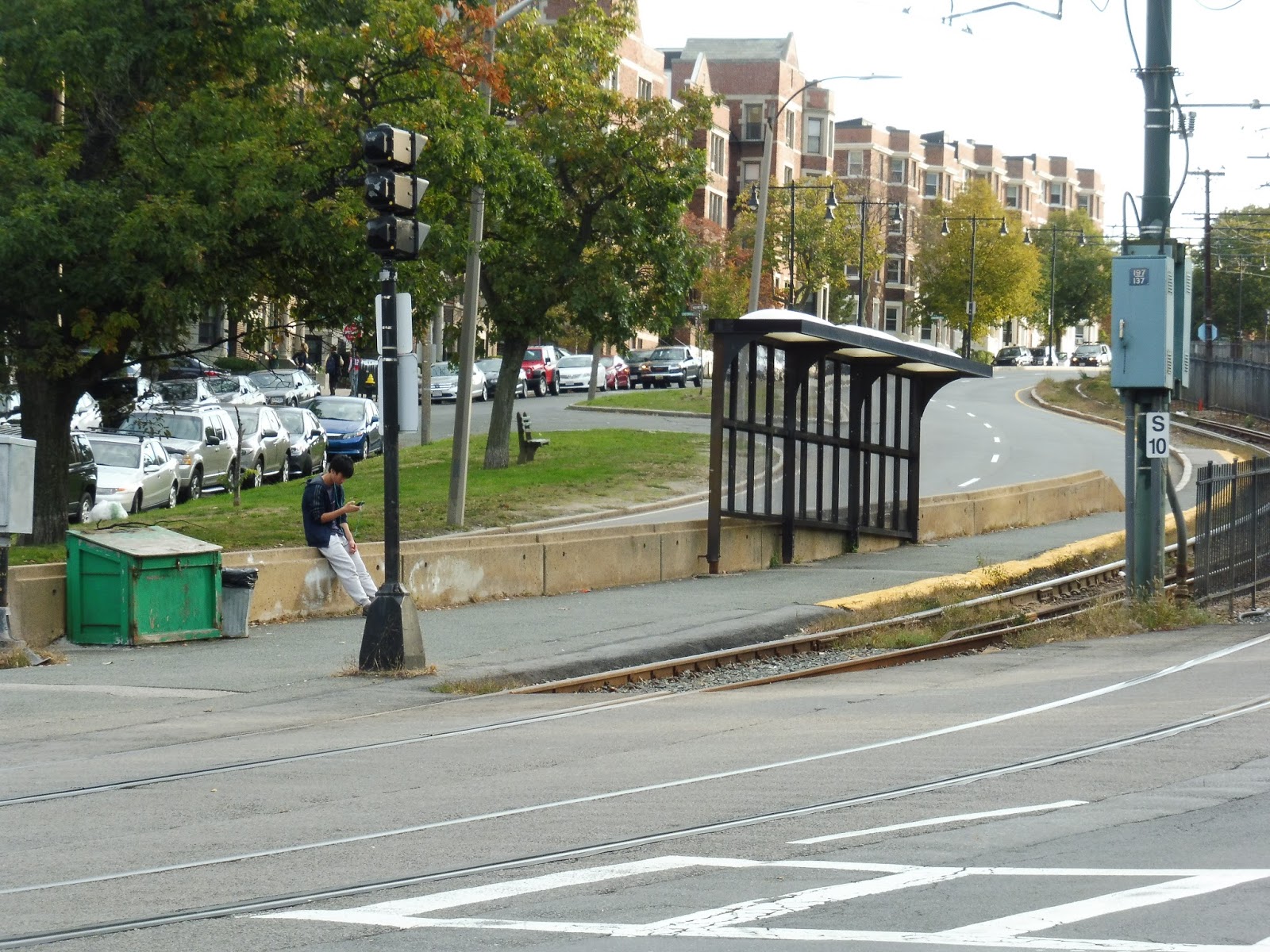 |
| Warren Street has quite a shelter! |
Warren Street is more of the same for the most part, but it is one of the more unique stations on the B. The outbound platform is simply asphalt with no barrier, as usual, but the inbound side is on a really steep hill! Its shelter has to be super offset from the ground in order to be straight! Yes, there are still no benches, but it’s definitely an interesting sight.
 |
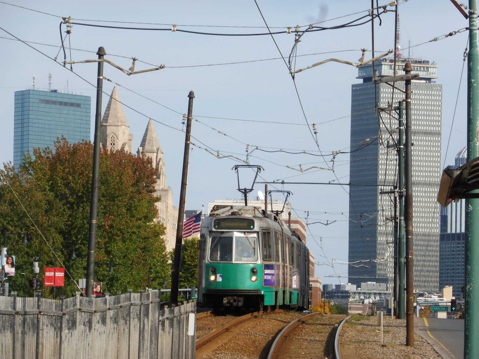
| There were a few train pictures I liked from these stations, so have three! |
Stations: Griggs Street/Long Avenue, Allston Street, and Warren Street
Ridership: Griggs Street and Allston Street get pretty standard Green Line ridership, with 1,203 and 1,437 riders per day, respectively. Warren Street, on the other hand? It’s the fourth-busiest station on the B, with 2,047 riders per day! Huh…okay!
Pros: There isn’t much good to say about these stations, but at least each one is unique. Griggs Street/Long Avenue gets the reward for longest station name on the MBTA; Allston Street is the only B Line station with the metal barriers seen on the outbound platform; and Warren Street has that incredible hill!
Cons: Butttttttttttt…they’re still standard B Line stations. That means essentially nothing going outbound, and a single solitary shelter with no bench going inbound. Great…
Nearby and Noteworthy: There’s not much in the way of businesses around here, aside from a few supermarkets and convenience stores. I like the look of the apartments along this part of Commonwealth Ave, though!
Final Verdict: 3/10
Yeah, whatever, I’ve got nothing new to say here. However, I will say that these stations get imaginary bonus points for being unique!
Latest MBTA News: Service Updates
Harvard Avenue
I thought this would be a good one! I THOUGHT THIS WOULD BE A GOOD ONE! It…it looked so promising… But nope, turns out Harvard Avenue is just as stupidly bad as every other B Line stop. Wonderful.
 |
| The outbound side. |
The sad part is that the outbound side is actually okay! I mean, it has an ADA platform with a nice curve and a fence blocking passengers from traffic. The shelter has no benches under it, but it’s a modern shelter. The platform also has a wastebasket and a wheelchair lift. So yeah, one would think that if the outbound side is this competent, then the inbound side would have to be even better! Well…
 |
| WHAT IS THIS? WHAT IS THIS??? |
THE INBOUND PLATFORM IS A JOKE. A JOKE! LOOK AT ALL THOSE PASSENGERS CROWDED ON THAT TINY THING! SURE, THE PLATFORM IS ADA, BUT IS THERE SHELTER? NO! ARE THERE EVEN ANY BENCHES? NOPE! ALL YOU’VE GOT IS A HORRIBLE WASTEBASKET! ABSOLUTELY RIDICULOUS!
 |
| An inbound train. |
Station: Harvard Avenue
Ridership: Oh, you know, it’s only the BUSIEST STREET-RUNNING STOP ON THE ENTIRE GREEN LINE! It’s such a shame those 3,602 riders per weekday have nowhere to SIT!
Pros: The platform is great – it’s ADA, it has the yellow bumps, wonderful. And for the few people going outbound, they shouldn’t have much of a problem here.
Cons: Too bad the VAST majority of people here are going inbound! Because, you know, people commute into the city. And for a major “accessible” stop like this one, you would think a shelter would be a given. Heck, you would think a bench would be a given! My gosh, the 66 stops here, and it gets a shelter on one side and a few benches on the other side – you know it’s a bad station when the bus stops have more amenities than the train platform!
Nearby and Noteworthy: Harvard Ave is a major street lined with businesses, although Commonwealth Ave around here is mainly apartments.
Final Verdict: 4/10
This station is just…stupid. Considering the huge amount of riders it gets, how can the inbound platform get away with not even having a single bench??? Who thought it was a good idea to give the outbound platform a shelter but not the inbound? Harvard Ave gets a 4 because its platform is in good ADA condition, but only because of that. From a planning perspective, it deserves way lower.
Latest MBTA News: Service Updates
Babcock Street and Packards Corner
Finally we’ve left Boston University! My gosh, so much of the “straight” section of the B Line is in the shadow of BU! But now, we’re departing both the university and the “straight” section of the line as it takes a left onto the much more curvy part of Comm Ave. But first, we need to look at the final stations on this inner section of the line: Babcock Street and Packards Corner.
 |
| The shelter at Babcock Street. |
Okay, one thing I can say about the shelters at the previous stations is that at least they were somewhat modern. Sure, they were benchless and horrible, but at least they looked decent. Welp, that’s been thrown out the window at these stations, where now we have these really ugly old shelters. And guess what? Still no benches!
 |
| Packards Corner’s platform. |
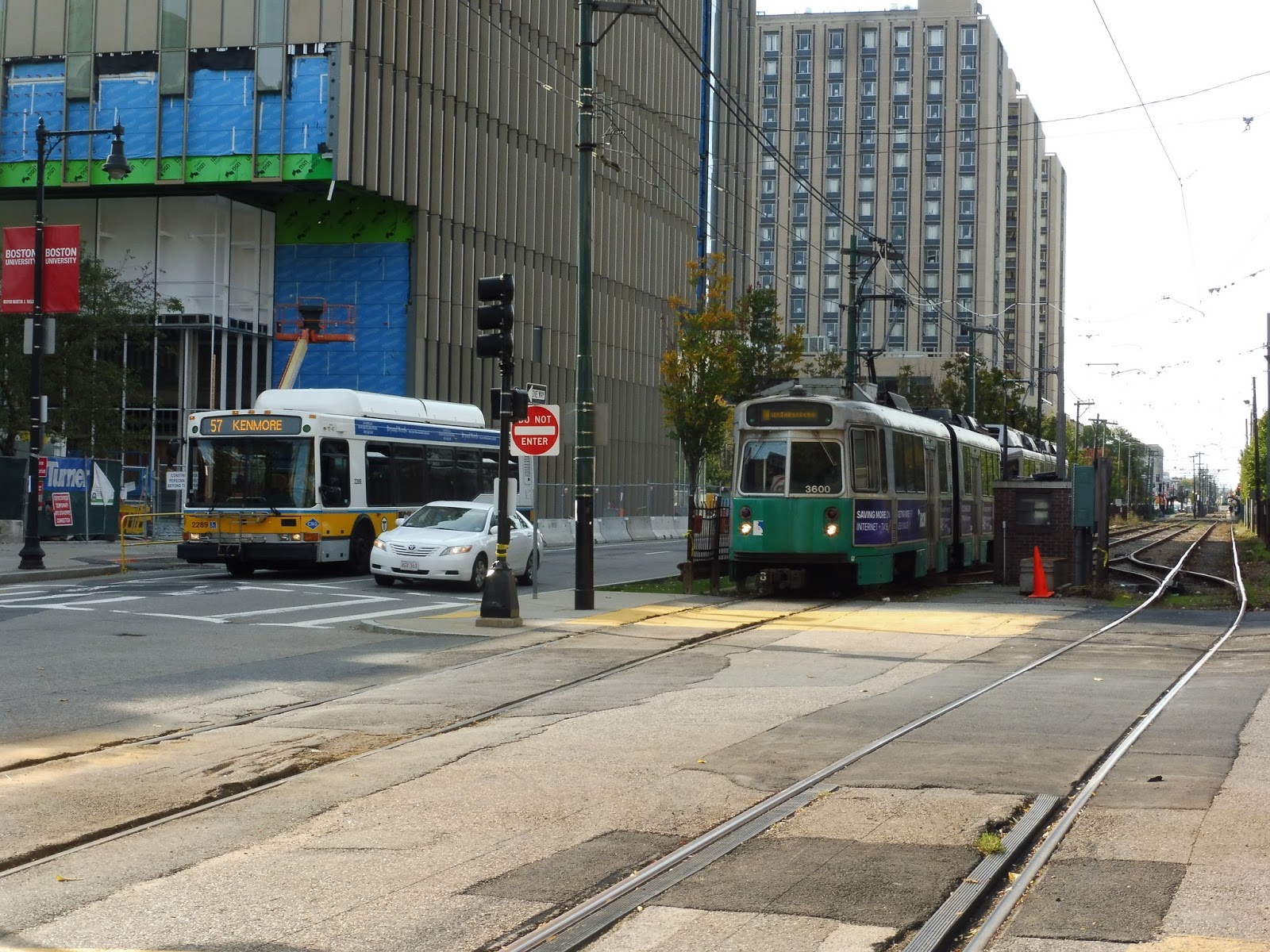
Packards Corner is noteworthy because it’s where the B takes a left and leaves the 57 once and for all. And of course, I’m sure many of you know that Packards Corner has a track stub where the former A Branch to Watertown used to split off! It’s not much, but it’s cool to see. But…nah, the station itself is still terrible.
 |
| A train rounding the curve! |
Stations: Babcock Street and Packards Corner
Ridership: Babcock Street has pretty average ridership, with 1,387 riders per weekday. Packards Corner, on the other hand, is one of the busiest stations on the Green Line! It gets 2,654 riders per weekday, and boasts the second-highest ridership on the B and the ninth-highest ridership for the Green Line branches.
Pros: Well, there’s a shelter on both inbound sides. That’s…nice. Packards Corner has a somewhat decently-sized barrier on its inbound platform.
Cons: Basically the same problems as before. These stations still don’t have benches under their shelters, and the platforms are in terrible condition.
Nearby and Noteworthy: There are a few final outposts of Boston University near here, but by this point, Comm Ave is mostly dominated by businesses and apartments. Also, check out the A Line stub at Packards Corner if you’re interested!
Final Verdict: 3/10
Meh. These stations aren’t at all noteworthy by themselves, aside from the stub at Packards Corner. The B Line still has no idea where to put its benches at stations, so sheltered seating is still out of the question. So yeah…nothing to see here.
Latest MBTA News: Service Updates
Saint Paul Street (B) and Pleasant Street
Boston University’s campus is hugeeeee! I mean, it’s really funny that it goes far beyond BU West Station, with modern buildings and dorms coming into the neighborhood of Saint Paul Street and Pleasant Street. And…uh…well, these stations could definitely be better, to say the least.
 |
| Saint Paul Street’s platform. |
Hmm…yeah, we don’t have much to work with in the platform department for these two stations. For one thing, the barriers between the platform and the road are gone for the most part – that’s right, a mere curb separates you from getting run over by a car! Oh wait, I’m sorry…the inbound side at each station has a crumbling knee-high concrete barrier that doesn’t extend over the whole platform and probably does more harm than good. Great!
 |
| The platform at Pleasant Street. |
And what about the shelters? Well, once again, they have no benches. Except…except…OH, WOW, BOTH SHELTERS ON THE OUTBOUND SIDE HAVE BENCHES! GREEEEEEAAAAATTTTT! SORRY, INBOUND PASSENGERS! Well, hey, at least inbound people get a WASTEBASKET! And it’s TERRIBLE! WONDERFUL! GUESS THAT WAS AN OXYMORON RIGHT THERE! YOU KNOW THE STATIONS ONLY GET WORSE FROM HERE?
 |
| A train heading inbound. |
Stations: Saint Paul Street (B) and Pleasant Street
Ridership: These two stations are slightly below average for the Green Line, with 1,296 riders per day at Saint Paul Street and 1,167 riders per day at Pleasant Street. As I’ll discuss later, though, ridership at the latter can SPIKE on certain occasions.
Pros: Well…if you’re going outbound, I guess you have sheltered seating. Good for you?
Cons: I’m done ranting about the shelters…go back and read the all-caps paragraphs if you want to hear my opinions on them. You know what I AM going to rant about? Pleasant Street! I went to an event at Agganis Arena (I saw the Cure!) and afterward, the police had to BLOCK OFF the intersection in order to accommodate the GIGANTIC amount of people trying to cram into the front door of a B train! For heaven’s sake, GIVE THE PEOPLE SOME AMENITIES! YOU CAN’T PUT SUCH A TERRIBLE STATION OUTSIDE OF SUCH AN IMPORTANT ARENA!!!
Nearby and Noteworthy: More BU buildings, basically, including the arena! As you head into Brookline, however, you’ll find a quiet residential neighborhood.
Final Verdict: 3/10
Andddddddd we’re heading in a downward spiral! It irks me so much that these stations only have proper shelters with benches going outbound, while inbound passengers just have to stand. This is horrible for Pleasant Street in particular – once again, Agganis Arena is a huge arena! That tiny station CANNOT handle the amount of people that it gets!
Latest MBTA News: Service Updates
Boston University West
After the B Line crosses over I-90, we reach the next stop, Boston University West. It’s a little weird that they call it that, though, since Boston University continues west well past this stop! Oh well, dubious name aside, let’s see what this station is like.
 |
| Definitely a departure from the last few stops… |
BU West has a few differences from previous stations right off the bat. Firstly, the platform is a lot narrower than before, which is rather annoying. Also, no longer is there a nice big fence between the platform and the road – now it’s just a small concrete barrier, and a sometimes-crumbling one at that!
 |
| Oh dear… |
However, there is also some stuff to like about BU West. For one thing, its amenities are no worse than the other two BU stations – we still have two shelters on the inbound side with no benches, as well as a lame wastebasket. The outbound side even has a shelter with a bench…for some reason. Plus, BU West actually has artwork on the station signs, which gives it a lot of respect from me – this is the only B Line station with any form of art.
 |
| A train with some recognizable buildings in the background! |
Station: Boston University West
Ridership: BU West only gets 704 riders per weekday, making it the fourth least-used station on the B. So, uh…yeah, not great.
Pros: It’s definitely competent for a B Line stop. It has shelters, although they’re benchless on the inbound side, and the art is especially a nice touch. Like I said, no other B Line station has artwork!
Cons: Still, the platforms are very narrow, and the barriers between them and the street are in pretty low quality. Plus, the benchless shelters are just as annoying as ever!
Nearby and Noteworthy: Possibly one reason for BU West’s low ridership is that it doesn’t really serve that many BU buildings (ironically, there are more of them as you go further west). Still, it covers the College of General Studies, and a few random businesses.
Final Verdict: 5/10
We’ve definitely experienced a drop in quality since the last few stations, and it only gets worse from here. BU West does have some nice artwork, but otherwise, its platforms are narrow, its inbound shelters are benchless, and its concrete barriers are mediocre. Yes, it’s better than many other B Line stations, but that isn’t saying much.
Latest MBTA News: Service Updates
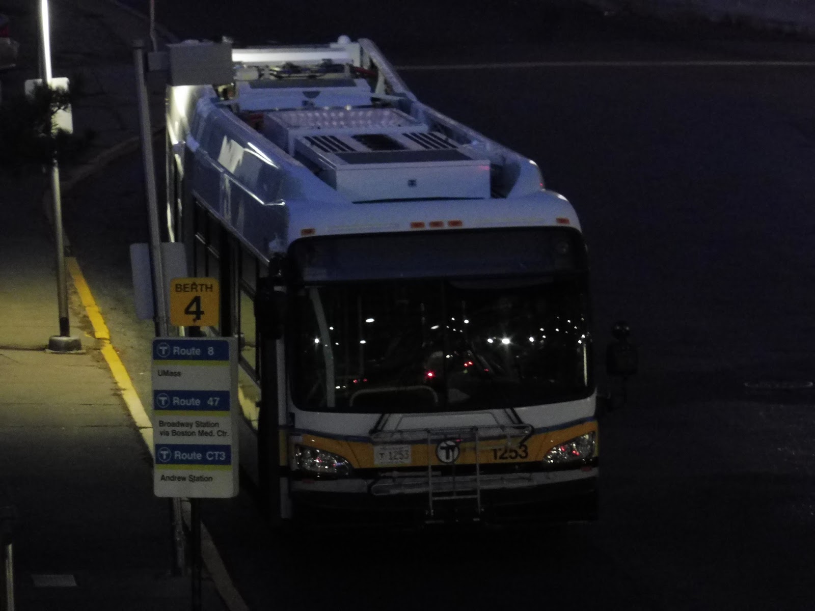
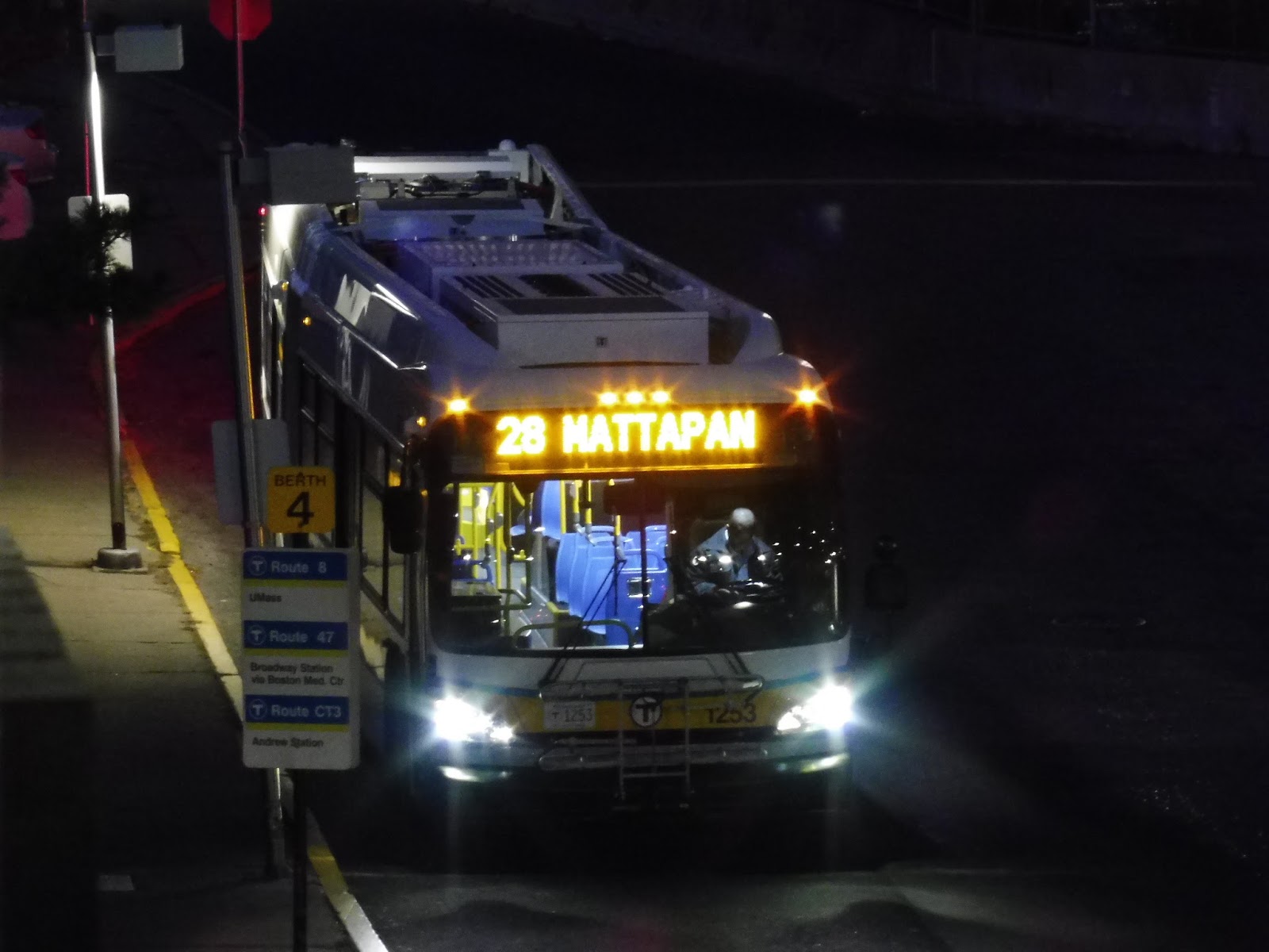
New MBTA Articulated Bus!
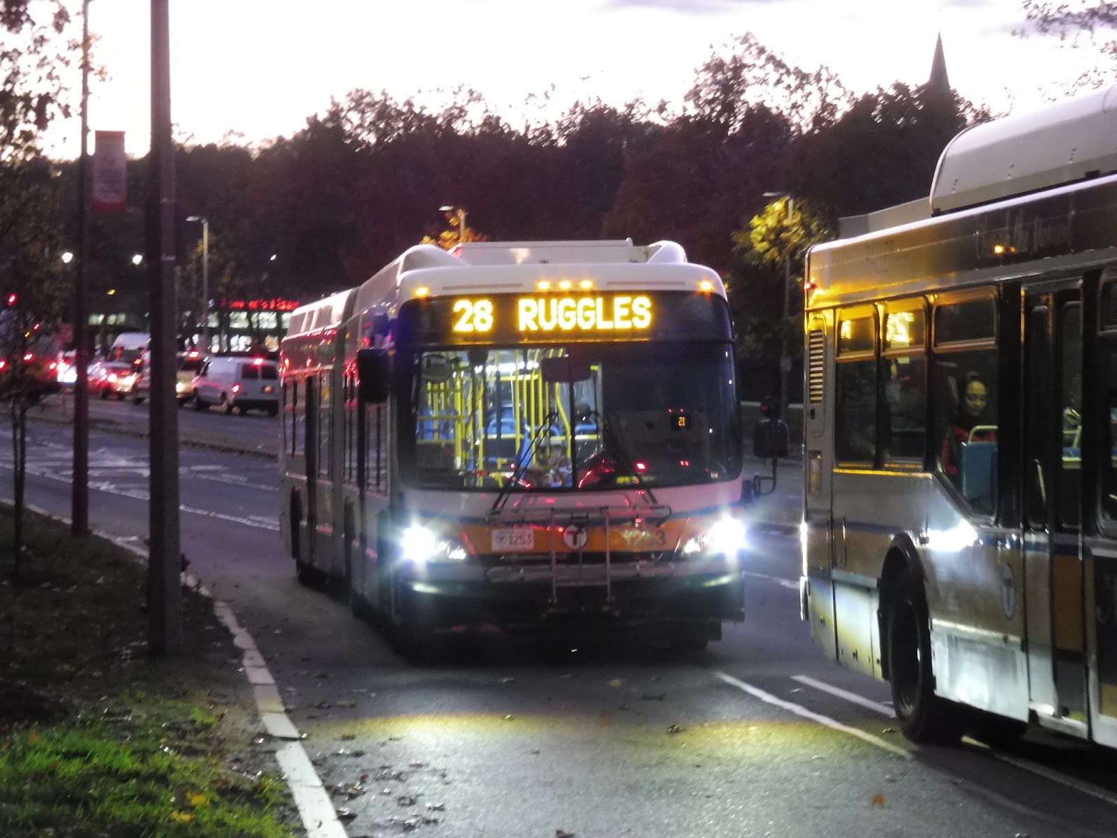
Yes, folks, the first of the new articulated buses on the MBTA have entered service today! To be honest, I wasn’t expecting to be able to ride it, but my friend Chloé and I ended up at Ruggles today, so I called Sam and asked him to track it for us. It was somewhat close, so we decided to take it one glorious stop from Tremont Street opp Prentiss Street to Ruggles! Okay, it was a ridiculously short ride, but it let us see how nice the bus was. On to the pictures!
 |
| Low light, unfortunately. |
 |
| Another exterior shot. |
 |
| The driver yelled at me for taking pictures, which was really annoying…it’s a new bus, after all! |
 |
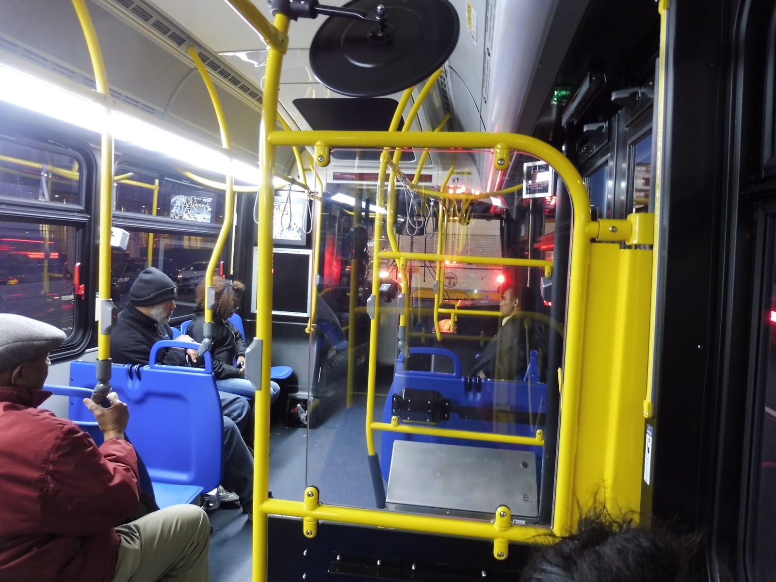
| Looking toward the back. I love that one seat in the middle of the articulated section! |
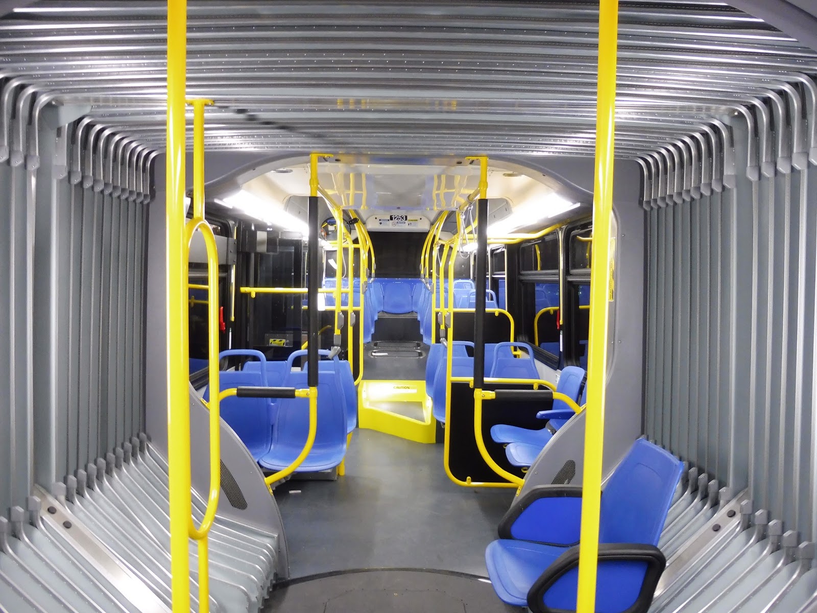 |
| Another shot once the bus had emptied out at Ruggles. |
 |
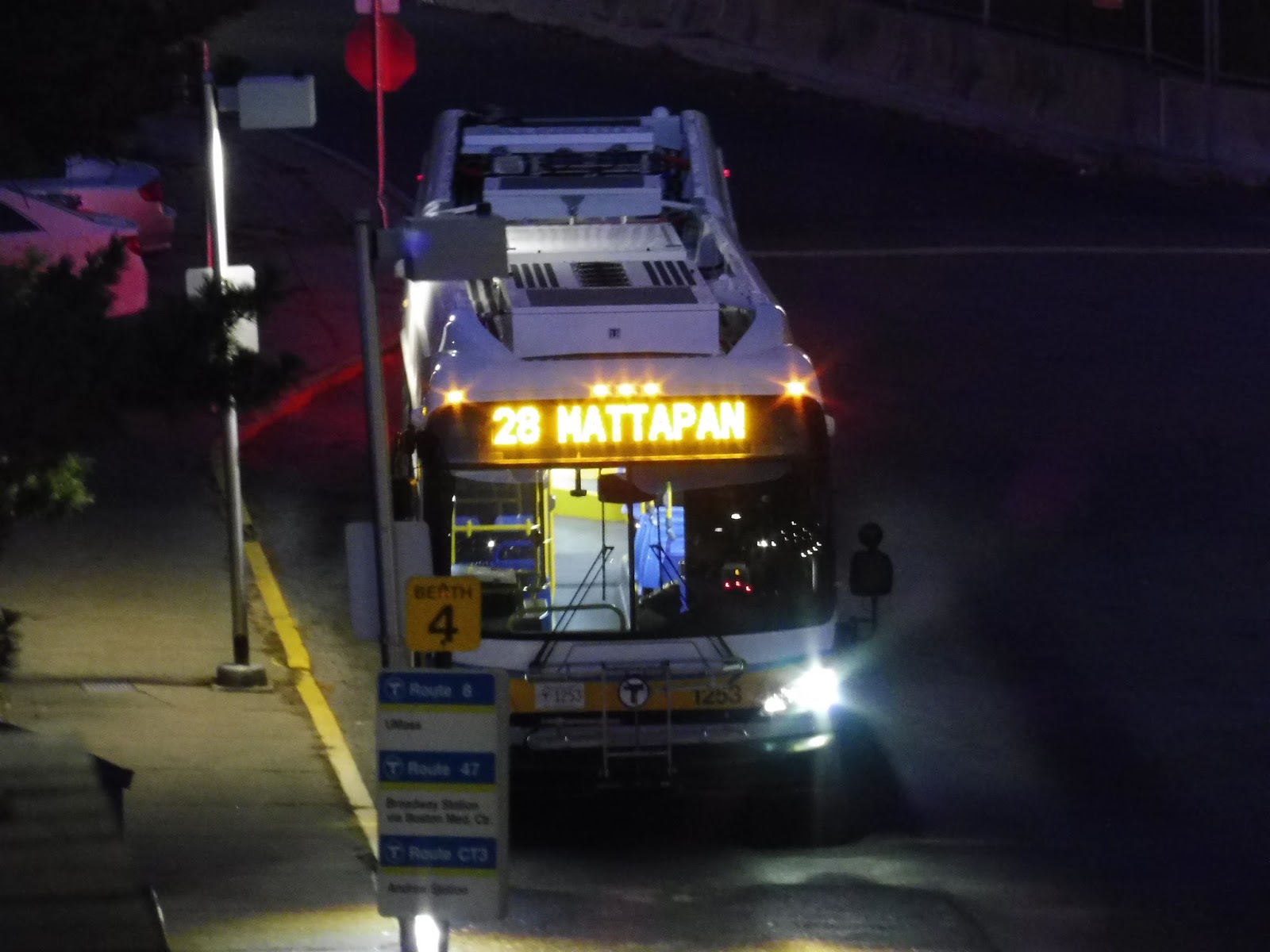
| A blurry shot of the bus speeding away. |
 |
| Pictures of the bus at Ruggles. |
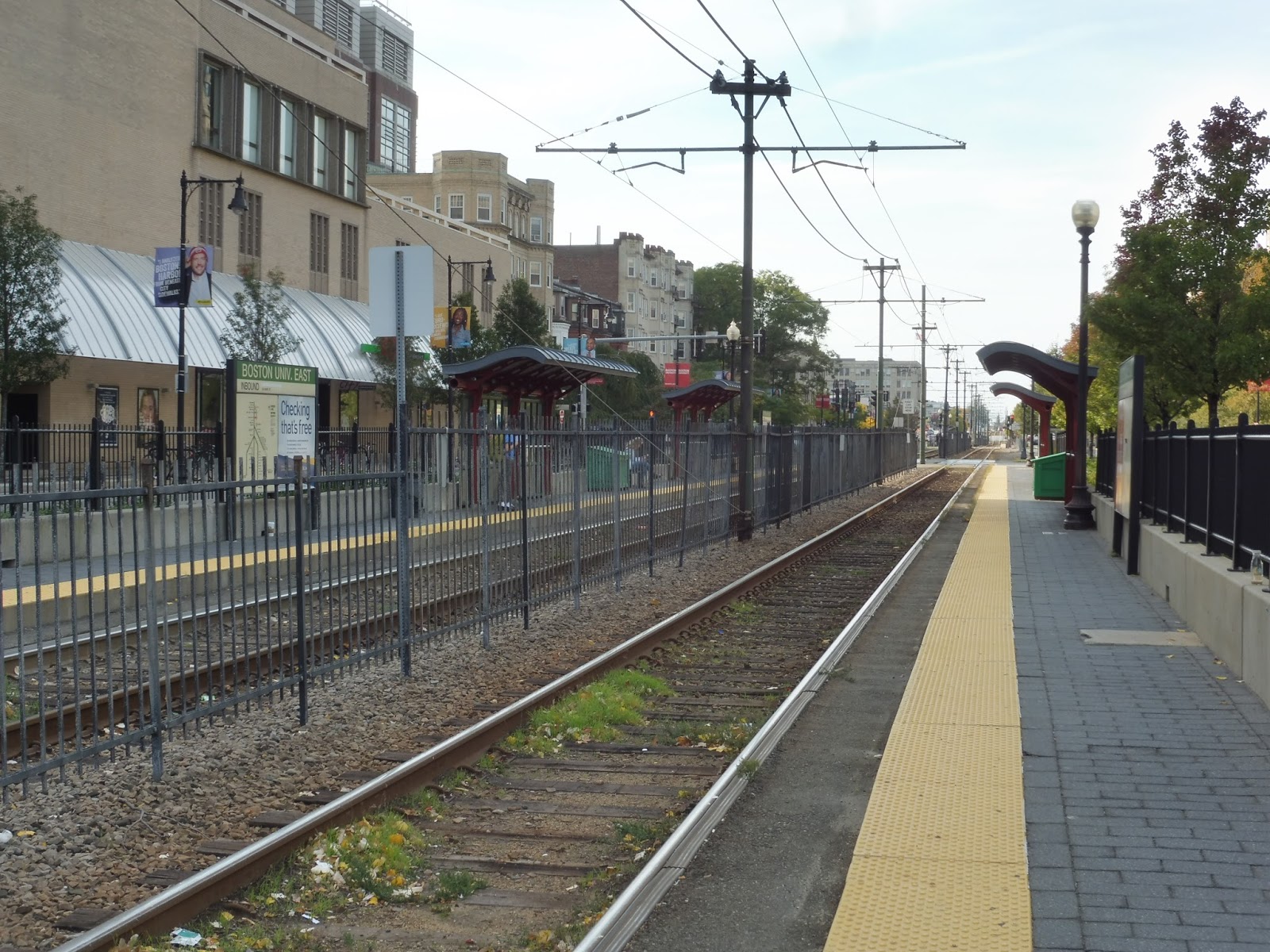
Boston University East and Central
Up next on this B Line tour, we’ve got two stops that achieved “appearing on the map” status before the map started showing every station. That’s right, we’re taking a look at BU East and BU Central, two stations that are rather close together. Well, okay, most stations on the B are ridiculously close together, but still…
 |
| The platform at BU East. |
Well, let’s start with the positives first. I complained about the lack of ADA platforms at Blandford Street, but both of these stations have ’em! This area also has the nicest part of the B Line right-of-way, with bushes and trees lined up along the tracks. Finally, large fences separate the stations from the road itself, so they feel safer overall.
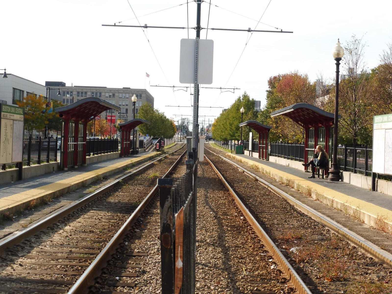 |
| Standing between the two tracks at BU Central. |
However, both of these stations feature a strange lack of amenities. Yes, they have two shelters on each side, but the shelters don’t have benches under them! There are just a few random benches sporadically placed around the platform. Both inbound sides also feature a really lame trash bin that’s just kinda…there.
 |
| A train leaving BU East. |
Stations: Boston University East and Central
Ridership: Both stops get pretty high ridership, with 1,747 people per day for BU East and 2,194 people per day for BU Central. Obviously the main demographic for these stations is students.
Pros: Conceptually, these stations could be E Line stations. They have similar shelters, rather nice right-of-ways, and ADA platforms.
Cons: However, they have one major flaw that just grinds my gears: no benches under the shelters. How hard is it to just stick a bench under there? Blandford Street managed to do it just fine!
Nearby and Noteworthy: It’s all in the names: BU buildings are the order of the day here.
Final Verdict: 6/10
These would be fine stations if they actually had benches that were in the right places! Instead, they both have perfectly fine shelters, but nothing under them. What a wasted opportunity – if the common courtesy of putting benches under shelters can be considered an “opportunity”.
Latest MBTA News: Service Updates
Blandford Street
Awwww yeah, it’s happening! Here we go! Get ready for the most hated line on the entire MBTA! That’s right, it’s time to review EVERY! SINGLE! STATION! ON! THE! B! Let’s get this horrible tour started with…a somewhat decent station, actually. Time to talk about Blandford Street!
 |
| The platform. |
Blandford Street is the first station out of the portal for the B, and it’s right near Kenmore Square – this means there’s a nice view of the Prudential and the Citgo sign. So what about the station itself? Honestly, it feels a lot like an E Line station, minus the ADA platform. There are two shelters on each side, and the right-of-way is reasonably pretty!
 |
| A train hanging out next to a 57. |
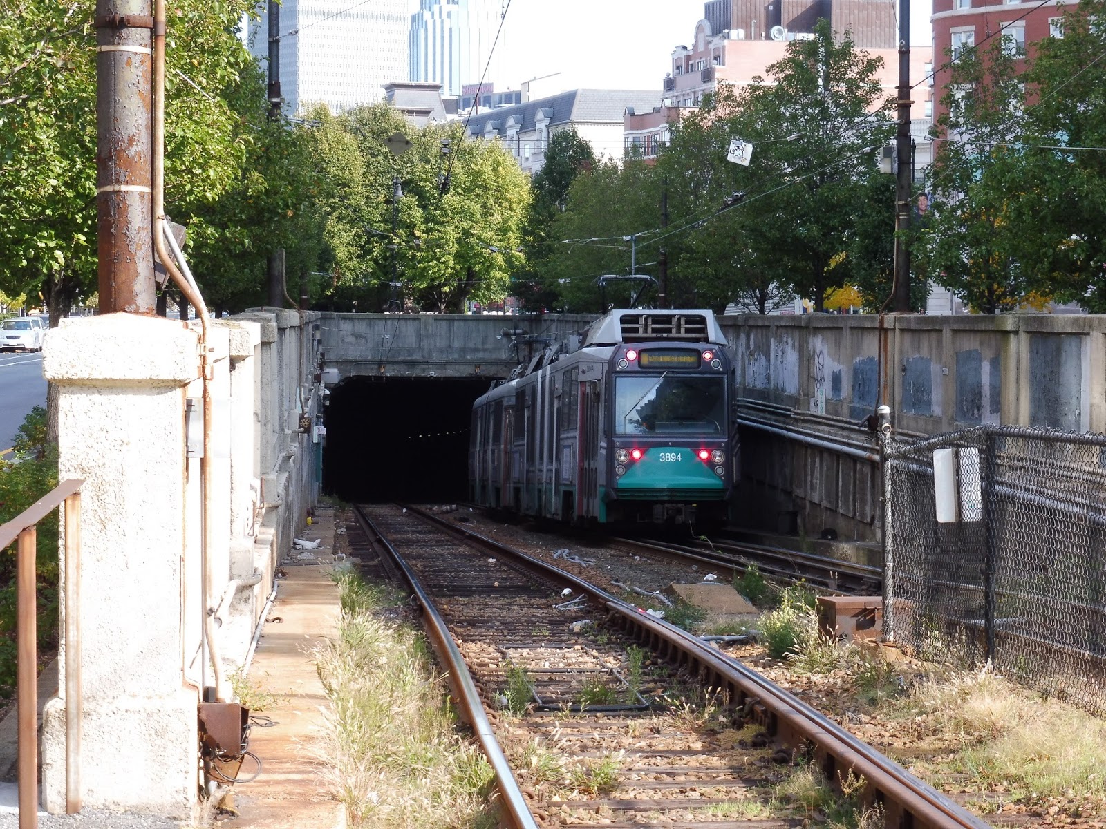
 |
| Into the abyss you go! |
Station: Blandford Street
“The B Line: Exposed” Trailer!
In the next two weeks or so, I’ll be reviewing every stop on the B branch of the Green Line! Pretty exciting, right? Well, once that’s all done, it will culminate with this epic video review! Stay tuned…
WRTA: Paxton Shuttle (Anna Maria College – Union Station Hub via Paxton Square and Tatnuck Square)
Okay, show of hands, who’s ever heard of Paxton, Massachusetts? No one? Okay, good. I hadn’t heard of it either until my friend Nathan pointed out that the WRTA has a bus that runs there…but only on Wednesdays and Fridays. Well, whaddayaknow, we had a free Wednesday off from school! So let’s ride this really strangely scheduled Paxton Shuttle…
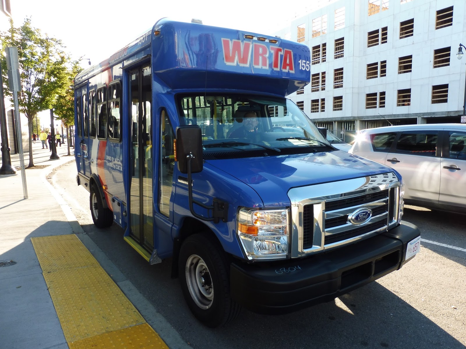 |
| The bus (if you can call it that) at Union Station. |
Keep in mind that Nathan and I had to run to make this bus, having departed the chronically late MART Worcester Shuttle. We had assumed the bus would board in the actual WRTA Central Hub at Union Station, since the schedule says “Union Station Hub” like any other WRTA route. But…no, turns out it boards outside the Central Hub, on Foster Street. And the bus has no signage, so we had to ask the driver to make sure it was the right route.
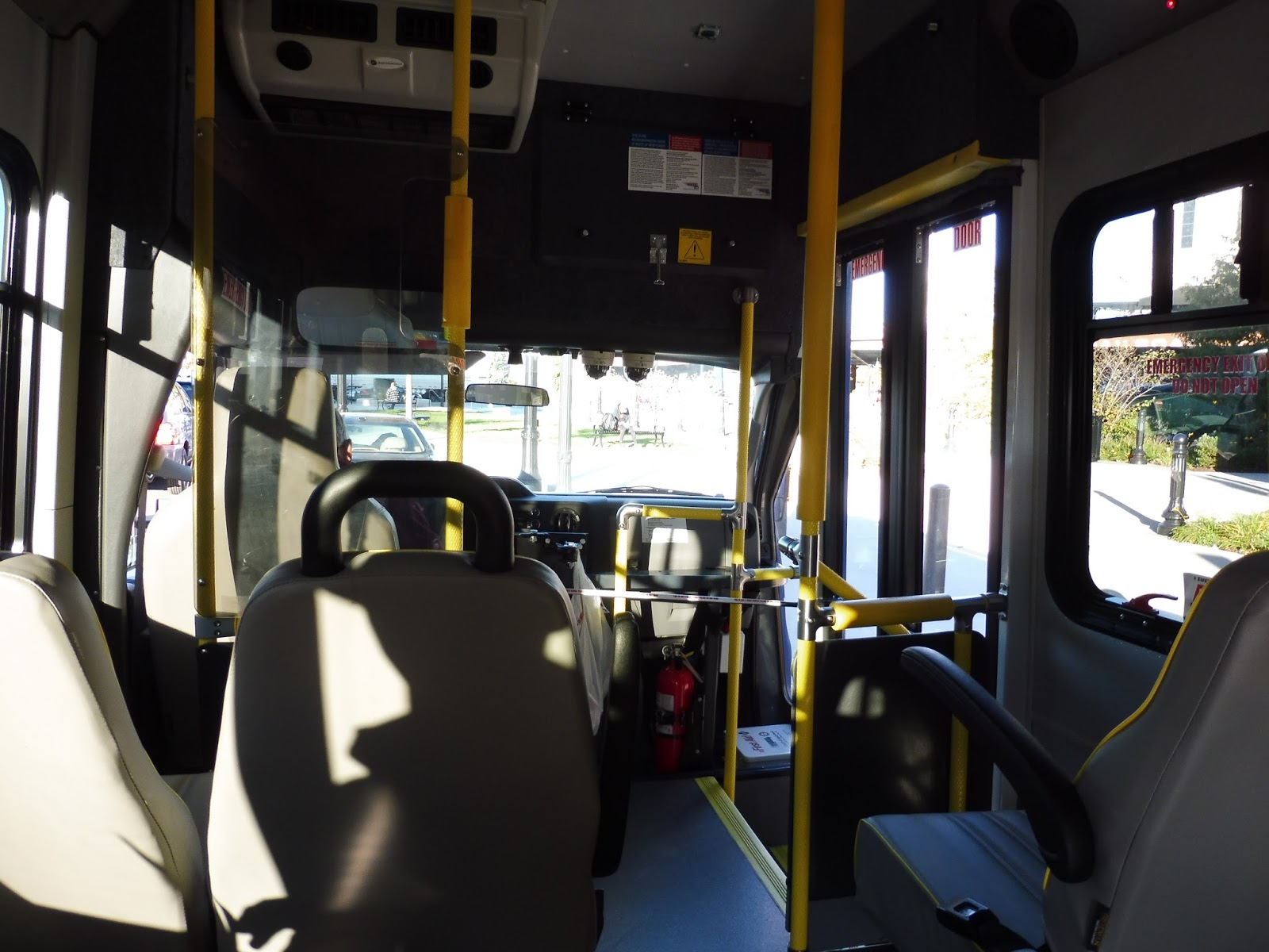 |
| The inside of the vehicle. |
Of course, calling this a “bus” is a bit of a joke, since it had literally six seats. That’s right, it was basically a “The Ride” vehicle! Indeed, I’ll bet it is just a dial-a-ride vehicle that happens to do a fixed route once in a while. It was really strange…
 |
| Awwww yeah, rear-view shot! |
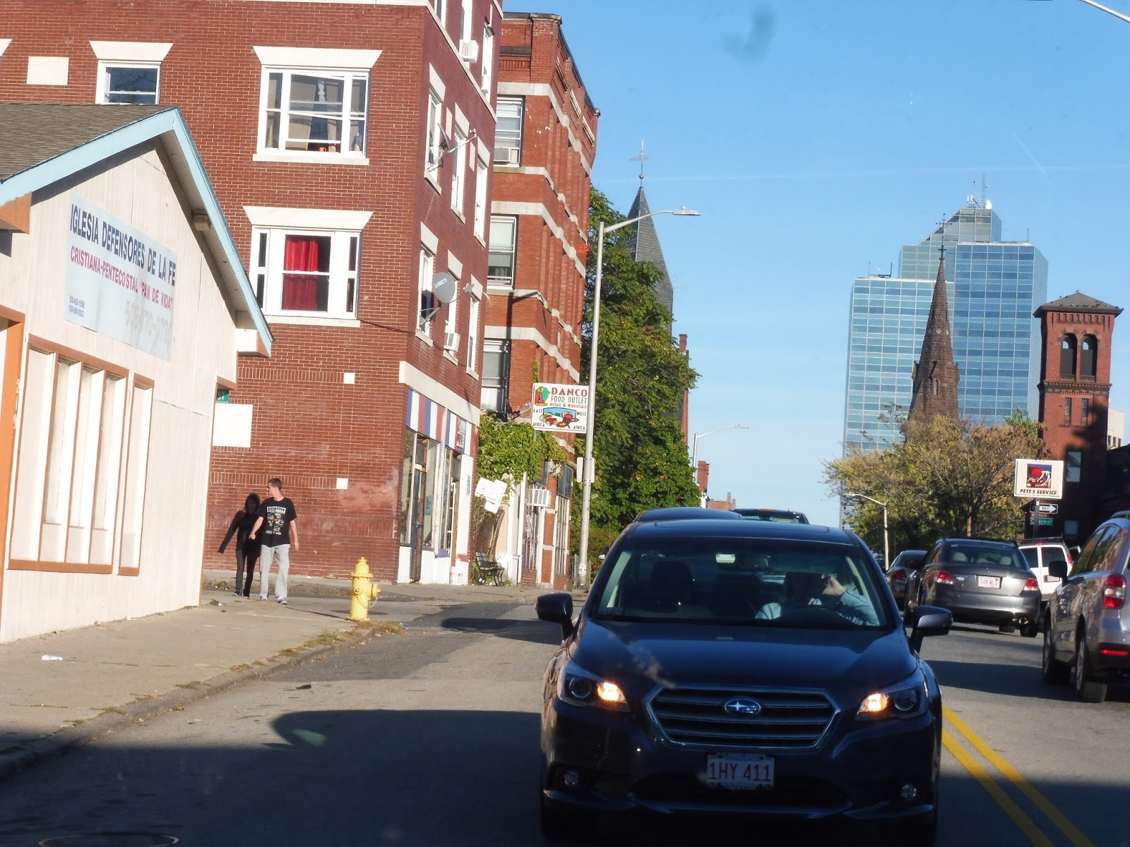
We turned onto Front Street, which took us into downtown Worcester. One side of the street had the Worcester Common, while the other side was lined with multi-story buildings. We passed City Hall, then continued onto Pleasant Street, following the 2. Now, there are two things to note here: number one is that the Paxton Shuttle is supposed to follow the 6’s route, but I guess we…weren’t doing that? The other thing is that the route operates closed-door in Worcester, so it makes no stops – I guess that means it doesn’t matter what route it takes, then.
 |
| A side street. |
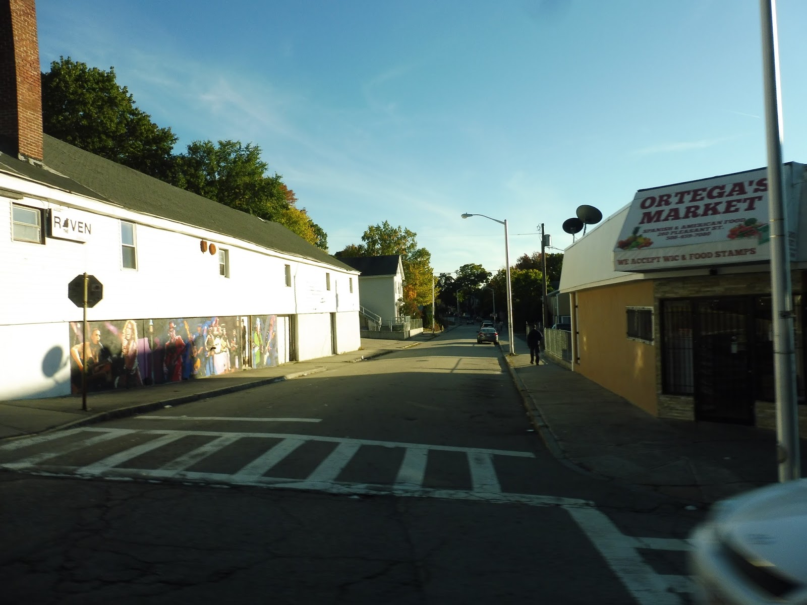
The street became a mix of businesses, houses, and apartments as it coasted down a hill. There were also some churches and a small park in the mix. After we crossed Park Ave, though, Pleasant Street became entirely residential, with woods on the other side!
 |
| Goin’ around a small rotary. |
We arrived at a roundabout, and Pleasant Street continued to be lined with houses beyond, now on both sides of the road. There were, however, some nice-looking local businesses at the intersection with Richmond Ave. After many more houses, we finally arrived in Tatnuck Square, where there were varied retail buildings. This is the Paxton Shuttle’s only other stop in Worcester.
 |
| Some businesses in Tatnuck Square. |
We continued down Pleasant Street, which rose up on a slight hill and started to feel rather woodsy. The spread-out houses we passed were huge, but they got a bit smaller as we entered a denser neighborhood, even passing a few businesses. Finally, we entered Paxton and began the route’s unique section!
 |
| Blurry houses along Pleasant Street. |
The scenery was quite nice along here, with the road curving around small houses on either side. It was basically all residential, aside from a few farms here and there. And…yeah, that was about it for this part of the journey. Most of the houses were natural, but at one point the road went through a more developed neighborhood where the residences were all the same.
 |
| Woah, check out that lens flare! |
Eventually, the houses were finally broken, as we passed the nice public safety complex of Paxton, containing both fire and police vehicles. This area also featured an industrial garage, a Dunkin’ Donuts, an animal hospital, and a fitness club. A little later, there were some businesses and a lovely town common in Paxton Center.
 |
| Paxton Town Common. |
We turned onto Maple Street, taking us over hills and past beautiful trees and more houses. Next, we turned onto Grove Street, which was a less charming road due to its wideness. Finally, we headed onto Sunset Lane, which took us into the campus of Anna Maria College, the last stop of the route.
 |
| The bus at the college. |
It’s worth noting that on the way back, we actually made an extra deviation that doesn’t appear in the schedule or on the map! It was pretty soon after leaving the college; we turned off of Grove Street in order to serve The Hills at Paxton Village, an apartment development. It was a strange deviation involving reversing the bus multiple times (despite an easy loop right in front of the building), but eventually we were on our way back to Worcester again.
 |
| Another shot at the college. |
WRTA Route: Paxton Shuttle (Anna Maria College – Union Station Hub via Paxton Square and Tatnuck Square)
Ridership: The driver gave some very showing statistics for this route’s ridership: “I get five people per day – four students and one professor.” So basically, this shuttle is utilized by the same five people from Anna Maria College every day, meaning one person per round trip (this held true for us, with one person going from Anna Maria to Worcester). And keep in mind that the route only runs Wednesdays and Fridays, so it’s only about 40 people per month!
Pros: The route is very useful…for five people. The same five people. Twice a week. Hmm…
Cons: Oh come on, does this route really need to exist? Paxton is such a tiny town, and a bus that only runs twice a week, five trips per day, really isn’t helping anyone. Except for…five people, I guess. I mean, if they really want to increase ridership on this thing, how about giving it consistent service, seven days a week? You know, like a normal bus route.
Nearby and Noteworthy: Paxton Center was nice enough, I guess, but I doubt it would be able to hold anyone’s interest for more than half an hour…
Final Verdict: 1/10
It is a rather pleasant ride, don’t get me wrong, but this bus just seems so useless. I mean, who would be affected if they cut it? Just…four students and one professor. Gosh…knowing who these people are gives me such a personal connection to them…maybe they should keep this route around!
Oh wait, a route with 5 riders per day is ridiculous. CUT IT!
Latest MBTA News: Service Updates
MART: Worcester Shuttle
A shuttle from Fitchburg to Worcester? Wow, okay, that sounds kinda useful! The idea of an “intercity crosstown” route, as it were, is pretty cool and a good way of encouraging suburban growth. High praise? Yes indeed. Too high? Absolutely – the Worcester Shuttle is not a route to be taken seriously.
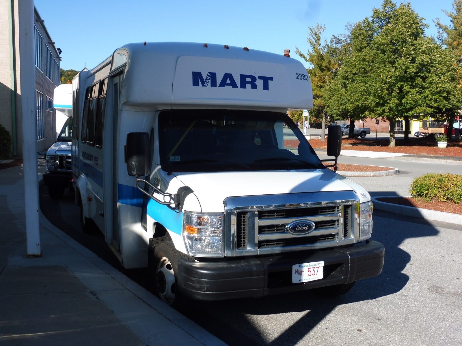 |
| The bus at the Intermodal Center (note the lack of signage). |
So what’s the deal with this route? Well, it’s mainly meant for veterans, seniors, or people with disabilities, but it’s also open to the general public. The way it works, the route has several “guaranteed stops” in Fitchburg, Leominster, and Worcester that – as you would expect – every trip stops at. The other stops are at hospitals, and they operate on a request basis. If no one wants to go there, the bus ain’t stoppin’.
 |
| Ewwwww… |
Okay, first of all, let’s analyze this schedule. Now, I’m not gonna mention the fact that it only runs three times a day, but rather, we’re looking at the logistical side of this. Notice that the route is given five minutes to travel from the Fitchburg Intermodal Transit Center to the Leominster Senior Center. Umm…that’s a 12 minute drive…by car…without traffic! So since the bus is already 7 minutes late when it gets to Leominster, it’ll have an even harder time getting to Worcester on time, even without making the “non-guaranteed” request stops along the way! And the trip back is even worse! So basically, it’s impossible for the Worcester Shuttle to be on time. Great…
 |
| Not the best interior shot I’ve ever taken… |
But you think that’s crazy? How about the boarding procedure?? My friend Nathan and I (having confirmed with the driver that the bus was indeed the Worcester Shuttle – it had no signage and wasn’t stopped in the actual busway) boarded the vehicle, and instantly started getting interrogated!
“Last name?”
“Taylor.”
“First initial?”
“M.”
“Destination?”
“Union Station.”
*driver writes furiously on clipboard* “That’ll be 10 dollars.”
Okay, well, after that annoying process (repeated for Nathan), we were finally ready to leave…10 minutes late.
 |
| Going over the Commuter Rail tracks. |
We headed down Main Street, then turned onto Water Street, going over the Commuter Rail tracks and descending past Central Valley Plaza. However, we soon ascended again, over a river and onto higher ground. The street was lined with a mixture of dense houses, apartments, and industrial-looking businesses.
 |
| I love that bridge! |
Eventually we started to come down a hill again, going by an abandoned Halloween-themed store. The road became a mix of houses and industrial buildings once more, along with the occasional sketchy-looking business. The street widened for an intersection with Wanoosnoc Road (fantastic name), and after that there was a short all-residential stretch.
 |
| Wooo, an auto shop! |
As we entered Leominster, the street became North Main Street and the surroundings became more industrial, and other businesses showed up, too. There were even houses here and there, mixed in with everything else. The road grew way wider when we crossed over Route 2, then it narrowed slightly as we passed Water Tower Plaza and a big hospital.
 |
| Going over Route 2. |
We had been following the 2 this whole time, but we left that route as we merged onto Washington Street. This was a purely residential neighborhood, right up until we turned onto West Street and arrived at the Leominster Senior Center. There was a proper shelter here (the stop is also served by the 8), but no one waiting.
 |
| A side street in Leominster. |
Well, I guess it was time to leave and head to Worcester! Right? RIGHT? Ha, nope! The driver filled out another piece of paperwork when we arrived, but then we were just doing nothing, even once he had finished! Keep in mind that Nathan and I had a connection to make in Worcester, so we needed to be on time. Waiting here at the Senior Center for seemingly no reason was not helping.
 |
| Coming into downtown Leominster. |
Finally, finally, FINALLY we left, continuing down West Street and arriving at Monument Square, the “downtown” of Leominster. The street became Mechanic Street, and we crossed over a railroad track as we left Monument Square. There was a short industrial section, then after a cathedral, it was a mix of houses and apartments.
 |
| That’s an impressive cathedral! |
As we left the neighborhood, the street widened with a median and became the Leominster Connector. We ran through pretty open land, crossed over a river, and then merged onto I-190, heading south towards Worcester! I had never been on 190 before, which made it all the more interesting to be there on a minibus.
 |
| A random highway view… |
There isn’t much to write home about with the scenery, though. It was, uh, basically just woods. It wasn’t until we entered Worcester that it became interesting, with a cool panoramic view of some industrial buildings, and later on some houses and some malls.
 |
| The latter view. |
The highway merged into I-290, which continued at ground level past more industrial buildings. We took the next exit, 18, which brought us onto Lincoln Street. The wide road curved past a variety of buildings before becoming Major Taylor Boulevard. As we came into downtown Worcester, the bus turned onto Thomas Street, then the tiny Commercial Street (essentially an alley).
 |
| Downtown Worcester. |
Next, we turned onto Martin Luther King Junior Boulevard, and finally onto Main Street, arriving at the stop for the Worcester District Court. Looked like no one was getting on or off, so it was time to continue towards Union Station! Right? RIGHT?
 |
| A parking lot with some apartments above it, as seen from the unmoving bus. |
 |
| BOOOOOOOOOOO! |
Cons: TOO BAD THIS WAS ONE OF THE WORST BUS EXPERIENCES OF MY LIFE. Okay, first of all, the boarding procedure is so ridiculous! Why the heck do passengers have to give their information? Why does the driver have to fill out paperwork? Why does the vehicle have no signage? Why does it not just board in the main busway? But noooooo, that’s not the main problem! IT IS LITERALLY IMPOSSIBLE FOR THIS BUS TO BE ON TIME. THE FACT THAT IT HAS TO WAIT FOR FIVE MINUTES AT EVERY STOP, COUPLED WITH THE IMPOSSIBLE SCHEDULE, MEANS THAT YOU’D BETTER GIVE YOURSELF A BUNCH OF EXTRA TIME TO BE LATE! WHAT KIND OF HORRIBLE ROUTE IS THIS????
Nearby and Noteworthy: Fitchburg and Worcester, but there’s not much point in riding this if you live in the Boston area. Mostly because it SUCKS.
Final Verdict: 1/10
It’s one thing to run a route with completely ridiculous boarding requirements, no signage, and long wait times at each stop. But to run a route that’s guaranteed to be late is just about the stupidest thing I’ve ever seen! Argh, it just infuriates me that someone scheduled this and expected it to work! But why complain when I can fix the solution? I present to you a REALISTIC schedule for the route (the stops with asterisks are “guaranteed stops”):
Compare it to the official schedule at the beginning of the post – quite a lot longer, isn’t it? Admittedly, this schedule assumes that the bus makes every non-guaranteed stop, which isn’t likely to happen; without stopping at any of them, like on my trip, I would peg the arrival at the Worcester Courthouse to be at about 4:20 – slightly earlier than when we got in, actually. My trip couldn’t even beat the “realistic” schedule!!! But yeah, the point is that the current schedule is ridiculous, and honestly, this whole route is ridiculous. I guess it has to stay around for political reasons (presumably), but man, it’s SO BAD! Ech…
Latest MBTA News: Service Updates
MART: 4 (Fitchburg State University)
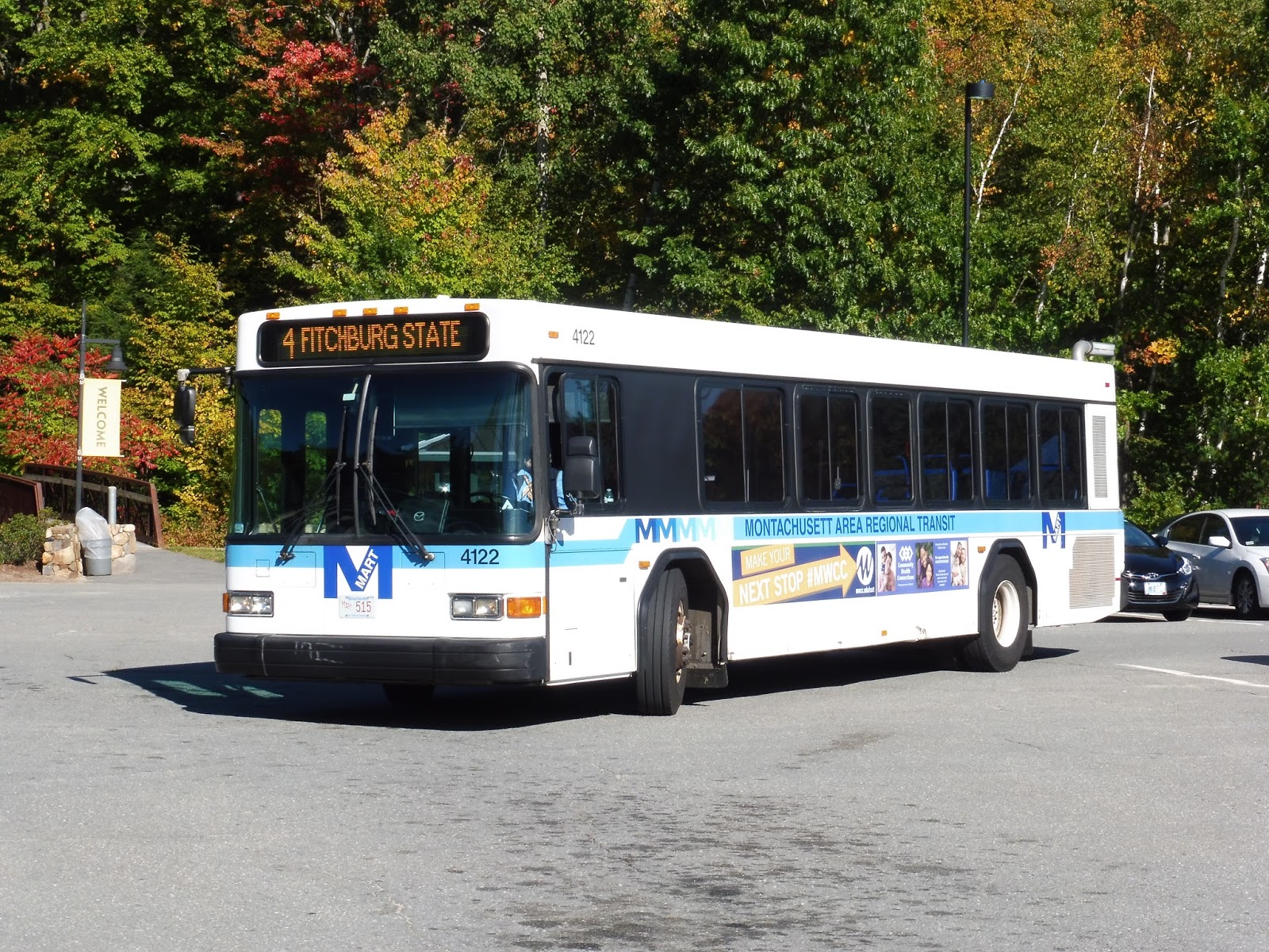
I had a lot of expectations for this route, and seemingly none of them were fulfilled. One of the main ones was that I assumed it would cost $1.25 to ride, the typical MART fare. Well, no, turns out it’s free! Okay, I certainly can’t complain about a free ride. So let’s take a look at this short shuttle from Fitchburg Station to FSU, the 4.
 |
| A MINIBUS? NOOOOOOOOOO! |
Yes, another one of my dashed expectations was that the route would use a full-sized bus. Nope…a minibus just HAD to pull up to that berth, didn’t it? Granted, it was a perfectly fine minibus with comfy seats and a fairly unjiggly wheelchair lift, but…it was a minibus.
 |
| Going by a bank. |
We pulled out of the Fitchburg Intermodal Center and headed up North Street, basically bypassing downtown. It got residential pretty quickly, but we also passed FSU’s Recreation Center. And beyond that, we were in full-on college land, with fairly tall university buildings lining the street.
 |
| Interesting buildings here! |
At one point, the road went under what I can only assume is the FSU dining hall (just based on the fact that that’s the name of the stop under the building), which was pretty cool. Also along this section, we passed a full-sized bus going the other way! Yes, apparently the 4 uses two buses, which debunked another one of my expectations – I thought there would only be one.
 |
| Passing a parking lot. |
Eventually we left the main drag, and it became residential once we passed the McKay Campus School, another FSU building. Next we turned onto John Fitch Highway, and soon after we headed into a parking lot. This took us past a field and then up to the Wallace Civic Center, the last stop on the route.
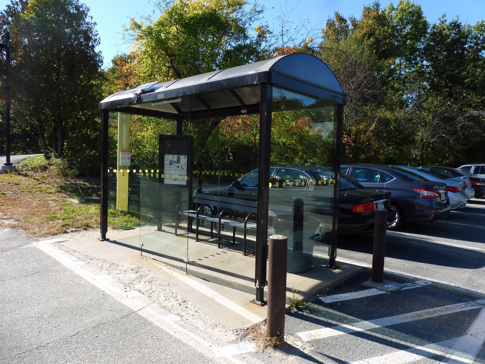 |
| The shelter at the Civic Center. |
However, the stopping procedure at the Civic Center was ridiculous! The bus goes right past the main entrance, but can it stop there? Noooooo, it has to meander through the parking lot and get to a shelter that’s really far away from the building! Sure, it’s a nice shelter, but letting people off at the front of the building would be nicer!
 |
| My friend Nathan and I waited for the full-sized bus to take us back to the station. |
MART Route: 4 (Fitchburg State University)
Ridership: The 4 is by far the most-used route on the MART, with over 180,000 riders per year! Of course, most of those riders are concentrated when school is in session, and I only wish the MART gave summer data, as I’m sure it’s much lower. Still, due to its nature as a college shuttle, the 4 gets lots of people when school is happening!
Pros: The 4 is incredibly useful for FSU students – it’s a free bus that can take you anywhere along North Street (people can flag down the bus anywhere) that comes every few minutes! Who wouldn’t want to rely on this thing?
Cons: I question the Saturday and summer service, which is every hour. There are no public ridership statistics for these times, but I can’t see that many people using such a tiny route when school isn’t in session. Also, the Civic Center stopping situation is terrible.
Nearby and Noteworthy: Need to get to FSU? Well, this is your route! It doesn’t really go anywhere else…
Final Verdict: 9/10
It’s the freeness that bumps the 4 that extra point up. The fact that it’s free means that college students can just hop on the bus anywhere without having to wait too long and go essentially wherever they want on campus! And yes, I know that FSU students ride free on the MART anyway, but…well, making it free for everyone is just a nice thing to do, isn’t it?
Latest MBTA News: Service Updates
Wells (Amtrak)
Well(s), well(s), well(s), time to take a look at Wells! This is a station on the Downeaster in a very middle-of-nowhere section of the town of the same name, and it’s the one we used to get home from Transit Day. What kind of stuff does it have to offer? Let’s find out.
 |
| Special thanks to Sam’s camera! Mine was out of battery… |
We were dropped off in the station parking lot, which features a nice loop for drop-offs and pick-ups. It’s also a busway, served by a Greyhound trip every day, as well as the Shoreline Explorer, which serves Wells with one full-year route and one summer trolley. Finally, the station features private car parking, of course, with about 200 spaces.
 |
| Heading around the side of the building. |
The side of the Wells building features bike racks and newspaper boxes. There’s a path that leads around to the platform, which is useful if you’re rushing for the train and don’t want to enter the building. Finally, there were some nice Halloween decorations in the mulch.
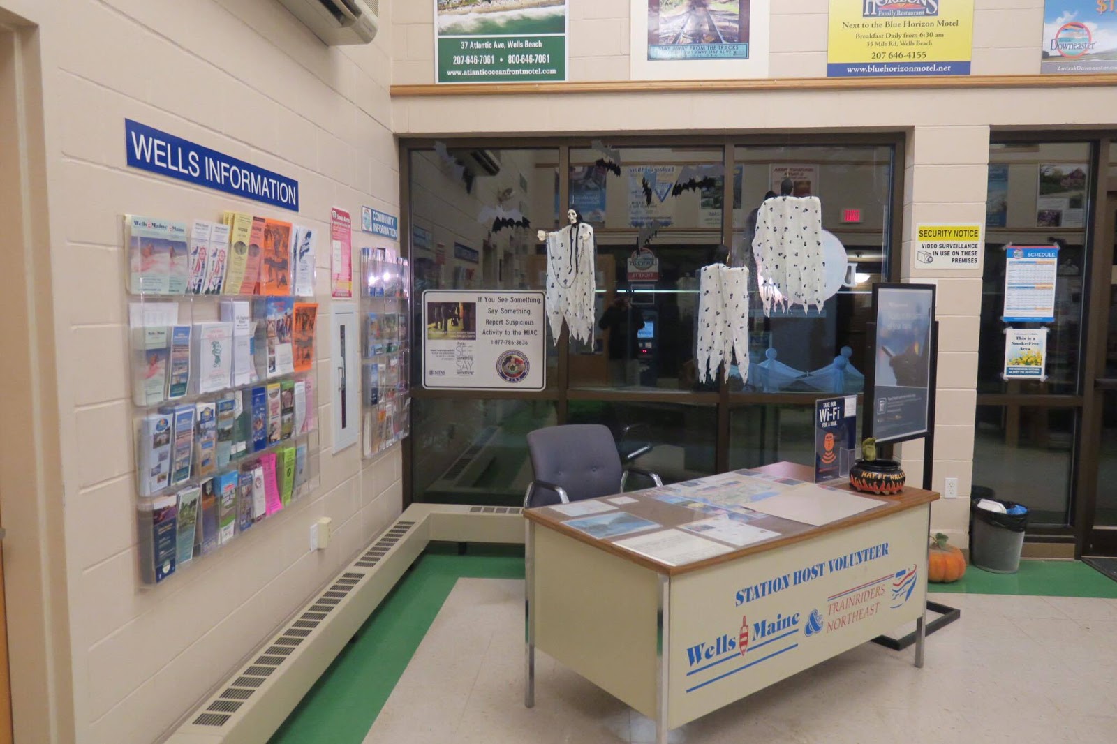 |
| The inside of the building. |
Wells has a fantastic modern building, with a bunch of amenities inside. Firstly, it features basically any type of brochure you can imagine, from Wells-related ones to Maine-related ones to travel-related ones! There’s a desk for a station host, but they probably weren’t working this late at night. The building also features a Quik-Trak ticketing machine, as well as a human to sell tickets.
| The “transportation corner”. |
What else, what else? Well, there are some vending machines in the center of the room to provide snacks, and a few benches to wait for the train inside. There are bathrooms here, too, and they were very clean! Oh, and the whole inside was decked out with Halloween decorations, which was super cute.
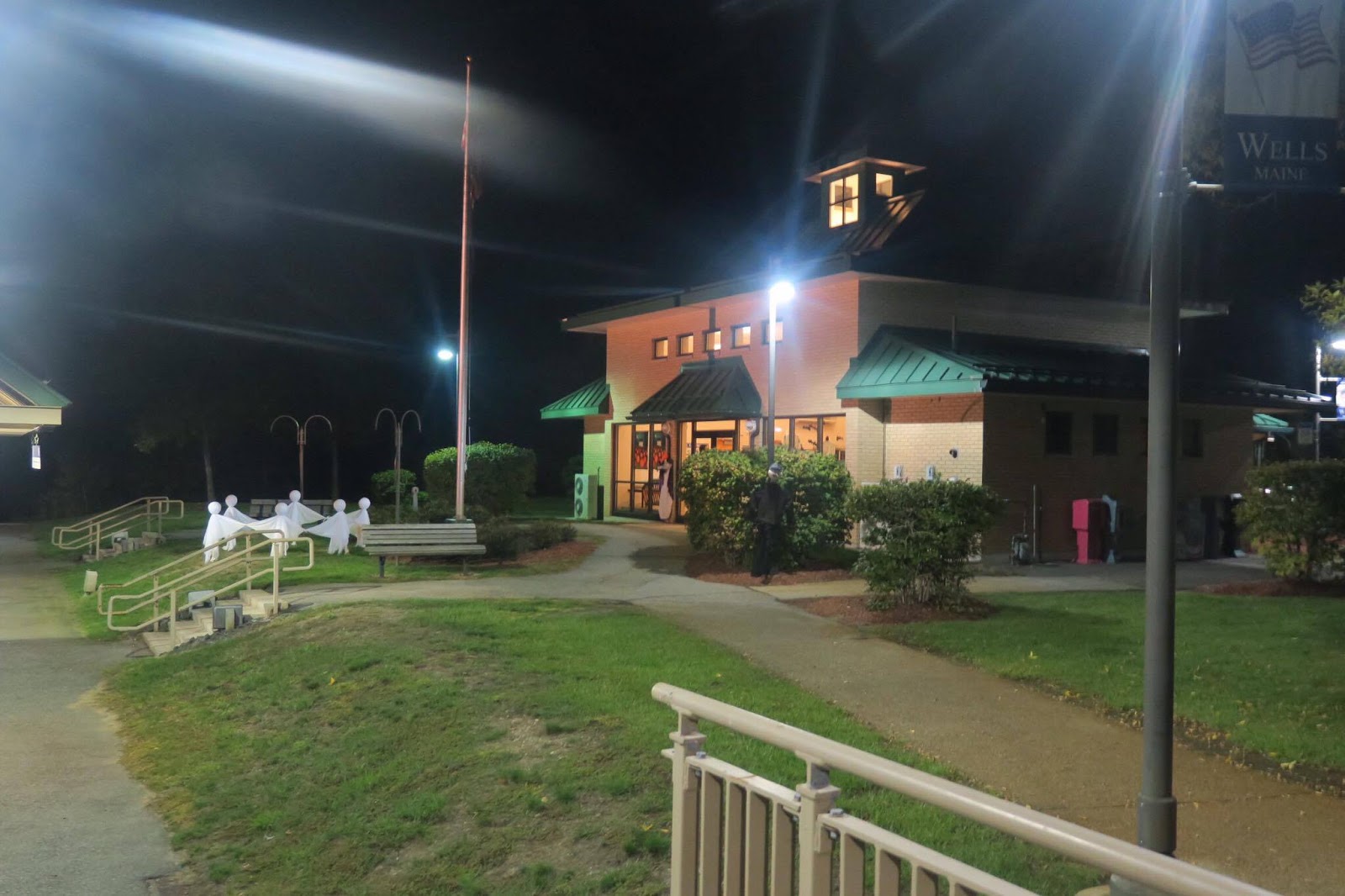 |
| The building from the outside. |
Heading out of the building, there’s a nice little park next to the platform. It has a flagpole, some benches, and in honor of Halloween, an absolutely fantastic little display of ghosts dancing around in a circle! Seriously, what train station has Halloween decorations? I love it!
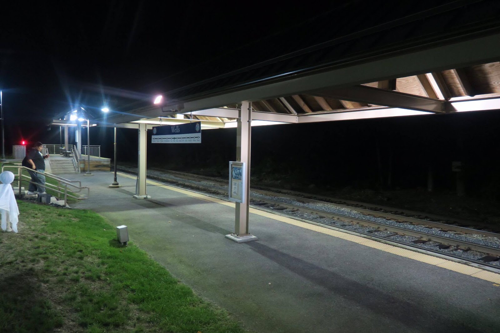 |
| The platform. |
Wells’s platform is…well, probably the least interesting part of the station. It’s pretty small to begin with, and much of it is low-level with a bit of shelter. It features a mini-high, too, which has more shelter and at least a bench. I guess they expect most people to wait inside the building instead, which is certainly reasonable.
 |
| I…I…I think that’s a train! Maybe! |
Station: Wells
Ridership: In 2015, the station got 48,890 people, and unfortunately it seems that ridership on the Downeaster is generally decreasing. Still, that makes Wells the second-busiest station in Maine after Portland, and 134 passengers per day with only six trains isn’t bad.
Pros: Wells has so much character, from the great building amenities to (especially) the Halloween decorations! The parking seems to be sufficient (and right off of I-95), and the platform is standard for the Downeaster.
Cons: That does mean the platform feels a bit bare, but the building is the best place to wait for the train, anyway.
Nearby and Noteworthy: If you come here in summer, you can use the Shoreline Explorer to get to the beach! I can’t tell you how good of a beach it is, and I’m sure it gets crowded, but hey…the beach!
Final Verdict: 9/10
Even late at night, this station still felt very charming and welcoming. I’m sure it has a much different feel in the summer when it’s overrun with beachgoers, but I’m sticking to my guns and giving this place a 9. Seriously, what a lovely station!
Latest MBTA News: Service Updates
Suffolk Downs Shuttle
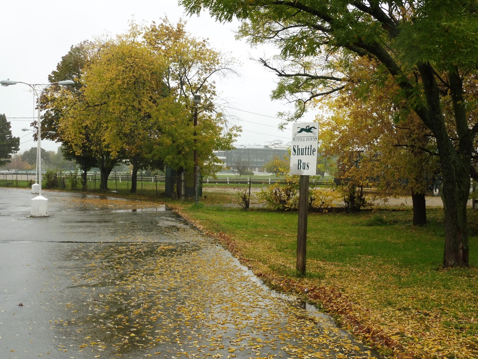
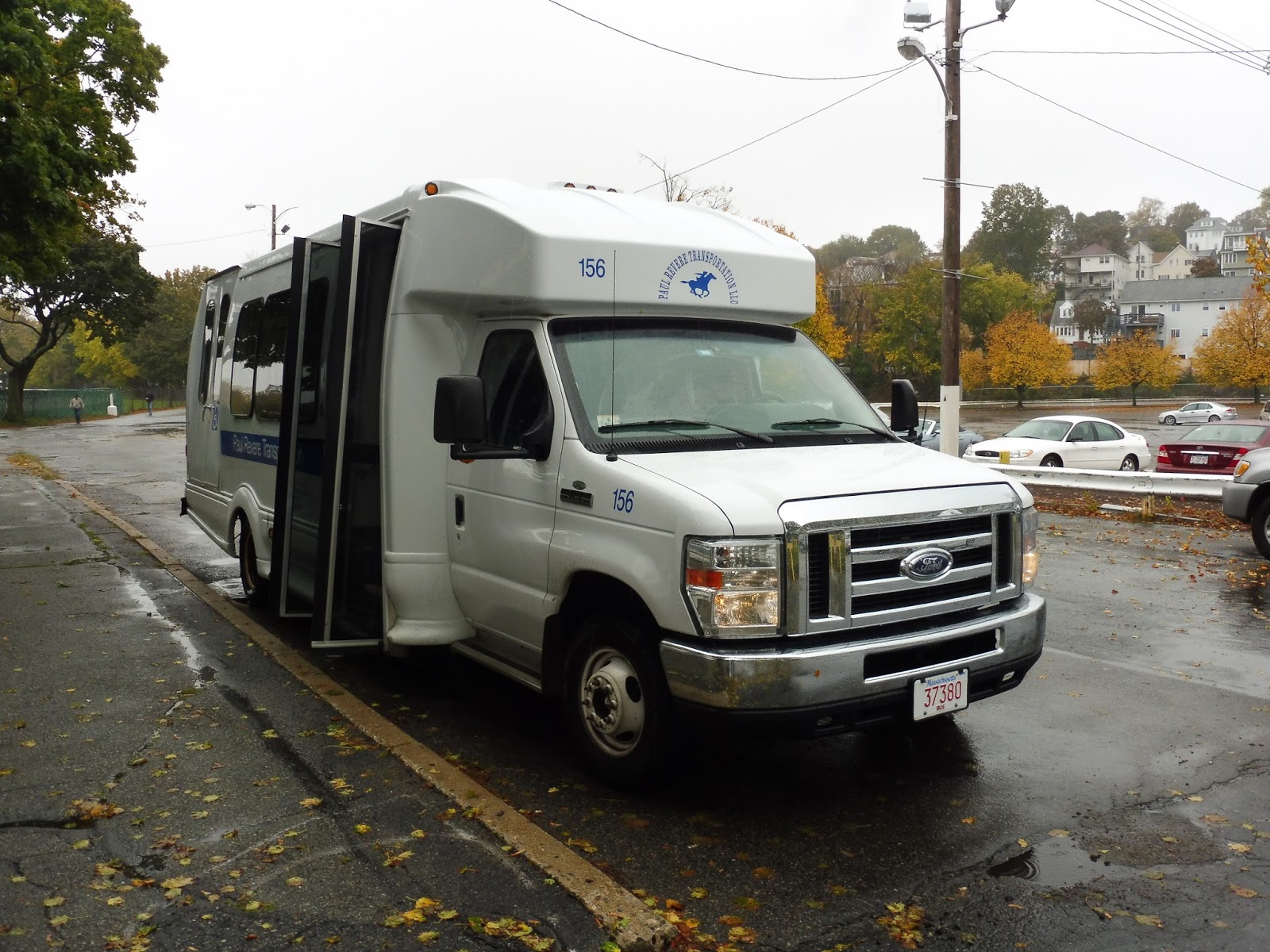
So…I guess Suffolk Downs has a bus service? Yeah, it was really strange when my friend Josh and I walked out of the station (which, incidentally, deserves a higher score than the 3 I gave it) and just saw people boarding a Paul Revere Transportation minibus at a weird pseudo-busway! Yeah, so…let’s look at this shuttle thing.
 |
| The…”busway”. |
So where does this shuttle even run? Well, it goes from the Suffolk Downs Blue Line station to the clubhouse for the Suffolk Downs track, a distance of 0.3 miles. As you can imagine, it’s not the longest trip in the world. The route boards at a loop on the Waldemar Avenue side of the station that surprisingly has signage!
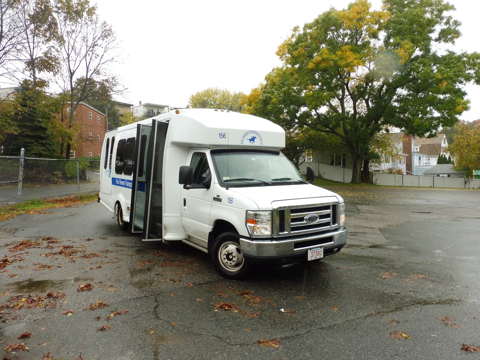 |
| The bus at the loop. |
The minibus wasn’t bad inside. It had a decent number of seats (that probably never get filled), and they were all quite comfortable. The wheelchair lift had a slight bit of jiggling action, but it wasn’t nearly as bad as other minibuses. And of course, the radio was on, but it was pretty quiet.
 |
| The only decent picture I could get through the rainy windows… |
The trip is…very short. We left the busway and headed down Waldemar Avenue next to the racetrack. It looks like there are actually two Waldemar Aves, but this one is mostly isolated from other streets, and is only within the Suffolk Downs complex. Eventually (by that I mean about 15 seconds later), we entered a parking lot and reached the final stop at the clubhouse, once again with signage! And, uh, that’s it.
 |
| Not a bad stop! |
 |
| The bus at the clubhouse. |
Route: Suffolk Downs Shuttle
Ridership: Surprisingly high! I mean, our initial trip got two other people, and every other trip we saw had at least one person. Sure, it’s no 111, but for a minibus, that’s really not bad at all!
Pros: It’s a link to the clubhouse that gets riders, I guess. Also, since the trip is so short, it runs really frequently. A one-way ride is literally a minute, so essentially the route runs every 2-3 minutes! Hey, it’s just one bus, and most trips have at least one person, so I guess I can’t complain.
Cons: Its length, I guess? I mean, the clubhouse is less than a third of a mile away from the station! That said, the ridership seems to consist of all seniors, so I’ll give the route a break.
Nearby and Noteworthy: You’re literally only going to ride this bus if you’re going to Suffolk Downs! So…yeah, Suffolk Downs.
Final Verdict: 8/10
Hey, I mean, it gets the job done, right? It runs frequently, it gets some degree of ridership, and it serves…something. I guess it’s, uh, good!
Latest MBTA News: Service Updates