Logan Airport Shuttle: 77 (Serves All Terminals to the Chelsea Garage)
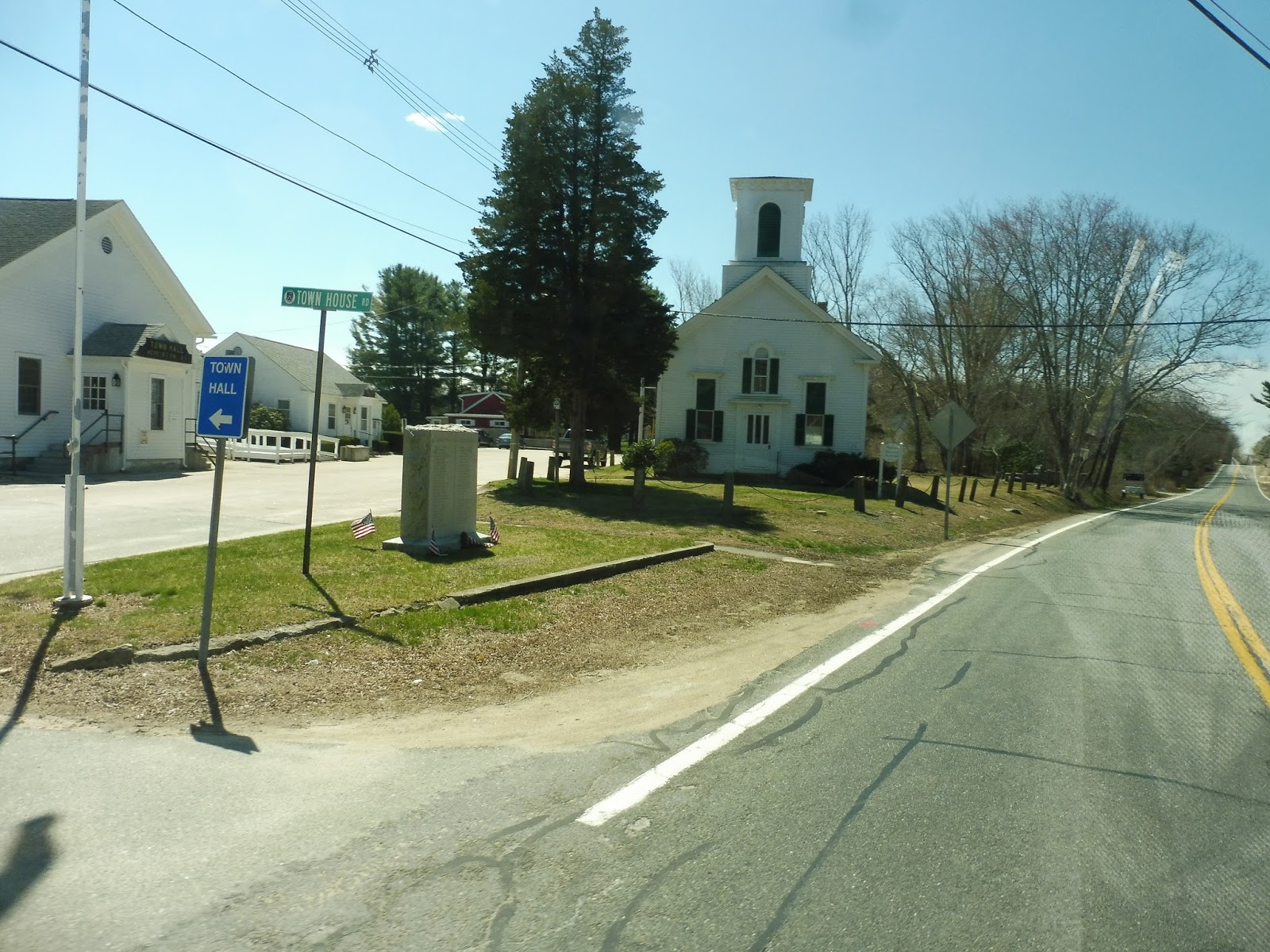
It’s odd that my first Logan Airport Shuttle review happens to cover the craziest and most obscure route on the system! The 77 “provided [sic] employee bus service between Logan Airport and the Chelsea Garage,” and it runs incredibly frequently whilst doing so. The route operates 24/7, and you’re never gonna have to wait long for the next bus to show up. Let’s take a look!
 |
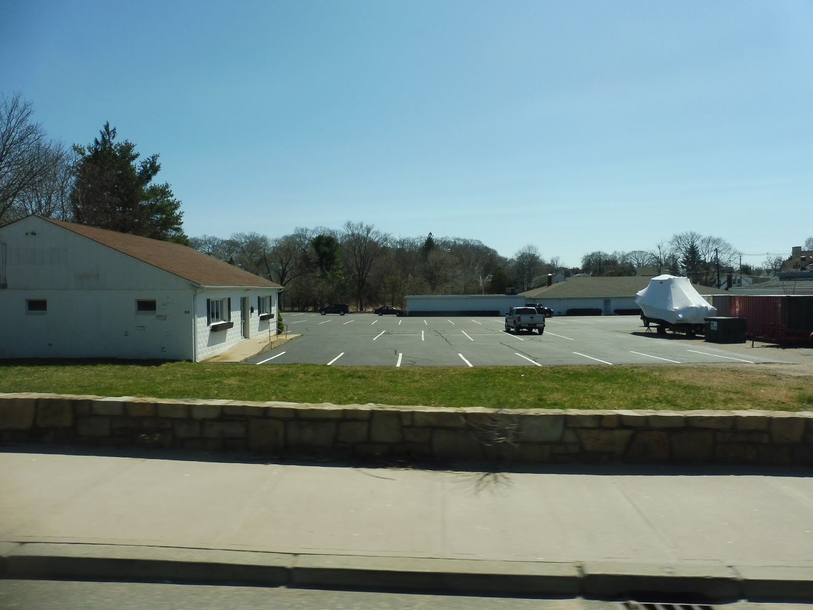
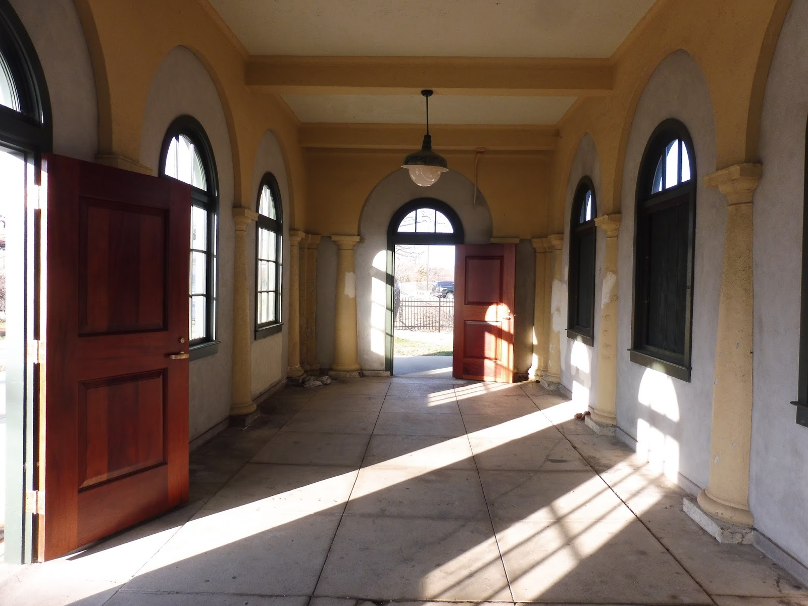
| The busway in Chelsea. |
The 77 actually gets a proper busway in Chelsea, and it’s great! There’s a loop for buses, and the service is so frequent that there’s always a vehicle waiting for passengers. Inside the employee garage, there’s a waiting area, but apparently it’s for “Authorized Personnel Only.” Come on, it looks nice in there!
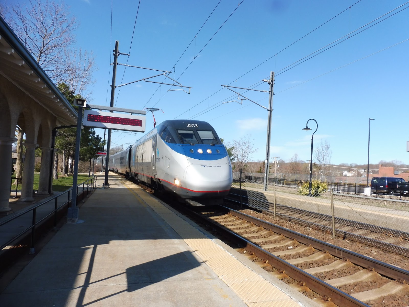
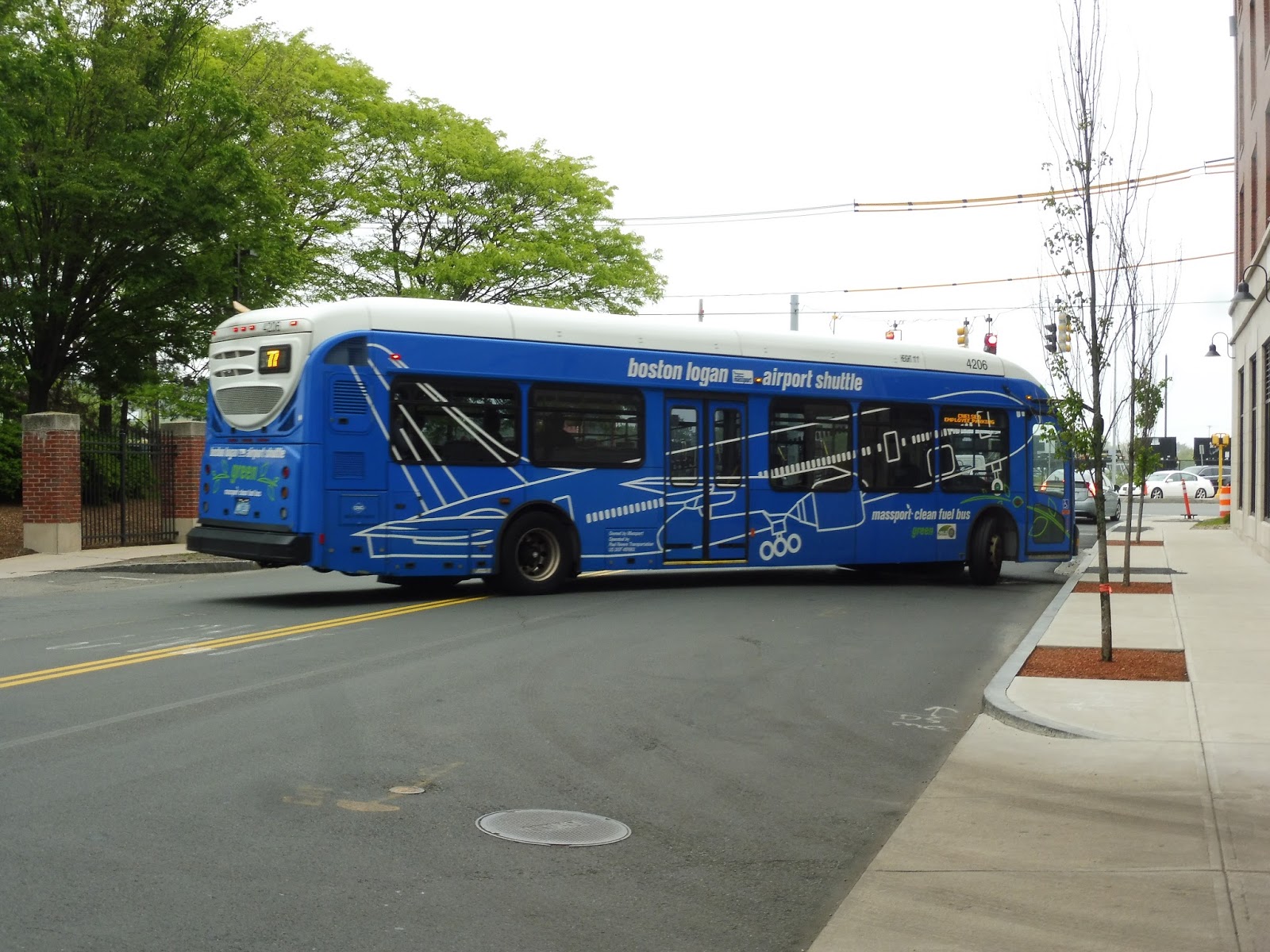 |
| A bus pulling out towards the airport. The route wasn’t using articulated buses this day for some reason. |
From the busway, we headed out onto Chelsea Street, going over the Chelsea River. We entered East Boston on the other side, and it was one of the most horrible industrial areas in the entire city. What do those huge vats contain? They’re so ominous!
 |
| Going over the river. |
Next, we turned onto Curtis Street, which crossed over a little marshy brook. We then merged onto Route 1A, getting a surprise express section! The highway went elevated past some more mysterious vats, Wood Island Station, triple-decker apartments, and a bunch of businesses before coming down alongside some parks and airport buildings.
 |
| The view from the highway. |
We curved alongside Airport Station, then came up alongside the East Boston Memorial Park. Eventually, we headed up onto an on-ramp that took us on an elevated bridge to the actual terminals. However, at certain times, the 77 splits into two “routes,” with one serving Terminals A and B, and the other service Terminals C and E. This was one of those times, and we were on the C and E route.
 |
| Pretty quiet over here at Terminal E! |
We zoomed past Terminals A and B up on the Departure Level, then we pulled into C and dropped a bunch of people off. After that, we came back onto the road for a bit before turning off again, this time into Terminal E. Technically, this isn’t the last stop – the route has one more at the Delta Hangar – but since it ends in such a restricted part of the airport, Nathan and I decided to depart here at Terminal E.
 |
| Goodbye! |
Logan Airport Shuttle Route: 77 (Serves All Terminals to the Chelsea Garage)
Ridership: The ridership for this thing is great. Massport doesn’t provide statistics for its individual routes, but from what we saw, the 77 has really consistent ridership. Considering how frequently it runs, the fact that our bus had about 15 people on it was great, and the other ones seemed to be pretty busy, too!
Pros: This is such an excellent route. It provides a speedy link from the Chelsea lot to the Airport, and it’s so frequent – every 8 minutes to all terminals in the morning and late at night, every 8 minutes on the two “routes” middays and late evenings, and every 5-6 minutes in the afternoon and…from 2 AM to 6 AM, apparently! That’s a lot of early-morning employees…
Cons: This route gets absolutely no signage anywhere at the airport! I think it’s technically meant to be “employees-only,” but this seems like a somewhat questionable policy. The Chelsea lot is right in the middle of one of the densest cities in the country! Wouldn’t it be great if residents knew about and could use this shuttle to get to the airport quickly? Sure, there may not be too many people in Chelsea who are going to the airport, but the demographic is certainly there, and this shuttle is so convenient! It’s also strange that it boards on the Departures Level going both inbound and outbound, but again, it has no signage up there, so it’s not at all obvious where it stops.
Nearby and Noteworthy: If you need to get to Chelsea from the airport, this is your bus! The parking lot is about a 15 minute walk from Bellingham Square.
Final Verdict: 9/10
As a route, the 77 is absolutely perfect. It’s frequent, fast, and serves an area of huge demand. I was so close to giving it a 10/10…but that lack of signage is really annoying. There’s no indication that it boards on the Departures Level, and no signs up there saying where it stops! If there was more signage, the route could be open to the public and increase its ridership even more.
UPDATE 9/11/2020: Oh wow, I’ve gotten two comments about this and failed to make the update. But this route has been eliminated! I guess Massport moved its employee parking to the airport itself so there’s no need for it now. I wonder what will go in the Chelsea lot’s place…
Latest MBTA News: Service Updates
GATRA: Pembroke Shuttle (Video Review)
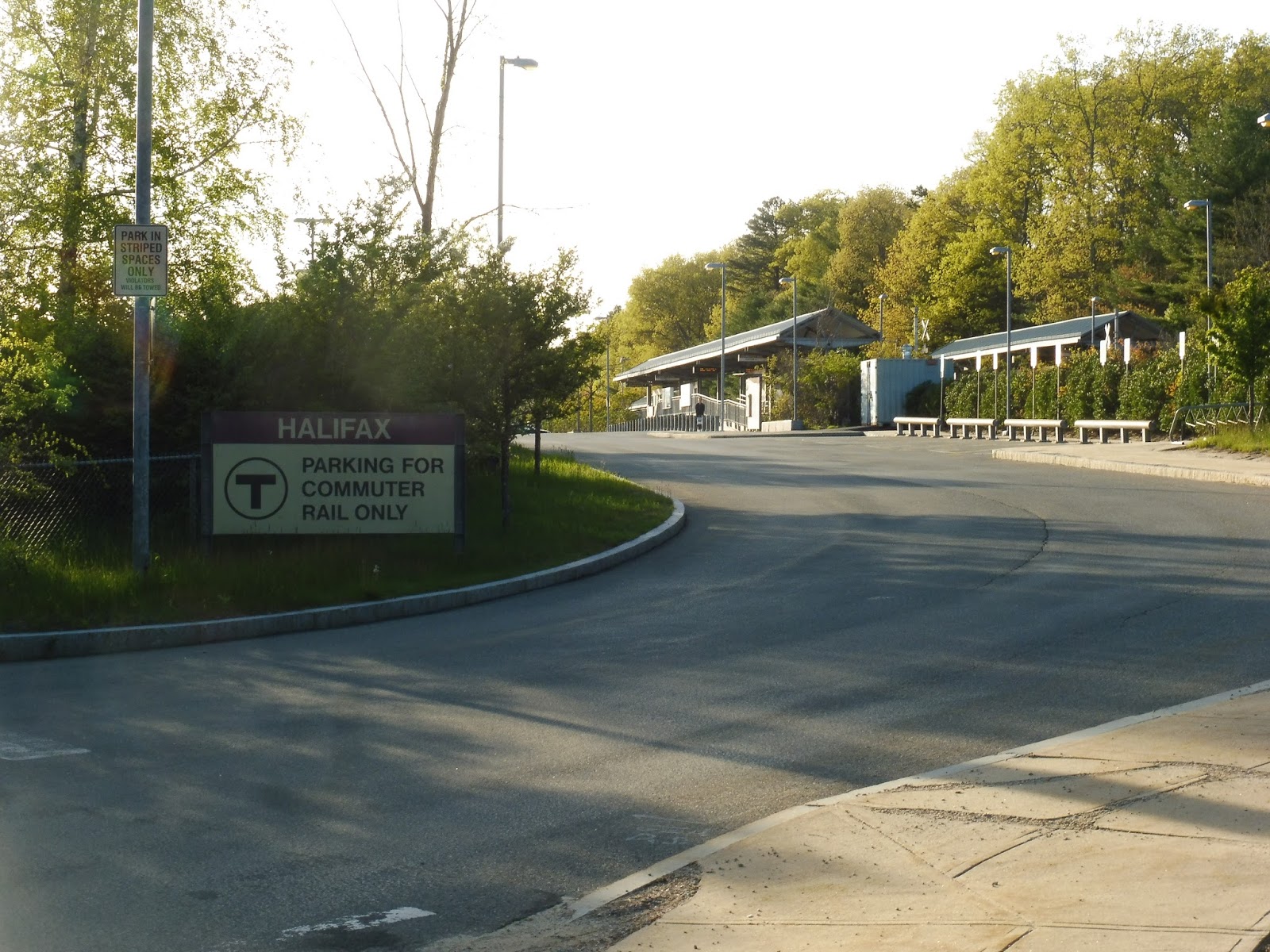
Surprise! How’s about a video review on this lovely Thursday evening? A walk from Pembroke to Halifax after taking GATRA’s shuttle turned a bit crazy…
Halifax
Hey, it’s an Old Colony station that actually has something noteworthy about it! It’s just too bad that one noteworthy thing is also terrible…but we’ll get to that. Here’s Halifax!
 |
| Coming into the station. |
It starts out pretty boring, though. The station is, of course, located in the complete middle of nowhere, although the tracks don’t go anywhere near Halifax’s center, so I’ll give it a pass. A long road leads to the station’s entrance and parking lot, with 402 spaces. There is also a bike rack near the entrance, with 8 spaces.
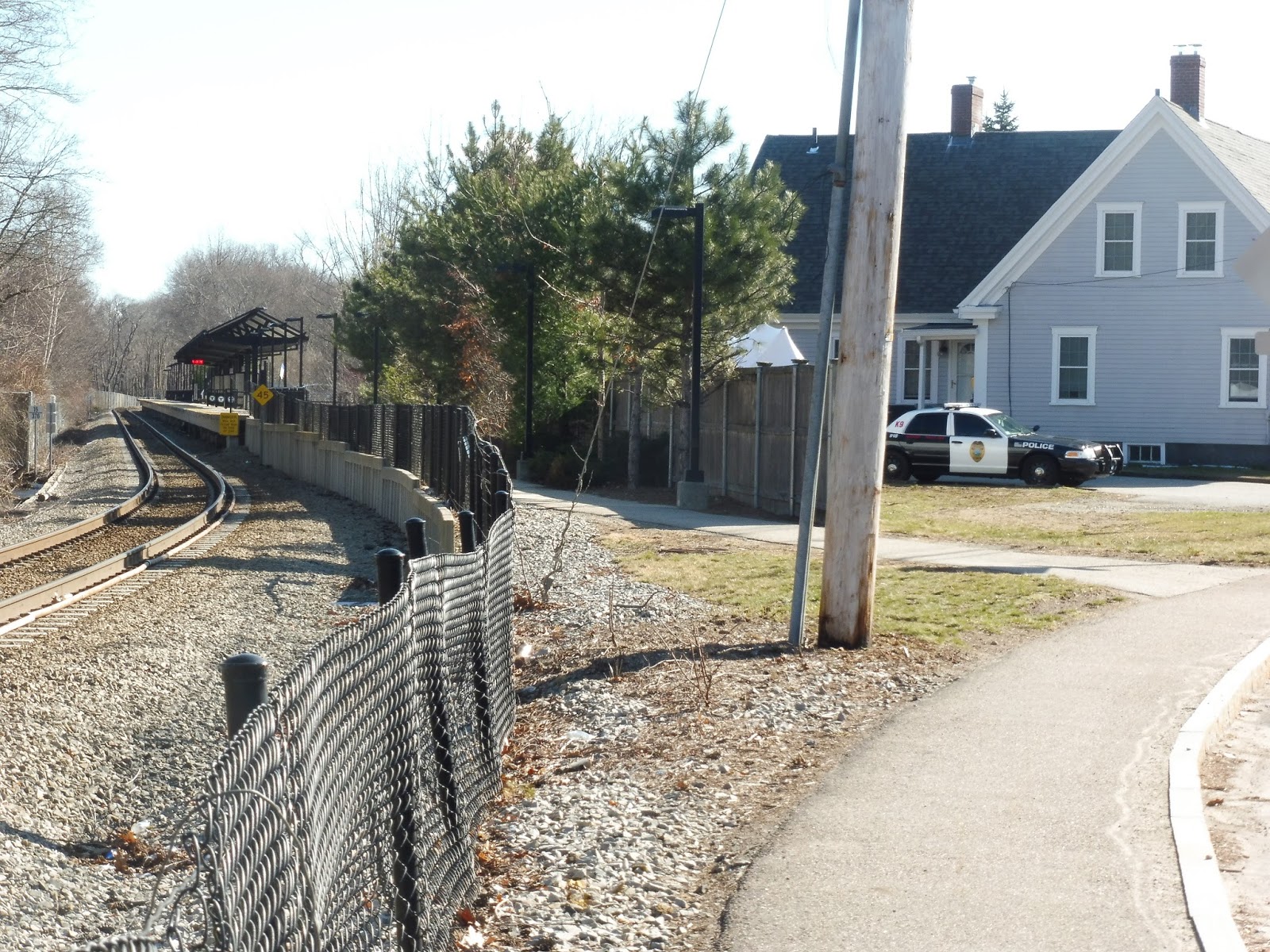
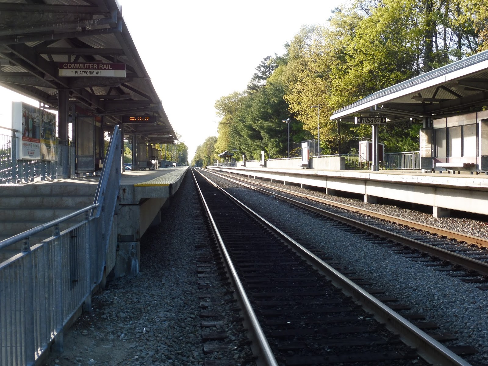 |
| Looking down the platforms. |
The platforms are completely standard for the Old Colony. They’re high-level, with shelters, advertisements, screens, benches, and wastebaskets. The platform stretches into the woods for a while, with mostly signs and benches, although there is an extra shelter on one of the sides. Which side is it? Hang on…
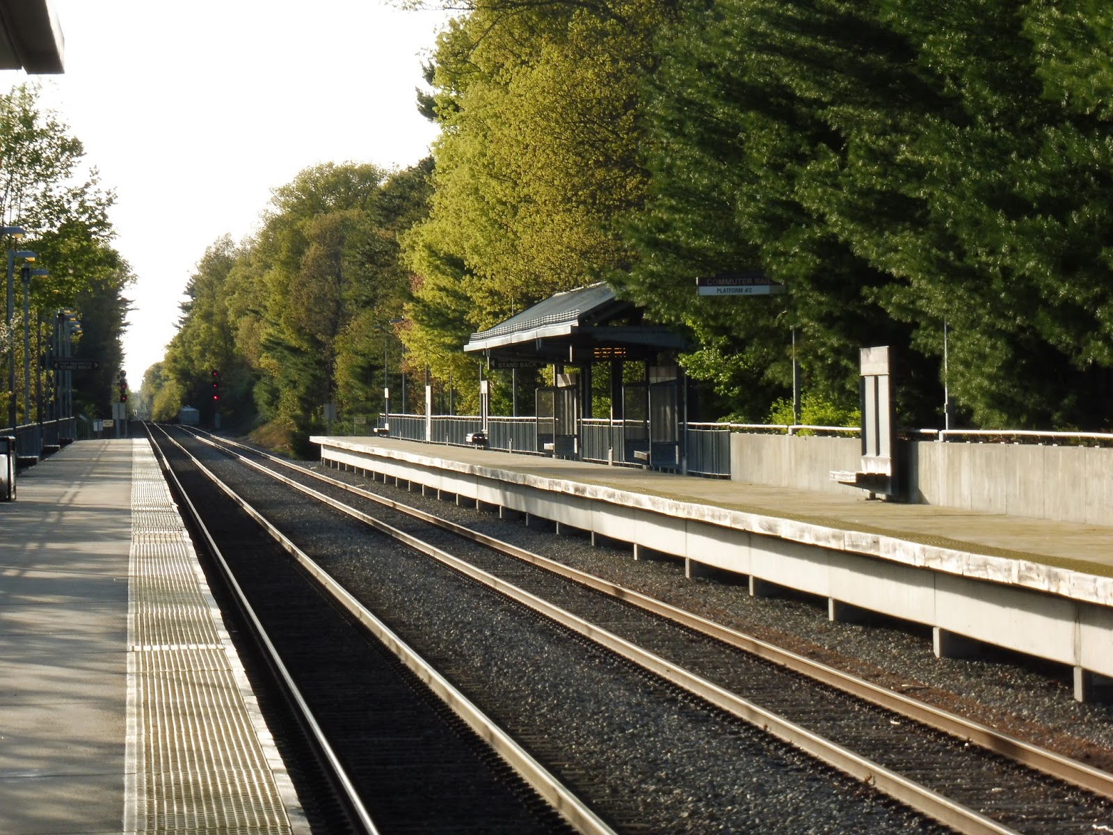 |
| The extra shelter. |
There’s no signage saying where the trains go! All passengers get is “Platform #1” and “Platform #2.” Maybe this is common knowledge and I just didn’t know it, but I had to use this page to figure out that “Platform 1” means outbound and “Platform 2” means inbound. Although strangely, our train to Boston boarded on Platform 2. Soooooo…now I’m confused…?
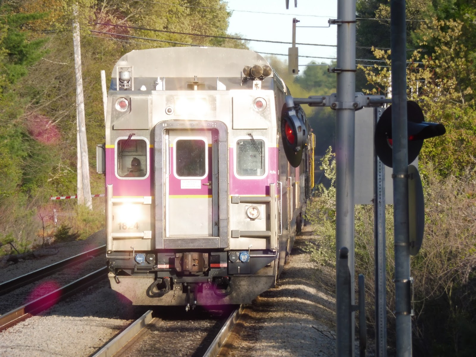 |
| Hey, you’re on the wrong side! |
GATRA: Pembroke Shuttle
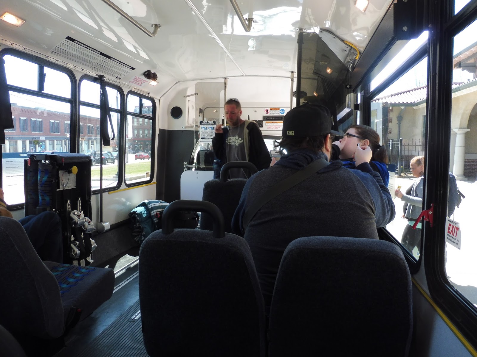
One of the strangest things about the GATRA is that it’s composed of many different “systems” that don’t really connect and have nothing to do with each other. Some of the most isolated of those systems are the rush hour-only commuter shuttles: weird, one-way routes that only operate during peak hours from Commuter Rail stations. Still, as a system that typically targets seniors, the idea of the GATRA catering to commuters is an interesting one. Let’s see how they do with the Pembroke Shuttle!
 |
| EW! |
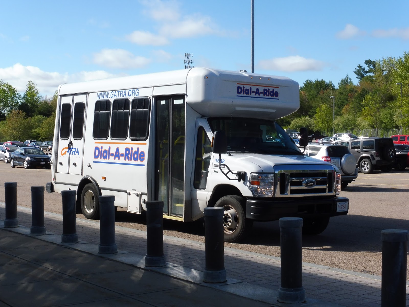
Well…evidently GATRA couldn’t care less about its Pembroke Shuttle, because it doesn’t even get a proper bus! Nope, this shuttle is stuck with a stupid Dial-a-Ride vehicle that doesn’t even get any signage. The inside was reasonably nice, though, with fine seats, an unjiggly wheelchair lift, and…a monkey. Sure, why not?
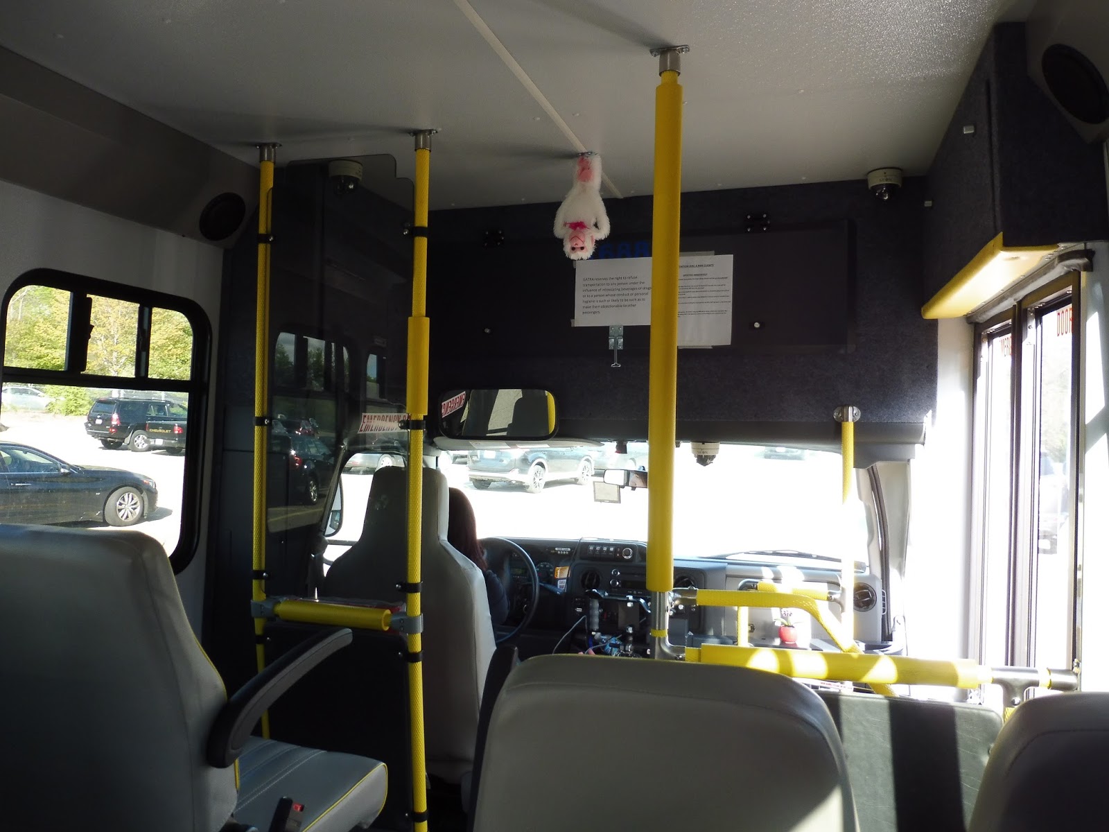 |
| A monkey! |
In the midst of traffic coming from the train, we edged our way out of the Hanson parking lot and turned onto Main Street. After a few industrial-looking businesses, the road became residential, and houses lined the street for the most part, aside from a police station. We came across some suburban retail with parking lots and a shopping center at the intersection with Monponsett Street, and a few more at the intersection with Mattakeesett Street (in a neighborhood called Bryantville), onto which we turned.
 |
| Some businesses in Bryantville. |
Now in Pembroke, we headed north past mostly houses. We also passed a cemetery, as well as some free commuter parking at Mattakeesett Fields. Yeah, I think “commuter parking” just means “use the same lot that you would use for the fields,” but it’s still a nice provision.
 |
| Nice view! |
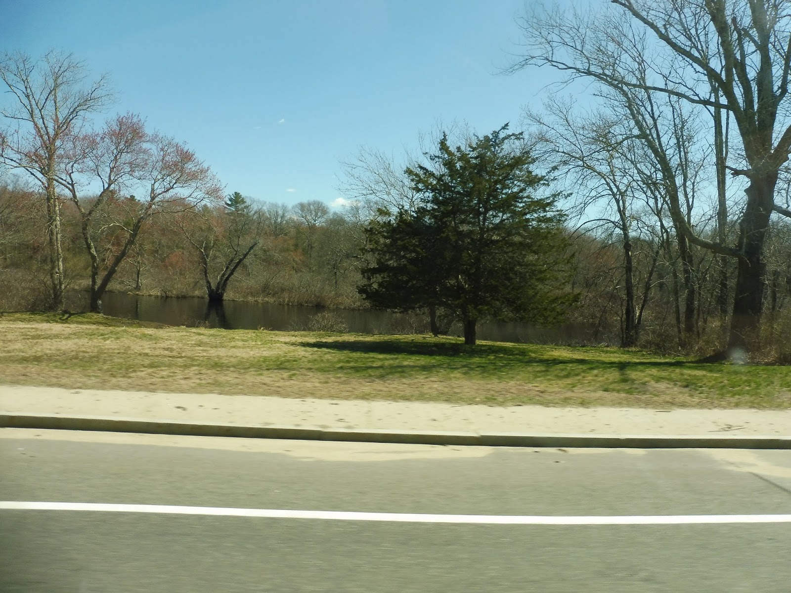
Next, we came up along a pond shrouded by trees, then a marsh on the other side. At a rotary we merged right, where the road passed between two other ponds and was lined with little houses. From there, it got a little industrial, with a few stretches of buildings of that category between the residences.
 |
| Downtown Pembroke, everyone… |
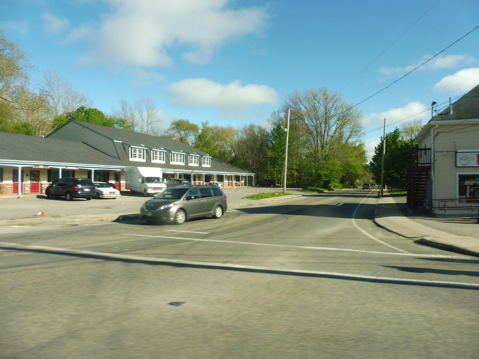
Eventually we arrived at “downtown” Pembroke, which was mostly just a cluster of suburban businesses with parking lots. The bus is technically supposed to deviate to serve more makeshift commuter parking at the Community Center, but we were the only ones on the bus, and we had told her we were going to the Housing Authority. Thus, we turned onto Center Street, and after a bit of confusion from the driver about where the turn was, we pulled into a housing development, ending our rather short trip. Time to walk to Halifax!
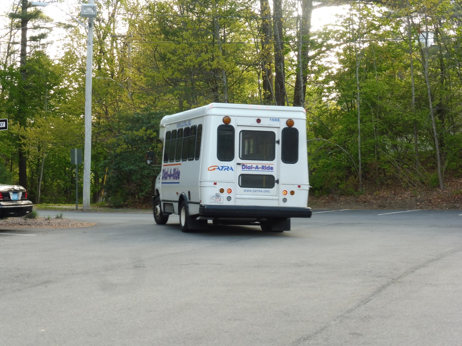 |
| The bus leaving the Housing Authority. |
GATRA Route: Pembroke Shuttle
Ridership: Well, on this trip, it was just me and my friends Michael and Shuvom. Do other trips get more people? We asked the driver, and she said the most she’s seen in a day is three. GATRA’s ridership report offers a slightly higher number, with 15 passengers per day in 2014 – divide that by two because of the commuter nature of the shuttle, and we’ve got about 7 people using this thing every day. Ouch!
Pros: Seeing GATRA cater to commuters is great, and this route’s schedule is perfect for them: the two morning trips and three evening trips all time very well with Commuter Rail trains going in and coming out of the city, respectively.
Cons: Does Pembroke reeeeeaaaallyyyyyy need a bus? I mean, come on, every house we saw had a driveway. The ridership for this route clearly isn’t there, either – seven people per day? That’s awful. If the trip we rode had no one on it, then cut the trip! In fact, I almost wonder if this route should just be once in each peak, timing with one train. That way, you could consolidate all seven-or-so people into one bus, drastically raising efficiency. I’m sure the driver just goes back to doing Dial-a-Ride work when the Pembroke shift is done, so it would free up another vehicle for that, as well.
Nearby and Noteworthy: Sorry, but Pembroke is a really boring town. Aside from a rather nice-looking library, all of Pembroke’s attractions are just chain businesses with big parking lots out front.
Final Verdict: 2/10
Unlike many of GATRA’s other routes, the Pembroke shuttle does actually have a schedule to match its ridership. Five one-way trips per day makes sense when you’re only getting 15 total riders! And really, they could easily consolidate that down to just two per day – one in the morning, one in the evening. That way the vehicle could be freed up for a longer period of time to do Dial-a-Ride work.
Latest MBTA News: Service Updates
Hanson
Why on earth would I come to Hanson, you ask? Could it be to ride the rush-hour only GATRA shuttle from there to Pembroke, you ask? Why, yes, that was exactly why I came to Hanson! Before I can review that exciting GATRA shuttle, though, I have to review…Hanson. Wooooo…
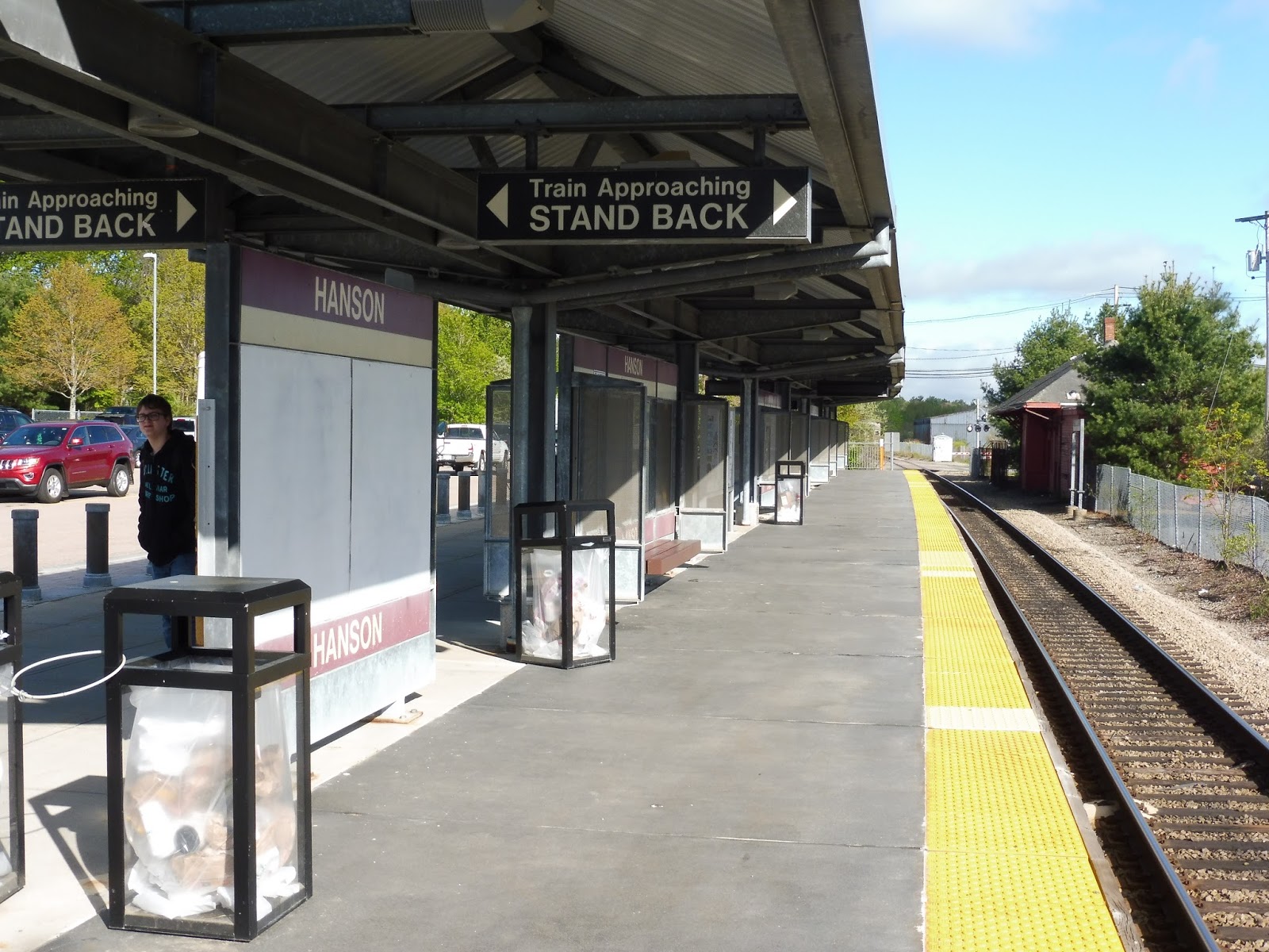 |
| The sheltered part of the platform. |
Hanson is as typically Old Colony as you can get. The platform is all high-level, with a sizeable sheltered portion featuring benches, signs, and wastebaskets. Of course, the platform stretches way beyond the sheltered bit, going into the woods where there are a few more benches and signs.
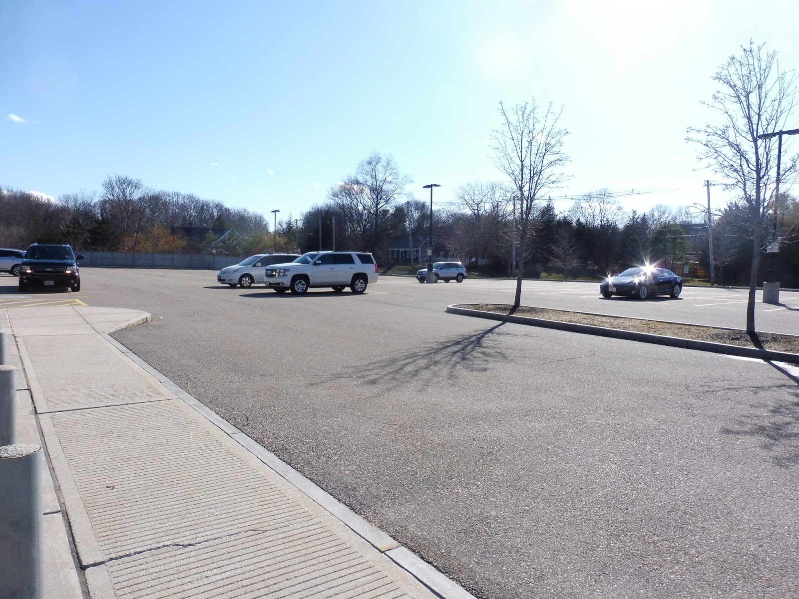
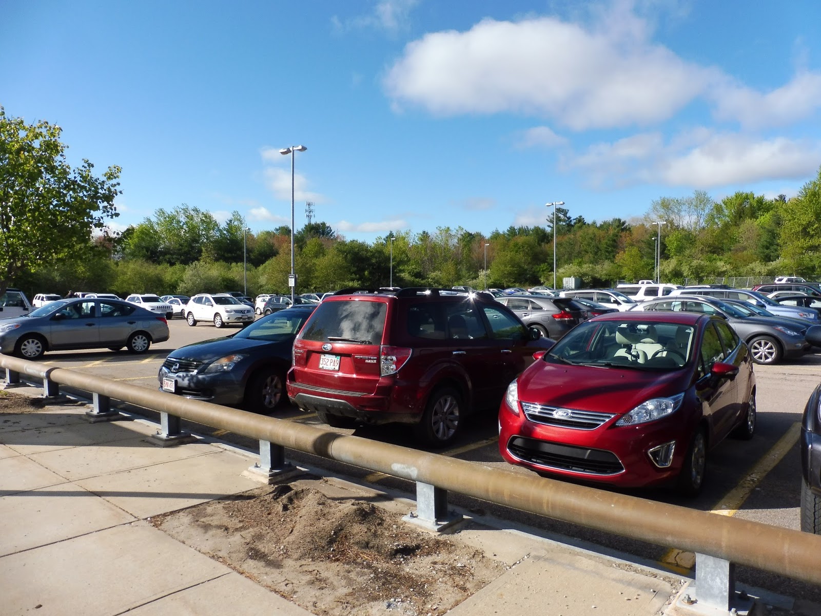 |
| Since this was on a weekday, the parking lot was actually busy! |
Does Hanson have a parking lot? Yes, of course it does, and with 482 spaces, it’s big enough to handle the rush hour crowds. There are bike spaces here, too, and a pedestrian path that leads out to the street. One advantage about Hanson is that it’s technically in a downtown – that is, if “downtown” Hanson was at all worth talking about.
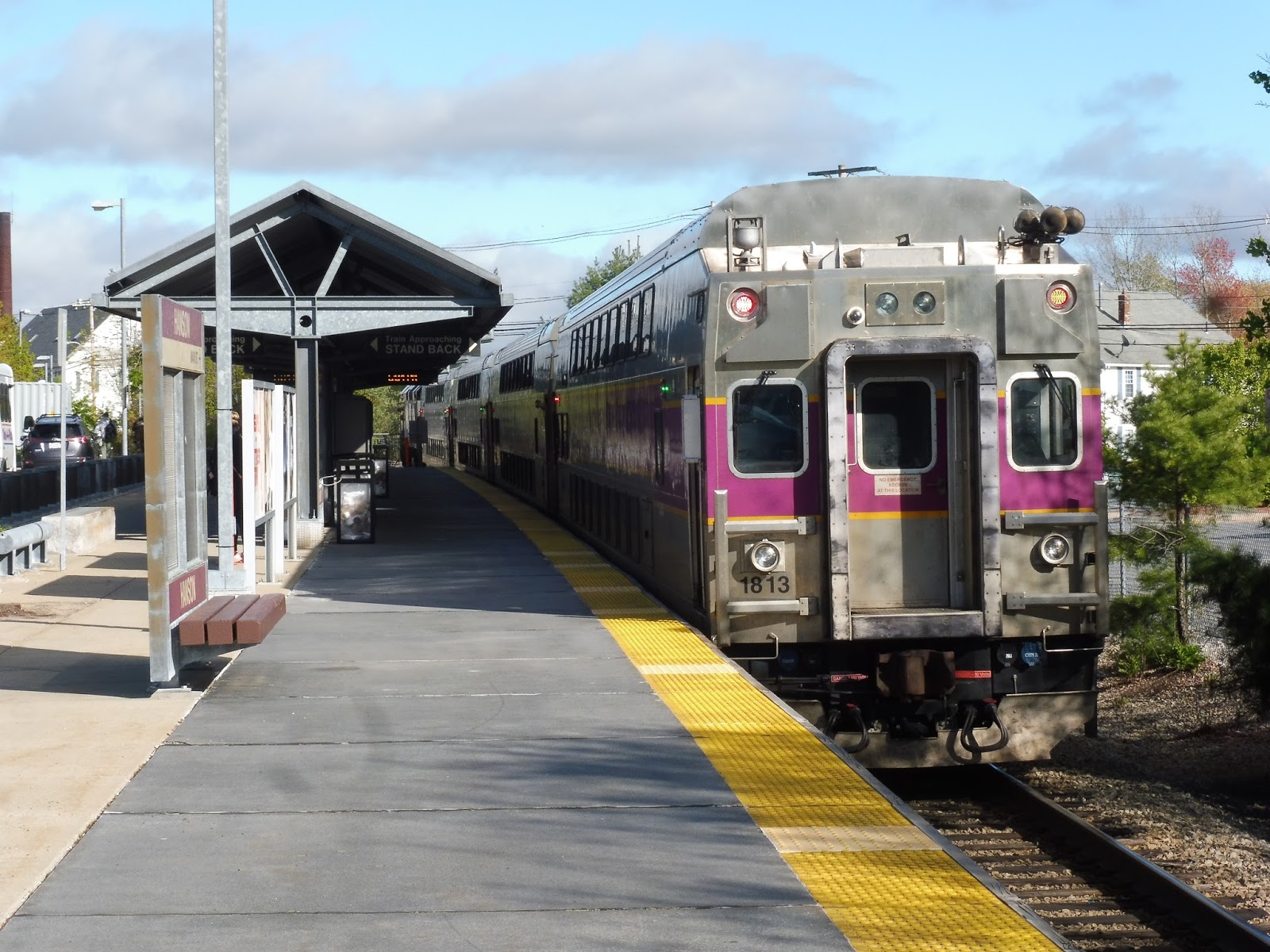 |
| A train leaving the station. |
Station: Hanson
Ridership: This is the second least-used station on the Plymouth Line, with only 473 inbound riders per weekday. Hey, the parking lot fits 482, so that works out pretty well, eh?
Pros: The high-level platform means the station is fully-accessible, and there’s plenty of seating space, with a well-sized parking lot. Yeah, I mean, there isn’t much to say here. It’s also in a “downtown”!
Cons: Not much – it’s just kinda boring. It’s an Old Colony station, so yeah, boringness fits the bill.
Nearby and Noteworthy: As I mentioned, we are in “downtown” Hanson! Highlights include a Dunks, a pizza joint, and a fireplace shop…and that’s about it.
Final Verdict: 8/10
Hey, you know, Hanson is pretty good for an Old Colony station! Okay, well, the only thing that makes it a cut above the others is that it’s technically in a downtown…and yes, it’s the most boring and suburban downtown possible, but it’s still a downtown. Old Colony reviews are so fun, aren’t they?
Latest MBTA News: Service Updates
RIPTA: 14 (West Bay)
Most of RIPTA’s routes are of pretty normal length…but then there are the long ones that go miles and miles into the Rhode Island hinterlands. The least-used of those long routes (not including rush hour expresses) is the 14, which runs along the west side of Narragansett Bay, as its name suggests. Like the others, it’s a beast of a route, with its longer branch taking almost an hour and a half to complete! Settle in for the long haul here…
 |
| Bank of Newport, I guess? |
I’ll be covering the Salt Pond Plaza branch of the 14 in this post, since it’s mostly unique while the Newport section essentially duplicates the 64 (although it is an absolutely beautiful ride). Thus, we left the really boring mall (seriously, half the slots for stores weren’t even occupied) and made our way up the wide Old Point Judith Road. This part was parallel to the 66, but it ended very quickly when we turned onto South Pier Road, starting our unique section.
 |
| A wide intersection. |
South Pier Road was mostly residential, although we also passed long driveways to both the Narragansett Middle School and the Narragansett High School. As we got closer to Narragansett Bay, the houses got denser, but we turned onto Boon Street before we could properly reach the water. There were a few businesses along here between the houses, with fleeting views of the bay down side streets.
 |
| Wow, that’s not tilted at all… |
Soon we arrived at a shopping development that blocked our way, so we had to make a one-block deviation to get around. Thus, we turned onto Kingstown Road, then Caswell Street, which became Narragansett Ave. This curved around past some condominiums, as well as a tiny marsh apparently known as “Lake Canonchet,” then we turned onto Beach Street.
 |
| Nice view…? |
As the name suggests, we were running right alongside Narragansett Beach! Unfortunately, some rather large parking lots obstructed the view of the water. The street became Boston Neck Road as it curved north, and the scenery became some rather large houses obstructed by trees. Eventually we crossed over a river, finally giving us the view I was craving.
 |
| Hooray! |
We ran through essentially open fields on the other side of the bridge, then some woods with low-lying trees. Eventually, some houses began to show up, many of them being fancy seaside properties. Indeed, there were occasional views of the bay through layers of trees and fields.
 |
| That house must have some great scenery in the backyard. |
The residences started to get denser and a little smaller as we continued north. The road curved away from the bay again, and some suburban businesses and shopping centers with parking lots started to line it. There was a short break with some houses and a chapel, then the businesses came back, along with a park.
 |
| How exciting… |
At Bridgetown Road, we were joined by the 64 on its way to Newport. The scenery got pretty woodsy, with houses hiding behind the trees and down side streets. As the road curved northeast, we entered North Kingstown, and there was a brief spurt of development (i.e. houses and a post office) at the intersection with Ferry Road.
 |
| Another view! |
After that spurt, though, we went through pure farmland for a little while, and the open space offered another view of the bay. Entering the woods again, it became residential, with suburban houses along the road. We arrived at a few businesses, and after a park-and-ride, we crossed over Route 138, the highway to Newport. This is where the Newport branch of the 14 joins up, and we enter the route’s “main line.”
 |
| No view of the amazing bridge to Newport, alas… |
There were more woods after the highway interchange, with the occasional open field. Eventually we started to pass some housing developments, as well as a gun shop (we were most definitely out in the countryside). There was an elementary school and some more businesses, and we crossed over the tiny Annaquatucket River near a marsh.
 |
| Another fleeting look at the bay down a side street. |
There were more businesses on the other side of the river, ranging from a pizza place to a few auto shops to a motel. It got mostly residential after that, though, and the surroundings consisted of entirely houses for a little while. Finally, we crossed over Wickford Cove, then went through an intersection with Brown Street, Wickford’s main drag.
 |
| This route has been pretty scenic, eh? |
Unfortunately, the 14 doesn’t directly serve Brown Street, but the charming businesses of the village are within easy walking distance of the route. Meanwhile, our road became Philips Street, and it consisted of mostly houses. We turned onto Route 1 (Tower Hill Road) next, going by a few suburban businesses and the Wickford Middle School.
 |
| A field for the middle school. |
There was more retail at the intersection with Main Street, then we passed a combined building for the North Kingstown police and fire departments. It was mostly residential again beyond there as the street became Post Road, but it all changed once we went by a Rhode Island State Police building. After that, there were two motels and a bunch of businesses with huge parking lots.
 |
| A rather nondescript building. |
The retail continued for a while, with a few random industrial buildings mixed in between them. Eventually the road went on a bridge over a train track and Route 403, then we made a strange deviation onto Gate Road. It took us out to a rotary and back, and basically only served to take the route slightly closer to a mall than if we had just stayed on Post Road.
 |
| The view of Route 403. |
Post Road was much wider than before when we returned to it, and it was lined with businesses, mostly of the sketchy variety. “Black Lotus Tattoo Studios” housed in a strange industrial building? No thanks. There was a proper shopping plaza (Kingston Plaza) with slightly more reputable businesses, and across the street was…Rhode Island’s largest aquarium? Huh…okay!
 |
| Looks like a great place for a bus stop… |
We went over the tiny Sandhill Brook, and there was a bit more retail on the other side. There was a bit of a break where we passed a cemetery and a church, but then the businesses came back. We crossed the Commuter Rail/Amtrak tracks, then passed some shopping plazas and entered East Greenwich.
 |
| Benny’s, I guess. |
East Greenwich offered much of the same scenery as before, until eventually houses became the dominant surroundings. We passed a few apartment developments, then the businesses came back, although the parking lots were much smaller this time. In fact, they went away entirely when the street became Main Street and we passed through beautiful downtown East Greenwich.
 |
| My camera was dreadfully low on batteries by this point, so sorry for no pictures of Greenwich… |
North of the lovely downtown, the street became Post Road again, and it got residential. Near some more apartment developments, we came up along the Northeast Corridor, which in turn was running right along the bay. We entered Warwick along this section, and eventually turned away from the tracks. There was a mixture of houses and businesses along the next section.
 |
| A side street. |
The scenery got pretty diverse soon, ranging from housing developments to industrial buildings to businesses to houses to a cemetery. We crossed over Hardig Brook, then Post Road curved right, becoming a one-way street. This was Apponaug, but aside from some beautiful historical buildings near an intersection and a bunch of traffic, there wasn’t too much of note.
 |
| A view of Apponaug. |
There were a few houses along the street as we left “downtown” Apponaug, then the street curved up and it got really industrial. The Route 1 designation left Post Road, but we stayed on it, going past a mixture of houses and businesses. Just as it started to become industrial, we made a few curves and took a ramp onto…oh, I guess it’s still called Post Road. Also, it was Route 1 again!
 |
| Some random parking lot. |
It continued to be industrial, with a few airport-related businesses along the way as well. Speaking of airports, we turned off onto the T.F. Green Airport Connector Road, taking us into the terminal. After stopping there, we made our way back around, turning back on ourselves to run the other way down the road – but it wasn’t just a “road” anymore. No, it was time for the express section to Providence, and we were on a highway!
 |
| The T.F. Green Airport walkway to the Commuter Rail. |
We went through the woods for a while, then merged onto I-95. We passed by some industrial-looking buildings, then it was a bit more forest…then industrial buildings again…then forest again! We entered Cranston when we crossed over the Pawtuxet River, and beyond there, we saw industrial buildings on one side and houses on the other.
 |
| Barry Manilow is great! |
We passed through a rather large interchange with the Huntington Expressway and went over the Northeast Corridor after that. From there, we got a nice view of the Roger Williams Park Zoo, beyond which dense houses lined one side of the highway. Next, we curved around into that gigantic industrial area south of Providence.
 |
| The view of the zoo! |
Easing its way around the Rhode Island Hospital, the highway made its way into some dense areas south and west of downtown Providence. By the way, did I mention that we had been stuck in traffic since Cranston? And that Nathan and I had a very short amount of time to make our train back home? Yeah, by this point, all we wanted was for the bus to leave the traffic-stricken highway and get the heck onto some side streets, but we kept on chugging…
 |
| The industrial area. |
Finally, at a gigantic interchange, we merged onto Memorial Boulevard, right outside the Providence Place Mall. We turned onto Francis Street, then Exchange Terrace, taking us along the northern side of Burnside Park. As it turned out, the 14 uses one of the closest Kennedy Plaza berths to the Commuter Rail station! Nathan and I got out and sprinted for our lives to the station, just barely making the train. This seems to happen a lot…
 |
| The bus allllllll the way back at Salt Pond Plaza… |
RIPTA Route: 14 (West Bay)
Ridership: Like I said, the 14 is the least-used “long” route on the RIPTA, since it doesn’t serve any particularly big ridership hubs (the 54 serves Woonsocket, the 60 serves Newport more quickly, and the 66 serves URI). Thus, in 2012, it only got 789 riders per weekday and 325 per Saturday, with most of them coming from the inner section of the route, before it splits in two.
Pros: Despite the fact that ridership isn’t as good as the other long RIPTA routes, the 14 still serves a huge part of Rhode Island. It’s the only route to some fairly important places like East Greenwich, Wickford, and Narragansett Beach, so clearly a lot of areas fall under the influence of the 14.
Cons: The problem is that the schedule is infrequent and inconsistent. It runs about every hour on weekdays, but it’s not consistent at all. There are bouts during the rushes where it gets more frequent, but again, it’s inconsistent. On Saturdays, it leaves about every hour and a half, but once again, the times are completely random. Also, the fact that it’s every 90 minutes means that service to each branch is once every three hours. Then there are some weird express trips that happen mostly during the evening rush that add an extra layer of complexity to an already crazy route, and we’re left with just a big mess.
Nearby and Noteworthy: Of all the towns the 14 serves, my favorite was East Greenwich. It’s surprisingly big, and simply oozing with charm, with a bunch of hills and dense businesses! If only it wasn’t such a pain to get there by public transportation – the 14’s schedule is hard to deal with.
Final Verdict: 6/10
The 14 is an important route, but the schedule completely drags it down. I think hourly headways do make a lot of sense, but why can’t they be more consistent? It also seems like it’s not particularly worth having Saturday service to the branches – if they cut it back to maybe Gate Road, they could improve the frequencies, plus it would improve ridership efficiency. Perhaps even Sunday service could be tried with this arrangement?
Latest MBTA News: Service Updates
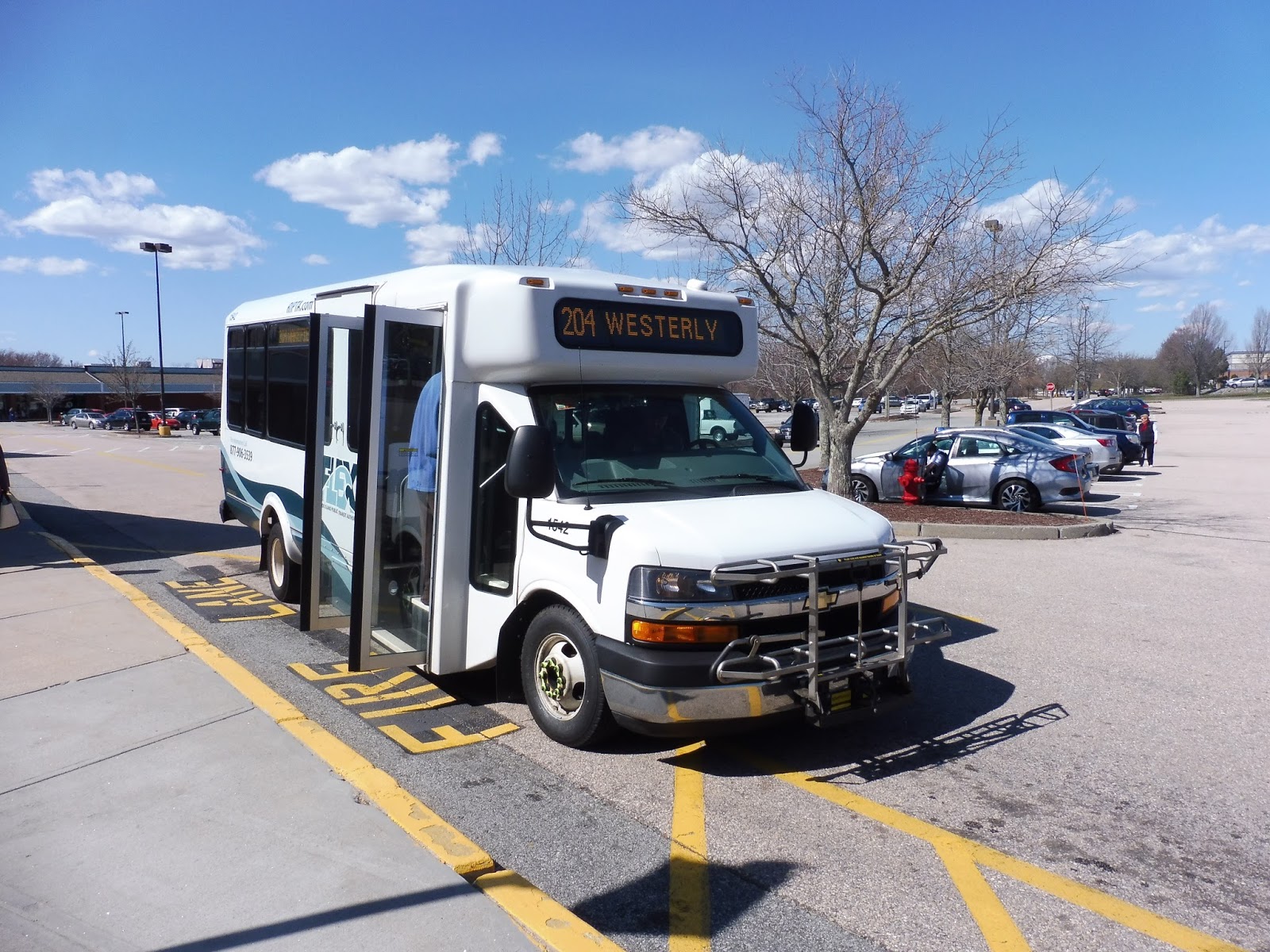
RIPTA: 204 (Westerly Flex)
After seeing the insane Fridays-only 301, it’s time to take a look at Westerly’s “primary” bus “route”…although it’s still incredibly barebones. The 204 is a flex service, which is why “route” is in quotation marks: you can call in to request the route to take you anywhere within the “Flex Zone,” which covers most of urbanized Westerly. Three times a day, however, the route breaks free of its zone and runs out to Narragansett to serve Salt Pond Plaza and connect with other RIPTA routes. This should be an interesting review…
 |
| The bus at Westerly Station. |
Confusingly enough, there are certain times of the day you can get on the Westerly Flex without having to call in – certain “Flex stops” at certain times of the day allow you to just get on and go wherever you want. Nathan and I got on at Westerly Station for the 2:00 PM “trip,” which operates almost as a fixed-route to Narragansett.
 |
| The inside of the bus. |
After some passengers boarded, we left the Westerly Station drop-off area and headed down Railroad Ave. As the name suggests, we were paralleling the Northeast Corridor on one side, while on the other side there were businesses and the “Westerly Armory,” which looked awesome! The road became Oak Street, and it was industrial for a few blocks before becoming residential.
 |
| I’m not sure what this is a lot for, but that boat is intriguing. |
It got industrial again after a bit, but then we unexpectedly entered…a highway interchange? Yes, I guess we were going onto an express section! We ran down Route 78, which is a short circumferential expressway around Westerly, but an expressway regardless. The driver pumped on the gas as we proceeded through the woods before the highway ended at an intersection with Route 1.
 |
| Well, this was unexpected! |
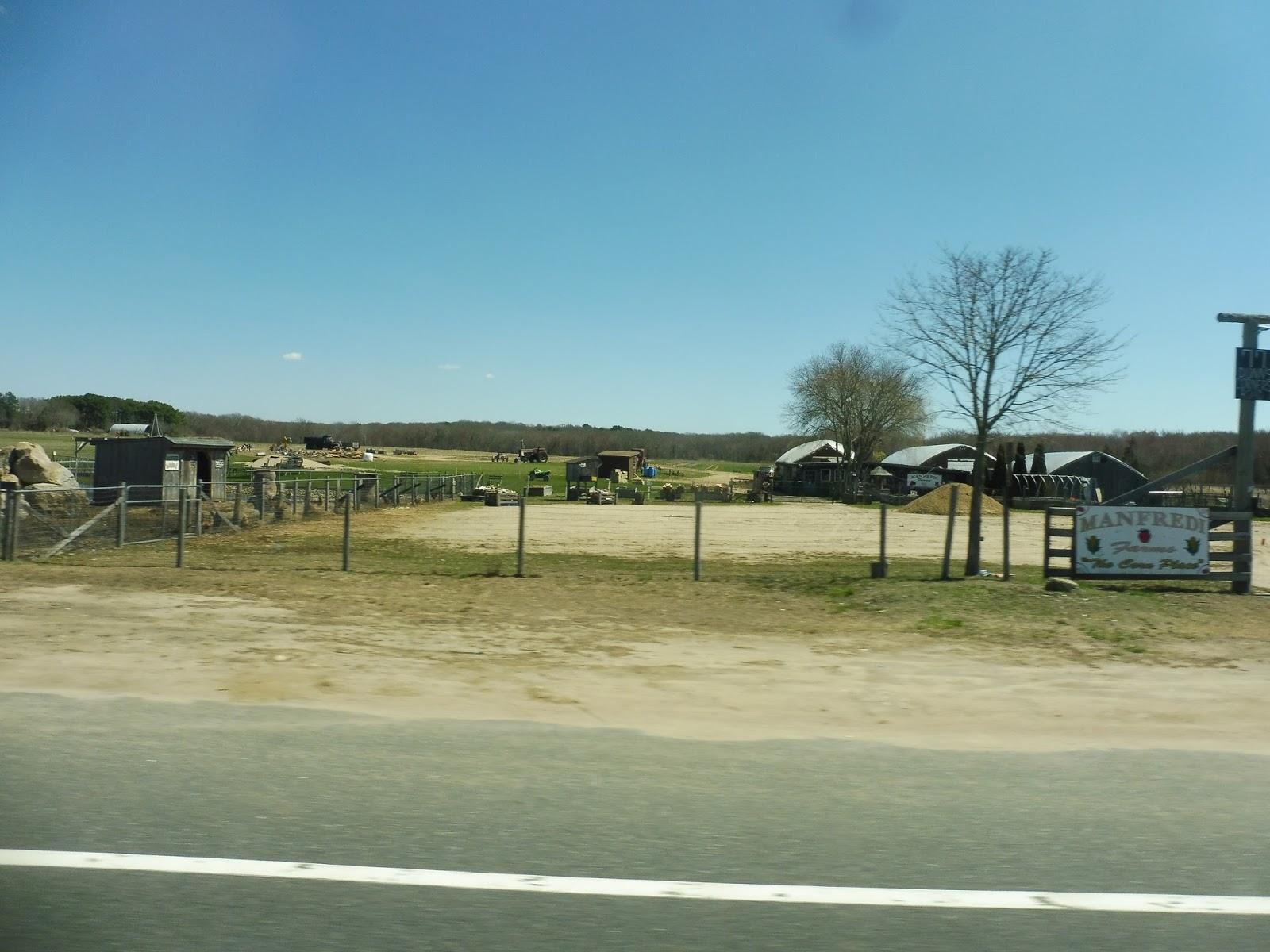
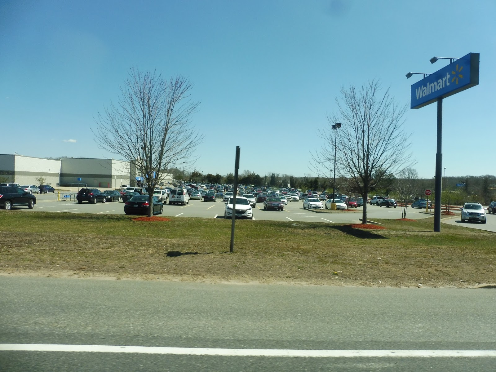
We turned onto Route 1, otherwise known as Post Road, and after some suburban businesses with big parking lots, it got more residential. We passed Westerly State Airport and a few random inns interspersed between the houses, then it became businesses once again. At this point, we deviated to serve Walmart, the next “Flex stop” on the route.
 |
| Howdy, Walmart. |
We continued down Post Road from there, and it was mostly woods, but there were a few random houses mixed in at various points. As we entered Charlestown, there was a section where the houses got slightly denser, and there were even a few businesses mixed in…including a minigolf course! We passed a surprisingly large amount of motels, as well.
 |
| Nice view! |
There was a long section of woods that lasted until we got to the more developed part of Charlestown. However, we didn’t serve any of it, barrelling through on Route 1 – some businesses were visible from the road, though. As we entered South Kingstown, it became Commodore Perry Highway…and the scenery got a lot more boring.
 |
| *yawn* |
For what seemed like hours, the bus was just running through endless forest, with only a few random buildings breaking it up on occasion. While there certainly is charm in woods and farms, the speed and warmth of the bus led Nathan to fall asleep and rendered me barely awake…I just robotically took pictures whenever it seemed fit. Thank goodness it eventually got interesting again.
 |
| Here we go! |
Route 1 went up onto a bridge and crossed over Silver Spring Cove, offering a view of the boats parked at the marina of the same name. The gigantic South County Hospital was visible to the north, then a lot of development surrounded the road but trees mostly blocked the view. We headed up the highway for a while before deviating to serve the Stedman Center, some sort of government office.
 |
| This place gets a Flex stop? |
For the record, I asked the driver if this place ever gets any people, and he said no…so yeah, how about not serving it? That would be efficient! We returned down the highway for a bit, but this time we got off at Old Tower Hill Road. This took us past the Wakefield Mall (although the Flex doesn’t stop there) and a bunch of other suburban businesses with parking lots.
 |
| The Wakefield Mall. |
Okay, this next bit was kinda weird. We turned onto Cherry Lane, a residential street behind a shopping plaza, and waited outside of a house for a while. “Someone always gets on here,” the driver said, “let’s try calling him.” Okay…I was under the impression, based on the schedule, that this area was out of the “Flex Zone,” so I’m not sure how someone could have flexed here once, let alone “always.” I guess it was nice that the driver tried to call, but there was no answer, so we continued along our merry way.
 |
| A residential street. |
The road became Robinson Street and curved westward, crossing over a bike path that eventually leads to Kingston Station. Next, we turned onto Woodruff Ave, which was entirely lined with houses. It stayed residential until a small office park, then we crossed over Route 1. Right after that, we turned into Salt Pond Plaza, where Nathan and I got off to catch another bus back to Providence…and civilization.
 |
| The bus at the mall. |
RIPTA Route: 204 (Westerly Flex)
Ridership: It’s hard to judge the ridership of the 204, since the RIPTA doesn’t have any public information on it, so I’ll have to base it off of our trip. Overall, there were five other passengers in total – they all got on at Westerly Station, a scheduled Flex stop, and got off either at Walmart or Salt Pond Plaza (both scheduled Flex stops). Sensing a pattern? Yeah, something tells me people prefer getting a scheduled route without any hassle instead of having to call RIPTA at least a day in advance…
Pros: I believe that Westerly is a substantial enough town that it needs public transportation, and as limited as the Flex is, at least it’s something. So yes, that’s my pro: it’s a bus route in Westerly.
Cons: The thing is, it doesn’t seem like too many people use the Flex for its, you know, flexing. Everyone got on or off at the scheduled stops, which I think shows that Westerly needs a fixed-route service instead of this barebones Flex route. You could run it with this same minibus, since I’m sure ridership would be only slightly higher, but a fixed-route is so much easier for passengers than the annoying “call on the day before” mentality that “flexing” the Flex requires.
Nearby and Noteworthy: I’ve said it before, I’ll say it again: Westerly is a great town. The central area is thriving and really interesting, with a bunch of diverse businesses. Amtrak is definitely the fastest way of getting here from Massachusetts, but the town could still use a bus route within itself…
Final Verdict: 3/10
It’s good that Westerly at least has one (weekdays-only) bus route, but from what I’ve gathered, people really only use this during the rare times that it actually has scheduled stops…and those times are indeed rare. It boards at Westerly Station and Walmart four times per day, and travels out to Salt Pond Plaza three times per day. Why not serve it all at consistent intervals by making this a fixed-route? Like this:
Yes, it’s every 2 hours…but unlike the current Flex route, this one has a consistent schedule, so it will allow people to actually rely on the bus coming. I have it serve Charlestown as well, since the route currently just blazes by there, and I got rid of Stedman Center service since it seems that not many people use it. Plus, the fact that the route is still using just one minibus means that it costs about the same amount of money to run as the current service. Yay!!
Latest MBTA News: Service Updates
10 “Boston Landing” Comments
So…my Boston Landing review kinda blew up. Thanks to posts on Universal Hub and Reddit, the post has gotten almost 3500 views in a few days! First of all, I want to thank everyone for reading, and welcome those who might be new – I hope you stick around. The exposure has also resulted in a bunch of feedback, and I found some pretty interesting comments. Let’s take a look at 10 of my favorites, eh?


2. On the topic of Allston, I got a good amount of comments regarding my description of the neighborhood Josh and I walked through. Hey, I’ve got nothing against Allston itself…but that neighborhood just to the east of Boston Landing is disgusting. I stand by that!
3. Alright, yeah, it was a pretty minor digression in the post when I said I was digressing, I’ll give you that one…

4. As it turns out, I really like my exclamation points. What can I say? They’re fun to use and add spunk to an otherwise boring sentence! That one in my reply is semi-ironic…

5. I have no idea who you are, Doctor of Taste, but your comment is amazing.

6. This thread led me to think about my writing style, and to be honest…I will continue writing “like a high school kid.” Because you know what, I’m talking about things that most people find boring. If I don’t make the posts conversational and enthusiastic, who would care outside of the hardcore transit fans? I’m not trying to write a professional blog or anything – my goal is to entertain you all while writing about what I love!

7. A whiny twit, eh? Well, it’s better than a “f***ing dweebus,” as one fellow who later deleted his comment called me. I also have to admire kittyscherbatsky for digging deep into the archives to find the super old posts where I talked about riding buses with my dad. Now there are some poorly-written reviews…

8. Um…no, I gave the station a 7/10. I don’t believe that constitutes as “sucks so bad”, last time I checked.


10. And finally, the true standout of these negative comments: someone took the “Cons” section completely out of context and wrote snarky parenthetical remarks to each sentence. Ahem…
- Yes, I have been to Ruggles, as another commenter pointed out.
- My complaints about the schedule regard consistency. Why provide all-day weekend service while leaving a huge hole in midday weekday service? The “Dictate!” bit is interesting, too…of course I don’t have the power to change the schedule, but I can at least show enthusiasm for the idea.
- “The cons mostly come in the forms of specific annoyances (like your review?).” Well played, well played.
- Just because many Commuter Rail staircases are falling apart doesn’t make it okay that a specific staircase is falling apart. That’s just common sense. This applies to the speaker comment, as well.
- This part about never being in a prison cell…I mean, did you read the post? How about going back and seeing what I actually mean when I refer to “prison cells”?
- “Josh needs to get a life.” So do you, buddy!
Boston Landing
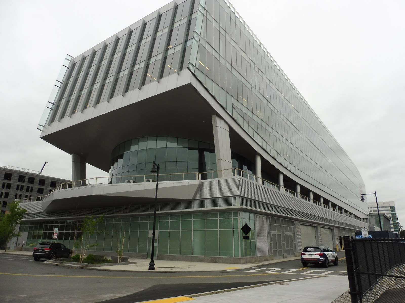
There isn’t much that’s more exciting than a new Commuter Rail station! Well…maybe a certain Green Line Extension would be nice (COUGH), but that’s not the topic of today’s post! No, today we’ll be looking at the Worcester Line’s newest infill station, located in Allston and funded by New Balance (which feels weird to say): Boston Landing! For the record, I did visit this station on the first day of service, but I wasn’t able to write the review yesterday because of an event at my school…sorry!
 |
| The station’s surroundings…from above. |
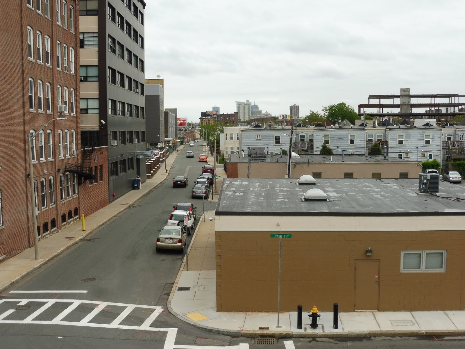
Yeah, I figured I’d mention that this station’s surroundings are…weird. I mean, Josh and I came in from the 66 to the east, and walking down Braintree Street, it was just an industrial dump. Then, all of a sudden, the buildings immediately get newer and a little less sketchy…and there was Boston Landing, right on the tracks parallelling the street!
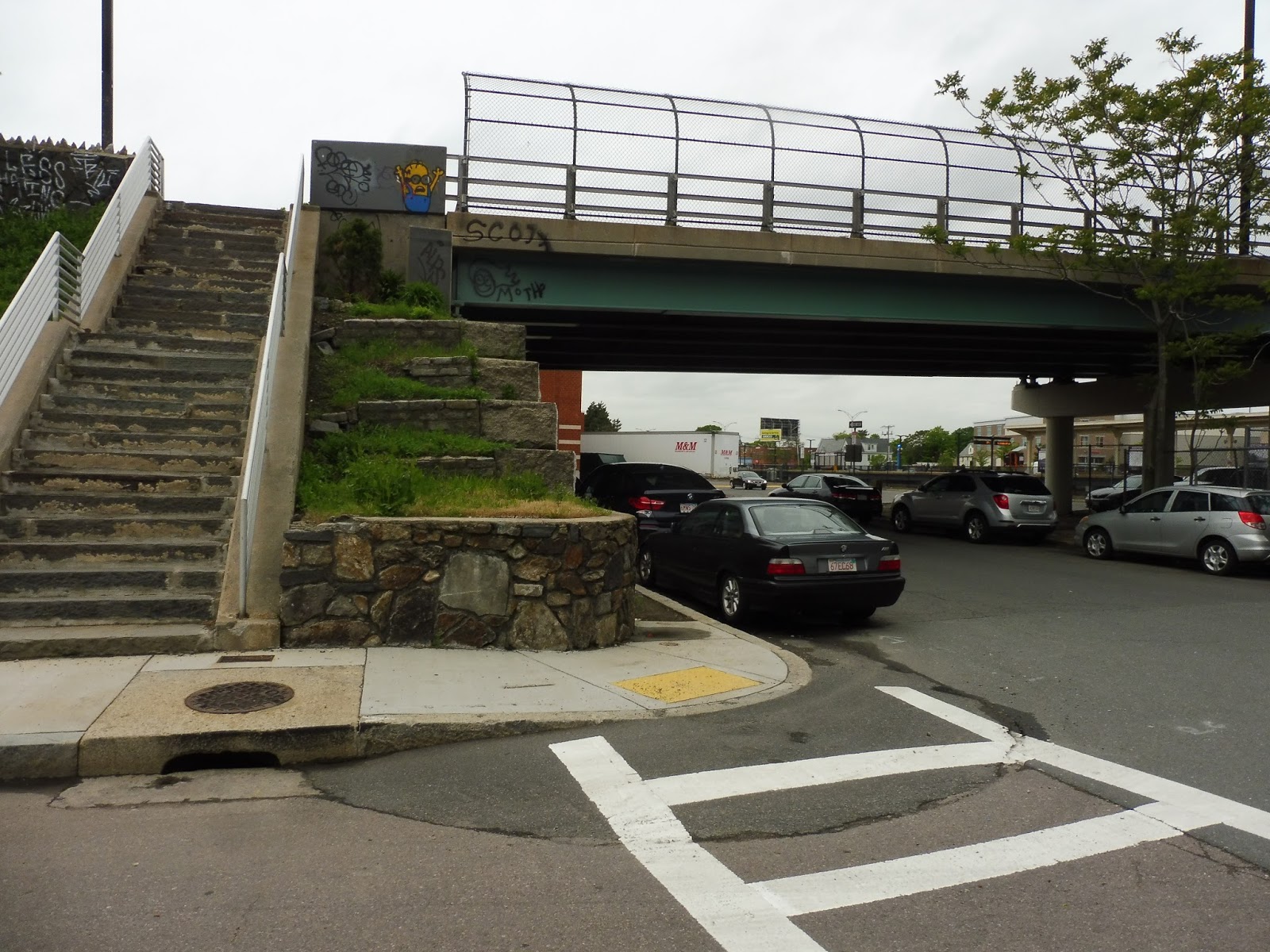 |
| Eww… |
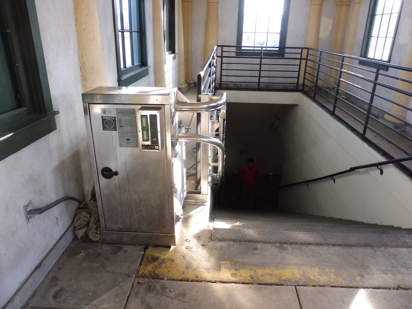
Unfortunately, you can’t get to the station quite yet. No, you have to traverse a really awful, old, decrepit stone staircase to get up to Everett Street. I know this isn’t part of the “station”, but from what I saw, a good amount of the riders came this way, so a ramp would be much appreciated…or at least an updated staircase!
 |
| Land ho! |
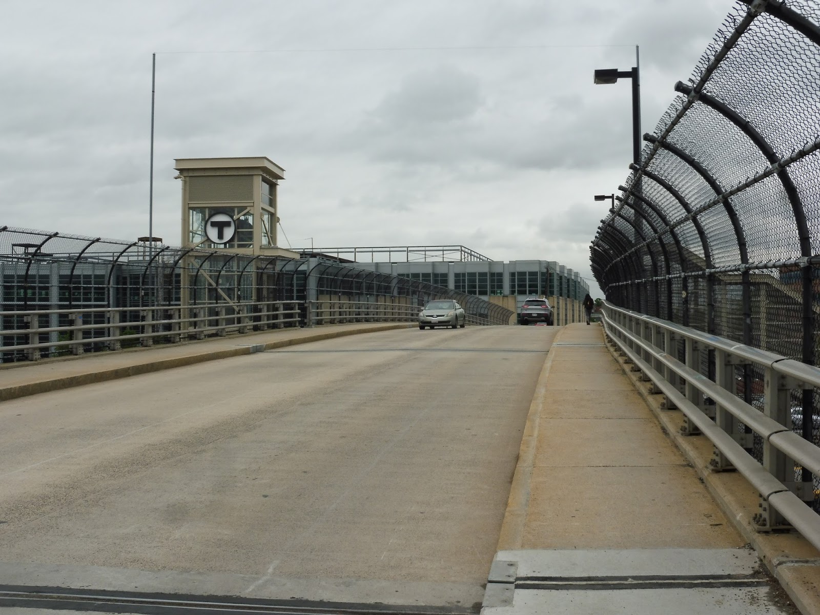
And now we finally get to the station itself. Along Everett Street, there’s an interesting setup where the elevator is on one side (with a nice T symbol!) and the staircase is on the other. The problem is that there’s no crosswalk between the two, so if a disabled person wants to cross the street to get to the elevator, they’re basically out of luck…and Everett Street can be busy!
 |
| The staircase entrance. |
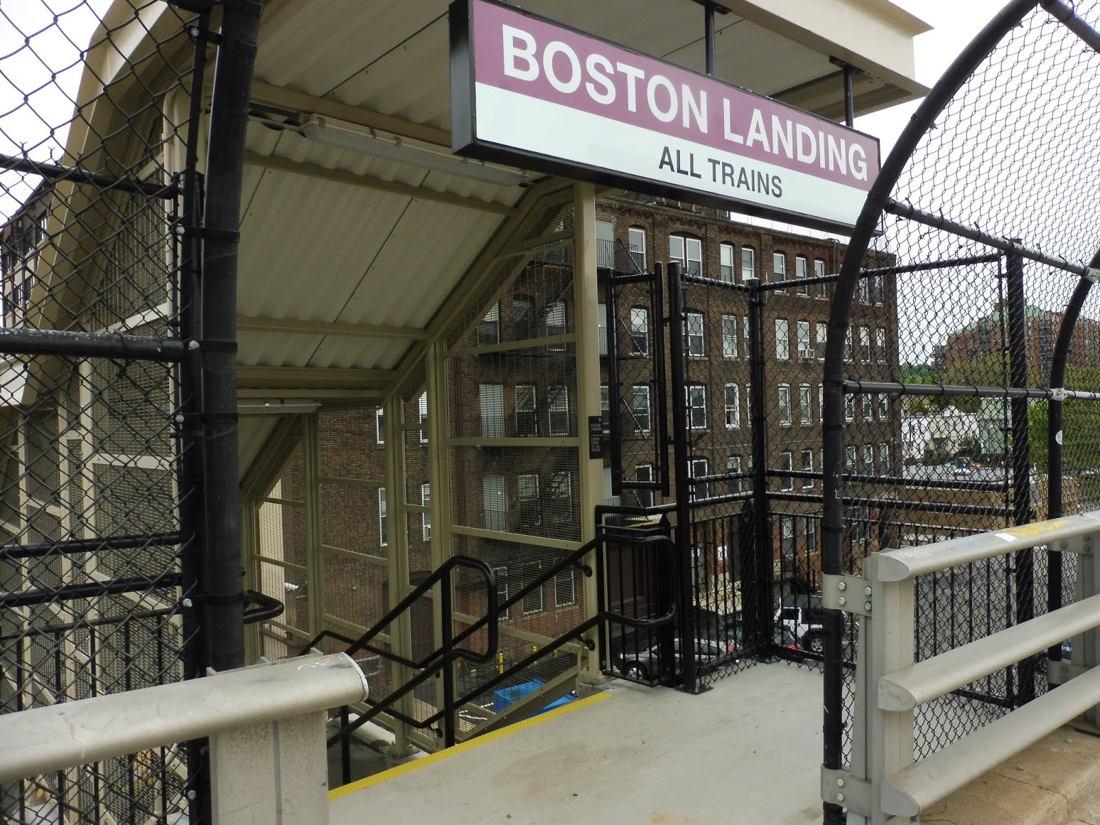
Look, this staircase is fine. It’s all sheltered, and even though the roof is kinda bland, and even though the bars on the side will probably get rusty soon, it’s a fine staircase…but come on, what’s with this entrance? Why does it shift over when you get to the top? The sign is obscured by the fence when you look at it straight on! I’m sorry, but this just looks ridiculous!
 |
| Yeah, see what I mean? Look across the street! |
Luckily, the elevator is great, at least for now. It has a lovely new smell, and the glass walls allow for a view on all sides. I do think it’s rather interesting to be in this modern glass elevator with a disgusting old factory right across the street, though!
 |
| The Everett Street end of the platform. |
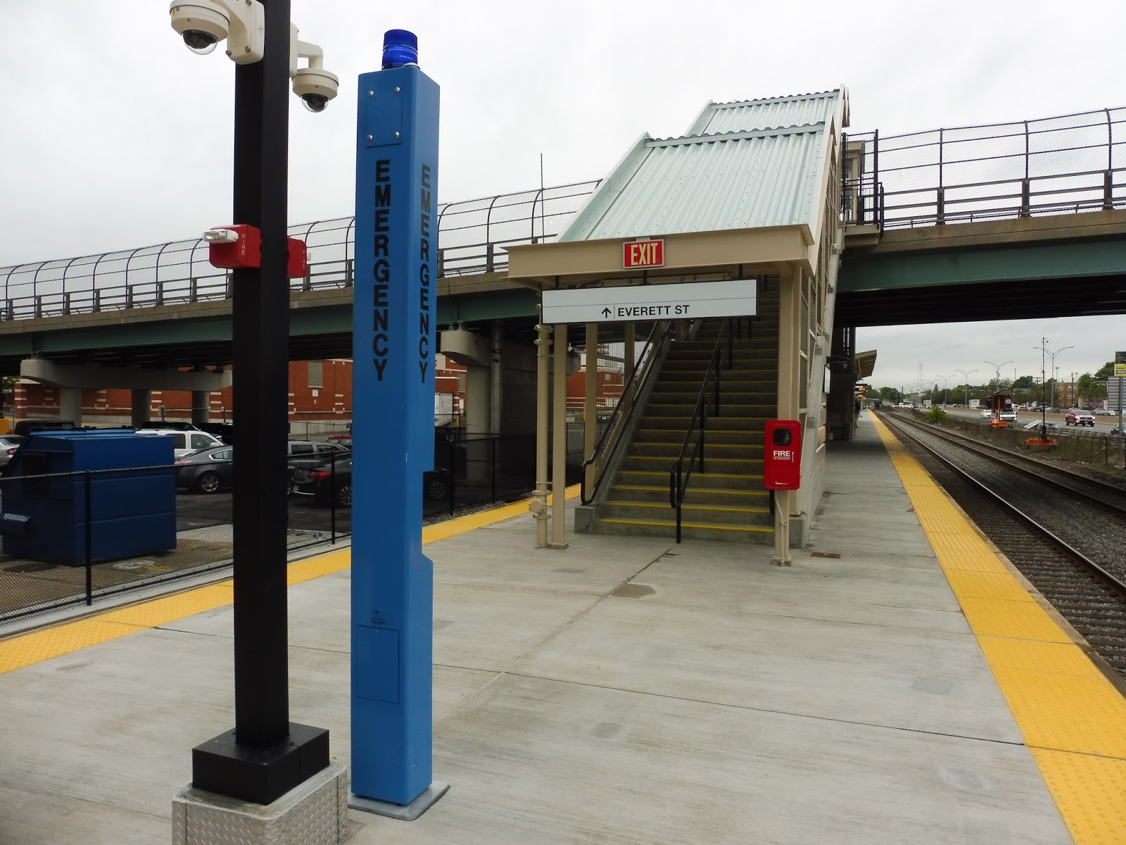
It’s kind of odd that the stairs lead to a pretty desolate part of the platform, but I guess that means better accessibility for people using the elevator…even though more overall riders will want to use the stairs, but I digress. This end of the platform doesn’t have much, but it does feature a fire extinguisher, a blue EMERGENCY pole, and fire alarms. The blue poles and fire alarms are prevalent throughout the whole station, so clearly there was a big focus on safety.
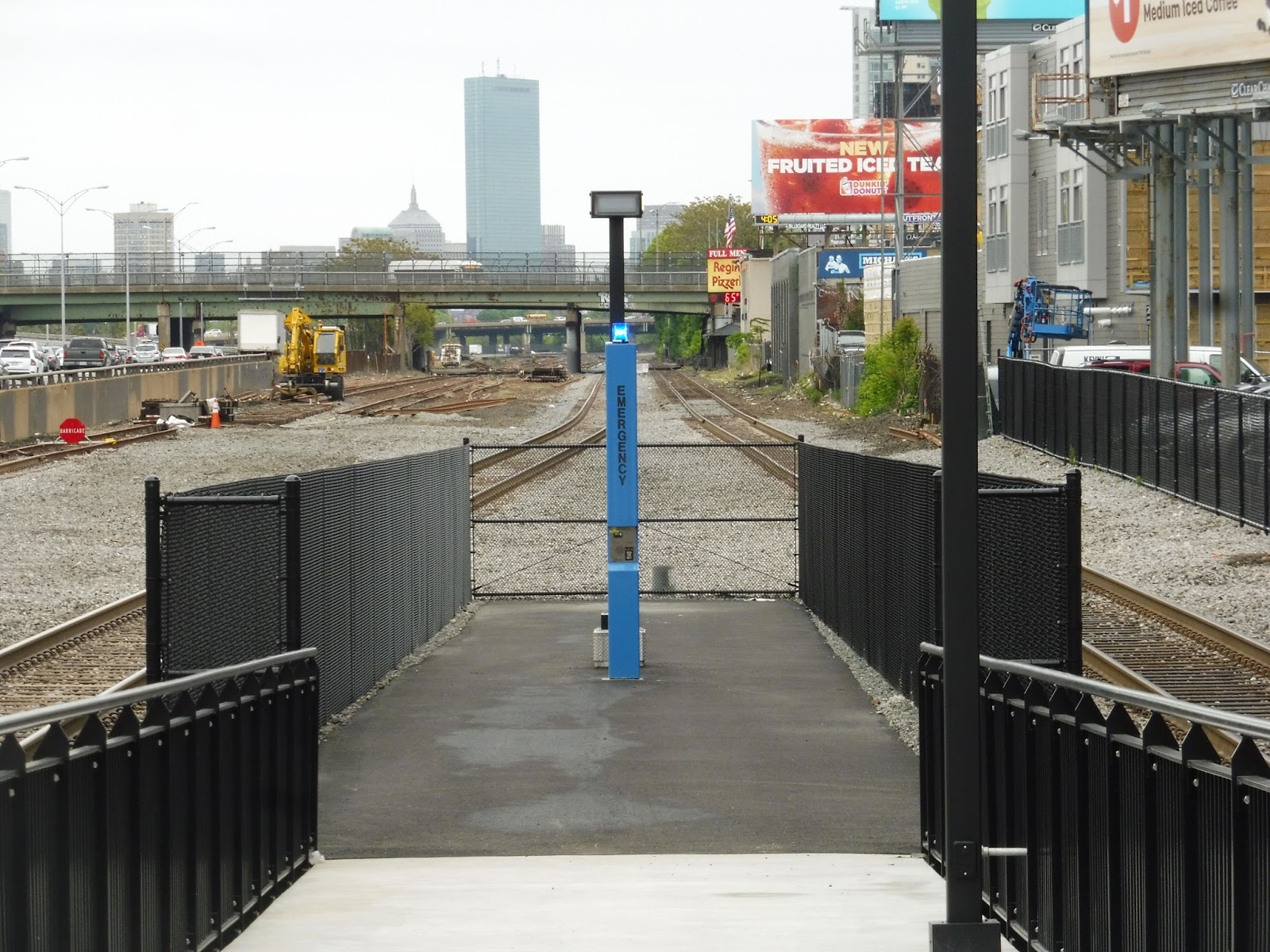 |
| Big focus on…safety? |
Okay, this is weird. Both sides of the station have “emergency exits” that feature big ramps leading to what I can only describe as “prison cells.” I mean, they’re just chain link fences with an emergency call button within, and no way to leave! The better “emergency exit” would just be to jump off the platform! At least then you could actually, you know, ESCAPE an emergency situation. I’m sorry, but I cannot see the point in these prison cells that offer barely any protection from the disasters that would necessitate their usage.
UPDATE (5/24): The “jail cells”, otherwise known as “areas of refuge,” are apparently required by code, due to the fact that Boston Landing lacks a sprinkler system. They still seem pretty useless, but thanks to Dave’s blog for the information!
 |
| Looking down the platform. |
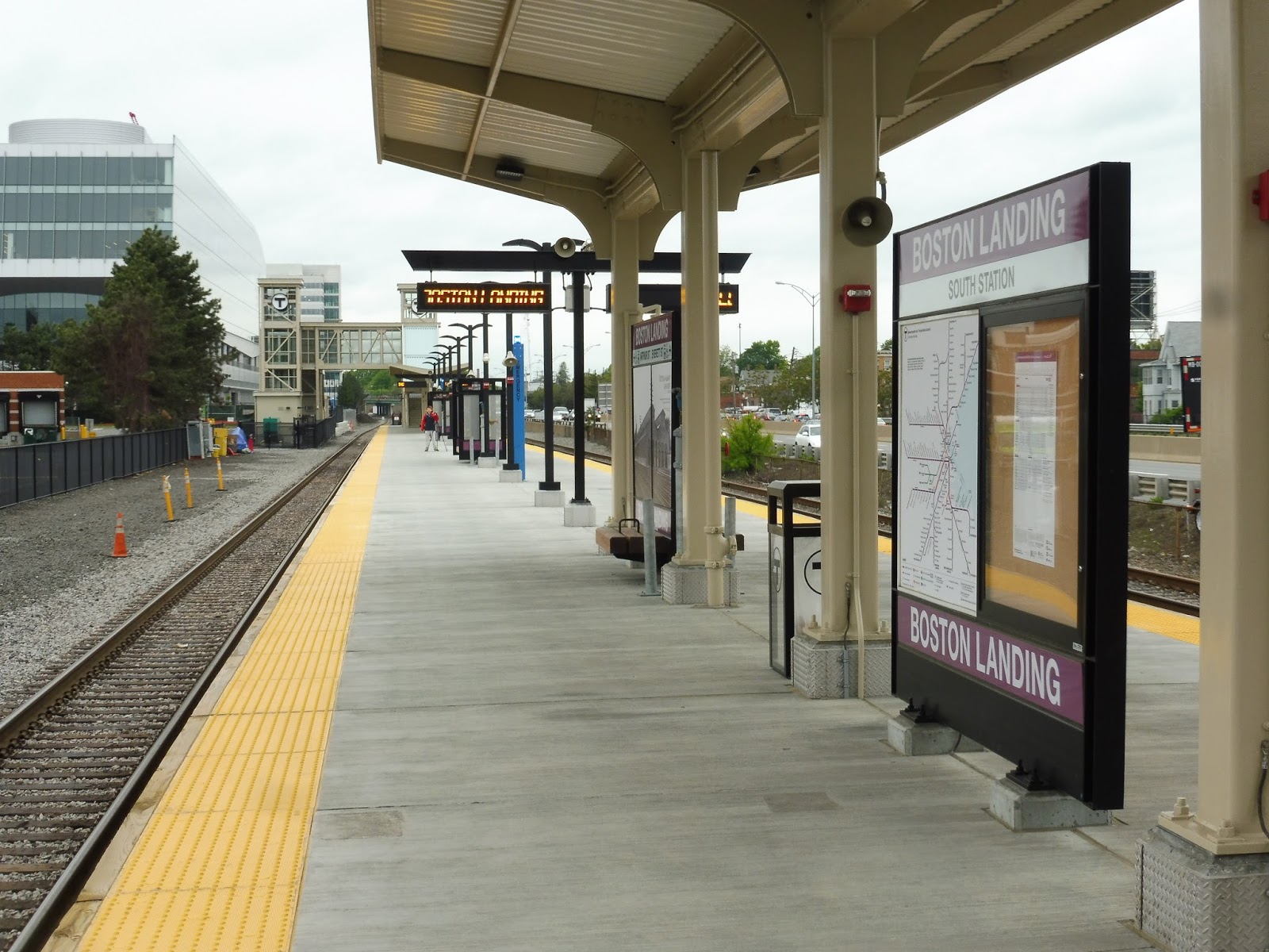
Okay, luckily the platform itself is great! Sure, it’s not the most exciting station in the world, but it’s nice and modern with a fully high-level platform. There are shelters that run for a bit next to each entrance, and they have benches and wastebaskets underneath. More benches sit out in the open area too, but they’re probably less likely to be used. Also, there’s a speaker system that reads out what the electronic signs say, but the audio quality is terrible!
 |
| Sweeeeeet! |
Other amenities on the platform include updated maps with the new station included, as well as some really neat historical photographs. It’s always sad to see how beautiful this corridor was before I-90 came barreling through (the highway makes for a noisy presence at Boston Landing), while there are also some amazing old streetcar shots! Additionally, I only found one grammatical error in the text, so…yay?
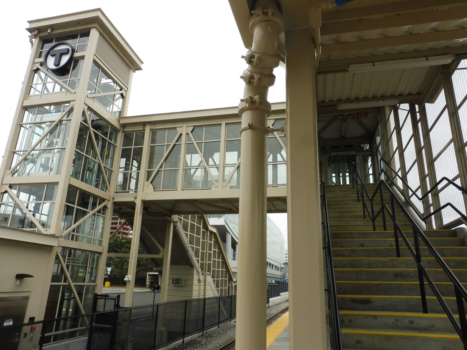 |
| The station’s footbridge. |
The other side of the station offers a second entrance, leading to the its main attractions: the New Balance building and the Warrior Ice Arena. This entrance consists of a footbridge over the inbound track, with stairs and elevators leading up to both sides. I can tell you that the elevators were both clean and modern, while the stairs were…well, perfectly fine stairs.
 |
| The second entrance. |
This entrance plays host to an emergency light, a wastebasket, and a rather nice sheltered bike rack with a bunch of spaces! Surprisingly, someone actually had a bike in there on the first day. A concrete path leads to another Boston Landing sign, complete with a…really squashed schedule. I mean, it looks awful, and they only squashed it to be able to fit in a “See something? Say something!” sign…
 |
| The huge New Balance building. |
This station is, of course, primarily meant to serve some vast new developments that have been built in the area…after all, New Balance was the company that funded it! Their building is beautiful, and it already seems to be a pretty big hub of activity (aside from the incredibly overstaffed New Balance store inside, but…oh well). Hopefully as the development grows, so will station ridership and train frequency!
 |
| The platform…from above! |
 |
| An outbound train leaving. |
Station: Boston Landing
RIPTA: 301 (Westerly/Hope Valley Rural Ride)
Sorry for the lack of posts, everyone! AP tests and SAT tests fell in the same week, so that was a big drain on my time…but now everything’s done and I can work on the blog again! Finally, it’s time to look at the RIPTA 301 – possibly the strangest public transit route in my jurisdiction. There’s a lot to talk about here…
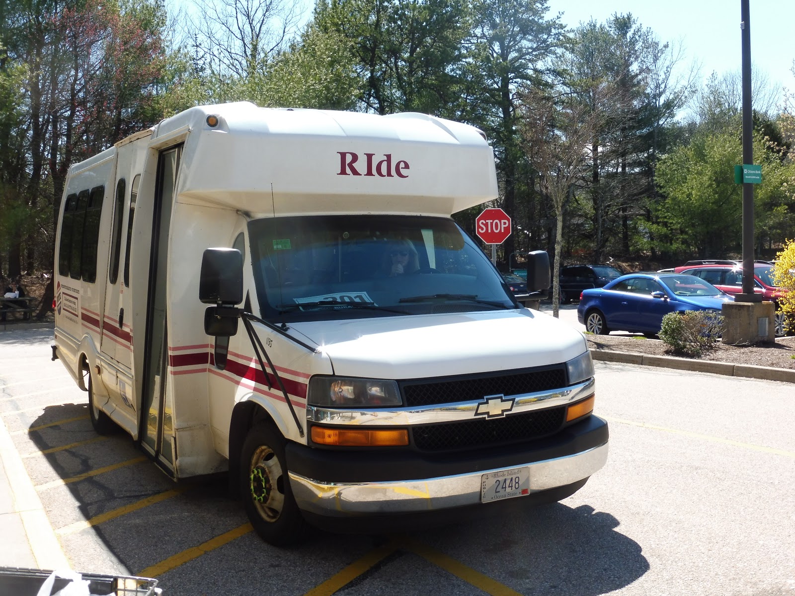 |
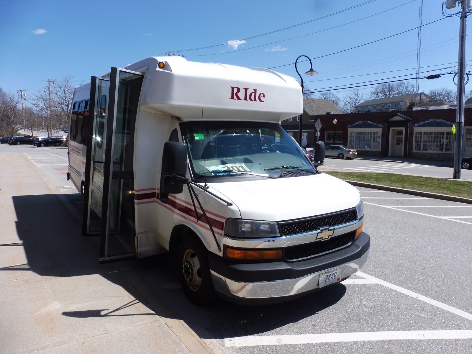
| That’s right – the Rural Ride isn’t even dignified with a proper bus! It just gets a “RIde” paratransit vehicle… |
How do I explain something as weird as the Rural Ride? Well, the route only runs on Fridays, and it only has one round trip and some change: an outbound from Westerly, an inbound back, and an outbound that traverses most of the route but not all of it. This truly is a “rural ride,” running through some very middle-of-nowhere parts of southwestern Rhode Island. Who could possibly use such a thing? Well…
 |
| The inside of the bus. |
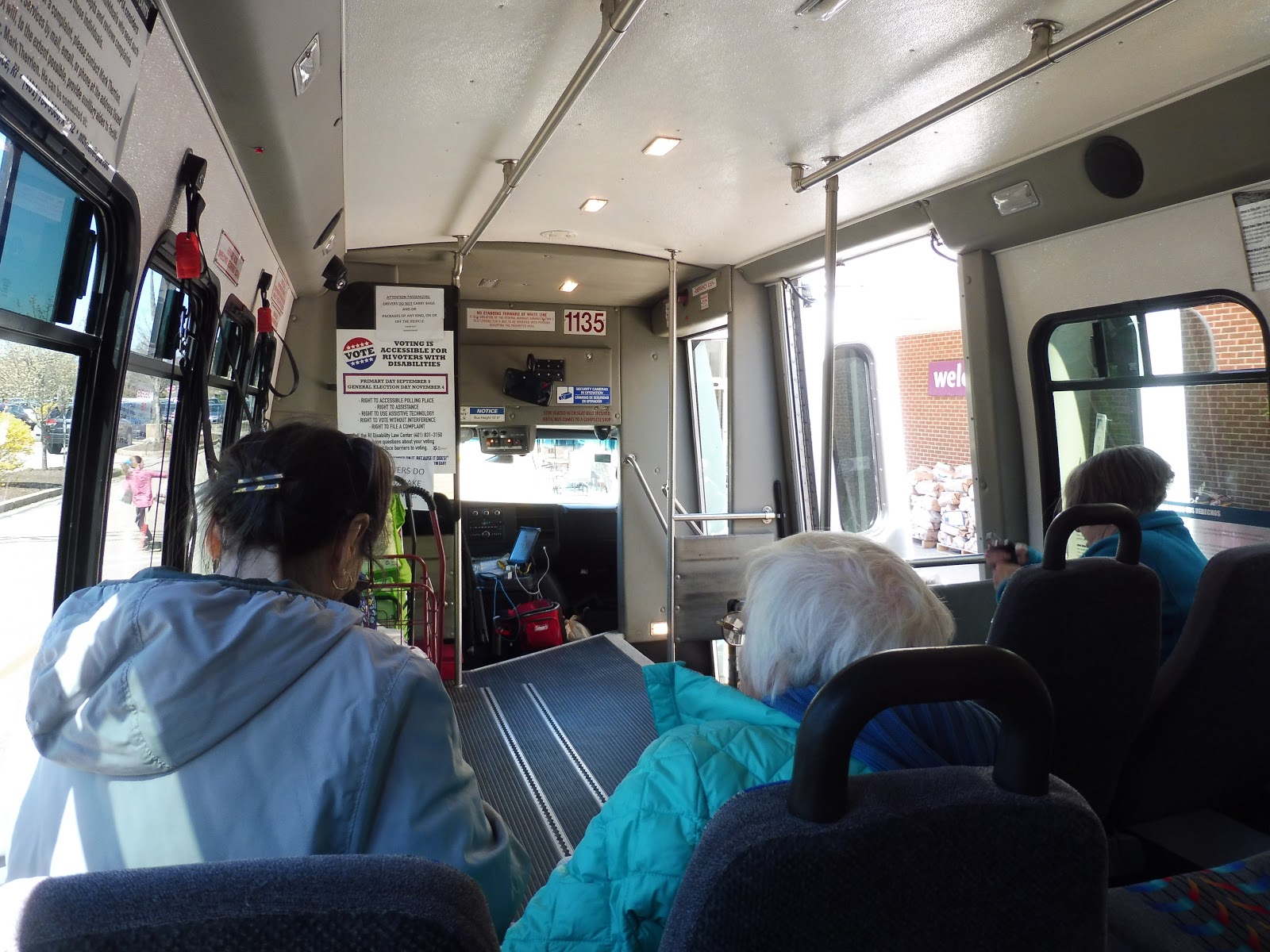
The trip started with a bang as the bus pulled into the Stop & Shop parking lot in Richmond. (How did we get there? Find out!) “You two are men,” the driver shouted to Nathan and I from the bus. “Help the ladies with their bags!” We helped the four old ladies waiting there put groceries into carts for the bus, then they each used the wheelchair lift one by one to rise into the vehicle. Once everyone was on board, the driver brought around a paper bag and we all put our money in. This was just the strangest start to any bus ride I’ve ever taken…
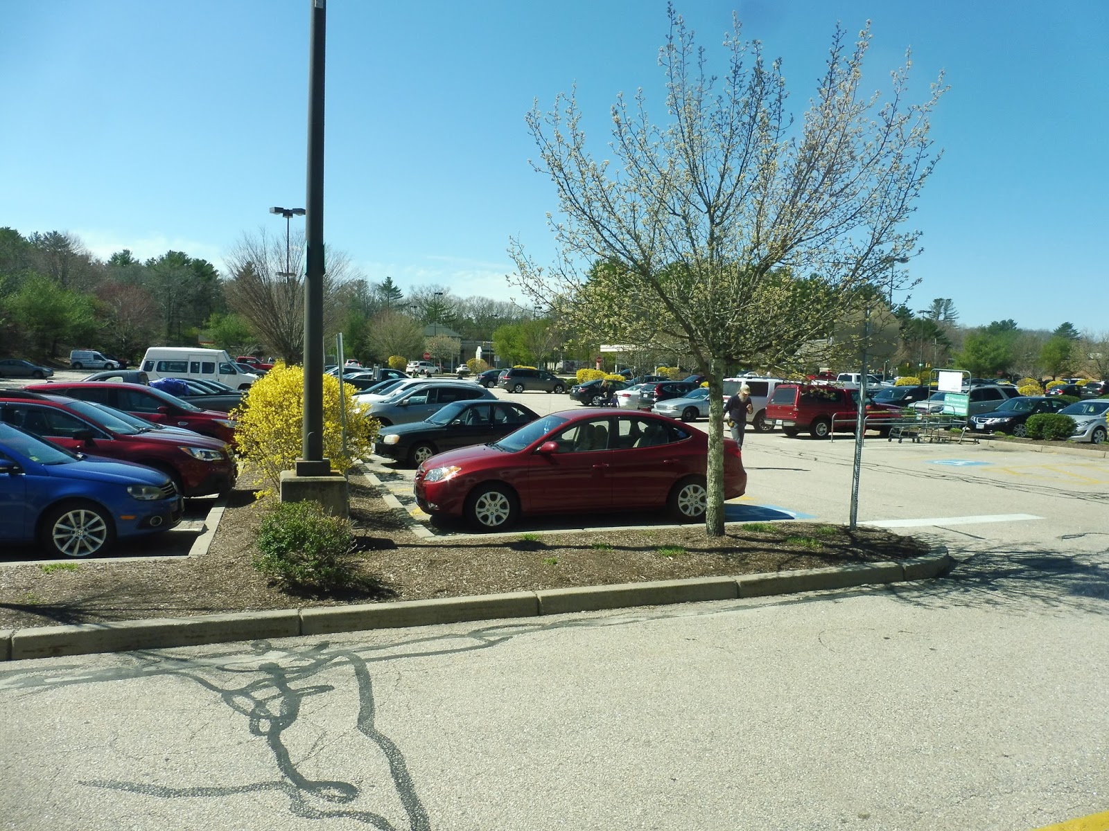 |
| The beautiful Stop & Shop parking lot. |
We left the Stop & Shop once all the ladies were settled in and the carts were in place, and we headed down the wide Kingstown Road. After going by a little park-and-ride for the 95X to Providence (it wouldn’t be our first encounter with that route), we went under I-95 and the street became Main Street. Still lots of suburban businesses with huge parking lots everywhere, though…
 |
| It gets more scenic later on, I promise! |
We merged with Nooseneck Hill Road (very interesting name) and passed some baseball fields as the other side of the road was lined with houses. There were also a few businesses mixed in there, like “Ma and Pa’s Country Store,” as well as a post office. This was technically a “downtown,” you see – Hope Valley.
 |
| A street in Hope Valley. |
There were a few more businesses and a fire station before we left Hope Valley and the surroundings became mostly woods with spread-out houses. It was starting to get truly rural, as the route name suggests, although there were still little bursts of civilization. For example, there was an auto shop, a housing development, and a golf course all in quick succession…but they were followed by a huge field and some woods, so I guess it evens out.
 |
| Rollin’ through the forest… |
All of a sudden, we made a turn into a deviation, serving a clinic called Wood River Health. Next, we pulled into the Canonchet Cliffs housing development, and this is where we dropped off two of the ladies on board. They used the wheelchair lift to get off the bus, taking their carts with them, and then we arrived at an intersection within the development and waited.
 |
| That’s a sharp turn!! |
“She said she was coming,” the driver said. “We’ll wait here a few more minutes.” All of a sudden, another old lady came speed-walking from her apartment to the bus. “I forgot my keys!” she said, “I had to run back and get them!” With a new passenger on board, we continued the deviation, dropping off the remaining passengers at Canonchet Cliffs II and picking up another old lady, then we returned to Nooseneck Hill Road.
 |
| Coming back to the main road. |
For a while, it really was just unspoiled woods, broken only by the occasional house or farm. Eventually, a single business – the Hopkinton General Store – and a weird sideways traffic light announced our arrival into “downtown” Hopkinton. It barely felt like a downtown, though – there were no other businesses, and the only other points of interest were a post office and the “town clerk.”
 |
| A rearview shot of the empty road! |
Here in Hopkinton, we merged onto the very narrow and very badly-paved Townhouse Road, taking us to Saugatucket Springs, an apartment building. We looped around the entrance to the building but didn’t pick anyone up, so we returned up the narrow street and made a sharp turn to get back to Nooseneck Hill Road. After a few industrial buildings, we went by another park-and-ride for the 95X and crossed over I-95.
 |
| This is about the extent of downtown Hopkinton… |
There were more woods on the other side of I-95 that continued for a while until we entered another village of Hopkinton: Ashaway. Suburban houses lined the street for a bit, then there were a few lame businesses with parking lots out front. Next, we turned onto Ashaway Road, which featured – surprise! – more woods.
 |
| A curvy intersection. |
After going under some telephone wires, we curved eastward, where we got to see some houses. There was a little grocery store and a gas station near the next intersection, at which we turned onto Main Street. We entered Westerly here, which is apparently a GIGANTIC town because we were NOWHERE NEAR the end of the route!
 |
| Well, isn’t this nice! |
After crossing the Pawcatuck River, we ran alongside it for a bit with a huge factory on the other side. We were also in another village: Bradford, to be exact. It wasn’t much of a village, though – there was only a pizza place and a post office, and that’s about it. We crossed over the Amtrak tracks on Bradford Road, and there were a few auto shops and a school on the other side.
 |
| In the middle of a complicated intersection. |
We continued down Bradford Road, where for possibly the first time on the entire route, the houses were actually consistent. Aside from a big field, the houses were evenly spaced for the most part. We passed through a complicated intersection with Westerly-Bradford Road, which leads directly to downtown Westerly, but we had a while to go on our route before we could get there…
 |
| Down on the farm! |
Our street, meanwhile, became Dunns Corner Road, and it was lined with all manner of houses, parks, and farmland. There was even a road leading to what appears to be a gigantic trailer park complex. After all that, though, the ruralness of the Rural Ride ended IMMEDIATELY when America’s favorite big box store came out of nowhere – hi, Walmart!
 |
| Hooray… |
We entered the parking lot, and this was where the two old ladies still on the bus finally got off. Now it was just me and Nathan, and it would stay like that for the rest of the trip to Westerly. Leaving the parking lot, we made our way onto Route 1 (Post Road), which was lined with a bunch of suburban businesses with parking lots until it got more residential.
 |
| An airport! |
Aside from the houses, we also went by some sketchy motels, a middle school, and Westerly State Airport, which actually does have a scheduled flight – New England Airlines to Block Island! Right after the airport, there were businesses with parking lots all over again, including some malls. We directly served one of them, Franklin Plaza, although the timepoint on the route calls it “Aldi’s Grocery.”
 |
| I miss the farmland… |
 |
| A local side street. |
After that deviation, we headed down State Street, then turned onto Beach Street outside of a shopping plaza. The road was mostly residential, but there was a factory outside of which Beach Street curved northwest. We then turned onto Main Street, which paralleled the Pawcatuck River (but we couldn’t see it) and was pretty darn industrial.
 |
| There’s kind of a view down there…? |
Due to one-ways, we eventually curved onto Union Street, then High Street, taking us through downtown Westerly. There were businesses on all sides of many different shapes and sizes, and they continued as we turned onto Canal Street. This took us up to the Amtrak station, where we made our way into the busway, ending this very long route.
 |
| I love the sad “301” in the window… |
RIPTA Route: 301 (Westerly/Hope Valley Rural Ride)
Ridership: In total? Six old ladies. And it’s the same six old ladies every week! The driver said it can go up to as much as 16 in the warmer months, but the point stands that ridership is low…and consists entirely of old ladies wanting to get out of the house. All of the ridership went from the Canonchet Cliffs complex to either the Stop & Shop in Richmond or the Walmart in Westerly.
Pros: This is the only way for these senior citizens to be able to get out of the house. Every week, Fridays only, the little 301 comes to give them a chance to escape the dreary lifestyle of a housing development in the middle of nowhere and go shopping. It’s truly a bus route like one I’ve never seen before…
Cons: The problem is that it works horribly as a bus route! The one-way trip is almost an hour and a half long! The ridership is incredibly low! The schedule is extremely limited! I mean, for all intents and purposes, as a route, RIPTA should have eliminated this thing long ago!
Nearby and Noteworthy: Yeah, well…the Rural Ride definitely lives up to its name. There aren’t any places on the route really worth visiting, but the ride itself is very pleasant! You really do go through the middle of nowhere, and the ladies that ride the route are very nice.
Final Verdict: 3/10 for the route, 8/10 for the concept
This isn’t just a bus route – this is a lifeline. For the people living in Canonchet Cliffs, the 301 is the only way to get out and see the world. But the problem is that…well, it’s also a bus route. And it’s a really bad bus route with low ridership, low frequency, and low efficiency. Here’s the thing: the 301 should not be RIPTA’s problem. This should just be a shuttle from Canonchet Cliffs that runs to Stop & Shop and Walmart. Maybe they could run it to each location on different days to give people more days to go out! Please, Canonchet: take this away from RIPTA, because if they eliminate the route, it will have a tremendous, negative impact on these people’s lives…and they have every reason to eliminate it from an operational perspective. It’s a lifeline…it’s a really important lifeline.
Latest MBTA News: Service Updates
Rural Ride Video!
The Rural Ride video is finally out! Does the most elusive bus route in my jurisdiction even exist? Find out here!!
Westerly (Amtrak)
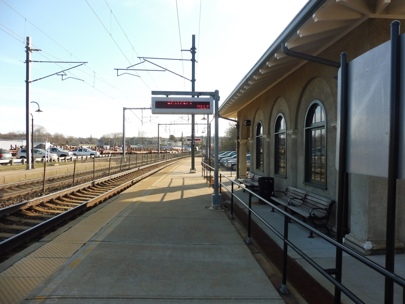
Wow, talk about a missed opportunity. Westerly has some of the most beautiful architecture I’ve ever seen at a small-town stop, yet the buildings have all fallen into disrepair. Indeed, the main building has what looks like an amazing interior, but it was…closed by Amtrak in October? Actually, no, this isn’t a “missed opportunity” – it’s a station that willingly shot itself in the leg!
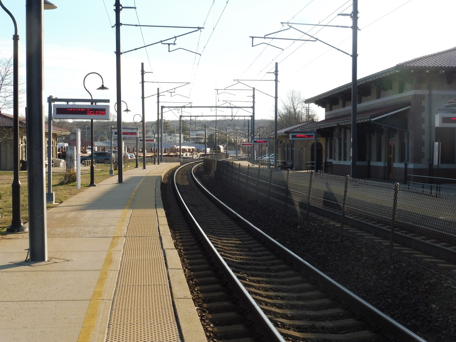 |
| Looking down the platform. |
Well, the first thing I noticed about the platform is that it’s entirely low-level. That’s right, there’s not a single mini-high platform here! Sure, the Amtrak website claims this place has a wheelchair lift, but the only one Nathan and I could find was a stationary one on the northbound side that didn’t appear to be movable! THIS SEEMS PROBLEMATIC…
 |
| It looks great until you notice the trash can… |
The only kind of waiting facilities on the outbound platform are two benches under a small building – the rest is all bare. Still, one can’t help but admire the beautiful architecture of this building! I love all the arches and columns, and that roof looks great, and…hang on, when’s the last time that trash can was emptied? WOW, that is absolutely disgusting!
 |
| This feels so weird… |
Look, I’m sure the inside of this building was incredible when the station was in its prime. Now, though…well, you can see that it’s not in the best condition. There’s paint peeling from some of the columns, while litter occupies the corners of the room and a pungent smell fills the air.
 |
| Is that the ghost of Westerly Station at the bottom of the stairs? No, it’s Nathan! |
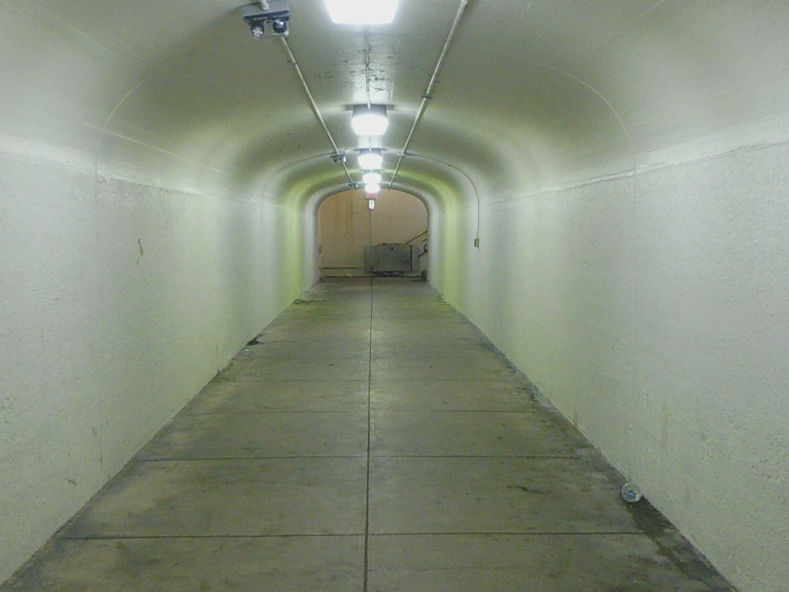
This building also houses the entrance to the “Westerly Subway,” which is just an underground passage to get between the two sides of the station. Interestingly, the staircase features a wheelchair lift that travels along the railing! The only problem is that it doesn’t work, and based on the rust it’s acquired, it seems like it might never work…
 |
| Ehhh… |
The tunnel definitely lacks the nice architecture we’ve been seeing in the rest of the station. I mean, this is just a bland, musty, echoey hallway that continues to harbor that awful smell from the building above. When you get to the other side, there’s another staircase with an old wheelchair lift – we were able to find on the lift that it was built less than 20 years ago, in 1998.
 |
| The entrance to the other building. |
The building on the northbound platform is even worse than the southbound side – this one doesn’t even have room to stand! It’s just the staircase, leading to a surprisingly modern-looking wooden door. But as for the rest of the building? Nope, like the other one, the architecture is beautiful, but it has certainly seen better days. Don’t get me started on the gigantic pile of clothes hiding behind the door…
 |
| The northbound seating arrangement. |
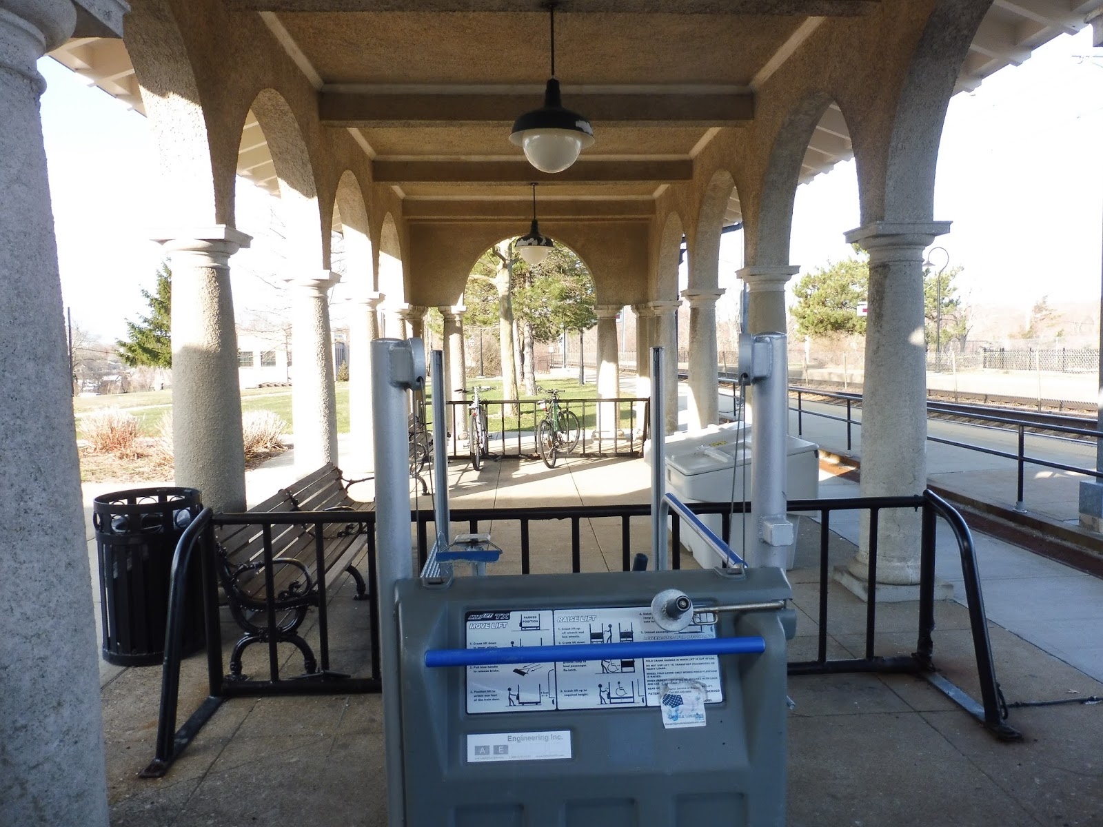
Alright, now the seating arrangement alongside this little building is just stupid. Look, there are a few benches and a wastebasket, but they’re separated from the platform by a railing! You have to walk all the way to the end of the building in order to step onto the darn platform! Also, see that payphone sign in the background? Yeah, there’s no payphone. False advertising, Westerly!
 |
| The sheltered seating area. |
At least the northbound side does have a proper waiting area, though. I mean, look, there’s a nice shelter, a wastebasket, some benches, and a good amount of bike racks! There’s also that wheelchair lift that doesn’t seem to be movable…but other than that, I think this place is pretty goo- HANG ON, IS THAT ANOTHER RAILING BLOCKING THE WAY TO THE PLATFORM?! OH, COME ON!
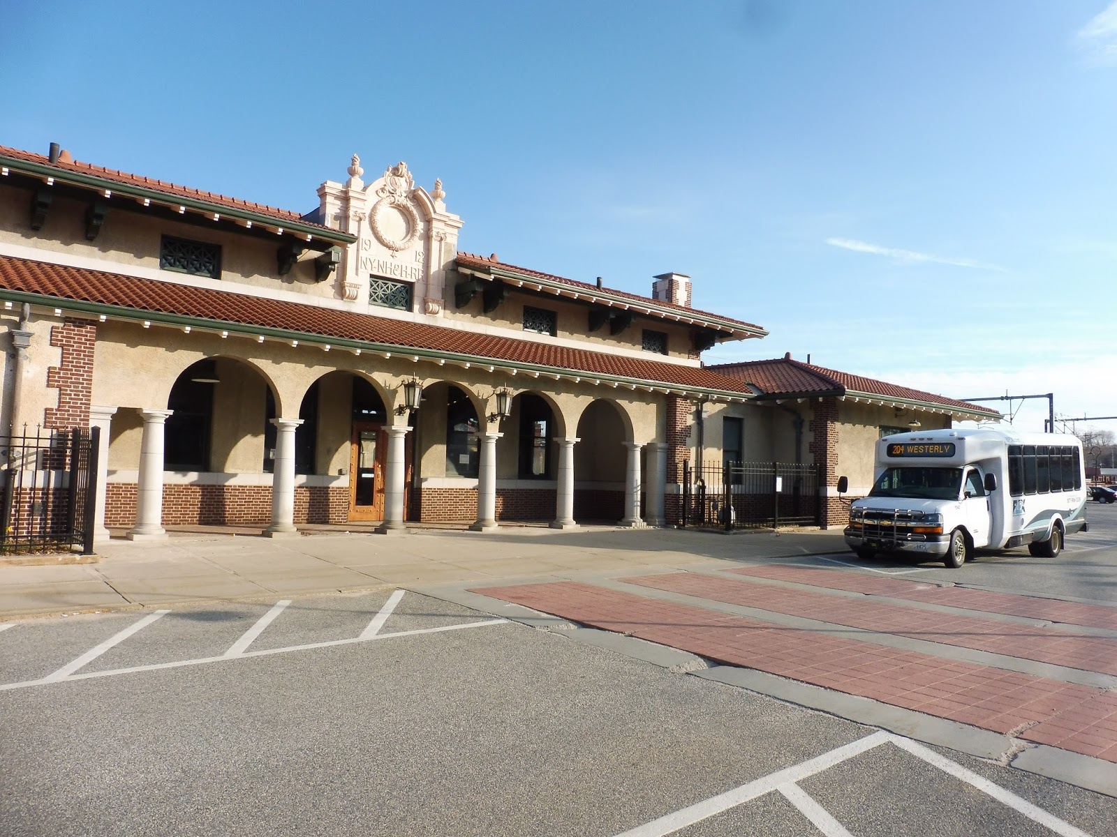 |
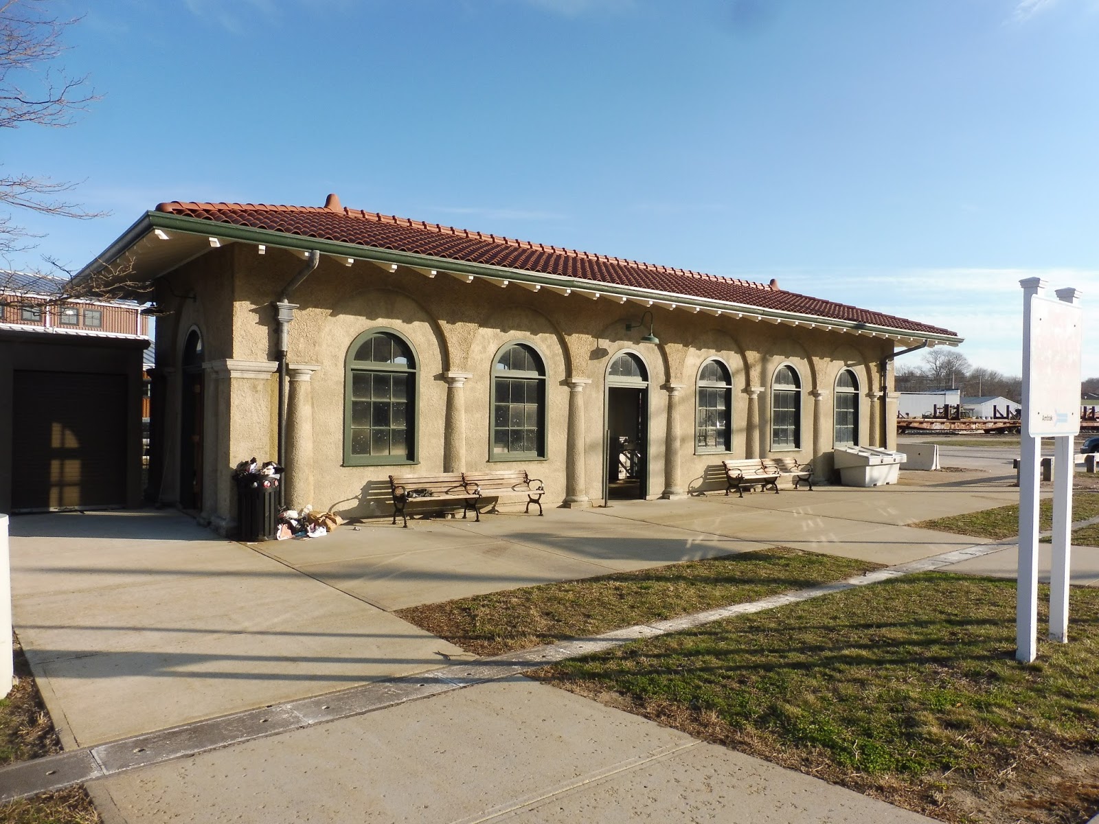
| Wow…now that is a beautiful building. Also, there’s a minibus! |
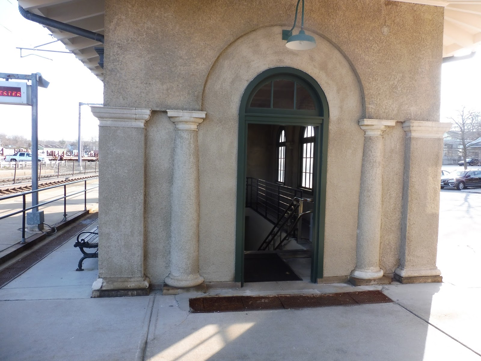
Well, when you walk around to the entrance and see the building, you can definitely see how amazing the architecture here is. Just look at that! What a beauty! It’s also out here where you can get the three miserable RIPTA connections: the rush-hour only 95X to Providence, the weekdays-only 204 Westerly Flex, and the Fridays-only 301 Rural Ride. Really great service, huh? Car parking is just as amazing, with 30 whole short-term spaces and no long-term spaces! I’m sure those won’t fill up quickly!
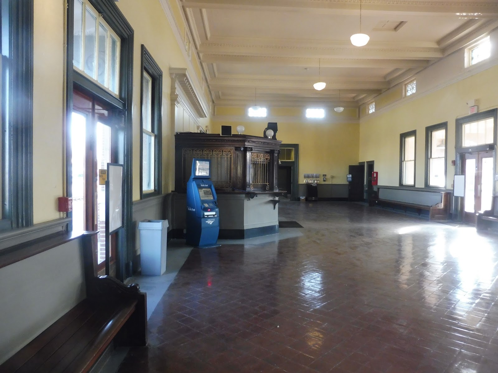 |
| Holy moly! |
Okay, why the heck did they close this building? Just look at that! That is absolutely gorgeous! I absolutely love the old-timey ticket office, and they probably had a bunch of benches in here and maybe a café…look, they even left the Quik-Trak machine on! What a waste of energy!
 |
| An Acela zooming through! |
Station: Westerly
Ridership: Over the course of 2016, this station got 42,560 passengers, which is about 116 people per day. Considering that this is an Amtrak stop and that a decent amount of trains skip through here, I would say that’s fairly decent ridership. It could probably be improved, though, as we’ll discuss later.
Pros: Well, the architecture here really is great. In its prime, Westerly must’ve been an impressive station! The Amtrak station also serves as the only weekend public transit to Westerly, even if using the Northeast Regional isn’t the easiest or cheapest thing…
Cons: I’m sure this station has been slowly falling apart for years, but I like the idea of blaming its neglect on the building’s closure. After all, without a station attendant, who’s going to repaint the walls, or empty the overflowing trash can, or pick up the…disgusting clothes lying around? I still can’t get over that last one. There are other quirks here that are awful, too, like the strange, seemingly immovable wheelchair lift (not to mention the other immovable wheelchair lifts on those stairs) or the lack of parking or the barebones RIPTA service.
Actually, it’s that last one that brings me to my next point: getting to Westerly is awful! I can’t blame this station for the RIPTA’s schedule, but the Amtrak fares from here are really expensive – the “Saver” fare from Westerly to Providence (requiring advance purchase, keep in mind) is $15.00! “Saver” fare from Westerly to Boston is $27.00! Okay, Amtrak, way to encourage commuting…or leisure travel…or, like, any kind of travel to Westerly. Going back to RIPTA, the 95X may only run during rush hours, but at least it’s only 2 bucks to Providence! Of course one would expect the train to be more expensive, but $15.00 is crazy – how about some sort of “Rhode Island Commuter Pass” that gives about a $10 or $11 value for Westerly to Providence trips? I think Amtrak does that kind of thing in North Carolina, but I could be wrong. Something like that could really increase ridership!
Nearby and Noteworthy: Westerly is actually a really fantastic town! It has a pretty big center that extends over the Pawcatuck River into Connecticut. There are lots of local businesses around, including two bookstores, a fantastic riverfront café, and…a PINBALL BAR?! WOW, THAT IS THE COOLEST THING! Too bad it’s still really expensive to get here…
Final Verdict: 3/10
In its prime, Westerly would have been the crown jewel of small-town stations. The architecture here is just amazing, and the inside of the building is beautiful! The inside…of the closed building. Yeah, that’s where the problems start. Closing that building has been a huge detriment to the station, leading to a lack of maintenance and wayyyyyy too much litter everywhere! The station isn’t accessible, it’s in disgusting condition, and it costs an arm and a leg to get out here. At least that architecture is good…
Latest MBTA News: Service Updates
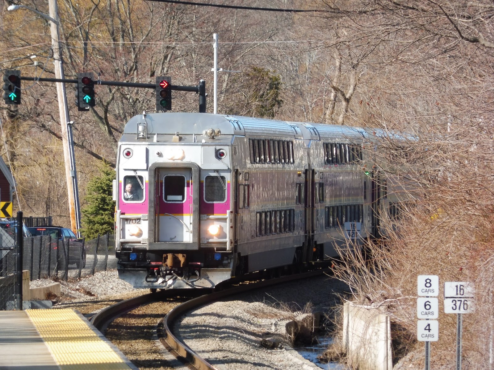
238 (Quincy Adams Station – Holbrook/Randolph Commuter Rail Station)
We’re really in the home stretch here! Ironically, despite this being a proper MBTA bus review, the route in question is one of the most suburban ones in the system! That’s not to say the ridership isn’t there, though – let’s talk about the 238.
 |
| Not the 238 I rode – I had to wait later in the day to get an in-focus picture! |
We left the Quincy Center busway and headed down Hancock Street, making a few twists and turns because of Quincy Center’s weird new traffic pattern. The street took us right through downtown Quincy, past a few office buildings, but mostly dense businesses on either side. We turned onto School Street next, where the businesses became interspersed with apartment buildings and a church.
 |
| Some houses alongside an intersection. |
Next, we made a bunch of turns within a quick period of time: Franklin Street, Water Street, Liberty Street, Quincy Street, and Burgin Parkway. It got industrial by the time we headed onto Burgin Parkway, a wide road that sped us further south alongside the Red Line tracks. The sight of a gigantic parking garage let us know that we were approaching Quincy Adams.
 |
| Racing a train! |
The 238 only recently started serving Quincy Adams on Sundays – before that, it would just go by without deviating. Thus, our Sunday trip turned into the ridiculously oversized Quincy Adams busway, although it happened to be getting use today because of a bus shuttle. Coming out of the busway, we made our way to Central Street, taking us back in a northwesterly direction.
 |
| Leaving Quincy Adams. |
The road was an odd mix of houses and industrial buildings, but it got more residential as we kept going. Just before a little “town center” served by the 215, we turned onto West Street. The road winded past a bunch of suburban houses after we went under I-93, and the driver was putting the pedal to the metal.
 |
| Some houses. |
We merged with Willard Street, going by an ice skating rink and an entrance to the Blue Hills Reservation. For a little bit, the reservation occupied one side of the street while houses occupied the other, but then it got…gross. As we entered Braintree and the street became Granite Street, it grew much wider, and we were surrounded by office parks, car dealerships, and parking lots.
 |
| A side street just before the gross section. |
We went under I-93 again, then passed multiple entrances for the South Shore Plaza without going into any. No, we had to wait for the very last one, which was a narrow road that ran through the woods and then served some office parks. As we turned onto South Shore Plaza Road, we arrived at the main mall stop, where many people got off, as expected.
 |
| The plaza. |
Returning to Granite Street, there were more suburban businesses with parking lots around, especially at “Braintree Five Corners,” which was little more than a five-way intersection with some retail around it. As we continued south, there was yet another shopping plaza, albeit a much smaller one, as well as Braintree High School.
 |
| If this was an RTA, we would’ve deviated to serve this awful plaza! |
There were some industrial buildings in view, then the street became Pond Street, with a mix of houses and industry. Soon, though, we entered Randolph and it became North Street – now the driver floored it again as we passed by mostly houses, albeit mixed with a few sparse industrial buildings. The road curved around a lovely park and cemetery…and then another park and another cemetery! Sure, why not?
 |
| Some more houses. |
From there, it was mostly houses up until Crawford Square, where retail was once again dominant. This is also where things get a bit odd for the 238: buses can terminate here at Crawford Square (nights, Saturdays, and some Sunday trips), they can run down Union Street to Holbrook/Randolph Station (weekdays), or they can go down South Main Street to Avon Square (Sundays only). I’ll get more into the service pattern later on, but for now, just know that it was a Sunday, so we were headin’ to Avon!
 |
| JOSEPH’SSSSSSSSS!!!! |
South Main Street was mostly residential for a while, with a few businesses interspersed between the houses. We went under some telephone wires right near a school, then after crossing a small brook, we passed some industrial buildings. The road became North Main Street as we entered Avon, and almost immediately after, we looped around a church, marking our arrival at Avon Square.
 |
| An awful picture of the next inbound 238 at Crawford Square, as seen from the bus. |
Route: 238 (Quincy Center Station – Holbrook/Randolph Commuter Rail Station)
Ridership: Considering the amount of trips it gets per day, the 238 gets really good ridership – 2,077 riders per weekday, 1,304 riders per Saturday, and 735 per Sunday. In fact, my Sunday trip got over 40 riders, which seems crazy! Only about half of them got on at Quincy Center, too, so the route has good local ridership.
Pros: Looking at this route, it seems like it serves a whole lotta nothing, but that’s apparently not the case! Sure, there are large parts of the route where no one got on or off, but the South Shore Plaza and Crawford Square are both huge ridership hubs! I also like the way this route is interlined with the 240, and they combine on Sundays to provide Avon Square service (Josh and I ended up staying on and just getting a ride back to Ashmont). The 238’s schedule is decent, too, with service every half hour during the rush, and every hour weekdays, nights, and Saturdays.
Cons: What about Sundays? Yeah, that becomes every 75 minutes! This is bad both for the 238 and especially the 240 – not only is it really infrequent, but people heavily use these buses on Sundays! If it was more frequent, I’m sure you could get even more riders – at least every hour! Also, the variations of termini depending on the time can be a little confusing.
Nearby and Noteworthy: It’s not quite as fast as the 236, but the 238 is still a great way of getting to the South Shore Plaza. Did you know that it’s apparently the 16th largest mall in the United States?
Final Verdict: 8/10
Sure, it’s a suburban route, but this ain’t the GATRA – people actually use the T, even if it’s not a city-dwelling line. Although the Sunday schedule leaves a lot to be desired, and the route could probably get away with increased frequencies at other times, too, it still provides an important link through Braintree and Randolph. Wow…only a few more MBTA bus reviews left, guys!
Latest MBTA News: Service Updates
West Hingham
Oh boy, an Old Colony station…but not just any Old Colony station. That’s right, we’re looking at the Greenbush Line today! The Greenbush Line: taking the tried-and-true concept of sticking stations in the middle of nowhere with huge parking lots, but adding golf courses! West Hingham is no exception!
 |
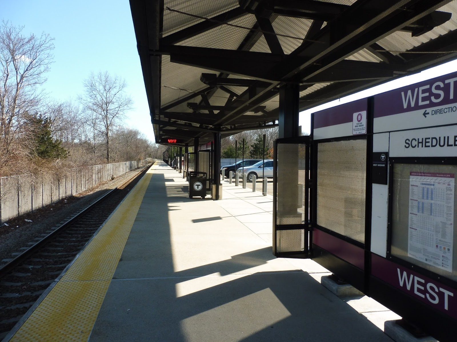
| Woah, this is weird… |
Okay, so West Hingham has a special entrance for…pedestrians? Well, this is not typical Old Colony style! It was a really nice little path, too, running right alongside the track with little creeks on both sides. I wasn’t expecting it to be so naturey!
 |
| Ah, that’s more like it. |
Of course, this wouldn’t be an Old Colony station if it didn’t have an egregiously large parking lot. This one is fairly conservative in size, actually, but its 214 spaces only get about 50% full on weekdays. The station also has some bike spaces, located in a little plaza with some newspaper boxes and old honor boxes.
 |
| Typical. |
There isn’t much to say about the platform that I haven’t said a million times before, but I’ll go for it anyway! The whole thing is high-level, with a modern Old Colony shelter along a good portion of it. There are benches, wastebaskets, and information along the sheltered portion, while a few benches extend to the unsheltered section out in the woods.
 |
| Hey! The train is ignoring the red light! Oh wait, wrong vehicle. |
Station: West Hingham
Ridership: Well, this is the least-used station on the Greenbush Line, with 374 inbound riders per weekday…but that’s not saying much when you realize that the line’s ridership is pretty consistent across each station. The highest one, Greenbush, only gets 527 riders, so they’re all in the same general ballpark.
Pros: We’ll put this station’s Old Colony-ness under “pros.” After all, there’s nothing bad about that high level platform with the shelter, benches, and wastebaskets under it. The station also offers plenty of parking, plus some bike spaces.
Cons: It’s boring! Like any Old Colony station, there’s no character here to speak of. Also, it’s in the middle of nowhere, yet Hingham Center is right down the line with no stop at all. Imagine an underground Hingham Center station!!! Okay, that’s crazy and stupid, but it would’ve been great if they had built an actual station closer to there…but noooooo!
Nearby and Noteworthy: Did you know that four out of the seven Greenbush Line stations have a golf course within a 1.5 mile radius? WOOOOOOOOO! Although West Hingham is one of the stations to offer those amazing thrills, apparently there’s also a model railroad club across the street! Sweet!
Final Verdict: 7/10
Yeah, yeah, it’s a fine station, yadda yadda yadda. It’s gonna be very hard to not repeat myself as I review more of these darn Old Colony stations. They’re all the same!
Latest MBTA News: Service Updates
Rural Ride (Trailer)
Nathan and I got up at 5 AM to take Amtrak to a rural place to ride a rural route. No, I’m not telling you what we tried to ride! Enjoy the trailer and stay tuned…