PVTA: 30 (North Amherst/Old Belchertown Road)
The 30 was a really nice convenience in the summer, mainly because of its clean schedule. Whereas the 31 runs every 35 minutes during the summer, the 30 is a nice every half hour. Of course, they both run every 15 minutes during the school year, when most people use them, but still…the clockface headways were great.
 |
| The bus coming into Puffton Village Apartments. |
After some confusion about where the heck the Puffton Village stop was (it doesn’t have a sign), Sam and I hopped aboard the 30 at its northern terminus, a student apartment complex. From there, we headed onto North Pleasant Street, going by more apartment complexes before reaching the roundabout just north of the UMass campus. We served the three main stops on campus, then we made the quick trip to Amherst Center.
 |
| That library really sticks out! |
From Amherst Center, we made our way down Main Street, which, despite its name, didn’t feel all that “main” – it quickly became residential. There were still a few businesses here and there, but the street was mostly lined with houses (although we did pass the former Amherst Amtrak station, which was awesome). They continued as we turned onto South East Street, but we hit a bunch of suburban retail at the intersection with College Street.
 |
| Some houses. |
We continued down South East Street a bit in order to deviate to serve Colonial Village Apartments. It was a typical housing development deviation, what do you expect? We turned onto Belchertown Road at the other end of the development, which was lined with houses and a few farms. We passed a few more housing complexes too.
 |
| Coming out of Colonial Village. |
We had to make a horrible deviation after that. This one was to serve the Valley Medical Center, and looping around the tiny tight parking lot was tough. I mean, this route sometimes uses 60-foot buses! Imagine how hard that would be! We came back to Belchertown Road, then we turned onto Old Belchertown Road, using it to loop around…and that’s it. Kind of a weird place to end, but that’s where the 30 stops!
 |
| Wait, don’t leave us here! |
PVTA Route: 30 (North Amherst/Old Belchertown Road)
Ridership: The 30 is one of UMass’s key routes, and its ridership is insane. The route gets about 3,057 riders per day, but that’s just taking the yearly amount and dividing it by 365 – on weekdays, this thing gets packed. Well, school weekdays anyway…in the summer, you only get about a full-seated load, which is still pretty good.
Pros: Like the 31, the 30 connects important apartment complexes to the north and south of UMass to the campus. During the school rush hours, the 30 gets packed, despite its 15-minute headways (on weekends when ridership is lower, it’s every hour), but the PVTA does a good job of spreading the crowds – the 31 skips certain stops in order to get more people onto the shorter 30. The route also runs late into the night on Thursdays, Fridays, and Saturdays, with service until 1:15 AM.
Cons: There should really be a sign at the Puffton Village Apartments stop. Also, that Valley Medical Center deviation is hard to make, pretty pointless (it’s about a 3 minute walk from Belchertown Road), and a waste of time.
Nearby and Noteworthy: This is a primary route from UMass to Amherst Center, but other than that, it’s mostly just boring apartment developments.
Final Verdict: 8/10
The 30 isn’t quite as useful or straightforward as the 31, but it’s still a really solid route. It’s frequent, it has a great service span, and it gets lots of riders. I have to say, though, I would be very interested in seeing a 60-foot articulated bus trying to navigate that stupid Valley Medical deviation…
Latest MBTA News: Service Updates
PVTA: 33 (Puffer’s Pond/Shopper Shuttle)
While other UMass routes get insanely busy at peak periods, the 33 is always just kinda…there. During UMass’s rush hour, packed 60-foot 30 and 31 buses truck students out to off-campus apartments, while the 33 just trundles through with a marginal amount of people on board. Funnily enough, my summer 33 did happen to get packed, but it was an anomaly.
 |
| It feels weird to see a UMass bus at a Stop & Shop… |
The route starts at this place called “Campus Plaza,” but the schedule just calls it Stop & Shop. From there, we made our way onto Northampton Road, passing all of the suburban development horror that that road goes through. Next, we turned onto University Drive, and it was time for another deviation: Big Y.
 |
| Not even UMass Transit can escape the tantalizing pull of Big Y… |
The stop on this deviation was placed in such a way that we had to navigate a real maze of a parking lot to get out. There was a variety of buildings along University Drive, including businesses, offices, and an eye doctor. We turned onto Amity Street and picked up a ridiculous amount of people from another summer program at a small shopping center. It was standing room only!
 |
| Houses on a side street. |
The rest of Amity Street was residential, at least until we got to Amherst Center, where we turned onto Pleasant Street and passed lots of businesses. We headed around Kendrick Park and some satellite UMass buildings began to appear. Finally, we entered the campus itself, making the three university stops along the main drag and dropping off that huge group of summer students.
 |
| Some campus buildings. |
On the other end of the campus, we hit a roundabout and headed right onto Eastman Lane. It went up a hill, going by various dorms, then there was a woodsy section for a bit. Outside of the Amherst fire and police stations, we turned onto East Pleasant Street, which was just lined with suburban houses.
 |
| A quiet side street. |
We went by a cemetery and a farm, then it was time for a strange deviation. We turned onto Pine Street and passed a common, a market, and a train track. Next, we turned onto Henry Street, arriving at the objective of the deviation: the Cushman Day School. It got no passengers, and we made our way back to Pine Street by means of Bridge Street. That was pointless…
 |
| A surprisingly clear shot of some trees. |
Pine Street was mostly houses, aside from a farm and an apartment development. Eventually, there was some retail in the form of a small shopping plaza when we turned onto Montague Road in Amherst Center. However, it quickly became houses again, and they continued as we travelled down Summer Street. This took us to our terminus, the Mill Hollow housing development, right next to Puffer’s Pond.
 |
| This is such a nice place to lay over! |
However, this is a loopy route, and we still had more to go. We turned onto Mill Street, then Pulpit Hill Road, then Montague Road, and finally, Cowls Road. After the houses we had been seeing for a while, Cowls Road had more of an industrial edge to it. We turned onto Sunderland Road next, going by the Amherst Survival Center and coming back into North Amherst Center.
 |
| Well, this is a change… |
Going back to UMass, the 33 takes the much more straightforward route down North Pleasant Street. It was mostly residential, but in the form of housing developments for UMass students. There were a few normal houses after those, but then it was back on campus, where Sam and I got off and let the bus make its way back to Stop & Shop.
 |
| See ya! |
PVTA Route: 33 (Puffer’s Pond/Shopper Shuttle)
Ridership: The 33 has two distinct tiers of ridership: shoppers on the southern portion, and residents on the northern portion. While the route may not get a gigantic amount of daily ridership (about 754 people per day), it averages out to about 35 passengers per trip, which is great.
Pros: This is almost like UMass’s “sweep route,” serving the nooks and crannies around campus that other routes don’t serve. The fact that it has two ridership classes fanning out from the main campus means that the bus has great ridership turnover within UMass. Still, it’s not like that many people use it, and the schedule reflects that well: every 40 minutes on weekdays and every 80 minutes on weekends.
Cons: Some of the route’s deviations are a little questionable. The Big Y one is a big pain going inbound, while the Day School one just seems pointless. The loopy nature of the route means that people getting on in one place may have to go for a long ride in order to get to where they’re going.
Nearby and Noteworthy: In the summer, Puffer’s Pond was a big swimming destination. Otherwise, you may have to suffice with Stop & Shop and Big Y…
Final Verdict: 6/10
The 33 is probably UMass’s chillest all-day route. It doesn’t get packed like the other ones – it just does its meandering little loops with generally marginal ridership. Yeah, some of the deviations are pointless, and the loops make it a little annoying to ride sometimes, but the 33 is just a nice, pleasant ride that serves a good amount.
Latest MBTA News: Service Updates
PVTA: NE (Nashawannuck Express Flex/Van Service)
Oho, you can tell from that title that we’re in for a good one today, folks! Oh man, it’s good to be back in the world of deviatory minibus semi-flex services. Dear viewers, let’s see what the Nash-a-wan-nuck Express has to offer. That’s hard to pronounce…
 |
| Nooooooo… |
Right, first we’ll talk about how this route works. It has a ridiculous four-tier stop system: first, you can get on the bus at the normal timepoints, which are color-coded by location for no discernable reason; next, there are “on-demand bus stops,” which can be requested by phone for the next available bus to stop at; after that, you have trip scheduling, because this route also has a gigantic flex zone into which you can deviate the bus if you call a day in advance – a few days in advance “for best results” (that is actually what they say); finally, you can “place a standing order,” which allows you to deviate the bus to your location regularly. Alright, got all that? There’s a test later.
 |
| The inside of the minibus. |
Gosh, it’s a good thing Sam and I had day passes already! The fare box on this minibus was prehistoric. Also, surprise surprise, we were the only ones on board. The driver shut the doors and we left the Academy of Music stop, turning onto the steep and narrow Crafts Ave. Next, we turned onto Old South Street, which led us to normal South Street, taking us out of downtown Northampton. It’s funny that this mess doesn’t serve Salvo House like so many other Northampton routes, but there were plenty more deviations to come.
 |
| Coming off of Crafts Ave. |
South Street was just lined with houses for a while, at least until a few industrial buildings as we crossed over the Mill River. The street became Easthampton Road on the other side of the river, and we were now zooming through the woods, passing the occasional industrial building. At some point it became Northampton Street, marking our entrance into Easthampton.
 |
| Ooooh! |
The road became this strange mix of open fields, industrial buildings, and housing developments, but those fields did offer some nice views! Eventually there were some shopping plazas and other businesses, then it got residential. After crossing the Manhan River, we made our way around a common and entered downtown Easthampton. It consisted of one nice block of businesses and…not much else of note.
 |
| The common. |
We turned onto High Street. “Council on Aging!” the driver shouted out as he pulled over. Now he turned to us. “Where are you going?” he asked. I did my spiel about how I write a blog, and we were just hoping to ride around, but he interrupted me. “Ohhhhhh, no,” he said, “that’s the number one rule of public transportation! You can’t ride around!” He continued to lecture us about how “they” have him on camera and “they” could get him in trouble, but eventually we negotiated a deal where we get out at the last stop and get back on after the layover as if we had done some shopping. Perfect!
 |
| Hey, guess what the Council on Aging has…its own bus! Glad we deviated! |
Now we turned onto Campus Lane, going around a Big E’s Supermarket. I guess the driver thought we were tourists or something, because now he decided to give us an in-depth tour of Easthampton by means of the Nashawannuck Express. “We are now on Pleasant Street,” the driver announced as we made our way around the common again and went down that street.
 |
| A woodsy parking lot. |
We went by some huge old factories while the driver was telling us about how the houses on the other side were built by the factories for their employees. “We are now turning onto Ferry Street,” he announced as we passed another factory and a pond. There was some dense housing as we went down Parsons Street, and it continued onto Everett Street.
 |
| I’m sure the driver had something to say about that tower, but I can’t remember it. |
We had to make an annoying deviation to serve an elderly home that, of course, got no passengers. “This is the first of three cemeteries on the route,” the driver said just before we turned onto Franklin Street. It was still residential, and there were more houses as we turned onto Clark Street. We were really close to Easthampton’s secondary “downtown” that the R41 goes through, but we didn’t serve it, going south on Holyoke Street instead.
 |
| A residential side street. |
The street was mostly residential, but there were a few businesses on street corners, too. The houses were getting less and less dense, and just before the R41’s amazing mountain section, we turned off onto Hendrick Street. “That’s Mount Tom,” the driver said, pointing out the humongous mountain in the background.
 |
| Yup, there’s Mount Tom! |
The road was mostly woods, but there were some houses mixed in there too. We made our way onto Plain Street next, featuring houses endowed with very large front yards. We turned onto Strong Street, which was more of the same. Strangely, the intersection of Hendrick and Plain is considered a “request stop” at night, while Strong and Plain is not. They’re both intersections that the bus passes through. What is there to request anyway?
 |
| The intersection with Strong Street. |
We merged onto Park Street, and soon enough it was time for another deviation. This one was to serve Treehouse Circle, a housing development, and no one got on. We were also supposed to deviate to serve the White Brook Middle School, but luckily we didn’t (it was summer). There were more houses back on Park Street, and they continued on Garfield Ave, as well as Williston Ave (where we went by the route’s second cemetery, said the driver).
 |
| Inside Treehouse Circle. |
We came up alongside the lovely Nashawannuck Pond and made our way up Union Street, passing a repurposed factory and Easthampton City Hall. There were businesses with parking lots along here, but they got denser and we went through a nice block of interesting ones. Soon enough, we were back in downtown Easthampton, and we looped around that same common again.
 |
| The pond! |
Now we went south down Main Street, which was mostly houses, but we also passed the third and final cemetery of the route! There was some retail at the intersection with South Street, and a little more further down the road. Finally, we entered Southampton and arrived at the Southampton Big Y…time to get out and wait for the departure.
 |
| What a nice view! |
After a 20-minute wait, the bus came back, and it was time to go back to Northampton. I was so ready for the trip back, mainly because of the timepoints: “CVS” and “Easthampton Post Office.” Were we seriously gonna deviate to serve such pointless things as those? No. No, we didn’t, it was just a straight shot back. Okay, but then why are there trips that shade out the timepoints like the bus is bypassing deviations?! They’re not deviations, you just go straight by them on the main road! What???
 |
| The bus back at Big Y. |
PVTA Route: NE (Nashawannuck Express Flex/Van Service)
Ridership: Well, I can’t find any information about the route’s ridership online, so I’ll just have to base it off of my experience: no one. The end! No, actually that’s not quite true – this route has one trip that I’ve seen get people, and that’s the 4:45 one. That always seems to get 5-6 commuters from Northampton, which is at least something.
Pros: Parts of this route feel like they could be useful, such as the section serving dense housing east of downtown Easthampton. Aside from that, though, there’s really only one other pro I can give: the driver. Man, he should be a tour guide! He somehow managed to make a town as boring as Easthampton sound interesting with his neat facts and enthusiastic announcing. He made this ride great!
Cons: Everything else. This route is actually very deceiving: it doesn’t deviate that much, making you think you’re actually going somewhere, but you’re NOT. It’s just this big stupid loop that forces anyone trying to get to Northampton to wait at the freaking BIG Y for 20 minutes! The stop system makes no sense, the route’s timepoints make no sense, and even the map makes no sense – there’s literally an arrow that points in the opposite direction of where the NE actually goes. And then there’s the schedule: every hour and a half for a route like this makes sense in theory, but honestly, it could just run two rush hour trips per day, and it would probably get the same amount of ridership. And why the heck is there a 9 PM trip on Thursdays, Fridays, and Saturdays? Are people really taking the Nashawannuck Express to Northampton to party until 9 PM? Yeah, wishful thinking. I’m sure that trip is empty, just like almost every single other one.
Nearby and Noteworthy: All of the interesting parts of Easthampton are also served by the R41, which would allow you to A) ride a nice, full-sized bus, and B) not have to travel around a gigantic loop to get where you’re going.
Final Verdict: 2/10
As a minibus shuttle, the Nashawannuck Express is at least a little more tolerable because the bus itself travels quickly and there are some nice views…but this is still just such a bad route. Forcing people to board on a one-way loop only to have to wait at the Big Y is just cruel. Why can’t the bus just have its layover at Northampton? Or better yet, why can’t the bus only run at rush hour? That seems to be the only time anyone actually uses it!
Latest MBTA News: Service Updates
PVTA: B6 (Union Station/Ludlow via Bay Street)
Ehhh, the B6 is just kind of a boring route. Sorry, I don’t have anything exciting to say for the intro…
 |
| The back of the bus at Union Station. |
We went down the main drag of Main Street for a while, at least until some tall buildings at Harrison Ave. There, we turned onto it, then we turned onto Dwight Street, which went by apartments and a hockey rink. Next, we turned onto State Street, passing a library, a church, and the US District Court.
 |
| Turning onto Dwight Street. |
We went by the Springfield Armory, which occupied one side of the street, while the other side held businesses. Once we hit Mason Square, our independent section began with quick turns onto Saint James Ave and Bay Street. This was a narrower road than State Street, and it was almost entirely residential, aside from a bit of retail at each intersection.
 |
| One of those retail intersections. |
Eventually, a cemetery took up one side of the road while we passed a housing development. After that, Bay Street became industrial all of a sudden…but only on the left side of the street. The other side was just woods! Finally, the trees were broken by the huge Springfield Central High School.
 |
| A field for the school. |
It was houses once again after that, but there was an apartment development as we turned onto Berkshire Ave. However, that went back to houses, at least for a bit until some industrial buildings cropped up. We went over some train tracks, and after a little more industry on the other side, it became residential once more.
 |
| Houses, houses, houses. |
Outside of a gas station, the route splits. Some trips stay on Berkshire Ave, but others, like mine, go via Page Boulevard. This road passed a cemetery, then we turned onto Goodwin Street, which curved its way through a monochromatic apartment development. Now, at this next point, we could’ve just gone down Oak Street and met up with the other routing. However, for some strange reason, the PVTA elected to have the route take tiny side streets to get there: Pasco Road, Essex Street, and Myrtle Street.
 |
| Back on the main route! |
We turned onto Berkshire Street for a block, then we turned onto Oak Street. Again, why didn’t we just go right onto Oak Street? Who knows? We turned onto Main Street next, and we were in some sort of “downtown”? It had some pretty nice-looking buildings, but most of them were just empty, even though they would be perfect for stores and restaurants.
 |
| A little before the “downtown.” |
There were dense houses and some businesses, but they eventually switched to industrial buildings and suburban businesses with parking lots. We merged onto Ludlow Ave, which took us over the Chicopee River into, yes, Ludlow! Next, we headed onto East Street, passing a shopping center, a park, and a few other businesses.
 |
| Coming into Ludlow. |
We turned onto Sewell Street, which started out with with a bit more retail that quickly turned to houses. Eventually we merged into Center Street and went under I-90. Right on the other side was the Big Y, which is what the PVTA chooses to call the B6’s terminus…even though it’s actually a shopping plaza with a number of other stores, and the bus stops as far away from the Big Y as possible.
 |
| Ready to go back! |
PVTA Route: B6 (Union Station/Ludlow via Bay Street)
Ridership: For some reason, the B6s I’ve seen have always been pretty light, but apparently the route does get very good ridership. It’s the eighth-busiest route on the system and it gets about 23 passengers per trip.
Pros: The B6 carves a straight path (for the most part) up towards northeastern Springfield and Ludlow. It has excellent service, running every 20 minutes on weekdays, every half hour on Saturdays, and every hour on Sundays.
Cons: First of all, the Pasco Road/Goodwin Street variant is just a curvy weird mess – it could take a much simpler route. Also, the Sunday service is just ridiculous. The route essentially deviates to Ludlow Big Y, then comes back to the Eastfield Mall and ends there…and on the way back, it deviates AGAIN to the Big Y. Why does it need to do it again? Why does it serve Eastfield Mall in the first place?
Nearby and Noteworthy: I utilized Joanne’s Arts and Crafts at the “Ludlow Big Y” for a project, and I must say, I was happy with their services. Hooray! As for the rest of the route…eh.
Final Verdict: 7/10
Overall, despite a few weird twists, turns, and deviations, it’s hard to hate the B6. It’s frequent, it serves a lot, and it gets pretty good ridership. It’s also (essentially) the only route to serve Ludlow, unless you want to count the B12’s service to the Hampden County Jail. I don’t.
Latest MBTA News: Service Updates
PVTA: R14 (Feeding Hills/Springfield)
Wow, how lucky was I to make it onto the R14’s one Saturday trip that deviates to the Heritage Nursing Home? Pretty darn awesome, I gotta say! Of course, there’s lots more to the route than that once-a-Saturday deviation…
 |
| Boarding at Union Station. |
We went under the Union Station train tracks on Dwight Street, then there were various offices, parking lots, and apartment buildings everywhere. We turned onto Harrison Ave next, and after a few tall buildings and a crossing of I-91, we went over Memorial Bridge into West Springfield. There was a roundabout, then we headed down Memorial Ave.
 |
| A quiet street in Springfield. |
We didn’t get too far before having to deviate, though. It was a pretty big plaza with an actual name, Century Center, but the schedule only calls it the “West Side Big Y.” Memorial Ave started to get industrial once we came back from the deviation, including a giant freight yard. Eventually it became more retail-oriented, and we also passed the Big E, some sort of exposition center.
 |
| Trains! |
Next, we went by a replica 18th century village (pretty cool) and crossed over the Westfield River. This led us into Agawam, and we turned onto Springfield Street alongside some shopping plazas. On Sundays, the route terminates here, but it has a lot further to go on weekdays and Saturdays. Onward!
 |
| Going over the river. |
We turned onto Walnut Street, running along the Westfield River with houses on the other side. The street curved around to become River Street, then we turned onto Bridge Street, going back south the way we came. This continued to be residential, but there were at least a few businesses when we turned onto Maple Street.
 |
| A residential side street. |
At this point, we entered the loop section of the R14, where the inbound route splits with the outbound route. We headed down Springfield Street, which was a mixture of houses and some pretty unappealing businesses. It was a weird, ugly road for a while, and it only got weirder when apartment developments and random stretches of farmland entered the mix.
 |
| “Feeding Hills.” |
I’m not sure where exactly the line is for this, but at some point we arrived at Feeding Hills Center. This was a big cluster of suburban businesses with parking lots, and it sure as heck didn’t feel like a “center.” We went down Southwick Street from there, which was lined with houses and the occasional patch of farmland. Next, we turned onto West Street, then Pheasant Hill Drive, looping around an apartment development of the same name. This was the last stop on the route, and we had a few minutes for layover.
 |
| The bus hanging out at the Pheasant Hill Apartments. |
We made our way back to Feeding Hills, but this time we took a different route. Instead of continuing onto Springfield Street, we turned onto North Westfield Street, going by houses and a residential development. There were a few businesses when we turned onto North Street, but then it was just houses until we rejoined the outbound route at Springfield Street.
 |
| Coming back onto Springfield Street. |
I remained vigilant for the rest of the ride looking for where the Heritage Nursing Home deviation would start, but it turned out not to happen for awhile. Instead of turning onto Suffolk Street over the Westfield River back into West Springfield, we continued down Main Street, which was mostly industrial. Next, we turned onto Cooper Street, which led us into the Heritage Nursing Home complex. We looped through it, got back onto Main Street, and went back the way we came.
 |
| Once a Saturday, once a Saturday! |
PVTA Route: R14 (Feeding Hills/Springfield)
Ridership: My Saturday trip was really quiet, with only about six people in each direction. Strangely, the Heritage Nursing Home deviation was the single busiest stop on the whole trip, with a few workers from the Home, which I wasn’t expecting since it only happens once a day. Overall, the route gets about 21-22 passengers per revenue hour, comfortably beating the 20 PPRH threshold.
Pros: This is the only PVTA route that serves Agawam, and the loop at the outer end allows it to catch as much as possible. The base R14 schedule is a solid every hour, including on Sundays when it operates a shorter route and interlines with the B4.
Cons: Weekday service to Pheasant Hill Apartments is really inconsistent, including a 3-hour gap from 1:10 to 4:10. However, on Saturdays, the apartments get all day service? That doesn’t make much sense! An even more inconsistent part of the R14 is the Saturday Heritage Nursing Home deviation. Clearly people use this to get home from work, but how the heck do they get to work? Finally, the PVTA eliminated the R14E route, which ran express to the Agawam Industrial Park, and shoehorned it in with the regular R14. This means there are awkward buses that go along the route at random times and break the hourly schedule. Why can’t it have stayed an express? Why do the R14E buses have to take a longer trip while not really serving anything new?
Nearby and Noteworthy: I’ll be honest, Agawam isn’t a very pretty town. There are no centers, no walkable retail areas…this route is ugly.
Final Verdict: 6/10
The R14 is a theoretically good route, but it suffers from inconsistencies that drag it down. The Pheasant Hill Apartments service on weekdays is abysmal, the Heritage Nursing Home deviation on Saturdays makes no sense, and the R14E trips are a complete waste of extra time. At least the route is decent outside of those inconsistencies, though.
Latest MBTA News: Service Updates
Thanks to Boston.com for this amazing article about my completion of the MBTA bus system! And welcome if you’re coming from there!
PVTA: R10 (Westfield/Westfield State University/West Springfield/via Route 20)
Thank goodness for my B23 being 20 minutes early! I was prepared to wait a really long time for the next R10, but thanks to a ridiculously early bus, I had time to both review the Olver Transit Pavilion and catch the previous R10! This is a route that runs every 60 minutes, keep in mind.
 |
| The bus at Westfield State University. |
I took the bus out to Westfield State University, then after taking a quick picture, we were ready to go. From Scanlon Hall, we headed down Western Ave, going by Westfield State buildings for a little while. After that, it was nice houses, at least until a big cemetery, where we merged onto Court Street.
 |
| The cemetery. |
There were more houses and a hospital, then we started to pass a few businesses, as well as Westfield City Hall. Court Street started to get a lot wider, but before it gained a full-on median, we turned onto Washington Street. After a church, a police station, an apartment building, and some houses, we turned onto Arnold Street, which took us back around onto Elm Street to serve the Olver Transit Pavilion.
 |
| A common in downtown Westfield. |
We headed down Elm Street, passing lots of businesses, then we made our way around a modern common (Park Square). After a few businesses, we merged onto Main Street, but we turned off to serve a Stop & Shop. Once that lovely deviation was over, we returned to Main Street, where there were suburban businesses with parking lots.
 |
| Case in point… |
It was residential, and the houses continued as we turned onto Meadow Street (there’s another variation of the R10 that just stays on Main). There was some retail along here, too, as well as the Westfield Food Pantry. We approached another park, where we turned onto Union Ave, going over the Westfield River.
 |
| The bridge over the river. |
Next, we turned onto Union Street, which was kind of a weird mix of houses, huge industrial buildings, and apartment developments. It got more industrial as we continued, with a few…random fields mixed in too. Of all things, though, there was just a mini-golf course in the middle of it all? Alright, well, we got some woods after that strange sight, then there were some businesses and industries as we turned onto Springfield Road.
 |
| Looking down Springfield Road. |
We were running alongside a train track, then the road got wider for a Walmart. Oh…and we had to deviate into it. After serving the big box behemoth, we returned to Springfield Road for about 0.2 seconds before yet another deviation. This time, it was on East Mountain Road, which went under the train tracks in a tunnel that wasn’t even wide enough for two cars to pass each other, let alone a car and a truck!
 |
| Yeah, why don’t you go first? |
This deviation took us up to Western Mass Hospital and East Mountain View Apartments, the latter of which we looped around in. Next, we came back to Springfield Road, which kept going along those train tracks with the Westfield River on the other side. The road became Westfield Street when we entered West Springfield, and we made a few curves past various types of buildings and over the train tracks.
 |
| Another narrow tunnel under the tracks! |
There was some retail after the train bridge, but now it was all residential. For a while, we were just going by suburban houses until the intersection with Kings Highway, where we got some businesses. There were more businesses as we continued down Westfield Street, but also a few more houses and apartment developments.
 |
| Some power wires bisecting a neighborhood. |
Eventually we got a line of retail, then an industrial/apartment development break, then retail again. We turned onto Elm Street, which featured a wide median, then we turned onto Park Ave, which featured a wider median! After that, we turned onto Main Street, running through a mostly residential neighborhood.
 |
| Now that’s what I call a median! |
Businesses started to get more abundant between the houses, and after going under some train tracks, we turned onto Memorial Ave next to a shopping plaza. We went around a rotary, then crossed over Memorial Bridge into Springfield proper. Once there, we turned onto Main Street, and after passing tall buildings, businesses, and offices, we came into Union Station.
 |
| The back of the bus. |
PVTA Route: PVTA: R10 (Westfield/Westfield State University/West Springfield/via Route 20)
Ridership: The R10 gets heavy student ridership from Westfield State University as well as commuters from Westfield. This all amounts to about 24 passengers per revenue hour.
Pros: This is an important link from Springfield to Westfield, and it’s one of two buses that connect the town to the outside world (the other being the B23). The academic year frequencies are pretty good, with service every 20-30 minutes during the rushes and every 60 minutes during the day, on Saturdays, and on Sundays. On school year weekdays, the R10 only goes as far as Westfield Center, while the R10S shuttle runs every half hour from there to the university.
Cons: The summer weekday schedule is pretty weird, with frequencies randomly shifting between every hour and every 45 minutes. Also, this is one of those routes where each trip is defined by a bunch of different letters representing routings and deviations. Do you have an “SWE” trip? Or a “UWE” trip? Or maybe an “SWR” trip? Have fun constantly referring to the bottom of the schedule to find out what these all mean!
Nearby and Noteworthy: Westfield is a decent town center, and this is the best way of getting there. There isn’t all that much of note along the route’s independent section, though.
Final Verdict: 7/10
Westfield doesn’t have many options for transit, so the R10 link is crucial. Since most of its riders are going from Springfield to Westfield, the strange letters on the schedule don’t usually matter too much, but it’s just such a pain to read. The summer schedule is also just…weird, but at least it makes sense during the school year!
Latest MBTA News: Service Updates
Thanks for all the positive comments and feedback about finishing the bus system. Yesterday the blog got its highest daily viewers – 9,989! So close to 10,000, but that’s okay – thank you to everyone for reading and following my adventures!
195 (Lemuel Shattuck Hospital – Tremont and Park Streets)
When I finished the 171, I was sure I was done. That was it. All the buses complete. Then I saw the anonymous comment (copied verbatim): “You stll need the 195 Shattuck Shelter-Park St. route.” “No, I don’t!” I thought. “It’s not on the website, so it’s not in my jurisdiction.” But just in case, I decided to check the website. Lo and behold, there it was. Sigh…how’s about one more T bus review?
 |
| The bus coming to the Shattuck Hospital. |
The route starts out at the Pine Street Inn, a homeless rehab center next to the Shattuck Hospital – it uses the 16’s stop over there. The only time it comes here is 8:15 AM on weekdays, and 8 AM on weekends. That’s it. No return trips. Nothing. This is it!
 |
| A field in Franklin Park. |
We headed down Circuit Drive, which zoomed its way through Franklin Park. On my side of the bus (the left), it was mostly forest, but the other side had a golf course. Eventually, we turned onto Franklin Park Road, someone hit the stop request, and they got off outside the zoo. Uhhh…I was under the impression that this route has only one stop between Shattuck and Park Street? It was a little weird to be making one here.
 |
| A bouncy castle! |
We turned onto the wide Blue Hill Ave, then the slightly-less-wide Seaver Street. One side of the road was occupied by Franklin Park, while the other side had various apartments. Eventually the park went away – when this happened, the street became Columbus Ave. After a library and a tall circular apartment building, we came into Egleston Square, where there was lots of retail.
 |
| The rocky edge of Franklin Park. |
North of Egleston Square, there were various apartments and a few auto shops. We passed Jackson Square Station, but this route is nonstop, so we didn’t have to deviate into the busway. The increasingly wide road came right up alongside the Orange Line tracks, while Roxbury Community College was on the other side.
 |
| Roxbury Crossing Station. |
After Roxbury Crossing, the road became Tremont Street, and we passed the Boston Police Headquarters. It felt really weird to just stay on Tremont Street without serving Ruggles, but again, the 195 is nonstop, so we just kept on truckin’. The street wasn’t as wide now, and it was lined with various apartments and businesses.
 |
| I’ve always thought that this gas station feels a little out of place. |
The one scheduled stop, Tremont Street @ West Springfield Street, was pretty popular, with a good chunk of the people getting off. The further we went, the more historic (and presumably ritzy) the apartments got. We passed a library, then there was an increase in the amount of businesses on the bottom floors of the brownstones. After going by the Boston Center for the Arts, there were some more recent (i.e. uglier) apartments, then we went over I-90.
 |
| Wow, the John Hancock building is shrouded in fog… |
We were now on Charles Street South, and it curved past some impossibly narrow side streets lined with apartments and a few little parks. As we entered the Tufts Medical Center area, though, the buildings started to get far taller and newer. At one point, someone requested a stop, and we just…stopped, double-parked with a bunch of cars. At least three people got off at this weird non-MBTA stop.
 |
| There’s an actual stop, like, 50 feet behind us… |
We headed out into greenery next, with the Boston Common to the right and the Public Gardens to the left. We turned onto Beacon Street, continuing our loop around the common, with lovely apartments on the other side. Outside of the Massachusetts State House, we turned onto Park Street, and then we finally made it onto Tremont Street. Okay, now the last route is done!!!

 |
| So I guess 1657 is the last bus! Sorry, 1796… |
Route: 195 (Lemuel Shattuck Hospital – Tremont and Park Streets)
Ridership: This route is meant to transport discharged homeless people from the Pine Street Inn back into the world, and so that’s who the clientele is. Truth be told, I was expecting the ride to be a lot rowdier, but it was totally fine. There were about 15 people in total who rode, which isn’t that bad, considering the special function of the route.
Pros: This route is a really nice shuttle for discharged people returning to civilization. Our driver disabled the farebox so they didn’t have to pay, and the bus offers a quick ride into downtown. It was right on time, and the one trip schedules perfectly with the discharge time from the Pine Street Inn.
Cons: The one problem with the 195 is that it really should just operate as a drop-off only route at local stops rather than the nonstop thing it does now. It seemed like people wanted to get off at more stops than the ones posted on the website, so having it drop off at local stops would make things more organized.
Nearby and Noteworthy: Hey, if you have the determination to go to the Shattuck Hospital at 8 AM, you can…uh…go downtown, I guess.
Final Verdict: 9/10
We still get to end on a high note! Hooray! So this truly is the last MBTA bus review. I think. I hope. Well, okay, the Silver Line Gateway is opening up in 2018, so stay tuned for that! But yeah…it feels weird to be saying this again so soon, but thanks to everyone for reading and staying with me for over four years! It’s been an awesome ride, and it sure ain’t over yet.
Latest MBTA News: Service Updates
171 (Dudley Station – Logan Airport via Andrew Station)
How do I introduce the MBTA bus route that will be this blog’s last? I still find it hard to believe that the thing I dedicated my life to for over four and a half years is…over. The last T bus route. This is it. We’ve been through a lot, everyone, but I think the 171 featured the biggest challenge of all: surviving Dudley Station at 4 AM. Ouch!
 |
| 1796…the last bus. |
How we actually got to Dudley is another story that you’ll see at some point in the future, but the point is that our bus left the labyrinthian, sketchy bus station at 4:20 AM. We started out going up Washington Street, but we turned onto Melnea Cass Boulevard outside of a ghostly Silver Line shelter that wouldn’t see service for an hour. After a brief one-block run on Melnea Cass, we turned onto Harrison Ave.
 |
| Guys, it’s Mass Ave! Can’t you tell? |
There were parking lots for a bit, then we got South End apartments on one side and Boston Medical Center buildings on the other side. Once we turned onto East Concord Street, we went right into the hospital campus, which continued as we turned onto Albany Street. Next, it was Mass Ave, which took us right into the industrial Newmarket area.
 |
| Buses at Southampton Garage getting ready to go. |
We merged onto Theodore Glynn Way, then onto Southampton Street, which took us past the Southampton MBTA bus garage. This route is very well-used by early morning MBTA employees, and though it was a Saturday morning so there were far less people on board, someone still got off here. After going under the Fairmount Line, we passed the South Bay Center mall (thank God we didn’t have to deviate to it) and crossed over I-93.
 |
| No trains here for a while! |
Next, we headed into the Andrew busway, picking a few people up, then we went north up Dorchester Ave. It was just pure industrial wasteland, although it did include the MBTA’s Cabot Yard. Usually this is a big stop, but on this Saturday morning, there were no T employees heading there.
 |
| Duh, this is totally Cabot Yard. Can’t you tell? |
We turned onto A Street, cutting through a neighborhood of Southie, but then we entered the Seaport and there were industrial buildings and parking lots everywhere. Next, we came into Fort Point, and as we went under Summer Street (which had a very fancy colored bridge), there were brick buildings on all sides. When A Street ended, we turned onto Congress Street.
 |
| Look, it’s the beautiful Boston skyline! Can’t you tell? |
After that, we turned onto “West Service Road Extension,” where it got industrial again. Next, it was South Boston Bypass, which let us sail onto I-90! We zoomed through the Ted Williams Tunnel under Boston Harbor, then came out at Logan Airport.
 |
| A tunnel in the airport. |
We made our way around into Terminal A, and I’m pleased to report that the 171 uses the Silver Line airport announcements! They sounded awesome over the high-quality Xcelsior speakers. Next, we served Terminal B Stop 1, which got no passengers, but a whole three people got off at Stop 2. I wonder where they were going…
 |
| Terminal C. |
We made our way to Terminal C next, then it was off to E. Now, the route is supposed to continue on to Airport Station – every schedule around says that it does. However, it would seem that no drivers ever actually do it, and this one was no exception. We were kicked off at Terminal E, so we walked into the empty international terminal. The final trip was complete.
 |
| That’s it… |
Route: 171 (Dudley Station – Logan Airport via Andrew Station)
Ridership: The 171 is technically the “least-used route on the MBTA,” but that doesn’t mean it doesn’t get good ridership. According to the 2014 Blue Book, the route got 36 riders per weekday, 39 per Saturday, and 48 per Sunday. With only two trips per day, that’s pretty good! Honestly, though, I think it fluctuates day by day – my ride got about 15 people, but other trips can reportedly be packed.
Pros: This route serves a very specific function, and it does it well. The reason for the 171’s existence is to A) bring early-morning airport employees to their jobs, and B) get early-morning MBTA employees to their shifts. There’s even the occasional person using this to get to the airport for a flight! It doesn’t need to run any times other than when it does (3:50 AM and 4:20 AM).
Cons: The only thing wrong with this route is the claim that it goes to Airport Station when it really doesn’t. Who’s even going to Airport Station at 4 in the morning? Just take it off the schedule – the bus never actually serves it.
Nearby and Noteworthy: Well, gosh, if you’re in Roxbury or Dorchester and you gotta get to the airport really early in the morning…I guess this is the bus for you?
Final Verdict: 9/10
Hooray, we finish the T bus system on a positive note! Yeah, there’s really nothing bad to say about the 171 other than its strange, false insistence that it serves Airport Station. I do think the popularity of this route for early-morning employees (as well as its counterpart, the 5:10 117 from Haymarket to the airport) is a clear indication that the Bostonians would benefit from a 24-hour bus system, but that’s beside the point. The 171 is an eccentric route…but it’s also a great one.
Latest MBTA News: Service Updates
Well, that’s it. The last route. It took almost 4 years and 8 months, but we did it. I’ve had an absolute blast riding the entire T, and ending it with this crazy route was awesome. I want to thank everyone for reading, whether you were there from the start or whether you just found this blog today. You’re the reason I’ve kept doing this and worked so hard to ride all these routes and write all these reviews. Of course, just because I finished the T doesn’t mean the blog is over, though. After all, I still have all of my RTA’s to get through! Don’t worry – you’ll still be hearing from me for a long while after this.
Thanks again,
Miles 🙂
GUEST POST: 72 (Huron Ave – Broadway @ Felton Street)
My girlfriend Zofia has some very strong opinions about the 72 school trip to Cambridge Rindge and Latin High School…
Wanna have a stress free ride to school? Don’t count on the school trip 72 to do that for you. Yes, most days it can get you to school on time but you’ll probably be cutting it close. Well, unless it’s a rainy day or there’s snow on the ground then you’re probably just not going to get to school. I rode this bus for about 2 years before realizing that taking the 71/73 would get me to school faster because those actually run. Before we really get into this I should just say one more time it’s a school trip so why do the drivers let the adults on? Let me tell you, that happens way too often and then the adults get all confused and it makes the trip longer because they all want the bus driver to stop and let them off at Harvard.
So this bus starts at the top of Aberdeen Ave, which for me is where Mount Auburn Street is and it’s supposed to leave there at 7:29. Then it gets to the end of Aberdeen Ave. at 7:30 which is where I would wait with a bunch of other students. Would it ever arrive at 7:30? No, sometimes it would get there at 7:50 and, well, school starts at 8:05 so when that happened there was no way of getting to school on time.
We’re high school kids; not all of us are organized and have CharlieCards so many kids would just pay with coins or bills which would take forever, but I can’t judge because, well, I would do that sometimes. I was mostly just annoyed when the driver would make them pay and we were already so late. Although most bus drivers didn’t want to deal with it and they just let people on for free which was really nice.
Once everyone was on we’d turn onto Huron Ave where traffic could be found, and we’d slowly go along but once we’d pass Fresh Pond Parkway, traffic would clear up from then on. So Huron Ave. has been under construction for like the past 40 years…ok, fine probably just 5 years? So all you’d see is construction, which I mean to some they might find it nice but I kinda just didn’t care for it. But that’s besides the point. So then we’d just go along Huron Ave picking up kids and sometimes adults. Then we would turn on Concord Ave and would sometimes pick up kids, but most just got on on Huron Ave.
Depending on the bus driver they would either turn and go towards the Cambridge Common or continue on Garden Street and then go under the tunnel and onto Cambridge Street, where there was always traffic so we’d be stuck there for a while.
The bus is then supposed to turn on Felton Street, and this again depended on the bus driver. Some would let us off at the bottom of Felton Street and others at the top. Some would also just continue on Cambridge Street until they got to our school and let us off there, so that way we didn’t have to walk too much, which was always nice especially in the winter.
Ridership: This will depend on the season. In the fall and spring there won’t be all that many kids since most bike. If it’s winter or a rainy day then the bus can be packed.
Pros: It’s students only and it goes directly to school. I really can’t think of anything else that’s good about this.
Cons: It’s basically never on time. The poor adults, because the bus driver doesn’t tell them it doesn’t go to Harvard. Yeah ok, the adults can read and see it goes to Felton Street but, like, who wants to read what the bus says? That’s just too much work right?
Final Verdict: 5/10
Ok, yeah, I may not like this route but it gets the job done. Maybe not in the best way possible, but you know, it gets to me to school on time mostly, but not without cutting it close. Not going to lie, I just really hate this route because I don’t like to have stressful mornings, but you know, it’s convenient for kids to use and it gets them to school without having to walk through Harvard Yard.
PVTA: Olver Transit Pavilion
Okay, what is it with naming unnecessarily fancy transit centers after John Olver? Don’t get me wrong, I’m sure he was a great congressman, but geez! First there was the FRTA’s gigantic John Olver Transportation Center, and now we’ve got the PVTA’s smaller (but no less fancy) John Olver Transit Pavilion in Westfield. Alright, then…
| The building. |
The Transit Pavilion is definitely a smaller affair than the huge FRTA terminal, but just look at that building! It really sticks out in Westfield Center, a place mostly with older brick buildings. Right outside the Pavilion structure, there’s a bench, while the other side has a fare machine, bike locks, and a vending machine for bike parts. Wow!
| Squeaky clean! |
Geez Louise, here we go again. The inside of this thing is impeccable. It’s very well-lit, modern, and clean, with lots of benches all around the outer wall. There are also vending machines, a fare machine, and a departure board. A wavy table along the middle of the room features outlets for charging devices.
 |
| Huh…alright. |
The Pavilion also houses a strange little touch screen thing. It shows bus departures, whatever the heck “CHAMBER” is, and even the Yelp reviews for restaurants and businesses in Westfield. This seems very useful for Westfield’s throngs of tourists consisting of approximately no one. There’s also a really empty cork board with a few lone schedules in it and a space for retail that wasn’t filled when I was here.
 |
| The bathroom! |
Since this hub is so quiet, Westfield’s bathrooms are squeaky-clean! Maybe now that college has started up at Westfield State University, they’re far worse, but who knows? There’s also a water fountain that additionally fills up water bottles. It had only saved 608 plastic bottles when I went there in July, but I’m sure now it’s higher!
 |
| The boarding area. |
The Transit Pavilion’s boarding area isn’t much, but it gets the job done. There are benches along the more northerly section, but once you go further down the line, they disappear. There’s plenty of seating inside, though, so it doesn’t matter all that much. The plaza is clean and modern, and some newly-planted trees and bushes look very nice.
 |
| Further down the platform. |
PVTA Station: Olver Transit Pavilion
Ridership: Well, when I was here on a Saturday in July, it was practically empty – there were only three or four people in the terminal. Perhaps it gets busier during the school year when there are students from Westfield State University?
Pros: Just like the FRTA’s Olver building, the Transit Pavilion is near-perfect. It has lots of amenities, including seating space, wastebaskets with recycling, outlets, bathrooms, vending machines, bike racks, bike vending machines, and weird touch screens!
Cons: ALSO like the FRTA’s Olver building, the Transit Pavilion doesn’t seem all that…necessary. I mean, even in this video from the first day, it still looks empty! And that was the grand opening!
Nearby and Noteworthy: Downtown Westfield is fine, I guess. There’s nothing about it that seems all that interesting to me.
Final Verdict: 9/10
The Olver Transit Pavilion is in the exact same boat as the FRTA’s Olver Transit Center. It’s beautiful and fancy with many amenities provided, but it just seems like kind of a waste of $3.6 million. Westfield students had been concerned about not knowing when the bus was coming…couldn’t transit arrival screens have sufficed? But oh well, what’s here is here, and it’s certainly a great terminal!
Latest MBTA News: Service Updates
MBTA Bus Roadeo 2017!
Once again, I got the opportunity to attend the MBTA Bus Roadeo! It was basically the same thing as last year’s Roadeo, but of course that means I had a blast! Like last year, I was a runner, bringing score sheets up to the scorers, and it was great to be able to help out. Since the proceedings were basically the same as last year, I’ll just put up the pictures I took from this year’s competition:


448/449 (Marblehead – Downtown Crossing via Paradise Road or Humphrey Street, Lynnway, and Airport)
My very first review was of the 459. My second-to-last MBTA review will be of its counterparts, the 448 and 449. The funny thing is that I took the 449 over a year ago, but I just didn’t want to review it until I had the 448 done and I could do both in one post! Well…it’s finally time. Let’s do this.
 |
| There were a few 7’s blocking the actual stop… |
 |
| That’s a problematic destination sign! I think it’s still like that on that bus… |
I’ll be documenting the 448 trip primarily, since I took that one, you know, yesterday. I would say the trip started off great: the bus arrived 20 minutes late. Awesome! The driver told us to hurry on, then we accelerated our way bit by bit onto Summer Street. Traffic was far more plentiful than the narrow streets could handle, and it was slow-going.
 |
| Downtown streets. |
Summer Street got a heck of a lot wider as we crossed Atlantic Ave and the Greenway, then we stopped outside of South Station. We were about to cross over the Summer Street bridge, but at the last second we turned onto Dorchester Ave. Next, we made our way onto the Congress Street Bridge, featuring the Boston Tea Party Museum right in the middle of its span.
 |
| Goodbye, Summer Street! |
After the Fort Point Channel had been crossed, we entered the neighborhood of the same name. There were lots of brick buildings everywhere, then Congress Street widened and we were surrounded by…parking lots. Yeah, the switch from Fort Point to the Seaport District is a sudden one. We turned onto B Street, then Seaport Boulevard, which went by the World Trade Center.
 |
| Crossing Congress Street. |
We turned onto D Street, then we went by the Silver Line portal and turned onto Massport Haul Road. This took us around into the I-90 tunnel, although we did come up for air briefly…then it was into the Ted Williams Tunnel. Under the harbor we go!
 |
| Heading onto the highway. |
We popped out of the tunnel and curved our way around onto Airport Road, passing two bunched and crowded SL1’s in the process. Bypassing Terminals A and B, we finally made our way into Terminal C, where someone actually got on! From there, we skipped Terminal E and returned to I-90, which ran up onto an elevated viaduct next to the Blue Line tracks.
 |
| Planes! |
The highway became Route 1A, but we were only elevated for a little while longer. Eventually we came back down to ground level and the road became McClellan Highway, famous for playing host to the ugliest buildings in America! Woah! From awful billboards to dreary Logan Airport parking lots to run-down industrial wastelands to the most out-of-place Starbucks ever, McClellan Highway has it all.
 |
| Oh, and traffic. Did I mention traffic? |
We went by a lot of big mysterious vats, then the road went over Winthrop Ave and the Newburyport/Rockport Line tracks. After a long wait in some truly horrific traffic, we arrived at the Bell Circle Rotary. (Aren’t rotaries supposed to alleviate congestion??) Here, we merged onto VFW Parkway, which went over the tracks again and past an abandoned building and a really dead-looking shopping plaza.
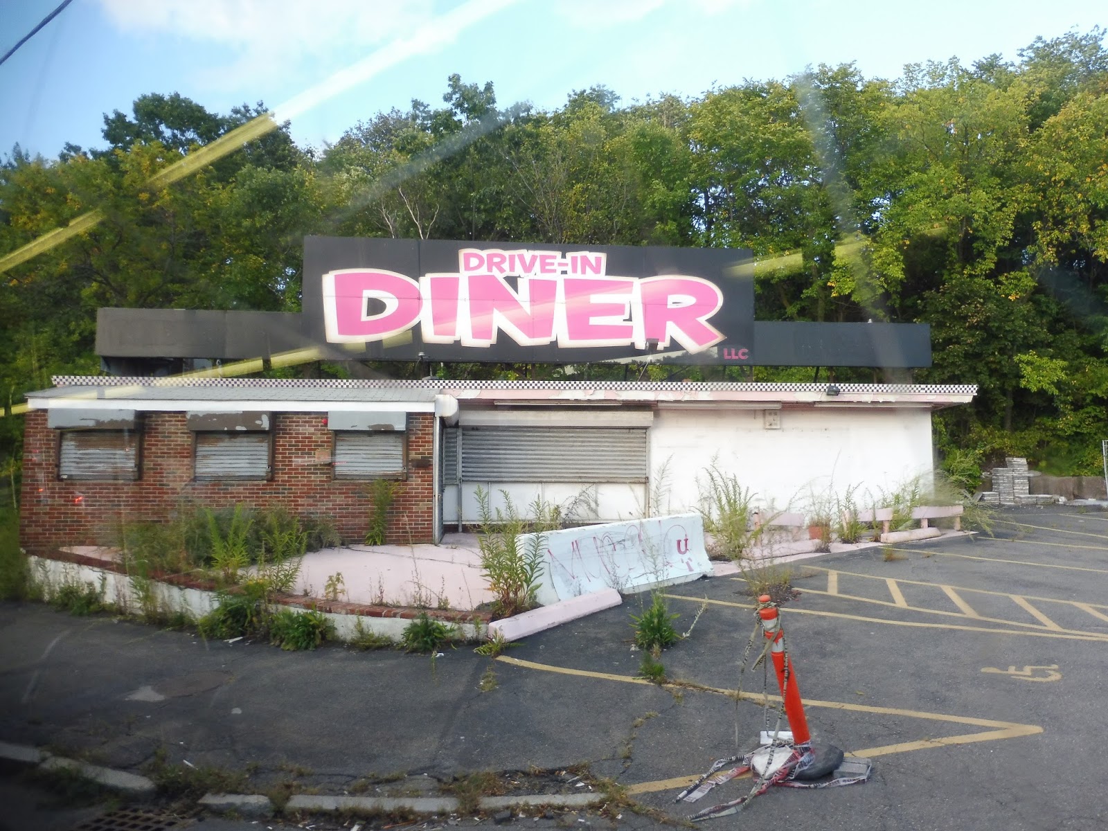 |
| This diner has seen better days… |
There was more traffic at the next rotary, but eventually we were able to weave our way around into Wonderland Station. It had taken us 40 minutes to get this far. Coming from the South Station area, it would only take about 25-30 minutes on the Blue Line. Even from the World Trade Center, it would still take about the same amount of time as us, 40 minutes, on the Blue Line. I’m starting to see a problem with this route…
 |
| It wouldn’t be this crowded if we were right behind a 441 or 442! |
Now we headed up North Shore Road, which was at first residential with a few businesses. However, there was also lots of marshland between the buildings, offering either terrific open views, including a train heading north, or awful views of the backs of apartments – depends on what side you sit on. The further we went, the more industrial the road got, at least until the Point of Pines neighborhood where it got residential again.
 |
| Some houses in the marsh. |
Luckily, we didn’t have to do that annoying Point of Pines deviation that the 441/442 does. In fact, the 448/449 runs express between Wonderland and Lynn, so we didn’t have to make any of the stops that the 441/442 does! We went over a bridge into Lynn, where there were a few gigantic businesses and a lot of industrial buildings.
 |
| A view! |
As the wide Lynnway continued north, it basically just got entirely industrial. It, uh, kinda took a while to go away, but eventually we came up alongside the water and turned onto Market Street. Next, we turned onto the Lynn Busway, right next to the Commuter Rail station, then we made our way up Union Street and turned onto Exchange Street.
 |
| Downtown Lynn. |
Exchange Street merged into Broad Street, featuring a mixture of dense houses, apartments, and businesses. Eventually, it became Lewis Street and we passed what looked like an abandoned elementary school, or at least a very run-down one. The house-business mix continued as we entered Swampscott and came about a block away from the ocean.
 |
| So close!!! |
Unfortunately, the 448 doesn’t go by the ocean, preferring to go inland on New Ocean Street. It soon became Paradise Road, but the scenery stayed the same: dense houses lining the street. There was an elementary school and a park, then some industrial buildings after a line of telephone wires.
 |
| Houses on a side street. |
It started to get more hilly and rocky, although not in any kind of exciting or scenic way. We went by a few big apartment complexes, then there were a few barebones shopping plazas and businesses with parking lots. This was “Vinnin Square,” but it wasn’t much of a square at all, and it was, in fact, pretty ugly and boring.
 |
| Yup, there it is. |
We turned briefly onto Vinnin Street, then made another quick turn onto Salem Street. We passed through a golf course, then there were some fairly dense houses alongside the road. Once we reached Humphrey Street, we turned onto it, rejoining the 442 and 449.
 |
| Tee up! |
Of course, I need to talk about the 449’s unique section, too, so we’ll go back to Ocean Street briefly for that. That route does go by the ocean, and it goes right by the ocean. It runs along Humphrey Street with water on one side and houses and businesses on the other side, and it’s really scenic.
 |
| NICEEEEEEEE!!!! |
After a nice section along a beach, though, that was it – we were inland again. It was mostly houses, but we did also pass a police station and a park. The houses got a little bigger and more spread out as Humphrey Street curved north, and once we hit Salem Street, we were joined by the other routes. Back to the 448! Well, technically still both of them, but you know what I mean.
 |
| How’s about one more view before we go inland again? |
Humphrey Street was almost entirely houses, aside from the one-off retail building on occasion. There was also a church and a school, but not all that much else until we merged onto Pleasant Street, where there was…another church and another school. It was still mostly residential, but now we also passed a rail trail, a fire station, and yet another school.
 |
| Lotsa houses. |
There was a small shopping plaza soon after, though, and then we entered Marblehead Center! Of course, there were businesses everywhere. Pleasant Street turned one-way beyond there, and it got very narrow with really dense houses on either side. There was even more retail when we turned onto Washington Street.
 |
| Marblehead is so charming! |
Washington Street was just historical houses that were really close together, and the street was so narrow that cars had to pull over to let us by. Finally, we turned onto Franklin Street, arriving at the lovely terminus at the Marblehead Fire House. There was a 442 waiting right there, so after a bit of a wait for it to actually open the doors, we hopped on board and headed home.
 |
| Darn it…the bus changed to a 441! |
 |
| At least we’ve still got the 449, albeit still with that horrible destination sign. |
 |
| I love this terminus! |
Route: 448/449 (Marblehead – Downtown Crossing via Paradise Road or Humphrey Street, Lynnway, and Airport)
Ridership: Okay, I’m not gonna lie and say that these routes don’t get a lot of ridership, considering how many trips they have: the 448 gets 176 people per day, while the 449 gets 158. HOWEVER, these numbers don’t take into account how many people actually ride this thing from Boston. You see, on both my trips, the express ridership was tiny. I can’t remember what it was on the 449, but it was a measly five people on the 448. Sure, 20 extra passengers boarded at Wonderland, but they could’ve just as easily waited for a 441 or 442 that plies the exact same route.
Pros: The big draw for the 448 and 449 as express routes is that they offer a one-seat ride to the Seaport District. This is definitely a good thing in theory. I also love the fact that they run express from Wonderland to Lynn, meaning they don’t get bogged down with even more 441/442 passengers. The schedules for the routes also make sense, with service about every half hour during weekday rush hours only.
Cons: The thing is, these routes don’t need to exist. I mean, let’s take South Station as an example. Google Maps affirms that it takes about the same amount of time (in fact, a little faster) to take the Blue Line to the 441/442, rather than just take the one-seat ride on the 448/449. The Seaport is a bit of a different story, since it’s further from the Blue Line, but the 448 and 449 are often so late anyway that you’ll have to wait a long time for them, and they’ll take far longer than their scheduled time. Ergo, the 448 and 449 are essentially redundant, and they don’t have to exist.
Nearby and Noteworthy: Oh, Marblehead is still a beautiful town. However, I can’t imagine why anyone would want to take a day trip up there starting at 5 PM! Yeah, the 441/442 is a lot more flexible with regards to getting to Marblehead…
Final Verdict: 2/10
Look, all these routes do is get a few people to their jobs at the Seaport at a marginally faster speed than the 441/442. And you know, the 441/442 gets absolutely slammed at rush hour. Why is the T wasting four buses (five in the morning rush) to do these trips that really only get people on the combined section with the 441/442? No, a much better use of resources would be to take the four or five buses and put them on the 441/442 to increase service. Maybe there could even be a new route, the 440, that runs from Wonderland to Lynn, where most of the ridership is. The full trips on the 441/442 to Marblehead could run express between them, while the 440 would make local stops. Even just pumping up service on the existing routes is fine…but please do something with these buses other than put them on this waste of an express route.
UPDATE 9/1/19: Yay, they’ve been eliminated!
Latest MBTA News: Service Updates
One more to go…
PVTA: B23 (Holyoke/Westfield via Holyoke Community College)
The trip I took on this route would now be impossible! Yes, I took the B23 on a Saturday, and the PVTA has now eliminated Saturday service for it. I feel so accomplished!
 |
| The bus just kinda sat in the middle of the street like this for a while… |
We went down Maple Street from the Holyoke Transportation Center, running past brick buildings and parking lots. We passed the Holyoke Public Library, then we turned onto Hampshire Street, passing brownstones strangely reminiscent of the Back Bay. Next we turned onto Beach Street, which went by the huge Holyoke High School building, as well as lots of houses.
 |
| Oh no! |
We came up alongside the Holyoke Medical Center, and I think the bus is supposed to deviate to it, but we…uh…didn’t. We stayed right on Beech Street, which became Cherry Street and got a heck of a lot wider. After going under I-91, it was time for a deviation that we did perform: we turned onto Fairview Street, taking us up a huge hill to Soldiers Home. There was also a great view from up there!
 |
| Too bad my picture didn’t really capture it… |
We returned to Cherry Street, which had lots of houses, but also some apartment developments for nearby Holyoke Community College. Speaking of which, that’s where we went next, as we made our way down George Frost Drive through the woods for a bit before entering a gate to the college. We turned onto Campus Road, although strangely enough, the driver decided to skip serving the little loop in front of the main building.
 |
| Onward to more trees! |
We continued down Campus Road, then made our way onto Doyle Drive, which passed something called the Kids Place, and…hey, we were supposed to deviate there, too, and we didn’t! Okay, well, we just stayed on Doyle Drive, then turned onto Westfield Road when that street ended. This was just pure, hilly woods, and it was awesome. Not quite R41 awesome, but still awesome.
 |
| Yeah, basically just this for a while. |
So after lots of forest, we finally got some houses when we entered Westfield and the street became North Road. There was also a sorry excuse for a shopping plaza and a pond where a family got off to go to its beach. We went through some marshland next, then we went by a series of churches, businesses, and houses.
 |
| Marshland! |
There were a few businesses where we turned onto Southampton Road, which got very industrial with warehouses, auto shops, and one random pizza joint. Next, we went by Barnes Airport, a general aviation facility, as well as some unfortunately-located houses. There were also lots more industrial buildings, as well as two cemeteries, a school, and a bit of retail.
 |
| Of all the places for someone to get on… |
For some reason this is written on the map for the B23: we crossed over I-90 at Exit 3. This is pretty significant, though, since the distance between Exit 3 and Exit 2 on I-90 is 30 miles – the 7th longest gap between highway interchanges in the country. We went over a single train track, then there was all manner of residential, retail, and industrial buildings.
 |
| No more exits until Lee… |
Eventually, Elm Street split into two one-way sections with the following in between: first a nice park, then random industrial buildings, then a parking lot, then another nice park. We crossed over the Westfield River on one of two one-way bridges, then there was some pretty nice retail on both sides of the street. There were even more businesses after we went under a train track, then we arrived at the Westfield Center bus station…20 minutes early. Geez, PVTA, this is crazy even for YOU!
 |
| You early rascal! |
PVTA Route: B23 (Holyoke/Westfield via Holyoke Community College)
Ridership: I can definitely see why they got rid of Saturday service on this route, because my ride had barely anyone on it. However, weekday service actually gets lots of people, with about 20 passengers per revenue hour. I’m sure it gets especially busy when school is in session, both for Holyoke Community College and Westfield State University.
Pros: The route serves as an interesting connector between Holyoke, its Community College, and Westfield…and honestly, not all that much in between. It’s actually pretty neat that this thing gets good ridership, since on a map it looks like it wouldn’t do well at all. The B23 also has a fitting schedule, for what it’s worth – it runs every hour on weekdays only. There used to be a marginal number of trips on Saturdays, every two hours, but I can totally see why they got rid of those.
Cons: You wanna give this thing a legitimate time from Holyoke Community College to Westfield? I dunno, I think being 20 minutes early might mean the schedule is a bit too padded. You know, maybe. It’s even worse going the other way, when the route would be about as early coming into Holyoke Community College. This time it’s in the middle of the route, and you know what that means: CLASSIC PVTA WAITING!!!! On a side note, why the heck did we skip three of the route’s four deviations? This may have just been a driver thing or a Saturday thing or something, but it was definitely weird.
Nearby and Noteworthy: There actually isn’t much that the B23 can call its own. All of the noteworthy places along it (i.e. Holyoke, the Community College, and Westfield) are shared by other buses.
Final Verdict: 7/10
The B23 is most definitely a “doing its thing” route. It just does its run through practically the middle of nowhere between some pretty sizeable ridership hubs. It runs on weekdays only because that’s the only time it’s really needed, and it does its job well within those times. Not much else to say.
Latest MBTA News: Service Updates
PVTA: R24 (Paper City Express)
I think the R24 can be summed up by what a passenger said to the driver as he got off the bus: “This took way too long! I’m never taking this bus ever again! Goodbye!” Couldn’t have said it better myself.
 |
| The bus coming towards the transportation center. |
We started this loopy disaster by pulling out of the Holyoke Transportation Center and heading down Maple Street. It was mostly just brick buildings and parking lots, at least until the lovely Holyoke Public Library. At this point, we turned onto Cabot Street, which became residential in the form of dense houses.
 |
| A grim-looking side street. |
Outside of a nursing home, we turned onto Locust Street, then Essex Street, then Pleasant Street. Keep in mind that Cabot Street becomes Pleasant Street, but I guess we have to do that one-block deviation so the residents of some apartments don’t have to walk a whole block. Geez! There were more apartments along Pleasant Street that were, incidentally, much bigger than the ones we had to deviate to.
 |
| Crossing Appleton Street. |
Next, we turned onto Hampden Street, which had some retail, as well as more apartments. Wait…we stayed on Pleasant? But I’ve got the route map right here, it turns onto Hampden…oh, I see that’s after it does a figure-8 on itself. Sigh…alright, so we continued up Pleasant, turned onto Lincoln, and then deviated to serve a Stop & Shop. Hey, you know the B48 can get you here far faster than the R24, right? And way faster coming back…at least, if the B48 actually had a southbound stop there. But I digress.
 |
| Cars, cars, cars. |
Okay, now we turned onto Hampden Street and actually started going somewhere again. There were businesses along the street for a bit, but then it turned back to dense houses. Next, we turned onto the wide Northampton Street, which was simply lined with suburban businesses with parking lots.
 |
| About to head onto Northampton Street. |
Around the time we got to a cemetery, it became all residential again. There were a few smaller businesses mixed in between the houses, too. Next, it was time for another deviation as we turned onto Corser Street and made our way to the Holyoke Medical Center. You know, the B23 can get you here far faster than the R24. That makes two redundant deviations so far!
 |
| Serving the hospital. |
This deviation was particularly painful, too, since we now had to backtrack a ways down Northampton Street. It felt like it took forever – finally, we turned onto Sargeant Street, going by a park, but mostly houses. The street took a curve to the southeast and a few businesses made their way into the mix.
 |
| A residential side street. |
Eventually we passed some apartments and the Holyoke Senior Center (which, strangely, doesn’t get any kind of timepoint), and the former continued as we kept going. We turned onto High Street eventually, which featured lots of varied businesses that felt more “downtowny” the further we went. However, instead of going down Hampden Street to go to the transportation center, we had one more deviation to do. And I swear to God, it makes absolutely no sense.
 |
| So…close!!! |
First, we turned onto Lyman Street, then alongside a big cathedral, we turned onto Maple Street. This took us past Pulaski Heights, the apartment building we were ostensibly deviating for. Does that mean this huge mess was over? No, not at all. We turned onto St Kolbe Drive, then Chestnut Street.
 |
| This is pretty ugly… |
Now we turned back onto Lyman Street for a block, then Elm Street for a block, then Hampden Street for, yes, a block. Next, we did Walnut for a block, and after that, we were back on Lyman for, wow, a whole three blocks! Finally finally finally finally finally, we turned onto Maple Street, and that took us back to the Holyoke Transportation Center. THIS IS THE MOST INSANE BUS ROUTE IN THE UNIVERSE!
 |
| GET AWAY FROM ME! |
PVTA Route: R24 (Paper City Express)
Ridership: This thing gets 17.4 passengers per revenue hour?? I’m sorry, I’m sorry, I know I should trust the numbers, but my Saturday ride had four people. Four people! Was it a fluke? Does this route get far more riders than I give it credit for? I mean…yeah, I guess so!
Pros: It serves stuff. In the most indirect way possible.
Cons: Paper City Express? Paper City EXPRESS???? WHAT PART OF THIS ROUTE SUGGESTS AN “EXPRESS” AT ALL???????? This thing twists and turns its way around Holyoke like it wants to travel down every single street in the entire city! The B48 already serves Stop & Shop! The B23 already serves Holyoke Hospital! And those ridiculous turns just before returning to the hub? What, did a child plan this route? Did they have a five-year-old scribble all over a map and say “Okay, there’s our route!”? It sure seems like it!
Nearby and Noteworthy: If you’re looking for a slow, agonizing sightseeing tour of Holyoke, I’ve found the bus for you!
Final Verdict: 3/10
This route is painful. The phrase “Paper City Express” sends shivers down my spine. You know there’s actually a special bus that has a Paper City Express livery? It’s never actually on the Paper City Express, so that means that this route can still haunt me, even if I’m trying to avoid it! WHYYYYYYY?????
Latest MBTA News: Service Updates
Holyoke (Amtrak)
Holyoke was a newer addition to the newly-rerouted Vermonter, and it shows. This thing was designed with people in mind, and unlike Greenfield and Northampton, it actually has a full high level platform! Would you like to see more? If not, then you probably should, uhhh, close the tab or something…
 |
| The entrance to the station. |
The Holyoke Amtrak station is a bit of an oasis in the area it’s in. Located in the Flats section of Holyoke, this neighborhood is dominated by abandoned industrial buildings. Thus, this modern station with lots of green trees around it sticks out in a great way.
 |
| The…”busway”? |
I’m not entirely sure what buses stop here, if any (definitely nothing on the PVTA), so I have no idea why this place has a bus area. Truth be told, it seems like it would be tough to fit a bus into the parking lot anyway! Speaking of the parking lot, this station actually offers long-term parking! Yay! There are 9 short-term spaces and 16 long-term ones. THANK YOU for actually providing long-term parking on this one, Amtrak! There are also ten bike spaces.
 |
| The platform. |
Like I said, the entire platform is high-level, and a huge amount of it is sheltered, to boot! There are plentiful benches and wastebaskets along the whole thing, and it all feels modern and clean. Also, down on the far end of the platform, there’s an interesting emergency exit that just leads into the grass. Better than Boston Landing’s prison cells, I guess!
 |
| It actually GOES somewhere! |
Station: Holyoke
Ridership: Well…granted, this is a new station, and it would definitely take a while to gain traction, but…three people per day in 2016? I mean, gosh…that’s, uhhh…that’s ridiculously low. Obviously.
Pros: The whole station is really modern and clean! I love that most of the platform is sheltered with lots of seating, while the station also offers long-term parking and a few bike racks. It feels like a welcome addition to downtown Holyoke.
Cons: Geez, that ridership…Holyoke has the opposite problem of Northampton. Northampton had a platform that was far too small for the number of riders it gets, while Holyoke’s station seems way fancier than necessary! I just hope ridership grows as it settles in, but it’s hard to attract passengers with only two trains per day.
Nearby and Noteworthy: Good ol’, weird ol’ downtown Holyoke, baby! Love it or leave it!
Final Verdict: 8/10
As a station, Holyoke is very satisfactory, providing basic amenities in a clean modern space. It would just be nice if more people could experience it! Apparently there are tentative plans for a commuter rail line from Springfield to Greenfield, which would definitely boost demand here, but until that happens (if it ever does), I can’t imagine growth here being very fast…
UPDATE 2019: This station does get three trains a day in each direction now, thanks to the new Valley Flyer Amtrak service up to Greenfield.
Latest MBTA News: Service Updates