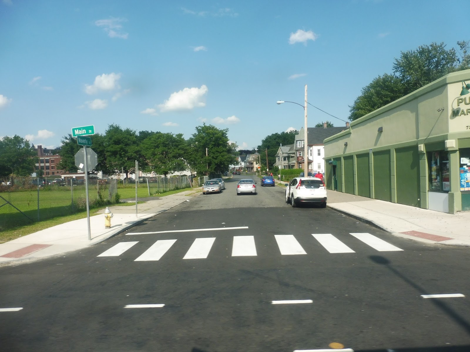
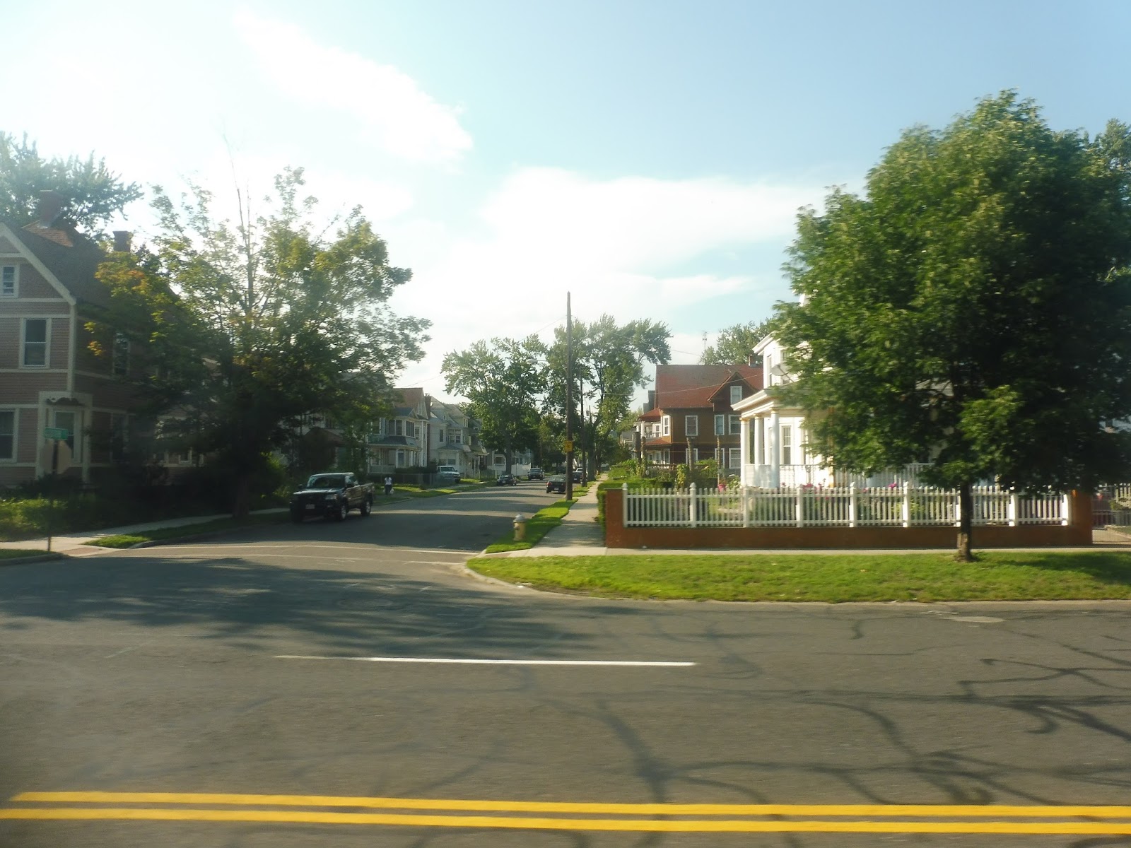
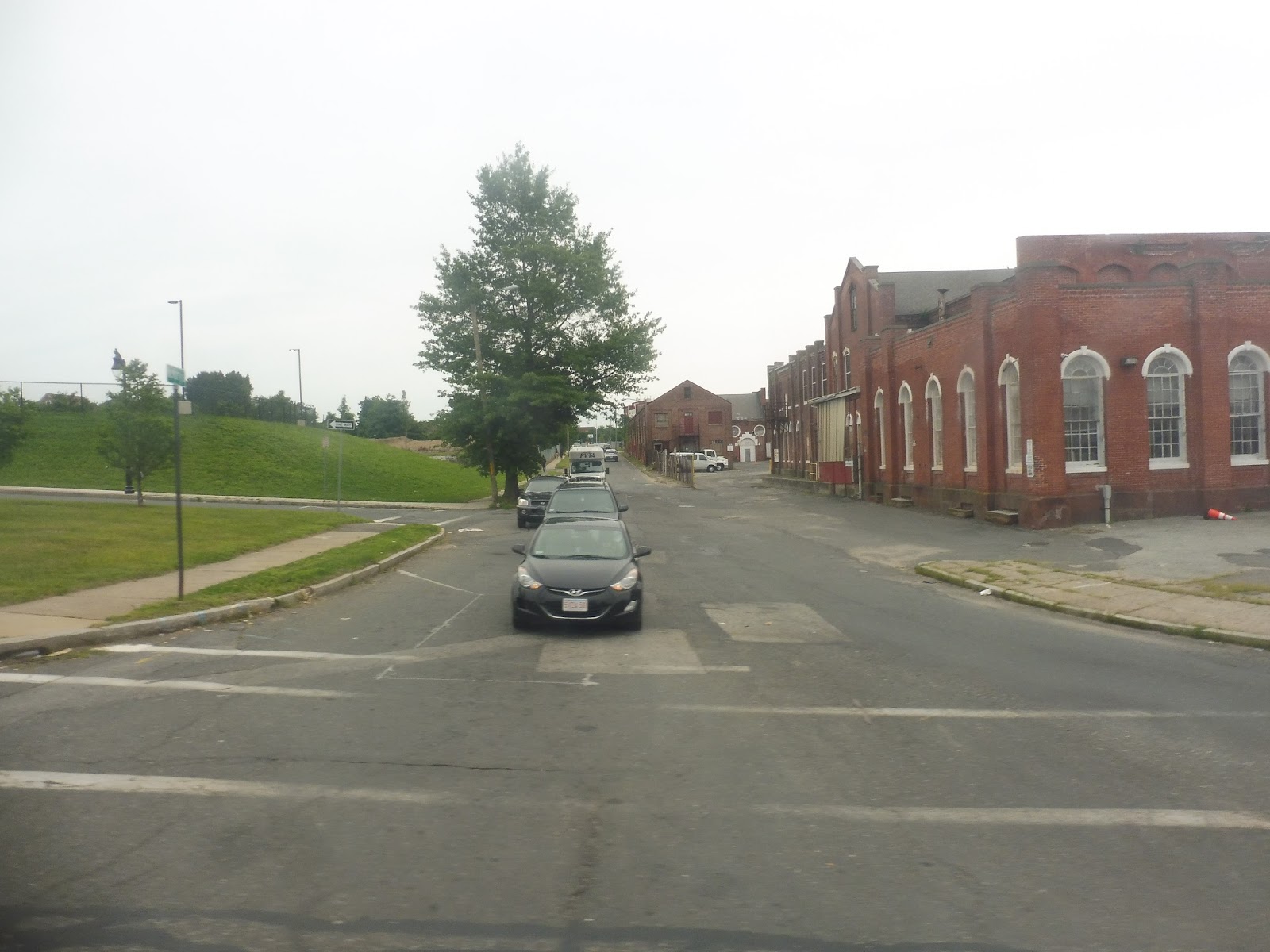
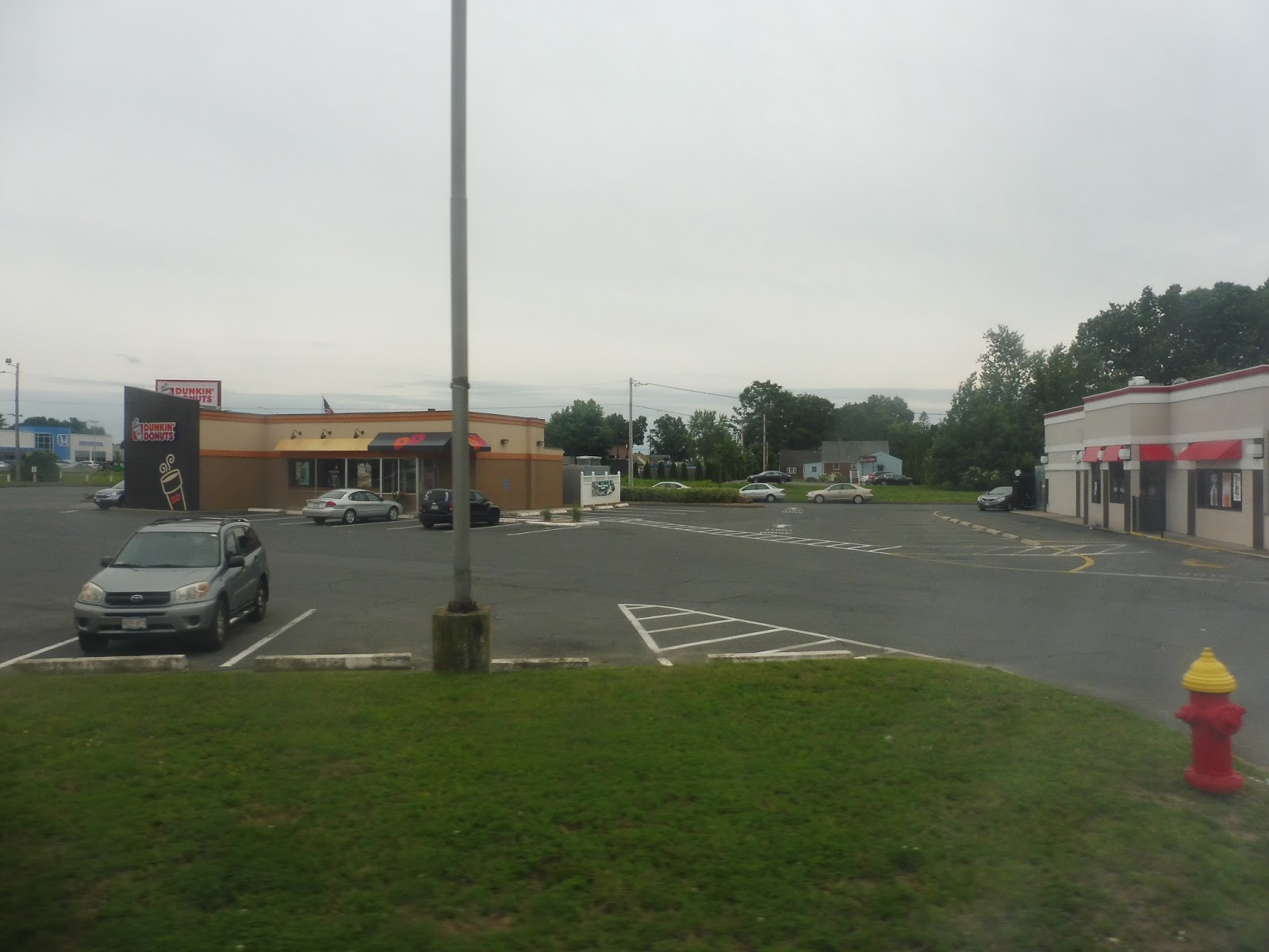
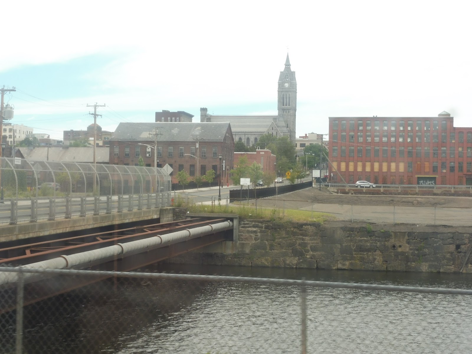
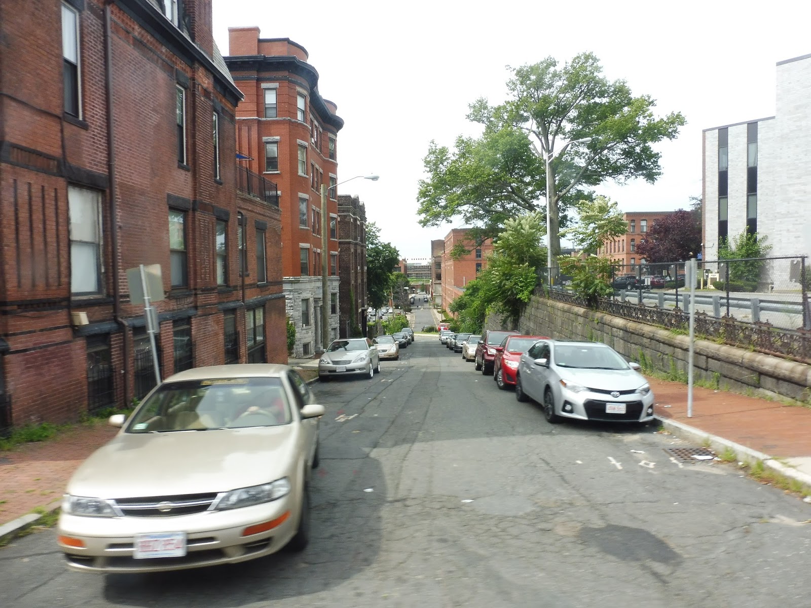
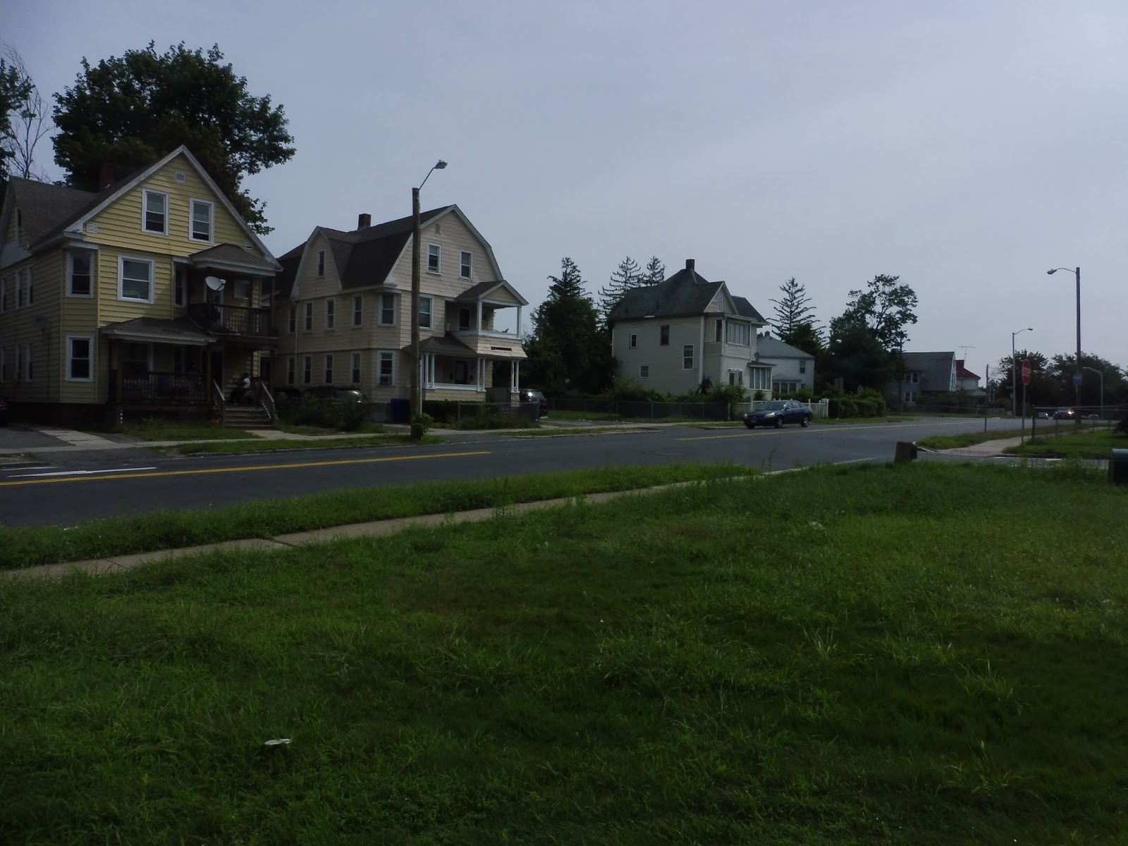
Morton Street
Let’s take care of a one-off Fairmount Line review, shall we? This is Morton Street. It’s a Fairmount Line station in Mattapan. That’s all the background you need.
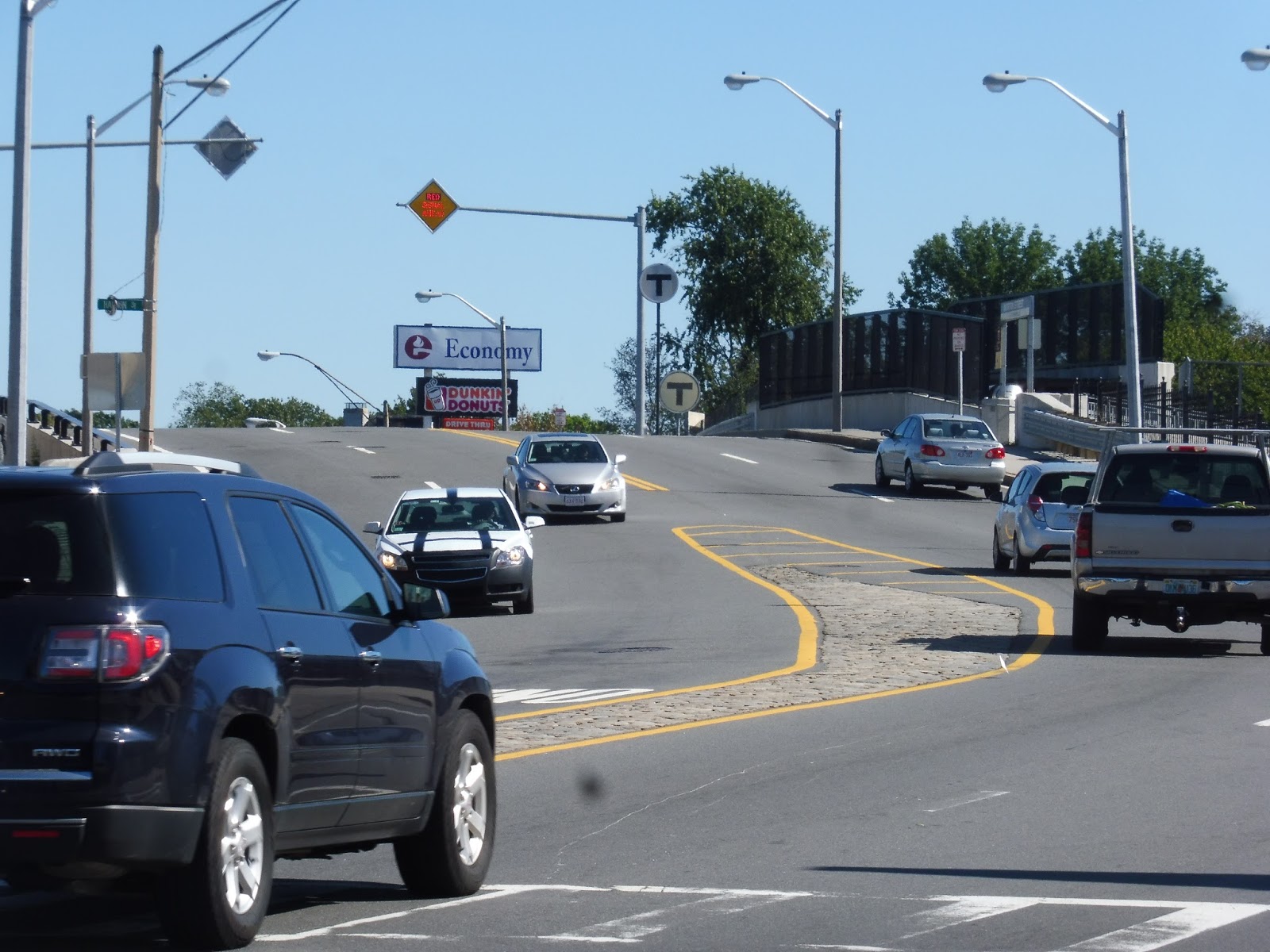 |
| There it is! |
Morton Street Station is located on the road of the same name, a four-lane behemoth of speeding traffic. It’s too bad, then, that the station entrance is only on one side of the road, with no crosswalks for a while on either side! It’s not too big of a deal, I guess, but it’s definitely a little annoying. The entrances are marked with a few T symbols and station signs. There’s a secondary entrance to the outbound platform on Flint Street.
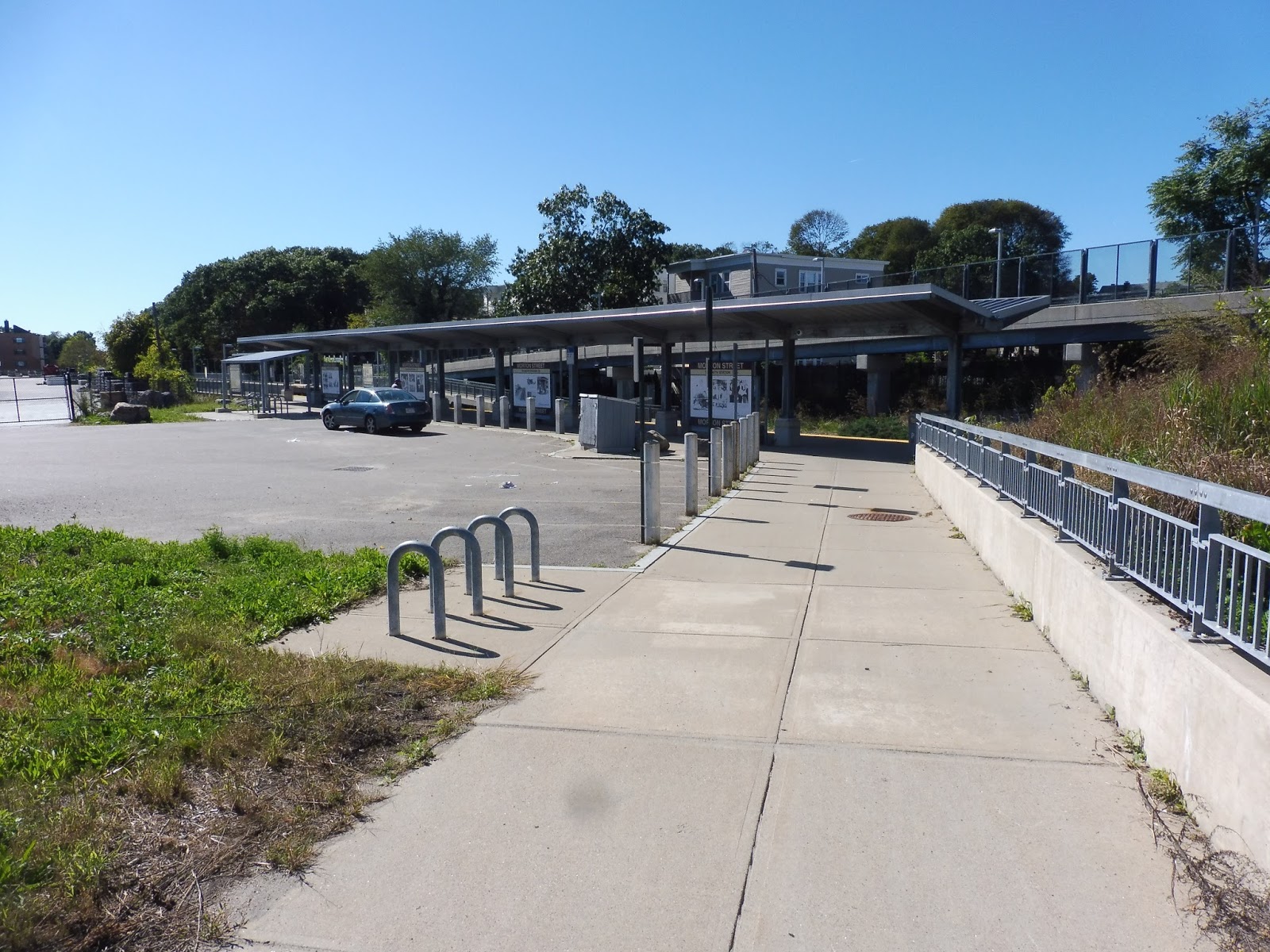 |
| Coming down on the inbound side. |
The inbound side of the station has a lot more amenities than the outbound, such as a staircase and a ramp (the other side just has the latter) and some bike racks. This side also has a little parking lot, which is interesting. The MBTA website claims there’s no parking here!
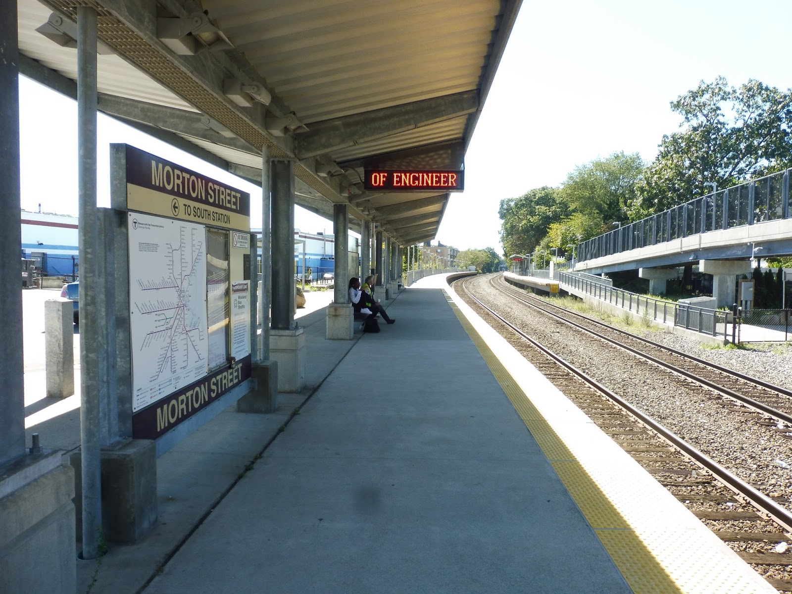 |
| The platform. |
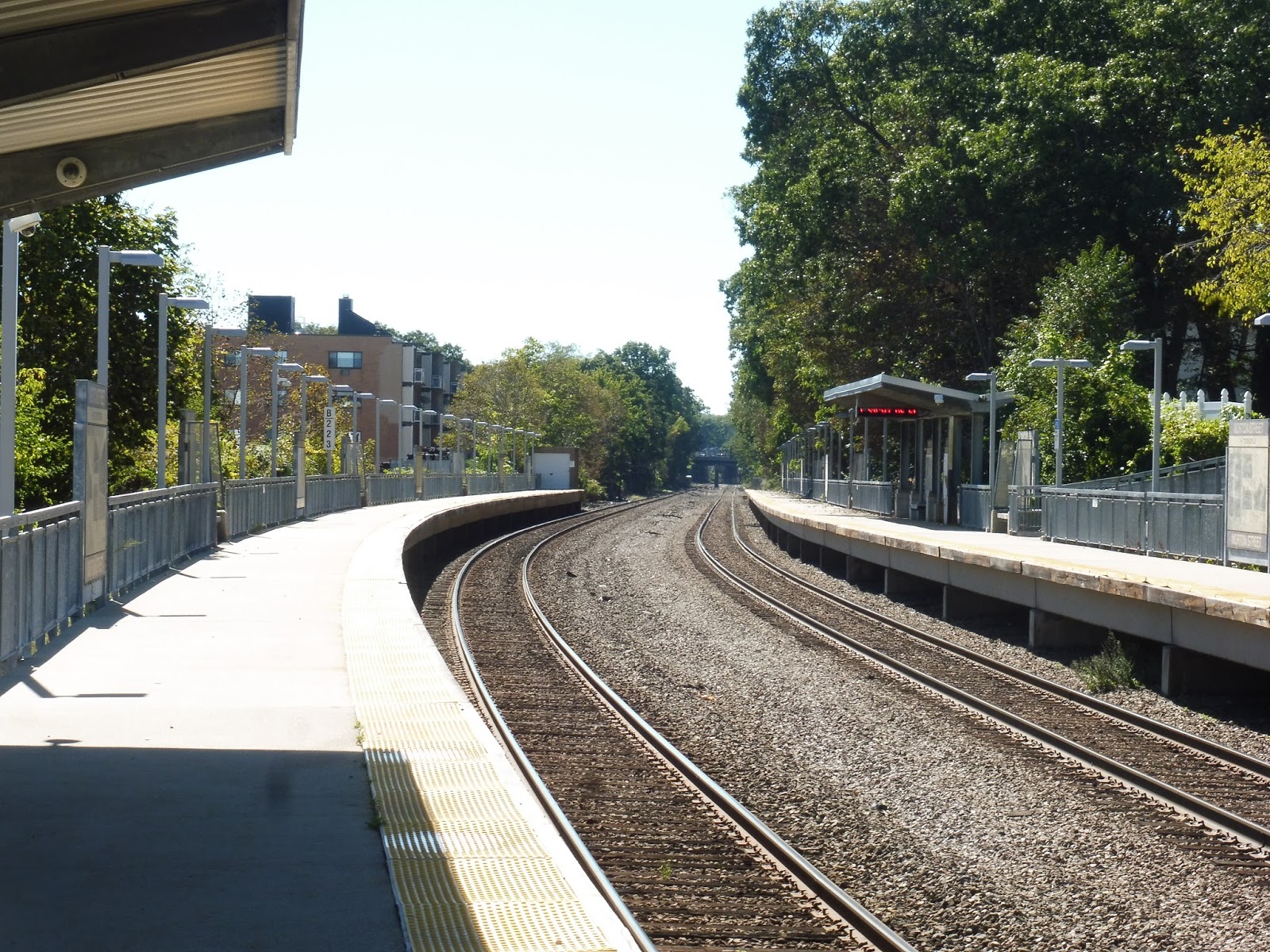 |
| No train picture, unfortunately, but here’s another one of the platform. |
Pros: As a normal Fairmont Line station, Morton Street features luxurious high-level platforms, beautiful convenient shelters, and more benches than are probably necessary, since this thing can’t generate any kind of ridership with an hourly Commuter Rail service because this is destined to be a rapid transit line ARGHHHHHHHHH!!!!!
Cons: I gotta say, this station is somewhat lacking in the wastebaskets department! Other than that, it’s really just the fact that there needs to be way more frequent service here, because the Fairmount Line as it is is just a joke.
Nearby and Noteworthy: There are some businesses to the east of this station, but they don’t look particularly appealing…
Final Verdict: 7/10
It’s a Fairmount Line station. The end!
Latest MBTA News: Service Updates
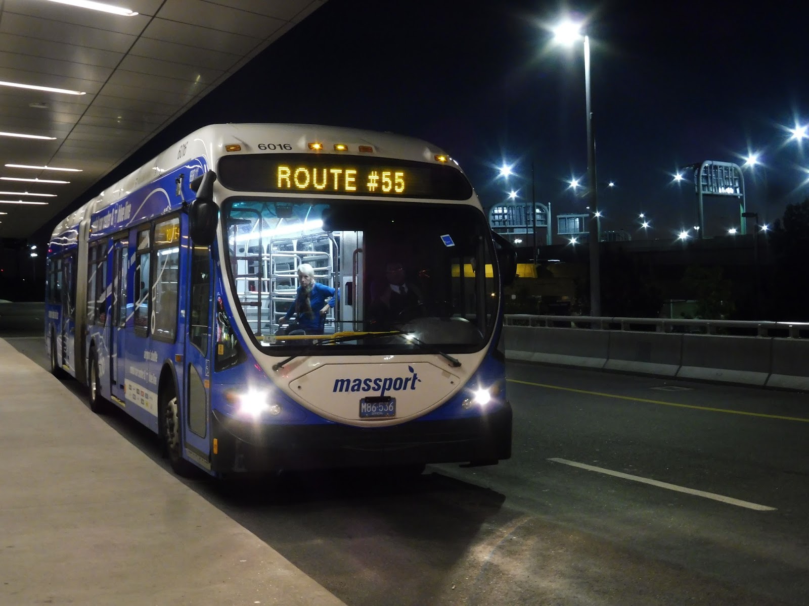
Logan Airport Shuttle: 55 (Serves All Terminals to subway station and to Rental Car Center)
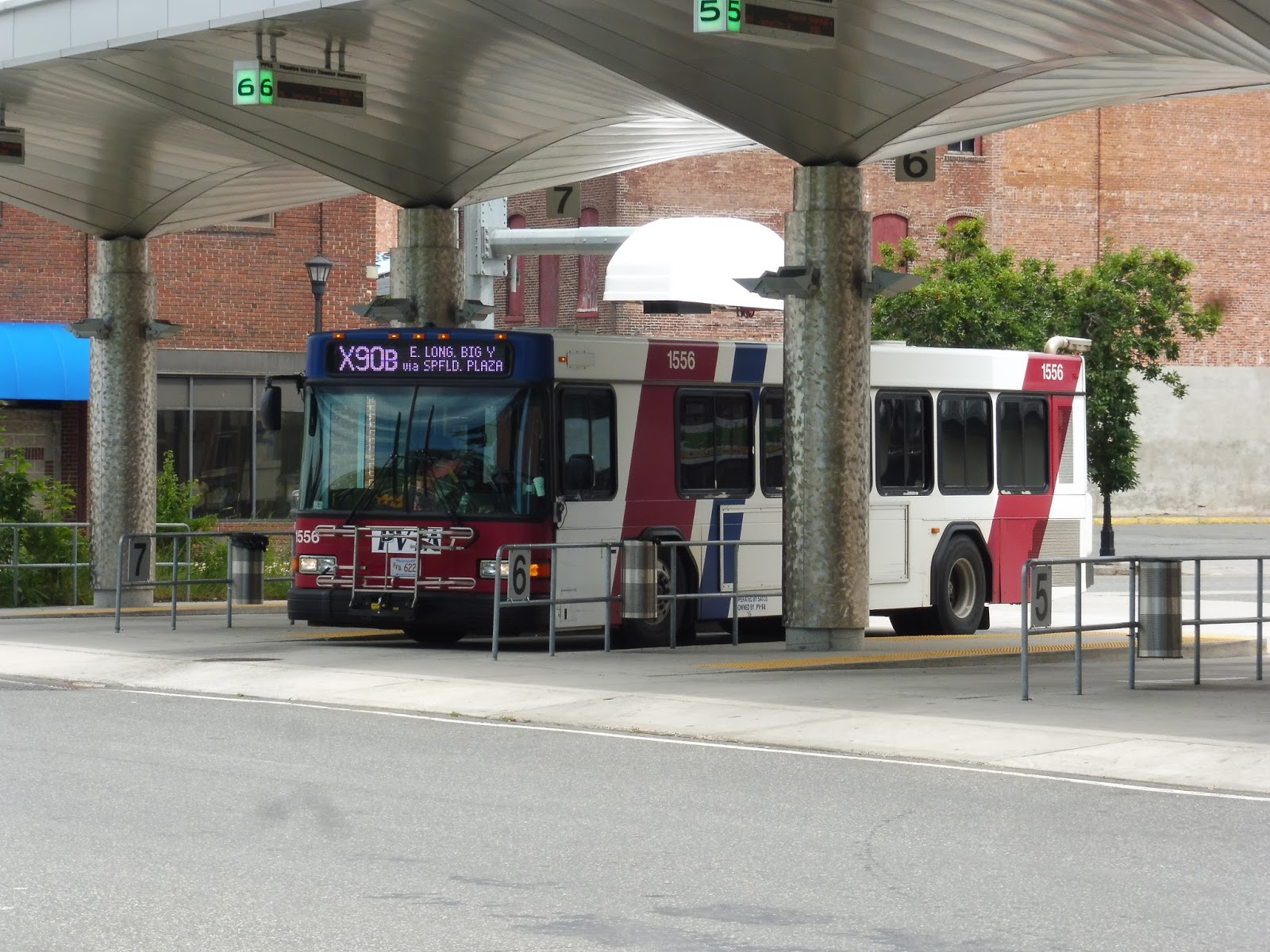
So I found out that before I can do the big review, I have to do some other reviews that sorta pertain to the big review in a way, mostly for dramatic purposes for when the big review finally comes out. It’ll become clear at some point. Well, anyway, before I can do the other reviews before the big review, I’m gonna patch up the time by taking care of some reviews in my backlog of my reviews, not pertaining to the other reviews or the big review. Thus, here’s my review of the Logan Airport 55 route review. Review? Review!
 |
| The bus at Terminal A. |
The 55 is basically a combined version of the 22 and 33 that runs in the late evening and early morning in lieu of those routes. That’s about it. So we started at Terminal A and proceeded to, yes, Terminal B – stops 1 and 2. From there, and I know this is a big surprise, we went to Terminals C and E! Oh, and there was also that weird Massport control tower stop between B and C that no one ever uses…
 |
| Oooh, blurry! |
After Terminal E, we headed down Service Road, passing a gas station, some parking lots, and a few airplane hangars. Eventually we turned into Airport Station, then from there we went down Transportation Way. There was a park on one side, and we curved around it before running up to the upper level of the Rental Car Center. Alright, review over!
 |
| Another 55 getting ready to go back to the airport. |
Logan Airport Shuttle Route: 55 (Serves All Terminals to subway station and to Rental Car Center)
Ridership: Since this route operates during the airport’s off-peak hours, ridership is pretty light. My trip had maybe seven people in total.
Pros: It makes sense that during times of lighter ridership, Massport combines the 22 and 33 into one route. It does mean a longer ride to Terminals C and E, although in the case of E, most international flights don’t leave when this route runs, so it’s not too big of a deal. The route operates with consistent frequency, and you should never have to wait too long for a bus.
Cons: It’s kinda weird that this uses 60-foot buses, isn’t it? I mean, there really doesn’t seem to be enough ridership to justify them, and I imagine the costs for running them are higher than normal 40-foot buses.
Nearby and Noteworthy: Every terminal of the airport! Woah!
Final Verdict: 6/10
I don’t really have all that much to say about the 55. It’s just a fairly meh shuttle that runs when the ridership isn’t high enough to support the 22 and 33. Basically, you’re in for a slow, quiet ride in a 60-foot bus with very few people on it.
Latest MBTA News: Service Updates
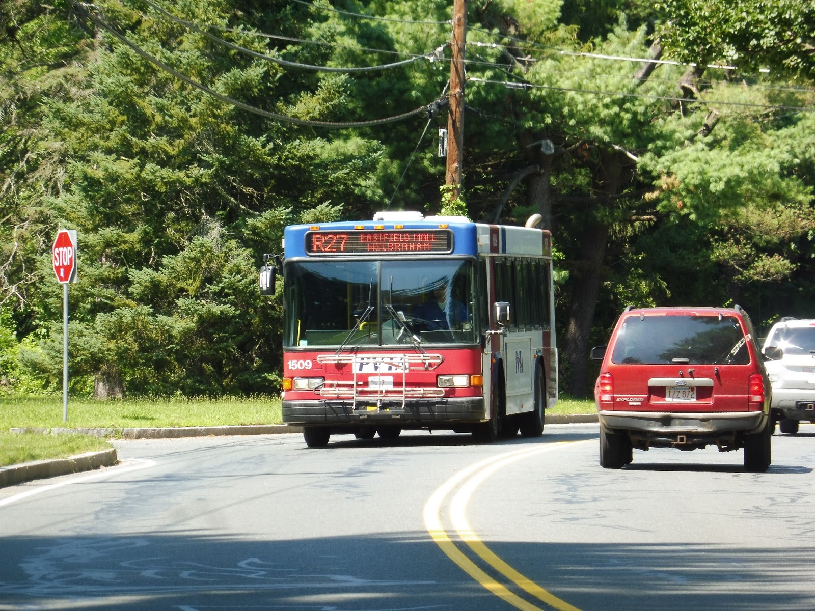
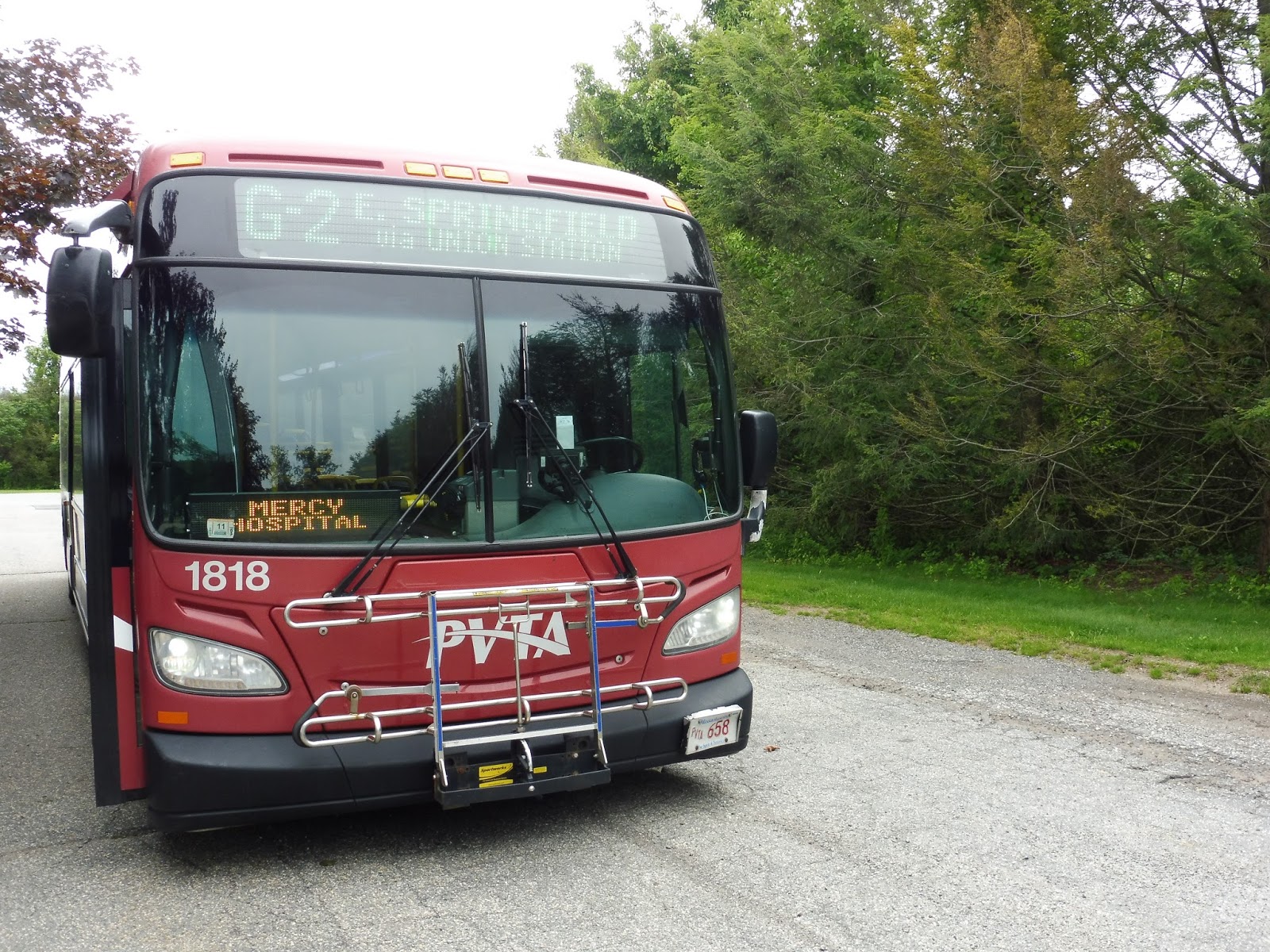
PVTA: R27 (Springfield/Eastfield Mall via 16 Acres-Wilbraham)
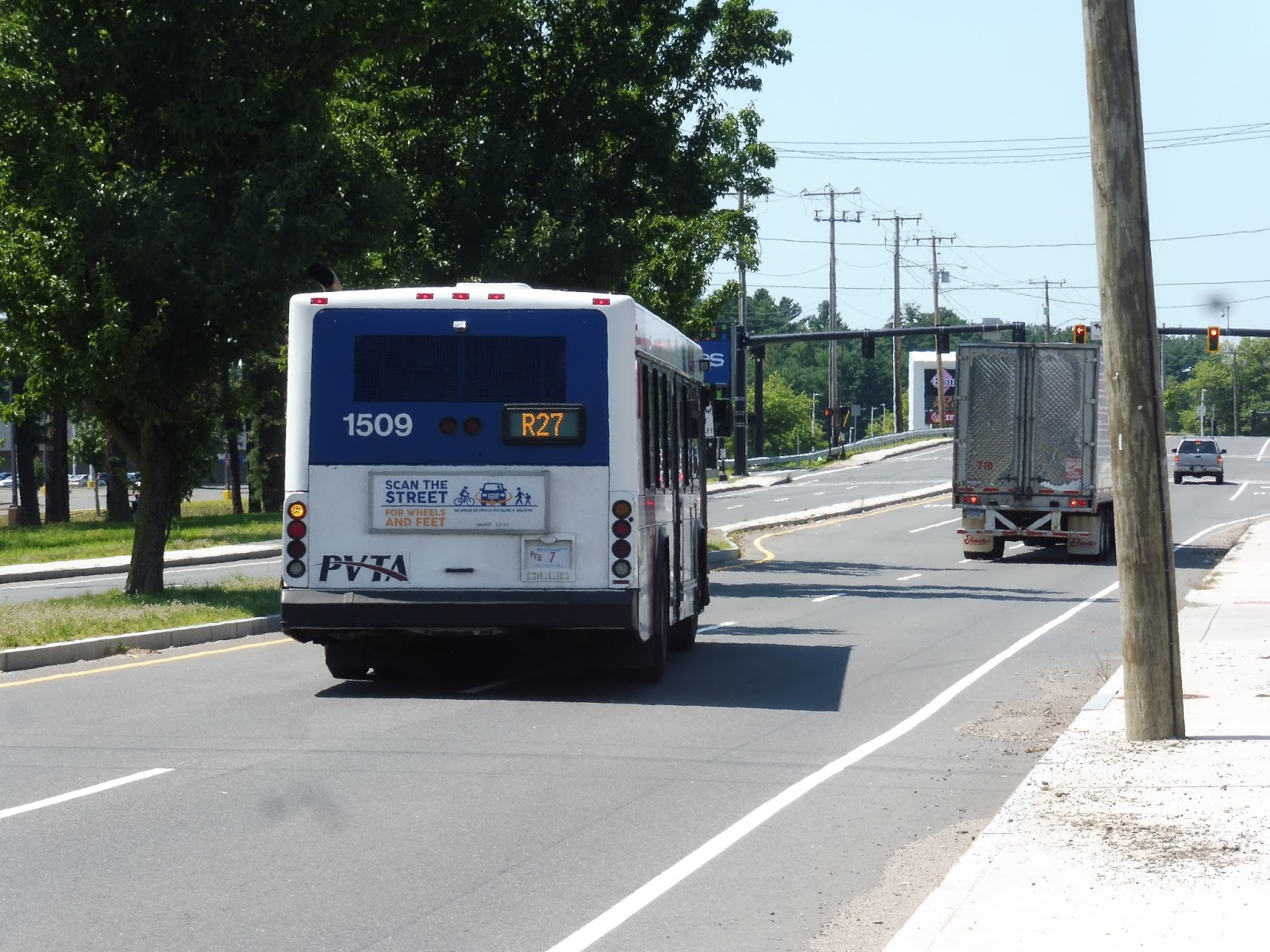
As I continue to work on my big review that I know all of you will like quite a lot, let’s take a look at a defunct PVTA route! The R27 was eliminated pretty soon after I left Amherst, so I’m glad I got the opportunity to ride it – and it was hard to find even when it existed! Having been on this elusive bus, I can safely say that…yeah, good thing the PVTA cut this thing.
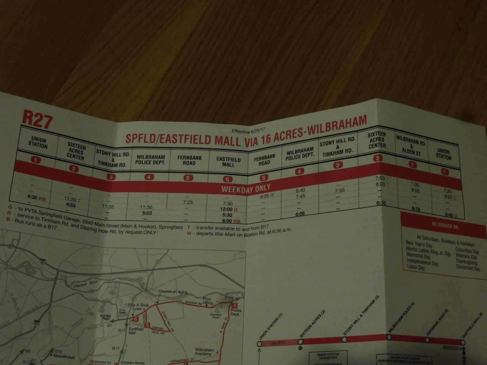 |
| This schedule is Exhibit A! |
Oh boy, it’s one of these schedules, huh? More dashed lines than actual timepoints? Every single trip has some sort of letter attached to it that makes it different from all the others? Cooooool. I’d also like to point out that only three of the five trips actually operated as R27s; the two evening ones were deviated B17s.
 |
| Well, here’s the stop…or something… |
Sam and I took a B17 to Sixteen Acres Center, and we had half an hour to wait for the R27 (despite the fact that the schedule promised a “transfer to and from the B17”). We literally spent almost all of that time poring through the horrible PVTrack app looking for the right R27 stop – there were so many of them, and they were in seemingly no order at all! We were paranoid about missing the bus (or worse, the bus not coming at all), so we settled for the stop after Sixteen Acres Center, which was pretty desolate.
 |
| IT EXISTS!!!!!! |
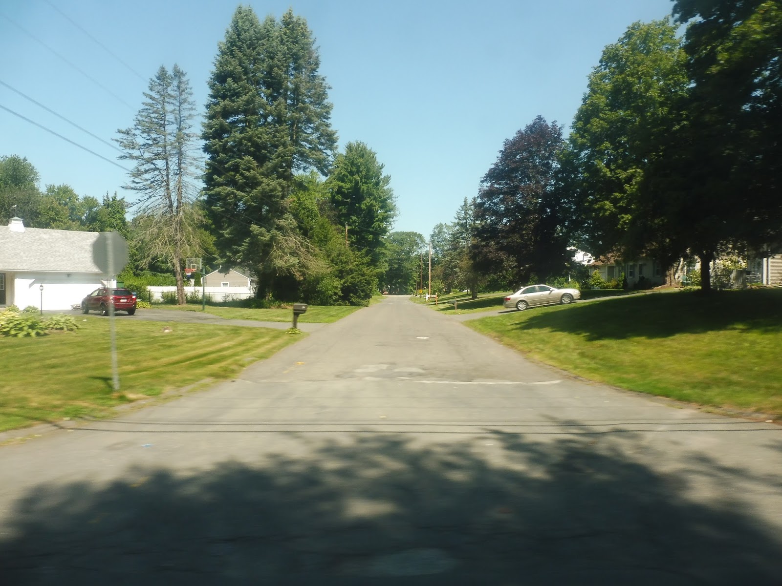
We were already past the suburban businesses of Sixteen Acres Center at this second stop – by this point, it was all residential. We headed down Wilbraham Road past lots of houses; eventually we entered Wilbraham, and the name changed to Springfield Street. It already started to feel more rural, with more trees and larger spaces between houses.
 |
| A pleasant side street. |
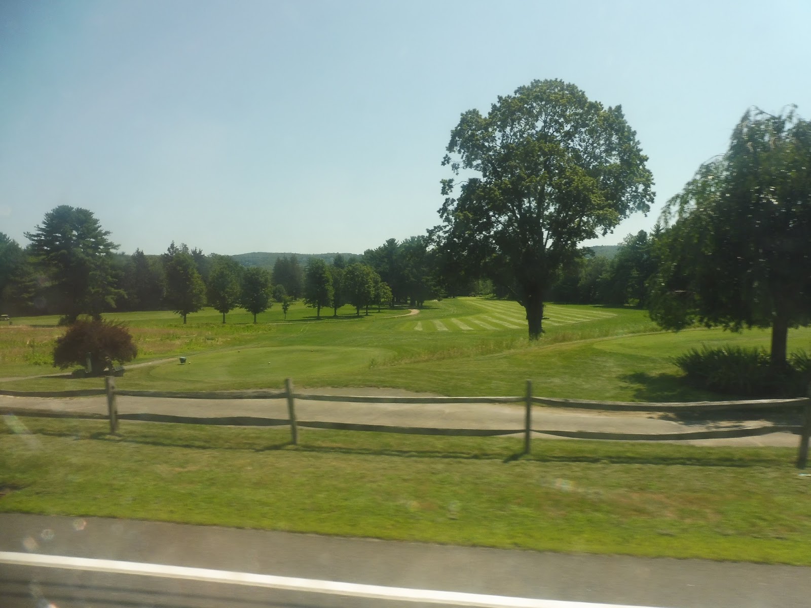
For some reason, the R27 was planned in the most complicated way possible. It had two deviations along the route that certain trips served, and my trip was doing one of them. Thus, we turned onto Stony Hill Road, which was more houses, then it ran straight through a golf course. We turned onto Tinkham Road next, passing more sparse houses.
 |
| Fore! |
We went by the entrance to the Minnechaug High School, then a cemetery, and next, we turned onto Main Street. There was farmland for a bit, then it went back to being residential once more. Eventually, at the intersection with Springfield Street, we reached Wilbraham Center! It was basically a few businesses and a small common…and Main Street dissolved into woods a few seconds after passing through the downtown.
 |
| Welcome to Wilbraham Center! YAY!!!!! |
Houses came back pretty soon, and they were the only thing along here for a while. Eventually we went by a church, and soon after, we turned onto Boston Road. This was completely different from before: now there were auto shops, suburban businesses with parking lots, and…a few ponds!
 |
| This is me trying to get a picture of one of them… |
The suburban sprawl continued for basically our entire run on Boston Road. Now, Sam and I were trying to catch the Palmer Village Shuttle from the Eastfield Mall, where this route terminates. Somehow, though, our bus was late (a rarity for PVTA!) and we had to get off just before the mall in order to catch the PV on its way out. Still, there isn’t much to the end of the R27 – all it does is deviate into the mall, and that’s the end of the route.
 |
| This could very well be the last picture ever taken of an in-service R27! |
PVTA Route: R27 (Springfield/Eastfield Mall via 16 Acres-Wilbraham)
Ridership: My ride featured a grand total of one other person! Cool! According to the PVTA, this route got 11 riders per revenue hour, which seems like a lot. I mean, maybe the rush hour trips got busier, but my midday trip was empty.
Pros: The PVTA must have some political obligation to serve Wilbraham, because there can’t be any other reason why fixed-route buses are running through such a low-density area. In that sense, I guess this route provided that service?
Cons: The R27 was just a confusing mess – its schedule was completely nonsensical! Also, the ridership was really low, and the route was just way too complicated for its own good, with too many deviations and service variants. The stops were organized really badly on the app, too, and the route itself was insanely hard to find in real life!
Nearby and Noteworthy: Wilbraham Center is not a thriving hub of activity by any means, but…yeah, that’s about all you’ve got on this route.
Final Verdict: 2/10
The only thing keeping this from a 1 is that if the numbers are to be believed, this route got at least a little ridership. Anyway, the way they replaced it was well-done: they just deviate three rush hour B17 trips per day to Wilbraham now. It doesn’t affect that route’s frequency, and B17 riders aren’t impeded at all – the ride takes the same amount of time, with the added bonus of less padding on those trips. That means less waiting at random stops! Yay! This is much simpler and more convenient than what the R27 was like, so I’m really glad they integrated the two routes.
Latest MBTA News: Service Updates
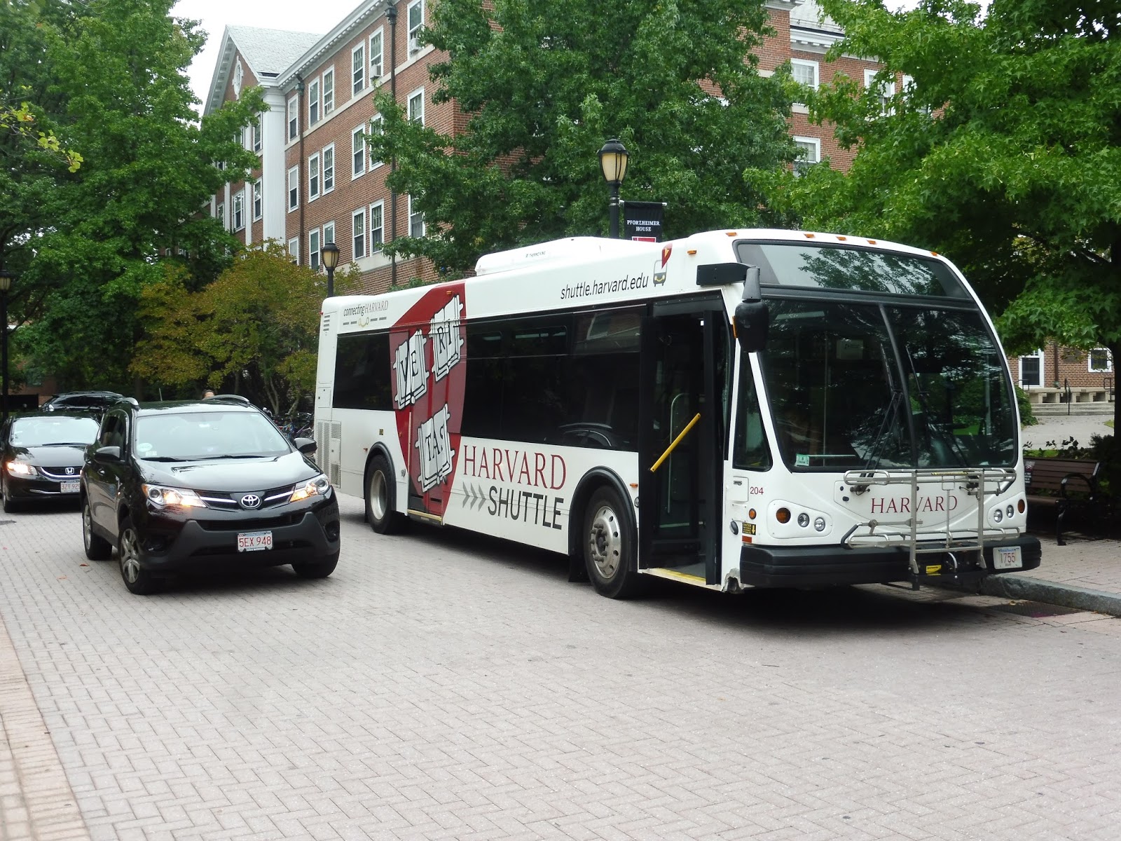
Harvard Shuttle: Crimson Cruiser (Quad – Mather House via Memorial Hall)
Might as well crank this one out while we’re on the topic of Harvard Shuttles. The big review that’s coming will be really good, I promise!
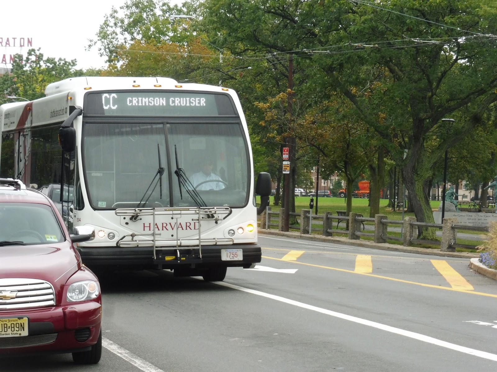 |
| The bus alongside Cambridge Common…and a car that got in the way. |
I got on at Garden Street along Cambridge Common, and we looped around the Harvard Bus Tunnel onto Mass Ave. After going by the Harvard Law School, we turned onto Everett Street, then Oxford Street, which took us past the Harvard Natural History Museum, among other buildings. Next, we turned onto Kirkland Street.
 |
| Ah, much brighter than the Extended Overnight! |
We pulled into the Memorial Hall deviation, and…oh, cool, we were early? Great, fun, let’s wait around. Luckily, we were only stuck here for about a minute, and we were soon off to make our two-block jog because of one-way streets. Finally coming onto Quincy Street, we ran alongside Harvard Yard and dropped someone off at the Lamont Library.
 |
| Somewhere on some side streets. |
After the library, we cut our way down Bow Street, curving down onto DeWolfe Street. This took us down to Cowperthwaite Street, where we arrived at our Mather House stop…four minutes early. Sigh…alright, more waiting…
 |
| No one’s on board. At least we have the nice poofy seats! |
Finally, it was time to go, so we went up Banks Street, then looped around to Mass Ave. We ran on this all the way up to Harvard Yard, where we made the stop at Holyoke Gate, then continued around the yard past the Red Line station. After that, we looped around the bus tunnel again in order to get back onto Garden Street, which we took out of the square and back to the Quad…where the bus was early. Again.
 |
| Aw man, the sign is off! |
Harvard Shuttle Route: Crimson Cruiser (Quad – Mather House via Memorial Hall)
Ridership: Here’s the lowdown for morning ridership: from the Quad to Harvard Square, the bus gets packed. Going around the Memorial Hall loop, you might see one or two people; ditto for Mather House. Then the bus loops empty back to the Quad and gets another huge load of people for the trip back down to Harvard. In the afternoon, I imagine the Quad traffic switches to the other direction, but I’m pretty sure the other ridership camps still stay light.
Pros: This route provides crucial weekend morning service around Harvard, which is clearly well-used by students. There’s also service for a few trips weeknights, replacing the former River Houses B. After we establish the fact that this is an important route, though, it all goes downhill…
Cons: Firstly, this route has the same earliness and timing problem that the Extended Overnight has: it has mid-route layovers, and it runs with uneven 35-minute headways. Unlike that route, though, traffic is more variable during the day, and getting rid of layovers to increase frequency may not be the best idea just in case an unexpected jam occurs. Instead, a better solution to run more frequent service would be to cut one of the deviations – either Memorial Hall or Mather House. Neither one gets very high ridership, and getting rid of one would easily allow for half-hourly service. However, I’d also like to point out that the 1636’er, which runs weekend afternoons and replaces this route, gets two buses and runs every 20 minutes. Why does that route get more service? It’s basically the same thing as this one (almost), except in the afternoon and evening! Clearly the Crimson Cruiser would benefit from more service – it can get really crowded to the Quad!
Nearby and Noteworthy: Well, you’ve got all of Harvard Square, I guess! Oh, except for Peabody House – this route unfortunately doesn’t perform that “important,” “useful” deviation.
Final Verdict: 5/10
The Crimson Cruiser’s main function, at least based on ridership, is getting people between Harvard Square and the Quad. The other two deviations, as far as I’m concerned, are pretty unnecessary, although probably political – I doubt Harvard could eliminate them. Still, something has to be done about those crowds, and the solution might have to be an extra bus. After all, the 1636’er gets another one! Why can’t the Crimson Cruiser have one too?
Latest MBTA News: Service Updates
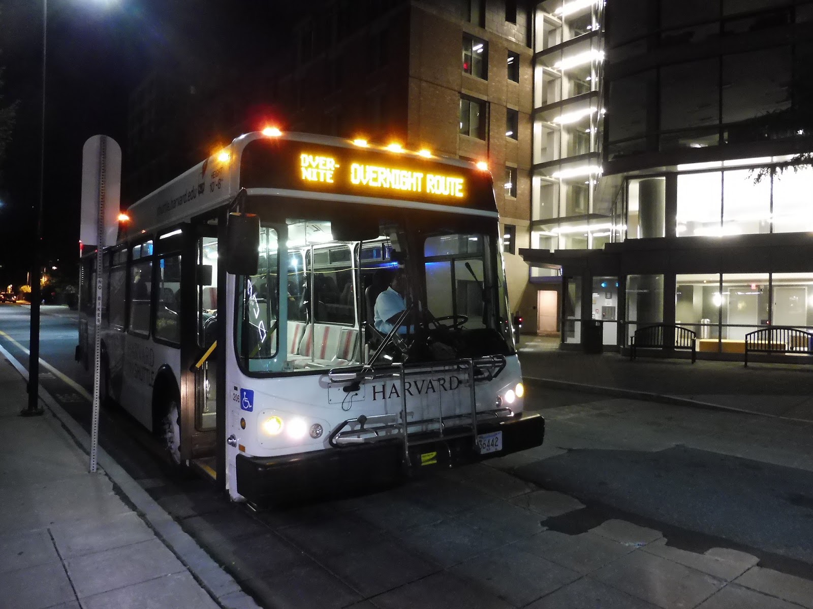
Harvard Shuttle: Extended Overnight (Quad – Mather House via Memorial Hall)
We’re taking a break from the PVTA for just a bit while I work on a huge review that I think all you guys will really like! In the meantime, let’s look at this piece of trash.
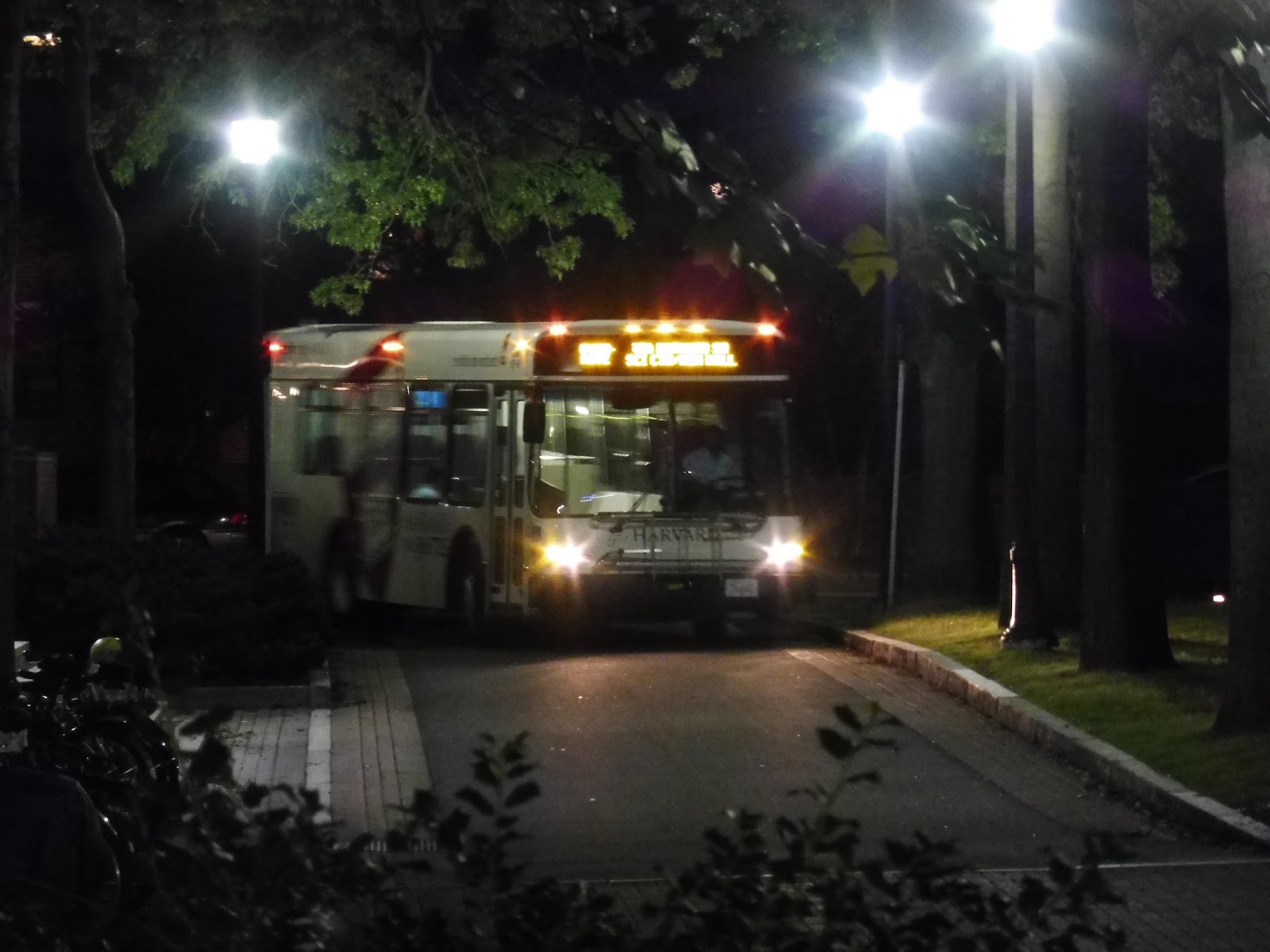 |
| Comin’ round the bend. |
The Extended Overnight is Harvard’s overnight bus (obviously), running from around 1 AM to 4 AM (5 on Saturday and Sunday mornings) on a strange, loopy, deviatory route around the entirety of Harvard Square. Nathan, Sam, and I took this route before doing the 171, because…well, why not? We boarded at the Quad at 3:10 in the morning.
 |
| No buses coming out of here at this time of night! |
From the Quad, we made our way down to Garden Street, which was briefly residential before we came up alongside Cambridge Common. We looped all the way around, circling the Harvard Bus Tunnel and running up Mass Ave. It wasn’t for long, though – we turned onto Everett Street, then Oxford Street, going by various Harvard buildings.
 |
| Uhhhh…trippy? |
We turned onto Kirkland Street, then we pulled into the Memorial Hall deviation…and had to wait, because we were early. Well, gosh, I might as well be reviewing a PVTA route, since clearly Harvard took a page out of their book! We finally left and made a loop around the block via Quincy Street, Cambridge Street, Prescott Street, and Broadway, before coming back to the one-way Quincy.
 |
| The Yahd! |
We were alongside Harvard Yard now, and we continued our loop around its perimeter by heading onto Mass Ave. We ran past the Holyoke Gate stop, however the route bypasses it, because…no, I have no idea why it does that. We turned onto Dunster Street, then Mount Auburn Street, going by smaller, more local Harvard Square businesses.
 |
| The intersection of Mount Auburn, Bow, and Linden Streets…duh!!! It’s so obvious from the picture! |
Next, we turned onto Dewolfe Street, then Cowperthwaite Street, which took us to Mather House…and we were early again! Oh boy! After a wait, we had to deviate to serve Peabody Terrace (or “Peobody” in the schedule – good one, guys), so we turned onto Banks Street. Upon reaching the stop, we just…did a three-point turn to turn around. Sigh…
 |
| The driver graciously let me take a picture at Mather House! |
We went up Banks Street until Mount Auburn Street, where we looped around to Mass Ave for the third time on the trip. We took this up towards Harvard Square, but we got off at the stop just before it, at the intersection with Quincy Street. The bus continued towards Harvard, where it would eventually go back up to the Quad.
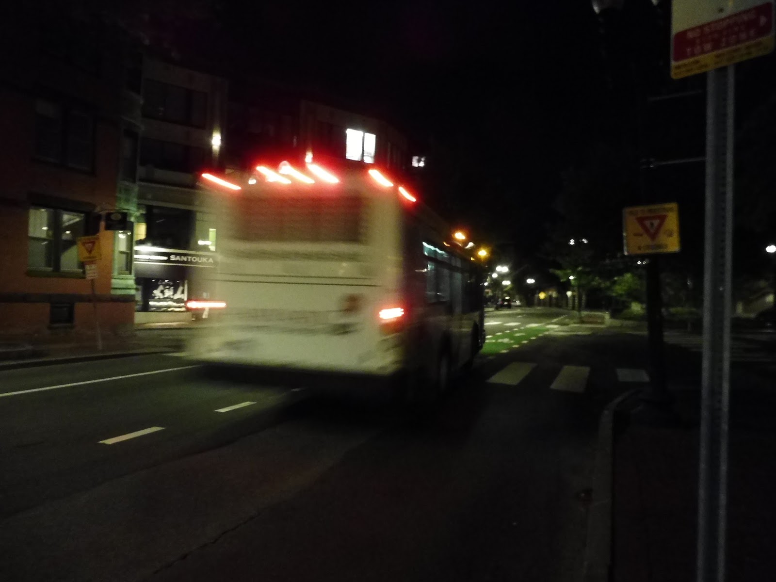 |
| Goodbye, you rascal. |
Harvard Shuttle Route: Extended Overnight (Quad – Mather House via Memorial Hall)
Ridership: On the outbound trip to the Quad, there was one person who got off. For our entire ride, there was absolutely no one. Yes, folks, this route truly gets amazing ridership.
Pros: It does provide overnight service to Harvard, but as we’ll see, this doesn’t mean much…
Cons: Okay, first of all, the route is a loopy mess. It’s literally faster to walk to your destination than take the bus a lot of the time! Also, why the heck is it every thirty-five minutes? I mean, this thing definitely has at least five minutes of waiting time – it could easily be cut down to every 30 minutes to simplify the schedule. Finally,and here’s the real kicker, why does this route run at all? Harvard provides an evening on-demand van service for all students and faculty that can be called with a special app – why isn’t this just the only service? It would get people to their destinations much faster, plus it would save the university money by not having to run the Extended Overnight around in circles all night!
Nearby and Noteworthy: I don’t know what you’re doing up at 3 AM, but if you are, all of Harvard Square is at your fingertips with this route!
Final Verdict: 1/10
Cut it. Cut it. Cut it. Okay, I know there’s probably some political reason that this route needs to exist, but why? The evening van can literally perform all of its functions more directly and more efficiently. That’s right, I am actually calling a flex service more efficient than a fixed-route service. That’s how bad this route is!
Latest MBTA News: Service Updates
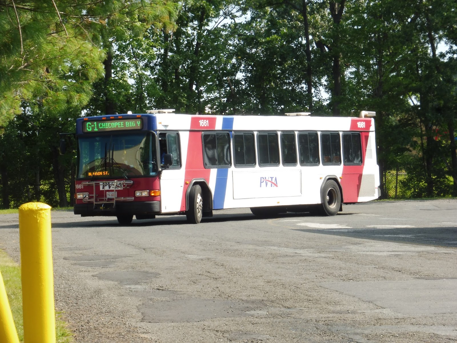
PVTA: G1 (Chicopee/Sumner-Allen/Canon Circle)
The G1 is honestly the most legit-feeling bus route on the PVTA. Sure, the B7 is busier and more frequent, but the deviations along the route still make it feel like an RTA. The G1, meanwhile, could honestly pass for a T bus route in Boston, at least for most of it.
 |
| Okay, not this part. |
 |
| Coming onto Memorial Drive. |
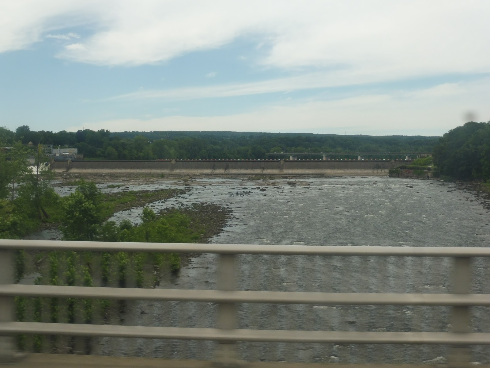
We turned onto Memorial Drive, a wide road with suburban businesses and parking lots on either side. They got a little sparser after we went under I-90, and in fact, it even got a little woodsy. There were a few more businesses, then we went over the Chicopee River, where there was an amazing view.
 |
| On the other side of the bridge. |
After the river had been crossed, we turned onto Main Street, then Grove Street. There were businesses at first, but Grove Street added some apartments to the mix. We merged onto Front Street next, which was mostly retail, but there were a few random houses in there as well.
 |
| A residential side street. |
We went by a park, then it started to get more urban, with lots of different buildings lining the road. There were dense houses, businesses, a library, a basilica, and a school, among other things! We soon entered Chicopee Center, where we turned onto Cabot Street, taking us through the really boring and run-down downtown.
 |
| Oh, gross! |
We passed a post office and a small park, then we merged into Center Street. After a mix of auto shops and normal retail, the road grew really wide for an interchange with I-391 and we came up alongside the Connecticut River. It was woodsy for a little while, but it got industrial after we went under I-91.
 |
| Some random auto shop. |
Soon we entered Springfield, and the street became Main Street. We went through part of the Baystate Medical Center complex, then we went under I-91 again. On the other side, there was a gas station, a post office, and some businesses later on. We also passed the PVTA garage; there are lots of short-turn “G1” trips that pull back here from other routes.
 |
| A side street. |
From that point, Main Street was basically lined with businesses for quite a while. Eventually it grew really wide and we went under I-291 (so many highways to go under!) and past some office buildings. Finally, we came into Union Station, the midpoint of the route. There were a lot of people waiting to get on.
 |
| Union Station! |
We returned to Main Street, going under the Union Station tracks and past lots of buildings and businesses. The buildings were tall for a while until eventually they lowered and it became just pure retail. There were also some apartments and churches mixed in there, too. Also, did I mention the bus was packed by this point?
 |
| This is getting a little ridiculous! Remember, this isn’t the MBTA! |
Eventually we merged onto Locust Street, then another merge onto Fort Pleasant Ave. This was a wide road lined almost entirely with dense houses. Next, we turned onto Sumner Ave, which was…basically the same. We passed a park, and there were lots of businesses when we went through The X, but it was back to houses after that.
 |
| Leafy! |
There were a few bits of retail at certain points, but it was almost entirely residential by now. Also, at some point along here…we were passed by another G1. I’ll repeat: we were passed by another G1. THIS IS AN RTA ROUTE WITH BUNCHING! HOW COOL IS THAT?? Okay, it was also kind of annoying, but still!
 |
| Houses, houses, houses… |
We merged into Allen Street, which was one-way, and it continued to be the same kind of housing as before (aside from an apartment development at one point). Once the two one-way roads merged back together, there were suburban businesses with parking lots, mostly to the south. Allen Street eventually got narrower, and after a run through a semi-woodsy area, we turned onto Cooley Street.
 |
| More, more, more houses. |
After some regular residential areas, we turned onto Canon Circle, which was home to Spring Meadow Apartments. We looped around the development, then made our way back up Cooley Street. This time, we bypassed Allen Street in order to deviate to both Stop & Shop and Five Town Plaza. Yeah, the G1 feels like a legitimate bus route except at both of its termini…
 |
| More people! Poor bus! |
 |
| Two G1’s going in opposite directions – the one on the left was our bunch. |
PVTA Route: G1 (Chicopee/Sumner-Allen/Canon Circle)
Ridership: This is the third-busiest route on the PVTA, so…yeah, it gets great ridership. It averages about 33 passengers per trip, but my late bus got absolutely packed, as you could see! The buncher behind us wasn’t that busy…
Pros: The G1 provides frequent service to lots of dense parts of Springfield and Chicopee. By “frequent,” I mean every 20 minutes on weekdays, every half hour on Saturdays, and every 45 minutes on Sundays. This is an important route!
Cons: Wow, as it would turn out, I have a lot of problems with this route. First of all, the G1 is decidedly busier than the P20 (not by much, but still), yet the P20 is far more frequent on weekends. Also, the whole Walmart thing with the G1 bothers me – it needs to be way more obvious in the schedule that the route serves Walmart first. Finally, there’s the fact that this is a huge beast of a route that clearly gets late a lot. It seems like it would be better to split it into two – are there really that many people going from one side to the other, anyway? If it was two routes, I’m sure the on-time performance would be much better.
Nearby and Noteworthy: Meh, I didn’t see much of note along here. The malls and stuff that it serves are probably the most interesting places, since downtown Springfield and Chicopee Center are not.
Final Verdict: 6/10
Huh…okay, well, turns out I dislike the G1 more than I thought I would. It’s an important route, but in that vein, it feels like it should be more frequent on weekends. As for the Walmart bit, I think I wouldn’t care if I hadn’t experienced it the hard way, but I did, so now I’m a big advocate for making the footnote on the schedule way more obvious! And then there’s the lateness…this seems to be the one PVTA route that normally gets late (from my experience, at least), and I think a good way of fixing this would be to split the G1 at Union Station. That way, late buses would get some layover time and they wouldn’t have to stay late all the way to the other side of the route.
Latest MBTA News: Service Updates
The Last Route (Video)
Well, this is long overdue! Here’s a video review of the last bus route on the T…but that’s easier said than done. Enjoy!
PVTA: G3 (Springfield Plaza via Liberty/King-Westford)
The G3 is the least “trunky” of the three routes that run from one end of the system to the other via Union Station. I mean, more than half of the northern G3 parallels the X90 (although I would love for that to change), while the southern section ends on really tiny cute residential streets! This is an interesting route.
 |
| Oh look, its tongue is sticking out! |
The G3 starts at Springfield Plaza, and since it was a Saturday, we could get right to the route – on weekdays, it has to make an extra deviation to the Springfield RMV after the plaza. We went onto Liberty Street, and after a brief bit of woods, there were houses on both sides. As we got far enough south, businesses finally started to appear along the road.
 |
| Liberty Street runs at an angle to other streets. |
Eventually we reached a big rotary around an interchange with I-291. At this point, the X90 left to go onto Armory Street, and so we were finally alone on Liberty. There were dense houses on one side and industrial buildings on the other, but eventually the latter moved to both sides.
 |
| Welp… |
We made a brief deviation down Franklin Street to serve Saab Court, which had a few sizeable apartment buildings. Coming back to Liberty Street, it turned out we were pretty close to Union Station – we pulled in there after a few blocks. After a brief wait, we were off again.
 |
| At Saab Court. |
We went down Main Street, which went under the Union Station train tracks and into downtown Springfield. Next, we turned onto Harrison Ave, Dwight Street, and State Street, passing various urban buildings. State Street went by the Springfield Museums, the US District Court, and the Springfield Armory.
 |
| A side street. |
There were lots of businesses along here, as well as Springfield Technical Community College. All of a sudden, we entered our unique section by turning onto the narrower Hancock Street. There was retail for a little while, but once we turned onto King Street, it was all houses.
 |
| This is so pleasant! |
There was a big cathedral eventually, and soon after that we saw some athletic facilities for Springfield College. We turned onto Westford Ave next, then Westford Circle, which had a nice leafy median. After that, we turned onto Middlesex Street, which was the start of the bus’s loop to turn around – I got off along here.
 |
| See ya! |
PVTA Route: G3 (Springfield Plaza via Liberty/King-Westford)
Ridership: It may not get the highest ridership in the world, but it’s above the threshold of 20 passengers per trip – about 23 people. It adds up over the course of the day, too; this is the 10th-busiest route on the system, which is pretty good!
Pros: The G3 is sort of a nook-and-crannie route, covering little parts of Springfield that other routes don’t serve. It does this with relatively good frequency, at least on weekends: every half hour on Saturdays and every hour on Sundays (when ridership is less).
Cons: More than I realized, honestly. First of all, there’s that stupid weekday RMV deviation the PVTA added recently…WHY IS THAT A THING? For one thing, the route already serves one down near Union Station, and for another, the deviation made the weekday schedule really weird – it has 30-minute gaps, 40-minute gaps, 45-minute gaps…it’s just a complete mess. Also, the nature of the route requires it to spend a lot of time paralleling other ones. It’s not so bad with the State Street corridor in the southern section, since it basically has to use that, but in the north, so much of the route is with the X90. It’s even worse on Sundays, when for some stupid reason, the route is extended to Chicopee Falls. WHY? All it does is parallel the X90 more, and they’re not even coordinated – they run about 10-15 minutes apart. The route could go way more frequently if it was cut back to Springfield Plaza! Sigh…
Nearby and Noteworthy: I gotta say, the southern end of this route is really pleasant. It’s quiet, peaceful, and right by a calm river!
Final Verdict: 6/10
Wow, that’s too bad. This route has so much potential! If the X90 were to go onto Saint James Ave like I proposed, two of the G3’s problems would be solved: it wouldn’t have to parallel the X90, and it wouldn’t have to serve the RMV, meaning it could go back to normal half-hour frequency on weekdays. As for the Sunday extension to Chicopee Falls…yeah, just get rid of that already. I don’t know why it even exists in the first place.
Latest MBTA News: Service Updates
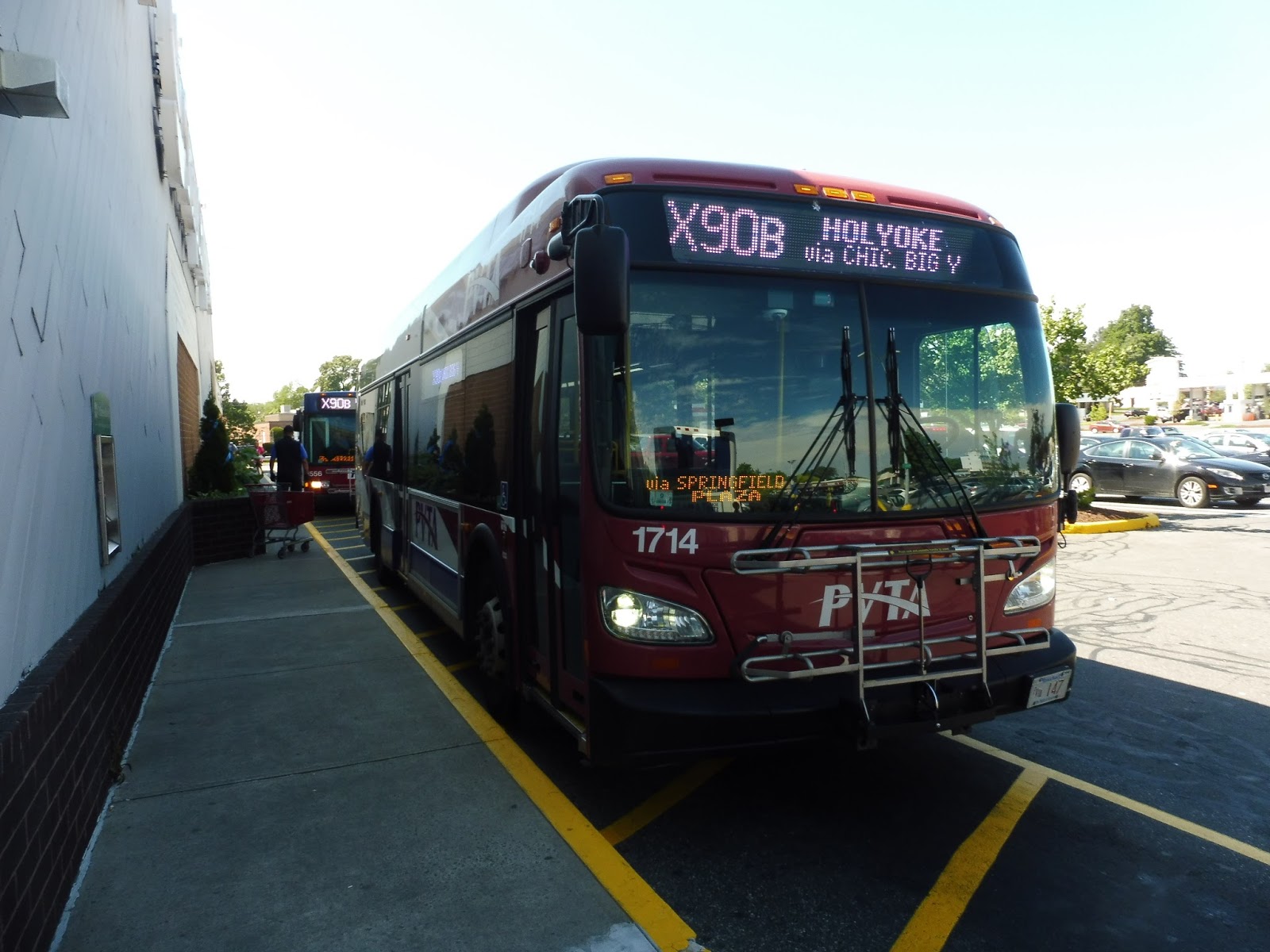
PVTA: X90 (Inner Crosstown)
The X90 has a split personality, both literally and figuratively. The literal part is that it’s split into two branches, the X90A and X90B. The figurative part is that the southern half of the route is fine, while the northern part of the route is so horrible. We’ll start on the southern end.
 |
| We’re not quite at the first stop, unfortunately. |
I didn’t get to ride the bus from the very first stop, since I was walking from my G2 trip on its other branch that doesn’t run with the X90. Still, it’s not like I missed much – just a deviation to Stop & Shop and a deviation to the East Longmeadow Big Y. I boarded at one of the first street stops after that, and we headed down North Main Street.
 |
| Some houses on a side street. |
There were pretty ugly businesses for a bit, but as soon as we entered Springfield, it was residential and the road was now White Street. We broke off from the G2 when it turned onto Belmont Ave, and there were bits of retail both at that intersection and at the one with Sumner Ave. There were more dense houses from there, as well as an elementary school.
 |
| That’s a nice median there! |
We merged onto Allen Street, which made some twists and turns and went over a small river. There were some abandoned-looking factories here, then the street became Walnut Street and we passed some businesses. After that, there were a lot of dense houses and apartments, but businesses showed up in there too.
 |
| Some of the factories on Allen Street. |
As we crossed State Street, we passed some businesses, as well as the buildings of Springfield Technical Community College. Next, we turned onto Lincoln Street, then Magazine Street, which became Armory Street. It was kinda weird and industrial around here.
 |
| Some scraps and what looks to be a church. |
We went over some train tracks, then we crossed I-291 on a weirdly-shaped rotary thing and merged onto Liberty Street. We were now joined by the G3, and we would be running with that route for a while. Along here, there were businesses, auto shops, churches, and dense houses on the side streets.
 |
| An auto shop with houses behind. |
Eventually everything but the houses left, and they started to get more spread out. There was a brief section of woods, then all of a sudden, the huge expanse of Springfield Plaza came into view. Of course, we deviated into it, and…oh God, did I mention this route has some of the worst PVTA Syndrome on the system? We were 9 minutes early. And this wouldn’t be the last time we would have to stop and wait at a timepoint!
 |
| I guess that means more time to admire this…uh…parking lot… |
We finally left and returned to Liberty Street, which quickly became Broadway Street when we entered Chicopee. It was residential for a while, but there were some businesses at the intersection with Saint James Ave. For the first time, the two branches of the X90 split: the X90B went onto Grove Street, while I was on an X90A, so we just stayed on Broadway.
 |
| A parking lot for somethin’ or other. |
The street was pretty diverse, with a park at first, then some dense houses, retail, a cemetery, and an apartment development, in that order. We rejoined the X90B (that was quick!) and headed onto the Deady Memorial Bridge over the Chicopee River. On the other side, we headed onto the wide Memorial Drive and zoomed past lots of trees.
 |
| What a view! |
After going under I-90, we were absolutely surrounded by suburban businesses with parking lots. Time to deviate into some of them! First we served Chicopee Walmart, as well as Chicopee Marketplace. Next, we went over to the other side of Memorial Drive, ran around Chicopee Big Y, and finally arrived at the stop for it. Luckily we weren’t early, and we could just keep going.
 |
| The Big Y stop was right next to a hotel. |
We travelled down a weird unnamed entrance road that took us all the way over to Montgomery Street. We quickly merged onto Granby Road from there, which featured a trailer park and an apartment development, then suburban houses for a bit. However, when we came back to Memorial Drive, all those businesses with parking lots came back.
 |
| Sigh… |
Memorial Drive was really just those kinds of businesses for a long time. Sure, there was the occasional apartment development or shopping plaza to spice it up a bit, but it was still really really boring. We went around a rotary, then we passed houses for at least a little bit. Finally, we waited forever at a light to make a left turn onto Britton Street.
 |
| At least it’s kind of a change… |
We turned onto Montcalm Street, which was residential, and we arrived at the Montcalm Heights Apartments stop, a major timepoint. After that, we turned back onto Memorial Drive, and…oh, that whole thing was a deviation? Now we have to take it all the way back to that second rotary? Oh…okay, then.
 |
| The backs of some houses. |
Back at the rotary, we turned onto James Street, which was mostly just residential. We were joined by the X90B at Montcalm Street, and we both headed together down James. Eventually it got woodsy, then it became Syrek Street, with houses on one side and the Connecticut River on the other. There wasn’t a view, though.
 |
| Now there’s a view! |
We entered South Hadley and the street became Main Street, but it didn’t last long. We curved around past a park, then we turned onto Bridge Street, taking us over the Connecticut River into Holyoke. The street went over a canal, then we turned onto (surprise) Canal Street. Here, we split from the X90B again – the B stays on Canal Street, while we turned onto Lyman Street, which was lined with various apartments.
 |
| Welcome to Holyoke! |
We turned onto Race Street, and right next to the Holyoke Amtrak station, we turned onto Dwight Street. After two more canals and the Volleyball Hall of Fame, we made our way around to the Holyoke Transportation Center. Finally! That was a long ride. So that’s it, right? I don’t have to do the X90B, do I…?
 |
| OH NO!!!!!!!!!!! |
The X90B takes a different route out of Holyoke, travelling down the main drag of the city. Well, we were one block over from the main drag on Maple Street, so it was less “main draggy,” but it was close enough. At the Holyoke Public Library, we turned onto Cabot Street, which became industrial after some apartments and a canal crossing.
 |
| The window was open, so these pictures came out great! |
After a second canal crossing, Cabot Street had some businesses along it. Eventually we got really close to the bridge that would take us to the next part of the route if the X90B was planned with any kind of sense. But guess what? It’s not. Instead we turned onto Canal Street, which was literally just a stretch of abandoned factories. Good thing they deviated the bus to serve all this!
 |
| WHY?! |
Eventually we rejoined the X90A and headed onto Bridge Street together. We stayed with the A on Main Street, Syrek Street, and James Street for a bit before turning off onto a unique section again. This was Montcalm Street, but it quickly became Prospect Street, and it was residential.
 |
| Getting a little more urban. |
 |
| A mostly residential side street. |
 |
| THIS DOESN’T LOOK LIKE A RIVER. |
 |
| That stupid hotel again… |
 |
| Well, finally! |
 |
| A northbound bus, with mine in the background. Both were early. |
There are multiple advantages to this routing. Firstly, there are practically no neighborhoods that lose service; it’s only where there’s a single black line on the map, and most of that is industrial. Secondly, the Saint James Ave route passes the Springfield RMV, meaning the G3 could eliminate its new deviation there, which caused that route to lose frequency (we’ll be covering the G3 soon). Third, this route is slightly longer than the current one, so the schedule padding at Springfield Plaza would be at least a little smaller. Finally, it serves a pretty sizeable neighborhood of dense homes with no access to bus service! Seems like a win-win-win-win to me, but there’s probably some reason why it can’t happen. Oh well…it looks good on paper!
Latest MBTA News: Service Updates
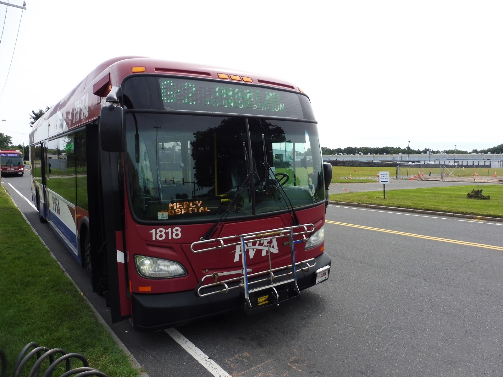
PVTA: G2 (East Springfield via Carew/Belmont-Dwight)
We’re getting to some of the PVTA’s really long local routes! The G2 forms a big crescent, running from the Memorial Industrial Park in northeast Springfield, down to Union Station, and back out to southeastern Springfield and East Longmeadow. Let’s see what the journey is like!
 |
| I see that X92 lurking in the background… |
 |
| Pretty ugly… |
 |
| A side street. |
 |
| The intersection with Chestnut Street. |
 |
| Coming out of Union. |
 |
| Darn it! |
 |
| Some retail and houses on another street. |
 |
| Looks like a nice neighborhood! |
 |
| Looping around the home. |
 |
| At least the Big Y is an actual…like…place where people want to go. This is at the nursing home. |
Pros: The G2 serves a lot, including lots of dense residential and retail areas of Springfield. It’s also really frequent for PVTA standards, running every 20 minutes on weekdays, every half hour on Saturdays, and every hour on Sundays. It’s an interesting choice to have this be one route that goes right through Union Station instead of being two separate routes, but I think it works fine in the G2’s case.
Cons: There are a few weird quirks in the schedule that are worth addressing. For one thing, the weekday schedule has a few half hour gaps and a few ten minute gaps, the former resulting in a really crowded bus and the latter resulting in a really empty bus. It would be nice if it was a little more consistent. Also, do we really need the Dwight Road variant? The one person who stayed on down there was just a friend of the driver, and she took the bus straight back. All it does is add weird service gaps to East Longmeadow Big Y service, where I’m sure the ridership is much higher.
Nearby and Noteworthy: There are a lot of small businesses along the route, as well as bigger shopping plazas on the East Longmeadow section.
Final Verdict: 8/10
This is one of the better routes on the PVTA. It serves some dense important neighborhoods, gets lots of ridership, and operates with frequent service. Those scheduling quirks definitely make my heart weep a bit, but they’re generally few and far between. Dwight Road seems like a real waste, though…
Latest MBTA News: Service Updates
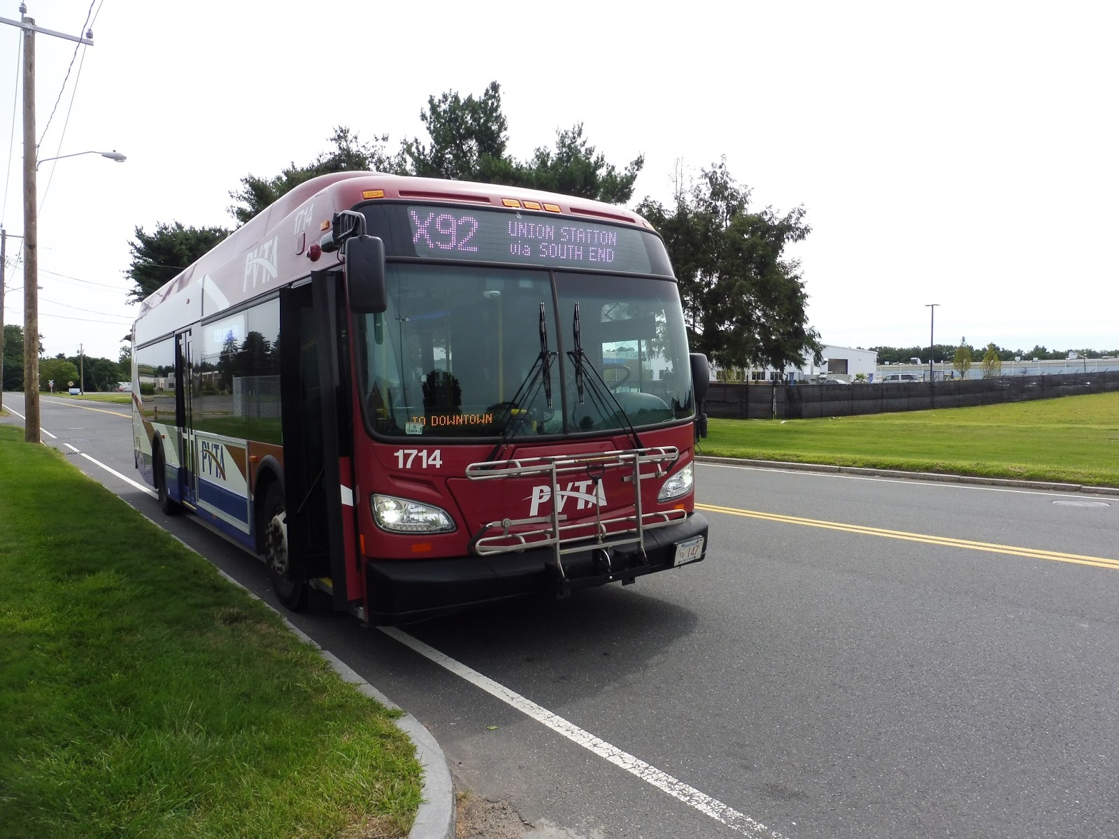
PVTA: X92 (Mid City Crosstown)
Look, I appreciate the PVTA’s efforts to have crosstown routes that allow riders to get from one side of Springfield to the other more directly…but come on, this is awful. The X92 is circuitous and pointless, and it’s time to see why!
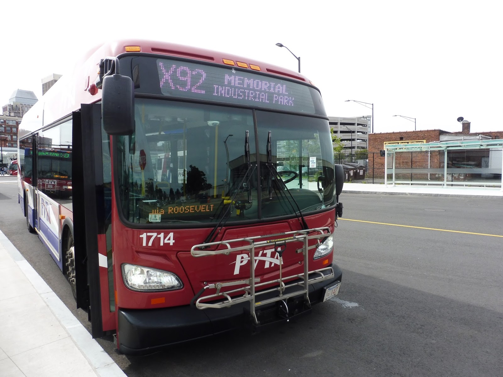 |
| The bus at Springfield. |
Despite being a crosstown route, the X92 still starts at Union Station. Alright, that’s a little weird…but yeah, we left the station and came down onto Main Street. There were tall buildings and businesses everywhere, but due to a construction detour, we had to make a deviation via State Street, Maple Street, and Union Street.
 |
| A steep hill from Maple Street. |
By the time we came back to Main Street, the buildings were only 1-2 stories tall, but they still had retail in them. It started to get less dense, too – by the time we reached the intersection of Main Street and Locust Street (which had a nice square in the middle of it), there were now parking lots accompanying each building.
 |
| The Basketball Hall of Fame poking out behind a car wash! |
We turned onto Mill Street around here, running for a brief independent section along the residential road before the G5 joined us. The street got a median for a little bit with some businesses, but we merged onto Orange Street, which was lined with dense houses. There was still retail at certain intersections, though.
 |
| Not the nicest-looking side street. |
The G5 left us, then we turned onto Allen Street, which was briefly industrial. Next, we turned onto Island Pond Road, and outside of a little shopping plaza…oh no, PVTA Syndrome strikes again. We weren’t that early to the stop, but we were early enough that the driver left the bus to spend some time on her phone. I was also the only person on board by this point, so that was kinda awkward…
 |
| Alrighty then… |
There were a few more shopping plazas, then it became entirely suburban houses. The street became Roosevelt Ave when we crossed over the South Branch Mill River, and soon one side became occupied by woods. We crossed the B17 at Wilbraham Road, then we had to do a weird little jog to get onto State Street, joining the B7. Oh, but before that, we stopped at some random stop because, guess what, we were early again! Hooray…
 |
| Wow, this picture came out dark! |
We headed down State Street for a bit, then we turned onto Blunt Park Road, passing a hospital and a school. After a deviation to serve Independence House, an apartment building, we turned back onto Roosevelt Ave. This took us past a fire station, some houses, and eventually the massive campus of Springfield Central High School.
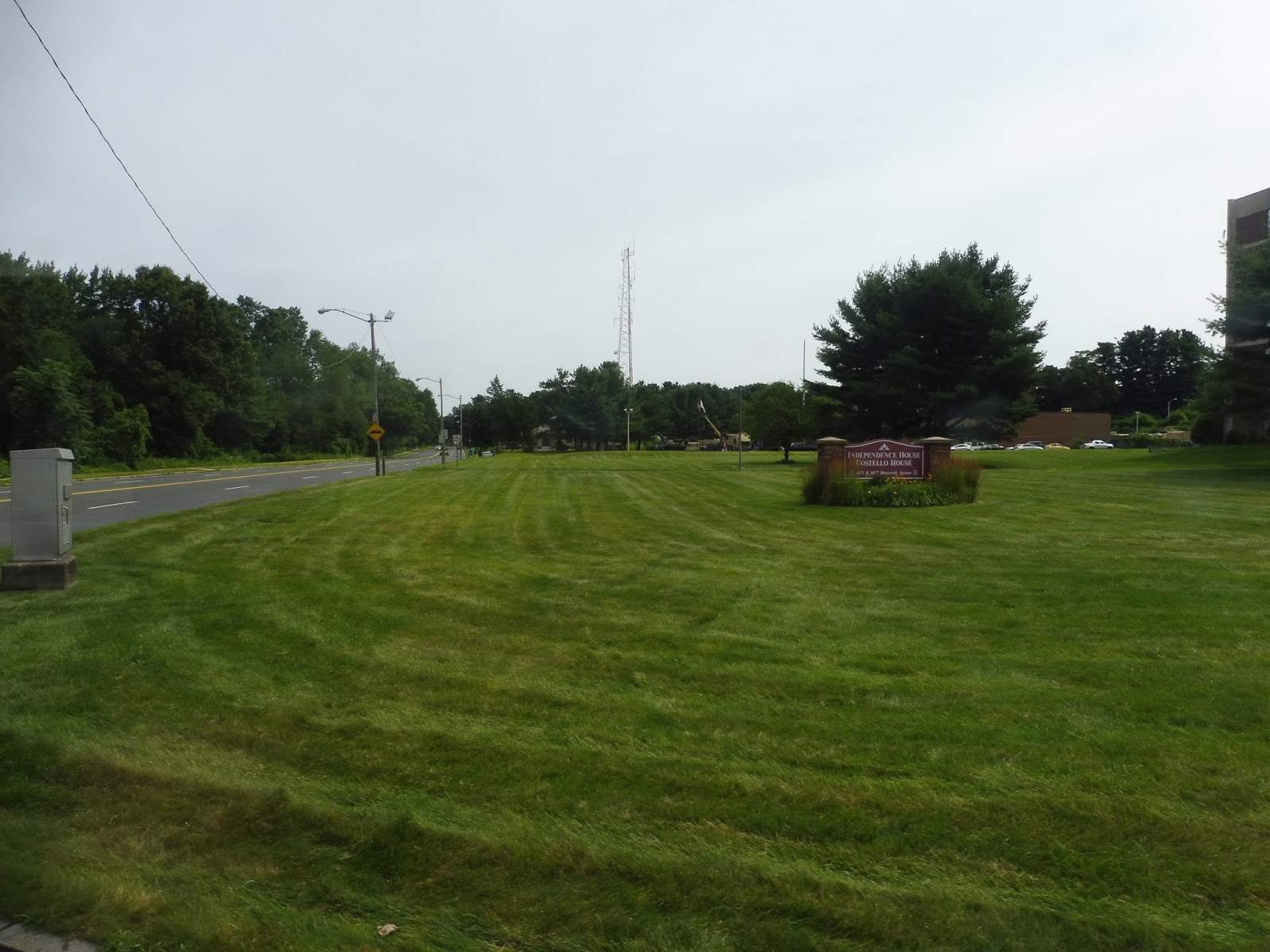 |
| Coming out of Independence House. |
We crossed over the B6 on Bay Street, then we went over a train track. We were now in a really industrial area, with lots of factories and warehouses, including a Big Y distribution center! It wouldn’t be a PVTA route without a Big Y in some form. We turned onto Cottage Street, then Industry Ave, taking us past more industrial buildings and finally, our terminus at the Memorial Industrial Park.
 |
| What a weird place to end a bus route! |
PVTA Route: X92 (Mid City Crosstown)
Ridership: My Saturday morning trip got a measly four people, but maybe that was because it was a Saturday morning. Maybe other trips get more people? Nope – this thing averages 7 passengers per trip. That’s awful, especially considering that A) the threshold for a good route is 20, and B) much of the route is shared with the G1 and G2, and I’ll bet a lot of people just use this for the shared section.
Pros: I’m gonna say that the sentiment of this route is good. It’s nice to see the PVTA experimenting with crosstown routes to better connect their system. However…
Cons: This route is stupid. It’s pointless. A waste of resources. It requires two buses in order to operate 45-minute headways, Mondays-Saturdays, but what’s the point? It parallels the G1 and G2, both very busy and frequent routes, from Union Station to Mill Street. After a tiny independent section, the route runs with the G5 for a bit, and by that point it’s already empty! Theoretically this would be useful for connecting southern Springfield with northeastern Springfield, but no one actually uses the route for that purpose. So why run it?
Nearby and Noteworthy: There are a few shopping plazas on the unique section, but they’re really boring. Yeah, there’s nothing much to see here.
Final Verdict: 2/10
If this route really wanted to be a circumferential crosstown route, it would go from Memorial Industrial Park to maybe The X…but then no one would use it! I feel like most of the riders on the X92 just take it on the G1/G2 shared section, making the route redundant. They honestly could cut this without affecting too many people – almost all of the connections this route makes could still be done with one transfer.
Latest MBTA News: Service Updates
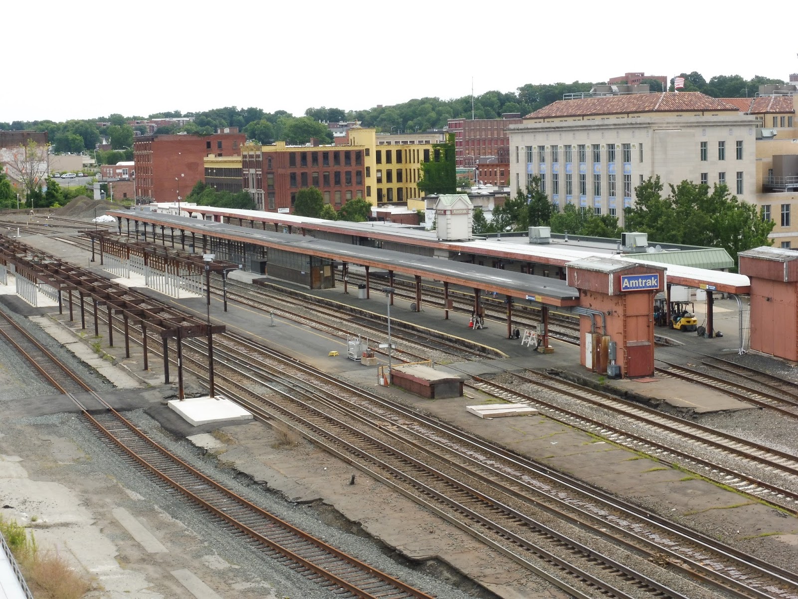
Springfield (Amtrak)
Well gosh, that’s a simple title, isn’t it? It doesn’t really give away the multimodal nature of Springfield Station: multiple Amtrak lines, freight traffic, a possible commuter rail system, intercity bus lines, and the hub of the entire PVTA. Looks like I’ve got my work cut out for me!
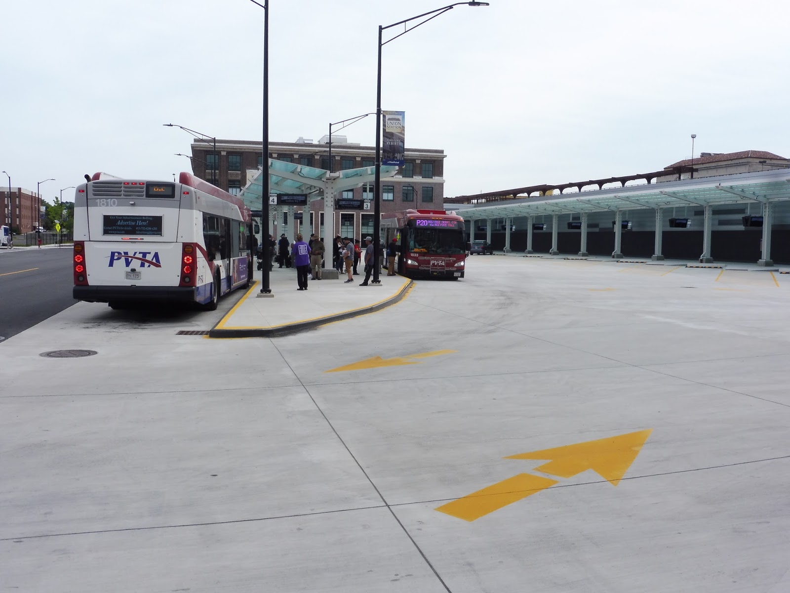 |
| The PVTA busway, with the then-empty intercity busway to the right. |
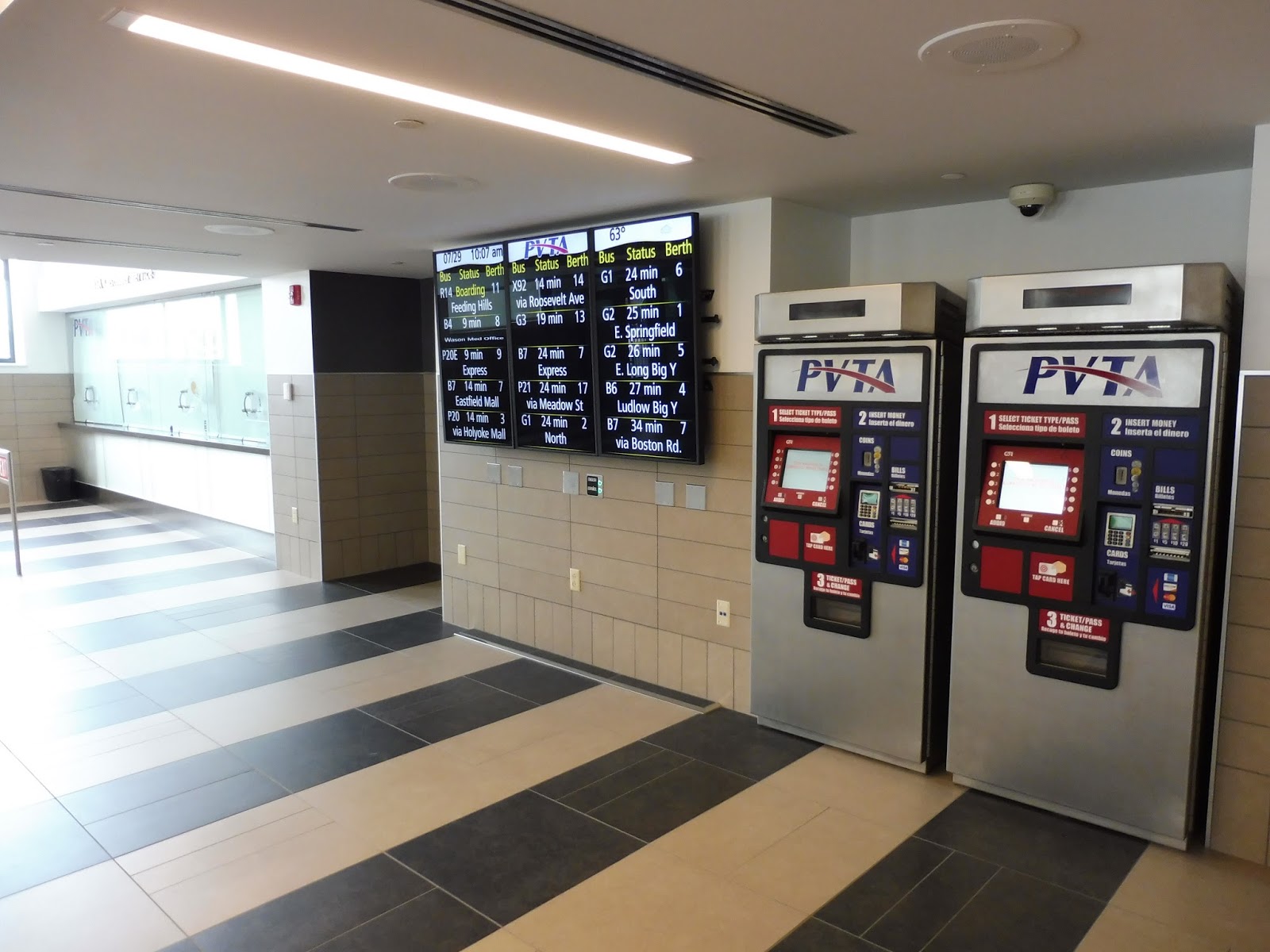
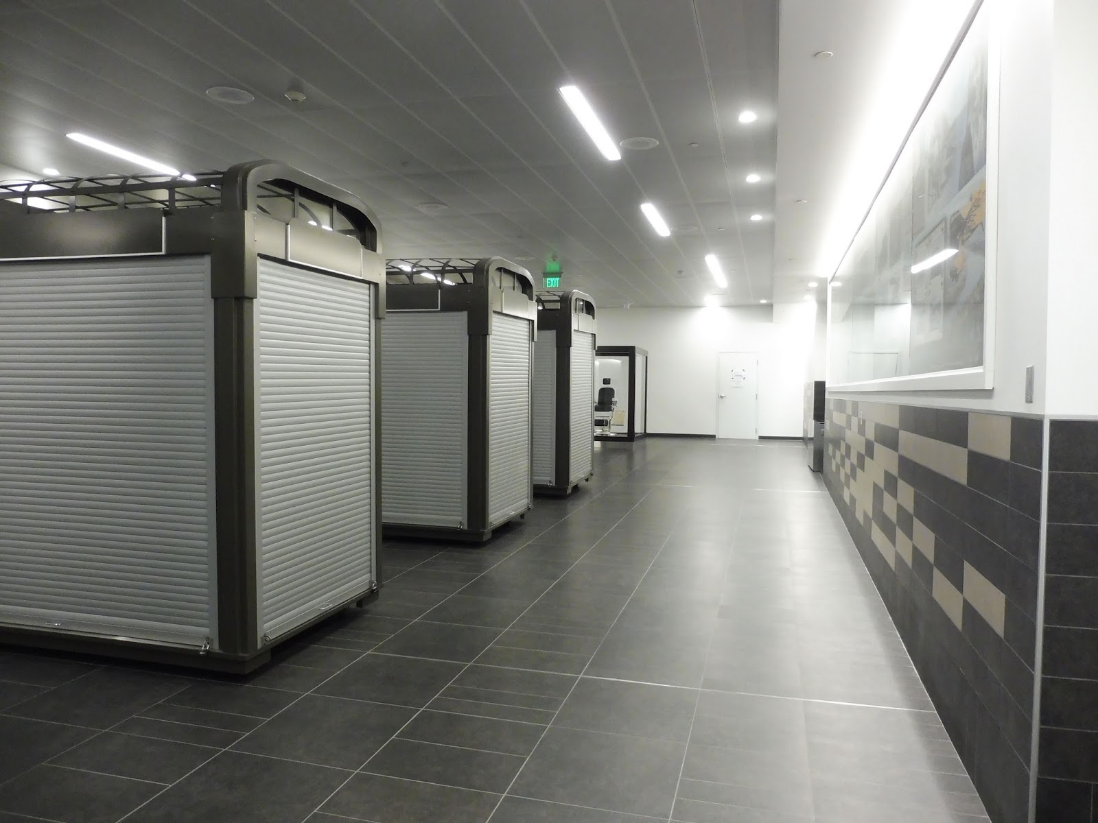
The PVTA busway is where I spent the most time here, and it does well. Finding which bus route you’re getting isn’t too difficult thanks to the big departure board as you exit the station. There are a few different “islands” – two of them have small shelters, while the central one is a long shelter spanning the whole thing. The central one, incidentally, is where the busiest routes board.
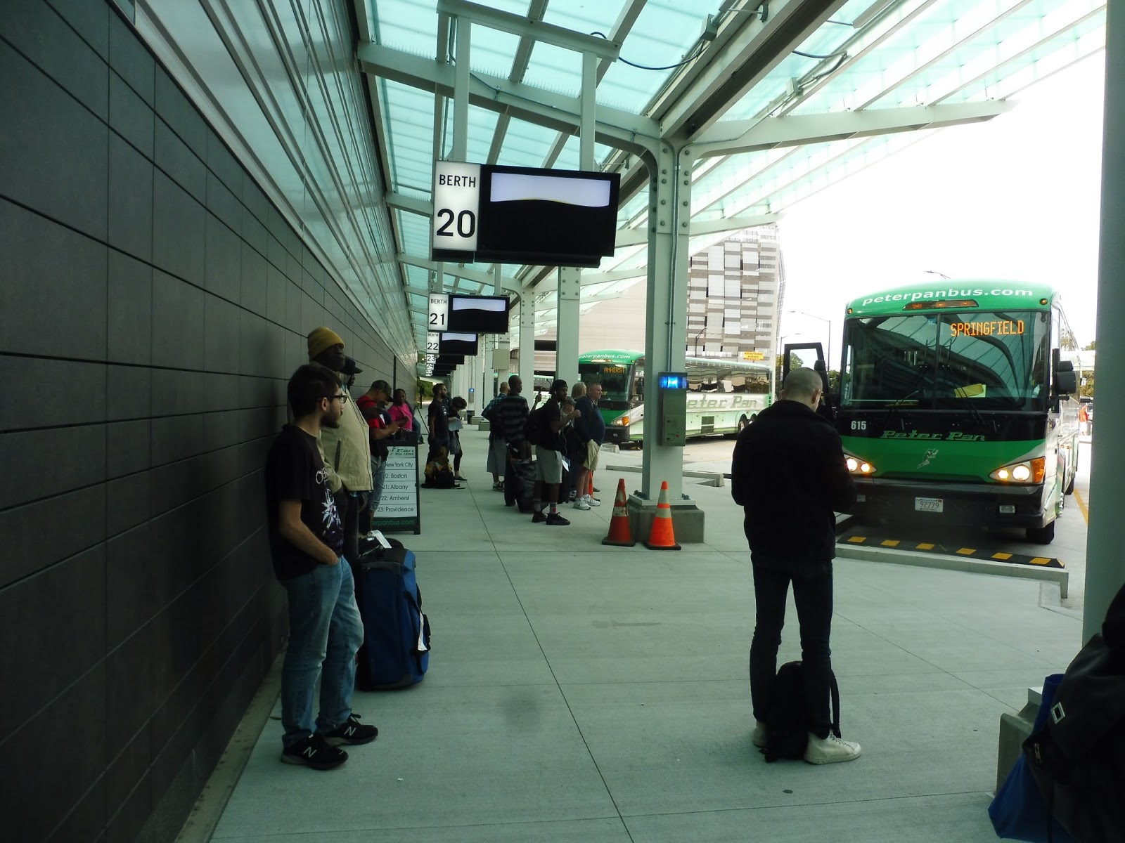 |
| The intercity bus terminal! |
It’s important to note that when I did my return trip to the PVTA, intercity buses had fully migrated from the disgusting Springfield Bus Terminal to Union Station. It was a really welcome change, not only for aesthetic reasons, but also because it makes for a much more centralized hub. The actual boarding area doesn’t have many amenities, since there’s a proper waiting area inside, but most people don’t seem to actually use it.
 |
| Inside the parking garage. |
The Union Station Garage was practically brand-new when I visited it (as was the rest of the Union Station bus area). It’s not actually run by Union Station, but rather by the Springfield Parking Authority. Luckily, I’m pretty sure overnight parking is possible, since there’s nothing on their website saying it’s not.
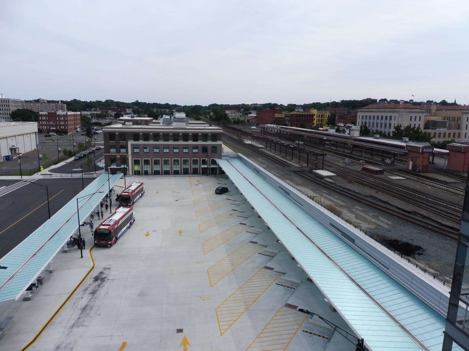 |
| The station…from above. |
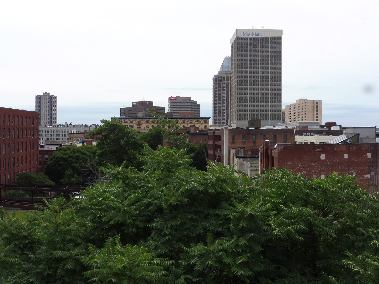 |
| Downtown Springfield. |
Of course I had to take the elevator to the top of the 377-space lot to see what the view was like. The elevator was very clean, and the view was awesome, particularly the one of the station itself. There was also a big scary bug in the elevator room on the roof…
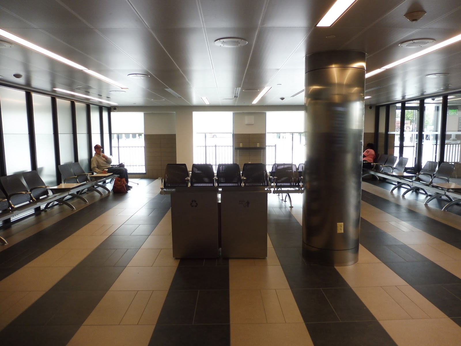 |
| The PVTA waiting room. |
Ah, I spent a lot of time in these relaxing waiting rooms. There are separate ones for PVTA and intercity buses, and they’re both spacious and modern. They both have plenty of seats, wastebaskets, recycling bins, and charging outlets. I personally preferred waiting at the intercity waiting room, since it was almost always empty, but the PVTA room doesn’t get too crowded either.
 |
| A few more amenities in the PVTA section. |
The PVTA part of the room also has some ticket machines that have yet to work (I think they’re part of the upcoming “Fast Break” smartcard program – no idea why they couldn’t have just used CharlieCards), a departure board, a ticket window, and paper schedules.
 |
| Squeaky clean! |
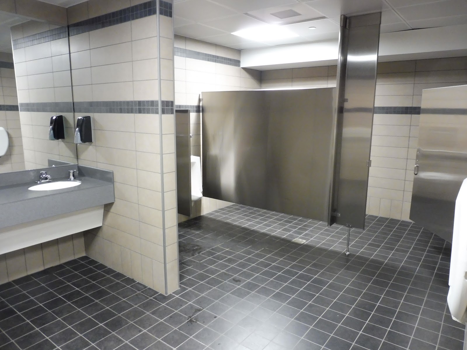
Heading toward the main concourse, there’s a hallway featuring a water fountain and bathrooms. The bathrooms are great – they’re spacious, clean, and modern, just like the rest of the station. The one qualm I have with them is their weird tiny hand dryers…they’re powerful, but it’s strange how small and close to the wall they are.
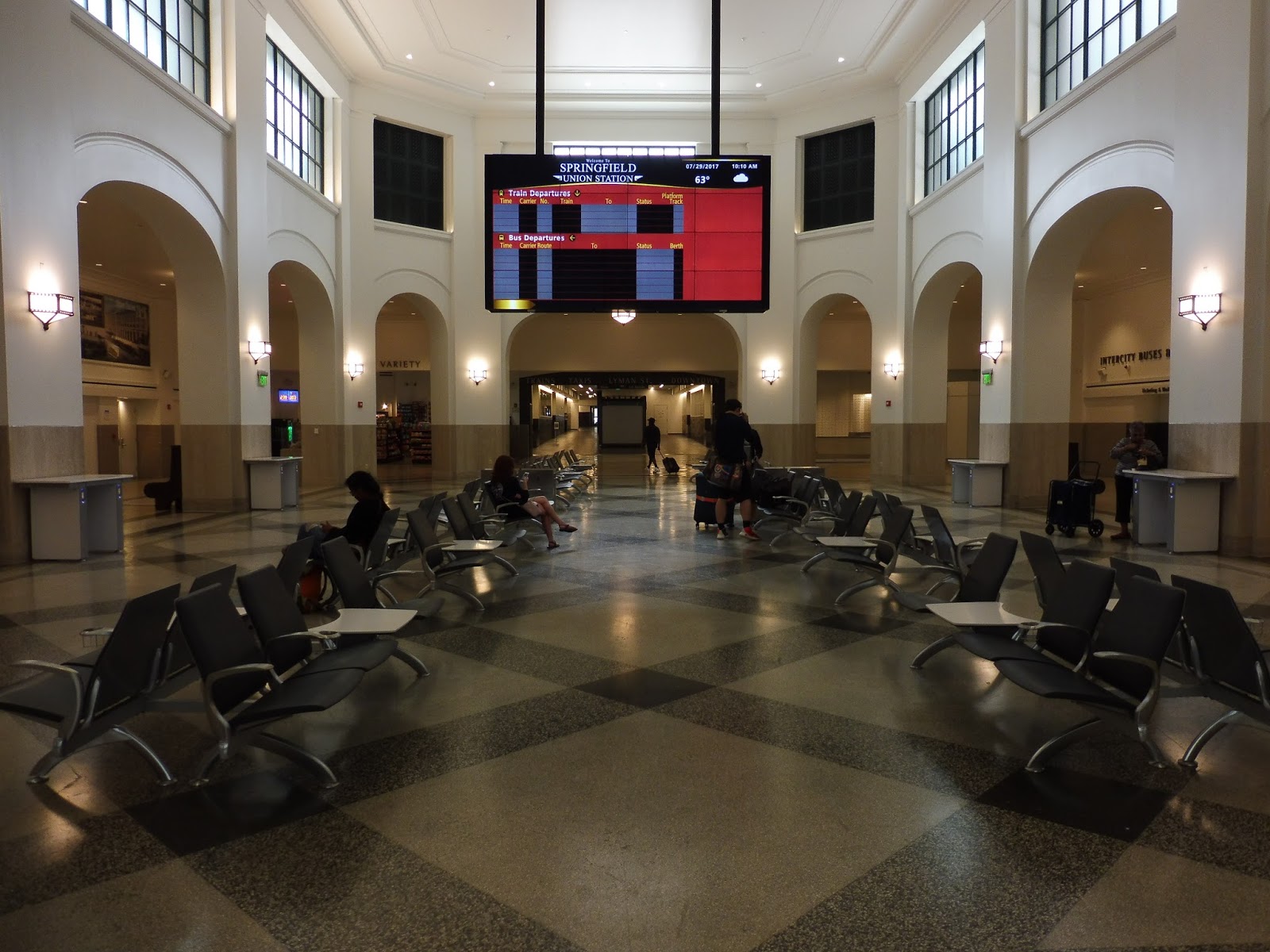 |
| The main concourse. |
The main concourse of this station is beautiful. It’s huge, with lots of seating (who knows what people would be waiting for) and tables, more charging outlets, and a big destination sign that…doesn’t work. It didn’t even work when I came back here! When are they gonna activate it?
 |
| My stomping grounds! |
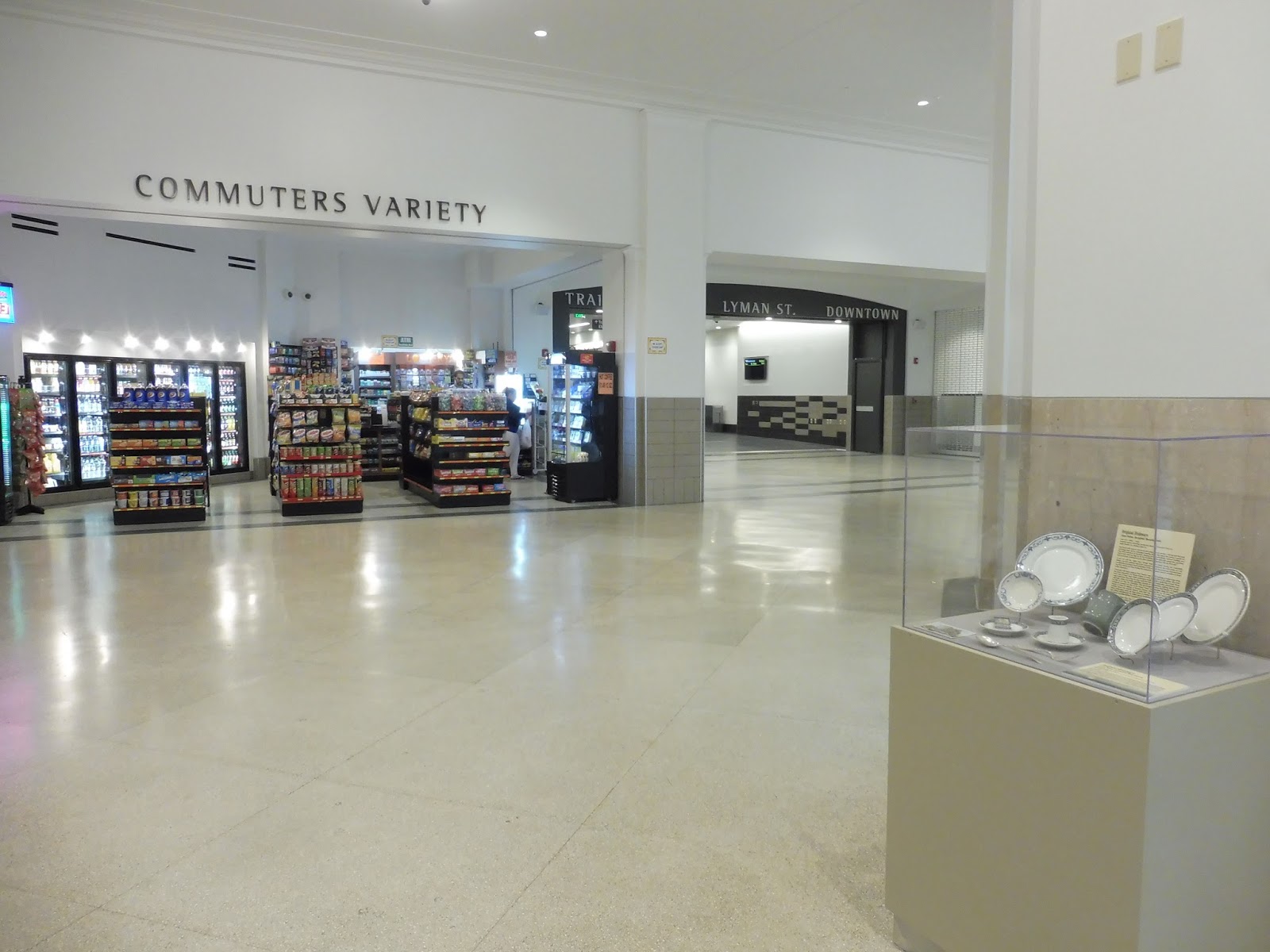
There’s a convenience store in the concourse that I have fond memories of buying pretzels from every time I went to Springfield. Thanks, Commuters Variety! The concourse has lots of other amenities, though, including a Dunkin’ Donuts and a Subway (which weren’t open in the summer, but have since moved in), lots of historical information, and ticket offices for intercity buses.
 |
| The strange hallway leading out. |
From the concourse, there’s kind of a weird hallway that leads toward the Amtrak station. It has more historical information along the walls, but in the middle, there are just these weird…I don’t even know, they’re just things. Maybe they’ve opened up since the summer (I didn’t have time to check out this part of the station when I came back), but they definitely were strange at the time. There’s also a historical barber’s chair at the end, which is…kinda cool, I guess.
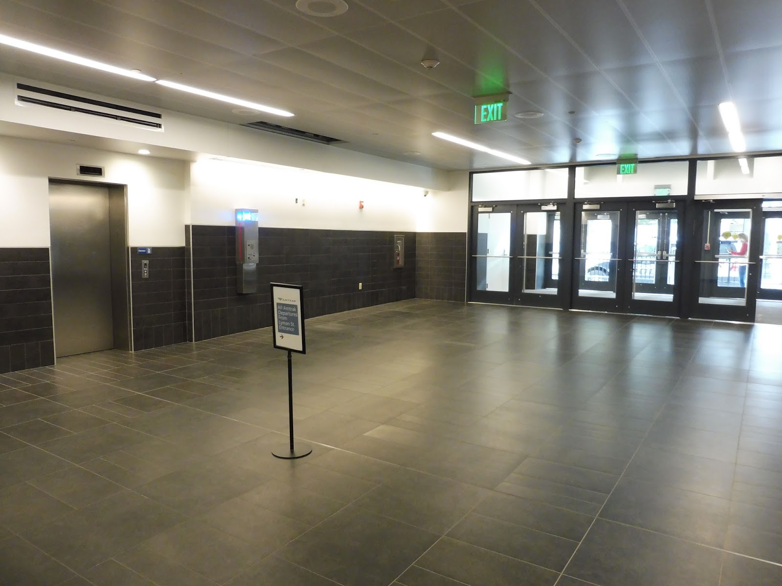 |
| The Lyman Street entrance. |
The hallway eventually leads towards Lyman Street, which has its own mezzanine area. There isn’t much here – it’s basically just a staircase and an elevator up to the Amtrak station, and an exit out to Lyman Street. This is also the final part of the station that actually looks…good.
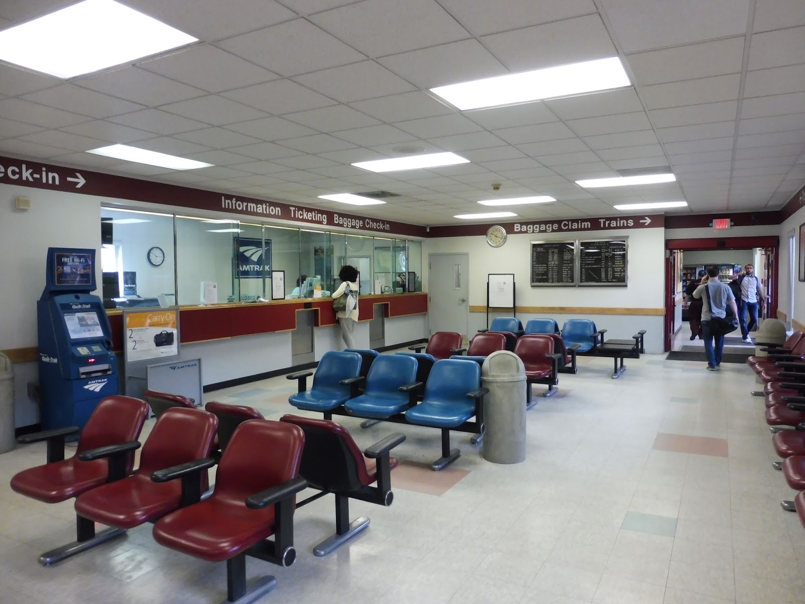 |
| OH NO!!!!!!!! |
Yeah…whereas the other part of the terminal is completely new, this section of the station is much older, dating all the way back to…1994? Okay, come on, this is the same era as Beachmont – this is really what they came up with? The ugly waiting room features absolutely grotesque-looking seats clustered in small groups.
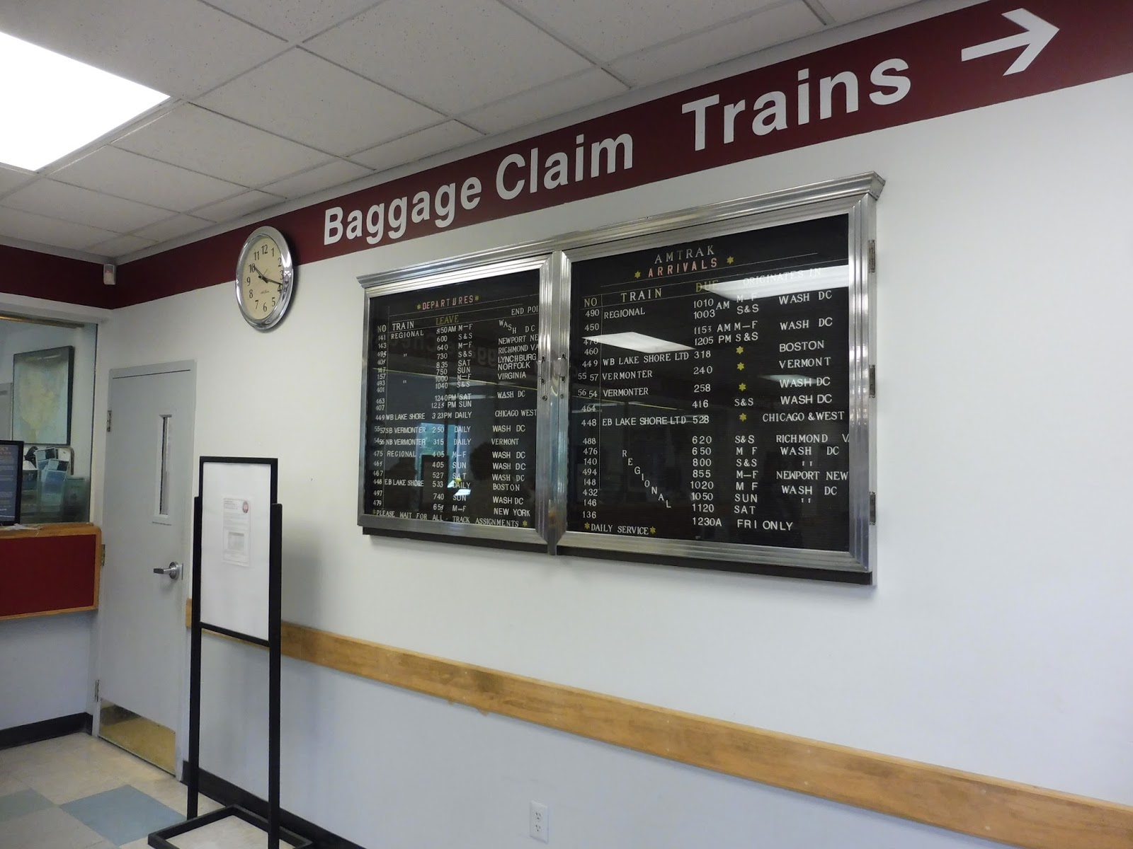 |
| You call that a departure board?! |
Other amenities in here include both a human ticket office and a Quik-Trak ticket kiosk. There’s also a really sorry excuse for a departure board – it’s just a bunch of letters and numbers pasted onto a board. Not only is it ugly, but it’s hard to read and understand! Finally, I checked out the bathroom, and it’s disgusting.
 |
| The platforms…from above. |
The station itself is in the process of getting renovated, which is good, because at the moment it’s just horrible. The platforms are low-level, there are incredible barebones amenities on each one, and everything’s falling apart. Also, this isn’t the station’s fault, but it’s a real pain that Vermonter trains have to reverse into here from the north – it slows down the trip quite a lot.
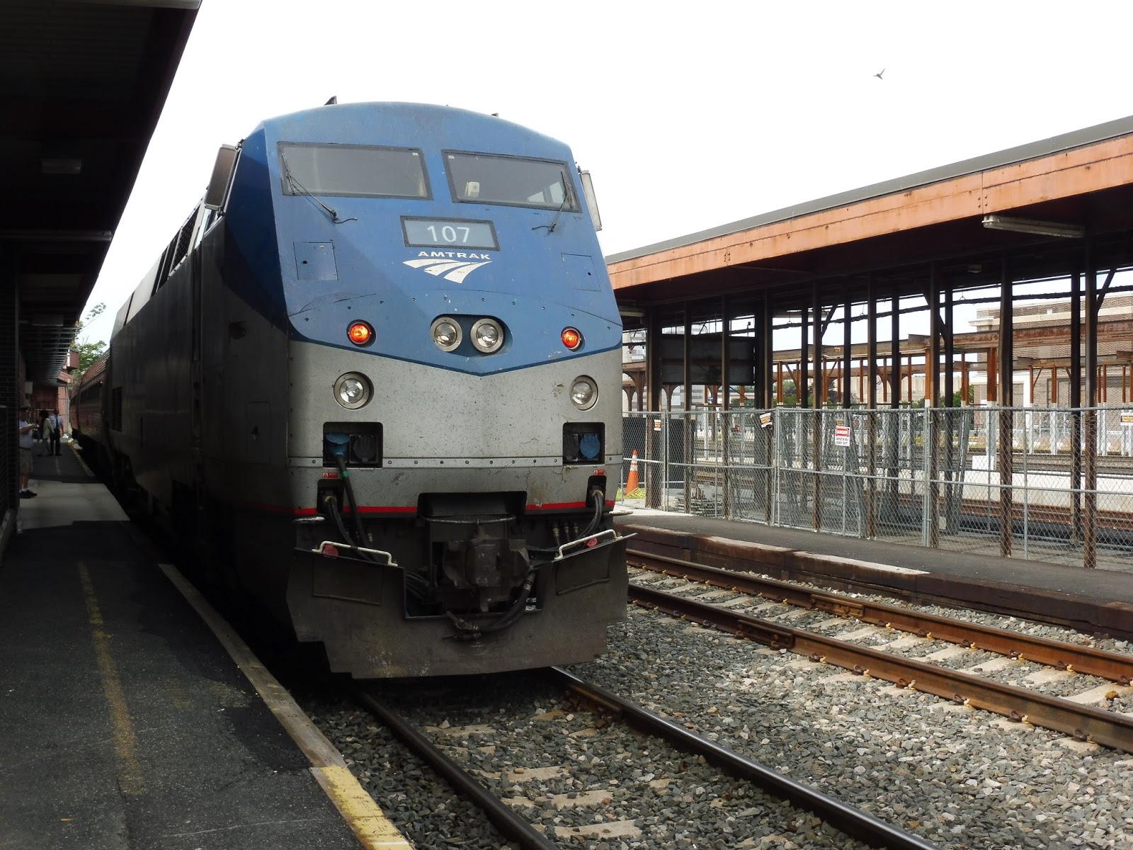 |
| What luck that there was a Shuttle train in the station to take a picture of! |
Station: Springfield
Ridership: Ridership experienced a significant drop in 2016, going from 123,200 riders in 2015 to 92,354 riders – about 253 people per day. The PVTA side of the station is busy, and though I can’t give exact numbers, I’ll say that there are lots of people that board local buses here. Finally, while there aren’t numbers for intercity buses either, they’re the only feasible way of getting from here to Boston (the Amtrak Lake Shore Limited is only once a day), so traffic is high.
Pros: The modern part of the station is great on all fronts. The bus terminal is simple and flows well, the waiting rooms are clean and pleasant, and the main concourse is just beautiful. I love how all of these modes have finally come together into one building, making for much easier transfers.
Cons: The Amtrak section is just horrible – it’s cramped, musty, and ugly. That “destination board” just grinds my gears!
Nearby and Noteworthy: Beautiful downtown Springfield is right at your fingertips from here! Not that that’s a particularly nice place to be…
Final Verdict: 8/10
The entirety of Springfield Station is great, aside from the one little scab of the Amtrak section. However, that section of the station is undergoing renovations, and once they’re complete, this station could definitely get a 9…maybe even a 10, depending on how extensive the renovations are. I spent a lot of time here, particularly in the PVTA section, and I gotta say…I came to love it.
Latest MBTA News: Service Updates
Would you be interested in Miles on the MBTA merchandise?
I had an interesting conversation with a friend and a teacher today about the possibility of creating a Miles on the MBTA t-shirt. It would be really neat to have some sort of merchandise! Of course, the real question is if any of you guys would actually get one. It would be black, with a design like this:

Let me know what you think!
Would you be interested in seeing a Miles on the MBTA t-shirt?
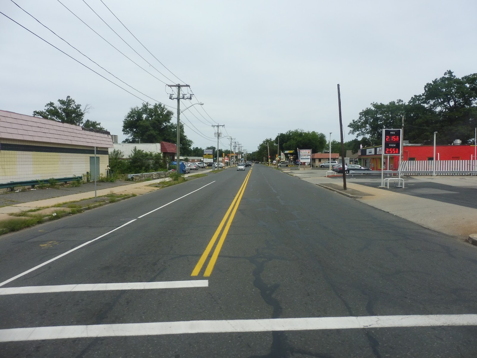
PVTA: P21E (Springfield/Holyoke I-91 Express)
Taking the route all on its own, the P21E by far the fastest way of getting from Holyoke to Springfield, and it’s a massive convenience. However, when you factor in the fact that it uses a Proterra electric bus…well, now we’ve just got the best route ever, don’t we?
 |
| OH MY GOSH, EVERYTHING ABOUT THIS BUS IS AMAZING. |
The inside of this thing just feels clean. I’ve been on it a few times, and even when it does have some litter in it, it still feels so modern and new. And the sounds…I mean, wow. As we left the Holyoke Transportation Center, I was just relishing in the delightful electronic whine emitting from the bus – it was incredible.
 |
| This is just amazing! |
We headed down Maple Street, passing the backlots of businesses along the main drag one block away. There were some apartments when we got to the Holyoke Public Library, and it was mostly residential from there, aside from a few businesses on street corners. All of a sudden, it grew wide open, and we made our way onto I-391.
 |
| Did I mention the Proterra also has a rear window? Awww, yeah! |
Now, as I mentioned, I had been enjoying the sounds of the bus up to this point. But when we got onto the highway…oh my God, I couldn’t believe it. The pitch kept getting higher…and higher…and higher…WHEN WOULD IT STOP? IT NEVER STOPPED! HIGHER, HIGHER, HIGHER, WE ACCELERATED DOWN THE HIGHWAY AND IT WAS JUST THIS GLORIOUS HARMONY OF THE MOST AMAZING BUS SOUNDS I HAD EVER HEARD IN MY LIFE!!!!!!!!!!!!!!!!!
 |
| HOW COULD I EVEN FOCUS ON TAKING PICTURES WHEN I WAS ENJOYING THE SOUNDS SO MUCH??? |
We went over the Connecticut River and a residential area on an elevated structure. After that, though, the view from the highway was pure woods for a while. We went under some telephone wires and I-90, then crossed the Chicopee River.
 |
| Nice view! |
We ran past some more neighborhoods, then we merged into I-91. The route would now take Exit 11 off the highway, but we’ll talk about that service change later. For now, we continued down I-91 until the exit for downtown Springfield, which took us underneath the highway bridge. We turned onto Liberty Street, and that was that – we arrived at Springfield Union Station.
 |
| Oh man, it’s gross under here! |
So that was the P21E in the summer: a direct express route to Union Station. However, the PVTA decided that wasn’t enough, so they made the route serve the Baystate Medical Center on the Springfield end. On my return trip to the PVTA last week, one of the routes I rode was the P21E on its new alignment. Let’s see what that was like…
 |
| Coming onto Chestnut Street. |
From Union Station, the route heads up Liberty Street, then turns onto Chestnut Street. It goes over I-291, and after some apartments and a clinic, it becomes mostly residential. Outside of the Baystate Medical Center building, Chestnut Street turns to the left, and finally reaches I-91, where the route can begin its express portion.
 |
| Back in the summer, here’s the bus charging in Springfield. |
PVTA Route: P21E (Springfield/Holyoke I-91 Express)
Ridership: Unfortunately, I can’t find any online ridership information about this route, but I’ve used it a few times, so I can at least tell you about my experiences. I’ve seen the route get mostly in the 10-20 people range, which isn’t bad, but I would love to see it do better – after all, the PVTA wants to get rid of this thing really badly. The only reason it survived the summer service cuts was because they got a grant to keep running it!
Pros: As a route, this is just such a fast way of getting from Springfield to Holyoke. It beats out the P21 by at least 10 minutes (it’s hard to judge because of PVTA’s earliness syndrome) and the P20 by over half an hour! It’s just one bus shuttling back and forth, giving it an hourly schedule, which seems to make sense based on the ridership. Also, speaking of the bus itself, uhhh, you know, it’s, uhhhhh, THE BEST THING EVER!!!!!!!!!!!!!!!!!!!
Cons: Okay, the Baystate Medical Center deviation isn’t that bad, but it definitely slows down the route, even if it’s not by a lot. I dunno…I liked when it was just a pure express, but I guess serving the hospital would increase ridership.
Nearby and Noteworthy: This is the fastest way of getting to Holyoke! Because everyone wants to go there…
Final Verdict: 9/10
The P21E is a life-saver for Springfield to Holyoke travellers. Sure, the P21 isn’t so bad, but who wants to sit through all of the P20’s horrible mall deviations when this fast express route exists? And the bus…oh my gosh, the bus is just SO AMAZING. THE ROUTE IS WORTH RIDING JUST FOR THE BUS!!!!!
Latest MBTA News: Service Updates
PVTA: 45 (Belchertown Center/UMass)
Ever since I found out that there was a place called Belchertown, I really wanted to visit it. Ever since I found out that there was a bus to Belchertown, I really wanted to ride it. Finally, my dreams have come true…the 45, everybody!
 |
| Oh…okay, it’s kind of a pit. |
Yeah, turns out Belchertown really makes me want to belch, because its center is little more than a common, a few municipal buildings, and some sketchy-looking restaurants. Sam and I were originally gonna hang out in Belchertown for an hour and a half until the next bus, but upon our arrival, it was clear the place has absolutely nothing to do. Thus, we hightailed it out of there on the bus, making our way around the common on Main Street.
 |
| Goodbye, Belchertown! |
There were houses for a bit, then we got some suburban businesses with parking lots as we merged onto Federal Street. Those businesses ended pretty quickly, though – after one brief stretch of industry, it became houses and a heck of a lot of woods. We headed down Amherst Road and just sped through the forest!
 |
| I think that’s a horse back there! |
We merged back with Federal Street, then we made a sudden turn onto Old Amherst Road, basically in order to serve another residential area. Upon our return to Federal Street, there was a church, a self-storage center, an auto shop, a small housing development, and a vet. We briefly entered Pelham, then came into Amherst, with the road becoming Belchertown Road.
 |
| Coming back onto Federal Street. |
At Old Belchertown Road, we were joined by the 30. Luckily, we didn’t have to do its horrible deviation to the Valley Medical Center, so we just continued up past the Rolling Green Apartments. However, we broke away from the 30 by going onto Gatehouse Road, serving another apartment complex.
 |
| Yup, there it is… |
After that, it was time for some narrow residential streets – we used Stony Hill Road, Heatherstone Road, and Pelham Road to eventually rejoin the 30 on Main Street. It was smooth sailing from here; after the mostly residential Main Street, we turned onto North Pleasant Street, passing the businesses of North Amherst Center. From there, it was just a straight shot to UMass, where Sam and I got off at the first of the three stops.
 |
| The bus became a 46 at UMass, so here it is where we originally got on at Old Belchertown Road. |
PVTA Route: 45 (Belchertown Center/UMass)
Ridership: The 45 doesn’t have all that many trips per day, but its ridership per trip is good – about 25 people. This is mostly during the school year, though, as my summer trip was much quieter.
Pros: This route provides an important rush hour connection from UMass to Belchertown, which surprisingly attracts a decent amount of commuters. The route’s schedule is a little weird, but it does its job – service is inconsistent, but it generally runs during rush hour, with a few midday trips. This is also just a really fun ride – speeding through the woods is a blast!
Cons: I’m a little dubious about how much ridership the 45 actually gets on its own. You see, a large portion of the route parallels the 30, and I’m wondering how many people use it as a quieter substitute for that bus. Also, does the 45 really need those midday trips? I doubt they get that many people…
Nearby and Noteworthy: Nope! Belchertown is awful! The rest is woods! Sorry!
Final Verdict: 7/10
The route does its job getting Belchertown commuters to and from UMass, and that’s about it. No frills. Its schedule is a little weird, and I’m a little unsure about how many of its riders actually go to the unique section, but this is a fine route.
Latest MBTA News: Service Updates