Greenfield (Amtrak)
Welp…I’m officially jealous of Greenfield. Their bus system, the FRTA, only gets about 155,000 riders annually, yet they get this absolutely amazing terminal! Some of the T’s antiquated hubs can get that much in a week! Oh well…as long as we’re out here, we’ll take a look at Greenfield Station and the John W. Olver Transportation Center.
 |
| The Amtrak platform. |
We’ll start with the Amtrak station, since it really isn’t much. Serving the Vermonter once a day, the stop is little more than a wooden mini-high platform with benches on it…and yet, I really like it! It has this amazing woodsy smell and a surprising amount of character, especially for such a new construction.
| I’ve got a publicity shot for you, FRTA! |
My gosh…this building is just beautiful. The architecture is so modern, and yet it somehow captures the rural nature of Franklin County perfectly. Did I mention it’s net-zero? There’s a gigantic solar array set up to the south of the building to generate electricity.
| The bus boarding area. |
The bus boarding area is great, with benches underneath the shelter of the building, along with wastebaskets. There’s also a bike shelter that had a surprising number of bikes in it, considering how middle-of-nowhere the FRTA usually is. This outdoor area even has a little picnic table alongside the tracks! Unfortunately, car parking is limited to only a few half-hour short-term spaces.
| WOAH. |
And now we get to…the inside. Ohhhhhh my gosh, the inside. Where do I even begin? There are lots of benches, both waiting-room style and in table formations. Along the wall, there are some lovely paintings, as well as a bunch of charging stations, including chargers for every type of phone.
| This is AMAZING. |
Further down the terminal, there are television screens showing live bus departures (they unfortunately weren’t working when we were here). Beyond there, you’ve got a ticket machine and a ticket booth, as well as schedules for every FRTA route, and every route that the FRTA connects to. I mean, come on, how many amenities can a place have?? It’s also worth noting that the paper for the FRTA schedules is WAY better than the paper for the PVTA or MART schedules. Take that!
| Of course I always have to get this shot! |
Oh man, this place has some nice bathrooms. They’re modern, functional, and squeaky-clean! Heck, the doors to the bathrooms even have an accessible door-opening button! Outside the bathrooms, there’s also a set of water fountains.
| The atrium. |
Moving towards the front of the building, we get to the atrium. This area has more benches, more artwork, and stairs and an elevator up to the second floor. The upper level has FRTA offices, the Franklin Regional Council of Governments, and, apparently, a meeting room!
 |
| The front of the building on Olive Street. |
Station: Greenfield (Amtrak)
Ridership: Assuming most FRTA ridership comes from this hub, I’d estimate that about 500 people use it every day for the bus, give or take. As for Amtrak, the station got 5,885 riders in 2016, meaning about 16 riders per day. Peter Pan and Greyhound buses also serve the hub, but I can’t make any assumptions about their ridership. Still, I think one thing is clear: very few people use this place.
Pros: Uhhhh…everything? I mean, my gosh, it’s all so perfect! The building’s exterior is gorgeous, the Amtrak station has a ton of old-timey character, the bus boarding area works great (aside from a rather tight loop for full-sized buses), and the inside is just unspeakably amazing. From the multiple types of seating to the incredible chargers to the impeccably clean bathrooms, I have not a single complaint about the customer experience here.
Cons: One thing: there’s no long-term parking! That’s a big problem for Amtrak passengers who are going long distances, probably for a few days.
Nearby and Noteworthy: I didn’t get the chance to explore downtown Greenfield, but I’ve heard good things about it, and Google Street View makes it look like a nice little town center.
Final Verdict: 9/10
Yes, the short-term parking is definitely a problem, but that’s not the true reason this place is getting a 9. No, it gets a 9 because it just doesn’t feel necessary. I mean, look at T stations like Sullivan with more bus routes than the entire FRTA system and more ridership in a week than the FRTA gets in a year, yet they’re decrepit, disgusting, and falling apart. Why does Greenfield get the big, beautiful, expensive hub that’s going to be used by so few people? Oh well…as a station, it’s near-perfect and I absolutely love it. I just wish it was in a place where it was more necessary.
UPDATE 2019: This station gets three Amtrak trains a day now, thanks to the new Valley Flyer Amtrak service up to Greenfield.
Latest MBTA News: Service Updates
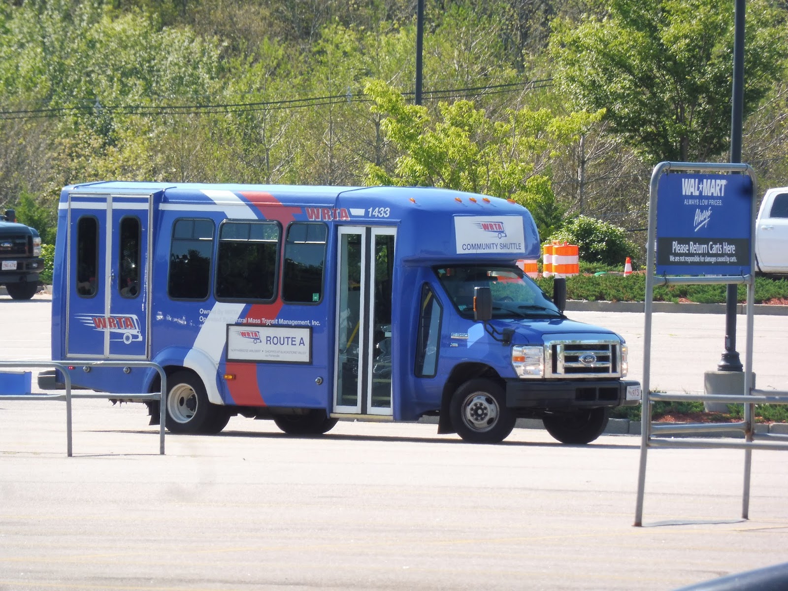
WRTA: 11 (Union Station Hub – The Fair Plaza via Vernon Hill and Greenwood Street)
I’m not trying to stereotype, but…are all WRTA drivers really mean? I mean, Nathan and I tried to go to the end and back from Walmart on the 11 twice. The first time, the driver wouldn’t even let us on, so we ended up on the 1 instead; we were able to do it the second time (with a lot of sass), but we got a lot of flak for it. Here is the fruits of our labor…
 |
| The bus at the end of the route. |
At its terminus, although the route loops through The Fair Plaza to turn around, it doesn’t actually let passengers off in there – they have to board at street stops. I’ll, uh, save this for the “Cons” section. Anyway, we headed up Greenwood Street, which was mostly residential aside from a few offices here and there.
 |
| The stop where passengers have to get on; the mall is behind me. |
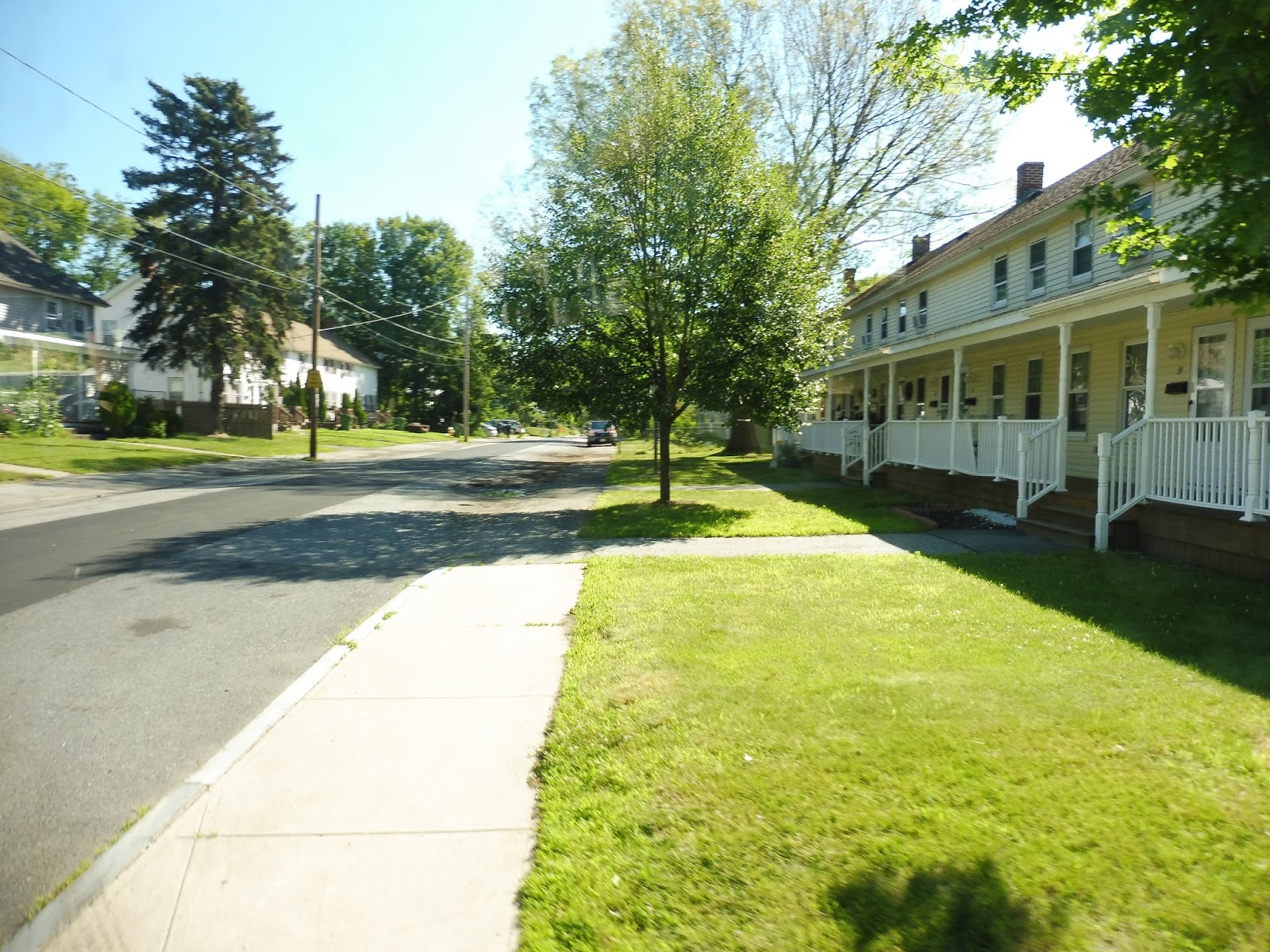
Next, we turned onto Spofford Road, which was entirely residential. This led us to Upland Gardens Road, taking us through Autumn Woods, an apartment development. We turned onto Upland Street after that, which went up a steep hill past trees and houses.
 |
| A residential side street. |
Upland Street eventually led us back to Greenwood Street, which was industrial for a little while. Soon, though, it became a dense, varied neighborhood. There were apartments, businesses, and other different kinds of buildings all along the road. After a school and some more retail, we turned onto the wide McKeon Road, then Tobias Boland Way.
 |
| Going over train tracks on McKeon Road. |
This took us to Walmart, where we picked up some passengers. Next, we turned onto a road in the middle of its parking lot, serving the second stop in the complex. After that, we made our way around the back of Walmart, back up to McKeon Road, over Route 146, and up Providence Street.
 |
| Looking down a hill. |
We went under some telephone wires and past a residential development, then it became mostly dense apartments, which continued as we turned onto Upsala Street. As we went over a hill, we also passed a school in between the residences, then we turned onto Vernon Street. This took us on a downward slope past dense houses and a few businesses.
 |
| Another hill! |
We passed the Vernon Medical Center and a church soon after, but it was still mostly dense apartments. After going over I-290, the road became Green Street, and it was suddenly almost all retail. We went under the Commuter Rail tracks, then made our final turn onto Foster Street, which took us to the WRTA Central Hub.
 |
| The bus that wouldn’t let us on, back at Walmart… |
WRTA Route: 11 (Union Station Hub – The Fair Plaza via Vernon Hill and Greenwood Street)
Ridership: This is one of four contenders in WRTA’s “1,000 Riders Club,” boasting the fourth-highest ridership on the system, with 1,108 per weekday. On my ride, there was strong ridership from shoppers, as well as local residents in some of the neighborhoods.
Pros: The 11 serves a lot of southern Worcester, including some very dense residential areas and some desirable shopping areas. It also does so with surprising frequency for WRTA standards, running every half hour on weekdays and every hour on weekends. It’s also great that the ridership turnover is so good, with people getting on and off along the whole route.
Cons: I’m not one to suggest a deviation, but directly serving The Fair Plaza would be way more convenient than the current street stop…not to mention the route goes in there to turn around! I mean, come on, really? Common sense! Put a stop in there! I’m also a little dubious about the every-hour schedule on Saturdays; I could see it getting pretty crowded with headways like that.
Nearby and Noteworthy: This route takes about the same amount of time to get to Walmart as the 4 (maybe a few minutes slower at most), but it’s a lot more frequent.
Final Verdict: 8/10
Despite the mean drivers giving me an initial bad impression of the 11, it ended up being a great route! It’s generally frequent, although it perhaps could stand to run more often on Saturdays, and it serves a lot of Worcester. Although come on, put a darn stop in The Fair Plaza already and stop inconveniencing people!
Latest MBTA News: Service Updates
FRTA: 23 (Sutherland/Greenfield)
I still have more WRTA routes to cover, but I figured I’d start interlining the PVTA stuff in between them to vary it up a bit. Except…what’s this? Yes, my first PVTA review isn’t even a PVTA review, but an FRTA review! This is a system I’ve been wanting to ride for ages, and it absolutely met my expectations.
 |
| Arghhh, not a minibus! |
FRTA has always struck me as a transit system that thinks it’s way better and more important than it is. They have these sprawling routes that never run, hardly get any passengers, and go into the middle of nowhere, yet they all have fixed stops, shelters at stops to serve literally a single store, and, on a few of the routes, full-sized buses. Not to mention the agency has a beautiful website, a gorgeous modern transit center (which we’ll get to in another post), and an upcoming smart card system. Geez, all this for, like, six middle-of-nowhere routes?
 |
| The inside of the bus. |
The point of the 23 is to connect to the PVTA’s 31 (which, again, we’ll get to in another post) and take UMass commuters to Greenfield. The route used to go all the way to Amherst proper, but now it’s cut back to Sugarloaf Estates, a housing development in Sunderland. Sam and I got on the minibus from the 31, and with a few passengers on board, we were off.
 |
| The entrance to the development. |
We headed up River Road, which quickly became South Main Street. It was lined with houses set far back from the road, as well as some businesses and farms. Pretty soon we arrived in Sunderland Center, which was basically just a bunch of mismatched businesses with parking lots. It wasn’t much of a town center…
 |
| Sunderland Center. |
Past the center, it was again a mix of houses and farms. After going by a particularly large specimen of the latter, we entered the woods, which really was just trees aside from a few houses hidden behind long driveways. Next, the street became Montague Road, and the houses started to appear a little more often…then it was pure woods again.
 |
| Wow, it’s pretty out here! |
It became farmland after that, with huge fields stretching out before fading back into woods. Soon, the houses came back, but they were still far apart and set far back from the road. As we entered Montague, the street became Sunderland Road, and there was lots of farmland for a while.
 |
| A tiny side road. |
The name of the road changed again, this time to Main Street, although the farmland and woods didn’t exactly suggest anything “main.” However, eventually the houses became denser, and we arrived at Montague Center. What did it consist of? Uhhh…basically just a single tiny market, a common, and a library. It wasn’t much.
 |
| Welcome to the Montague Village Store! I’m impressed by the shelter, though… |
We turned onto Center Street, taking us out of the center past more farms, then we turned onto Federal Street. The scenery was mostly the same, aside from a random auto shop in the middle of the woods. Later on, there was another anomaly: a store selling tractor equipment. Wow, we were really out there…
 |
| Turning onto Federal Street at a cool-looking intersection. |
The pattern of farms, houses, and woods continued on, with one particularly long stretch of forest featuring a railroad bridge over the road. We also entered Millers Falls along this section. After some more houses, we went over a different set of railroad tracks, then curved around past a restaurant and an industrial building.
 |
| Making a turn. |
As the houses suddenly became dense, we entered downtown Millers Falls by turning onto Main Street. This was a proper town center, although by “town center” I mean something like the lonely main street of some wild west town. Next, we turned onto Franklin Street, going through a rather nice dense residential neighborhood.
 |
| Some houses. |
We turned onto Newton Street at the end of Franklin, then we headed south down Bridge Street, looping around back to where we started. We turned back onto Main Street but continued on it this time, until it became Millers Falls Road. The houses thinned out and we once again entered the forest.
 |
| Goodbye, Millers Falls! |
We reentered Montague and went through a brief industrial area surrounding the Turners Falls Municipal Airport. Next,we entered a residential neighborhood, but pretty soon after we arrived, we turned onto Cross Street in order to deviate to serve the…Turners Falls High School. Come on, FRTA, it’s summer! Don’t pull a GATRA on me!
 |
| No no no no NO! We don’t need to serve this! |
We returned to Millers Falls Road, continuing through the first generic suburban residential area on the entire route. Eventually, the street curved northward and became Unity Street. It took us past Scotty’s Convenience Store, which is considered a major timepoint in the schedule, plus it gets its own FRTA shelter!
 |
| Making a turn. |
Union Street curved down a hill, then we turned onto the residential Park Street. It merged into 7th Street, then we turned onto L Street, going by more houses and even some apartments – it was pretty dense! Next, we turned onto 3rd Street, then A Street, the main drag of downtown Turners Falls, and it was really interesting. A lot of the businesses were…hipstery! I never thought I would see anything like it out here! It seemed like a really nice downtown.
 |
| Looking down Avenue A. |
There were more varied businesses as we continued down the street, as well as a park and a post office. After going by a little shopping plaza (another major timepoint), it became industrial, then we merged onto Montague City Road. It was residential again, but one side of the road was occupied by a huge golf course.
 |
| The golf course. |
The course was eventually replaced by woods, but houses still occupied the other side of the street. It stayed residential for a while until we passed a sizeable hospital, another major timepoint. After some more houses, we went onto a really shaky, rickety bridge over the Connecticut River, taking us into Greenfield. It was a great view, but it was really hard to get a picture because the bus was shaking up and down!
 |
| Man, I love the Connecticut River. |
The houses continued on the other side, although we also passed a recycling plant and some industrial buildings. The road briefly became Cheapside Street as it went under two separate railroad bridges and alongside the Deerfield River. Next, it turned into Deerfield Street, where we went by some industrial buildings, including the FRTA garage, where a New Flyer Midi appeared to be sitting!
 |
| The garage. |
Eventually it became residential again and we were paralleling the Green River. The occasional business mixed in with the houses, and then it got a bit industrial as some train tracks occupied the right side of the road. Finally, we went under them and curved around into the Olver Transportation Center, which we’ll be covering…next post! Or…two posts from now! Or something…
 |
| The bus in Greenfield. |
FRTA Route: 23 (Sutherland/Greenfield)
Ridership: I can only find ridership data from when the route went to Amherst, and at that point it got 11 riders per day from two trips – so about five per trip. Since they cut it back to Sunderland, the route gained two extra trips per day, and mine had five other people going out and three coming back. Honestly, for a rush hour-only minibus route that runs through the middle of nowhere…that’s not bad!
Pros: The 23 serves an important purpose in that it connects towns in Franklin County to UMass for students and workers. The transfer to the 31 is easy and free, and many of the route’s riders use it. FRTA is changing the route to take a completely different road to Montague, skipping out on Millers Falls, which makes sense – it will speed up the run and get riders to where they’re going faster. There are other routes that already serve Millers Falls.
Cons: Not much – sure, the ridership may be pretty low, and the route’s subsidies are high, but it’s still an important lifeline for UMass commuters.
Nearby and Noteworthy: I really liked Turners Falls, from what I saw of it! This definitely isn’t the easiest way of getting there, though; buses on other routes run there every hour throughout the day.
Final Verdict: 8/10
Wow, it’s actually a good route! Or, at the very least, an important one. I definitely can see why they only run this thing outside of rush hour, but when it does run, it gets well-used by people coming from and going to UMass. Plus, the ride is beautiful!
Latest MBTA News: Service Updates
WRTA: 1 (Union Station Hub – Mount Saint Ann via Providence Street)
The 1 used to be the shortest, stubbiest little route, and I always wondered how the heck it could possibly get ridership. Ever since the demise of the 22, though, the 1 has been rerouted to cover some of the lost service, as well as extended to Walmart for…some reason. Sure, why not?
 |
| The bus at the busy Central Hub. |
We headed down Grafton Street after going around a rotary. The street went under the Commuter Rail tracks and paralleled the elevated I-290. Soon, Grafton Street went under the highway and got pretty industrial, but a block later we made a sharp turn up the hilly Waverly Street.
 |
| A little parking lot. |
We soon turned onto Providence Street, going further up the hill and passing dense triple-decker apartments. As we approached Dorchester Street, we went by Worcester Academy and some retail, then we turned onto Dorchester. This took us even further up the hill…and then back down, very steeply.
 |
| Woah!!! |
Alongside Worcester East Middle School, with a park on the corner, we turned onto Grafton Street. There were a few businesses at a complicated intersection where we merged onto Massasoit Road, then turned onto Heywood Street. Now the residences were a little further apart, and there were more single-family houses in the mix.
 |
| A side street. |
We passed a few housing developments, then outside of the Worcester Senior Center, we turned onto Providence Street again. After going by a field for a bit, we turned onto Holcombe Street, which was a steep road going back up the hill. Next, we turned onto Granite Street, continuing to ascend alongside more triple-decker apartments.
 |
| Along Granite Street. |
Eventually, we arrived at the Holy Name High School, and it turned out that this was a deviation to serve it. Now the bus had to turn around, and it struggled to make it around the very sharp bus loop. We retraced our steps all the way back to Providence Street.
 |
| This is all the bus has to turn around?? |
We continued alongside that field from earlier, as well as more apartments – including some buildings. The road went by another school, then after some pylons, it grew a lot wider. We crossed Route 146, then turned onto one of its service roads, Tobias Boland Way. This took us to our final stop: Walmart.
 |
| The bus at Walmart. |
WRTA Route: 1 (Union Station Hub – Mount Saint Ann via Providence Street)
Ridership: Back in its short state, the 1’s ridership was pretty bad: 265 people per day. Admittedly, our trip only had about 7-10 people on board, so it hasn’t increased too much since then.
Pros: The 1 definitely serves a purpose, and many of the residential neighborhoods it covers are dense. The schedule is generally sensible, with service about every hour, seven days per week.
Cons: It’s not quite every hour – the times shift by five minutes every once in a while throughout the day. Also, the route is really indirect, and it’s definitely not the fastest way of getting to Walmart. Speaking of Walmart, why doesn’t the route do the same loop that the 4 and 11 do? It’s really unclear that it doesn’t serve the stop along the loop, as Nathan and I found out when a bus passed us by because we had no idea it wasn’t coming our way.
Nearby and Noteworthy: Still, there isn’t much of note along the rest of the route, so…I guess I’m gonna have to say Walmart here.
Final Verdict: 6/10
The 1 is a fine route, serving local residential areas once an hour. It does have a few problems that could be ironed out, like the weird five-minute shifts or the fact that it loops around at Walmart differently. Still, these are relatively easy fixes.
Latest MBTA News: Service Updates
WRTA: A (Northbridge Walmart – Shoppes at Blackstone Valley via Fisherville)
Alright, take the B. Give it a bunch of extra deviations. Make it have a significantly worse schedule and way fewer riders. That’s the A!
 |
| The bus at Walmart, with an actual sign! |
Leaving Walmart, we went down a hill out of the parking lot and turned onto Main Street. There were some houses for a bit, then the street became an isthmus on a pond, and it was beautiful! Next, we made a deviation via Border Street, D Street, and North Main Street in order to serve New Village, a housing development.
 |
| Within the New Village. |
Returning to Main Street, we went by a pond and a factory. Past that point, there were a few houses, a fire department, and another huge factory. However, whereas the B goes down Church Street, we stayed on Linwood Ave, which took us past a few churches, some more houses, and a middle school.
 |
| Some industrial building. |
Further down the road, there was a great view of a pond, as well as two more schools (a Christian school and a high school). Finally, we deviated to serve Linwood Mill Apartments, a rather small apartment building housed in a mill. And then…we turned around. Yup, that whole little adventure was just a long deviation.
 |
| Nice view! |
On the way back, we turned onto Cross Street, going by an elementary school and a church. Next, we went back onto Church Street, rejoining the B and passing mostly houses. Unfortunately, it wasn’t too long before we arrived at the A’s crazy cluster of deviations. It was insane.
 |
| A residential side street. |
So first we headed into the Northbridge Senior Center and looped around that, even though the Senior Center already has its own bus. Next, we returned to Church Street, continuing onto Church Street Extension. It took us down a hill, where we turned onto Commerce Ave and served the Tri-County Medical Center. Despite the fancy name, it was really just a little clinic.
 |
| Some scenery on the way down to the medical center. |
Returning the way we came, it was time for another deviation into Whitinsville Plaza. From there, we headed north on Providence Road, past lots of houses and two cemeteries. There was a short industrial area, then some woods and more residential areas.
 |
| One of the cemeteries. |
After going over the Blackstone Canal, we came into Rockdale, which played host to businesses, some triple-decker apartments, and a huge old factory. We paralleled the Canal beyond there, then the road curved inland and we went by some more houses and a few farms and businesses. There were a few more businesses in Fisherville, which is where we finally left the B by turning onto Main Street.
 |
| Planes…okay! |
There were some dense houses and businesses, then we crossed over the Blackstone Canal again and passed by a nice park. Beyond there, it was mostly residential, with the occasional business, church, or school breaking up the houses. There was a much higher concentration of retail at the intersection with Depot Street…but no one could get off there even if they wanted to, because we were now in Sutton, where the A’s “closed-door” section begins.
 |
| A housing development. |
With the street now called Providence Street, it got industrial, with sizeable factories and warehouses persisting until after we crossed over a train track. There was a bit more industry after that, but once we got to Milford Center, there was a healthy dose of retail. We bypassed the center itself, though (the 4 covers that, and we were still on our closed-door section), by means of the residential Canal Street.
 |
| Some monstrous telephone wires. |
We headed up North Main Street from Milford Center, (going by Miles Street!!) which was mostly residential with a few businesses here and there. Eventually, the road became very wide as we passed through an interchange with Route 146. On the other side, we went up onto a hill and drove through the gigantic sprawl of the Shoppes at Blackstone Valley. Finally, we arrived at the WRTA stop on the other side of the mall.
 |
| A minibus in Proterra territory! |
WRTA Route: A (Northbridge Walmart – Shoppes at Blackstone Valley via Fisherville)
Ridership: Ready for the astronomical number? Ten people per day. Hooooooooooo boy…the route has exactly ten one-way trips, so that means one person per trip. Last I checked, this is, um, awful ridership!
Pros: I guess it connects to the rest of the WRTA at Blackstone Valley…? Not that anyone’s making that transfer.
Cons: Like…everything. First of all, the schedule is such that the route is an absolute pain to ride: every hour and 40 minutes. Also, because of all those deviations, the A takes 40 minutes to get to Fisherville – the B goes to the same place in 20. Not to mention that essentially the entire unique section of the A is closed-door, aside from the Shoppes at Blackstone Valley.
Nearby and Noteworthy: Geez…I dunno, nothing more than some small town centers and the Shoppes at Blackstone Valley.
Final Verdict: 1/10
Nope, nope, nope. I see no reason why we should keep this around. It would be one thing if the route was serving a lot of unique areas, but it doesn’t – the whole thing is basically just a slower, more deviatory version of the B. So…why not just have the B?? It gets over double the ridership, and I’m sure the majority of the A’s riders could use the B almost just as easily.
Latest MBTA News: Service Updates
James Asks…
| Beaconsfield: a classic D Line station. |
WRTA: B (New Village – Rockdale – Stop and Shop – Grafton MBTA Station)
Time to check out that “dubious-looking minibus” we saw in Grafton! This is the B, one of the WRTA’s “Community Shuttle Flex Van Services,” a long-winded name that basically means it’s a minibus route that one can call in to deviate for 3/4 of a mile if they so wish. Let’s see what this Community Shuttle Flex Van Service has to offer!
 |
| The bus at Grafton Station. That person isn’t getting on… |
Nathan and I were the only ones on the bus leaving Grafton, making our way up to Westboro Road. Paralleling the tracks, it was mostly woods, with the occasional industrial building or business. Next, we merged onto Waterville Street, which was lined with pretty sparse houses.
 |
| An industrial building. |
Eventually, we came up along a cemetery with a church on the other side of the street. The houses got denser after that, joined with some businesses as we turned onto North Main Street – this was “downtown” North Grafton, but it wasn’t much. Indeed, it became houses again almost right after we entered the downtown.
 |
| Uhhh…missing a period there? |
We merged onto Worcester Street, taking us past more houses and under I-90. There was a brief section of woods where we got a really quick view of a river, then we passed the Grafton Housing Authority and the Country Plaza Shopping Center. This is where midday trips on the route end, but we passed right by without deviating!
 |
| Well, isn’t this lovely! |
There were more businesses and small shopping centers past there, then we got a great view of a lake. It was a short one, though, as Worcester Street headed inland and became mostly residential – although we also passed the Massachusetts State Police Museum and Learning Center, which appears to be closed indefinitely.
 |
| Grafton Common! |
We came into downtown Grafton soon after that. It was a classic New England town center, with a common, a few churches, and some great old buildings. We stopped here for a bit because we were early, then we headed down Millbury Street, taking us past a bunch of houses. Next, we turned onto Providence Road, which went by more houses and a marsh.
 |
| Very nice trees indeed. |
There was a whirl of residential developments as we continued south – so many different clusters of identical houses and apartments lined Providence Road! We got a brief break from these when a cluster of telephone wires swooped over the street, and after one more development, it was normal houses again.
 |
| A house on a hill. |
There were some businesses around the intersection with Main Street, where WRTA’s Route A joined us, and essentially would follow us all the way down to Walmart. And then, at the absolute strangest of places (outside of an industrial building next to a sewage plant)…we got a passenger! Yay! It was mostly residential as we continued south from there.
 |
| Down in Rockdale. |
There were a few odd little businesses along the way (notably this one) as we entered Northbridge, but the houses reigned supreme for a while. After a stretch alongside the Blackstone Canal, a huge factory suddenly appeared and we were in Rockdale. There were some dense triple-decker apartments, then a nice little business block.
 |
| Another great view! |
We crossed over the lovely Blackstone Canal, and soon after that, a railroad track. It was once again residential from there, aside from a brief industrial stretch and a cemetery…then another one! After that second cemetery, there were a few businesses, then Whitinsville Plaza. Of course, we deviated into it, but only to serve the Shaw’s, if the schedule timepoint is to be believed…
 |
| The rest of the plaza, which fails to get a deviation. |
There were lots more suburban businesses with parking lots around there, but it soon turned to houses again when we turned onto Church Street. Eventually, we ended up in Whitinsville, which had a lot of buildings that could contain nice businesses, but most of them had nothing in them. After going by Northbridge’s town hall, there was a gigantic, seemingly abandoned factory!
 |
| Some dense houses on a side street. |
We went by a fire station, then a lovely pond and another huge factory (this one was in use). We made another deviation after that, turning onto North Main Street, D Street, Border Street, and back onto Main Street. It was to serve “New Village”, a sizeable housing development.
 |
| Woah! |
There was a brief section of woods after that, then Main Street became an isthmus in the middle of Whitins Pond. It was absolutely beautiful! After some more houses, the outline of a parking lot appeared up on a hill. It was clear when we turned onto Valley Parkway that yes, we were coming into Walmart, thus ending this long route.
 |
| The bus at Walmart. |
WRTA Route: B (New Village – Rockdale – Stop and Shop – Grafton MBTA Station)
Ridership: Sigh…according to this, in 2016, the B got about 25 passengers per day in 2016. Wanna know how many trips it has? 23. So basically, each trip had one person or less. Great.
Pros: The route definitely serves a lot, and I definitely see reason to at least keep it around. It serves a bunch of residential areas, downtowns, and shopping centers, plus it has a mostly-consistent every hour schedule throughout the day.
Cons: What happens at 11:55 on this route, and why does it create a two-and-a-half hour gap in southbound service? And why does the bus deadhead back to the other end of the route to start again? Also, the trips to the Commuter Rail station don’t seem to get any passengers, and in general, the span of this route could be reduced. Unless some proper marketing is done to commuters, it really doesn’t need to start until maybe 9 or 10 AM (unlike its current 5:55 AM start). Also…yeah, the ridership really is awful. At least cutting the service span would decrease the number of empty trips?
Nearby and Noteworthy: There were definitely some charming downtowns along here – Grafton in particular was rather nice.
Final Verdict: 3/10
This route definitely should stay around because it serves a lot, but it needs some serious changes. I understand having a midday driver break, but why does it involve a deadhead back to Walmart? Also, the service span is way too long, and there’s no point in running commuter trips when no commuters are using the bus. This is definitely more of a shopping route, and as such, it probably only needs to run from about 9 AM to 4 PM.
Latest MBTA News: Service Updates
Grafton
Ohhhh, Grafton, you’re lucky the Commuter Rail tracks don’t come anywhere near your town center…otherwise, I would have to complain about this place being in the middle of nowhere! Which…yeah, it is.
 |
| Interesting lighting from the bright morning sun. |
For a modern Commuter Rail station, Grafton actually has a surprising amount of personality! The inbound side is dominated by a really long ramp that leads from the station’s footbridge to the mini-high platform. Meanwhile, a hill decorated with different plants separates the outbound side from the parking lot. The low level platforms themselves are pretty simple, though – both sides have lots of benches, wastebaskets, and a shelter.
 |
| The inbound mini-high platform. |
Grafton’s mini-highs do their job well – that’s really all there is to say. On the inbound side, ramps lead from both the footbridge and the platform, while on the outbound side, a ramp goes to the platform while a set of stairs heads up to the parking lot. The platforms both have wastebaskets and benches, although the latter face backwards…
 |
| We’ll get to that dubious minibus in the next post. |
Outside the station, there’s a good amount of amenities alongside the parking lot, all pretty standard fare. You’ve got bike racks, you’ve got newspaper boxes, and you’ve got benches. Grafton’s parking lot has 373 spaces, and it seems to be enough. There’s also a connection to the WRTA Route B, which runs down to Northbridge – it doesn’t have a stop sign, alas.
 |
| A train leaving the station. |
Station: Grafton
Ridership: I was surprised by this one, because it’s way higher than the parking lot’s capacity: 724 inbound riders per day! I guess there’s just a bunch of people who get dropped off here. I can’t imagine too many people using this place during off-peak hours, though, since it’s essentially in the middle of nowhere.
Pros: For a modern Commuter Rail station, Grafton actually has a decent amount of character. I love the hill up to the parking lot with a bunch of foliage, while the ramp coming down from the footbridge looks great. Also, the tracks don’t actually go anywhere near the center of Grafton, so the middle-of-nowhere-ness of this station is excusable.
Cons: Parts of the footbridge is definitely starting to show their age – when you walk under it, bits are coated with rust, and parts of it have started to fall off. That’s always a little scary to see, I have to say…
Nearby and Noteworthy: If you want to learn how to be a vet, Grafton is the place for you! The “Cummings School of Veterinary Medicine at Tufts University” is right nearby, for all your veterinarian-learning needs.
Final Verdict: 8/10
Grafton is definitely a cut above the typical modern Commuter Rail station, mainly for that great hill that adds so much character. Of course, it also provides all the amenities you would expect, including wheelchair accessibility, benches, wastebaskets, and a good amount of parking. Thank goodness the tracks don’t actually go to the center of Grafton, too, so I don’t have to complain about this place being in the middle of the woods for no reason!
Latest MBTA News: Service Updates
Christopher Asks…
 |
| Unfortunately the only half-decent picture I have of the town is this awful shot from a bus… |
 |
| Looking down the platform. |
 |
| A train zooming through the station. |
 |
| The area just outside the station has a lot to offer. |
ANNOUNCEMENT: “Miles on the PVTA,” for a month or so
Yes, it’s true – I’ll be in Amherst with Sam for the next month attending the Summer Transportation Institute at UMass. I’ve given myself the lofty goal of riding every PVTA route, at least those that run in the summer. Thus, after I finish up my backlog of Boston-based reviews, you’ll be seeing lots of PVTA stuff. I hope you all enjoy it! I’m excited to take a look at a new system – maybe I’ll even be able to head up to the FRTA, because that’s one I’ve been wanting to visit for a while.
MBTA Buses in Winthrop!
I’m very late on this, but the old Paul Revere buses on the 712/713 have been replaced by brand-new T buses, with announcements and all! They still use the awful Paul Revere fareboxes, so you still can’t use CharlieCards on the route, but it’s still a huge improvement. Here are some pictures!


Bonus Review: Logan Airport Ferry Terminal
Wow, who knew the Logan Airport Ferry Terminal had this much…infrastructure? I guess I wasn’t expecting a building and everything – in my head I thought it would just be a dock – so this was a very welcome surprise! Is the terminal any good, though? Let’s find out.
 |
| The building’s exterior. |
The outside of the terminal is pretty basic – it’s just a white building, with some paint chipping on the roof. Around it is a brick patio with a wastebasket and a newspaper box on one side of the building. A shelter from the building leads out to the busway, where although there are no benches, there’s plenty of waiting space inside.
 |
| The inside of the building. |
Wow…this was unexpected! The inside of the building is beautiful! It has a really cool circlular design, and enough natural light comes from the plentiful windows that all the artificial bulbs were off. There are some amazing panoramic photos all around of people swimming that add a bunch of atmosphere, as well as some collage artwork on two of the walls.
 |
| Some information. |
One other thing this building is in abundance of is information…but is it correct? No, it’s actually rather inconsistent and outdated. A placard about the 66 (featuring a picture of a really old bus on the route) says the route runs every 12 minutes, while the sign outside claims it goes every 24. Also…”accessability.” Beautiful.
 |
| The outside area. |
Outside, there’s a lovely view of Boston, as well as some more information, mostly about the water taxi. Speaking of the water taxi, the way to summon it from here is amazing – there’s literally a yellow box with a walkie-talkie attached to it! That’s just incredible!
 |
| Somewhere within the mess of dock ramps… |
The docks here really leave something to be desired. The ramps themselves are kind of a mess, with way more than necessary, and if you look down, you can see the cold water billowing underneath the path. I guess a dock doesn’t have to be too great, but this one felt old and falling apart.


 |
| Well, I HAD to do a bunch of boat pictures with THIS view, didn’t I? |
Station: Logan Airport Ferry Terminal
Ridership: According to the MBTA Blue Book, ridership on the Quincy Ferry to the airport (sorry, that’s the only information available – I know the Quincy Ferry doesn’t exist anymore) apparently totaled about 96 people per day! That’s a lot more than I was expecting, and I wonder if that still holds true on the Hingham/Hull to Logan Airport ferry today. The Water Taxi has low, but consistent, ridership, picking up or dropping off about 2-3 people every 10 minutes or so (at least from what we saw).
Pros: The inside of the waiting room is just lovely, with the great circle design, beautiful photos, and lots of seating space. The outdoor area is pretty good, too – I love the walkie-talkie to signal water taxis, while the view of the city is top-notch.
Cons: Still, parts of the terminal are definitely showing their age. The paint chipping from the roof of the building’s shelter is a big one, while the inconsistent and outdated information is another. The dock is also a borderline mess, with its rickety ramps and decrepit appearance.
Nearby and Noteworthy: Come on, are you really going to take a boat to the airport? Unless you’re coming from Hingham or Hull, which does make sense (but $18.50 per ride is a lot), boat fares are usually ridiculous. Taking a T ferry costs $9.25, while the water taxi (using tiny, rocky boats) is a whopping $12.00. The Blue and Silver Lines are both much faster, and they only cost $2.25!
Final Verdict: 6/10
I gotta say, this terminal was a pleasant surprise! Who knew the Logan Airport Ferry Terminal would have so many amenities? My favorite part of this place is most definitely the inside of the building – those panoramic photos of the water with people swimming are just gorgeous. Sure, there are definitely signs of age here, and the information is awful, but this is a nice little terminal! Whether I would actually want to take a boat here is another story, though…
Latest MBTA News: Service Updates
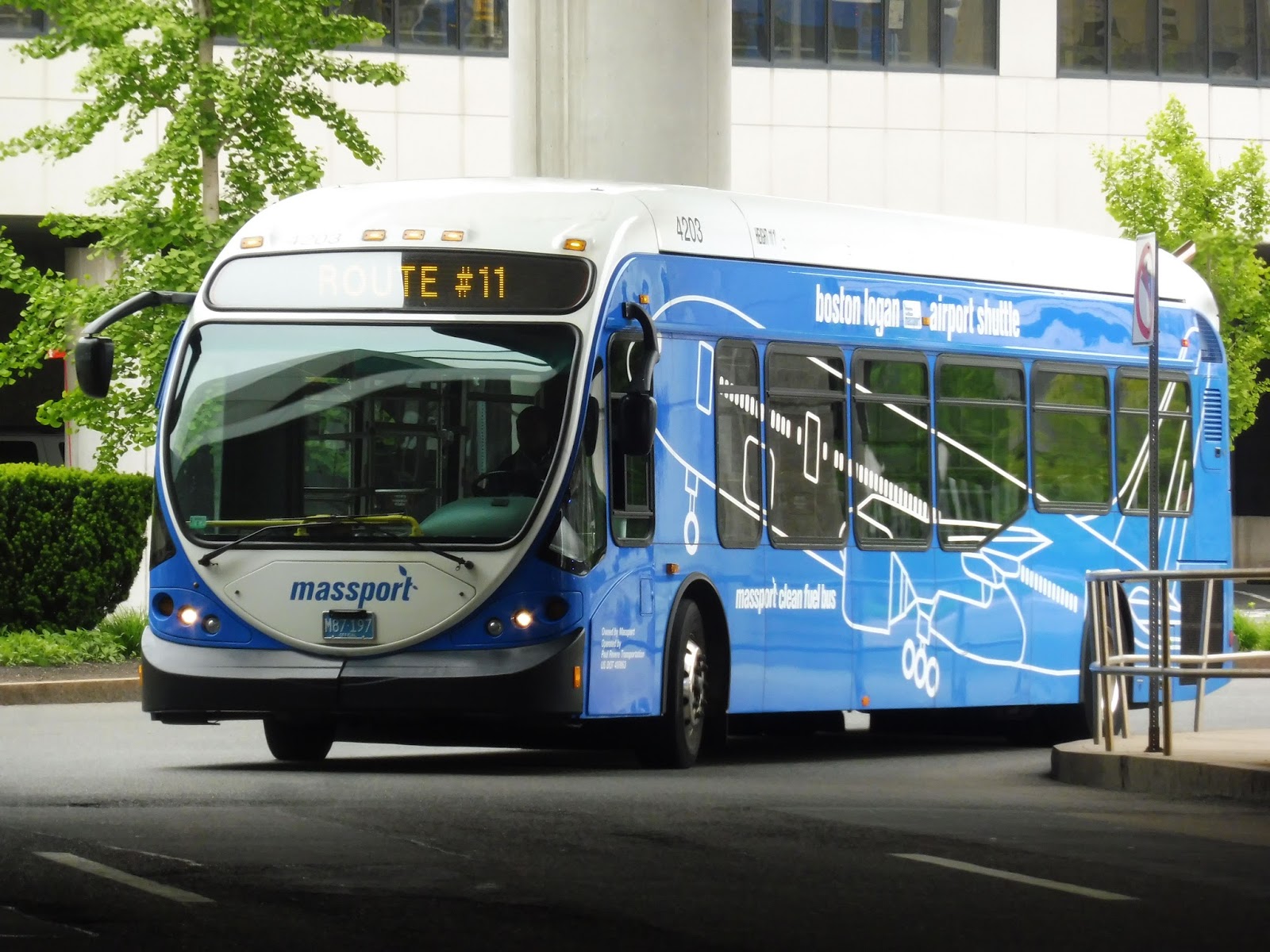
Logan Airport Shuttle: 66 (Serves All Terminals, subway station, LOC, and Water Transportation Dock)
The 66 feels like Massport said, “Let’s have a shuttle route that serves everything!” And thus, this long, complicated route was born. It’s time for about as epic a ride as you can get where airport shuttles are concerned…
 |
| The bus earlier at Terminal A. |
Nathan and I boarded at Terminal B, Stop 2, and from there the bus headed up towards Terminal C. After that stop, we made our way to Terminal E, and then headed down Service Road. This took us past a gas station, a Dunkin’ Donuts, and a bunch of parking lots.
 |
| The gas station. |
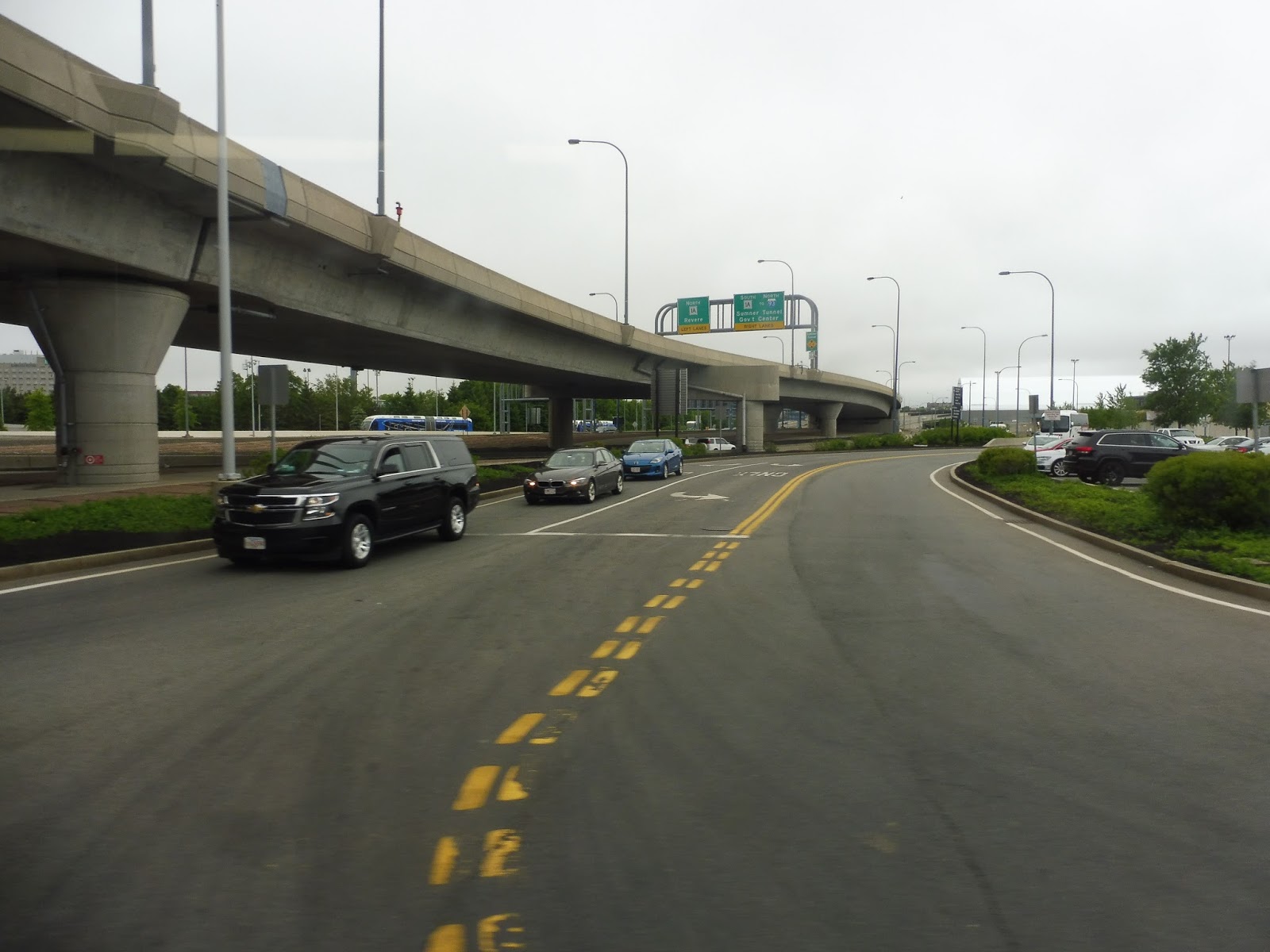
Now, it would be quite easy to go from here to the Water Transportation Dock directly using Hotel Drive, but Massport decided the 66 needs to also serve the Blue Line station. Thus, we continued up Service Road, mostly running past airport buildings and huge hangars. We then went under I-90, pulling into the busway for Airport Station.
 |
| A street leading towards Economy Parking. |
From the station, we headed down Transportation Way, which had I-90 on one side and a park on the other. The street curved around to become Harborside Drive, and we passed the Rental Car Center (seemingly the only thing this route doesn’t serve). Next, we went by various parking lots and buildings, then the street twisted south.
 |
| You can see the city! |
The road took us behind Terminal A’s second building (that’s a real pain to get to), as well as the Logan Office Center, representing the mysterious “LOC” in the route’s title. I have no idea what the LOC is, but it gets a nice shelter on one side of the street. In order to get from the LOC to the airport, passengers unfortunately have to take the 66 out to the Ferry Terminal and back. Next, we passed an “overflow parking lot,” and finally, we turned into the Logan Ferry Terminal loop.
 |
| The bus in the busway. |
Logan Airport Shuttle Route: 66 (Serves All Terminals, subway station, LOC, and Water Transportation Dock)
Ridership: I have to say, the 66’s ridership is pretty miserable. Of the three other people who boarded, one of them went to that overflow parking lot, and the other two went to the Hyatt right next to the Ferry Terminal…which gets its own shuttle, anyway.
Pros: There’s no denying that a shuttle to this part of the airport complex is necessary. Despite being pretty small, the overflow lots need a connection to the terminals in order to encourage parking in them. And no matter how infrequent or expensive the boats from the Ferry Terminal are, they still need a connection to the airport.
Cons: The low ridership is a pretty big problem, and I almost wonder if they could remove the second bus from the route to make it every 24 minutes instead of every 12. Then again, you could easily improve frequency by cutting out the deviation to the Blue Line station. It takes forever, and there are so many other buses connecting the terminal to the station – I’ll bet with one bus, you could cut the loop down to about 16 minutes, which is a perfectly fine frequency for a route with as little ridership as this.
Nearby and Noteworthy: There isn’t much of note on the 66’s independent section, but this is the shuttle to use if you’re going to the overflow lots or the ferry terminal.
Final Verdict: 6/10
The 66 seems like a necessary evil in the realm of Logan Airport shuttles. There definitely needs to be a link to the ferry terminal for the small but consistent amount of people that uses it, but the route could definitely be more efficient. Serving the Blue Line station seems like a complete waste of time, and if it was eliminated, you could get a slightly higher headway with only one bus.
Latest MBTA News: Service Updates
Logan Airport Shuttle: 11 (Serves All Terminals)
A Logan Airport shuttle that just loops around all the terminals makes perfect sense in theory. In practice, though? Well, let’s find out with a ride on the 11.
 |
| The bus pulling into Terminal E. |
Nathan and I decided that the only part of the 11 we really needed to take was the section between Terminal E and Terminal A, since it’s the route’s unique section and the only situation in which one would have to actually use this route. The bus came into the terminal, arrived at the stop, and just…sat there. We waited for about five minutes before finally leaving the stop.
 |
| These airport roads are confusing… |
We headed down Service Road, travelling alongside a concrete wall. The street curved a bit and passed a gas station and a bunch of parking lots, then another wall. Next, we made our way onto Hotel Drive, taking us beneath an elevated highway and alongside another one. As the name suggests, it also took us past the airport Hilton.
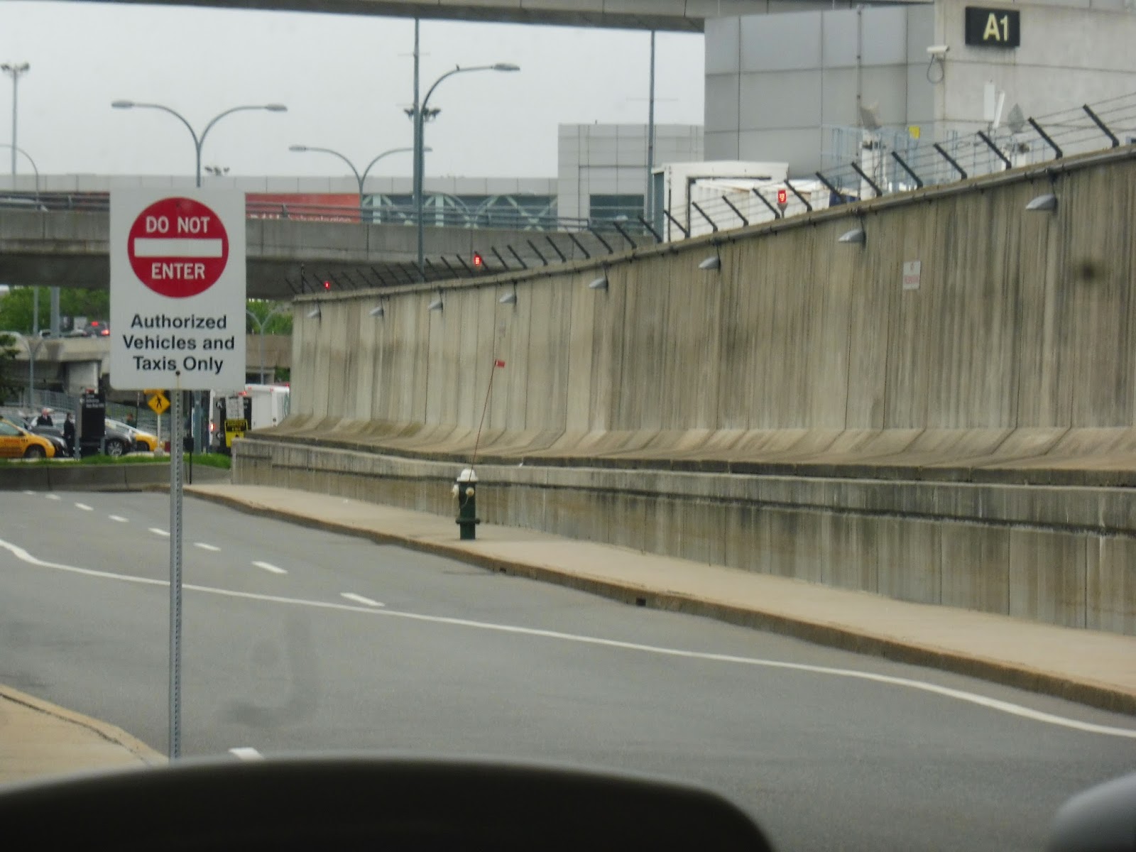 |
| Ooooooh! |
After going beneath another highway, we actually did something kinda cool that I wasn’t expecting: we went onto an “Authorized Vehicles and Taxis Only” road! Lined with a big imposing wall, this street seems to act as the layover point for Logan Airport buses. It took us right into Terminal A…and then from there the route just got boring.
 |
| Terminal B, Stop 1. |
From Terminal A, we went to – wow! – Terminal B. After making the first stop,we made the 180-degree turn around to the other side of the parking lot to serve Stop 2. Nathan and I had seen enough by this point, and we had another bus to catch, so here we left the 11 to continue on its journey back to Terminal E.
 |
| Get back on your endless loop, 11! |
Logan Airport Shuttle Route: 11 (Serves All Terminals)
Ridership: The ridership on this route consisted of two other people…who realized they had gotten on the wrong bus and had to leave. It’s not just our ride, either – every time I see an 11, it’s either completely empty or has maybe one person on it!
Pros: Like I said, a route like this makes sense in theory. To anyone not familiar with the geography of Logan Airport, a terminal loop seems like a great idea.
Cons: This is just pointless, though! For one thing, the route only uses one bus, so it ends up being pretty infrequent for an airport shuttle. Also, its only real use, getting from E to A, is marred by the fact that it takes forever to get between them! You have to meander down all these random roads, and the driver was really taking her time. There are other buses that serve all terminals, anyway, except for that one section between E and A…but there’s a nice walkway between E and A! It even has moving sidewalks, so it’s completely accessible.
Nearby and Noteworthy: The airport, I guess…I dunno, that’s literally all this route serves.
Final Verdict: 2/10
The 11 feels like a bare minimum service provided just because the idea of a terminal loop is theoretically a good one. The problem is that it’s infrequent, it never gets riders, and it’s too darn slow where it’s most needed! The thing is, Logan has such a great network of walkways that when you factor in waiting time, it’s usually faster to walk. Sure, the 11 may be useful in certain rare cases, but honestly…they could just scrap this one.
Latest MBTA News: Service Updates
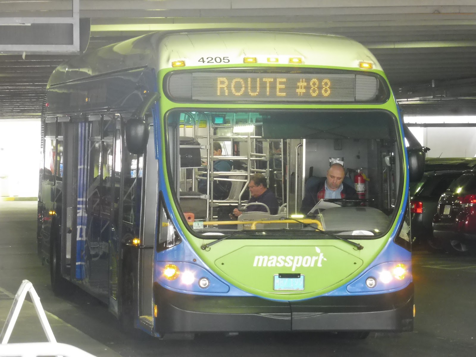
Logan Airport Shuttle: 88 (Serves All Terminals and Economy Parking Garage)
Oh, Logan Airport parking…why musteth thou beeth so expensive? At a hefty $32.00 per day, Central Parking may be convenient to all the terminals, but it sure ain’t cheap. Luckily, Economy Parking is here to help, with a rate of just $23.00 per day! What a “steal!” How does one get from Economy Parking to the terminals, though? They must use the 88.
 |
| We didn’t actually start at the Economy Garage, but this is the only place where I actually got pictures of the bus… |
Contrary to the picture above, Nathan, Sam, and I got the bus at Terminal A. Since the 88 serves all terminals, we got to do that whole shabang…always a pleasure. Thus, we deviated our way to the Terminal B parking lot in order to serve Stops 1 and 2, then we served the exteriors of C and E as well.
 |
| Some parking at Terminal E. |
From Terminal E, we headed down Service Road, going by a bunch of parking lots, as well as a gas station, while a huge wall occupied one side of the street. The wall continued as we proceeded down the road, but hangars and airplanes were occasionally visible. The other side of the street was taken up by I-90.
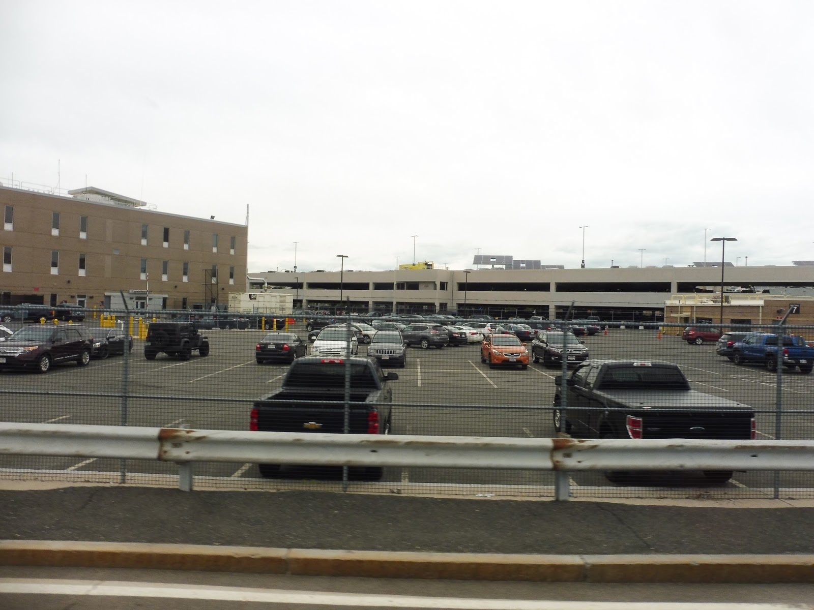 |
| Hark! Economy Parking approaches! |
We passed Airport Station without serving it, then turned onto Cottage Street. It’s a bit of an odd name, really, as there were no cottages around – only parking lots. Of course, the mother of all those lots was the big Economy Parking Garage. We drove straight in, using a bus-only entrance, and arrived at the stop within the garage.
 |
| That’s a tight fit! |
Logan Airport Shuttle Route: 88 (Serves All Terminals and Economy Parking Garage)
Ridership: Ridership on this thing is great for an airport shuttle. Our bus had about 7-10 people going to Economy Parking, which is great when you consider the frequency of the route. There was a good smattering of people going the other way as well, so ridership on the 88 seems to be steady and consistent.
Pros: I gotta say, I didn’t know about Economy Parking until I rode this route, but this makes it seem pretty darn attractive! The 88 is frequent, relatively fast, and well-used. I’m glad it doesn’t waste time serving Airport Station, instead opting for a direct route right to the terminals.
Cons: The waiting area at the Economy Parking Garage could be better – it’s really just a few wastebaskets, and that’s about it. Come on, let’s get a bench there!
Nearby and Noteworthy: Economy Parking really isn’t much less convenient than Central Parking, and it’s a heck of a lot cheaper! Seems like the best place to park at the airport, really.
Final Verdict: 9/10
I gotta say, my experience with the 88 definitely turned me on to Economy Parking. The shuttle is so frequent and direct that when you consider the lower price, it’s really a no-brainer! Sure, the waiting area at the garage could be better, but at least you’re not going to have to wait too long for a bus.
Latest MBTA News: Service Updates