PVTA: Holyoke Transportation Center
Is it possible for a transit center built in 2010 to look like it came from the 1970s? The Holyoke Transportation Center tries to answer this question, and clearly, the answer is a resounding “Yes.”
| *Ahem.* Case in point… |
Yeah…this is it. Gotta love that…floor pattern. And the…wall colors. And the…seat designs. Okay, granted, the transportation center was retrofitted from an old fire station, and I imagine they just didn’t bother to change the decor.
 |
| A corner of the room. |
Okay, but still, this place just feels dated! I mean, we’ve got some perfectly adequate vending machines, but then the departure TV screen is just ripped from a Windows 7 computer with some sort of notification no one bothered to close. Then on the wall, there’s a master schedule of all the PVTA Holyoke routes, which is great, but also random maps and directions for the X90 (which does go to Holyoke) and the R14E (which doesn’t go anywhere near Holyoke, and also doesn’t exist anymore…I hope they took its map down now! That being said, why was it up in the first place?).
 |
| Another corner. |
On the other side of the room, there are lots of PVTA schedules, as well as a lone security guard with nothing better to do at this quiet hub than to use his phone. Hey, I don’t blame him! There was also a ticket booth, but it was closed because the ticket agent went on maternity leave and the PVTA didn’t bother to replace her. Sigh…
 |
| The bathroom hallway. |
There’s also a hallway that leads to some bathrooms and a water fountain. Unfortunately, I couldn’t see what the bathrooms were like because they’re only open on weekdays from 9 to 5. Well, darn it! The bathroom picture is the most important part of any station review!
| The outdoor area. |
There isn’t all that much to say about the outdoor waiting area next to the building. It’s got benches, bike racks, and another Holyoke master schedule, and that’s about it. I will say that the brick transportation center building is quite charming, though!
| The boarding area. |
The Holyoke Transportation Center’s boarding area is a prime example of form over function. Sure, it looks pretty, but all of the bus boarding bays are really narrow with no benches or anything – just a little wastebasket at each one. I do like how little alarms go off when a bus is leaving, but other than that, this outdoor area just isn’t much.
| That’s a nice building! |
PVTA Station: Holyoke Transportation Center
Ridership: Although lots of routes converge here, I’ve never seen the hub be all that busy. Maybe it’s the fact that there are three different places to wait (the inside, the benches outside, and at the berths themselves), or maybe it’s that the hub is just kind of a quiet place, but it never feels crowded at all.
Pros: The outdoor areas all look great. The inclusion of master schedules everywhere is helpful for knowing when departures are, and the screen inside, as ugly as it is, is even more helpful. There’s plenty of seating inside the building, and it never gets too crowded.
Cons: Ugh, the decor on the inside is just…ech! The PVTA just doesn’t seem to care all that much about this place – they didn’t bother to replace the ticket inspector, they stuck a lone security guard in here with nothing to do (not that the PVTA doesn’t do that in other places, too), and they close the bathrooms on weekends, even though that aforementioned security guard could literally make sure no one loiters in them!
Nearby and Noteworthy: Downtown Holyoke is a weird place. I don’t think I’ve ever discussed it on this blog, but it’s kinda like…Lawrence. Except weirder. And more abandoned-feeling. Uhh…okay, having taken a walk through the downtown, all I can say is that it’s a hard place to describe.
Final Verdict: 5/10
The Holyoke Transportation Center is in a convenient location and it serves lots of bus routes, but it just offers a…subpar experience. I can’t stand that the outdoor berths have no seating of any kind (people often just sit on the railings), and I simply refuse to believe that the inside wasn’t designed 40 years ago! At least the outside looks good.
Latest MBTA News: Service Updates
GUEST POST: Service Change: Big Blue Bus: 1 (Santa Monica Blvd and Main Street)
Sam recently took a trip to LA, and he’ll have several guest posts coming soon about the bus system in Santa Monica, Big Blue Bus. Here’s the first in a series.
The Big Blue Bus Route 1 is very similar to the MBTA’s 1, in the way that it’s long, frequent, relatively straight, and very busy. It also, like the 1, is an important link between several dense ridership draws. My hotel was in Venice, on one end of the 1, and I just so happened to be on the other end of the route in UCLA. Thus, our review begins.
 |
| A bus in Venice |
Since I was riding on a Friday afternoon, my trip began at the UCLA Hilgard Terminal. However, the terminal is only used on weekdays between 7:00 AM and 8:00 PM. At all other times all of Big Blue Bus’s routes begin at the nearby P2 terminal. Hilgard was incredibly quaint, nestled in the midst of a quiet residential area. Not too many riders board buses here. One major con of Hilgard is the lack of any berths. Despite being about 200 feet long, buses kind of leave from wherever they please. I was waiting at the wrong end of the platform and had to run for my bus, which almost left without me.
We made a right out of the busway and soon made a left on Westwood Blvd. We picked up a handful of people at each stop, and soon arrived at Westwood, where several people got on. Westwood was lined with tall buildings, flashing lights, and lots of people. We continued down Westwood Blvd. for a few more blocks, with people still getting on, before making a right onto Santa Monica Blvd.
The route spends most of its time on Santa Monica Blvd. People began spilling off the bus, presumably to walk to the nearby Expo Line. The stops were comfortably spaced out and all of them were used. Santa Monica Blvd was very commercial, with lots of businesses lining both sides of the street.
 |
| Another bus; this one a newer Gillig |
Soon, we arrived in Santa Monica. The bus zig-zags quite a bit here, making a left, followed by a right, then another left, then a right, then one last left onto Main Street, where the route spends the rest of its time. During the zig-zagging, the bus services the Santa Monica Station.
Main Street was very dense. It runs near the Pacific Ocean and the beach culture spreads onto the street, with several surfboards and bathing suits seen on pedestrians. The bus only had 5 or so people at this point. After fighting through thick traffic, we arrived at a roundabout, where we veered to the right and entered the Venice busway.
Ridership: The trip I rode was the first to come in 25 minutes. That being said, it never had more than 30 people on at once. However, I was traveling against the peak; several buses travelling the other way were packed. In FY2014-15, the route carried 2.4 million people.
Pros: This route serves a lot: UCLA, Westwood, Santa Monica, Venice, and several places in between. It runs frequently enough for one to not need a schedule, and it carries a lot of people.
Cons: The 1 is very prone to bunching, and isn’t always the most reliable. While the 1 rarely has gaps of 25 minutes like the afternoon I took the bus, gaps of 15 to 20 minutes are commonplace, as are bunches of 2 to 3 or more buses. The sheer number of traffic lights on Santa Monica Boulevard, as well as unpredictable traffic and fluctuating ridership contribute to this problem.
Final Verdict: 8/10
The 1 certainly does its job, and man, does it have a big job to do. It connects several major ridership hubs with very frequent service. It is definitely one of Big Blue Bus’s best performers and does the area a lot of economic good for sure.
Latest MBTA News: Service Updates
PVTA: R41 (Northampton/Easthampton/Holyoke Community College/Holyoke Mall)
Wow, this route is scenic! The name of it doesn’t sound all that impressive, but the R41 offers some awesome views from mountain peaks as it winds its way from Northampton to Easthampton to western Holyoke. Let’s see how my awful pictures ruined those views…
 |
| The bus coming into Northampton. |
Oh, but before any of that could happen, we had to serve Salvo House, like practically every other Northampton route. We went down Main Street, which was the main drag of Northampton and there were businesses everywhere…you’ve heard this before. Next, we turned onto Pleasant Street, where there was more retail, as well as the Northampton Amtrak station.
 |
| Some houses. |
It started to get less dense the further we went, and the businesses started to get parking lots in front of them. Some houses even started to show up as we made our way around onto Conz Street via Wright Ave. This took us to Salvo House, that apartment building that so many routes serve, then later on we turned onto Old South Street.
 |
| Yup, we’re definitely in Northampton! |
We turned onto (regular) South Street next, which was residential, and it finally took us out of that Salvo House loop. The street was basically lined with suburban houses until we went over the Mill River, where there were a few other buildings. The street was called Easthampton Road after the river crossing, and it was now industrial buildings mixed in with patches of woods.
 |
| Just after entering Easthampton. |
There were a few businesses as we entered Easthampton, then we turned onto Oneil Street, which was industrial again. Eventually it took us over the Manhan River, where it became Lovefield Street. This took us onto Pleasant Street, where there were both old factories and old factory houses.
 |
| An example of the latter. |
There were some dense houses after that, then we curved around Main Street Park onto, well, Main Street. We rolled through downtown Easthampton along the wide road, which featured four lanes as well as parking spaces perpendicular to the sidewalk. There wasn’t all that much in the way of businesses, either, and what was there was pretty boring.
 |
| Some churches downtown. |
There were more businesses when we turned onto Union Street, and these were a lot more interesting than the ones on Main Street. Plus, the street was much narrower, so it had more character. We left downtown soon enough, though, and the businesses got parking lots out front. Coming alongside a lovely pond on Cottage Street, there was a repurposed old factory on the other side, then there were some more charming and interesting businesses!
 |
| Some kayakers enjoying the pond. |
We merged onto Holyoke Street next, which was lined with houses. They got smaller and more spread-out the further we got, and their front yards got way bigger. We went by a big field, then the road started to curve its way up the side of the looming Mount Tom. It was time for the scenic part!
 |
| Darn trees in the way! |
The road climbed up along the mountain, with a sheer cliff going up on the left and a sheer cliff going down on the right. That right-hand side offered a simply fantastic view of the surrounding areas, and other than that, it was just pure woods. Actually, at one point there was a tavern, an event venue, and a coffee shop all in a row, but that was about it.
 |
| Gotta admit, it’s a good place for a restaurant. What a view! |
The street became Easthampton Road as we entered Holyoke, but aside from an animal hospital, of all things, it was still just mountainous woods. We were starting to head down, though, and soon enough we were in a mostly flat residential neighborhood. Aw, man!
 |
| BORING. |
We turned onto Jarvis Ave, where it was basically all houses. There was also a residential development called University Park, presumably for students of Holyoke Community College, and a few similar developments further down the way. Next, we turned onto George Frost Drive, which went through the woods for a bit.
 |
| Coming into the college. |
We went through a gate into Holyoke Community College, then we turned onto Campus Road. This took us to the college’s main building, where we made our way around a little loop in front to serve the bus stop. After that, we headed onto Doyle Drive, which went through the forest until we reached Westfield Road, onto which we turned – this was residential.
 |
| The intersection with Homestead Ave. |
There were some businesses when we turned onto Homestead Ave, but it went back to houses as soon as we proceeded down the road a bit. All of a sudden, we came to a factory, where we turned onto Lower Westfield Road and went under I-91. There were lots of suburban businesses and shopping centers on the other side, where we turned onto Holyoke Street. This took us to the mother of shopping centers: the Holyoke Mall, the R41’s final stop.
 |
| The bus at the mall. When it gets back to Northampton, it’ll do an R42. |
PVTA Route: R41 (Northampton/Easthampton/Holyoke Community College/Holyoke Mall)
Ridership: My Saturday trip had pretty low ridership, but that being said, it was a summer Saturday. I would guess that more people use this thing on school-year weekdays as a commuter route from Northampton to Holyoke Community College. I mean, it gets about 18 passengers per revenue hour, which isn’t awful.
Pros: The R41 provides an important connection from Northampton to Holyoke Community College without the need of any transfers. It has a decent schedule, too, with every hour service on weekdays and Saturdays. Plus, the thing is so scenic!
Cons: Weirdly, it’s not quite every hour – for some reason, there’s a 75-minute gap from 12:45 to 2:00 from the Holyoke Mall. It’s not too big of a deal, but it doesn’t seem to make much sense. There’s also a shift from leaving on the :00 to the :05 at 4 PM from Northampton, which also doesn’t make much sense.
Nearby and Noteworthy: As I was going down this route on Google Maps, this place in Easthampton caught my eye. It’s basically a game where you and a few other people get locked into a room and you have to solve puzzles to escape. That’s a cool concept!
Final Verdict: 7/10
The R41 is an important route, even though it may not have all that much ridership. It still provides a useful connection from Northampton to the Community College, and actually, it’s the only direct route from Northampton to the Holyoke Mall too. Sure, it’s not very busy and it has a few minor schedule quirks, but this is still a decent, useful route.
Latest MBTA News: Service Updates
PVTA: TT (Tiger Trolley (Holyoke Transportation Center to South Hadley Commons))
On the day this post comes out, August 27th, 2017, the Tiger Trolley is being eliminated. Good freaking riddance.
 |
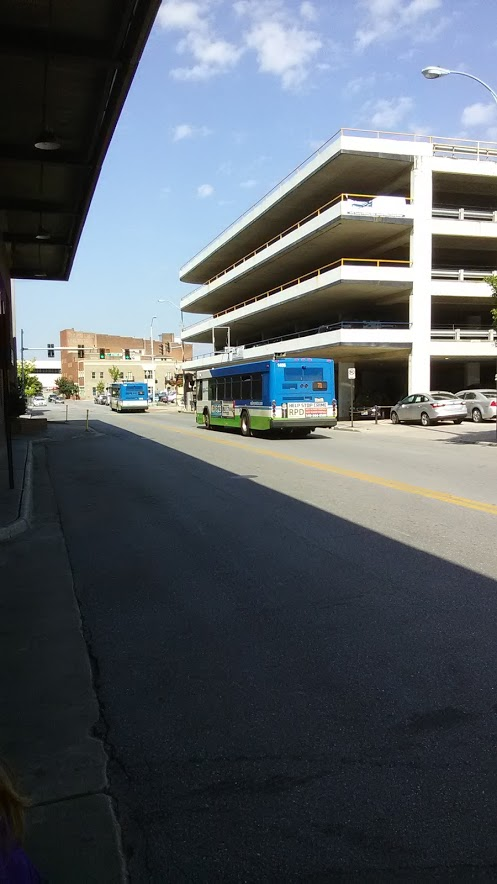
| The bus at the Holyoke Transportation Center. |
We left the Holyoke Transportation Center and made our way up Maple Street, then we turned onto Lyman Street. As we passed a few housing developments, we descended a hill to “The Flats,” the part of Holyoke where there are a bunch of industrial buildings and canals. And…uh…yeah, we basically just went by those.
 |
| A canal and a railroad bridge. |
We turned onto Canal Street, which did indeed parallel a canal, and it was just more industrial buildings. Next, we turned onto Bridge Street, which, yes, did feature a bridge! Two, in fact! The first was over another canal, while the second took us over the Connecticut River into South Hadley.
 |
| This incredible view never gets old! |
On the other side, I was assuming we’d just continue down Bridge Street like the R29, but the Tiger Trolley is never as straightforward as just “continuing down” something. Instead, we turned onto Main Street, going by some industrial buildings and businesses. Those weren’t the point of this endeavor, though – no, we had to deviate to the South Hadley Public Library. And, oh boy, we were a few minutes early, so we had to wait for a bit! Fun!!
 |
| A side street. |
We returned back down Main Street, and this time we actually continued down Bridge Street. There was a mixture of houses, businesses, and industrial buildings along here, and it all continued as we turned onto Lamb Street. However, all of a sudden, out of nowhere, we left the R29 again by getting on a highway ramp.
 |
| WHAT IS THIS??? |
Okay, turns out it was the very end of the highway, and it instantly became the residential Granby Road. As we came alongside a cemetery, the road widened and we reached an intersection with a school on one side. You’d better get used to me talking about this place, because this bus comes through here a lot.
 |
| The school. |
The first thing we did from here was turn onto Willimansett Street, a wide road with a median that curved south past nothing particularly interesting. This led us to the South Hadley Big Y, into whose parking lot we deviated. Oh, and we were a few minutes early again. Sigh…more waiting…
 |
| Hi, Big Y. |
We returned the way we came, back to that same intersection, and now we turned back onto Granby Road in the same direction we had been going before. It was residential for the most part, but we did start to get some businesses along the road as we came up alongside a reservoir. Right after that, we deviated into…well, gosh it was just an empty commercial building! Turns out there’s a medical building right behind it, but still!
 |
| THIS IS NOT DEVIATION-WORTHY!!!!!! |
Sigh…we came back to that same intersection for the last time. Now we turned onto Lyman Street, which was lined with houses for a while before it came up alongside a cemetery. After that, we turned onto Newton Street, which had lots of suburban businesses, but we targeted a shopping plaza: Woodlawn Plaza, to be exact. We pulled into its parking lot, stopped at a random place, and…oh my God, are we seriously thirteen minutes early?
 |
| I guess I don’t blame him for leaving… |
If you were a bus driver, what would you do if your bus showed up at a timepoint thirteen minutes early? How about leave the bus and get some grub? I don’t see why not! Yeah, our driver did just that, visiting both Friendly’s and Dunkin’ Donuts over the course of the layover. Might as well take advantage of the time, right?
 |
| A side street. |
We even left the mall early! We headed up Newton Street, which was mostly residential, with a few businesses and industrial buildings thrown in. The street became College Street soon, and it briefly took us alongside a river. Next, we arrived at the street’s namesake, Mount Holyoke College. We didn’t actually serve the university, though – no, instead the Tiger Trolley terminates at Village Commons, a downtown shopping mall-type thing across the street. Sure…
 |
| Good riddance! |
PVTA Route: TT (Tiger Trolley (Holyoke Transportation Center to South Hadley Commons))
Ridership: This thing’s ridership is just abysmally low. The PVTA claims it gets 2.4 passengers per revenue hour, but I dunno – had Sam and I not taken this thing, our trip would’ve been completely empty.
Pros: The route…uh…serves stuff. And gets hardly any passengers. Oh wait, that’s a con.
Cons: Okay, complaining about the fact that this route is a deviatory mess (complete with strange stops called “transit access points” that require a reservation for the bus to serve) that hardly gets anyone is like taking candy from a baby. We all know this thing is just a waste of resources. But even if it was to stick around, why the heck does it run every hour and a half? The schedule is padded so ridiculously much, maybe because of the stupid “TAPs,” that it’s running far more infrequently than it has to. This thing could easily do its trip in half an hour plus a bit of padding, so it could run every hour with no problems at all.
Nearby and Noteworthy: Woodlawn Plaza and Village Commons are both served by the R29, plus the library is within easy walking distance of that route. Thus, the only real “destination” this thing serves on its own is the South Hadley Big Y. How exciting…
Final Verdict: 1/10
Luckily, the PVTA shares my sentiments with this route. Like I said, it’s being eliminated today. HA! WOOOOOOO! LET’S HAVE A TIGER TROLLEY GOING-AWAY PARTY! SEE YA, TIGER TROLLEY! WOULDN’T WANNA BE YA! WEEEEEEEEEEE!!!!!!!
Latest MBTA News: Service Updates
PVTA: X98 (Crosstown Northampton)
I let out a groan when this thing showed up and it was a stupid minibus. I mean, with some routes you expect it. The “Tiger Trolley”? Yeah, that’s a minibus. The “Palmer Village Shuttle”? Gotta be a minibus. But the X98…gosh, I mean, that sounded like a legitimate route…
 |
| Ugh, it’s got the paper sign on the side and everything… |
We started off at Salvo House, an apartment building south of downtown Northampton. The bus left that and made its way around the building on Fruit Street, in order to serve…oh come on, a Senior Center deviation already? Alright, so we served the Northampton Senior Center, then we proceeded down the residential Fruit Street.
 |
| Leaving the Senior Center. |
Next, we turned onto Old South Street, which went past some parking lots, then up a steep hill into downtown Northampton. We turned onto Main Street, the main drag, where there were tall buildings with charming businesses on both sides. Just after going by the Academy of Music, we turned onto State Street, which became narrow and residential.
 |
| Bustling downtown. |
The dense houses continued as we turned onto Finn Street, then Prospect Street. Eventually, we did pass a temple, a YMCA, and the Northampton Survival Center, but it was back to being residential when we turned onto Jackson Street. We passed the Northampton Bikeway, then there was a school, and later on a housing development.
 |
| Looking into the development. |
We continued onto twisty Cooke Ave, which went down a hill around the back of Hampshire Plaza. Next, we entered the plaza itself, and…oh, we were ten minutes early? Cool, alright, that’s totally FINE. So after waiting for what felt like an eternity, we were off again.
 |
| The parking lot. |
We made our way out of the mall and headed onto North King Street. We were paralleling I-91, while on the other side (and later on both sides when the highway curved away), there were industrial buildings. North King Street started to go up a hill, then we turned into the River Valley Market, a small grocery store. What a strange place to end…
 |
| The bus back in Northampton. |
PVTA Route: X98 (Crosstown Northampton)
Ridership: The standard for good ridership on the PVTA is 20 passengers per trip. The X98 averages 2. That’s exactly what my trip got: a mother and her kid got off at the residential development we passed.
Pros: It serves the Survival Center. That’s about it.
Cons: Like, the Survival Center is basically the only thing this route serves. Everything else is about a half mile from the R44, so this route is pretty darn redundant. When I took it, it was running every hour throughout the day, weekdays and Saturdays, which was just far too much service. Not to mention, and this is just the tiniest nitpick on a gigantic cake of awfulness, there was the classic PVTA schedule padding at Holyoke Plaza.
Nearby and Noteworthy: Like I said, all this route really serves is the Survival Center. And a bunch of houses that are a 10 minute walk from the R44.
Final Verdict: 2/10
PVTA’s service changes, which will go into effect for this route on September 3rd, make a lot of sense. They’re planning on reducing the X98 to just three trips per weekday, only serving the Survival Center during food distribution hours. That’s perfect – that’s all the route really needs to do. There’s also a bit about having the R44 deviate to cover up part of the lost X98, which is…uh…okay, if there’s anything the R44 doesn’t need, it’s another deviation, but oh well. The X98 is being given the right treatment, I think.
Latest MBTA News: Service Updates
PVTA: 46 (South Deerfield/Whately Park & Ride/UMass)
Rush hour-only bus time! Oh…except there’s one midday trip. And one late morning trip. Alright, so I guess the 46 is 66% rush hour-only…
 |
| The bus zooming down the street. |
 |
| An auto shop north of North Amherst Center. |
 |
| A farm. |
 |
| Wow! |
 |
| 46, UM… |
PVTA: B48 (Northampton/Holyoke Transit Center)
The B48 is amazing and wonderful and I love it to bits! Final Verdict: 10/10. Alright, review over, have fun! No…I guess there’s more to talk about than just that…
 |
| The bus coming into the terminal. |
Leaving the Holyoke Transportation Center, we headed down Dwight Street past a post office, a parking lot, and apartments. Next, we turned onto Beech Street, which made its way up past a field and around a huge rotary. Whilst traversing the rotary, we passed over the same train tracks twice, then we turned onto Hampden Street.
 |
| Going by a park. |
There were some houses, then we merged onto Lincoln Street, going by a Stop & Shop on one side and a park on the other. Unfortunately, this area only seems to have a stop on the northbound side, which is a big problem. Lincoln Street curved west and it was lined with dense but yard-endowed houses, then we turned up onto Northampton Street.
 |
| Some shrubbery at the turn. |
Northampton Street was also residential for a while, but then we entered the reason why I love the B48 so much: the majority of the route is just woods! Also, the majority of the route is stopless, which is great for through passengers, but the bus does go by a lot of houses in certain places that could possibly use the bus. I mean, we even went by a tourist attraction: a bunch of dinosaur footprints by the Connecticut River! I don’t know who would take the bus to those, but it seems like they deserve a stop.
 |
| I love this route I love this route I love this route |
Next, the road came alongside the Connecticut River, giving us a great view for a good amount of time as we also paralleled a train track down which the Amtrak Vermonter runs. Meanwhile, the other side was mostly woods, but we also went by a few housing developments and motels. As we curved away from the river, we started to see some other buildings: a banquet hall, a church, and some houses.
 |
| A factory poking above the trees. |
After that, there were some woods again, as well as a field, then we passed a hotel and a factory. As we entered Easthampton, there were some houses, then we were briefly on an isthmus between rivers that took us into Northampton. The street was now called Mount Tom Road, and there were more woods, then a bit of farmland.
 |
| Did I mention I love this route? |
We came up to an industrial area, then passed a development called Atwood Drive. Except…on one B48 trip, and I took a good amount of B48 trips, we actually deviated into it. And there was a shelter and a sign and everything in there, and…well, I have no idea what the deal with that is. I wanna say the PVTA is eliminating the “deviation”, but I can’t remember the exact details of the sign I saw, and there’s no information on the website. Either way, it’s weird.
 |
| Wow, nice fire truck! |
We went under I-91, traversed around a roundabout, and all of a sudden there was development everywhere. We went down Conz Street, going by industrial buildings at first, then an apartment building and some dense houses. Next, we turned onto Old South Street, then New South Street, which took us up to downtown Northampton. Our final turn was onto Main Street, where we arrived at the Academy of Music stop.
 |
| The bus and a…shopping cart. |
PVTA: P21 (Holyoke/Springfield via Chicopee)
Ahhhh, the P21 is like the total opposite of the P20, and from a riding perspective, that makes it way better of a trip. No malls, no deviations, just a nice straight route from Holyoke to Springfield. Yeah, it still takes a while, and it’s less frequent, but it’s a much better ride!
 |
| Heyyy, that destination sign is red, not purple! |
 |
| Oh, I guess there’s a “Micky D’s” on the business side of things over there on the right… |
Outside of that library, we turned onto Cabot Street, and after some apartment buildings, we passed through the old industrial part of Holyoke. We went over two canals, then it was a mixture of apartments and businesses. We passed over another canal, then it was time for a big bridge over the Connecticut River.
 |
| One of the canals. |
We were in Chicopee on the other side, and our street was called Chicopee Street. It curved around next to a train track, then there was a mixture of dense houses and businesses. Eventually, we went under I-391, which had a park right next to it – because, you know, a busy elevated highway is the perfect place to put a park!
 |
| A side street. |
It’s at this point that the route splits into two possible alignments. Every other trip goes via Chicopee Street, while the others (including mine) merge onto Meadow Street. It was mostly residential at first, with a few businesses thrown in too. However, one side of the road eventually became occupied by a huge office park.
 |
| Still houses on the other side, though! |
One side of the street was still industrial, but the other side started to see some housing developments, too. There were even more of them when we turned onto Meetinghouse Road, at least on the northern side of the road – the other side was normal houses. We turned back onto Chicopee Street, rejoining the other routing.
 |
| One of the many housing developments. |
After passing a golf course, it was entirely residential on Chicopee Street. We finally got a few businesses at the intersection with Meadow Street, then the road got wider and went over a train track, under I-90, and under I-391, all in quick succession. Next, we turned onto Springfield Street, which took us over the Chicopee River.
 |
| The river. |
There were some old factories, and after going over a canal, we turned onto Front Street, then Cabot Street. There was a shopping plaza here, but once we turned onto Exchange Street, there were more traditional retail buildings on either side. This was downtown Chicopee…but I can’t say it was a particularly interesting downtown.
 |
| No pedestrians…it’s empty. |
We continued onto Springfield Street, going by dense houses, a few churches, and a high school. Later on, we went by College of Our Lady of the Elms, then it was just all houses for a little while (aside from some retail at the intersection with Asinof Ave). We entered Springfield soon enough, where there was a little roundabout called Glenwood Circle with a few businesses.
 |
| Houses. |
Springfield Street continued to be almost entirely residential past there, with really nice houses with big front lawns. After a side street called “Derby Dingle” (I’m really curious where that came from), we passed the gigantic Baystate Medical Center. The street became Chestnut Street, but we weren’t on it for much longer, turning onto Jefferson Street, then Dwight Street, going around a park.
 |
| Said park. |
It was mostly dense houses and apartments along here. Eventually, we went under I-291 as the street widened, then there were some businesses, offices, and parking lots on the other side. Finally, we arrived into Union Station.
 |
| There we go, now it’s purple! |
PVTA Route: P21 (Holyoke/Springfield via Chicopee)
Ridership: The P21 gets great ridership, and it’s ranked 9th overall in the system. It averages about 39 people per trip, which is amazing! Yes, it’s a long route with a lot of destinations along the way, but like the P20, you’ll generally get pretty busy vehicles along here.
Pros: This is an important route for Chicopee, running straight up through the western end of the city. It’s the second-largest city in western MA, and yet it really doesn’t have all that much bus service. Granted, it’s a small city, but anyway, the P21 is an important route through it. It’s also pretty frequent on weekdays and Saturdays, running every half hour.
Cons: Sundays the frequency becomes every 45 minutes, which…okay, yeah, I’m not saying it doesn’t make sense from a ridership perspective…it’s just kind of an ugly number. But hey, this route didn’t really suffer from the PVTA’s earliness problem, so yay!
Nearby and Noteworthy: I can’t say there was much along here – Chicopee Center was the only true “destination,” and it just seemed boring.
Final Verdict: 7/10
I wouldn’t call the P21 as good of a route as the P20, just because it’s not as frequent and doesn’t serve quite as much. In particular, the Sunday schedule is kinda wonky since it’s not clockface, but it’s not too bad. After all, the P21 is still a lifeline to Chicopee, plus it’s the fastest local route between Springfield and Holyoke! At some point later on, though, we’ll cover its express variant…that’s gonna be FUN.
Latest MBTA News: Service Updates
Long story short, two guys broke the T record and are trying to send it to Guinness. Needless to say, expect a run from me at some point soon…
PVTA: P20 (Holyoke/Springfield via Riverdale Street)
Why does the most frequent route from Springfield to Holyoke also have to be the looooonnnngggeeeesssstttt? The P20 is a miserable splurge of shopping malls and housing developments connecting the two biggest hubs of the PVTA system. Okay, it’s not a useless splurge, but it’s definitely a miserable one.
 |
| The back of the bus at Union Station. |
We didn’t even get to serve downtown Springfield – instead we travelled northwest down Main Street, where it gets a lot more suburban already. After going under I-291, we turned onto Plainfield Street at an intersection with a small statue in the middle. This took us over I-91, then the road became West Street and passed some industrial buildings.
 |
| Crossing the Connecticut River! |
As you can see, this street went over the Connecticut River, then immediately turned into a rotary on the other side in West Springfield. We merged onto Park Street, which was a good name for it, because the street literally had a park in the middle of it! Next, we turned onto Elm Street, which still had a leafy median.
 |
| Houses on a side street. |
There were a few businesses at first, but as the street lost its median, it became lined with dense houses. Eventually the street curved left and there were a few industrial buildings, then we curved right and it was a strange horrendous mix of houses, housing developments, industrial buildings, car dealerships, and motels. Oh, and a COUNTRY CLUB hidden behind a layer of trees!
 |
| Sigh…a lot of the route’s gonna be like this… |
There were a few suburban businesses with parking lots, but once we turned onto Riverdale Street, everything got bigger: a bigger road, bigger businesses, and bigger parking lots. It was also time for our first deviation, a long trip through the parking lot of Riverdale Shops. It took a while to actually get back to the road…
 |
| Sigh…there’s a good amount of this on the route, too… |
We went under I-91, and then it was time for a wholeeeee lot of businesses with parking lots. Like, a lot. They just kept on coming. Yeah, at one point we went under some pylons and came kinda close to the Connecticut River, but it’s not like we could see anything. There was kind of a forest break, I guess, when we went under I-90, but that was just for an interchange.
 |
| Wow, I can almost see the river… |
Finally, we turned onto Highland Ave, a residential street lined with houses. Yay! Something different! Next, we turned onto Whitney Ave, which took us to…the Holyoke Mall. Oh, come on! Not to mention we were ten minutes early! Great, time to sit here for what seemed like forever…
 |
| At least there was a big empty parking lot to look at. |
After the mall, we went up Holyoke Street, which had more businesses and parking lots along it. Next, we turned onto Lower Westfield Road, then Holy Family Road. This was a deviation to serve a few different housing developments, most notably Holyoke Farms Apartments, which were mostly along Tokeneke Road. We used that to make our way to Whitings Farms Road.
 |
| Or…Holyoke Hill Apartments? |
There were some houses for a bit, then we passed a few office parks. As the street curved east, we went by a fire station, then we entered for…another mall deviation? Okay, this is getting old. We had to travel down the entire length of the mall, which the PVTA refers to as K-Mart Plaza while Google Maps calls it Holyoke Shopping Center.
 |
| This is getting old! |
We made our way up Northampton Street after the deviation, which passed a cemetery and then became residential. Next, we turned onto South Street, which had a mix of dense houses and businesses. We went by another shopping plaza (thank goodness we didn’t deviate), then we curved onto the one-way High Street, which was mostly industrial at first.
 |
| A scene in downtown Holyoke. |
As we got further into downtown Holyoke, there started to be more businesses, apartments, and in true Holyoke fashion, abandoned factories. Eventually it turned to brick buildings housing retail on their ground floors, which was at least a little nicer. Finally, we made our way around the block and arrived at the Holyoke Transportation Center.
 |
| The bus boarding for its journey back. |
PVTA Route: P20 (Holyoke/Springfield via Riverdale Street)
Ridership: The P20 is one of the highest-ridership routes on the PVTA, ranked at number 5 in 2016. The route averages 48 passengers per trip, which is huge! Okay, it’s kinda long, and there’s a lot of ridership turnover along the way, but you’ll still get a reasonably busy bus along the whole route.
Pros: The greatest asset of the P20 is its frequency. The route runs every 20 minutes weekdays and Saturdays and every half hour on Sundays, which is really good! Also, for as miserable as the full ride is, the route really does serve a lot of important shopping centers and connects them up to the two biggest hubs on the PVTA. I doubt (and hope) that no one subjects themselves to ride this thing from beginning to end, though – there are much faster ways of getting between Springfield and Holyoke.
Cons: Aside from the route being the longest and most miserable way of getting between Springfield and Holyoke? For as long as I’m reviewing PVTA routes, I will forever be complaining about earliness; the real culprit of the P20 is at the Holyoke Mall. For some reason, it’s only on the northbound route where they do this – the southbound trips are only padded at the end! That seems to be extra evidence that the “layover” at the Holyoke Mall has absolutely no point.
Nearby and Noteworthy: This route basically serves any mall in West Springfield or Holyoke, so it’s a great one for shopping.
Final Verdict: 8/10
While I personally hated my ride on this route, the P20 is ultimately very useful and well-used. The frequency is great, and the route serves quite a bit of important destinations. I’d rather not wait for 10 minutes at the Holyoke Mall when I’m going north, though, thank you very much!
Latest MBTA News: Service Updates
PVTA: B12 (Stonybrook Express)
Heyyyyy, let’s hop on the Prison Express! No, I’m not joking, that’s literally what the B12 is: a nonstop, highway-running express route…to a prison. Like, a gigantic, proper prison. Huh. Yeah, I’m just gonna go ahead and say that this is a strange route.
 |
| Here we go! |
 |
| Some parking lot. |
 |
| A formless apartment building? I guess that works too. |
 |
| Woooo. |
 |
| A “business” and a motel. |
 |
| Very rustic! |
 |
| Here we go! |
We looped around the parking lot and headed onto Texas Drive, going by a small lake-pond-something? There were random buildings along the way, then we pulled into the Pre-Release Center, where prisoners are allowed to spend the day outside of the prison with trackers around their ankles. The driver said that operators of the B12 are specially trained to report to the Sheriff if any of the pre-release passengers act up even a little bit. This is intense stuff! There was no one getting on there today, though, so we just headed back to Springfield with an empty bus.
 |
| Security is high… |
PVTA Route: B12 (Stonybrook Express)
Ridership: This route has two classes of ridership: there are the pre-release prisoners, as I mentioned, and there are also visitors. My ride was entirely the latter class, with seven women going to see people in the prison. In 2016, the route averaged about 4 passengers per trip, which makes sense, considering the first inbound and last outbound are almost guaranteed to be empty.
Pros: It’s, uh, a prison express? You know, it’s a weird thought, but it definitely provides a really important service. Plus, the entire route is paid for by the Hampton County Sheriffs Department, so PVTA doesn’t have to worry about a thing!
Cons: The schedule is really weird. Maybe it has something to do with how the prison works, but there are four trips from Springfield, weekdays and Saturdays: 1:48, 4:03, 6:03, and 7:48. Strange times…
Nearby and Noteworthy: Uhhhh…literally just the prison. That’s it. Have fun!
Final Verdict: 7/10
This is sort of a hard route to review, but I think a 7 suits it pretty well. It definitely provides an important service for a very limited group of people, and it’s fully subsidized, but…gosh, it’s just weird! The fact that it makes no other stops is strange, and those schedule times (seemingly) make no sense. One thing’s for sure, this was an interesting experience, and I’m really glad I was able to ride this crazy route!
Latest MBTA News: Service Updates
GUEST POST: Service Change: Roanoke Valley Metro System
Gary took a trip on the Roanoke Valley Metro System and wrote up an interesting overview of what he saw. Thanks, Gary!

The Valley Metro is a system in southwestern Virginia that comprises of thirty-one local and two express routes, special event shuttles, and the Starline Trolley.
Their paratransit system, called “S.T.A.R.” which stands for Specialized Transit-Arranged Rides, is operated by R.A.D.A.R.
Valley Metro is mostly comprised of Gillig buses, the newer buses being the low-floor “Advantages” and the older buses being the high-floor “Phantoms.” Their Starline Trolley is a trolley-body bus that is manufactured by Hometown Trolley. Their primary express service is called the “SmartWay” which utilizes MCI coach buses and operates two legs, a Blacksburg-Roanoke leg which serves the students of Virginia Tech, and a Roanoke-Lynchburg leg which connects to Amtrak Northeast Regional trains. With the Amtrak service coming to Roanoke proper this fall, I am not sure if the service will continue to operate.
The main terminal is Campbell Court, which is a parking garage that includes bus bays and berths for Greyhound, Megabus, and the Valley Metro, as well as a decent indoor passenger area with restrooms, vending machines, and ticket windows. The Amtrak station will operate on the other side of Salem Street from the main building.
The “SmartWay” bus is the only service that operates seven days per week and 365 days per year. It’s also the only service that runs past nine in the evening.
The local buses make up the bulk of the service, but are set up in the following manner:
- Most routes operate a 30 minute weekday only peak frequency, with midday, Saturday and the remaining routes such as the 91 and 92 to Salem being strictly hourly. The FINAL run departs at 8:15 PM, NO EXCEPTIONS.
- You can NOT purchase a day pass (called a “24 hour pass”) or any other pass on board the buses; you MUST do so at Campbell Court. Also at Campbell Court, purchases are CASH ONLY. That caused a mild degree of inconvenience as I had to go find an ATM once I got to Campbell Court.
- Drivers are NOT required to use the shoulder strap for wheelchair passengers; the operator said the policy exists as most wheelchair-bound passengers stated that they preferred NOT to be strapped in.
- The majority of the routes leave outbound from Campbell Court as one route, then interline at the other end of the route onto another route. This makes the routes look somewhat loopy, and it got confusing for me, as from the hotel we boarded a route 51 outbound but had to board an inbound 55 to return to the hotel on the same routing, if we were travelling to or from Tanglewood Mall.
- The Starline Trolley is the only route that operates in fifteen minute intervals, WEEKDAYS ONLY from 7-7.
 |
| Valley Metro buses making their way through downtown Roanoke. |
System: Roanoke, Virginia “Valley Metro”
Ridership: Ridership, as I have observed, varies from one route to another, with there being routes that are busier than others.
Pros: The buses are generally clean and on-time. They also serve a majority of the primary activity nodes people would want to get to. They also connect to Blacksburg Transit and Radford Transit (connections to Radford University).
Cons:
1. You can NOT purchase a day pass on board.
2. There is NO Sunday service outside of the “SmartWay” route.
3. The frequency for a couple of routes could be improved.
Nearby and Noteworthy: Lots of stuff. Roanoke Convention center, two shopping malls, Virginia Western Community College, the Virginia Tech, several medical centers, a Veteran’s Administration hospital, Blue Ridge Mountains, downtown Roanoke, Roanoke Rail Yard Dawgs (ice hockey), and OF COURSE, the real reason I went there in the first place: the Virginia Transportation Museum, Commonwealth Coach and Trolley Museum, and the Brain Injury Center of Southwestern Virginia.
Final Verdict: 8/10
It is a REALLY good system, and I would give them a 10 if it wasn’t for the issues involved with simply buying a day pass, as well as their lack of Sunday service, which I am sure is a hassle for the locals. The pleasantness of the operators, customer service staff, the cleanliness of their buses and the stunning views help, however.
More information on the Valley Metro can be found here.
PVTA: B4 (Union Station/Plainfield Street)
Man, I wonder how the residents of Plainfield Street got around “b4” the B4 came around! HA! Ahem…
 |
| The bus at Union Station. |
We left Union Station and headed down the wide Main Street. We were going away from downtown, though, so the scenery was boring – just offices and businesses with parking lots. After going under I-291, we merged onto Plainfield Street outside of two churches. This took us over I-91.
 |
| A view before the highway crossing. |
Once over the bridge, we took a right onto…Plainfield Street. Okay, I guess the street decided to turn along with us. We were traveling along a field on one side and a housing development on the other, then we turned onto Clyde Street and entered the development. As we curved north, the street became Sanderson Street.
 |
| Lotsa identical houses… |
We were basically between two different apartment developments now. Meanwhile, the Connecticut River was only a block away, but the view was blocked by a wall. We curved around eastward, and outside of a clinic, we turned again onto Plainfield Street.
 |
| There’s the wall! |
Along Plainfield Street, it was mostly dense houses, while we also passed a few churches and an elementary school. Eventually, we left the neighborhood and turned onto Wason Ave, which went along an abandoned lot and some trees. Finally, we deviated into the Baystate Medical Offices, ending the very short trip.
 |
| The bus laying over. |
PVTA Route: B4 (Union Station/Plainfield Street)
Ridership: Since it’s such a short route, the B4 isn’t going to do quite as well as something longer, but it still holds its own pretty well. In terms of daily ridership, it got 733 passengers on average in 2012, while it got about 10 people per trip in 2014. Most of the passengers on my ride got off in the apartment developments along Clyde and Sanderson Streets.
Pros: I have a soft spot for super short local routes, and the B4 is just that. It serves a very important, dense, and transit-using neighborhood, and since the route is so short, it can achieve decent frequency with only one bus. On weekdays, it’s every 40 minutes, while it runs every 30 on Saturdays and every 60 on Sundays (interlined with the R14).
Cons: This is seemingly a minor thing, but it bothers me so much. Take a look at the schedule:

PVTA: B17 (Eastfield Mall via Worthington/Wilbraham Road)
Sometimes the madness of the B7 can be a bit much. I just wish there was an alternative way of getting from the Eastfield Mall to Springfield that’s a little bit quieter. Wait…the B17 is quieter and faster? Wow, okay, cool! Just let me adjust to these 45-minute headways and I think we’ll be good!
 |
| The bus at the mall. |
 |
| Some houses on a side street. |
We left the suburban businesses of the wide Boston Road behind; we were now on a narrow street going right through a quiet residential neighborhood. The road went over the tiny North Branch Mill River, then later on we passed a cemetery. Other than that, it was just houses, houses, houses.
 |
| Like these ones! |
We went by a residential development and a church, but the single houses still reigned supreme. Eventually, we reached Sixteen Acres Center, an intersection with lots of suburban businesses with parking lots…and somehow, we were early! Geez, PVTA, I’m glad you pad your routes, but do you really have to do it in the middle of them?
 |
| A gas station. |
We made a nice right merge onto Wilbraham Road, which was…oh…more houses? Huh, alright. Eventually, though, the scenery did change – we went by a church, a gardening center, and Western New England University.
 |
| All that stuff was on the other side of the bus, though, so…enjoy these houses! |
Next, we went by a housing development and a few shopping plazas at the intersection with Breckwood Boulevard. There was also a school, a church, and a small, dense cemetery. Soon after that, the road went on an isthmus through Lake Lookout, but it was short and trees blocked the view of the lake.
 |
| The little graveyard. |
After Lake Lookout, the houses became a lot denser. We passed by the back of a gigantic MassMutual complex, then after a connection with the X92 at Roosevelt Ave, it became a mix of dense houses and the occasional business. We went by an elementary school and American International College, then we joined up with the B7 on State Street at “Mason Square,” which wasn’t much of a square at all.
 |
| A bounce house!!!!! |
The wide State Street was an all-around mix of apartments, businesses, industrial buildings, and municipal buildings. We weren’t on it for a particularly long time, though – soon we turned onto Saint James Ave, then made another quick turn onto Magazine Street. There was a park and dense houses along here, then they became apartments as we turned onto Worthington Street.
 |
| Making a turn. |
We rounded a curve and headed down a hill. We gained a lot of riders at a stop outside of a homeless shelter, then there were lots of industrial buildings and abandoned property lots. And then…then it was time for “A Million Crazy Curves Frenzy!” Get ready for this…
 |
| A parking lot with some rather decrepit-looking buildings behind it. |
Alright, we got this party started by turning onto Chestnut Street for a block, then Taylor Street for a block. Next, it was time for Dwight Street, which took us past brick buildings and parking lots – basically what we had been seeing this whole Frenzy. Eventually we reached Harrison Ave and turned onto that, then we finally made it onto Main Street. We took this through downtown Springfield, under the railroad tracks, and into Union Station.
 |
| The bus picking up for another trip. |
PVTA Route: PVTA: B17 (Eastfield Mall via Worthington/Wilbraham Road)
Ridership: It’s weird, I’ve ridden the B17 twice and seen it many times, and it’s never had that many people on it. However, according to the PVTA, its ridership is pretty good: 815 daily riders in 2012 and 26 passengers per revenue hour in 2014, which is above the 20 PPRH threshold for a well-performing service. I guess I’ve just been unlucky on my trips?
Pros: The B17 serves a lot of suburban areas out in East Springfield, plus it offers a faster trip to the Eastfield Mall than the busy and slow B7. This is also the only route to serve that homeless shelter in Springfield, and that stop always has at least three to four people waiting for the bus in either direction from what I’ve seen. The route runs every 45 minutes weekdays and Saturdays only, which is a bit of a wonky headway, but I guess it equates to some good ridership numbers, if the counts are to be believed.
Cons: Again, this is only based on my experiences, but it seems like this route gets way more ridership in the dense inner section than the suburban outer section. I’m wondering if it would be worth it to short-turn some trips to improve frequency on that inner part. Also, this route suffers from the classic PVTA earliness problem – we left late, yet we still had to wait along the way. But honestly, the part of the B17 that really grinded my gears was that crazy turn frenzy in Springfield. At first, I thought it was just necessary because of one-way streets. That’s not true. Then I thought maybe it was to serve downtown Springfield. But why would the outbound route bypass most of it? No, this just seems stupid to me…
Nearby and Noteworthy: The route is pretty darn gritty in downtown Springfield, while the outer portion is just houses. This is a slightly faster and less busy route to the Eastfield Mall, though, so if you have the option between the B17 and the B7, take this one.
Final Verdict: 6/10
This is a generally good route that can perform its functions, and it seems to get more ridership than I give it credit for, but I’m just not feeling greater than a 6 for this thing. The real culprit is, of course, the insane amount of turns within Springfield. I mean, the routing takes 6 minutes when it could be lowered to as little as 2 minutes:
This is hard to view properly within the blog, so I recommend hitting that full-screen button to open the map in a new tab. I have two alternative routes here: there’s one that takes a direct routing via Chestnut Street (2 minutes), while another one uses Taylor Street to still serve downtown a bit (3 minutes). Remember, the current route is 6 minutes, so the time could be at least 50% faster. I rest my case.
Latest MBTA News: Service Updates
PVTA: B7 (Eastfield Mall via State/Boston Road)
Woah, hey, it’s, like, an actual bus route! Yes, despite the fact that much of the PVTA does feel like a typical RTA, they also have a fair amount of routes that feel like legitimate city buses. The B7 is one such example, running northeast from Springfield up to the Eastfield Mall.
 |
| The bus at Springfield Union Station. |
We already had a pretty crowded vehicle as we left Union Station, making our way down to Main Street. After going under the Amtrak tracks, we were in the heart of downtown Springfield, with fairly tall buildings housing businesses everywhere. Eventually, we came up alongside a little park that featured a fancy bus shelter.
 |
| Alongside the park. |
Outside of the huge MassMutual Center, we turned onto State Street and passed a very tall apartment building and the Springfield Museums. The wide road went by a courthouse, then one side was occupied by the Springfield Armory while the other side had a high school and some businesses. The street gained a median, and we passed some office buildings and more retail.
 |
| Some businesses before an intersection. |
From there, it was a dynamic mix of basically everything: there were apartments, businesses, parking lots, community buildings, religious buildings, and abandoned property lots. The bus kept filling up, too. After Mason Square (which wasn’t much of a square, just a skinny park between two streets), State Street lost its median.
 |
| Davis Square? Harvard Square? Nahhh, Mason Square is where it’s at! |
We went by American International College on one side of the street (while parking lots occupied the other side), then we got some industrial buildings and businesses. After going over Roosevelt Ave on a bridge, we passed a huge MassMutual office building and turned onto Blunt Park Road. This was a deviation that took us past a school and a hospital; its real purpose, though, was to serve Independence House, an apartment building.
 |
| Well, I do believe this is the entrance to Independence House! |
We came back to State Street, where it was once again a mix of businesses and industrial buildings. Soon, we merged onto Boston Road, taking us past a cemetery and…well, basically the exact same scenery as before. Other points of interest included a big abandoned lot and a small church.
 |
| Going by a park. |
We passed through a short “forest,” then we went by a shopping center where buses that don’t serve Independence House deviate. It was more businesses and parking lots after that, including some more shopping plazas. Finally, we came to one deemed worth deviating for; it had a Walmart in it.
 |
| Woo! |
After that deviation, it was…more businesses with parking lots. The road got really wide for the intersection with Parker Street, and after a few more shopping plazas, we pulled into the biggest one around: the Eastfield Mall. We made our way through the gigantic parking lot to the main bus stop at the back of the mall, where the remaining passengers got out and the bus headed off to lay over.
 |
| Here it is after its layover getting ready to go back to Springfield. |
PVTA Route: B7 (Eastfield Mall via State/Boston Road)
Ridership: This is the busiest route on the PVTA, with 5,475 riders per day. Believe it or not, that’s almost as much as the MBTA’s 71, which gets 5,548 riders! Clearly, we are dealing with a legitimately busy route there, and my ride was no exception, with a total of around 45 riders and points where people had to stand. Not only were there trips from Union out, but people also used the route for local rides between smaller stops.
Pros: The B7 serves a very important and busy corridor to the northeast of Springfield, and it’s clear from the ridership that many people rely on this. Thankfully, it also has the frequency to support the ridership: the route runs every 15 minutes on weekdays, every 20 minutes on Saturdays (with additional express trips every hour to the Eastfield Mall), and every half hour at night and on Sundays.
Cons: The only real problem I have with this route is that it can be slow, particularly with red lights. If signal priority was given to buses, travel time could be decreased, and they could also get rid of those strange redundant Saturday express trips that never seem to get many people.
Nearby and Noteworthy: The Eastfield Mall is probably the biggest attraction on the route. Having explored it a bit, I can say that I found about 4-5 unique smaller businesses, which is kind of a lot for your typical mall, I guess.
Final Verdict: 9/10
The B7 is a very important route, and the busiest on the whole PVTA. It’s frequent, with good ridership turnover, and its only real problem is the speed. All it really needs is a bit of signal priority, and…huh? The PVTA is planning on conducting a BRT study for this corridor? Huh! Alright, well, if that gets implemented, we could have a 10/10 on our hands!
Latest MBTA News: Service Updates
PVTA: P20E (Holyoke Mall/Union Station I-91 Express)
After the monster review of the R29, it’ll be kinda nice to do something and short – and the P20E is perfect for that. This is an express route from the Holyoke Mall to Springfield Union Station, and it’s truly an express route. Making literally ONLY those two stops, this is a tiny trip!
 |
| The bus at the mall. |
We left the Holyoke Mall after a long trip through its gigantic parking lot. Running up the wide Holyoke Street, the surroundings consisted entirely of suburban businesses with parking lots. Next, we turned onto Lower Westfield Road, got onto I-91, and…wow, that was quick. Time for the express section!
 |
| Heading onto Lower Westfield Road. |
We went by a few office buildings, while the mall occupied one side of the interstate for a little while (it’s a big mall). Next, the scenery was mostly just woods as we entered West Springfield and crossed over I-90. There were some suburban businesses in view as we went over Riverdale Street, then we got a lovely view as we crossed the Connecticut River.
 |
| Awesome! |
We were now in Chicopee, and we made our way through an interchange with I-391. As we entered Springfield, dense buildings started to show up behind a layer of trees. Just before the highway went up onto an elevated viaduct past downtown Springfield, we took an exit and travelled under the bridge on Columbus Ave. Finally, we turned onto Liberty Ave, which led us to Springfield Union Station.
 |
| That was quick! |
PVTA Route: P20E (Holyoke Mall/Union Station I-91 Express)
Ridership: This route is even newer than the R29, and I can’t find any ridership information about it. I guess I’ll have to use my ride as an example, then: one other person. No, but that’s not fair at all – I was doing an inbound trip right after the mall opened, so of course no one was heading to Springfield. I’ve seen this bus fairly busy later in the day.
Pros: The P20E is scheduled to take about 18-20 minutes to get to the mall, but it honestly takes more like 12-14. That is ridiculously convenient compared to the normal P20, which takes about half an hour to get to the Holyoke Mall on its local route. That’s less than half the time! How can you beat that?
Cons: Every 40 minutes is a bit of a wonky headway, I have to say. Honestly, they could probably finagle this thing to be every half hour if they cut some of the padding, but that might be too frequent.
Nearby and Noteworthy: The Holyoke Mall is kinda the only thing this route serves, so I guess that!
Final Verdict: 8/10
This is a great express alternative to the normal P20. The PVTA is actually cutting weekday service on the route, so it will only run on Saturdays – however, this makes sense, since most shopping would probably be done on Saturdays. It is kinda funny to imagine a Saturday-only express route, but it totally works in the P20E’s case.
Latest MBTA News: Service Updates