PVTA: R29 (Amherst/Holyoke Mall via Route 116 and Holyoke Transportation Center)
The R29 is a beast. Running from UMass all the way down to the Holyoke Mall, it passes colleges, cities, woods, suburbia, mountains, and everything in between. A one-way trip takes an hour and a half! Let’s get right into this!
 |
| My stalker shot is ruined by the fact that the back sign wasn’t working! |
We started at UMass Haigis Mall, then travelled down the length of the mall before turning onto Massachusetts Ave. The street had a gigantic median for a bit, but it went away once it curved into North Pleasant Street, taking us past some fringe buildings of UMass. We merged around a park (taking a slight detour because of construction), which took us into Amherst Center, where retail was everywhere.
 |
| Amherst Center. |
The street became South Pleasant Street as we left the center, running past Amherst Common and Amherst College. South of that, we got a marvelous view of open fields and rolling hills, as well as less marvelous views of typical houses. After crossing over the tiny Fort River, the road became West Street, and it continued to be residential.
 |
| Some businesses in view at an intersection. |
There was some boring suburban retail at the intersection with Pomeroy Lane. It was houses once again after that, but eventually we got some scenic fields. It was around this point that we turned into Hampshire College on a windy road with the strange speed limit of 17 miles per hour.
 |
| Some paths within the college. |
We made our way around to the university library, then headed back around and further into the campus. This was a much smaller campus than UMass, and we got through it pretty quickly. Other points of interest were the Yiddish Book Center and the Eric Carle Museum. After all that, we used Bay Road to get us back down to West Street.
 |
| That foggy mountain in the back is beautiful! The industrial building…not so much. |
There were a few more houses, then we entered the pure, mountainous woods. The road winded its way past oceans of trees, weaving its way up and down hills, and it was really nice. Eventually, we entered Granby and the road became Amherst Road. After some more forest, we passed an apartment development, then we entered South Hadley and houses lined the street.
 |
| Trees! |
It was residential for a little while, then there was a nice break with woods and fields. We got more houses soon enough, though, then the road made a few curves and became Woodbridge Street. This took us to South Hadley Center, which offered a variety of attractions such as a fire station, a post office, two churches, a bunch of businesses, a common, and Mount Holyoke College.
 |
| Coming into the center. |
The street became College Street, which was a good name, because it went along Mount Holyoke College for quite a while. Eventually, we paralleled the Mill River, then crossed it; there were a few industrial buildings here. We started travelling down Newton Street, which was lined with houses, businesses, and industrial buildings.
 |
| A residential side street. |
We went by a large shopping plaza with a Big Y in it (as it turns out, western MA has a lot of Big Y’s), then there was once again a mix of houses, businesses, and industrial buildings. We passed Hadley High School and some accompanying fields, after which there were more houses and another fire station. After going through an interchange with Route 202, it was that same triple-threat mix again – residential, retail, industrial.
 |
| Okay, this is purely industrial. |
The road got the interesting name of Lamb Street, but we soon turned off of it onto Bridge Street. This took us past mostly dense houses and some apartments, as well as a police station. There were a few businesses at the intersection with Main Street, then we went onto a magnificent bridge over the Connecticut River with a gigantic dam in view!
 |
| Wow! |
On the other side of the bridge, we were now in Holyoke, and there were factories everywhere. We crossed over a canal, then turned onto the aptly-named Canal Street, which curved around until we turned onto Lyman Street. This took us past gritty old factories and dense apartments.
 |
| The view across a canal. |
Underneath a railroad bridge for freight and Amtrak trains, we turned again onto Canal Street, which merged into Race Street. We were going right along a canal, and the surroundings were still mostly old factories. Next, we turned onto Dwight Street, going over two canals and passing more industrial buildings.
 |
| Another canal. |
Now on the Holyoke “mainland,” we passed the Children’s Museum and Volleyball Hall of Fame (housed in the same building) and soon turned onto High Street. This was lined with nondescript brick buildings with businesses ranging from boring to downright sketchy – Holyoke is a strange place. Next, we turned onto Hampden Street, then we pulled into the Holyoke Transportation Center.
 |
| An intersection in Holyoke. |
We were about ten minutes early here, and you know what that means: time to wait! Granted, the PVTA’s trademark earliness makes at least a little sense here since it’s a major terminal, but it was still pretty annoying. The wait was long enough that I took out a book and read for a bit before we finally took off.
 |
| Running along Veterans’ Memorial Park. |
We made our way back onto Dwight Street and went back the way we came for a bit. After crossing the two canals again, we turned onto Main Street, right outside of Holyoke’s Amtrak station. It got industrial to the point of feeling like a wasteland, but eventually we got some businesses in the mix too.
 |
| Ew… |
Unfortunately, those didn’t last long – it was back to just abandoned factories in no time. We went under I-391, and then at least some of the factories seemed to be active. Eventually, we came up alongside a park, while the other side of the street became occupied with dense houses and apartments.
 |
| Finally, a somewhat normal street! |
Sigh…all good things must come to an end, right? It went back to being industrial after only a short time next to the park. Eventually, we went past (and under) a high school as well as a park, then the houses came back! As we merged with another road, Main Street got a heck of a lot wider and gained a divider.
 |
| In the midst of the merger. |
We deviated up a hill to serve the Providence Hospital, then we came back down to Main Street. It continued to be lined with industrial buildings, and we actually entered West Springfield for a bit. Next, we turned onto the residential Highland Ave, then merged onto Whitney Ave. This took us back into Holyoke and the mall of the same name – after navigating its gigantic parking lot, we reached our terminus.
 |
| The bus went out of service at the mall, so here’s a different R29 at Holyoke later in the day. |
PVTA Route: R29 (Amherst/Holyoke Mall via Route 116 and Holyoke Transportation Center)
Ridership: Wow, I had no idea that the R29 is a practically brand-new route – it was created in fall 2014! As such, there isn’t as much data for it, but I have found out that it only gets about 16 riders per trip, which is pretty on par for my ride. Considering that it’s such a long route, it’s unlikely to ever have more than about five people on board at a time.
Pros: Being the monster that it is, the R29 serves a heck of a lot of stuff, and the one-seat ride from UMass to Holyoke (particularly the mall) is really convenient. I’m not gonna say that the schedule (every two hours) is convenient or frequent or anything, but at the very least, it, uh, caters to the ridership, if you know what I’m saying.
Cons: That being said, every two hours is still really bad for a typical rider. Also, what’s the deal with the extra night trip on weekends? Normally the last one is 5:30, but on weekends there’s another trip at 7:30 that gets back to Holyoke at 10. It just seems kinda weird and pointless! I saw that trip in Amherst Center once and it was completely empty.
Nearby and Noteworthy: For UMass students, the Holyoke Mall has a lot more to offer than the Hampshire Mall, which is closer to the university. This bus is the only convenient way of getting there.
Final Verdict: 6/10
The R29 serves its purpose and speeds up trips for the people who use it. Sure, that number is pretty small, especially considering the route’s length, but it’s still important to keep it around. The PVTA is actually cutting this thing down to only two trips per day – one in the morning, one in the evening – which seems like a bad move to me. It may not get that much ridership, but it serves an important purpose. Plus, it will prohibit direct mall travel for UMass students. Maybe I should just lower that 6 down to a 3 or 4…
UPDATE: Turns out they meant two trips per day on weekends! It’s still inhibiting Holyoke Mall connections for students, but at least weekday service is still intact. Maybe we’ll just lower that score to a 5/10…
Latest MBTA News: Service Updates
Transit Tales: Late for Neverland
I had the perfect plan to get back to UMass from Hartford! Everything timed perfectly – Peter Pan from Hartford to Springfield, the P21E to Holyoke, the B48 to Northampton, and the B43 back to Amherst. Plus, it worked out that there were 25 grace minutes for the coach bus to be late, just in case. Sam and I got to Hartford Union Station feeling great after our adventure.
Even better, there was a 6:00 bus and a 6:10 bus, both of which would get us to Springfield. That way we had something to fall back on if anything went wrong. We bought our tickets and the woman told us to go to Gate 6. We got to the gate, and waited. And waited. And waited.
Okay, clearly the bus wasn’t coming. I went back to the woman to ask her what was going on, and she said “You just gotta wait. Gates 5 and 6. There are two buses!” I pointed up to the sign that said that the Amtrak Shuttle replacement bus was on its “Final Boarding” phase and asked about that. “That doesn’t work,” the woman said hastily. “It’s wrong!” I figured it was typical customer service lying tactics, but I didn’t want to get into an argument, so I joined Sam back at the gate.
A few minutes later, the woman came out of a service door, probably going on her break. “So, are you making a train connection at Springfield?” she asked as she came by. “A bus connection,” I replied. “Oh lord,” the woman muttered as she disappeared into another door. Clearly it wasn’t looking good, and the sass really wasn’t helping…
Eventually we realized we could try using a tracker to at least see where the bus was. “Half an hour late,” Sam said. Welp…this was problematic. The P21E we were trying to get from Springfield was the last one, which would take us to the last B48. If we missed that P21E, we were screwed. And yet, all we could do was try to think of alternative transportation options as we waited for this nonexistent bus.
“Springfield!” Sam shouted as the bus came in. It had made up some time – “We might make this,” Sam said as everyone got out and got their luggage from the bus. A wholeeeee lot of luggage… “Maybe not,” he muttered, with the line of people trying to get luggage was seemingly never-ending. Finally, they were all finished, the driver collected our tickets, and we were off.
 |
| Inside the bus. |
The ride was really really stressful. I kept telling myself in the back of my head that it was possible to make the bus, it was possible to make the bus, but I was too afraid to check my watch. Finally, there was a sign that said Springfield was 5 minutes away…could we make our 7:05 bus? I checked my watch: 7:01. God, it was gonna be close.
Why couldn’t the P21E have been a 7:10 departure? Why couldn’t the P21E have been a 7:10 departure??? Yeah, of course we didn’t make it, but it was really close. We dejectedly left the bus at the disgusting old Springfield bus terminal and walked inside. I was thinking we would have to get another bus to Holyoke, then take an Uber to Northampton, but that would be expensive. All hope was lost.
Just out of curiosity, we decided to ask the person behind the desk if there were any buses leaving for Amherst. She did some tippity-typing on the computer and said there was one to Amherst at 7:30. We were both ecstatic, and immediately bought tickets. The woman said we had about 15 minutes, but we could head out there if we wanted to. She was really really nice…or maybe it was just that she, uh, wasn’t the employee back in Hartford.
I was starving, so I asked Sam if he thought we would have time to grab something. He said “Yeah, of course! We have fifteen minutes!” There were only two people in line at Subway, so surely I would be able to get a 6-inch sub before the bus would leave…unless, of course, Subway’s on-time performance was on the same level as Peter Pan’s. That couldn’t be the case, right?
Standing there in line, I was waiting for the two other people to order seemingly everything in the entire restaurant. It didn’t help that there was only one person manning the counter, and they were driving her all over the place. As the clock kept ticking, I kept looking back at Sam and asking if we still had time. 7:18, 7:21, 7:24…
“This is ridiculous!” Sam said loudly so that the woman behind the counter could hear. “This should NOT take this long!” As we stormed out, the second person in line was still driving the entire stock of the establishment dry…
Luckily, this bus was on time. It pulled in, the driver got our tickets, and the few passengers loaded onto the vehicle. And yet…7:30 came and went. Sam suggested I go out and get a picture of the bus, but as I got to the front, I found out that we were all locked in. Clearly Peter Pan is not one to depart buses on time.
Finally, the driver came in and started the bus up. We were finally heading home. This would be relaxing – we basically had this big empty coach bus to ourselves, aside from a few quiet people in the front. After all the commotion and crazy characters, we could finally kick back…
“I SMOKE WEED ERRYDAY!” declared a disheveled man reeking of alcohol who stormed into the bus, scratching himself all over. He sat two rows behind us, sending that lovely beer smell right to our seats. Let me tell you, it’s kinda hard to relax when you have this constant drone of swear-filled rants coming from behind you. Eventually, I did manage to fall asleep; as I write this, Sam is demanding I include the picture(s) he took of my slumber, and I’m steadfastly refusing.
You have no idea how much of a relief it was when we finally pulled into the UMass Haigis Mall. I was basically done with everything at this point, and as we walked towards our dorms, I didn’t have much to say, aside from hypnotically pointing out the presence of a bunny over and over again. Yeah…I was tired. When I got back to my dorm, I threw on headphones and basically just lived in my own little world until it was time for bed. What a night.
 |
| Never again!!!! |
Service Change: CTtransit – 905 (Windsor Locks-Enfield Express)
Anyone familiar with the area must have known this was coming. Yes, of course, how could I have ridden the G5 without taking advantage of its connection at MassMutual: the CTtransit 905, express to Hartford? Time to visit the Insurance Capital of the World!
| Woah!! |
That’s right, the 905 uses actual coach buses – and they’re nice. Our bus had comfy seats that reclined, as well as lights, AC, and stop request buttons on top. Sure the stop announcements were nothing short of terrible, but the vehicle itself was great.
 |
| Neat! |
We left the MassMutual building in Enfield and headed up Bright Meadow Boulevard, then turned onto Enfield Street and crossed over I-91. We would be returning to that eventually, but first we had the local section to serve. It was industrial at first, as we passed a water filtration plant, then there was a mixture of houses and suburban businesses.
 |
| How bland… |
Man, there’s not a lot to talk about for this section – it was the same boring scenery for a while. Finally, we got some variety as we turned onto North Main Street next to Enfield Town Hall, taking us through a pretty, albeit very fake-looking park. We also passed more businesses and houses.
 |
| A fountain in the park. |
The street became Pearl Street just as we entered what appeared to be downtown Enfield…but man, was it lame. It had some of the most colorless, blandest buildings I’ve ever seen in a downtown. It was dead. Continuing down Pearl Street, it became pleasant, relatively dense houses, then we crossed over Route 190 and turned onto the residential Frew Terrace.
 |
| Sigh…welcome to downtown Enfield. |
The road became an on-ramp to Route 190, then we turned off again onto I-91…going north? Yes, we had to deviate north one exit, getting off onto Elm Street. Very soon after turning off, we made our way into the Enfield Square Mall parking lot, where a section has been dedicated for a transit park-and-ride. What a great idea, and a great use of space!
 |
| Part of the mall parking lot. |
From there, we got back onto I-91 for the true express section. The scenery wasn’t much – it was just woods for a really long time – but hey, nothing beats the thrill of zooming down the highway in a coach bus! At one point, we crossed over the Connecticut River, offering a beautiful foggy view that I couldn’t capture through the rainy windows…
 |
| Instead I’ll use this kinda cool picture of getting onto the highway. |
A little south of the interchange with Route 20, we got to enter an HOV lane, which made the express experience even better! Still, the scenery remained almost exactly the same, with the minor addition of sound barriers as we got a certain distance into Windsor. As we entered Hartford proper, it started to get industrial, but the skyline was in view in the distance.
 |
| Oh dear…well, I tried… |
I think the route is supposed to take an earlier exit to go down Columbus Ave, but we skipped that and went a little further to Exit 31. This took us around onto State Street, where the many office buildings of downtown Hartford were everywhere. The local section was short, though – the bus went out of service outside of Hartford’s Old State House.
| A different 905 with a working sign…although a far worse bus. |
GUEST POST: North Quincy
A guest post from Phillip Byrne about North Quincy. Thanks, Phillip!
Continuing south on the Braintree Branch of the Red Line, North Quincy is about 2 minutes to Wollaston. Going north it’s eight minutes to JFK/UMASS, the longest distance between 2 stops in the subway system!
 |
| The view from JFK/UMASS to North Quincy. |
Once at North Quincy I noticed how many parking spots there are. There are exactly 1,206 parking spots. Most of the parking spots are taken up by park and riders as well as workers from a nearby office park. Weekday availability according to the MBTA’s website is about 31%. Some spots are unfilled; on weekends the lot never fills up and it’s rather easy to find a decent parking spot.
 |
| A vast number of cars in the parking lot on a Monday afternoon. |
Once inside the station you can’t help but feel a feeling of isolation and quietness. The mezzanine is pretty narrow and dark. It’s also not big at all, just a narrow hallway with a set of faregates and ticket machines. Thus, it’s straightforward and very easy to navigate. There is some natural lighting from the large window at the end of the hallway but it still feels isolated and dim.
 |
| The mezzanine – it’s dim in here. |
 |
| A set of faregates at the end of the mezzanine. |
 |
| A large hallway with some natural light to overcast the darkness. |
 |
| The outside of one of the odd wide glass screened waiting areas. |
 |
| Inside of one of the sheltered areas; notice how you cannot see the time on the countdown board. |
 |
| The platform! Like I said, it’s pretty bland and narrow with the unique waiting areas separating the inbound and outbound sides. |

 |
| The escalators, one going up and one going down. |
 |
| The busway with some vending machines and benches. It also has a countdown clock for incoming trains. The Pedal and Park area is to the right. Photo credit to Miles. |
There is also a constant line of cabs at the station waiting to deliver passengers to Logan Airport. In my time at the station, about an hour, I only saw 1 cab get service.
 |
| My visit at the station has ended and I leave. |
Station: North Quincy
Ridership: As mentioned earlier, North Quincy is mainly used by park and riders as well as nearby commuters from an office park and a nearby high school. The station gets around 7,000 people daily, making it the second busiest station on the Braintree Branch of the Red Line. The honor of the highest on the Braintree Branch goes to Quincy Center.
Pros: It’s straightforward and easy to navigate, and the escalators, along with the presence of a countdown clock in the busway, are convenient. The sheltered areas on the platform are unique and are aesthetically not bad. Plentiful parking and a good busway also give the station some more pros.
Cons: Well, the whole station is a bit dim and outdated. I call for a renovation here to make it a bit more open and not as dark. A remake would also make the platform not as bland architecturally. Not being able to see the countdown clock from the sheltered areas is not really a con but an annoyance. In a remodel they should definitely fix that.
Nearby and Noteworthy: The immediate area is not pedestrian friendly whatsoever. It’s right next to a McDonald’s, a high school, and a Walgreens, and a 5 minute walk down the road there is an Applebee’s with a Panera Bread.
Final Verdict: 6/10
The station is highly outdated and needs a makeover, but a good busway, aesthetically appealing unique sheltered areas, and straightforwardness add to the final total. Hopefully, the MBTA can give North Quincy a renovation as it will be beat down with an influx of 4,000 passengers from the upcoming Wollaston renovation.
PVTA: G5 (Springfield/Dickinson/Jewish Home/Longmeadow)
How can any bus route be scheduled this incompetently? How can any bus route be scheduled this incompetently? Unless the PVTA has figured out how to slow down and speed up time, the G5 defies any sort of logic.
 |
| The bus at Union Station. |
From Union Station, we headed onto Main Street, taking us right through the heart of downtown Springfield, as the name suggests. There were multi-storied buildings everywhere, housing businesses on their lower floors. We even went by a few proper “skyscrapers,” but we left the main drag when we turned onto Harrison Ave.
 |
| The rain made for some pretty bad pictures… |
Next, we turned onto Dwight Street, passing parking garages and buildings that looked like they came from the ’60s or ’70s. The street became Maple Street and we rode it up a hill around a few curves, taking us up to a residential neighborhood. Now the scenery consisted mostly of apartment blocks.
 |
| That’s a steep hill! |
After a convenience store located in an apartment building, we merged onto Central Street, taking us past some pretty dense houses. Next, we turned onto Pine Street, which consisted of houses and abandoned property lots. We got back onto Maple Street at a church and travelled down a hill onto Mill Street.
 |
| Making a turn. |
We passed over a little river (or it could have been a canal), and there were a few businesses as the road gained a median for a bit. From there, we headed down Dickinson Street, which was entirely lined with dense houses. There were a few concentrated businesses at one point, then a bunch more at “The X,” a six-way intersection.
 |
| A side street. |
Wow, this was bad – we were ten minutes late to The X! Could we make it to the terminus in time to get our connection? Oh well, no way to find out except to stay on. It went back to dense houses after The X, with some concentrated businesses around Olmstead Drive. Eventually, though, we entered the woods.
 |
| Some construction. |
It was forest for a little while, broken only by a few temples. We passed the Georgetown Apartments, but I’m inclined to believe based on the map that only the inbound G5 actually deviates to serve them. We still turned onto Converse Street to serve Jewish Home, a lifecare center. And we were…five minutes early? Now how did that happen? Now we would have to wait for five minutes here.
 |
| Coming out of the Jewish Home. |
Now in Longmeadow, we made our way back down Converse Street, which was lined with suburban houses with huge front yards. We turned onto Longmeadow Street next, which passed more houses and a few scattered businesses. We went by Bay Path University, then we went through what appeared to be downtown Longmeadow. It wasn’t much more than a common and some municipal buildings.
 |
| Some houses. |
There wasn’t much diversity south of that – it was either residential, woods, or both. The scenery finally changed dramatically when we entered Enfield, Connecticut. The street became Enfield Street (an apt name), and it was lined with suburban businesses with parking lots. Next, just before I-91, we turned onto Bright Meadow Boulevard, taking us past a Holiday Inn to our terminus, the gigantic MassMutual office.
 |
| We’re not in Kansas anymore! |
PVTA Route: G5 (Springfield/Dickinson/Jewish Home/Longmeadow)
Ridership: The G5’s daily ridership is about in the middle of the PVTA, with 556 passengers per day. From what I saw, though, the vast majority of those riders are concentrated in the inner section from Springfield to the Jewish Home. On our trip, the bus was empty past The X, and there was only one person who got on at MassMutual, even though it was the evening peak and cars were streaming out of there.
Pros: The inner Springfield section serves some residential areas that no other routes cover, while Jewish Home and the Georgetown Apartments seem like they could be big ridership draws.
Cons: Erghhhhhhhh…let me get the easy stuff out of the way first: the frequency is inconsistent on weekdays, ranging from 25 minutes to an hour, while on Saturdays the headways are huge – every hour and a half. It also seems ridiculous to me that midday and Saturday trips serve MassMutual. Surely there aren’t too many people working there then?
Okay, but now it’s time for the crazy thing: the schedule for this route is legitimately the worst I’ve ever seen. The bus is given 10 minutes to go from Union Station to The X – a distance which Google Maps says will take 14 minutes driving in the dead of night. Yeah, I checked it for times like 2 in the morning, and it still takes 14 minutes. During the day, it can take as long as 20!
Right, so we’ve established that the route is always guaranteed to be late to The X. But then why were we so early to Jewish Home? Well, the outbound route is given 20 minutes to get there. Wanna know how long it takes driving? In the heart of rush hour, it never takes longer than six minutes. This schedule legitimately baffles me – the bus will be insanely late to one timepoint and insanely early to the next! How is anyone supposed to plan around this thing??
Nearby and Noteworthy: Ehhh, not really – most of the route is residential. There are some businesses at The X, but that doesn’t strike me as the nicest of areas.
Final Verdict: 4/10
God, this would be a perfectly fine route if its schedule wasn’t horrible! I mean, come on, this is such an easy fix! I have never in my life seen any schedule this atrocious, and I doubt I will ever again! The PVTA said in their outline of service cuts that they want to cut this down to four rush hour trips per day – does that mean MassMutual trips (cutting most back at Jewish Home), or literally just four trips? This thing doesn’t deserve to be cut down to the latter option, because it really does serve some important areas, but by God, please please PLEASE fix the schedule.
UPDATE: Okay, turns out they meant MassMutual trips. Phew! There are now four of them per day, on weekdays only. All other trips end at Jewish Home.
Latest MBTA News: Service Updates
PVTA: R42 (Northampton/Williamsburg)
Wow, this route taught me about the existence of so many new neighborhoods and towns! Williamsburg! Haydenville! Leeds! All that and more on the R42!
 |
| This is about it for Williamsburg Center… |
Sam and I just took the route out and back in, but I’ll be covering the inbound direction because the bus makes an extra deviation going towards Northampton (although going out, it serves Salvo House, which a lot of other routes do). Out in Williamsburg, we used some residential side streets to turn around, then arrived back at the main stop at Williamsburg Center. It wasn’t much: a library, a post office, and a few businesses. The town only has 2,500 people, after all!
 |
| An open area. |
On the way out of town, there were some industrial buildings and a few straggling business. We crossed over the Mill River and the road was paralleling it closely, offering a quaint forest view. It was incredibly scenic and relaxing, but eventually a redeveloped mill broke the peace. We were in Haydenville.
 |
| A bridge over the river. |
Like Williamsburg Center, there wasn’t much in Haydenville, either. It consisted of houses, a few businesses, a post office, a library, a church, and a really really fancy hotel. Beyond Haydenville, it was mostly residential, aside from a huge beautiful golf course.
 |
| Another bridge in Haydenville. |
It became pretty rural after that, with a few spread-out houses and industrial buildings. As we entered Northampton, we passed a cemetery, then an extended care facility on the other side. The street was now called Haydenville Road, but we turned off of it onto Leonard Street. This was a quiet residential neighborhood, continuing as the road made a 90-degree turn, becoming Front Street.
 |
| A cemetery. |
We came around a bend and the street became Florence Street. Up on a hill, we got a decent view of Leeds Center, although this was the least exciting of any of the previous town centers – it was basically just a few old buildings. The bus only deviates to Leeds Center going inbound, unless someone requests to serve it on the outbound trip.
 |
| Trying to get a view of Leeds Center… |
Next, we passed the Leeds Elementary School and some more houses, then we merged into North Main Street, where there were a few businesses. There was a brief section of woods and a field, after which we turned into the VA Hospital. This deviation took us up a curvy hilly road up to the hospital, where we looped around and came back.
 |
| Entering the hospital. |
After a roundabout next to Look Memorial Park, North Main Street became entirely residential until Florence Center, where we did a strange little “deviation” of sorts around a common. We entered the center proper next; retail abounded. The street became Locust Street beyond the center, then we passed a field, a recycling center, and another hospital.
 |
| Coming into Florence Center. |
We merged onto Elm Street, which had one side occupied by houses and another side occupied by a park. After Northampton High School, the scenery became a somewhat dense residential area. Eventually, we started going by Smith College buildings, a sign that we were almost into downtown Northampton – then voila, we made it!
 |
| The bus at Northampton. |
PVTA Route: R42 (Northampton/Williamsburg)
Ridership: This is a pretty bad route for ridership – only 238 passengers per day. Riders per trip is similarly poor, with only 11 people on average. The main ridership hubs for the route are generally the major stops – Florence Center, VA Hospital, Haydenville, and Williamsburg.
Pros: This is an important route, and people definitely rely on it. It’s not like it’s an urban city route – in fact, it’s one of the most rural buses on the PVTA – but the people who ride this have no other option, and there are more of them than, say, a typical GATRA route. Also, the schedule is decent – every hour on weekdays and Saturdays. There’s no Sunday service, but the R44serves the VA Hospital on Sundays, still sending a bus to probably the R42’s busiest stop. Oh, and finally, the R42 is a really scenic ride.
Cons: The ridership is still low, there’s no denying that. It’s also kinda strange that the route leaves on the :50 from Northampton, missing the pseudo-“pulse” of key routes by 10 minutes. Finally, it’s kind of annoying that this route serves Salvo House on the outbound. I know it’s an important residential building, but so many routes serve it. Plus, it takes seven minutes just to loop around back to downtown Northampton on the R42’s outbound journey. Really?
Nearby and Noteworthy: This is the only PVTA route that serves Look Memorial Park, a big scenic park in the northwest area of Northampton. There seems to be a lot of fun stuff to do there.
Final Verdict: 6/10
Okay, I’m not gonna say that this route is efficient or anything, because it’s certainly not – 238 riders per day is still miserable, and I’m not gonna deny it. Sometime I might propose an idea I had to serve Salvo House without having all the other routes deviate to serve it, but for now, all I’ll say is that it’s really annoying. The R42 is an important route, though, and it serves as a lifeline to residents of Williamsburg and northwestern Northampton. Plus, you can’t beat the scenery on this ride; it’s lovely.
Latest MBTA News: Service Updates
Northampton (Amtrak)
Huh…y’know, this station is practically identical to Greenfield, and yet…yeah, I just don’t like it nearly as much. Why could this be? Well, we’ll have to take a look and find out. Here’s Northampton Station!
 |
| Well, this platform looks familiar. |
Yeah, this is the exact same platform as Greenfield. It’s small and wooden, with a few benches and a wastebasket, and that’s about it. But whereas Greenfield worked because the station melded with its rural setting perfectly, Northampton is right in the city. And it’s hard to appreciate a charming wooden platform when you’ve got a big truck growling behind you the entire time.
 |
| Parking? Ha, that’s a joke. |
Ready for the stupendous parking at Northampton? Alright, here we go: 10 short-term parking spaces; no long-term parking spaces. You know, short-term parking for a day trip – on a once-a-day service. I think this bothers me more than it did at Greenfield because there’s a whole parking lot to work with, yet most of the spaces are flat-out reserved for other places.
 |
| This is about the extent of Northampton’s “bike parking.” |
This one bothers me even more: there’s essentially no bike parking. Sure, there are the really sketchy bike racks seen above that just aren’t attached to anything, and four proper ones wayyyyy at the end of the parking lot where they can’t be found. I wouldn’t normally be too upset about this, but this is Northampton – it’s probably one of the biggest bike cities in western MA, and the station is located near multiple bike trails. Come on!
 |
| “Union Station.” |
The station happens to be located right next to the old Northampton Union Station, but that’s been taken over by restaurants. It’s too bad the station can’t be taken over by, you know, trains, but after laying dormant for years, I doubt the station will ever see train service again. There’s also a nice bridge the tracks pass over further down the bike path.
 |
| The southbound Vermonter coming in. Photo credit to Sam. |
Station: Northampton
Ridership: Ridership at this station has far exceeded the 2009 projection of 10,000 riders per year – in 2016, 17,332 riders boarded here. That’s about 47 riders per day, or 23 passengers per train. This will come back in the “cons” section…
Pros: It has really basic amenities. I mean, the platform’s high-level, so it’s accessible, and there are benches and a wastebasket. But…like…that’s kinda it.
Cons: No bike parking. Hardly any car parking. A tiny wooden platform that can barely handle the riders that use it. For a Commuter Rail station, this would be somewhat acceptable, but Amtrak generally has a higher standard than this.
Nearby and Noteworthy: Once again, Northampton is a lovely town. Still…probably not the best idea to use the once-a-day train to get here.
Final Verdict: 4/10
Apparently MassDOT is planning on rebuilding this station to have a longer platform and more amenities. This is great news, because currently, this place is too basic for the amount of ridership it gets. Once it gets redeveloped, I doubt I’ll have the chance to revisit it, but I certainly hope they can do better than this.
UPDATE 2019: This station does get three trains a day now, thanks to the new Valley Flyer Amtrak service up to Greenfield.
Latest MBTA News: Service Updates
PVTA: B43 (Northampton/Hadley/Amherst)
The B43 is one of the backbones of UMass transit…even though it’s not actually run by UMass Transit. Providing a crucial connection between Northampton and UMass (plus Smith and Amherst Colleges), this route can get absolutely packed during the school year. During the summer, unfortunately, I’m stuck with the reduced schedule, but the route still gets its fair share of riders.
 |
| The bus laying over at Smith College. |
Most Northampton routes start at the Academy of Music, but the B43 goes just a bit further to Smith College. This does twofold: it provides direct service from Smith to UMass and Amherst College; plus, it means the bus doesn’t have to loop around Northampton via Salvo House, which a lot of routes do. After leaving Smith, it was a short ride to downtown Northampton.
 |
| A Smith College building. |
We picked people up at the Academy of Music, then proceeded past the many businesses of Northampton. After going under the Amtrak tracks, Main Street became Bridge Street and we passed the Northampton Post Office. There were houses beyond there, as well as a cemetery.
 |
| Sheldon Field. |
Next up was the Sheldon Field Park and Ride, a small free lot where people can park their cars and take the bus to UMass. It continued to be mostly residential past there, then we went under I-91. After that, we went onto a beautiful bridge over the Connecticut River with an incredible view.
 |
| Gosh, I love this river… |
We were in Hadley now, and the street was called Russell Street. It was wide, and it went by a multitude of suburban businesses with parking lots…and also farmland. It was a strange mix. We passed West Street, which had a gigantic median, then we entered “Hadley Center,” for what it’s worth. It was mostly just more generic businesses…
 |
| Some sort of developing shopping center? |
Gosh, there isn’t much else to say about the Hadley section of the route. We went over a rail trail, and the businesses with parking lots just kept on coming. Eventually, we turned off Russell Street in order to serve a Walmart. We continued across Maple Street and made our way around a side lot for the Hampshire Mall, arriving at the shelter.
 |
| In the midst of serving Walmart. |
It was at this point that I encountered the PVTA’s main quirk for the first time: buses are always early. We had arrived at the stop seven minutes ahead of schedule, so we just had to wait for a while before being able to go again. When we could finally leave, we returned to Russell Street and continued past basically the same scenery we had been seeing for a while.
 |
| A gas station. |
As we entered Amherst, the street became Northampton Road. Next, we turned onto University Drive, going by more businesses, a few clinics, and a post office. Eventually, it became pretty woodsy, but that didn’t last long as we entered the UMass campus.
 |
| Some UMass buildings. |
We turned onto Massachusetts Ave, which gained a huge median, heading right through campus. We made our way into Haigis Mall, the B43’s main bus stop for UMass. After stopping there, we returned to Mass Ave, which curved south to become North Pleasant Street.
 |
| A side street. |
There were a few straggling campus buildings, then we made our way around a park and entered Amherst Center. There were businesses everywhere, and they only got denser as we continued south. We continued south of the center, then looped around Amherst Common and arrived at Amherst College, the B43’s final stop.
 |
| The bus in Amherst. |
PVTA Route: B43 (Northampton/Hadley/Amherst)
Ridership: I was actually surprised by how low the ridership of this route is. That’s not to say it’s bad – 2,226 riders per day is nothing to sneeze at – but based on the crowding this route experiences, I would’ve thought it would’ve been higher.
Pros: This is a crucial route connecting three of the five colleges, plus Northampton. In particular, a lot of people use this to get from Northampton to UMass, to the extent that the route uses 60-foot articulated buses during the school year. It has a good schedule, too, running every 20 minutes on weekdays, every half hour on Saturdays, and every hour on Sundays. The “reduced” schedule for vacation periods reduces all those frequencies to hourly, and although it’s inconvenient for me, it does make sense based on the lower summer ridership.
Cons: When we had to wait about six minutes at the Hampshire Mall, it seemed like a ridiculous awful calamity. I’ve been on a lot of PVTA routes since then, and honestly, the B43’s wait isn’t that bad. Sure, the padding really should be at the end of the route, but it’s not terrible in this case. I will say that the crowding for the route can apparently be insane during the school year, and the fact that it boards front-door-only doesn’t help that.
Nearby and Noteworthy: This is the easiest way of getting to both the Hampshire Mall and Northampton from UMass. I can’t say I like the mall, but Northampton is great!
Final Verdict: 8/10
The B43 is essential to the colleges it serves, but that does result in it getting a lot of passengers. It would be a lot better for boarding if the route used an honor system like the rest of the UMass routes – Five College students and staff are already subsidized to ride for free, and they probably make up most of the ridership, anyway. Still, this is a fast, frequent, important route, and it generally does a good job of fulfilling its functions.
Latest MBTA News: Service Updates
UMass Boston Shuttle: 2 (JFK/UMass – Library)
Finally, our last Boston-area route before I can switch entirely to the PVTA! Funnily enough, it’s a route serving a different UMass – UMass Boston. This will finish our reviews of the university’s small shuttle system.
 |
| This was a nice bus. |
Due to a Red Line shuttle, JFK buses were boarding at another section of the busway. We got on the 2 and left the busway down Mount Vernon Street. The wide street passed by offices and parking lots. Next, we went by a housing development and a school, then a few apartment buildings.
 |
| Always construction at UMass… |
We entered the UMass campus and navigated our way through many construction sites, eventually making our way into the Clark Athletic Center. After that deviation, we came back to University Drive, then turned onto Columbia Point. We turned again, going by the Massachusetts Archives, then turned once more onto Columbia Point.
 |
| More construction. |
We went alongside the water for a bit, then we turned into the Campus Center. After making that stop, we returned to Columbia Point, but this time we took it a little further than before. The next stop was the JFK Library, where we got off to let the bus make its way back to JFK Station.
 |
| The bus at the Library. |
UMass Boston Shuttle Route: 2 (JFK/UMass – Library)
Ridership: This route gets a good amount of ridership all the time. It doesn’t get as packed as, say, the 1, but you’ll still get a good amount of university commuter students, and especially people going to the library. That’s a big tourist attraction, and this is the way to get there directly.
Pros: This is basically UMass Boston’s “catch-all” route, serving as a slower, more deviatory version of the 1. Just because it’s deviatory doesn’t mean it’s bad, though – it still serves an important purpose. It’s also the only UMass Shuttle route to run on weekends, which makes sense, since it’s the one that serves everything.
Cons: It runs every 20 minutes, which is ebbing toward the infrequent side for a college shuttle. I’m not saying it needs to run more often, but you could easily take a bus off of the oversaturated 3 and throw it on this to double the frequency.
Nearby and Noteworthy: The JFK Library for sure. It’s not quite in that A-list range of Boston landmarks, but it’s still a great museum with a fantastic view of the city.
Final Verdict: 8/10
The 2 works really well as a way to serve basically everything at UMass Boston and connect it to the Red Line. It’s not as fast or as direct as the 1, but that’s not really its intent. Plus, one can use it to get to the JFK Library, so it serves an important tourist function too. (its freeness also helps with that – yay!) It does seem like weekday frequency could be increased by just taking a bus off the 3, though…I mean, the 3 is just run so ridiculously inefficiently, they have the resources to halve the headways for the 2.
Latest MBTA News: Service Updates
PVTA: R44 (Florence Heights via King Street and Bridge Road)
You know it’s a bad route when it reminds you of the GATRA. We’re not talking about the “empty, deviatory minibus” side of GATRA today, though…no, the R44 harkens most to the “somewhat less empty, deviatory full-sized bus” side of GATRA. It reminded me a lot of something like the 8. However, the 8 was a standout route only because the rest of the GATRA is so subpar – the PVTA is a legitimate bus system. Let’s see how the R44 stacks up.
 |
| The bus on its way to Florence Heights. |
The route starts out with – of course – a deviation. It’s to serve the Florence Heights housing development, and Sam and I got there by walking from Florence Center. Once on the bus, we headed up the woodsy Florence Road, where houses hid behind the trees. They started to get denser as we continued further north, then we turned onto Pine Street and crossed over Mill River.
 |
| The river. |
Pine Street passed by some industrial buildings, then we turned onto Park Street, going through a lovely residential neighborhood. After passing a cemetery, we curved onto Main Street, the main drag of Florence Center, which reminded me of a typical suburb of Portland, OR, for some reason. It was a reasonably nice downtown.
 |
| Florence Center. |
The street became Locust Street, but we didn’t stay on it for much longer, turning onto Straw Ave outside of an apartment building. After crossing the Northampton Bikeway, we turned into Meadowbrook Apartments, a slowwwwww deviation with lots of speed bumps. Still, it was also well-used, with a few people getting on at each stop.
 |
| Trundling through Meadowbrook Apartments. |
It took a while to get through here, but we finally turned onto Bridge Road, leaving the complex. The road took us past a field and a cemetery, then a bunch of houses and more housing developments. Next, we turned onto Cooke Ave, then Hatfield Street; both took us behind various buildings of Hampshire Plaza. As you would expect, we eventually made our way into the parking lot for the mall.
 |
| Inside the mall. |
After serving the mall and its Big Y, we headed out onto King Street, which became lined with lots of suburban businesses with parking lots. We didn’t make it too far down the road before yet another deviation, this time into Kingsgate Plaza to serve Stop & Shop. We left that mall, and it started to get a little more industrial, with auto shops and gas stations coming up in between some of the businesses.
 |
| Anddddd…another mall. |
There were a few houses lined up, then it all of a sudden got urban. We turned onto Main Street, and we were right smack in the middle of downtown Northampton. We didn’t get too far, though, before yet another deviation – this time, we turned onto Crafts Ave, taking us down a hill and past a few more businesses.
 |
| A side street in Northampton. |
Now we were on Conz Street, which went through a mostly residential area. At Walter Salvo House, we pulled into the front drive of the apartment building, then made our way around it on Fruit Street. This narrow residential road took us to Old S Street, which we took up a hill back into downtown Northampton.
 |
| Pulling into Salvo House. |
We turned back onto Main Street, once again passing by tall-ish businesses. We went by the Academy of Music stop, but we were on the other side of the road so we didn’t use the actual shelter. After that, we turned onto West Street, taking us past a mixture of houses and Smith College buildings.
 |
| An office building. |
We went over Mill River, then the road became Chapel Street and we passed a big office building. Beyond there, it was a mixture of houses and fields, until we made an unexpected turn onto a narrow hilly road. This led us up to the last stop: Hampshire County House of Corrections. That’s right – the route ends at a real, proper prison. Needless to say, Sam and I stayed on the bus…
 |
| This is just so weird… |
PVTA Route: R44 (Florence Heights via King Street and Bridge Road)
Ridership: In terms of average daily ridership, the 44 is below average for the PVTA, with 415 riders per day. It gets worse when you use other counting methods, though – it’s far below average for passengers per trip, carrying only 16, and dead-last for passengers per hour, with only 13.
Pros: There’s no denying that the R44 definitely serves a lot. It acts as kind of a Northampton circulator, serving housing developments and malls that no other buses serve. The schedule is also reasonable, with hourly service seven days per week.
Cons: Riding this thing from beginning to end is just miserable. It’s such a deviatory route, and it doesn’t help that for some reason, the worst buses in Northampton Garage always end up on this thing. Honestly, it would work far better as a loop, allowing for more efficient trips from the Florence area to Northampton.
Nearby and Noteworthy: Hampshire County House of Corrections all the way, baby! Or maybe, like, Stop & Shop or something…
Final Verdict: 5/10
This route serves a lot, for sure, and even though the ridership is low and the costs are high, it’s still important for the city of Northampton. Honestly, though, it would make a lot more sense as a bidirectional loop. The distance from Hampshire County House Corrections to Florence Heights is so small that you could have the same frequency with the same amount of buses. Take a look:
The loop takes about 41 minutes driving, so with padding, you could easily keep the hourly service with two buses, just like it is now.
Latest MBTA News: Service Updates
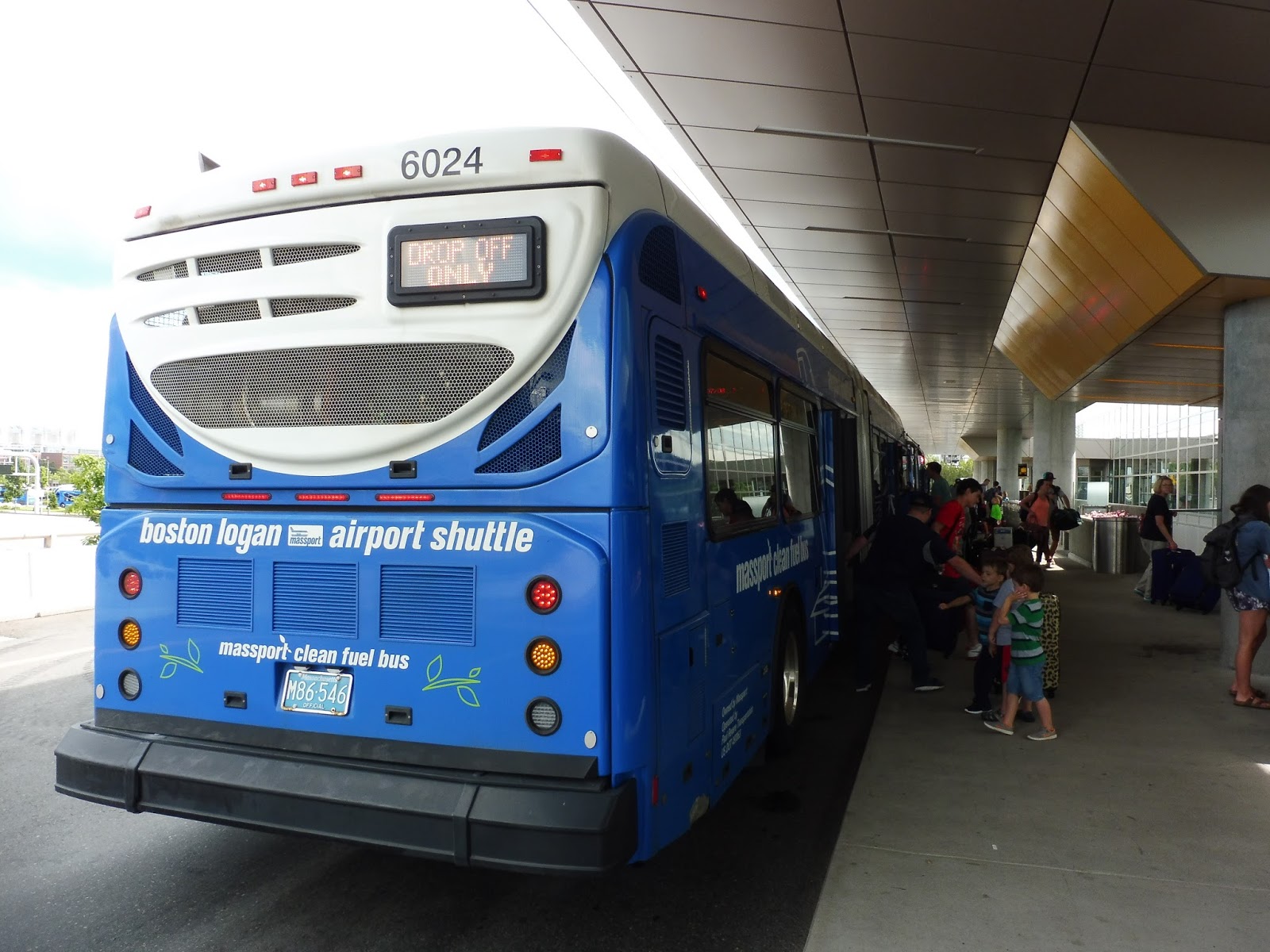
Logan Airport Shuttle: 22/33 (Serves Terminals A & B or C & E to subway station and to Rental Car Center)
The 22 and the 33 are the Logan Airport shuttles that everybody takes. Linking the Blue Line station and the Rental Car Center to the airport, they can often be quite busy – that’s why there are two routes to even out the crowds better. We’ll be looking at both today.
 |
| The 33 at Airport Station. |
From the Blue Line station on the 33, we headed down Transportation Way, paralleling I-90 with a park on the other side. We rounded a curve, and alongside a huge elevated interchange, we pulled into the Rental Car Center…and waited. And waited and waited and waited. This was where a bunch of people were getting on, carrying huge suitcases, and we just sat there to let more and more people board. By the time we left, the bus was packed.
 |
| Airport scenery… |
From there, we navigated a mess of roads to get up to the departures level. Since it was a 33, we were able to run “express” past Terminals A and B, then we pulled into C. Most of the passengers got off here, so we had to wait for everyone to drag their luggage off the bus. Finally, we left and made our way to Terminal E, the final stop of the route.
 |
| The 22 at Terminal A. |
From there, Jordan and I had a race to Terminal A where he used the elevated walkway and I took the 11 – he won, and he wasn’t even trying. From here, we got on the 22 and rode it around to Terminal B, stops 1 and 2. We went through an “express” section, skipping Terminals C and E, making our way down Service Road, and arriving back at the Blue Line station. Jordan and I stayed on to the Rental Car Center, but it was basically the same thing as before, except this time we used the upper level instead of the lower.
 |
| The bus at the Rental Car Center. |
Logan Airport Shuttle Routes: 22/33 (Serves Terminals A & B or C & E to subway station and to Rental Car Center)
Ridership: It can be anywhere from completely empty to completely packed – it really depends on the time. From my experience, most people usually get on at the Rental Car Center – probably because the shuttle is the only option from there, whereas the Silver Line is a much faster alternative to the Blue Line, unless there’s traffic, when it’s a nightmare.
Pros: If you use the Blue Line to get to the airport, you can expect a bus (or two, or three) to be waiting there to take you where you’re going. It’s also the only way of getting from the Rental Car Center to the terminals, so these routes are definitely important and they should run as frequently as they do. It’s good that there are two routes, so that passengers don’t have to sit through all four terminals. Plus, the way they run drop off/pick up only speeds things up even more. However…
Cons: These. Buses. Are. So. SLOWWWWWWWWWW. It’s like the drivers are contractually obligated to always go 5 MPH or less! I mean, you do not want to cut your flight close with these, because I can assure you, you won’t make it. It is absolutely crucial for airport shuttles to be quick, especially these ones that a lot of people use.
Nearby and Noteworthy: The airport. Yeah.
Final Verdict: 6/10
These are definitely important routes, there’s no doubt about that. But if you’re coming from the Blue Line or the Rental Car Center and you have a flight to catch, it’s crucial that the last-mile shuttle bus trip is fast…and it’s not. I don’t know why they go so slow, but they always do, and it drags them down and ruins their efficiency.
Latest MBTA News: Service Updates
PVTA: Northampton Academy of Music
Being a big hub for the PVTA, one would imagine that Northampton would have a relatively substantial terminal. No? How about a moderately substantial terminal? A single shelter, huh? Well…okay, that works too…
 |
| Huh. |
Yeah, it’s basically just a shelter, and a dingy one at that. I kinda hate waiting in there, what with the garbage everywhere and the pungent stench. Inside, there’s a map with route schedules and a screen that provides real-time information. Finally, there are some newspaper boxes outside the shelter.
 |
| A rather nice street clock with the plaza behind it. |
I’m not really sure if this counts as the “station” or not, but the shelter is located next to a plaza where a lot of people choose to wait for the bus. It has folding chairs and some rather nice foliage – it seems like it would be a nice place to wait. However, it seems to attract some…questionable people. Finally, behind the shelter, there are some bike racks, a wastebasket, and a recycling bin.
 |
| Voila! |
PVTA Station: Northampton Academy of Music
Ridership: Northampton is one of the PVTA’s principal hubs, so this place usually sees a good amount of people waiting for the bus. The routes serving Northampton aren’t that busy aside from the B43 and the B48, but the point is that people definitely use this stop.
Pros: It definitely provides some basic amenities – the bike racks are convenient and the real-time information is a nice touch. The plaza has the potential to be nice, but it’s usually…not.
Cons: This just isn’t a great place to wait for the bus. Everything feels dingy and dirty, and every time I visit it I think I like it less and less. This is a hard one to express in words, but it’s just…not a pleasant place to wait at.
Nearby and Noteworthy: Northampton is a lovely town. It’s like a combination of Cambridge and Portland, OR – it has the weirdness and attitudes of both cities, the northeastern charm of Cambridge, and the rebellious spirit of Portland. The downtown is really walkable, with lots of unique and interesting businesses. I love it!
Final Verdict: 4/10
When I first went to this place, I was alright with settling for a 5. However, I’ve done a lot of riding since then (believe me, I have so many PVTA reviews to do), and upon subsequent visits to this place, my rating has dropped to a 4. I think you have to actually go and wait there to understand what I mean when I say it’s not a pleasant place to wait, but…yeah, it’s not.
Latest MBTA News: Service Updates
WRTA: Westborough Shuttle (Westborough MBTA – Computer Drive (Commuter)/Westborough Local)
Ohhhhh, we’re in for a good one here…if “good” means “REALLY REALLY TERRIBLE.” I don’t even know where to begin with this one. Uhhh…okay, so it’s split into three “routes” that only run at certain times: a “commuter” route at rush hour, a “downtown commuter” route that barely runs at all, and a “local” route that runs midday from McDonalds to the Westborough Country Club (it sounds ridiculous just to say it). This is all done with one bus, keep in mind, so the timetable is just a complete mess. Luckily, there are two trips in the afternoon that do both a “local” and “commuter” in one trip, so we’ll be taking a look at one of those. Let’s check out the Westborough Shuttle.
 |
| First there’s a bit of a story… |
So Nathan and I were taking an Uber from Worcester to the Westborough Country Club, but we were running late, and unfortunately we just missed the bus. Clearly all hope was lost…until we realized we could walk to Westborough Station and beat the bus by about half an hour. Oh good, great, you know it’s a great route when you can walk from end to end and beat the bus by a significant amount of time…
 |
| The bus…from above. |
Of course there was no sign at the train station, but luckily the bus arrived early. As is common for these minibus shuttles, Nathan and I were the only ones on board. We left the station parking lot and took Smith Parkway to Otis Street, where there were a few huge office parks for a bit. The street led us to Route 9, which we merged onto.
 |
| Route 9. |
Route 9 was lined with those classic…Route 9 buildings. Basically, there were just a lot of businesses and shopping centers with parking lots everywhere, interspersed with random bouts of marshland and forest. After going through an interchange with Route 135, the road narrowed from six lanes to four and the businesses and parking lots got smaller.
 |
| A side street. |
The reprieve was short, though – after a mobile home park, the street widened again and all those huge businesses and parking lots were back in full force. The road did eventually get narrower once more, and after a brief section of woods, we exited off of it. Now it was time for quite possibly the most clustered bunch of deviations I’ve ever seen on any bus route…
 |
| It’s gonna be like this for a while. |
We headed down Research Drive, which closely paralleled Route 9. After going by the BJ’s Corporate Office, the street became West Park Drive and curved away from the highway. It took us into the woods, where a few office parks hid behind the trees. We went down this road to the end, then turned around and came back up.
 |
| Oh boy, how exciting! |
After going by that BJ’s again, we turned onto Friberg Parkway at an intersection with a very office park kind of pond next to it. This street took us past, surprise, more office parks. We curved around and then turned onto Connector Road, which was woods for the most part, aside from a few of those office park hotels you see in these kinds of areas.
 |
| A bit of a break! |
Connector Road took us over Route 9 and around onto Computer Drive, past a small shopping plaza. As we came down alongside the highway again, we passed more office parks, as well as that BJ’s again on the other side. Next, we turned onto Technology Drive, which looped around past – sigh – more office parks.
 |
| The Westborough water tower, I guess? |
We came back onto Computer Drive, running back along Route 9, and passing that stupid BJ’s one last time. We merged onto Route 9 and headed back the way we came just a bit before taking the first exit and pulling into the McDonalds parking lot. That’s right – the Westborough Shuttle deviates to serve McDonalds. This was also the start of the “local” route.
 |
| A road off of Route 9. |
We travelled down East Main Street, passing some housing developments and a post office, then it became mostly residential. It wasn’t long, though, before we made that most classic of minibus shuttle deviations: one to the Westborough Senior Center. There were a few houses and offices when we returned to East Main Street, then it became some really uninteresting businesses with parking lots.
 |
| What a great shopping plaza… |
After going under the Commuter Rail tracks, we turned into a modern outdoor mall sorta thing: Bay State Commons. It didn’t have any big-name businesses, though, aside from a Roche Bros. We then returned to East Main Street, which became West Main Street as we travelled around a rotary. This was downtown Westborough, and the street was lined with retail buildings.
 |
| A street in downtown Westborough. |
There were some relatively dense houses on the other side of downtown, as well as a municipal building and a library. Soon after that, we passed the Westborough High School, which all inbound trips deviate to serve at all times of the day. The driver said he had never ever picked anyone up at the school, even during school hours. After some more houses, we finally arrived at the Westborough Country Club, which the bus literally deviated to serve. Oh yeah, that’s the perfect place to end a bus.
 |
| The bus at the scenic country club. |
WRTA Route: Westborough Shuttle (Westborough MBTA – Computer Drive (Commuter)/Westborough Local)
Ridership: In early 2016, the route got a massive 26 people per day…meaning less than 1 person per trip. Oh, that’s some great ridership. The driver gave an even more telling report: no one uses this route except on the commuter trips. Very telling indeed…
Pros: Well, if you really want to find something good to say about this route, you could at least say it’s frequent – literally, this thing runs every half hour middays. Every. Half. Hour. For a route that connects McDonalds to the Westborough Country Club. I’ll just let that sink in.
Cons: Literally. Everything. Uhhh, let’s start with a simple one: the schedule makes absolutely no sense to look at. Give it a shot. See if you can make heads or tails of it. Also, the route really doesn’t serve anything that anyone would want to take the bus to. Other than that, literally every trip has problems:
- Morning Commuter Trips: I guess there’s nothing inherently wrong with these, but the way they’re written on the schedule is ridiculous. Why are all the trips shown as “outbound”? This is inconsistent from the evening commuter trips, which are actually written somewhat coherently.
- Midday Local Trips: Let me just repeat the route’s destinations: McDonalds to the Westborough Country Club. Every half hour. And all the inbound trips deviate to serve the high school. This is ridiculous.
- 2:05 and 3:15 Local/Commuter Trips: These trips are just stupid. Why does the route feel the need to serve the Commuter Rail station in the early afternoon? And why does it have to do the ridiculous office park loops even though no one is out of work; ergo, no one uses this bus to the office parks at this time.
- 4:20 Local Trip: So the bus has 15 minutes to kill at McDonalds before heading out on a Commuter trip. Does it A) take a layover like any normal bus route would, or B) do a completely pointless 15-minute round trip to Bay State Commons? Based on this schedule so far, I think you can guess which one it is.
- Evening Commuter Trips: These trips actually get people, heading to the Commuter Rail from the office parks, so it’s important that the bus times with the train. But no…the driver said he has to leave early so that he can get the commuters to the train on time, because the schedule doesn’t give the route enough time to get there. He said the commuters have missed the train before…with an early departure!
- Evening Downtown Commuter Trip: This one is just shown really stupidly on the schedule. The trip has three timepoints, but the schedule makes it look like it goes outbound to the second one, then inbound to the third! There’s an “MBTA Station” timepoint in the “Inbound” column…USE IT.
Yeah, I know it’s pretty deviatory, but this route actually serves busy malls that people would actually want to go to. Not to mention the trip takes about 28 minutes, so it would be an hourly service – a much more realistic frequency for a route like this. Also, get rid of that stupid combined local/commuter trip! What a waste of time!
Latest MBTA News: Service Updates
PVTA: 31 (Sunderland/South Amherst)
Finally! Our first PVTA review! As you may know, I’m doing a Summer Transportation Institute at UMass, so it makes sense that the first review out here would be of one of the system’s UMass routes. The 31 is actually one of the busiest routes on the PVTA (Pioneer Valley Transportation Authority), and even in the summer, it had a good amount of people. Let’s take a look!
 |
| The bus at Sugarloaf Estates. |
We started at Sugarloaf Estates, a housing development in Sunderland. From there, we made our way down Old Amherst Road, passing houses with farmland just behind them. There were a few small businesses as the street curved south, then we merged onto normal Amherst Road, passing a few more apartment complexes.
 |
| Coming onto Amherst Road. |
There were some businesses with parking lots continuing south, then we got some really beautiful scenery with farms, woods, and the occasional house. We eventually got to a point where there were a few industrial buildings, businesses, and houses, then it was farmland and woods again. It continued like that for quite a while until we finally turned onto Meadow Street, where there were some houses and yet another apartment complex.
 |
| A field. |
This street took us to North Amherst Center, which consisted of a few historical buildings and businesses. Here, we turned onto North Pleasant Street, taking us past lots of houses and more apartment complexes. There was one last farm and a few more houses, then we came into the UMass campus, and the scenery changed dramatically.
 |
| One of the housing developments. |
We went through a roundabout, then there were university buildings everywhere. Some were old, some were modern, and some were awful brutalist constructions. We made stops at the Graduate Research Center, Integrative Learning Center, and Fine Arts Center, the three main stops at UMass. Along the way, we got a nice view of the campus pond with the tall library in the background.
 |
| An earlier bus at UMass. |
The street curved to the left and we more or less left the UMass campus, but there were still a few straggling university buildings. Next, we turned onto East Pleasant Street, going around a park, with a few businesses on the other side. Soon there was retail on both sides of the street, and we came into lovely Amherst Center.
 |
| Amherst Town Common. |
South of the center, we went by Amherst Town Common and Amherst College, along with a few houses. We got an absolutely amazing view of rolling fields and hills for a brief moment, but after that it was mostly residential. Eventually, we turned onto East Hadley Road, which took us past more houses before we got to the route’s terminus: Boulders Apartments. The bus slowly looped around the complex in order to turn around and head up back to Sunderland.
 |
| Man, I love this view! |
PVTA Route: 31 (Sunderland/South Amherst)
Ridership: Like I said, this is one of the busiest routes on the PVTA – third, to be exact, with 5,114 riders per day! An even better figure is the passengers per trip, for which the 31 is number one, with a whopping 67 riders per trip. Since it was summer, ridership was a little lighter than that, but there were still about 30-40 passengers on my ride!
Pros: It may not seem like it based on a lot of the scenery I described (the route does pass through a lot of farmland), but this route serves a lot. Not only does it go by lots of apartment developments for off-campus students, who absolutely need this route, but it’s also one of the many buses plying the busy route from UMass to Amherst Center. Also, the schedule for the 31 is great – it’s every 15 minutes on weekdays, while on weekends and summer weekdays, it’s every 45 minutes.
Cons: This is a really minor thing, but I wish the route was better coordinated with the 30, the other key player on the UMass to Amherst Center route. On weekends, both routes run at different frequencies, so it’s harder to do, but on weekdays, they both run every 15 minutes with a 6 minute gap, then a 9 minute gap. It doesn’t seem like it would be that hard to coordinate them a little better…
Nearby and Noteworthy: I’ll have plenty of opportunities to talk about Amherst Center, but this is one of the main routes that serves it. Amherst Center is awesome – there are lots of interesting businesses and great restaurants everywhere, and for the most part, it’s very walkable.
Final Verdict: 9/10
The 31 is just great. It’s a well-used route, it’s frequent, it serves a lot, and it’s actually a really pretty ride at certain points! It may experience crowding during the school year, I imagine, but at least the all-door boarding can mitigate that to some degree (UMass routes are free). I still wish it could be better coordinated with the 30, though…it would be so easy to do!
Latest MBTA News: Service Updates
Westborough
Westborough, Westborough, Westborough…it’s a modern Commuter Rail station with a ridiculously high footbridge. That’s about its only notable feature…
 |
| Yup, that’s a huge footbridge. |
Westborough has a sizeable lot, with 448 spaces, but according to this page, the lot fills up pretty early on in the day. There are also some bike spaces – the T’s website claims 4, and unfortunately I don’t have any pictures to confirm, but there were definitely more than 4 bikes when I was here. Up by the station, there are some newspaper boxes and old honor boxes.
 |
| The station…from above. |
Most of the platform is low-level, and it’s what you would expect from any modern Commuter Rail station. There are shelters on each side, even though I can’t imagine many people going outbound from here, and other than that, it’s mostly just benches and signs. The big wall on the outbound side is interesting, to say the least.
 |
| The outbound mini-high platform. |
The station’s mini-highs are also standard. They’re sheltered, and they have benches, maps, schedules, wastebaskets, and signage. One annoying aspect of Westborough is the siren that’s supposed to go off whenever a train is coming in – when we were here, it went off all the time, regardless of whether there was a train or not.
 |
| Somewhere in the bowels of the footbridge. |
I honestly have no idea why Westborough’s footbridge is so high, but it is. It’s definitely a notable part of the station – long ramps curve around and around to get up to the top, passing through little mezzanines with benches in them. Luckily, there are also stairs. Of course, we can’t forget that the footbridge is showing its age, with a lot of rust. This place is only 15 years old!
UPDATE: Thanks to Skull for commenting – the bridge was built this tall to allow double-stack freight containers to pass through towards Beacon Park Yard, which is now closed.
 |
| A train coming in. |
Station: Westborough
Ridership: This is only the sixth-best station on the Worcester Line in terms of ridership, but it’s the Worcester Line, so Westborough still gets a bunch of people: 759 inbound riders each weekday. You can imagine that the 448-space lot may not be enough to hold them all…
Pros: Westborough has all those classic amenities of any modern Commuter Rail station. It’s accessible, there’s plenty of shelter, and the station has lots of seating. And the footbridge, for all its problems (which we’ll get to), is at least very unique.
Cons: Yeah, but everything else about the footbridge is pretty bad. Why is it so high? How is it rusting so much, so quickly? It seems like it would be an absolute pain to have to use it every day. Also, the parking doesn’t seem sufficient, and that’s including the fact that they expanded the lot in 2006. Additionally, the tracks pass right through Westborough Center, but no, of course there can’t be a station there. Finally, there’s that incessant siren that never seems to shut up.
Nearby and Noteworthy: There are some shopping centers north of the station, but they’re a mile away and it’s not a pedestrian-friendly walk. Oh, also, there’s this:

It seems to be part of some office park, but I have no idea what it could possibly be used for or what its significance could be. But it definitely stands out!
UPDATE: See Adam Gaffin’s comment for a truly brilliant explanation of the former company that occupied this office park. It was an insane place!
Final Verdict: 5/10
Westborough basically gives you everything you would expect from a modern Commuter Rail station, but slightly worse. The parking seems to be insufficient, the siren is just never-ending, and the footbridge, although it’s unique, is slowly falling apart and really high up. Sure, there are a lot of “fine” things about Westborough, but it has some substantial problems that drag it down.
Latest MBTA News: Service Updates