RIPTA: 92 (RI College/Federal Hill/East Side)
When riding RIPTA, it often seems like Providence doesn’t have any…um…nice parts. However, it turns out that they just saved all those neighborhoods for the 92!
 |
| Takin’ the layover. |
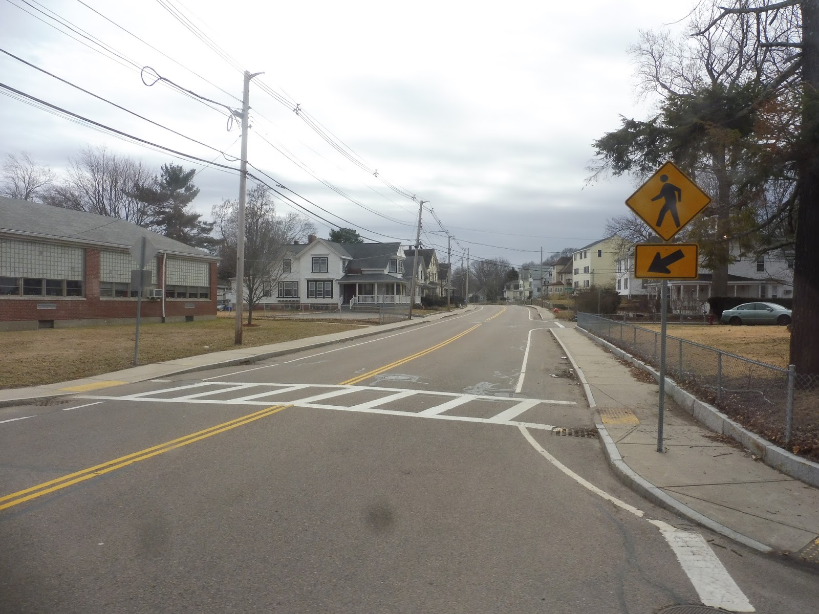
The route begins at Eastside Marketplace, a supermarket that out-Whole Foods Whole Foods. Still, it had really cheap, really fresh bread, so the grotesquely hipsterish atmosphere is forgiven. At any rate, it’s better than Trucchi’s! We headed out from the supermarket’s parking lot and headed down Pitman Street, which was lined with pleasant, dense houses. They continued as we turned onto the narrower Ives Street.
 |
| Bam! Houses! |
Eventually, really diverse and quirky businesses began to occupy the lower floors of the houses. They only showed up here and there, but it felt like a new hidden gem every time one appeared. This was Fox Point, and it was a really charming neighborhood. There was a nice park as we turned onto Wickenden Street, and the awesome businesses continued.
 |
| A cool little alley. |
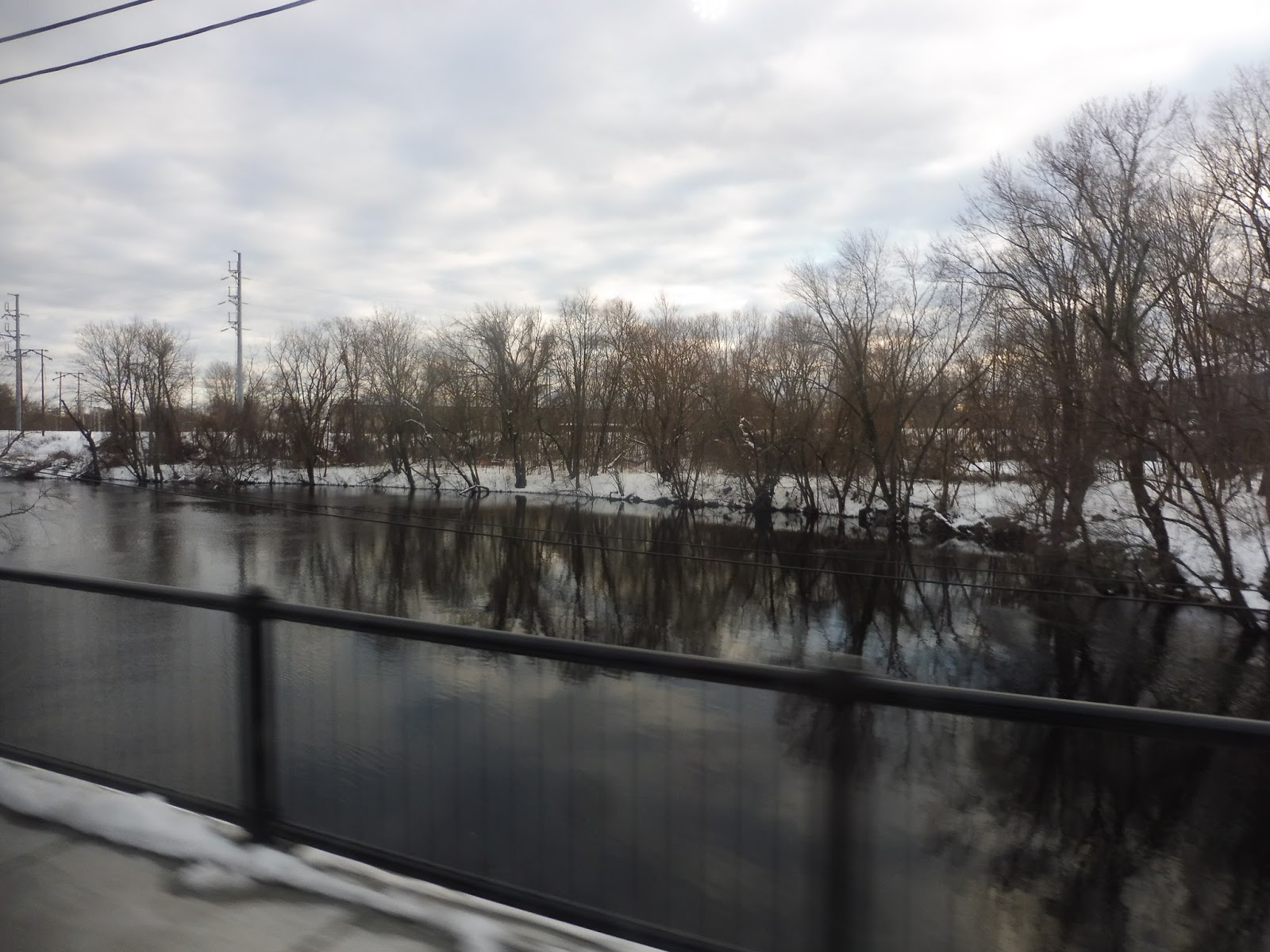
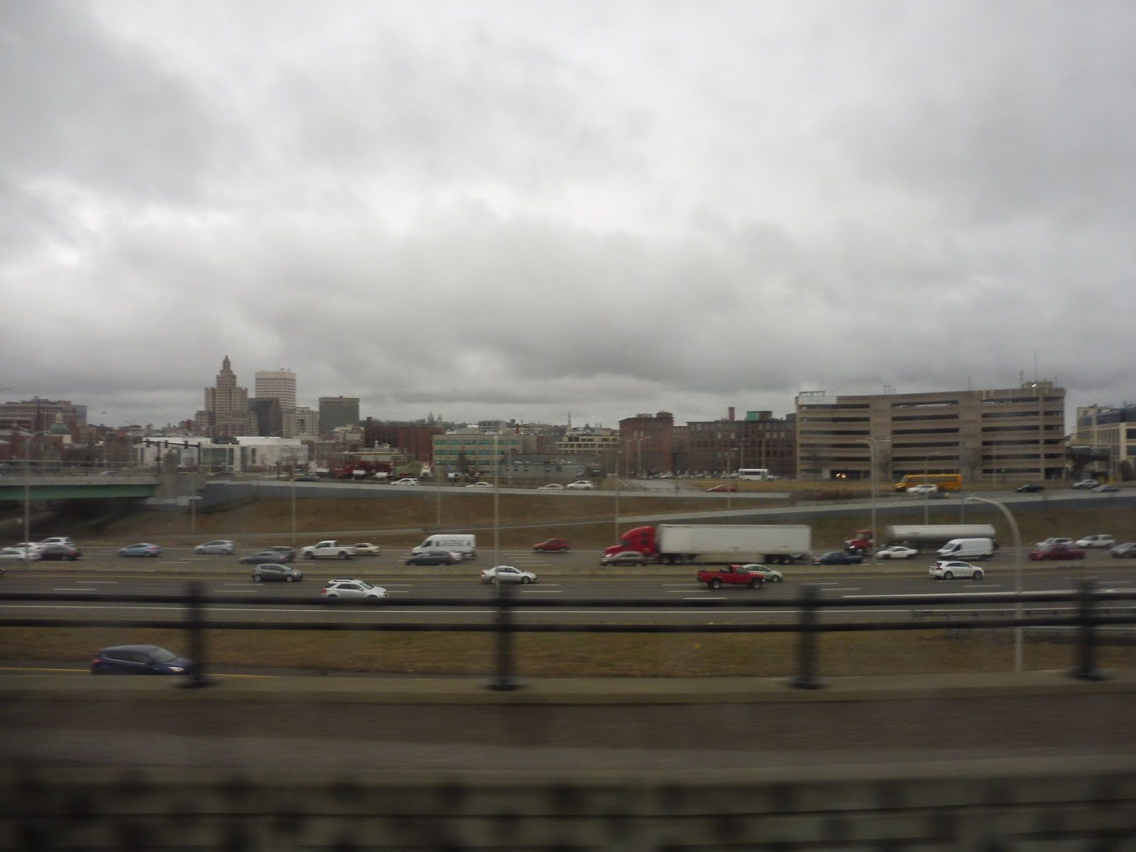
We eventually bursted out from the historical narrow streets and passed through an undeveloped piece of land between two streets. The street became Point Street as we crossed the Providence River, getting an awesome view of the Providence skyline. We turned onto Eddy Street on the other side, and we were in a mostly industrial area that seems to be on the rise: the Jewelry District.
 |
| Oooooh! |
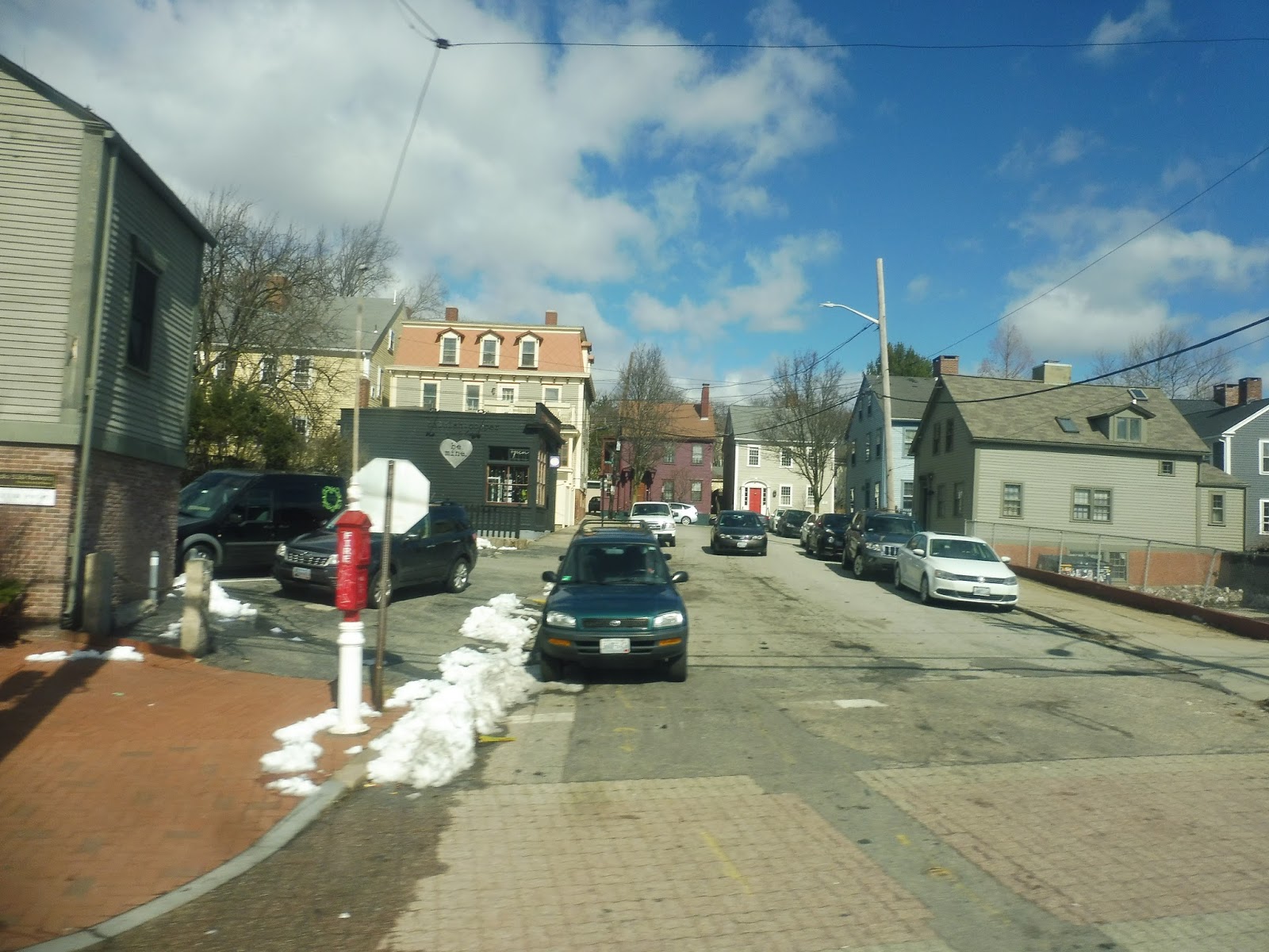
It became Dyer Street, and we went through an undeveloped wasteland for a stretch. Dyer Street skirted downtown Providence, going through more of an industrial area to the east of the city, but once we came next to the Providence River, we were in the thick of things. We turned onto Kennedy Plaza, and came into…yeah, Kennedy Plaza!
 |
| Turning to get into downtown. |
This is one of the few RIPTA routes that travels through the plaza, though – we were less than halfway done! Thus, we forged on, making our way onto Sabin Street, which went by the Rhode Island Convention Center and the Dunkin’ Donuts Center. We turned onto Atwells Ave next, going over I-95 and entering Federal Hill through a welcoming arch.
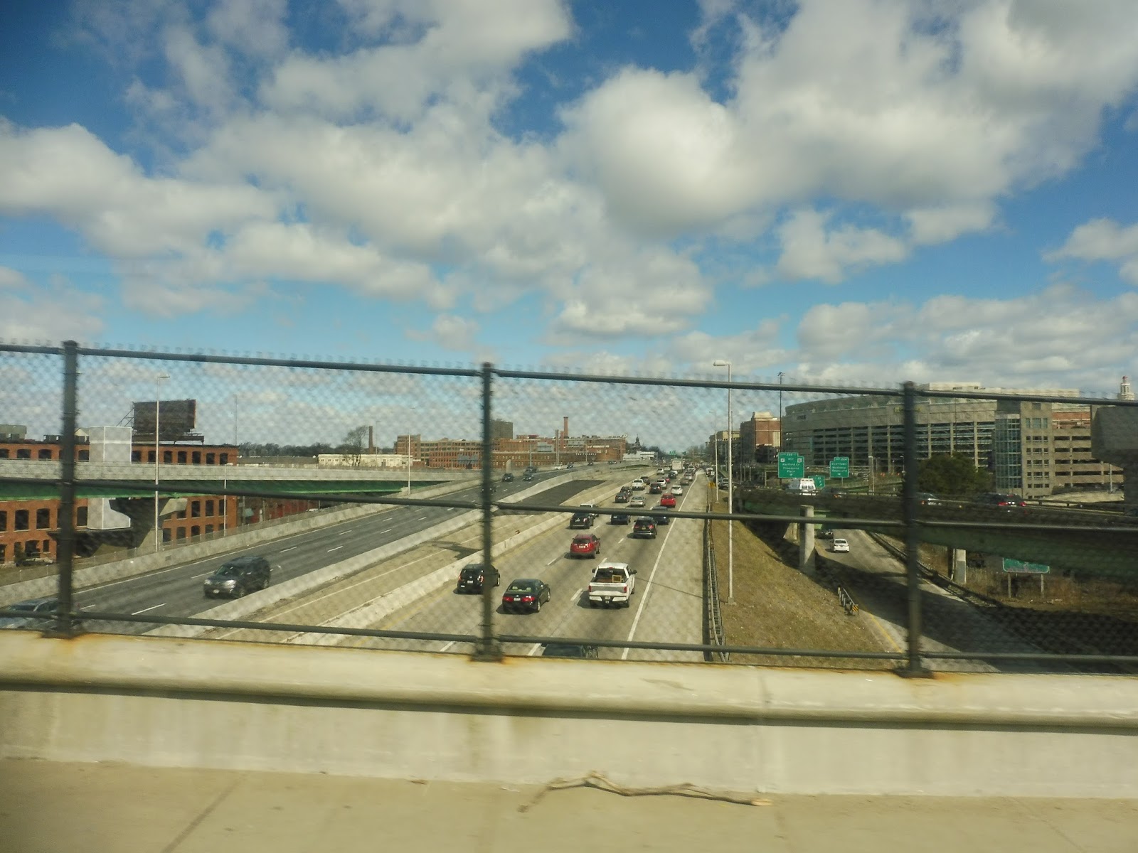 |
| Up and over the highway. |
As it turned out, Federal Hill was another gem of a neighborhood! There were diverse buildings lining the road, ranging from one to four stories, and many of them had retail on the ground floors. In particular, there were a ton of Italian restaurants, and based on the neighborhood’s reputation, it seems like they’re all great. It kinda felt like the North End merged with the architecture of East Boston!
 |
| WOW, I wanna come back here! |
We eventually went over Route 6 and the Northeast Corridor, and there was a definite change on the other side. This was Eagle Square, and it had more of a gritty industrial feeling, although there were still some nice businesses! It was a lot better than the Eagle Square in East Boston, that’s for sure…
 |
| Going over the little Woonasquatucket River. |
As we ascended a hill, the street became predominantly residential, with dense houses on either side. There was some retail when we turned onto Mount Pleasant Ave, but it was more locally-oriented – a laundromat and a hair salon, for example. Mount Pleasant Ave was almost all houses, not quite as bunched together as before, but still quite dense.
 |
| A side street. |
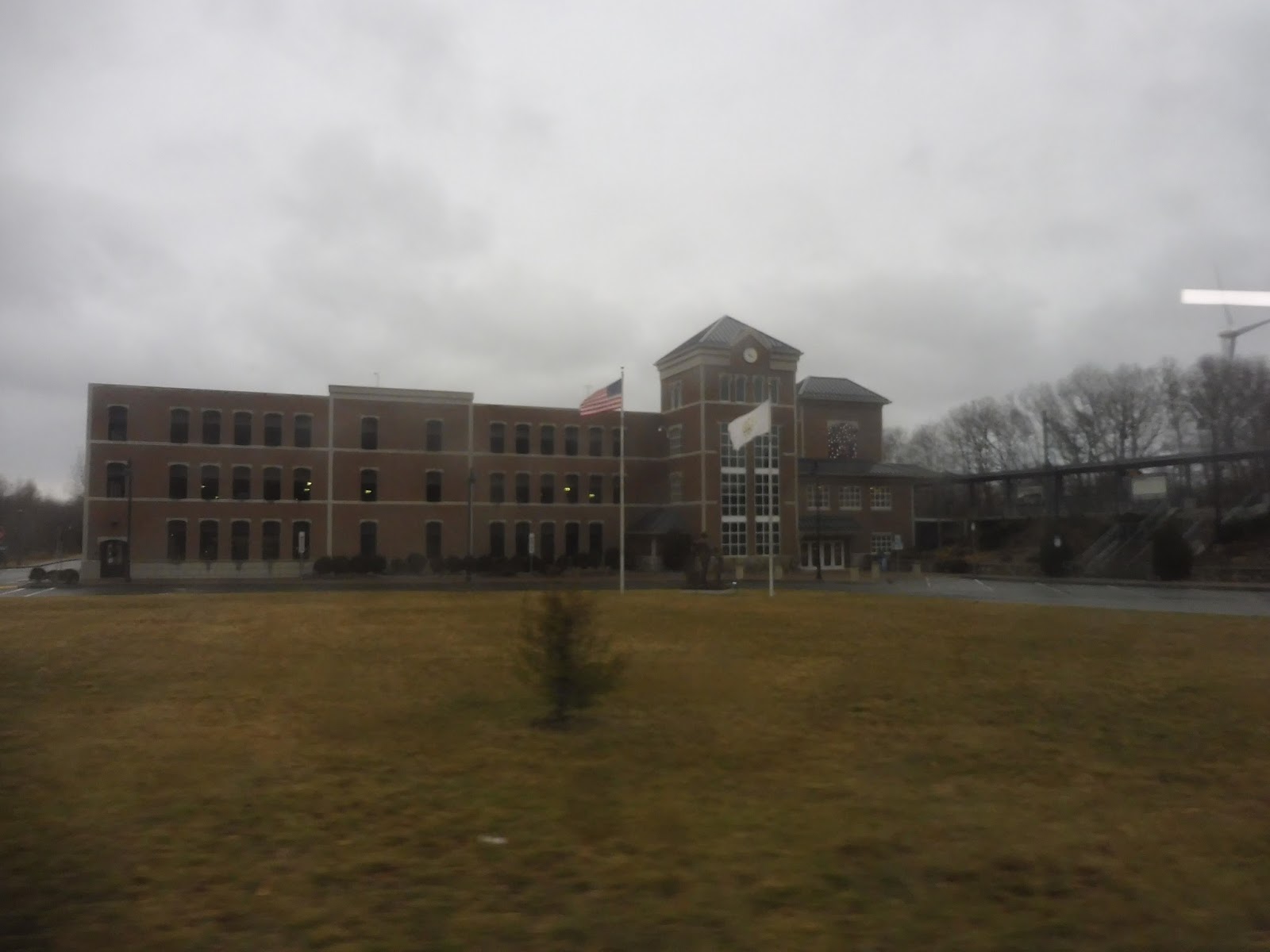
After a baseball field, we crossed Chalkstone Ave, connecting with the 56. There were businesses there, but it was residential again as we continued. We went by the Mount Pleasant High School, after which we turned onto College Road, running along the north side of a golf course. We entered the campus of Rhode Island College, and that was the end of the route! Rhode Island college built a really nice shelter for people to wait at, with an enclosed area, pull-down seats, and a TV that presumably shows arrival times (but it wasn’t working today).
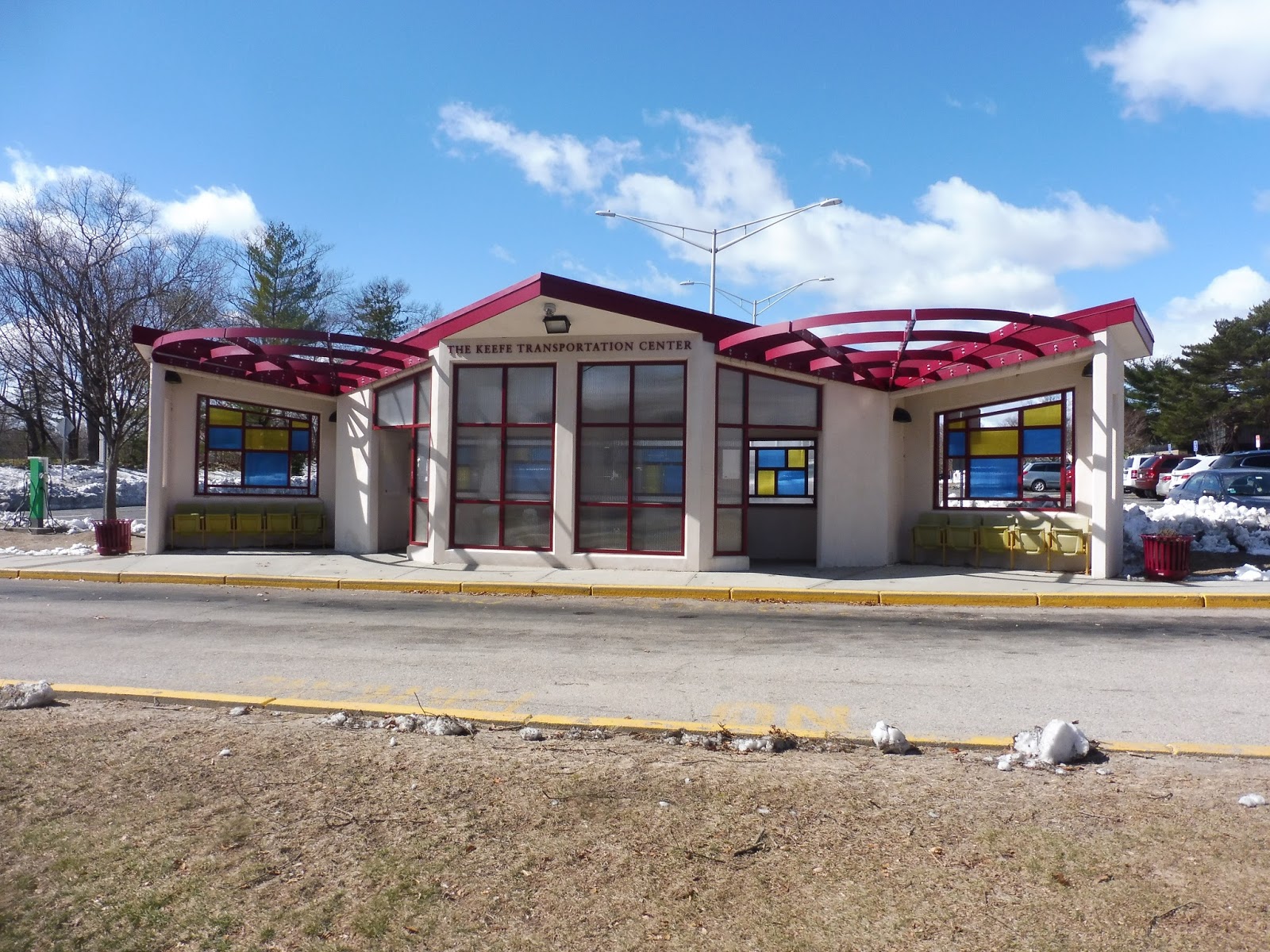 |
| Check out that shelter! |
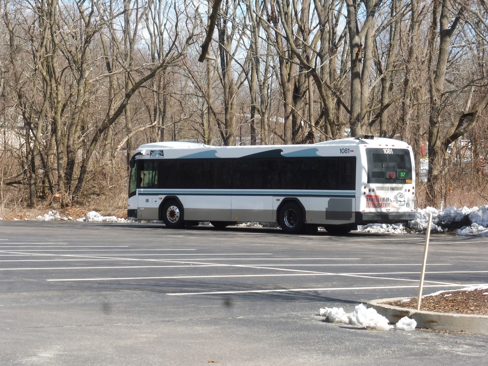 |
| The bus in a parking lot waiting to head back. |
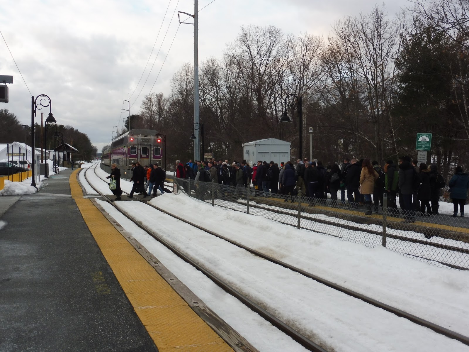
RIPTA Route: 92 (RI College/Federal Hill/East Side)
Ridership: My trip got 15 people on a Saturday morning, which isn’t bad! There was turnover at Kennedy Plaza, but a good amount of people rode through as well.
Pros: This is the closest thing Providence has to a tourist shuttle, and even though tourists don’t seem to use it, the locals luckily do. It serves some of the densest and most interesting parts of Providence, plus there’s the added bonus of Rhode Island College. The route runs super frequently, too: it’s every 20 minutes on weekdays and every 30 minutes on weekends, plus it runs until around 10:30 Monday through Saturday! From an operational perspective, the 92 is the rare RIPTA route that gets a normal amount of layover time!
Cons: The route stops running at 6:30 on Sundays, which seems early for a route like this, but maybe no one would use it past then. Also, buses seem to arrive at some stops a little early, so the route could be given less time to get from end to end.
Nearby and Noteworthy: Everything!!!! Fox Point has tons of interesting and quirky stores and restaurants, the Jewelry District is super up-and-coming, and there’s no better hub of Providence eateries than Federal Hill!
Final Verdict: 9/10
If you’re new to Providence, the 92 is the route to take. It serves almost all of the places a tourist would find interesting, it comes frequently, and it’s well-used (albeit mostly by locals). It might be hard to use to have Sunday night dinner and it might be a tiny bit early, but gosh, this one is fantastic otherwise!
Latest MBTA News: Service Updates
RIPTA: 33 (Riverside)
A route through the East Providence Transit Tunnel! YES, I love going through there! Where does the 33 go afterwards? Oh…a dead shopping plaza? Huh…I mean, alright, then…
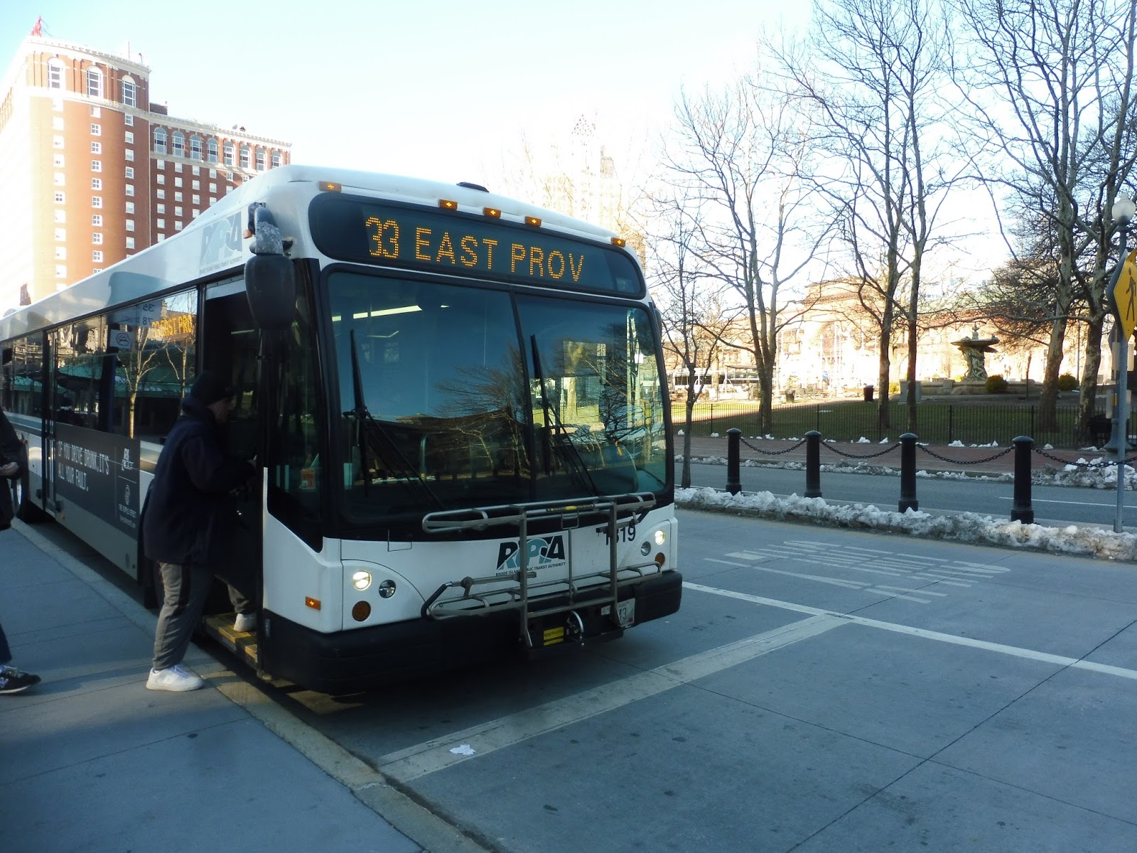 |
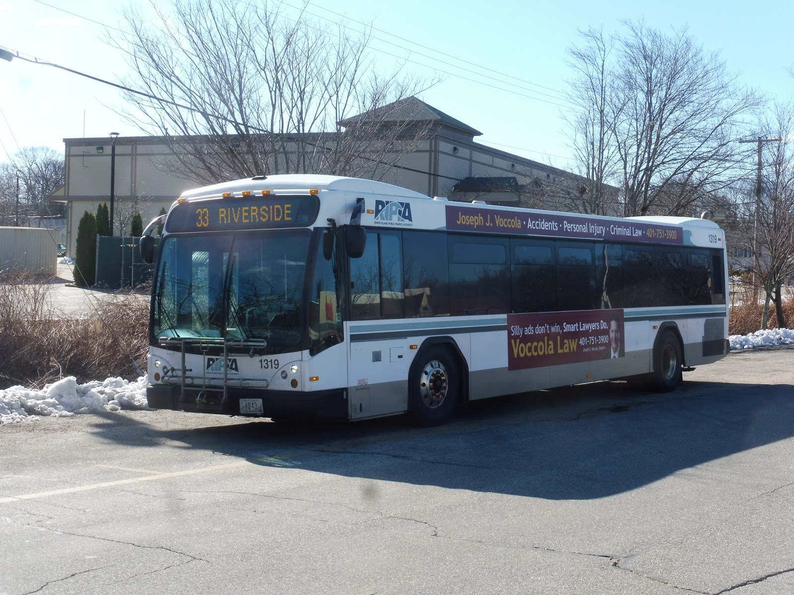
| A hastily-taken picture while boarding. |
We headed down Washington Street over the Providence River, and then it was straight into the tunnel! I always get a huge thrill going through that thing, even though the ride is only about 20 seconds long. We popped out at Thayer Street, where there were lots of student-oriented businesses and restaurants, but they thinned out as we made our way onto Waterman Street.
 |
| Thayer Street! |
The street was overwhelmingly residential, but some of the houses had offices or businesses within them. We eventually hit Wayland Square, though, conveniently located on Wayland Street – there was more retail here. This was a quick burst, and after some houses and a nice park, we were heading onto the Henderson Bridge over the Seekonk River, into East Providence.
 |
| Nice view! |
We took the first exit off the bridge, which led us onto Massasoit Ave. This industrial road curved eastward and started to gain dense houses and some businesses. Eventually, we arrived at East Providence’s bowtie-shaped downtown, and we used its weird network of one-way streets to get onto Taunton Ave. This had suburban businesses along it, as well as…oooh, a deviation! Yes, we headed into Wampanoag Plaza to serve its Stop & Shop.
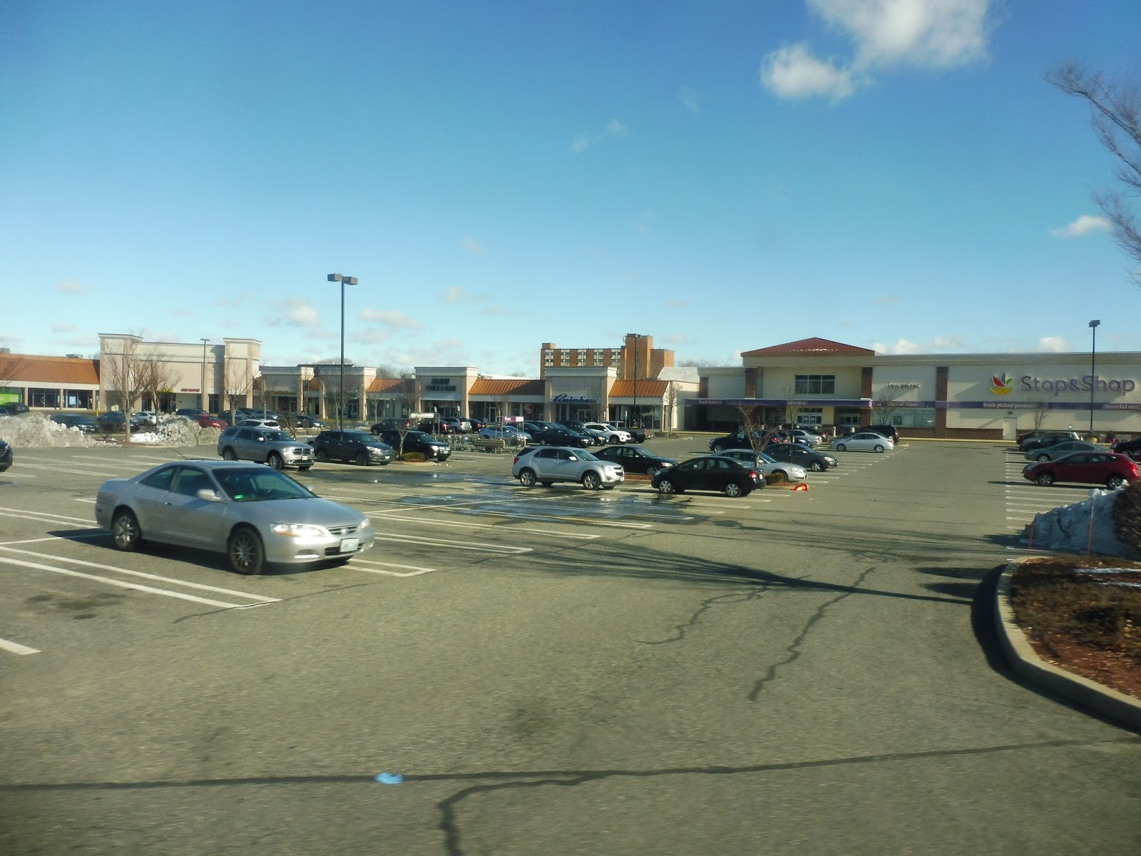 |
| Fun! |
We headed down Pawtucket Ave after that wonderful deviation, passing the East Providence High School and the local senior center. There were tons of industrial-type businesses along the road after we crossed Waterman Ave, but it changed soon after we crossed I-195. The street became lined with dense houses, and that continued until the retail came back around Martin Street.
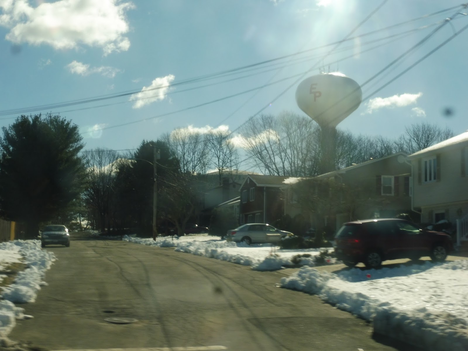 |
| A water tower! |
It was houses again for a stretch, but other attractions along there included Bradley Hospital and a Catholic school. We came up alongside a golf course for a bit, and then it got more industrial. The road became Bullocks Point Ave, and at this point, we were running by a little bit of everything. There were houses, apartments, businesses, industrial buildings, and the entrance to some sort of water filtration plant.
 |
| A little square of sorts. |
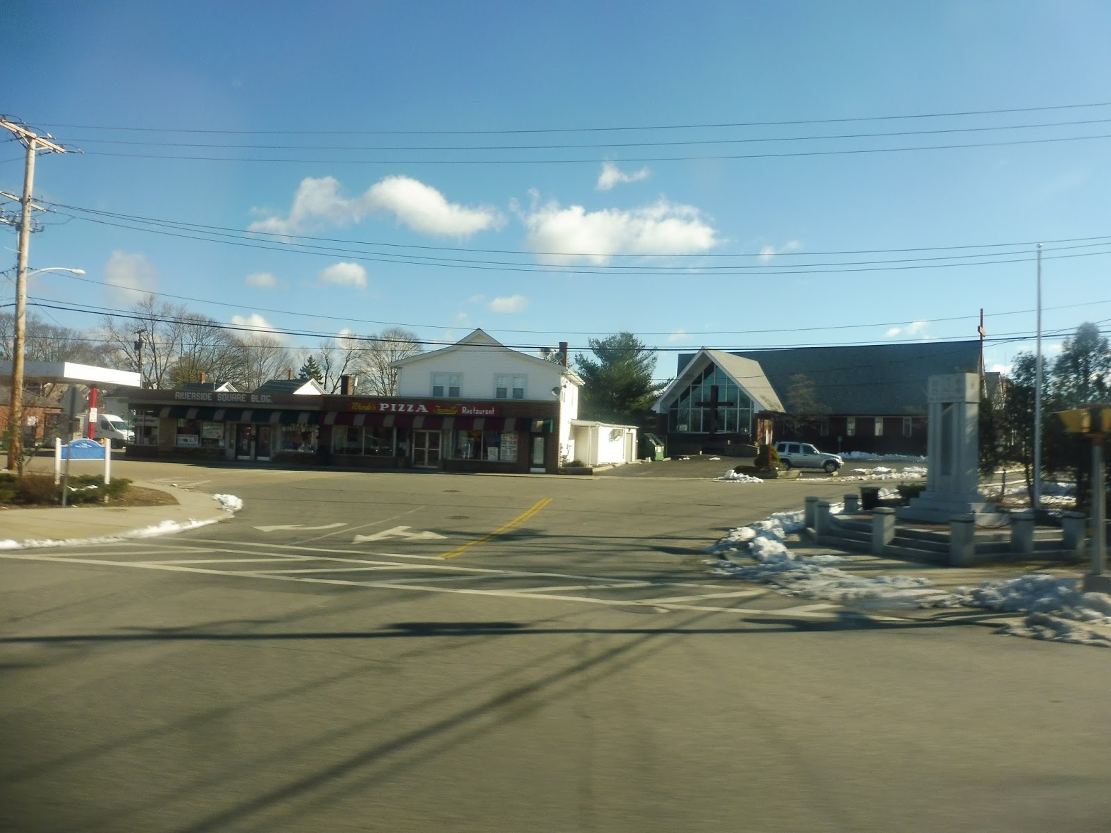
It settled on houses with the occasional business eventually, and we turned onto Crescent Point Ave near an apartment development. We went over Bullock Cove, which was a lot less scenic than it sounds, then we went through one more residential area. After a small circle with some suburban businesses, we arrived at Shaw’s, part of a terrible shopping plaza just next to the Barrington border.
 |
| Have fun on your 26-minute layover! |
RIPTA Route: 33 (Riverside)
Ridership: My Saturday morning ride seemed to get a good amount of people: there were 15 in total.
Pros: The 33 has a huge independent section, cutting straight down the length of East Providence. Also, it runs through the city, turning into the 17 to serve Olneyville Square, and passengers are free to stay on the bus – from what I saw, a good amount of people do that. The route runs every half hour on weekdays, every 45 minutes on Saturdays, and every hour nights and Sundays, which seems to make sense for the ridership.
Cons: The route seems to have some serious padding issues. For example, on the outbound trip, we had to wait for four minutes at Wampanoag Plaza because we were early. On the inbound, meanwhile, the driver left Shaw’s five minutes late, but we still ended up being early at the plaza! This route also has a ridiculous amount of layover time, especially considering the padding – on weekdays, for instance, it gets 27 minutes of layover…with 30 minute headways, remember! That means that a bus is arriving at Shaw’s just as a Providence-bound vehicle is leaving. And finally, RIPTA is really pushing the interlining here – would it solidify it better if the two routes were just combined? It would make no difference to how it’s run, but it would make a lot more sense to passengers!
Nearby and Noteworthy: The retail comes mostly in the form of lifeless suburban businesses and shopping centers, so I can’t say I have much to recommend here.
Final Verdict: 6/10
The most annoying thing about the 33 is its padding and layover time! I mean, they give the route enough time that they could shave off an entire bus but keep the same headways. I decided to reschedule the whole route, because I’m crazy:
You can also see it full-size here. My mindset here was getting rid of padding while still keeping the same frequencies. On weekdays, the trip time for most of the day is 67 minutes; I shortened it to 63 minutes, but there’s still a total of 21 minutes of layover, so buses should be able to stay on time. The best part is that my schedule only uses five of them, while the current schedule uses six. I managed to get an hourly schedule weeknights, but that required shortening the running time and giving the route only 2 minutes of layover. This is the biggest flaw in the schedule – headways could be increased to 70 minutes if reliability is an issue, although the buses would admittedly travel much faster at night.
On Saturdays, things are almost as tight, with a total of just 8 minutes of layover. I think it would work for the most part, and it makes the route able to run at the same frequency with 3 buses instead of 4, but if something goes wrong, it’ll have a domino effect. It might be worth reducing the Saturday frequencies to every 50 minutes, which isn’t a huge loss, especially considering the cost savings to RIPTA.
Indeed, that’s exactly what I did on Sundays, shortening the headways to every 50 minutes. It doesn’t cut any buses off the route, but why run it with three buses if they’re laying over for 56 minutes, which is the case in the current schedule? My schedule has 23 minutes of layover, but the route might even be able to run every 45 minutes if there’s demand. And that’s it! Just a few minor adjustments, and we get a route that runs just as frequently, if not more frequently, with fewer buses and mostly equal reliability! Sounds like a no-brainer to me!
Latest MBTA News: Service Updates
RIPTA: 35 (Rumford/Newport Ave)
Well, well, well, we finally return to my first RIPTA route! I was super excited to ride the 35 when I first did my Service Change post on it, but what is the 35 like as a route? Only one way to find out…
 |
| We’re going all the way to Prov, not East Prov! |
We began in Massachusetts – South Attleboro Station – but a quick jaunt on Newport Ave over the Commuter Rail tracks led us into Pawtucket, RI. Now, in my original 35 post, I talked about how I liked this neighborhood for some reason. Uhh…it was just a bunch of trashy businesses, at least along Newport Ave. No, I do not like this neighborhood anymore.
 |
| Cigar Bar, anyone? |
Once the 1 left us to go onto Cottage Street and we were all alone, it started to get more residential. Newport Ave was now lined primarily with dense houses, but those businesses still showed up sometimes. Other points of interest included a church, a middle school, connections to the 76 and 80 on their respective streets, and Hasbro headquarters, which is in the most unlikely of places here in Pawtucket!
 |
| I was sitting on the wrong side for Hasbro, so have some houses instead. |
After some retaily at the intersection with Armistice Boulevard, we went through a residential neighborhood before passing Slater Park and going under some pylons. There were a few dead shopping plazas where we were joined by the 78, and this is also where we entered East Providence. It was for a relatively short time, though; after we passed tons of gross businesses, we turned onto Wilson Ave, leaving the 78 behind.
 |
| Well, this is different! |
The character of the route completely changed. We were now in a pleasant residential neighborhood! Eventually, we turned onto Roger Williams Ave, which ran right alongside a lake. Once the lake ended, we went under a railroad bridge and over the Ten Mile River, then we turned onto North Broadway. The businesses were back…
 |
| The lake, the lake! |
We went through a half-interchange with the uncompleted Henderson Expressway, and soon after that, we arrived at the bowtie-shaped road arrangement of what I guess is downtown East Providence. Making our way around onto Taunton Ave via the weird one-way streets, we were going by mostly more businesses. We also passed East Providence City Hall, which was…uh…unimpressive.
 |
| Uncompleted highways are interesting! |
When I previously rode the 35, it went through the East Providence Transit Tunnel, but since then, RIPTA moved it to take a more direct route. Thus, we suddenly got onto a ramp for I-195, which took us over the Seekonk River into Providence proper. We ran express through Fox Point before taking Exit 2, spitting us out onto South Main Street. There was undeveloped land for a bit, but then we travelled through one of my favorite parts of Providence, featuring historical buildings and quirky businesses. Finally, we headed over the Providence River on Exchange Terrace and came into Kennedy Plaza.
 |
| Time for a trip back out. |
RIPTA Route: 35 (Rumford/Newport Ave)
Ridership: I took the first inbound trip on a Saturday, and it got about ten riders. Honestly, that’s not bad, and I’m sure it gets busier later in the day.
Pros: This is the closest thing RIPTA has to an urban crosstown route, and I really appreciate it for that. It runs north-south through Pawtucket, which mostly has routes going east-west towards the downtown, so this crosstown bus is fantastic. On weekdays, its schedule is passable, with service every 45 minutes.
Cons: Woahhhhh, every hour and a half on weekends??? This is an urban route! Who the heck is gonna ride a route that runs that infrequently? Yeah, that’s honestly my only qualm with the 35, but every 90 minutes is just ridiculously infrequent, and it’s hard to get past.
Nearby and Noteworthy: Okay, I probably made it clear I didn’t especially like the neighborhoods the 35 served. Sorry. But hey, Hasbro!
Final Verdict: 6/10
Almost everything about the 35 is solid. It’s straight, it serves a lot, and it acts as a crosstown in a system with very few crosstown services. That weekend schedule, though…geez, it’s so darn infrequent! It’s painful to see a city bus route that only runs every hour and a half, and I’ll bet there’s enough ridership to support service every 45 minutes or even every hour.
Latest MBTA News: Service Updates
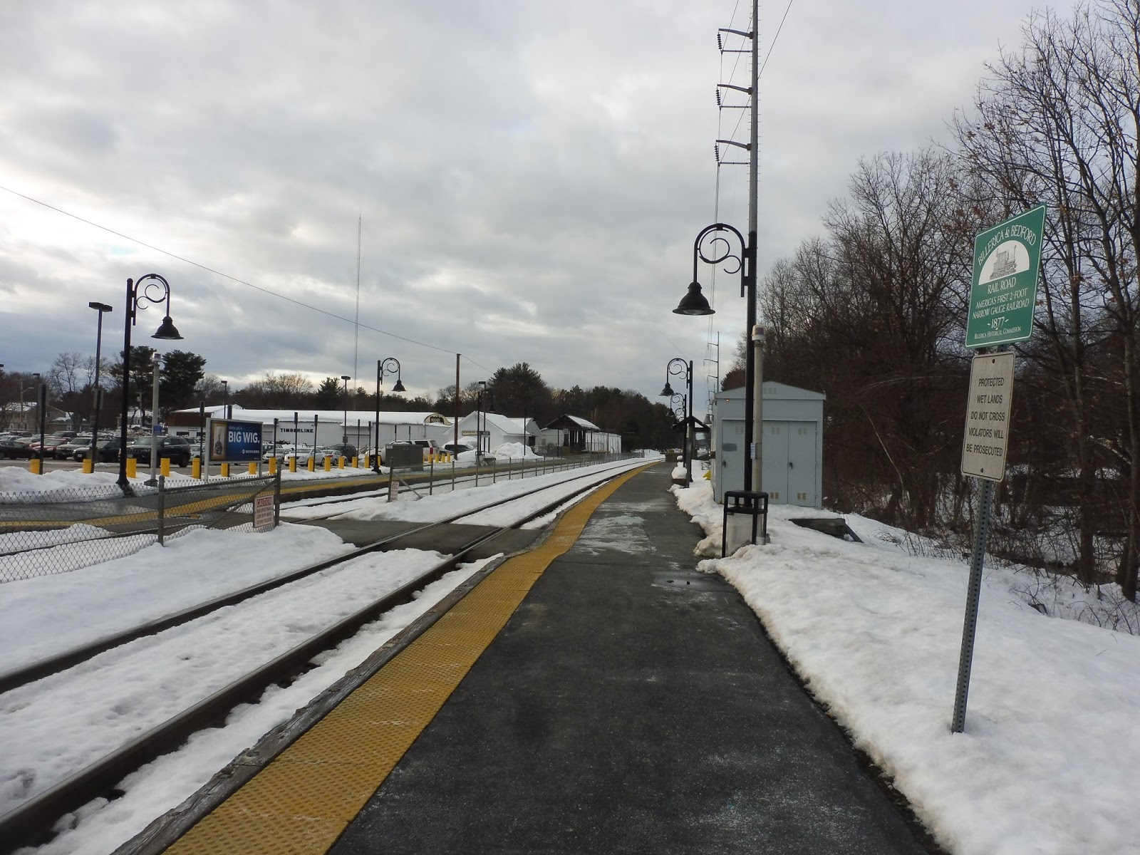
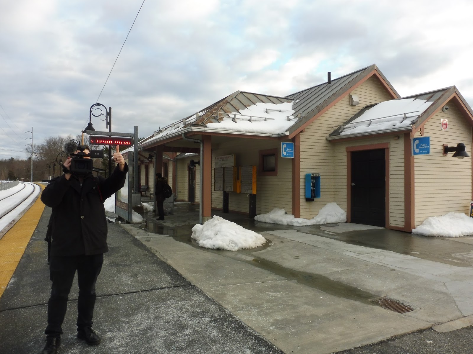
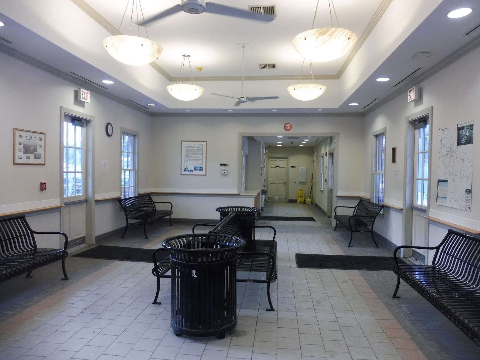
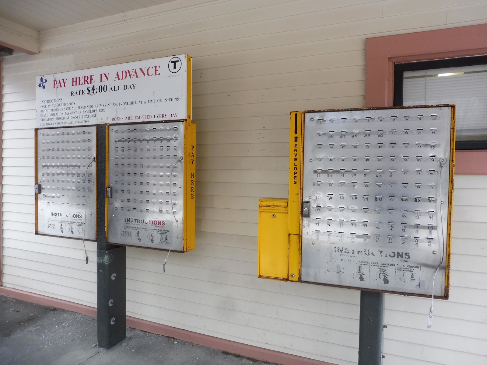
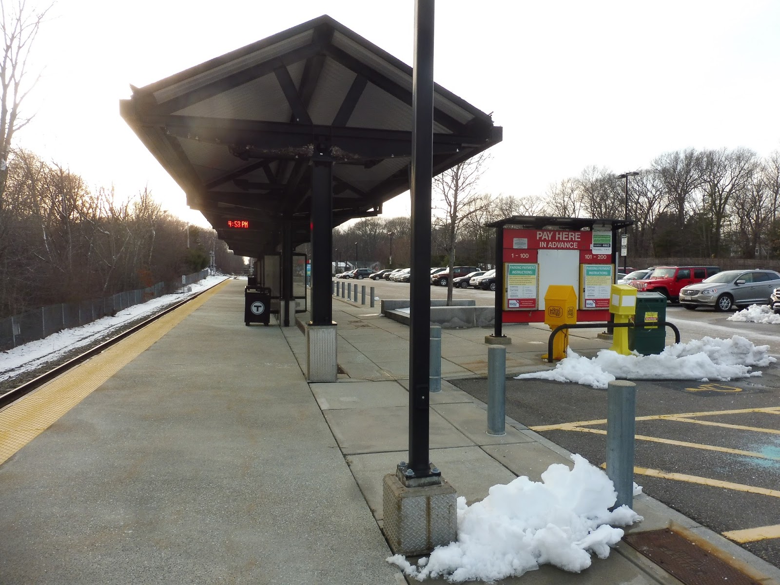
North Billerica (1000th post!)
Well, this was a surprise! NBC was still with me, and I was worried that North Billerica was going to be boring – apparently, that is absolutely not the case!
 |
| Looking down the ol’ platform. |
Okay, we’ll start with the platform, which is the least interesting part of the station. There’s a long low-level section with mostly signs and wastebaskets along it. There are mini-high platforms on the northern end of the station and benches underneath their shelters on both sides. The inbound side has some sheltered bike racks, which is a great place to put them.
 |
| SHOOT, THE PAPARAZZI GOT ME!!!! |
Ah, but here we have North Billerica’s crown jewel: the inbound side has a building! Now, even from the outside, it’s a nice structure. There are a few benches beneath its awnings for people to wait for trains, and it even has a payphone on the outside – too bad it’s broken.
 |
| WOAH. |
Now, most buildings on the Commuter Rail are only open for the morning rush period, BUT THIS ONE IS OPEN ALL THE TIME! AND IT HAS A TON OF BENCHES INSIDE! AND IT’S HEATED! AND IT HAS FREE WI-FI! AND THERE ARE VENDING MACHINES! AND IT HAS A WATER FOUNTAIN AND REALLY NICE, CLEAN BATHROOMS! SERIOUSLY, THIS IS SO CHARMING AND INCREDIBLE AND I LOVE IT TO AN INSANE DEGREE!!! I’M SURE NOTHING WILL COME UP TO SCREW THIS STATION UP!!!!!
 |
| Ohhhhhhhh…oh nooooooo… |
 |
| That’s a lotta commuters! |
A thousand posts???? Woah, okay, that’s a lot of posts! Uhhh…wow, this really snuck on me. Thanks for reading all the tomfoolery I’ve been writing a thousand times over!
THE BIGGEST VIDEO REVIEW WE’VE EVER DONE
CLICK ON THE LINK!!!!!!!!!!!!!!!!!!!!!!!!!!!!!!!!!!!!!!!!!!!!!!!!!!
https://youtu.be/BgrrPwP0pqY
Cohasset
Cohasset. More Old Colony. Cool.
 |
| The parking area. |
The high-level platform is completely and totally standard: it’s long, with benches along the whole thing, with a higher concentration under the station’s modern shelter. Some paths lead to the parking lot, which has 410 spaces, including another shelter at which to wait for pickups. There are some bike spaces here, too, while an alternative pedestrian exit goes to East Street.
 |
| Oof, that’s bright! |
Station: Cohasset
Ridership: Cohasset’s ridership is on par with the rest of the Greenbush Line, getting 391 inbound riders per weekday.
Pros: High level platform, shelter, and parking! Also, a TOD building, which is rare on the Old Colony, so that’s nice to see.
Cons: Inbound trains cause two level crossings to go down when they board, which is annoying.
Nearby and Noteworthy: There’s a rail trail from here that goes into the woods – it seems like a nice walk! Also, this is the Greenbush Line, so of course the station is right next to a golf course.
Final Verdict: 7/10
Yup, Old Colony. These reviews aren’t too interesting, are they? But stay tuned for a HUGE VIDEO REVIEW tomorrow!!!
Latest MBTA News: Service Updates
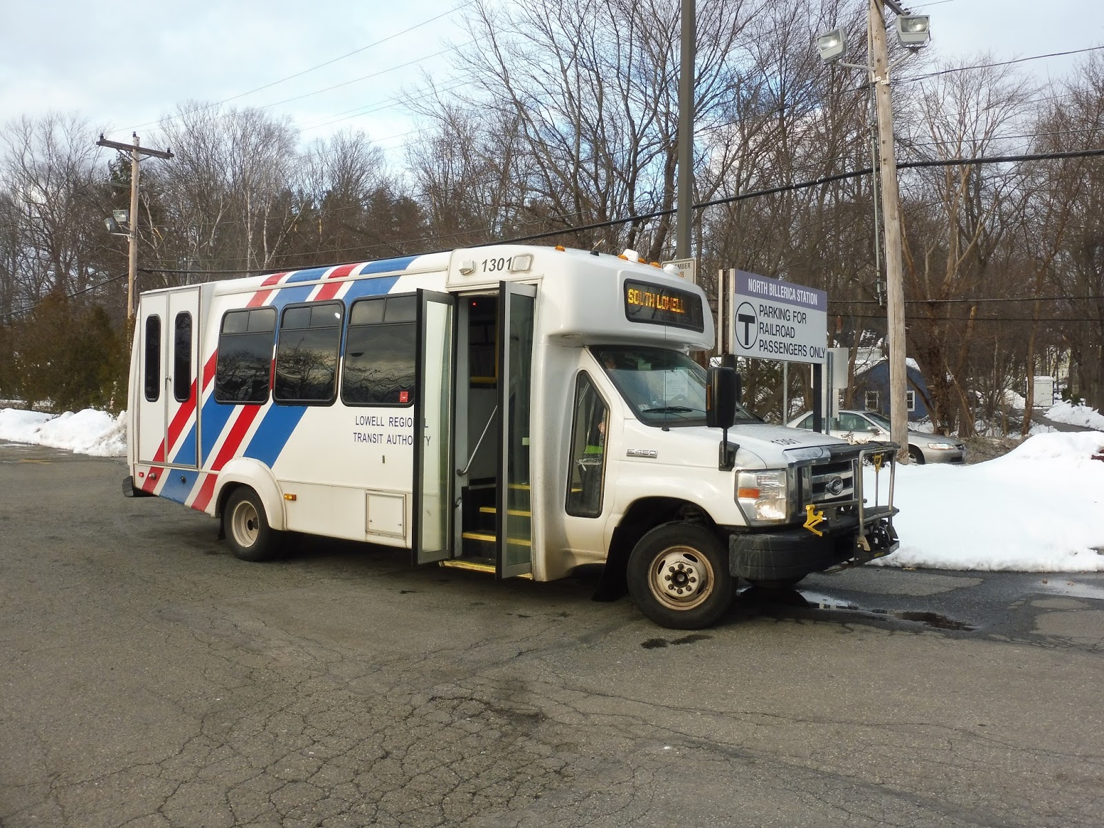
LRTA: 3 (South Lowell)
This is the route I reviewed with Rob Michaelson from NBC! And of course, because we had a big camera, the 3 had to be using a minibus! Being crammed onto a tiny vehicle with a big news camera was interesting, but it was a great experience…too bad the route is fairly uninteresting.
 |
| Of COURSE it’s a minibus! |
Our minibus left the Kennedy Center and made its way south down Thorndike Street. We went underneath the Lowell Connector, then we did a super sharp turn onto Gorham Street. This took us past the terminus of the Lowell Connector (since we were going north now) and some dense houses and apartments.
 |
| An apartment behind a small parking lot. |
There were some apartment buildings as we merged onto Veterans Way, and as we turned onto Church Street, we skirted the charming brick buildings of downtown Lowell. We passed a shopping plaza, then we went south again by turning onto Lawrence Street. This was mostly lined with dense houses, save for some retail clustered around Rogers Street.
 |
| As far as shopping plazas go, this isn’t bad! |
We went by some brick apartments and old factories as the street made an s-curve, and we came up along the Concord River. There were some parks, then we went over the river and past a cemetery. We turned onto Woburn Street at an intersection with a few businesses, but it soon became houses once again. The road crossed over Marginal Brook, and a few seconds later, it went under I-495.
 |
| Nice view! |
The houses were still dense, but it was starting to feel more suburban. Indeed, we left the city of Lowell, entering Tewksbury – once this happened, the scenery got industrial, with random office parks separated by tracts of forest. We once again entered a new town, Billerica, and the street became Billerica Ave.
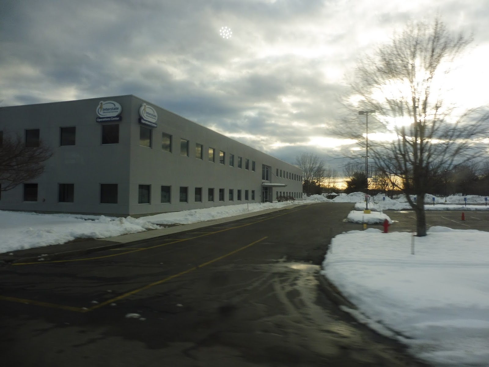 |
| Some office building. |
We went under a huge set of pylons, and the road was lined with suburban houses after that. Suddenly, along came a huge parking lot, marking our arrival at North Billerica Station. The bus pulled over at the edge of the lot, and we were let out straight into it. Not the best busway in the world…
 |
| Time for a long layover… |
LRTA Route: 3 (South Lowell)
Ridership: The LRTA doesn’t have publicized ridership data for the 3, which is too bad – we’ll have to judge it based on our trip. We got a total of 8 people, and that’s not awful for a minibus route. That being said, if it was using a full-sized bus (which it often does), it would’ve felt like less.
Pros: The route offers a relatively quick trip from Lowell to North Billerica, clocking in at just 16 minutes. It runs every hour on weekdays, with additional half-hourly (sort of) peak service. On Saturdays, the route is combined with the 4 to form a loop, which makes sense, and it’s one of the LRTA’s better “combination” trips.
Cons: Here’s how to make it even shorter: don’t have it do the weird jog to almost-downtown Lowell! But honestly, the route is so short that it should probably be combined with something longer – the LRTA suggested the 15, but combining it with the 13 would also work. Either way, it would be taking two routes that have excess capacity and putting them together at very little inconvenience to the passengers. Finally, the fares of the 3 really bother me: it costs 50 cents more to leave the city, even though it only takes ten minutes for the thing to leave Lowell! I guess that’s considered “suburban” in the LRTA’s eyes…
Nearby and Noteworthy: There were some local businesses along the way, but I’m not sure if any were gems.
Final Verdict: 6/10
Overall, the route is a nice connector from the southeastern parts of Lowell and North Billerica. It has office parks near the end, so there is potential for reverse-commute ridership, but the route is overall under capacity. Combining it with a long-distance route would make sense, and then the hiked fares for leaving the city would feel at least a little more justified. Also, making the route more direct would be a huge help.
Latest MBTA News: Service Updates
Hello to anyone coming from NBC! I hope you stick around – there’s plenty of great stuff here, and more down the pipeline!
Nantasket Junction
Nantasket Junction. Old Colony. Let’s go.
 |
| This is about all you need to see. |
It’s a single track, so it’s just one platform. There are benches along the whole thing, but there’s a higher concentration of them (plus wastebaskets) under the shelter. The station has 495 parking spaces for cars and a few bike spaces. It has entrances going both east and west: one to Summer Street, and a pedestrian-only one to Kilby Street.
 |
| Ahoy! |
Station: Nantasket Junction
Ridership: This station gets very average Greenbush Line ridership: 381 inbound riders per weekday.
Pros: It has all that sweet Old Colony stuff: a high-level platform, shelter, historical information on the signs, multiple entrances, and a big ol’ parking lot.
Cons: There are level crossings on both sides of the station, so no matter what, incoming trains will set one of them off. Also, it’s a little boring, but that’s no surprise.
Nearby and Noteworthy: The South Shore Model Railway Club and Museum left flyers on every car here advertising their open house…but they’re way closer to West Hingham! Oh well…yeah, there’s nothing around here.
Final Verdict: 7/10
Yup…it’s what you would expect.
Latest MBTA News: Service Updates
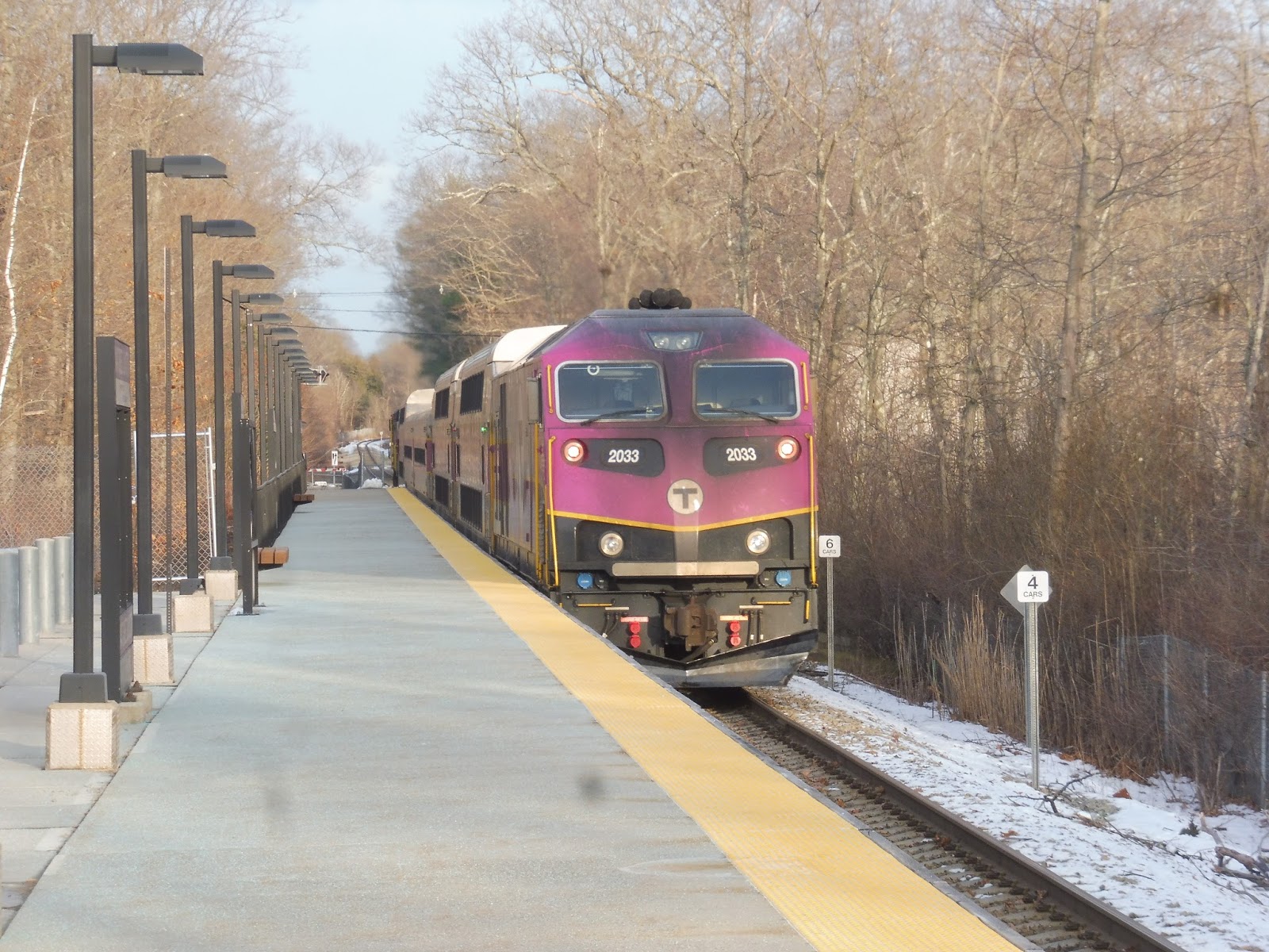
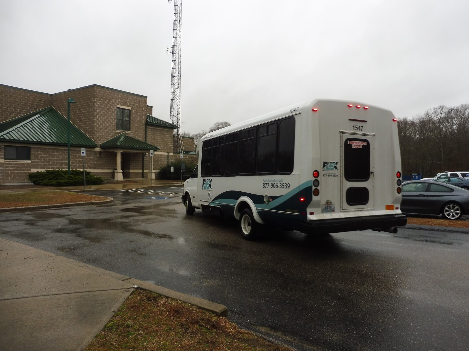
RIPTA: URI Services (211 Ram Line, 69 Hill Climber, & 70 Engineering Line)
Time for a gauntlet-style review of all of RIPTA’s URI services! Spoilers: they’re not too useful.
 |
| Shh…it’s trying to camouflage with the trees! |
A well-timed 66 from the 210 took Sam and I up to Fairgrounds Road. We got off here and walked down to Schneider-Electric, the starting point of the 70. This is the site of temporary lab spaces for engineering students while a new engineering building is being built on campus, so this route may only be temporary. There was also a sign for university parking here, though, so maybe it’ll stick around as a parking shuttle.
 |
| “70” occupies a whole slide to itself? Come on! |
We headed up Fairgrounds Road, which had some industrial buildings along it. We then turned onto Kingstown Road, going over the Amtrak tracks (and Kingston Station) and passing a few houses. It was forest from there until we entered the URI campus, and we soon turned onto Lower College Road. This led us to Memorial Union, the final stop of the short route.
 |
| That’s better. |
RIPTA Route: 70 Engineering Line
Ridership: No one on our trip. My guess is that this is a “peaky” route, only getting people when engineering classes start and end.
Pros: It’s a free link to Schneider-Electric, so it’s a necessity for anyone taking an engineering class. It’s a direct route with no frills or deviations, and I like that it leaves right from Memorial Union.
Cons: The route comes “every 20-30 minutes” weekdays only. Okay, you can’t play the headway card when the route is that infrequent! This kind of thing works when a bus is every 15 minutes or less, but “every 20-30 minutes” could mean anything! I guess you could always use URI’s awful tracker, but…ew! Also, of all routes, why is this the one that runs until 8 PM while the others end at 7?
Nearby and Noteworthy: Schneider-Electric, and nothing more!
Final Verdict: 3/10
This is the one URI route that truly goes somewhere, so I’ll give it some credit for that, but the schedule drags it down a lot. When a route is as infrequent as this one, there needs to be a schedule to look at! And I’m not saying it should be more frequent – on the contrary, the route would be much more efficient if it just timed with classes. That would give it a lot of layover time where it’s not doing anything, but it could go onto the 210 during those times.
 |
| Is there a stop here? |
From Memorial Union, Sam and I walked up to the library to get a 69. We thought we could cut through the building, but…turns out that’s not possible. So we had to go around, but then we couldn’t find a stop, so it took some extra time to locate the sign. Clearly, URI is investing a lot to make sure its students know where the shuttle stops!
 |
| The bus coming down the narrow, twisty road. |
The driver asked us where we were going. Since the 69 runs in a loop, we said the Pharmacy, which would more or less get us around the whole thing. “That’s right up there,” the driver said. “Oh well, I have nothing better to do than just drive around anyway.” Huh? We went down West Alumni Ave on the regular route, but then we…turned onto Butterfield Road. And headed onto Flagg Road. And turned onto Greenhouse Road. So we completely ignored the route, which isn’t supposed to take Butterfield or Greenhouse. And we only did, like, 10 percent of it. But…I think I’ve learned what I need to know.
 |
| Okay, bye… |
RIPTA Route: 69 Hill Climber
Ridership: Well…no one on our ride. We saw a bus later that had three people on it.
Pros: This route loops around the north side of campus, serving mostly…parking lots. The route runs every 6-12 minutes weekdays only, which is a big difference in headway, but it’s fine, I guess.
Cons: So…this is basically a taxi service, huh? Tell the driver where you want to go, and he’ll take you there directly? This is furthering my theory that URI should just use an on-demand system. Also, the 69 may serve all these lots, but why is it just a loop around the north side of campus? The whole thing has this useless air to it.
Nearby and Noteworthy: Just…URI stuff. Yeah.
Final Verdict: 1/10
“Oh well, I have nothing better to do than just drive around anyway.” Couldn’t have said it better myself.
 |
| Finally, the 211! |
I’ll say that the 211 seems to be more useful. It’s way more deviatory than the other two routes we’ve seen, but it actually serves stuff. We began at the Library, and from there, the bus took a left onto Butterfield Road. We were passing lots of dorms and dining halls, and they continued as we turned onto Campus Ave. However, then we turned onto Fraternity Circle, and…of course URI has a whole circle dedicated to frats.
 |
| A curvy road. |
We did a deviation to the Kearney Road parking lot and the Ryan Athletic Center before returning to Fraternity Circle. We came back up to Memorial Union, and this is where Sam and I got off to catch a 62 to Providence. From here, the bus goes by some more dorms before returning to Alumni Ave.
 |
| See ya! |
RIPTA Route: 211 Ram Line
Ridership: Okay, okay, this one actually got 5 people, so it’s not awful!
Pros: This makes more sense as a college shuttle. It connects dorms and frats to Memorial Union, athletic facilities, and classes. It runs every 8 minutes until 1:30 PM, and then every 15 minutes until 7 PM. I don’t know why that is, but it’s fine.
Cons: So I did the walking test on Google Maps: the two furthest points on the route (Kearney Lot to the Fine Arts Center) are a 15 minute walk away from each other, meaning that if you just miss a bus after 1:30, it’s faster to walk. But the thing is, most people aren’t going between those places – they’re most likely coming from the dorms, which are in the middle of the route. That means that even in the morning when the 211 is more frequent, it’s probably still faster to walk.
Nearby and Noteworthy: Frats, dorms, athletics, classes…
Final Verdict: 2/10
It’s better than the 69 as far as on-campus shuttles go, but I still don’t see much use for the 211. It’s often faster to walk, and the route is twisty and all over the place.
The problem with this system overall is that URI is just a small campus. Does it have much need for a fixed shuttle system, barring the 70 when it’s needed? If a fixed system was kept, I would have Memorial Union be the hub for everything, rather than the current system where the 69 is just running around on its own to the north. Ideally, though, this should be replaced by an enhanced 210 service with an on-demand app that people can use to request a bus. Ridership seems like it’s low overall, and if all these buses were put onto the 210, you would have an efficient system that would serve the needs of everybody. Also, this is such a party school – shouldn’t service run later?
UPDATE 9/1/18: These shuttles have been taken off RIPTA’s hands. They’re now being directly run by URI, so now it’s their problem!
RIPTA: 210 (Kingston Flex)
More Flex action! The 210 serves the URI campus, as well as some of the immediate surroundings, which presumably hold some off-campus student housing. Since our 62 would arrive a little later than the last timepoint stop on the route, though, Sam and I would have to call RIPTA to get the ride…
Unfortunately, this was easier said than done. RIPTA gives two numbers you can call: 1-877-906-FLEX, or 401-784-9700, ext. 200. The extension business seemed like a pain, so we tried the first number. Ringing. Ringing. Nope, doesn’t exist. Alright, extension it is. We dialed 401-784-9700200. Ringing. Ringing. Doesn’t exist. Maybe if we switch the phone we’re using and try the first one again? Nope, didn’t work.
Finally, I tried calling the number sans extension. “Please be advised that our extensions have changed to a four-digit system. Please add a 1 to the beginning of each extension to reach your party.” OKAY, THAT WOULD’VE BEEN NICE TO KNOW BEFORE! Although now that I look online, apparently you’re supposed to put a “pause” (*) to reach the extension, so our first dial wouldn’t have worked anyway – but still, we wouldn’t have known to put a 1 before it! Sorry, this is probably obvious to a lot of you older folks out there, but the younger generation has no idea how to use phones…
The call was positively painless compared to the Middleborough-Taunton Connection, though. All we had to give was our names. Oh, and the EXACT ADDRESS of where we were going. Even though “South County Public Safety Complex” appears right there on the route map, you can’t take the Flex there unless you know the EXACT ADDRESS. Boy, couple that with the extension thing, and the fact that these reservations have to be made a day in advance, and I think we’ve got an uptick in college students taking Ubers on our hands!
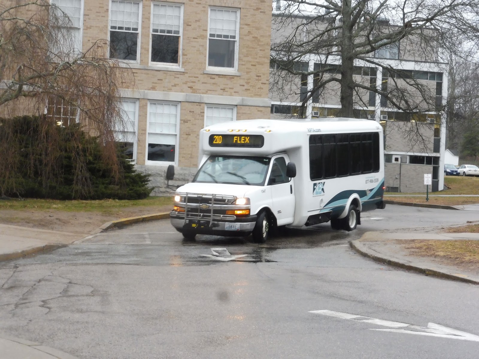 |
| Coming into Memorial Hall! |
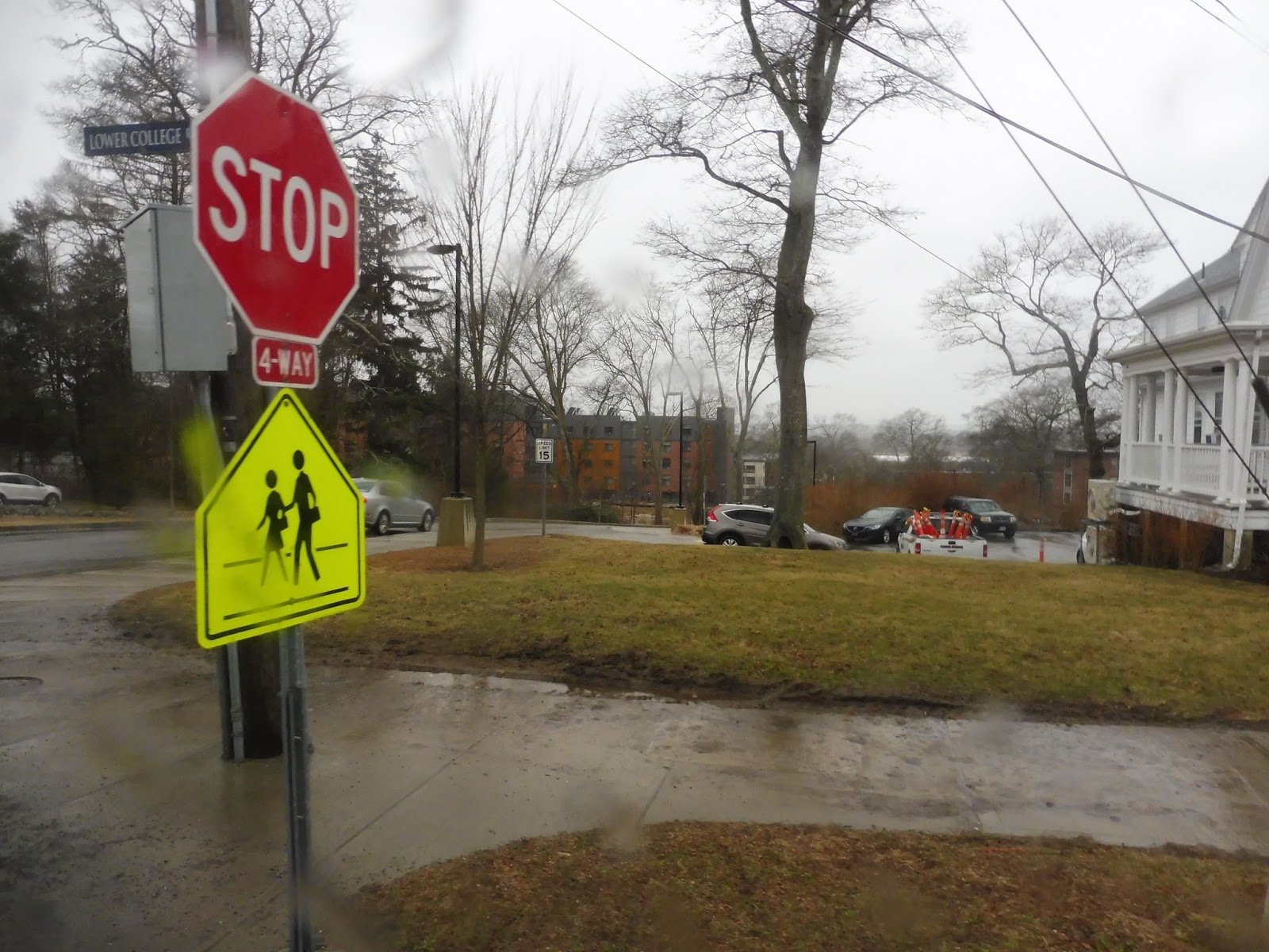
The minibus arrived early at URI, which suited us just fine – less time to wait in the rain. The driver opened the doors and we stepped up to the bus. “Who are you looking for?” the driver yelled out the door. “The 210,” I responded. “I’m Miles.” “Oh, okay,” the driver said. “Step on in!” We got on, and the bus headed out down Lower College Road.
 |
| Stop! (says the sign) |
“So what’s your story?” the driver asked. “Did you leave your cars down at the police station or something?” “Uhhh…it’s a long story,” we replied. “Oh, that’s okay,” the driver said. “Sorry to get in on your business like that. I hear lots of stories. Where are you guys from?” “Cambridge,” we responded. “Wow!” the driver exclaimed. “You have one HELL of a story!”
 |
| A woodsy road. |
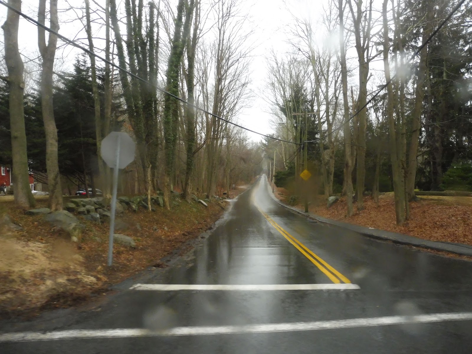
We entered into a long queue of traffic on Kingstown Road. There were some houses around the university itself, but as the road turned south, there were longer patches of forest. We passed through a section with some suburban businesses and then pulled into the South County Public Safety Complex. That was it!
 |
| Off to do more Flex-y things. |
RIPTA Route: 210 (Kingston Flex)
Ridership: For a Flex route, the 210 seems to get busy. The driver told us a few stories about riders he’s gotten (including three girls who all broke their legs at a party – classic URI), so that seems to suggest that at least some university students rely on the route.
Pros: I think the Flex Zone is great, covering the university campus and some of the areas around it. It seems to get people, which is…rare for Flex services. It also runs seven days per week, making it even more useful for people living on campus.
Cons: What college student is going to call the route a day in advance to make a trip across campus??? That is absolutely ridiculous, especially with the whole “1 before the extension” thing! The route only makes timepoint stops once every two hours, and it stops running entirely at 5 PM. This is a party school! You’re really only gonna run this thing until 5?
Nearby and Noteworthy: I mean, it’s basically just URI, but that’s all it needs to serve.
Final Verdict: 4/10
It works fine as a Flex route – indeed, it’s one of RIPTA’s better ones. But on a college campus in 2018, no one is willing to call in a day beforehand to ride the bus. The 210 (the other Flexes too, but this one in particular) needs to update to an app-based system. Since the Flex Zone is so small, it could just be an on-demand service whenever students need it. If this change was made, it might make sense for RIPTA to put even more resources into this service, and take some away from the university shuttle system…stay tuned for that.
Latest MBTA News: Service Updates
GUEST POST: Ashland
Another one from Mike N. – thanks, Mike!
Ashland, Ashland, Ashland. The one interesting thing about this station is that it exists. Yep, this will be a boring one.
Well, the first thing I saw at Ashland was a warning for high speed trains. But that doesn’t make any sense. Almost all of the scheduled MBTA trains stop here, and CSX is only going 20-30 mph anyway. So, why the sign?
Ashland’s inbound platform is pretty basic. There’s one shelter aside from the mini high that has a bench and a schedule under it. Scattered throughout the platform are numerous benches and wastebaskets. The walk from the shelter to the mini high isn’t bad, so that’s a plus.
Ashland’s mini highs are small, with a bench, trashcan, and stairs and ramp to go to the outbound side. The mini highs and stairs are very grimy and the walkway is rusty, so it can be a disgusting wait.
Ashland’s outbound platform is very similar to the inbound side, with a small, dirty mini high, and a long platform with a shelter and scattered trash cans. On both sides of the footbridge, there are random benches on each level and there’s one box on each side that’s locked. Seems pretty pointless – maybe it’s for Keolis employees. Ashland also has plenty of parking, with 678 spaces spread out on both sides. There is also a driveway on the inbound side that goes up to a bridge for drivers, but when we went that way, there was a giant barrier preventing us from going that way! Also, the drive from the main road down to the station is a mile long. That’s kinda stupid.
Station: Ashland
Pros: This station has what a commuter rail station needs: shelters, accessibility, parking, and a footbridge to safely cross the tracks.
Cons: The stairs are disgusting, the footbridge will only rust more with time, the station is a mile from downtown Ashland, and it feels kind of depressing waiting for the train here.
Final verdict: 7/10
This station does its job well, has functioning mini highs, plenty of parking, and a footbridge. However, that should be repainted. It looks disgusting and the rust will only get worse with time.
Will Asks…
That’s an easy one. There’s no doubt about it, it’s Chestnut Hill Ave. The outbound platform is so narrow that you can’t stand on it without being on the yellow line! Yeah…the B Line is fun.
 |
| Get off the yellow line, Jordan! |
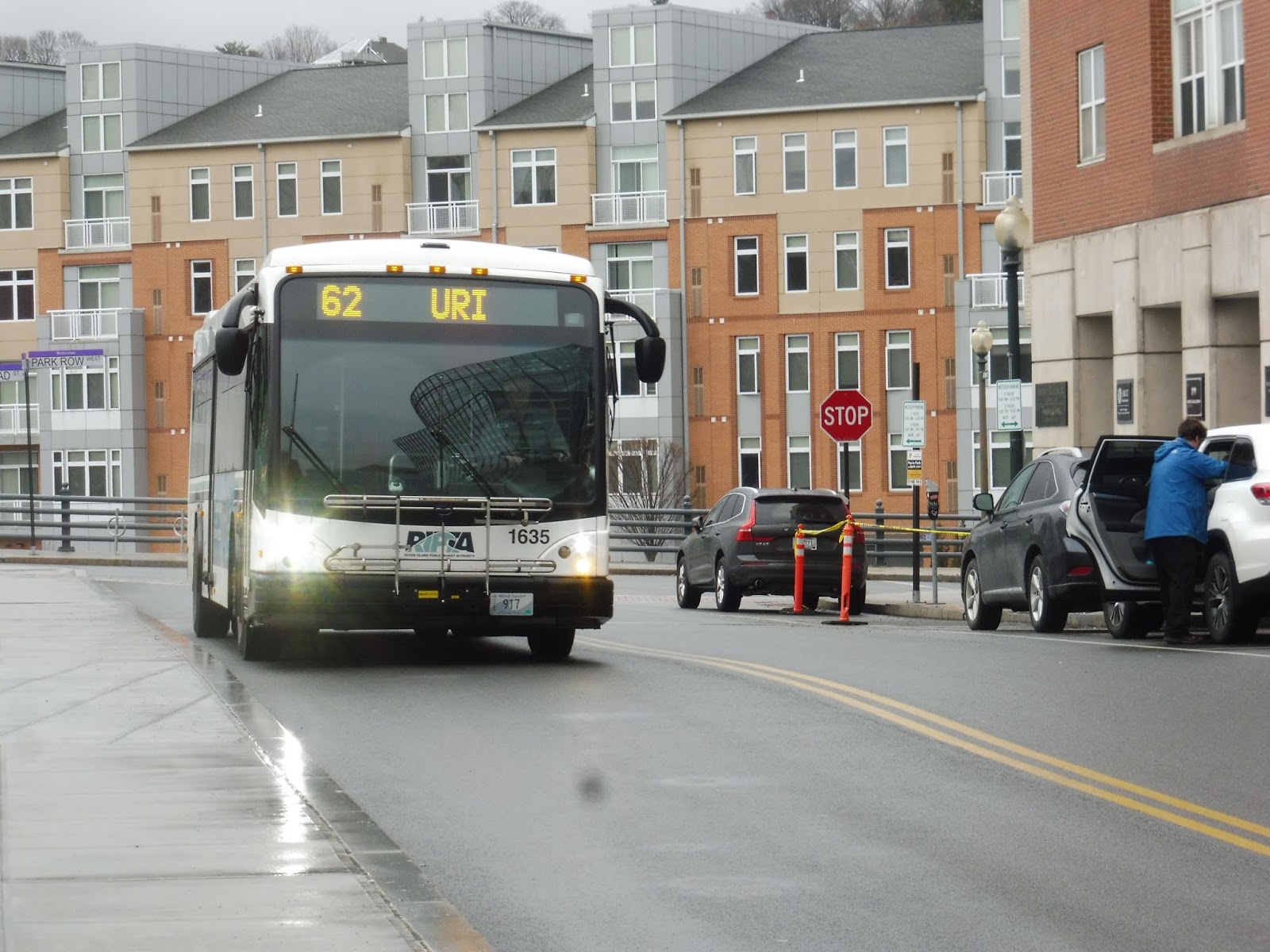
RIPTA: 62 (URI/Providence Station)
The 62 is a new route that was created to supplement the 66‘s service to URI. Can it do its job, or is it muddied up with useless deviations? Well, let’s find out!
 |
| You’re late! |
Both the 62 and the 66 were extended to Providence Station as part of RIPTA’s Downtown Transit Connector plan (I assume), but at the moment, neither route gets many people from there. Of course, Sam and I had to do the whole trip, though, so we boarded at the station and had the bus to ourselves until Kennedy Plaza (Exchange Terrace) a few minutes later.
 |
| The view crossing the Woonasquatucket River. |
One of my favorite parts about the 66 is how it starts its express portion right after Kennedy Plaza, so let’s go!! Oh…we had to serve something else first? Alright, let’s go onto Dorrance Street, then. This took us through Downtown Providence past lots of commercial buildings, then we ended up in the Jewelry District. This extended local section was to serve URI’s new Nursing and Education Center, so I guess it makes sense, but it was an annoying jog and no one got on or off there.
 |
| Finally, a highway! |
We used Ship Street to get to Clifford Street, which led to I-95. Turning onto West Franklin Street, we merged onto the highway, and it was finally time for the express! The highway took us past the Rhode Island Hospital and into an industrial part of Providence, lasting for quite a while. It was broken by Roger Williams Park, and we entered Cranston soon after that.
 |
| What a sight! |
We came tightly between two roads at one point, and while there were houses for a bit, it eventually got industrial once more as we entered Warwick. We got to skip the 66’s new deviation to TF Green Airport, which is really long and annoying, as I can tell you from experience. However, we still had to do the CCRI deviation, so we took the next exit, 12B, onto East Ave.
 |
| Some industrial buildings. |
We weren’t on East Ave for long, heading into the Knight Campus of CCRI. And, uh…boy, talk about a brutalist building. I mean, this was the absolute most brutalist building I had ever seen. Like, in a bad way. Oh well, we dropped someone off and made our way back onto the highway from there.
 |
| I wish I could’ve gotten a better picture, but GEEZ! |
It was mostly woods south of there, continuing as we made the exit onto Route 4. Interestingly, though, while the 66 and even the 65x take Exit 6 to get onto Route 2, we were able to stay express for a little longer. Instead, we took Exit 5A to Ten Rod Road, where there were some suburban businesses. We had to deviate to Wickford Junction Station, and then it was the other way down Ten Rod Road, curving onto South County Trail into Exeter.
 |
| Wickford! |
It was lots of farmland, houses, and forest along the ol’ South County Trail. Eventually businesses came into the mix, but it was still quite rural as we entered South Kingstown. We turned onto Kingstown Road next, going over the Northeast Corridor and passing Kingston Station. While the 66 goes into the station itself, we were spared from that deviation.
 |
| Middle o’ nowhere. |
There was some residential and retail development around the station, but we soon reentered the woods. This was a much shorter section of forest, though, and we soon came into the URI campus. Our final turn was onto Lower College Road, which took us to Memorial Hall, right in the thick of the university.
 |
| Going away, out of service. |
RIPTA Route: 62 (URI/Providence Station)
Ridership: Ridership on the 62 seems to depend on the time of day and the direction. Our trip in the afternoon going towards URI only got four people, but there were plenty on our inbound trip later in the evening.
Pros: URI is a huge ridership generator, so it’s great that RIPTA is using this to increase its service. Combined with the 66, service to URI is every 15 minutes at rush hour and every half hour middays! Keep in mind that the 62 is weekdays-only, but it’s not like the university needs anything more than hourly 66 service on the weekends.
Cons: To me, some of the deviations inhibit the 62’s usefulness. Instead of being just for URI, RIPTA has chosen to also serve the Nursing Education Center, CCRI, and Wickford Junction Station. Now, I understand the importance of having a connection between these places, but why not have only the 66 serve them? That route seems to be designed to cover everything, while I feel like the 62 should be more of an express just to URI, since that’s where most of its ridership comes from.
Nearby and Noteworthy: Most of the 62’s attractions are geared towards college students, so it’s lots of…colleges!
Final Verdict: 7/10
This is a supplement to the 66. It is faster than the 66, but it still makes a few questionable deviations that it may not have to make. It also seems to have issues with on-time performance – every 62 bus I saw was late. That being said, it still does its job, and the added frequency to URI is great.
Latest MBTA News: Service Updates
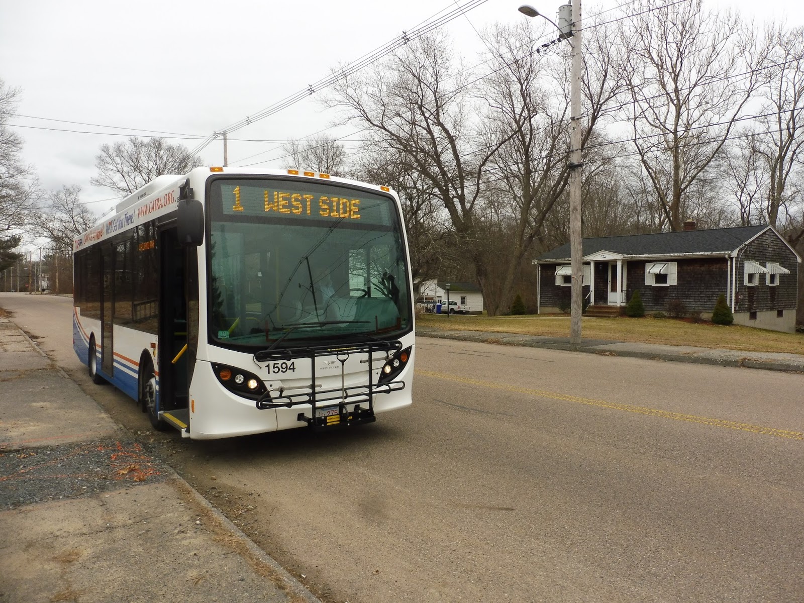
GATRA: 1 (Westside)
It’s another really short route that’s marginally more useful than the 9, I guess. Not much else to say, let’s look at the 1!
 |
| The bus at its berth. |
We turned west out of the Bloom Terminal, skipping downtown Taunton entirely. As we merged onto Kilmer Ave, it was basically all houses. We ran by Bristol Commons, a modern housing development, and merged onto Smith Ave. This became Highland Street, but we soon had to turn back onto Oak Street and deviate into the apartment development at Richard Dewert Terrace.
 |
| A typical view of the neighborhood. |
We came back onto Highland Street and used it to get to Winthrop Street. As we entered an area of suburban businesses, we turned onto Warner Boulevard and deviated into a Hannaford Supermarket. Continuing south from there, it was…a pleasant jaunt through the woods, apparently! Alright!
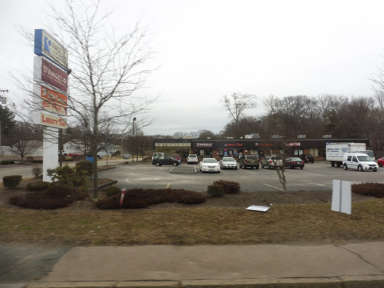 |
| A shopping plaza. |
That went on for quite a while, save for a few tiny residential roads and offices. We even entered Dighton, a town that I had never been to before! However, we reentered Taunton quickly by turning onto Spring Street, which led us past a few businesses and a factory, over a river, and into a residential area. We looped around via Railroad Ave, Somerset Ave, and South Street, and then it was time to head back.
 |
| Weird place for a bus to end… |
GATRA Route: 1 (Westside)
Ridership: This one gets 58 people per weekday and 44 per Saturday. So…yeah, it’s pretty bad, too.
Pros: The 1 actually serves stuff that other routes don’t serve, unlike the 9. I like how the two routes interline to provide every hour service..
Cons: The route’s ridership is still really bad. Unlike the 9, though, there’s no easy way of fixing the problem. The 1 should still run, of course, but there’s no denying that very few people use this thing.
Nearby and Noteworthy: All there really is is Hannaford, and the suburban businesses around it. There was also this interesting place near the end of the route. Their website is…strange.
Final Verdict: 4/10
The route does its job and serves what it needs to serve, but it’s not great. I don’t think there are any good ways of increasing its ridership, so it might as well just go back and forth on its route and do its thing. Oh well.
Latest MBTA News: Service Updates
GATRA: 9 (Weir/Route 138)
Oh thank God, it’s a normal bus route. You don’t have to call in to ride it. It uses a proper bus. The 9 is just a normal short, stupid, pointless bus route.
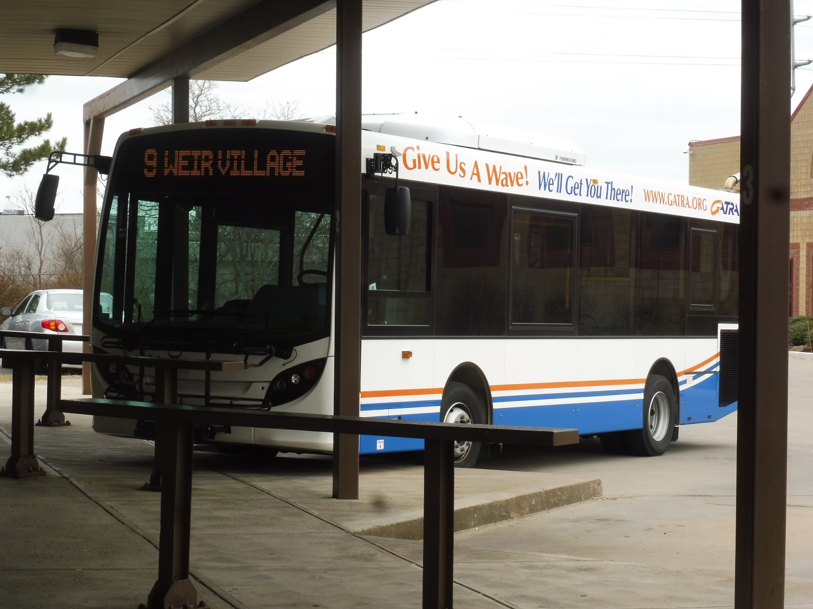 |
| HALLELUJAH! |
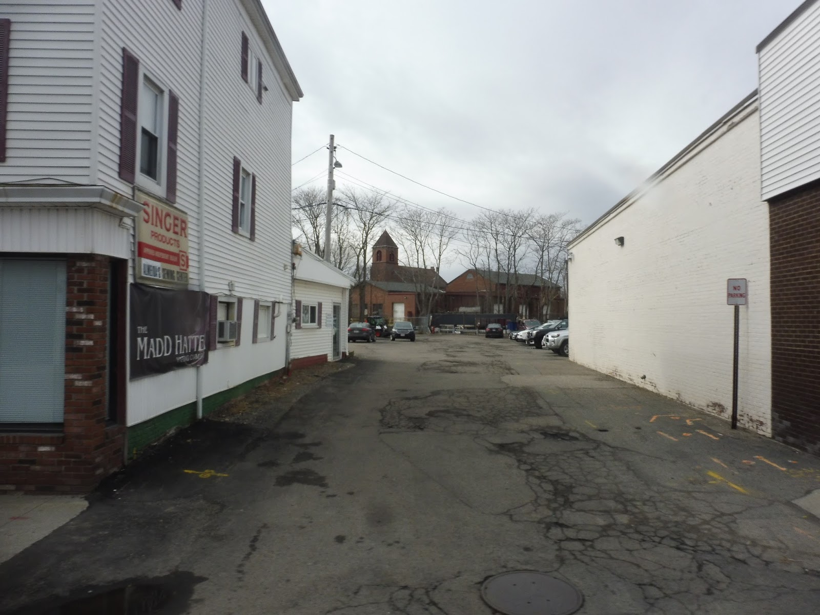 |
| An alley downtown. |
 |
| Some houses, seen from 2nd Street. |