GATRA: Middleborough-Taunton Connection
I…I’m speechless. I really don’t know what to say. GATRA…out-GATRAed itself. I didn’t think it was possible, and yet this route…defies explanation. Get ready for a crazy ride…
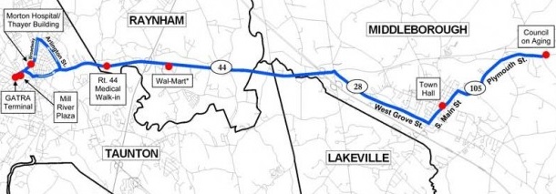
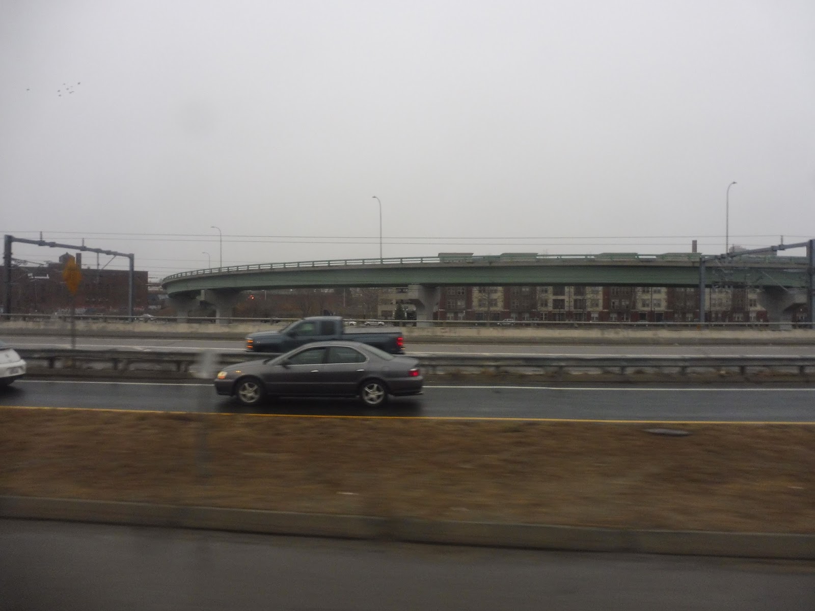
Okay, at first glance, this doesn’t look so bad. It connects Middleborough to Taunton, thus bridging two separate entities of GATRA. That’s good, because the system needs better connectivity. It’s weird that it starts at the Council on Aging, but it still serves downtown, so it’s fine. Now, this route has a higher fare than most other GATRA buses: it’s $2.00 from Middleborough to the Raynham Walmart, and $3.00 to Taunton. Not sure why that is, but okay. Fine.
Wait, now I’m looking at the schedule, and I see it only runs three times per day: 10:00, 12:00, and 2:00 from Middleborough. Hang on, and what’s this…”Operates Monday, Wednesday and Friday”? Oh geez…this is getting worse. But hey, at least on Mondays, Wednesdays, and Fridays, anyone can use this nice bus to get from Middleborough to Taunton. Let’s go!
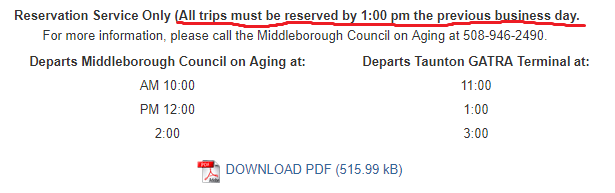
WHAT? No, seriously, WHAT???????? This is a call-in service?!!??!??!? But it’s not a flex route! This is very clearly a fixed route with a fixed schedule that runs on fixed roads!!!!!!!!! WHAT THE HECK EVEN IS THIS AEIOGMGEEGMLANCNAELCNAELNAEINGEAGN????????? Okay, okay, okay, it’s my duty as Miles on the MBTA to review the route. Let’s just calm down and give GATRA a call. Oh wait, no, it’s not GATRA, it’s the Middleborough Council on Aging. *breathe*…AOHGAEIOGAEEGMEAGMAEGEGMKL!!!!!!!!!!!!!! Okay, let’s call them.
Now, I had forgotten to call them by 1:00 PM the previous business day, so I left them a message at around 10 PM the night before Sam and I were going to ride the route. I assumed it was hopeless, but they actually called me back a little before 9 AM the next day, which was very nice. A pleasant lady answered the phone:
LADY: Hello, is this Miles? You left us a message last night saying you wanted to ride the 12:00 Taunton bus.
ME: Yes, I did, sorry about that.
LADY: It’s okay, we can absolutely get you on that trip.
ME: Awesome, thanks! It’s okay if I bring a guest, right?
LADY: We can accommodate a guest. Just make sure you get to the Council on Aging early – our driver likes to leave right on time.
ME: Will do. Thank you very much!
LADY: You’re welcome. Bye!
I didn’t need to get so worked up about that! That went very well. Cool, so now we’re scheduled to get the trip! I…oh, hang on, my phone’s ringing again.
LADY: Sorry, I just realized you’re not in our system. Could we get some information from you?
ME: Sure.
LADY: Okay, what’s your last name?
ME: Taylor.
LADY: Great. And what’s your date of birth?
Wow, that was quite a jump in privacy level! Maybe they wanted to make sure I was over 18 or something. I gave her the DOB.
LADY: Okay. Now, what is your address?
Address? Why??? How does that affect my bus ride at all? Oh well, don’t question it – I need to take this bus. I told her my address.
LADY: Fantastic. And can I have an emergency contact?
ME: A what?
LADY: An emergency contact. Name and number.
OKAY…THAT’S DRAWING A HUGE LINE. EMERGENCY CONTACT????? THIS IS A PUBLIC TRANSIT SERVICE WE’RE TALKING ABOUT! I DIDN’T REALIZE GATRA WAS A BABYSITTING COMPANY, TOO!!!!!!! WHAT COULD THEY POSSIBLY NEED AN EMERGENCY CONTACT FOR???? IF GRANDMA JUDY GETS A CUT ON HER PINKY FINGER, WILL HER EMERGENCY CONTACT BE WAITING AT THE NEXT STOP WITH A BAND-AID TO SAVE THE DAY????????????????? After giving Sam an incredulous look, I gave her my mother’s name and number. Sam looked (rightfully) confused.
LADY: Okay, great! So, I think that’s it. See you at noon!
ME: Awesome, you too!
LADY: Hang on, you said you were bringing a guest?
ME: Yeah, I am.
LADY: We’re going to need all his info, too.
ME: Sure, just let me scream and bang my head against the wall a few hundred times.
Okay, I didn’t actually say that, but I really wanted to. I passed the phone over to Sam with an expression saying I’m so sorry. I knew Sam got to the emergency contact bit when he had that same incredulous expression I made. Finally, after affirming one more time that we needed to get to the COA early, the lady hung up. After that ordeal…we were ready to ride this bus.
 |
| It all began at Trucchi’s… |
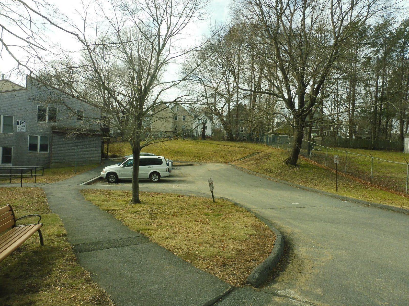
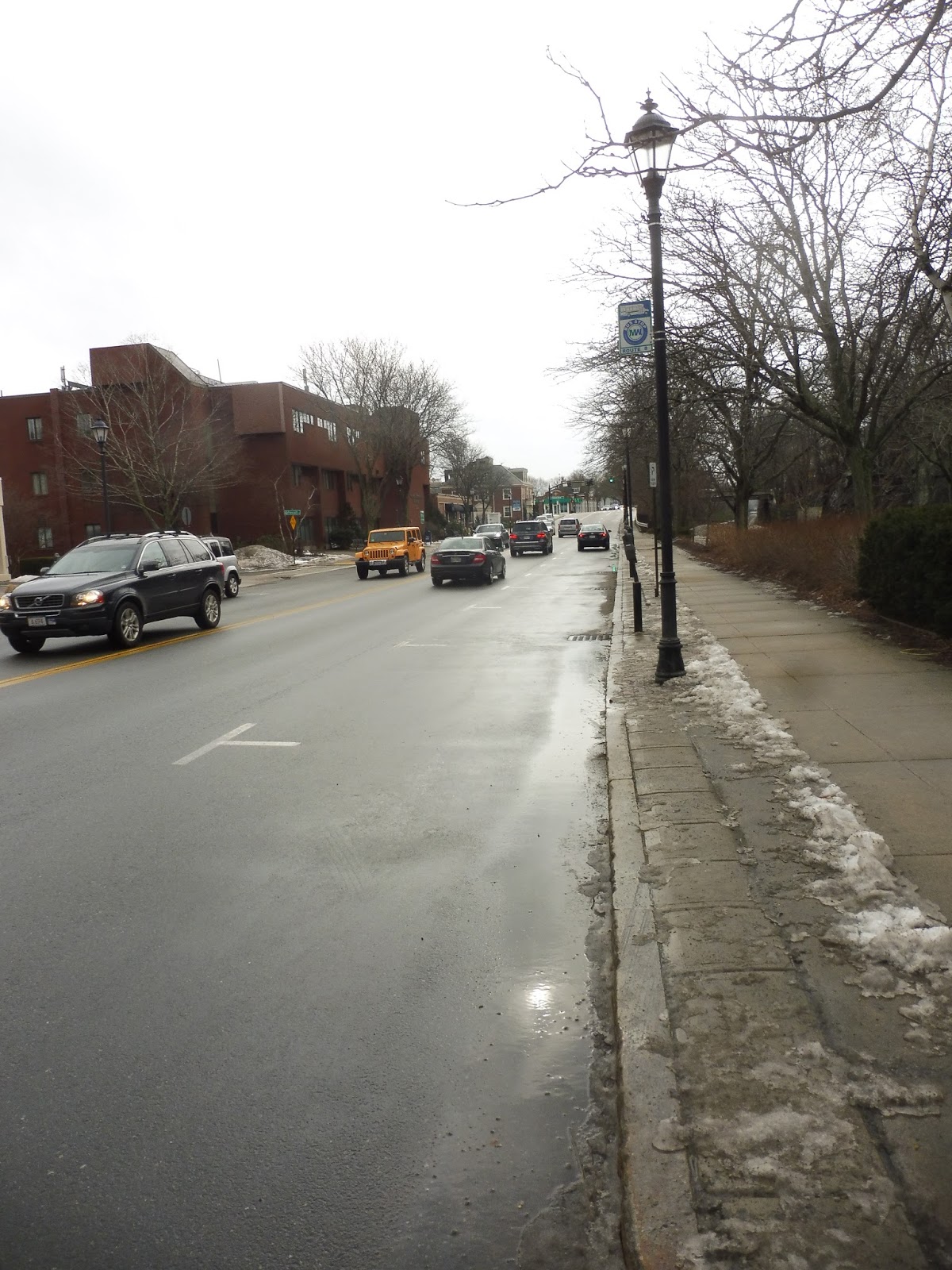
Having completed our wonderful ride on the Downtown Middleborough Shuttle, we were going to walk from its terminus at Trucchi’s Supermarket to the Middleboro Council on Aging. The most direct route was an hour and fifteen minutes – not bad! Aside from a rather nasty intersection near the supermarket, the first leg of the walk on the residential Anderson Ave was quite pleasant. We turned onto Erica Ave eventually, which was a nice side street.
Google Maps then told us to take a right onto Route 44. This was a totally different beast – it was a wide road with a big median, nothing but woods along it, and a speed limit of 50. It was bordering on highway. “I wonder if walking along a street like this is illegal,” I said. “Wouldn’t it be funny if a cop car came along?”
*Beep beep!* Lo and behold, there was a Middleborough Police car pulling up behind us. A stern police officer came out. “Hi! What are you doing walking along a highway?” “Google Maps told us to walk on here,” we explained. “Okay…where you guys going?” he asked. Oh God, we were going to the Council on Aging. We were two teenagers walking down a highway going to the Middleborough Council on freaking Aging. This would not end well…
“Why are you going to the Council on Aging?” the cop asked. We explained the blog and how we were getting a bus route from there. “Okay. I’m gonna need identification. Please stand to the side of the road and don’t move.” He got our IDs and disappeared into the car. Sam and I were making small talk, but he was in that car for what seemed like forever, and I was sick to my stomach. Were we going to get a ticket? Maybe even get arrested? I’m too young to get a blemish on my permanent record!!!
He came back out and handed the IDs back. “Okay, for future reference, don’t walk down Route 44. I’ll give you a ride to the Council on Aging.” Oh, thank God! We were okay! He let us into the back of the car. My seat was hard and uncomfortable, and there was no handle on black door. Still, my situation was better than Sam’s – he had the same conditions, but he was stuck in a plastic box! We talked for a little bit between the plastic barrier, but we were mostly silent. I was just so thankful we made it out of that situation without any consequences.
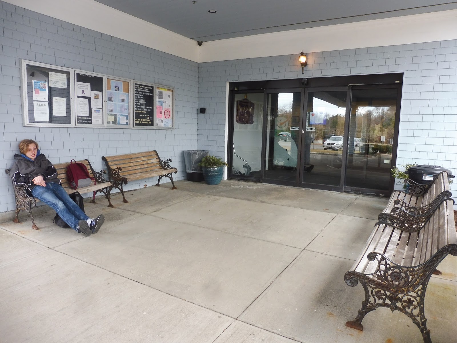
As we were running down Plymouth Street, the officer asked when the bus was leaving. “Noon,” we said. “Huh.” he said. “You might‘ve made it.” After just five minutes of driving, we pulled into the Council on Aging. We thanked the officer as he let us out, and we headed towards the front entrance. I was super thankful for the ride, but we were now incredibly early, so we just found a bench outside the building and sat down.
Under normal circumstances, Sam and I would’ve probably paced around the building as we waited, but the police car was just sitting there! I’m not sure if it was because they had nothing to do (Middleborough isn’t exactly an eventful town) or if they were making sure we didn’t do anything sketchy, but it restricted our movement to just the bench. By the time the car left, we had gotten comfortable, so I just reviewed the…uh…”bus stop.”
 |
| The only picture I got was the one where Sam was making the weird face…oh well. |
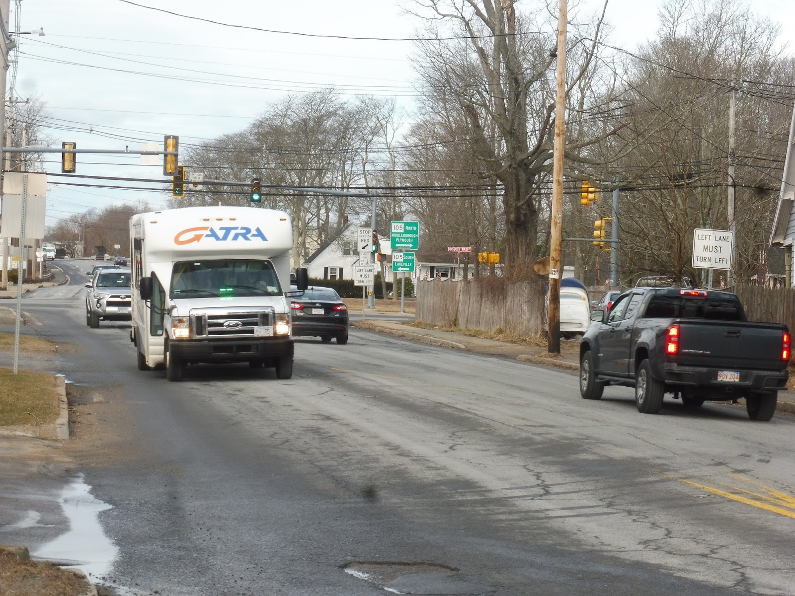
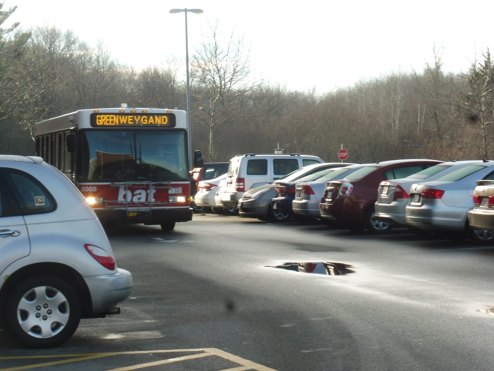
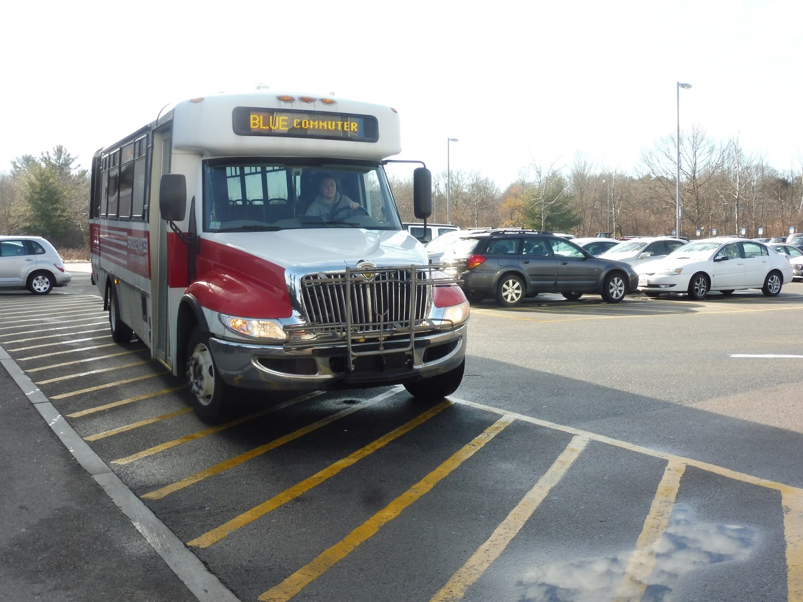
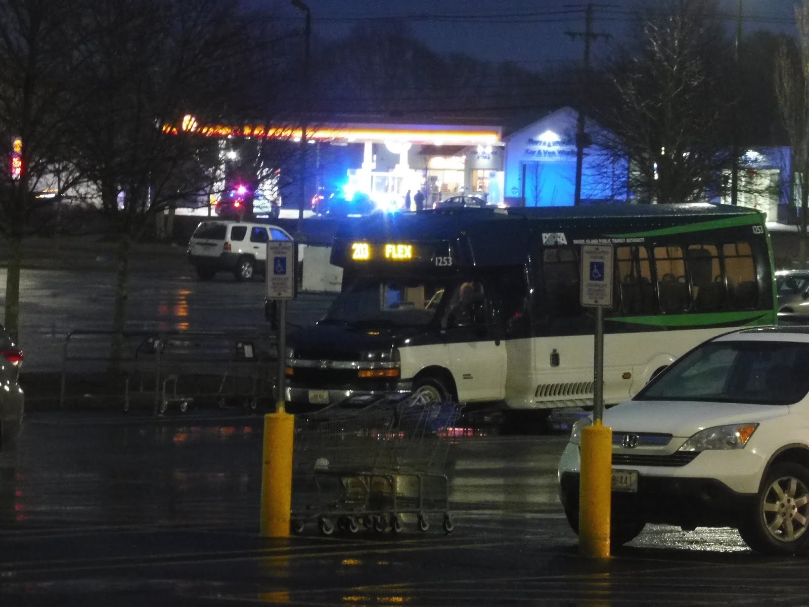
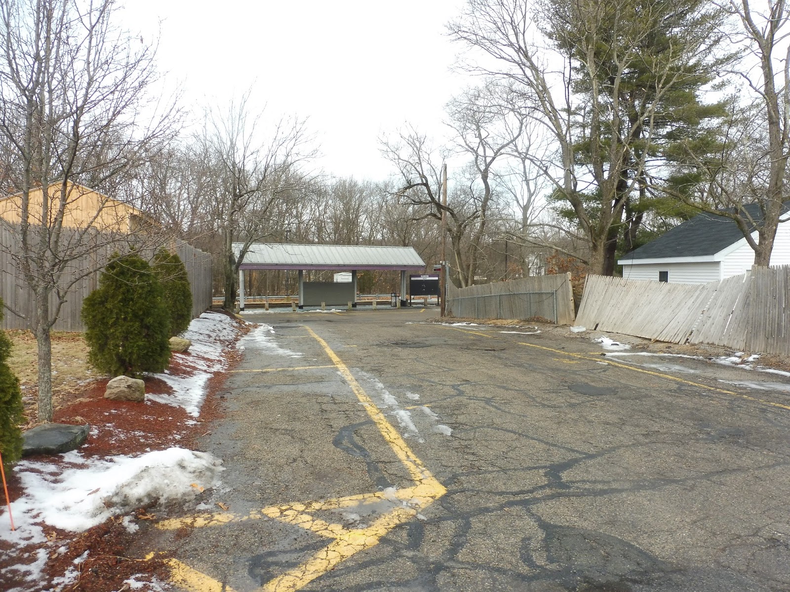
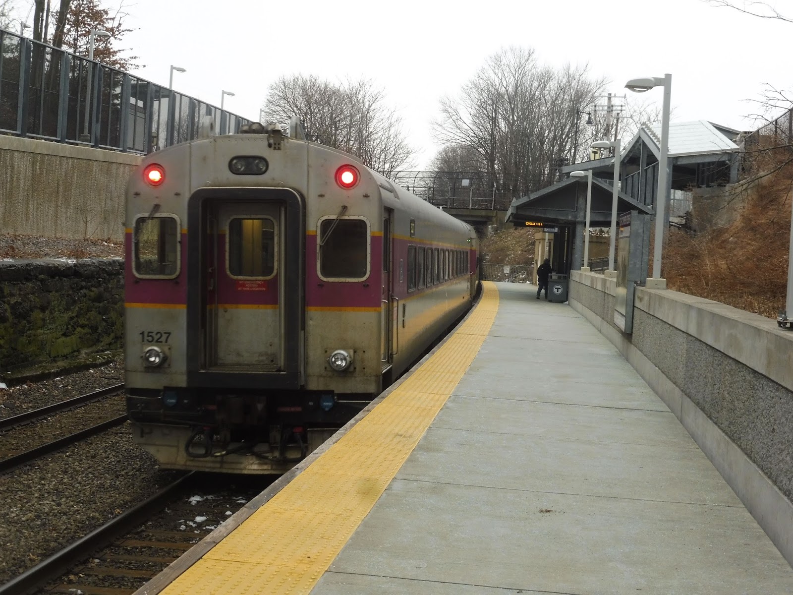
It’s funny that the Middleborough Council on Aging had better facilities than some Commuter Rail stations! I mean, the whole thing was sheltered, and there were four lovely benches at which to wait, as well as a wastebasket and some potted plants. There were tons of community flyers too, including one about the Middleborough-Taunton Connection, featuring an ancient GATRA dial-a-ride vehicle. There was one laying over right outside the building, so assuming that would be our bus, I snapped a picture of it.
 |
| Seems reasonable enough. |
I have to say, the Middleborough COA was a huge dial-a-ride hub! Those minibuses were coming in and out constantly! At one point, a driver went into the COA to drop off the fares he had earned, which were safely stored…clamped to a clipboard. Oh, GATRA…
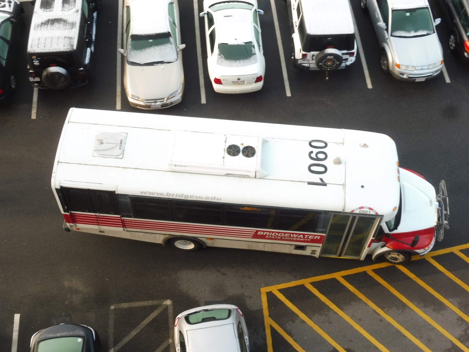
Eventually, a different kind of vehicle came in – it was just a Middleborough COA van. An old man came out and walked toward the entrance. “You must be my 12:00 out!” he said to us – so he was the driver for the route. “Oh! Is that the bus?” I asked him, pointing to the van. “Yup!” the driver said as he entered the building. Sam and I looked at each other, then looked at the van, then looked back at each other…and started laughing uncontrollably. HOW MUCH CRAZIER COULD THIS DAY GET?????
 |
| The…uh…bus? |
The driver came back out. “Okay, you guys ready? Buckle up!” he said as he opened the van doors for us. And…yeah, it was basically a van in there. The one key difference was the inclusion of, of course, a jiggly wheelchair lift. Oh boy, who needs proper buses when you can have – literally – a van with a jiggly wheelchair lift in it?! Well…after all that, at least we made it onto the vehicle.
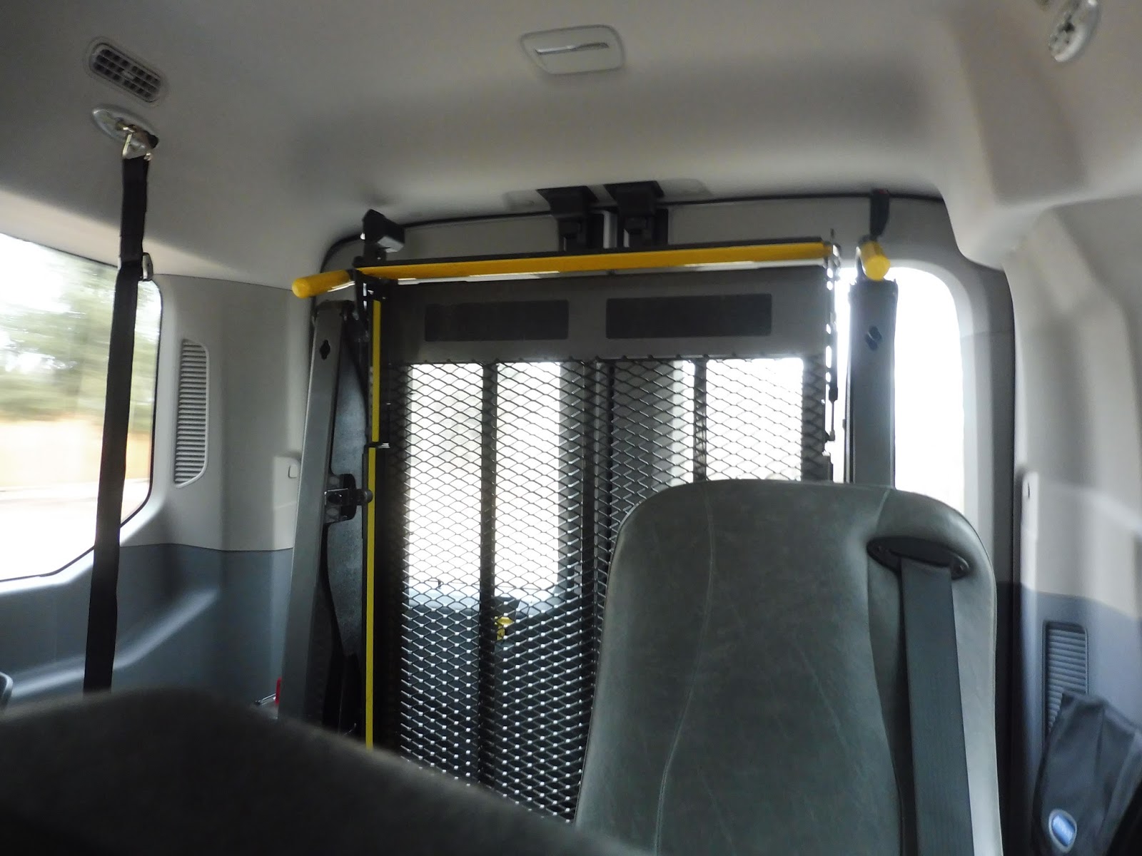 |
| There it is! |
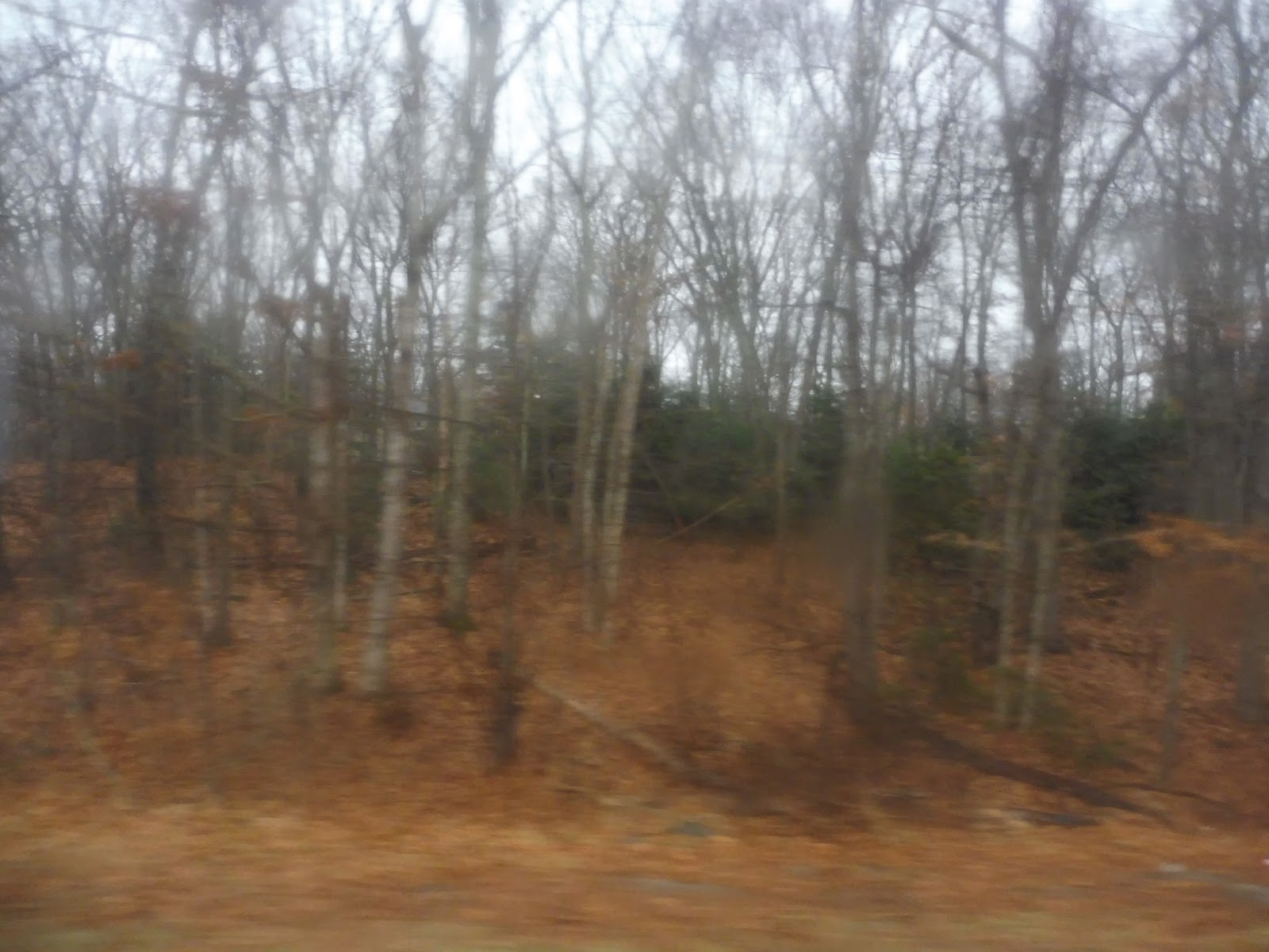
Alright, over 1500 words in, and it’s time to actually start the review! We left the COA on Plymouth Street before soon turning onto East Main Street. This was a residential road, but there were also sizeable patches of forest on certain stretches. Also, there was a place selling miniature horses, so if you want one, this is the route to ride!
 |
| Totally not sketchy at all! |
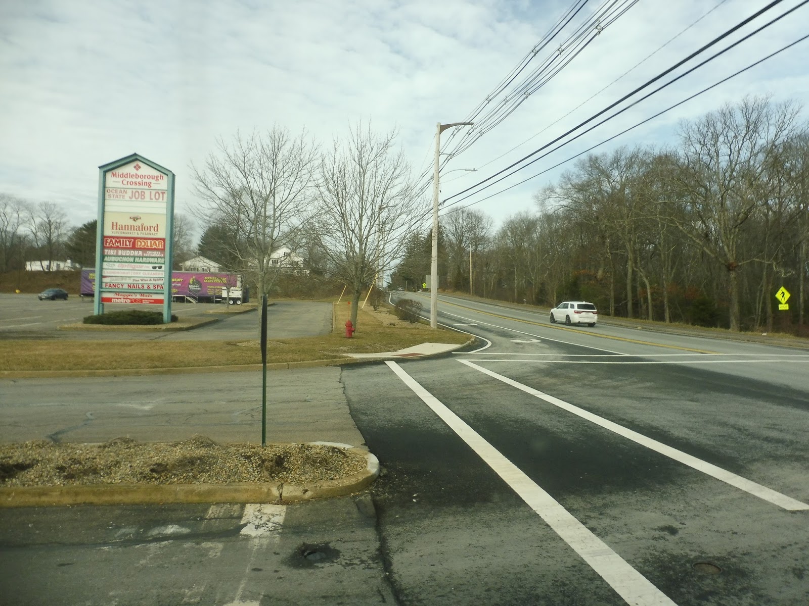
After crossing the Nemasket River, the houses started to get denser. We turned onto North Main Street, which eventually led us into downtown Middleborough. After going by its boring, bland businesses and its admittedly beautiful town hall, the street became lined with houses again. There was some suburban retail at the intersection with Grove Street, which we were supposed to turn onto, but we just kept on going. Where were we going? I-495! Express section time!!!
 |
| I just want to point out that we are currently on the highway in someone’s van. This route can’t get any weirder! |
We were only on the highway for a bit, but it was fun while it lasted – we soon took Exit 6 onto the infamous Route 44. This was a really boring road, consisting of bursts of suburban retail, then sections of woods. We passed through sections of Lakeville, Taunton, and Raynham in quick succession, but nothing along Route 44 changed.
 |
| At least the Taunton River broke things up a bit. |
After crossing Route 24, the suburban businesses were constant. Indeed, there were now a ton of shopping plazas along here, too! We also passed a small clinic that gets its own timepoint, for some reason – if you want to take the bus to “Route 44 Medical Walk-in,” you can! We entered Taunton soon after, coming up along the Taunton River. The road became Dean Street.
 |
| Can’t say I’m a big fan of the neighborhood. |
There was a mix between houses and offices, although not particularly big ones. Dean Street soon left the river, running along the lovely Church Green. Once it became Main Street, we were in downtown Taunton, running past tons of (mostly boring) businesses. Near the Taunton Green, we turned onto Court Street, which led us past some industrial buildings and a parking lot.
 |
| Going around the Green. |
We turned onto Washington Street, going over the Mill River. There were some suburban businesses along here as it became Oak Street, and finally, we reached the good ol’ Bloom Terminal. In a van. We pulled into one of the berths, and the driver opened the doors for us. “3 dollars each!” he said as he took out a ziplock bag. I don’t know why he had us pay at the end instead of at the start, but at least the ziplock bag was better than the clipboard from earlier!
 |
| That just looks so weird… |
GATRA “Route”: Middleborough-Taunton Connection
Ridership: GATRA has no ridership information for this route online, and I can only assume it’s low. I mean…our trip was just us! The woman on the phone did reference a “group” who was getting on at “Dunkin’ Donuts,” so maybe a few other people rode that day. Still, though – I’m very sure that ridership for this route is astronomically low!
Pros: NO NO NO NO NO
Cons: WHERE TO START? MAYBE I SHOULD JUST DO A BULLETED LIST…
- IT ONLY RUNS MONDAY, WEDNESDAY, AND FRIDAY
- IT ONLY HAS THREE TRIPS PER DAY
- THE ROUTE IS VARIABLE – CLEARLY, IT CHANGES BASED ON WHERE PEOPLE ARE GOING
- THE ROUTE MAP PUTS THE COA IN THE WRONG PLACE
- ON THE GATRA WEBSITE, THE ROUTE IS CALLED THE “MIDDLEBOROUGH-TAUNTON CONNECTION” IN ONE PLACE AND THE “MIDDLEBOROUGH/TAUNTON CONNECTOR” IN ANOTHER
- AT $3.00, THE FARE IS THREE TIMES THE NORMAL GATRA FARE
- IT WAS COLLECTED IN A ZIPLOCK BAG AT THE END OF THE ROUTE
- THE “BUS” WAS LITERALLY JUST A VAN
- THE DRIVER GETS PAID TO DO NOTHING IF NO ONE CALLS IN
- HECK, THE ROUTE HAS A TON OF LAYOVER TIME ANYWAY, SO IT’S STILL A LOT OF PAYING THE DRIVER TO DO NOTHING EVEN IF PEOPLE DO RIDE
- IN ORDER TO RIDE IT, YOU HAVE TO CALL THE MIDDLEBOROUGH COA BY 1 PM THE PREVIOUS BUSINESS DAY (SO YOU GOTTA CALL BY FRIDAY IF YOU’RE RIDING MONDAY)
- WHEN DOING SAID CALL, YOU HAVE TO GIVE THEM YOUR NAME, DATE OF BIRTH, ADDRESS, AND THE NAME AND PHONE NUMBER OF AN EMERGENCY CONTACT
- THIS IS LITERALLY JUST A FIXED BUS ROUTE, WHY DOES IT HAVE TO BE SO COMPLICATED TO RIDE?
- EMERGENCY CONTACT, I MEAN, REALLY??????? EGJAIGAEEGAIGGAE!!!!
GATRA: Downtown Middleborough Shuttle
I think we’ve done it: we’ve hit peak GATRA. This route, the Downtown Middleborough Shuttle, seems to do absolutely everything wrong. For example, it only serves Middleborough Station four times per day: 11:05, 12:50, 3:05, and 4:45. They time with trains, but why these specific times that don’t benefit commuters in any way? Huh, I dunno! It’s honestly one of the less confusing mysteries of this crazy route…
 |
| Here it comes! |
Because the bus didn’t time with our train, Sam and I walked to Grove Street to flag down the bus. “Where ya goin’?” the driver asked as he used his minibus lever to open the door. “We’re going to Trucchi’s.” I said. “Oh, okay,” the driver said. “Just know that it takes a while to get there, I gotta go to a bunch of places first.” Oh yeah…he wasn’t lying.
 |
| Some houses. |
We dropped our coins into the non-electronic farebox to get to the dollar fare (because come on, coins are the only true way to pay for a GATRA bus) and sat down. One of the two passengers on board, an old lady with sunglasses, turned around to look at us. “Thank goodness for the bus,” she said through a wide toothy smile. “Yup,” Sam said. Now she was just staring at us. Grinning. Sizing us up. The other passenger, an old man, turned around. “The local school must be nearby,” he said in an aggressive growl. What had we gotten ourselves into? The wheelchair lift jiggled.
 |
| A deviation, of course! |
We deviated into an ugly, dead shopping center: Middleborough Crossing. The old sunglasses lady finally stopped grinning at us to let the driver know she wanted to get off at Ocean State Job Lot. The old man got out first, and she made her way off the bus mumbling about what she was planning on buying. Awesome, now we had some time alone!
 |
| Not too many cars parked here today. |
But alas, we would get more passengers as we pulled up to Hannaford. The first was a typical GATRA old lady. The second was a man with big, bulging eyes and a mask over his nose and mouth. He stepped onto the bus with two grocery bags, then he gave us a long, hard stare with those beady eyes. We could hear his deep breaths behind the bright blue hospital mask. At some point he decided we were suitably scared, so he got off the bus to get his other two bags.
 |
| Leaving the shopping center. |
Hang on, did either of those passengers pay? No, no, they absolutely didn’t! And now that I think about it, the farebox was empty when Sam and I put our money in, so sunglasses lady and growl man didn’t pay either! Do people just not pay for this route? Gosh, I wonder what the GATRA accountants say about this money-losing mess!
 |
| An apartment development behind a laundromat. |
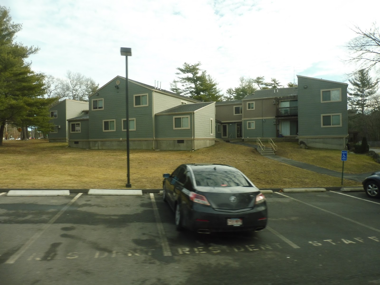
We went over the Nemasket River after returning to Grove Street, then it was mostly suburban businesses on the other side. We passed the Middleborough High School (perhaps the “local school” growl man was referring to?), then a few housing developments. Turning onto Wood Street, we then made our way into Middlebury Arms, an apartment development.
 |
| Coming into Middlebury Arms. |
The road ended with a dead-end. So, we did what any normal bus route would do: reverse into a driveway and three point turn our way back out! Coming back onto Wood Street, we were about seven minutes early, so we pulled over into the route’s…uh…layover point? I guess that’s the most professional name I can give the patch of dirt next to the road we were sitting in.
 |
| Reverse, reverse! |
A person in a passing car knew the driver, so they both opened their windows and had a screaming conversation, blocking the traffic on Wood Street. Once the woman left, the driver turned on the radio, which was playing an incomprehensible ad for the South Shore Gutter Monkeys. It was parodying something, but it made absolutely no sense! And then…”Call 911! No, just kidding, call [actual number].” Geez, come on, that’s not okay!
 |
| An auto shop. |
Finally, we pulled out of the dirt patch and headed back the way we came on Grove Street. We went over the Nemasket River again and passed Middleborough Crossing without deviating. Also, the actual radio station came on here: “Welcome to the feel-good station, playing hits from when you were growing up!” Uh-oh…cue the absolute cheesiest 70s and 80s music you’ve ever heard. “Lonely Boy,” by Andrew Gold, anyone?
 |
| Okay, that’s an awesome town hall! |
There were some suburban businesses at Main Street, onto which we turned. It was residential for a bit, but we soon arrived at Middleborough Town Hall, marking the beginning of downtown Middleborough…except we turned onto Webster Street before reaching the thick of things, because we had a deviation to do!
 |
| Heading onto Webster Street. |
There were dense houses along here, and they continued as we turned onto Benton Street. We then turned onto Spencer Street, taking us down a hill to the Riverview Apartments. Using a roundabout within the development to turn around, we pulled over, and…oh, we’re three minutes early, so we have to wait? Sigh…
 |
| One of the apartments, with regular houses in the background. |
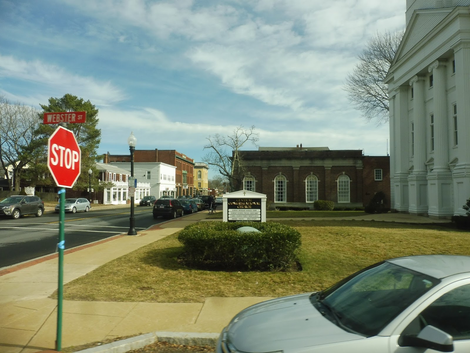
We finally pulled out of there, making our way onto Wareham Street. As it became Center Street, it took us into downtown Middleborough proper, which was a very…lifeless place. Everything about it was bland and dead. We turned onto Oak Street next, going by houses and a small hospital.
 |
| Woooooo! Downtown Middleborough!! |
We turned onto Maple Ave, then Maddigan Way, which was an apartment development. As we made our way down to Sproat Street, we entered a different apartment development, Nemasket Apartments. From there, we made our way onto Forest Street, although the route was supposed to return on Oak Street. Mask guy got off along here, and it took forever because he had to get his four bags out of the bus, while also staring at us the whole time. I was overjoyed to see him go, and I took solace in the fact that I would never have to be stared at by him ever again.
 |
| Coming off of Forest Street. |
We turned onto Center Street, and for the first time on the route, we were actually going somewhere without deviating! The road went over some freight and Commuter Rail train tracks, then we were in a mostly residential area. It was all houses, aside from Middleborough’s Central Cemetery. As the road made a southerly curve, it became Anderson Ave.
 |
| Finally, I was getting deviation withdrawal! |
We turned onto North Grove Street in order to serve…gosh, I don’t even know. The street just had sparse houses along it. We did a sharp turn around onto Grove Street proper, and there were a few…landscaping businesses there. Is that what GATRA’s trying to serve with this jog? There was a section of mostly woods after that, mixed in with a few suburban businesses, including two vape shops, apparently!
 |
| A very flashy diner. |
Near a State Police station, we passed a scheduled timepoint: Acorn Hill. I guess this is what we were serving? Doesn’t look like much to me! There were some suburban businesses as we went through an intersection with Anderson Ave, and then we pulled into Trucchi’s. Wait, hang on, we were supposed to go past it to deviate to Southeast Health Center! We’re not doing that, huh? Alright, then…last stop, Trucchi’s.
 |
| Give us a wave! |
GATRA Route: Downtown Middleborough Shuttle
Ridership: This route averages 46 riders per weekday, and based on what we saw, not one of them is under 65! The route gets about 5 passengers per hour, and since the route runs every hour, that means every 5 passengers per round trip. Pretty bad…
Pros: Well, I’ll say this: people are at least using it. It serves a purpose within the community. Sort of. And the every hour, weekdays only schedule is fine.
Cons: It’s sooooooo bad! It does almost everything wrong: it serves the Commuter Rail station at random times, the time given between timepoints changes on certain trips, the route is insanely deviatory, it doesn’t go the route it’s supposed to go, it costs $15.22 per passenger to run, it’s early everywhere so it has to wait, it has a 3.3% farebox recovery ratio, but it’s probably more like 0% because the passengers don’t pay (and are really creepy), and the route gets just 5 passengers per hour! WHAT DOES THIS THING DO RIGHT???
Nearby and Noteworthy: I have to say, Trucchi’s was the most GATRA supermarket I’ve ever been in. Just like on the bus, there was no one, worker or customer, under 65 in there!
Final Verdict: 1/10
There aren’t too many cases where I would say this, but come on – just replace this thing with dial-a-ride service. Everyone who rides it fits the requirements to ride GATRA’s dial-a-ride buses, and they’d probably get where they’re going a heck of a lot faster than on this route! The one problem is that dial-a-ride fares are $1.25 instead of a dollar, and, presumably, people would actually have to pay it. But I guess if GATRA wants to keep this free loop running around, that’s up to them.
Latest MBTA News: Service Updates
If you think this route was crazy, just wait until our next GATRA route tomorrow. It blows this one out of the water!!!
Bridgewater
The original Bridgewater station was closer to downtown, but I actually like the Old Colony placement more! Yes, you heard me: the Old Colony station is in a better location than the original. That’s because this stop now serves Bridgewater State University, and it’s right there.
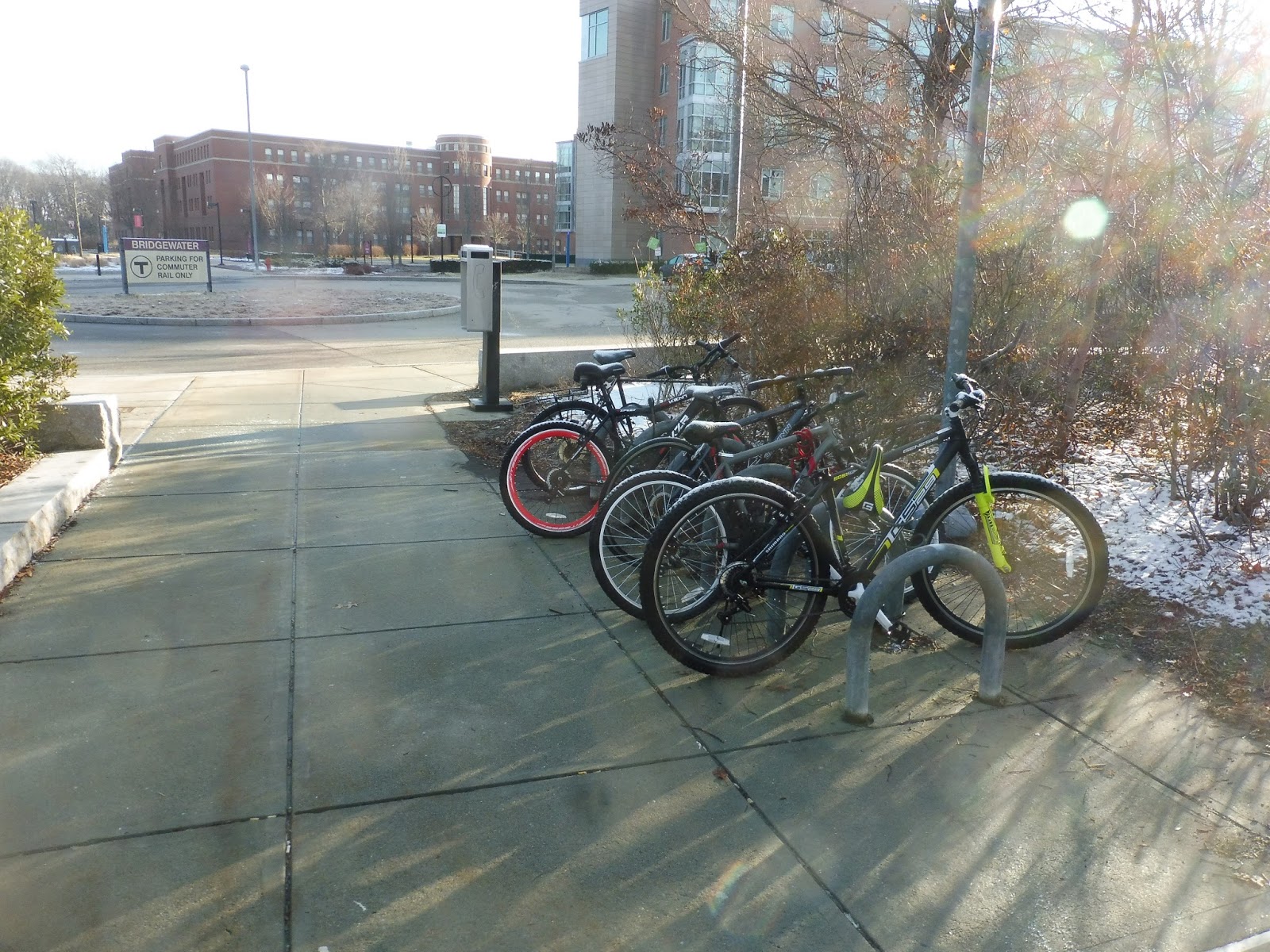 |
| Our first entrance. |
Bridgewater Station features four pedestrian entrances. The first one is at a little roundabout on the western edge of the station, and it has a payphone and some bike spaces. The other three are simple stairs or ramps leading from the parking lot. The easternmost one also has some more bike spaces, adding up to a total of 24.
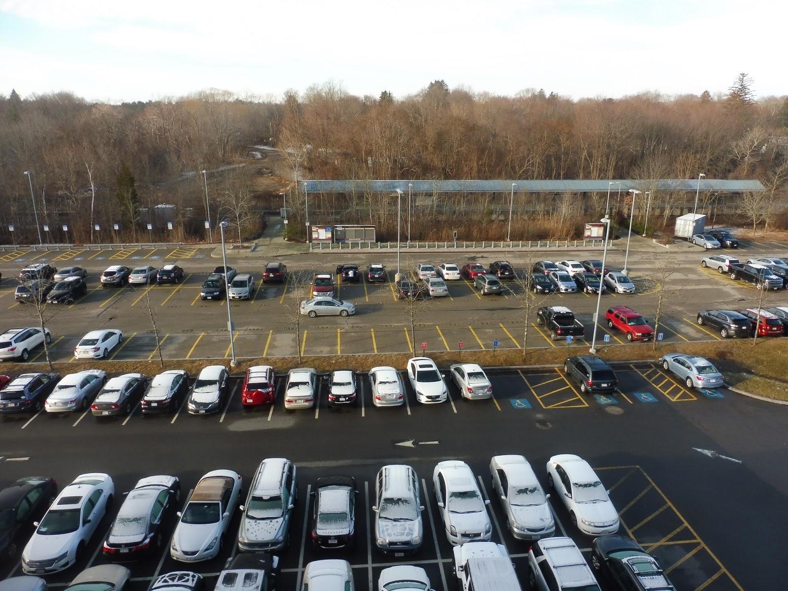 |
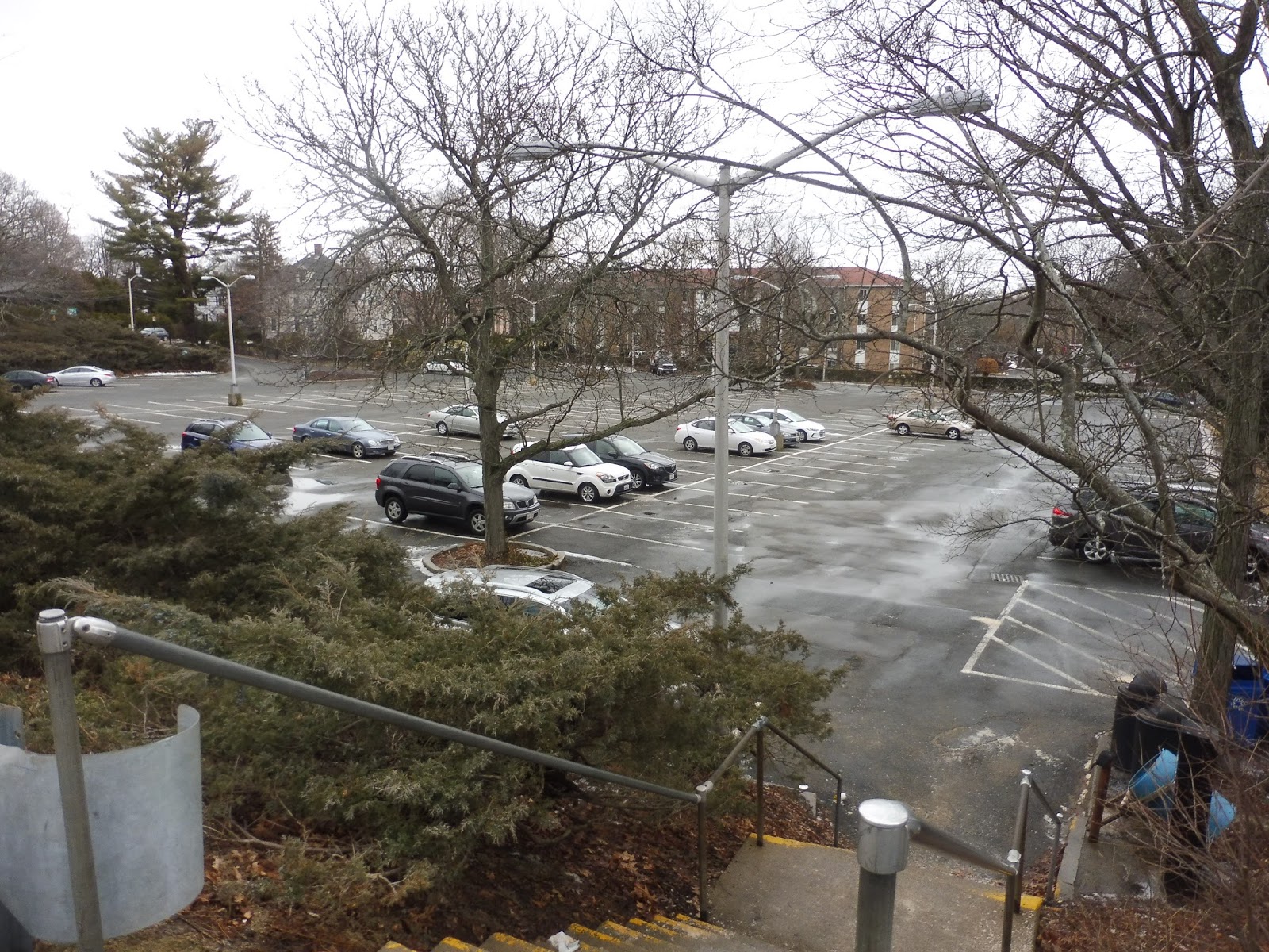
| The parking lot…from above. |
It’s an Old Colony station, so of course the parking lot is huge – it has 504 spaces. It can’t be seen in this picture, but I appreciate how the central entrance from the station has a sidewalk going straight across the parking lot, so it’s easier for pedestrians to get into the university. There’s a garage right nearby (from which I took the photo), but I believe it’s only for BSU purposes.
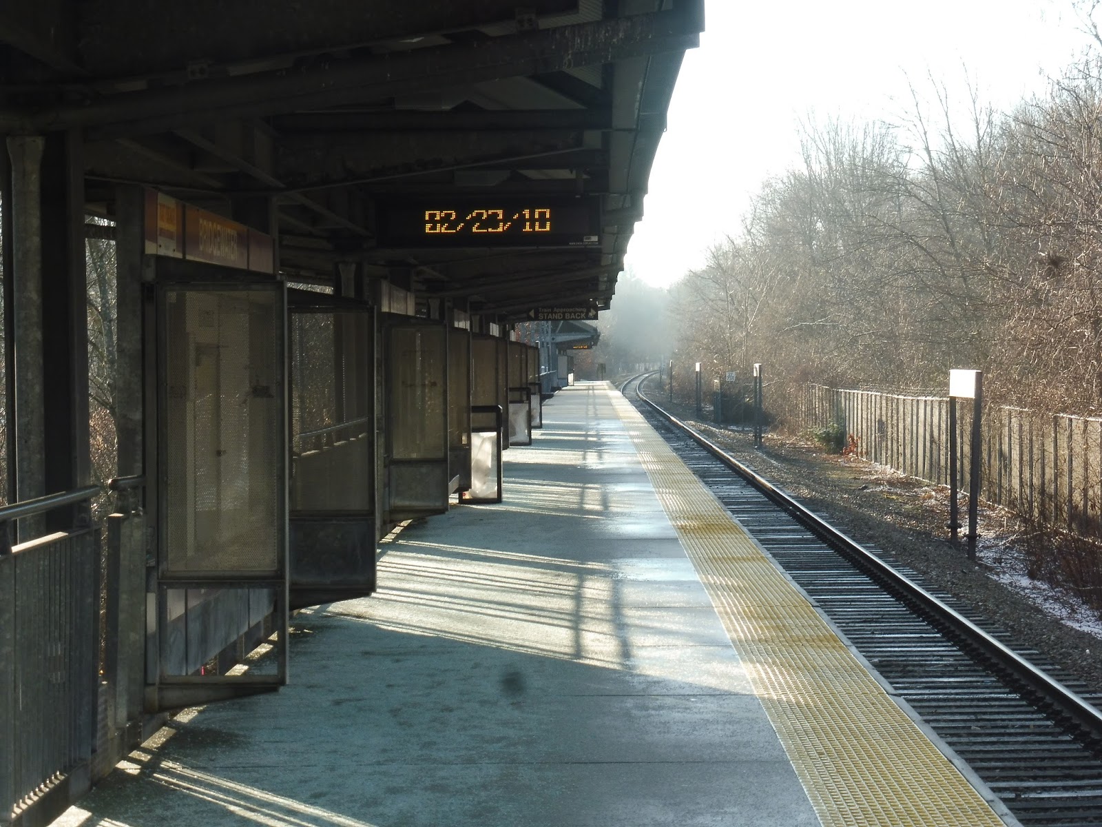 |
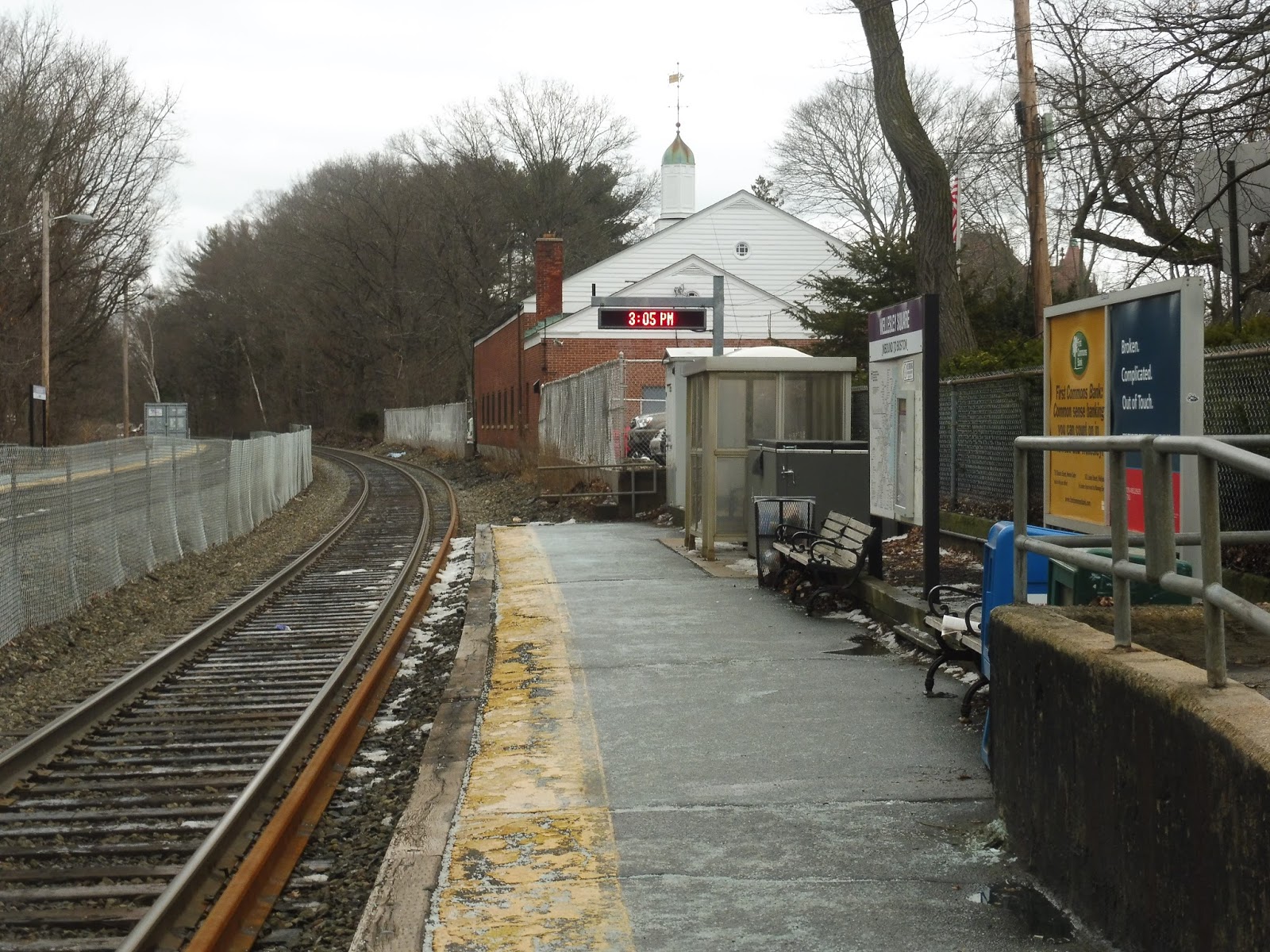
| On the platform. |
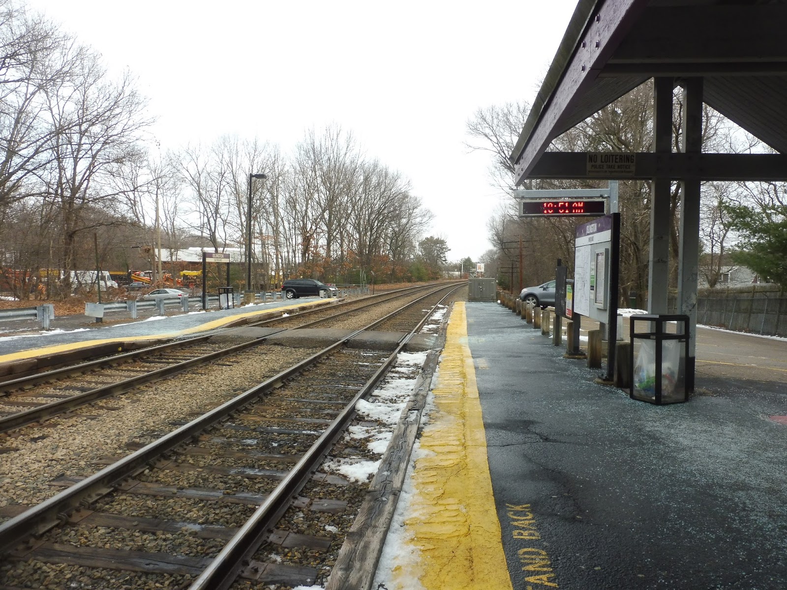
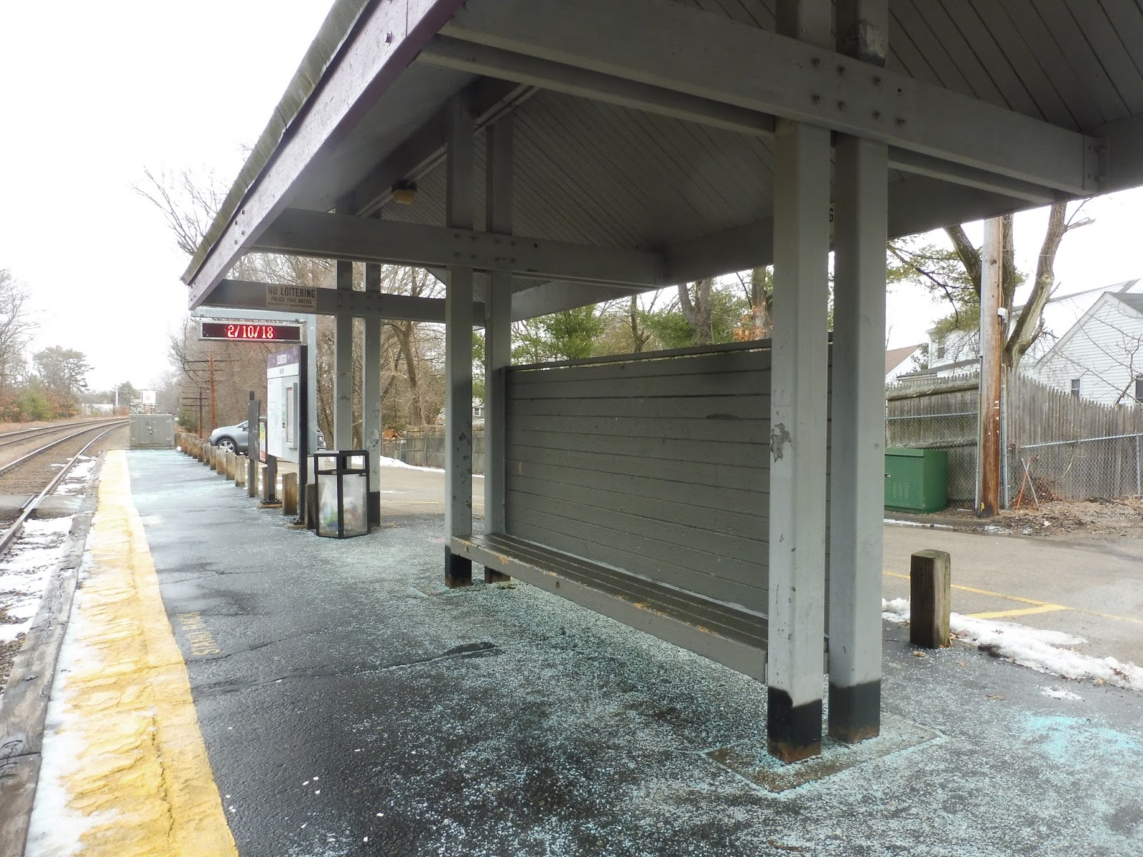
This is an Old Colony platform, so there isn’t much to say, but I do like it. The Bridgewater platform has two shelters on separate sides of the station, which is great. Both of them have essentially the same things underneath: benches, wastebaskets, information, and screens. Great!
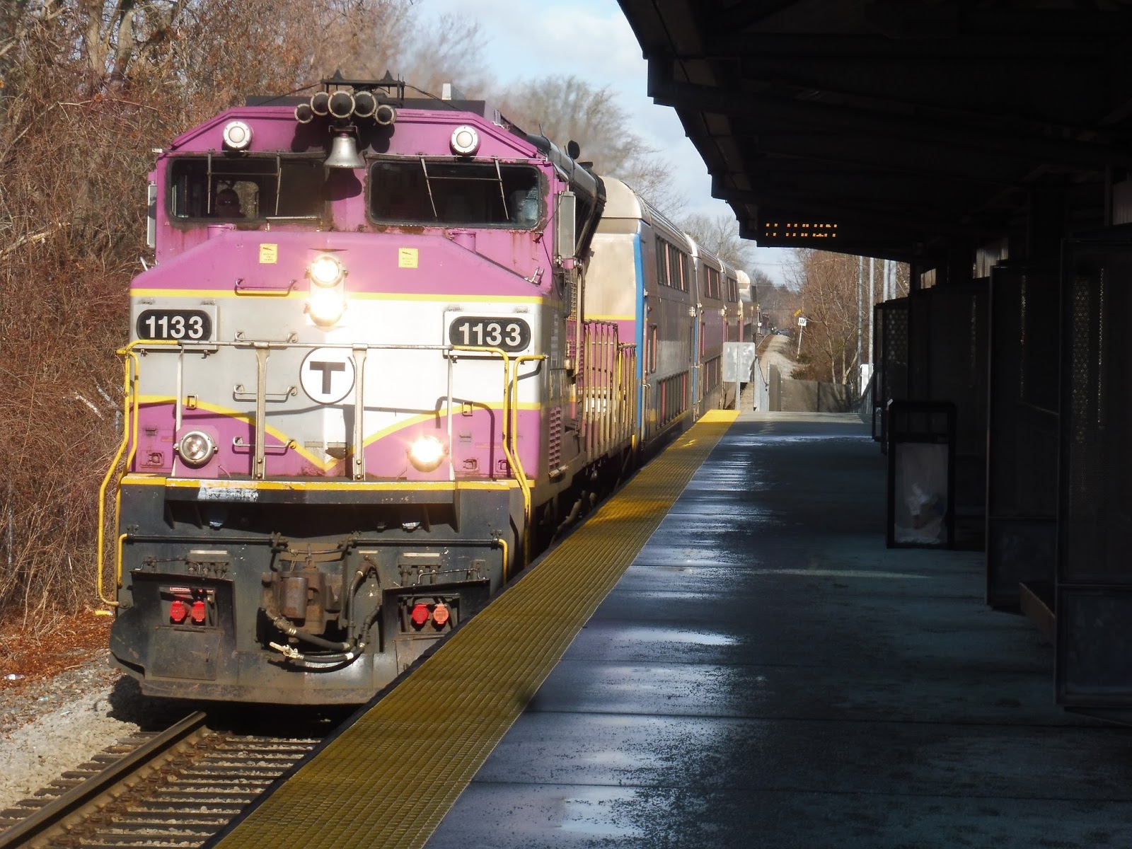 |
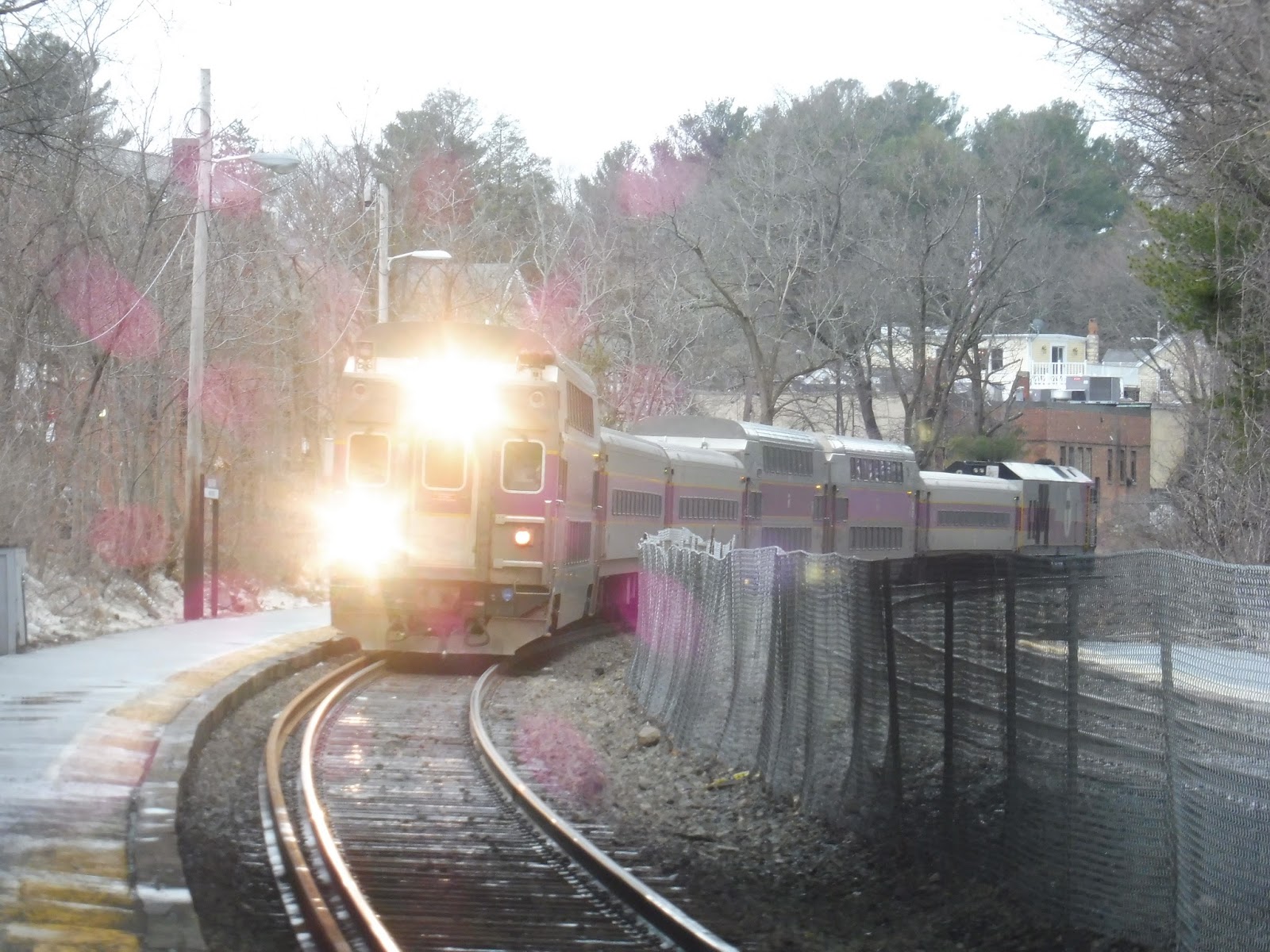
| On to Middleborough! |
Station: Bridgewater
Ridership: It’s huge! With 1,036 inbound riders per weekday, this is the busiest station on the Middleborough Line and the 20th most-used station on the Commuter Rail.
Pros: It has all of the Old Colony amenities you would want (plus a second shelter!), including a high-level platform and a big parking lot. However, Bridgewater goes above and beyond that with its location. Yes, we’re right in the Bridgewater State University campus, and thanks to fantastic pedestrian paths, practically anywhere on campus is walkable. If not, there’s always the BSU Shuttle!
Cons: The station got so wrapped up in serving the university that it totally forgot about the residential neighborhoods to the south! Now, granted, this isn’t Anderson/Woburn – people in those houses only have to walk about ten minutes to get to the station. But seeing as it’s right there, a direct path would cut the walk down by a huge amount!
Nearby and Noteworthy: BSU, of course! Bridgewater Center is also rather nice – it’s a fifteen-minute walk away.
Final Verdict: 8/10
This is a great Old Colony station, and just a flat-out great station. It has a totally high-level platform and it’s very convenient for students at BSU. It’s too bad there’s no access from the south, but creating it would require a lot of infrastructure for not too many riders – they only have to walk ten minutes to get to the station, anyway.
Latest MBTA News: Service Updates
BAT: BSU Service (Bridgewater State University)
Since BAT labels its free student-run Bridgewater State University shuttle service as one route, I guess I’ll have to review its lines in one post! Although to show how much BAT itself cares about the service, that link on the BAT website has outdated information – this is where everything is up-to-date.
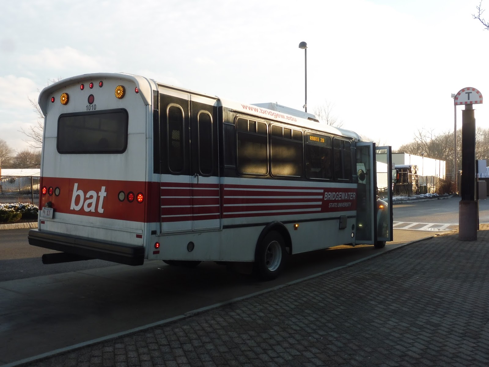 |
| Oh no, don’t tell me this is a system of truck minibuses! |
Route 28 (Express to/from BAT Centre): We begin with the university’s only numbered service, a route that runs from Brockton down to BSU. Sam and I boarded the bus at its own special T berth in the BAT Centre, and we departed down Montello Street. This closely paralleled the Commuter Rail tracks, and it had some hardcore industry on that side, while the other side had dense houses. Interestingly, no other BAT routes travel down this road.
 |
| Okay, it’s no surprise why that’s the case. |
The street basically darted between residential and industrial sections, all the way until Keith Park. Here, we turned onto Plain Street along the south side of the park, then we went onto Main Street, joining up with the 2. This street was a smorgasbord of stuff, including suburban businesses, houses, some huge apartment buildings, and the BAT bus yard.
 |
| Coming onto Main Street. |
Suburban businesses eventually became the primary buildings along Main Street, and we passed some of the most decrepit and abandoned-looking shopping malls I’ve ever seen. The route actually used to begin at one of these shopping centers, and Brockton-bound riders would be forced to transfer to the 2! Good thing that’s not the case anymore.
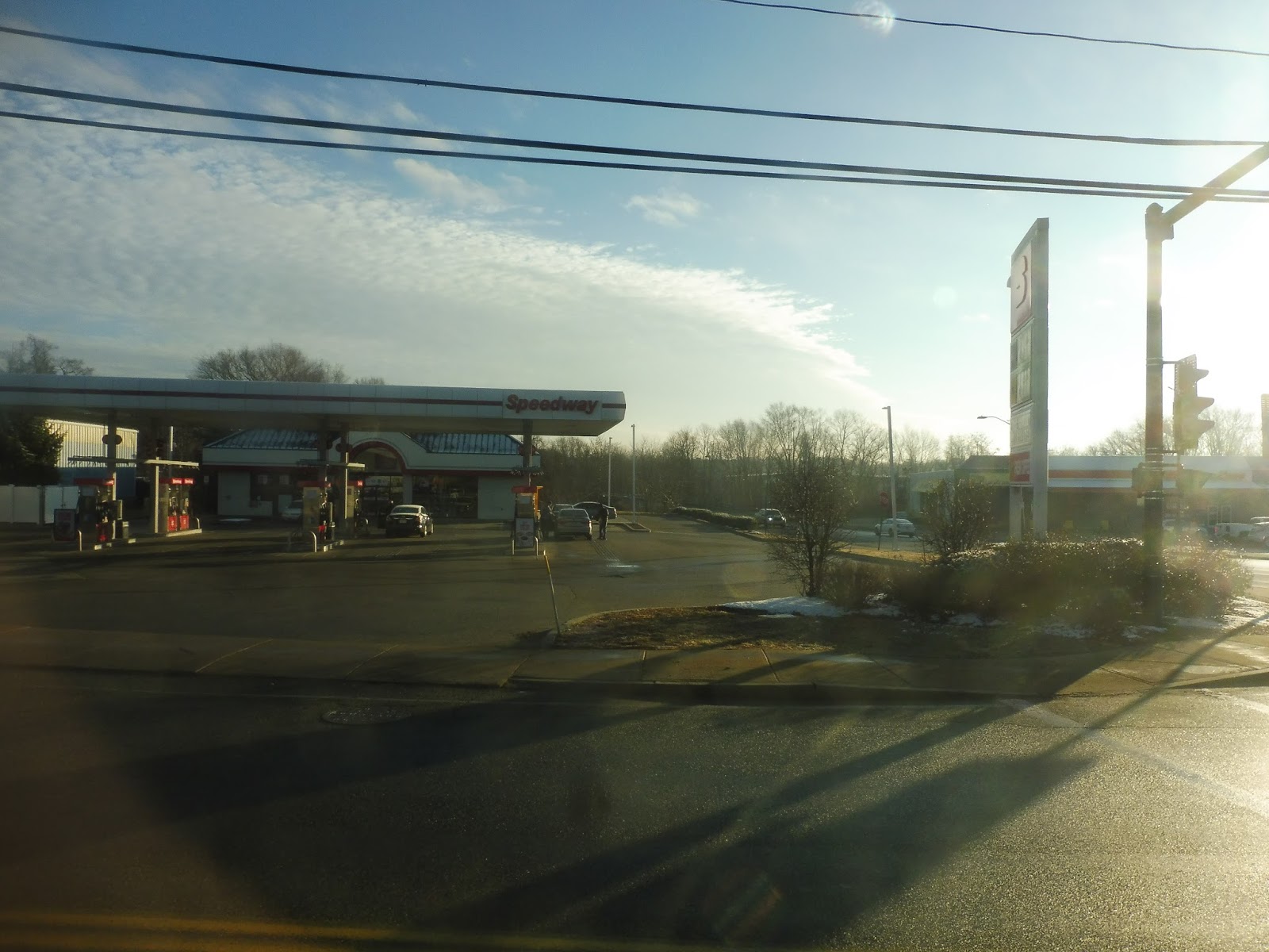 |
| A gas station. |
We continued beyond the terminus of the 2, entering West Bridgewater. There was a clear drop in development over the border – although suburban businesses still showed up in droves, there were no cross streets, and it was just forest beyond North Main Street. We eventually passed a cemetery and a solar farm, after which it briefly got residential with some proper woodsy sections.
 |
| The sun rises over the trees! |
West Bridgewater Center wasn’t much: there were just some chain businesses with parking lots surrounding a pretty inaccessible “common.” We made our way onto South Main Street here, crossing the Town River and going by mostly houses with a few industrial buildings in there. Eventually, we entered Bridgewater proper.
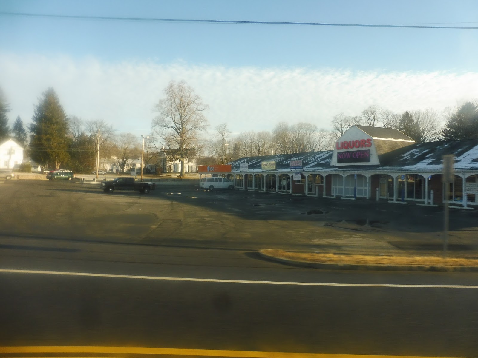 |
| Liquors! Now open! |
After lots of houses, we arrived at Bridgewater Center, which was much better than its western counterpart! There was a pedestrian-friendly common here, and it was surrounded by some nice businesses in charming buildings. We turned onto Central Square, which went around the common.
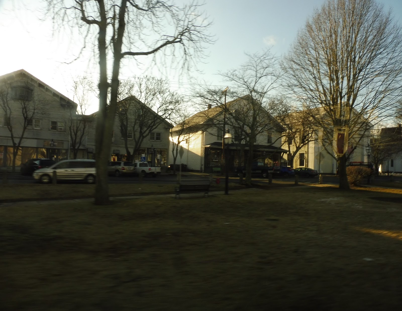 |
| Heading along the common! |
We turned onto School Street next, and that took us straight into the BSU campus. We made a stop at the Art Center, then we looped around a green to the second and final stop, Harrington Hall. Oh…or we could skip Harrington Hall entirely, instead turning onto Summer Street, then Plymouth Street, then Burrill Avenue, making our final stop at Hart Hall. Okay…I guess that works too?
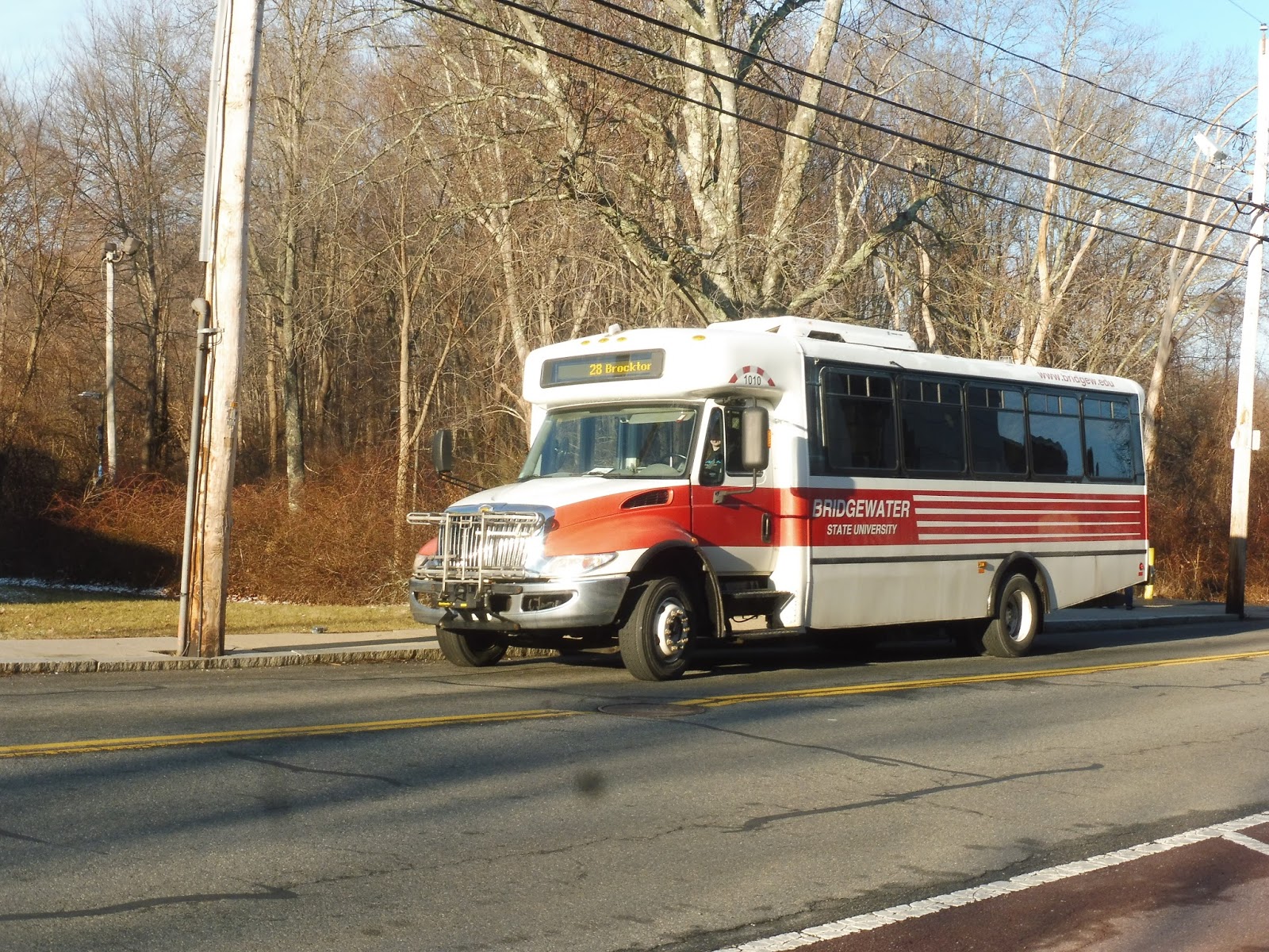 |
| Interesting place to end. |
BSU Route: Route 28 (Express to/from BAT Centre)
Ridership: My ride got about 10 people, which isn’t huge, but people are definitely using the service.
Pros: This is a fast connection to Brockton – it only takes about 20 minutes. And sure, the Commuter Rail takes 12, but this bus is free! It only runs five times a day, but I honestly don’t think it needs to come much more often than that.
Cons: The NextBus data for this route is really out of date. It has the bus only going as far as that shopping center just over the Brockton line, and it doesn’t mention anything about going to Hart Hall. Was that supposed to happen?
Nearby and Noteworthy: Brockton, of course – not that anyone who isn’t at BSU has much reason to take this there.
Driver’s Radio Preference: Top 40
Final Verdict: 7/10
This is a quick free shuttle for anyone coming from or going to Brockton. My guess is that the departure times reflect commuting patterns for students, and the bus would probably run empty if it ran more often. Its only big issue is the outdated NextBus data.
 |
| Hey, a proper bus! |
Green Line (East/West Connection): Next, we move onto the Green Line, which begins at Bridgewater Station and the parking garage for commuters next to it. We looped around onto Great Hill Drive from there, running through a bit of forest until a few buildings with parking lots. We turned onto Burrill Ave next, passing a few dorms – we did a deviation into one of them. However, we didn’t deviate into Miles Hall, so honestly, I should just give this route a 1/10!
 |
| Some of the dorms. |
We turned onto Hooper Street, passing Burnell Hall and a commuter lot. It was a left on the residential Plymouth Street after that, then we crossed the Commuter Rail track (with a painfully long railroad stop). From there, we turned onto Summer Street, and completed the route by looping around Boyden Hall, with stops at Harrington Hall and the Art Center.
 |
| Time for another trip back. |
BSU Route: Green Line (East/West Connection)
Ridership: My ride only got two people, but I saw another bus on the line that had a full-seated load. It was prime commute time, though, so I wonder what it’s like middays, for example.
Pros: Well, at least at rush hour, people do seem to use this thing! It runs about every 10-15 minutes from 7:15 AM to 7:00 PM, supposedly.
Cons: The problem is that it could be replaced by the “Red Line” at any point – we’ll get to that later. No, the other thing about the Green Line is that it’s kinda useless unless you’re really lazy. Thanks to BSU’s network of pedestrian paths, the furthest possible distance on the route is only about a 15 minute walk. That means that if you just miss a bus, it’s faster to hoof it!
Nearby and Noteworthy: Miles Hall, of course – duh!!
Driver’s Radio Preference: Soft Rock
Final Verdict: 4/10
I was wary of giving this route any higher than that. Sure, it gets used by commuters during rush hour, but it’s kinda useless for campus transportation unless you’re lazy. Everyone I’ve talked to who went or goes to BSU have said that they rarely, if ever, use the shuttle. Not to mention it’s unreliable, since it could be changed to a different routing at a moment’s notice. Gosh, maybe a 4 is too high…
 |
| The Blue Line bus…from above. This is on the other end of the route, but it’s better than the photo I got at the Art Center. |
Blue Line (Commuter Express): That’s a misleading name. Indeed, this “express” is the more annoyingly deviation-filled route on campus. We began it by heading out from the Art Center, turning onto Summer Street, and merging onto Plymouth Street. We were lucky because we were going eastbound, but the westbound route does a really long deviation just to serve a parking lot within a three minute walk of the main road. That deviation also comes really close to a mall, but for some reason it has no stop for it!
 |
| Looking down Spring Street. |
Plymouth Street became mostly residential past there, but once we arrived at a big football stadium, we turned onto an access road. This was a deviation to the Tinsley Center, where we looped around and headed straight back up. It was back onto Plymouth Street, where we went by a baseball field and some more houses. Next, we turned onto Great Hill Drive, which took a longgggggg, windy trip through the woods until we arrived at the Commuter Rail station.
 |
| In the parking lot. |
BSU Route: Blue Line (Commuter Express)
Ridership: My trip got two people, and I wasn’t able to see what other ones got, unfortunately.
Pros: Hey, the Athletic and Tinsley Centers are actually kinda far, so I can see how this route would be useful for those. However…
Cons: The longest possible distance on this route is an 18 minute walk. The route runs “every 15-20 minutes.” So again, if you’ve just missed a bus, it’s faster just to walk (it didn’t help that our driver was really slow…)! Also, why does this route bother to serve the Commuter Rail station? The Green Line already covers it, and the Blue Line could be much more frequent to its unique sections if it didn’t take that long trip there. Finally, that mall on the westbound Spring Street Lot deviation is legitimately far from everything else, and all that would need to be done is adding an additional stop on that deviation!
Nearby and Noteworthy: People mostly use this to get to the Athletic and Tinsley Centers, I imagine.
Driver’s Radio Preference: Country
Final Verdict: 3/10
This route has a lot of improvements that could be made to make it more frequent and useful. Eliminate the Commuter Rail section, run the shorter route more frequently, and add a stop on the Spring Street deviation for that mall. Also, this route can be replaced by the Red Line at any time, which is annoying! Speaking of which…
Red Line: Okay, so I didn’t actually get to ride the Red Line, but I can at least talk about it. The route is a combination of the Green and Blue Lines, doing every single one of their deviations. It comes every 15-20 minutes, and it runs…”as needed.” Okay, that’s vague. Based on a few inspections of the system at various times of day, the Red Line will just randomly replace Green and Blue Line service! Why can’t it just have set times, say, middays, while the lines run separately during rush hours? This whole “as needed” business just makes the system more complicated and unpredictable than it has to be.
Gold Line: There are a lot of routes for such a small campus, huh? The Gold Line is the only route that runs nights, from 7:00 PM to 2:00 AM. It’s also the only route that runs on weekends, but only during those nighttime hours. It’s similar to the Red Line, but it uses two buses (thus running every 10-15 minutes), and it has a few on-demand locations that can be requested by calling a number. I appreciate that these deviations can be done spontaneously, since that’s probably how most decisions are made by college students at 2 in the morning!
Overall, this all feels like a “courtesy” system more than anything. Most of the destinations these shuttles serve are within easy walking distance from each other, but these buses are here as a courtesy to those who are unable to easily get between them…or those who are lazy. I think it’s overly complex considering how many destinations it serves, but it is nice that the buses are student-run. Still, this system isn’t too useful, and it’s WAY too complicated for its own good. I’m going to have to give it a 3/10.
Wickford Junction
The MBTA has made many mistakes over the years. Wickford Junction is one of them.
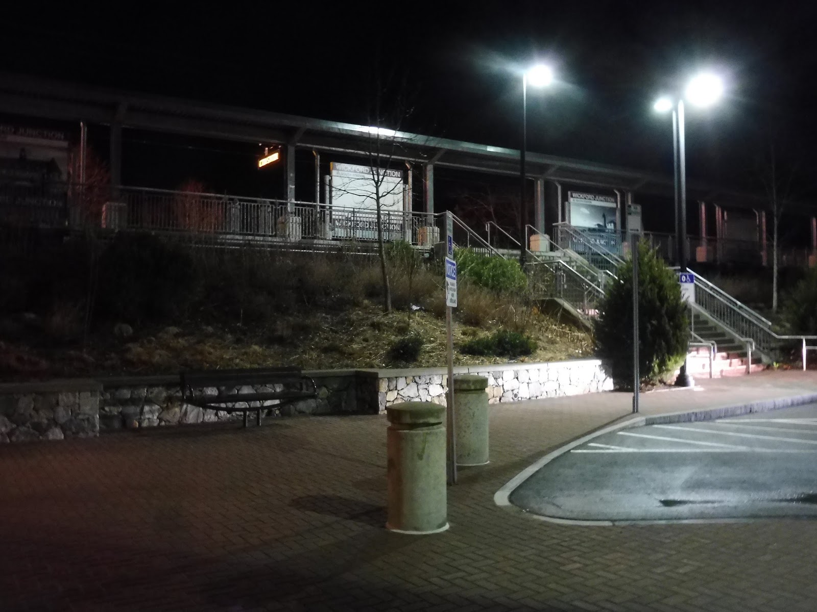
 |
| We begin with the busway. |
Throughout this review, we’ll be talking about the various ways Rhode Island has tried to make this waste of a station into something that comes even close to its ridership projections. Here’s the first one: RIPTA abandoned one of its park-and-rides to reroute all of the area routes to Wickford. Thus, the 62, 65x, and 66 all deviate into the busway here.
 |
| Odd! |
The busway itself is fine – it’s just a few benches and…wait, this sign is interesting. They have a normal RIPTA sign, but they just threw an MBTA-style sign above it! Hey, did you know that MBTA Commuter Rail monthly passes are valid for free travel on the bus routes that come here? That’s Failed Ridership Booster #2!
 |
| Stairs up to the platform. |
There’s a line of parking spaces right along the platform in the loop area outside the station. I’m not sure if they’re any different from the ones in the garage, but they’re here. From these spaces, there’s a simple staircase up to the platform, as well as a ramp that takes a loopy route to get up there.
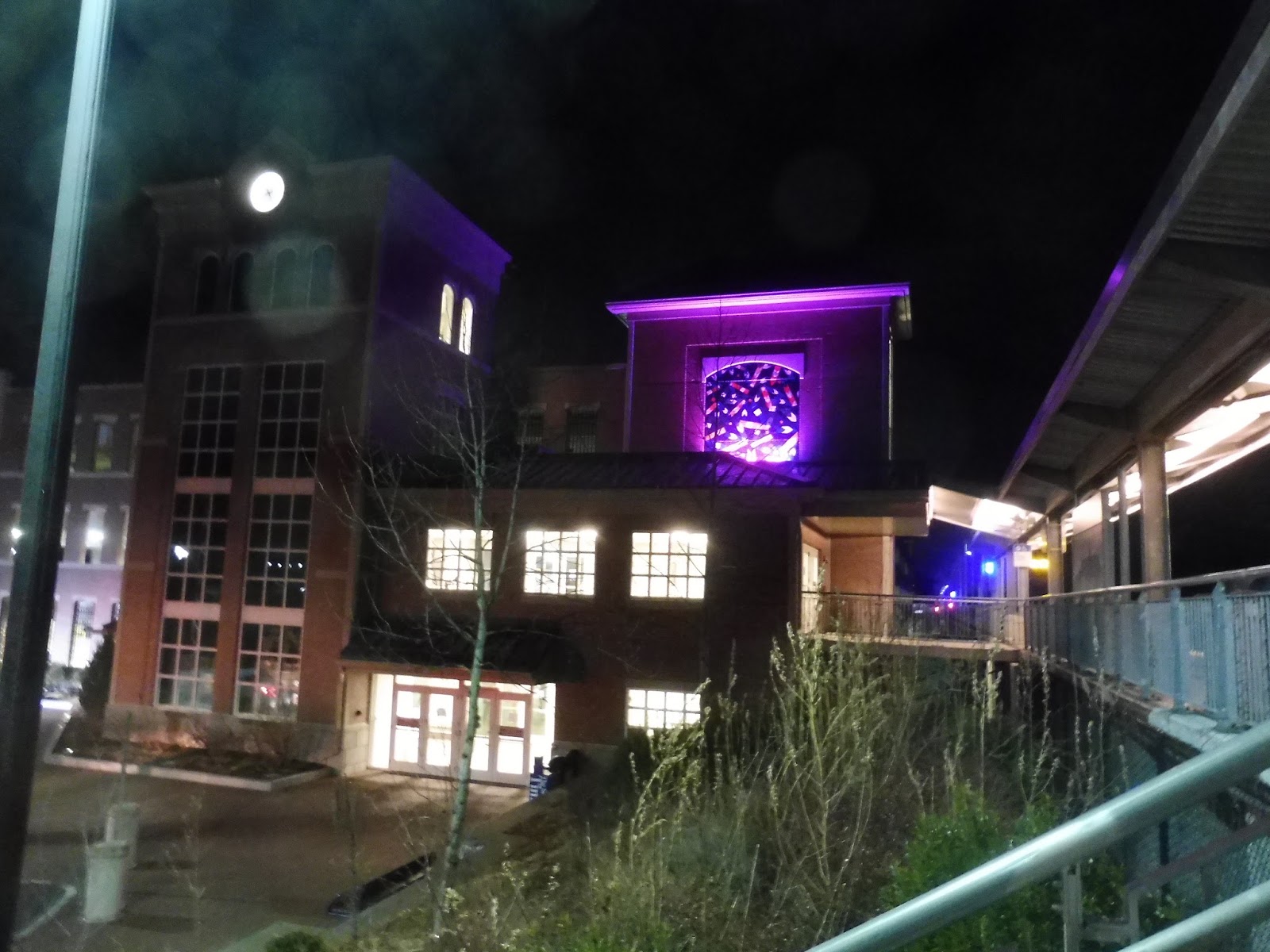 |
| Looking over at the building. |
Well, for a modern station, this is an awesome building! It still has a good amount of character, what with its clocktower and an art piece on a second tower. I don’t know what the art is supposed to be, but hey, it was nicely lit up at night – I can’t complain.
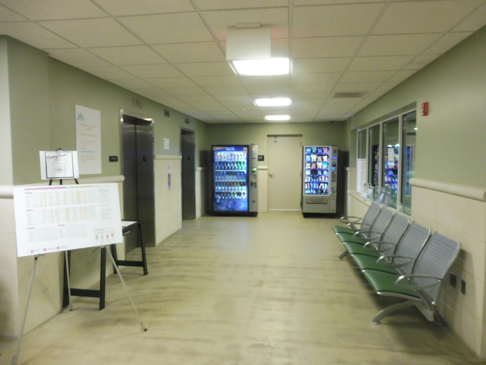 |
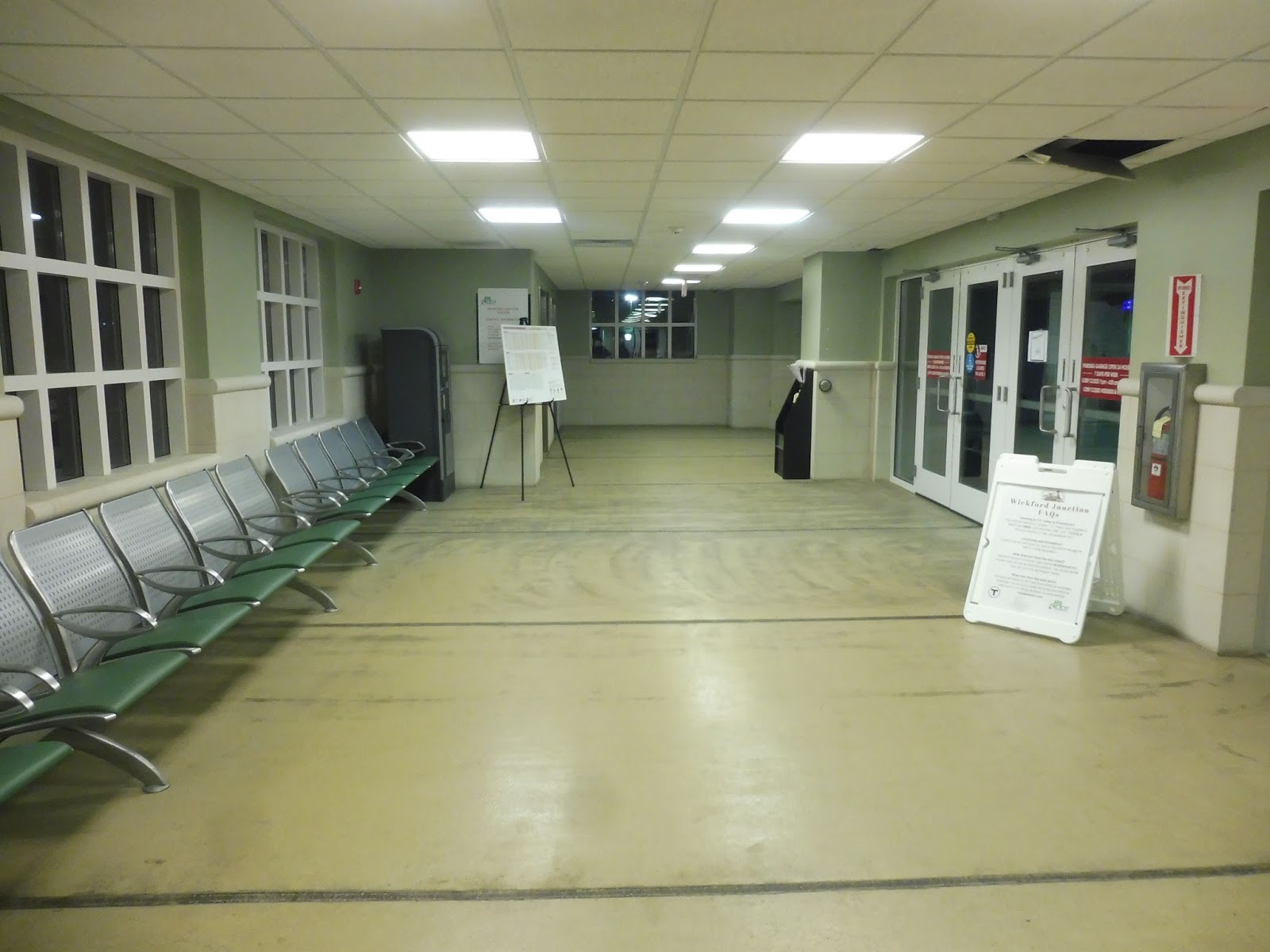
| Inside the waiting room. |
Wickford has a full-time waiting room whenever trains are running, which is awesome. The ground floor gets a few airport-style seats, a posted train timetable, and paper schedules for the RIPTA routes that serve the stop. There are vending machines, too – let’s take a closer look at those.
 |
| Woah, woah, woah, WHAT?? |
Like all normal people do, I thought I would check the expiration dates on the vending machine items to see how often they were being purchased. And…wow, they were very close to their expiration dates! How long could these snack items have possibly been in here? How often are these vending machines used??? How often is this station used?????
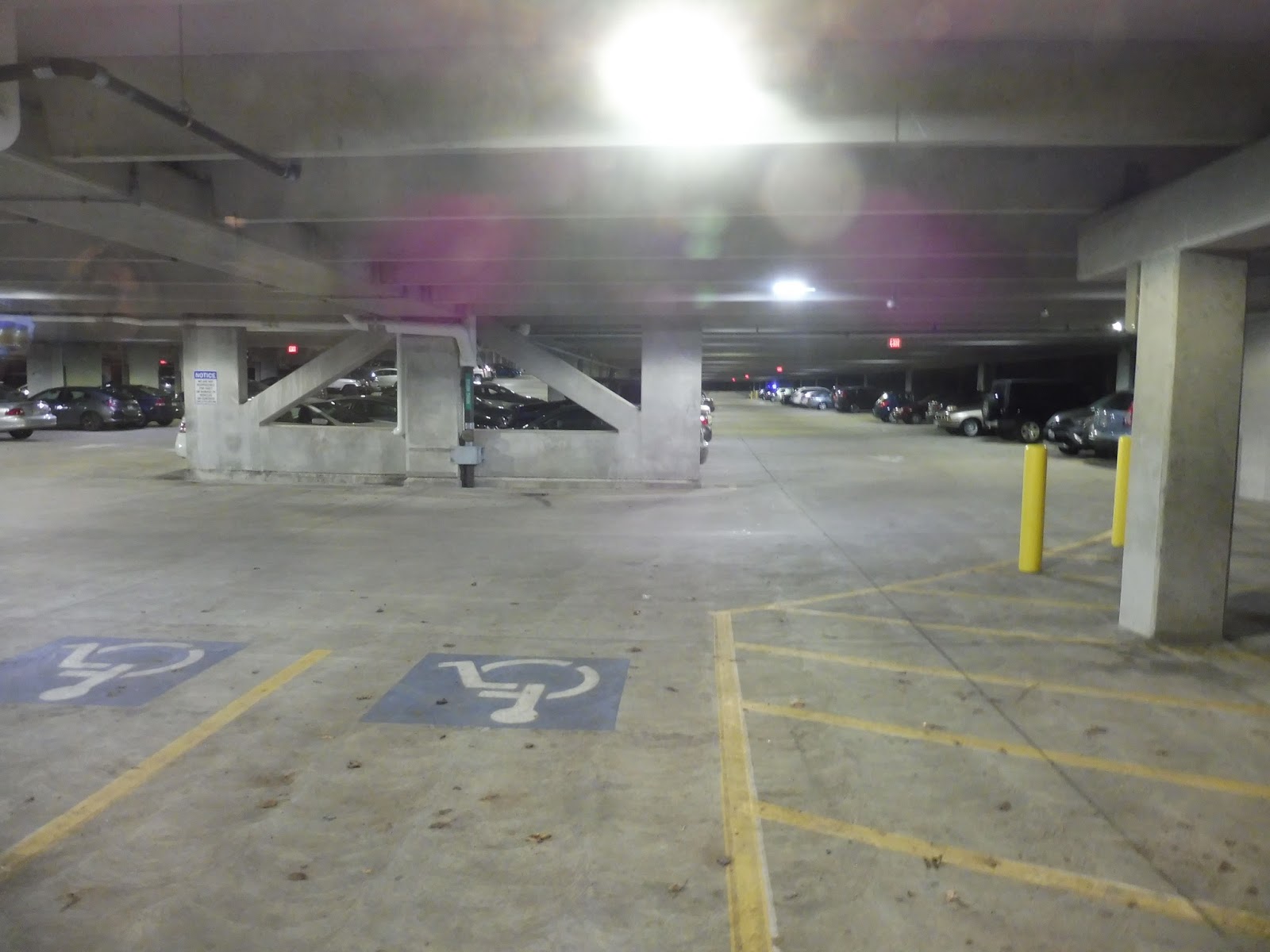 |
| Inside the parking garage. |
So Wickford Junction has one of the largest parking garages on the Commuter Rail. 1100 spaces. But the lot would only get 213 cars per weekday in 2014. Now maybe there are more that park in there now, and they certainly have incentive to: the parking is free. Yes, it’s our third Failed Ridership Booster! Beautiful glass elevators traverse the four floors of the garage, whose parking, if I may remind you, is free! I can’t get over that!
 |
| Huh… |
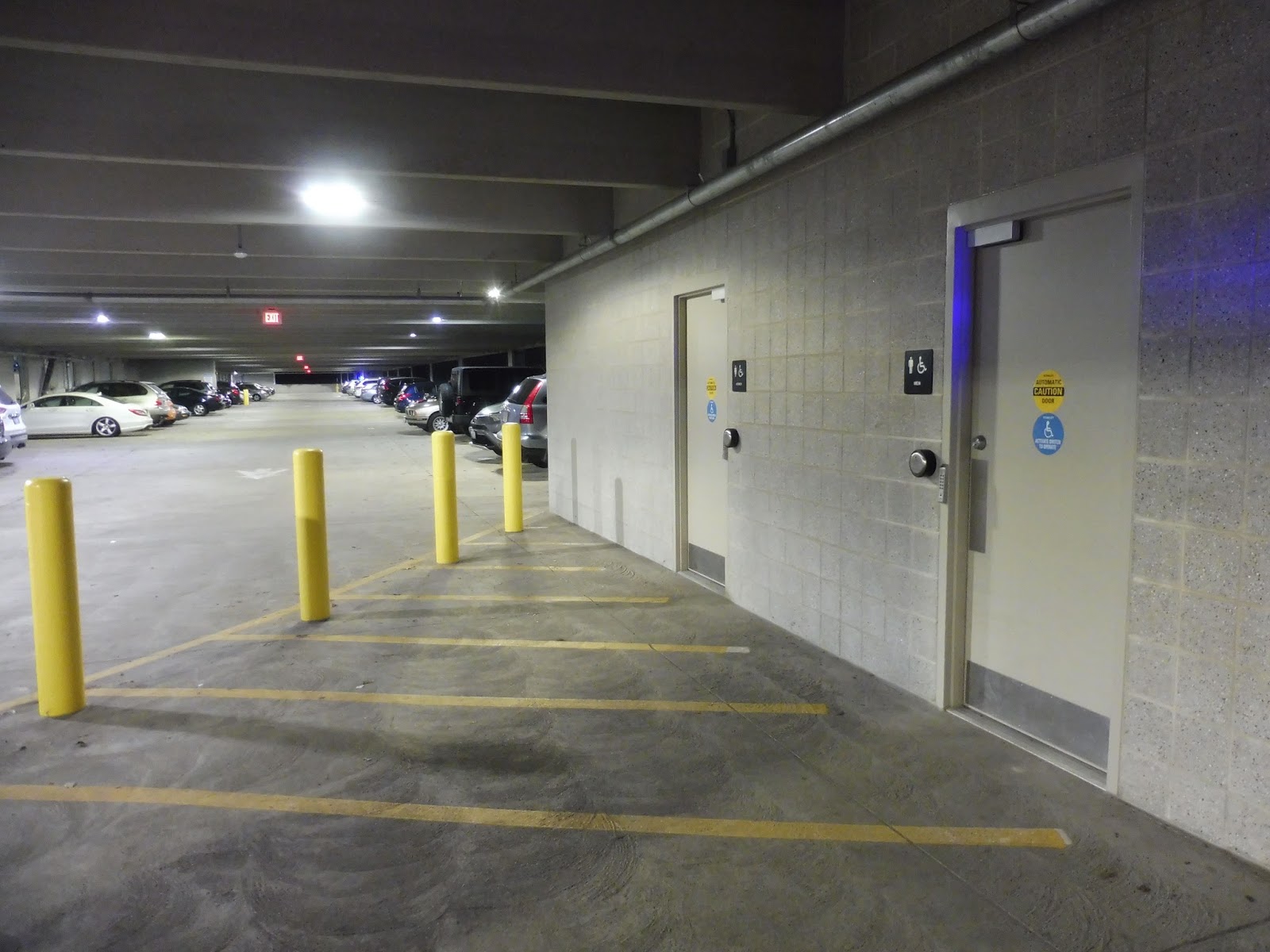
There are signs everywhere at Wickford Junction saying “Restrooms located on Level 1! Restrooms located on Level 1!” Okay, we looked everywhere in the first floor lobby and couldn’t find them! Where the heck could they be? Oh…they’re in the parking garage…on the first floor. Okay, guys, let’s work on the signage, huh?
 |
| Inside. |
Well, these are very nice bathrooms otherwise. They have buttons that open the doors for disabled folks, which is a great touch, and inside they’re mostly spotless, although the men’s room did have some graffiti on one of the stalls. Overall, though, these are great. Too bad the door-opening button doesn’t work for the doorway going back into the lobby.
 |
| Up on the second floor. |
Believe it or not, Wickford still has more building to explore! There’s a whole second floor here! The second floor lobby features some seats for waiting, another schedule, some historical information, and a Wickford Junction FAQ’s placard about how the train is free to Providence “until the end of 2017.” (an outdated Failed Ridership Booster) There’s also a parking payment machine that has been turned off, with a piece of paper on it saying “FREE PARKING.” Finally, there are signs advertising a café coming soon, but the retail space where it’s supposed to be coming in looks pretty darn bare.
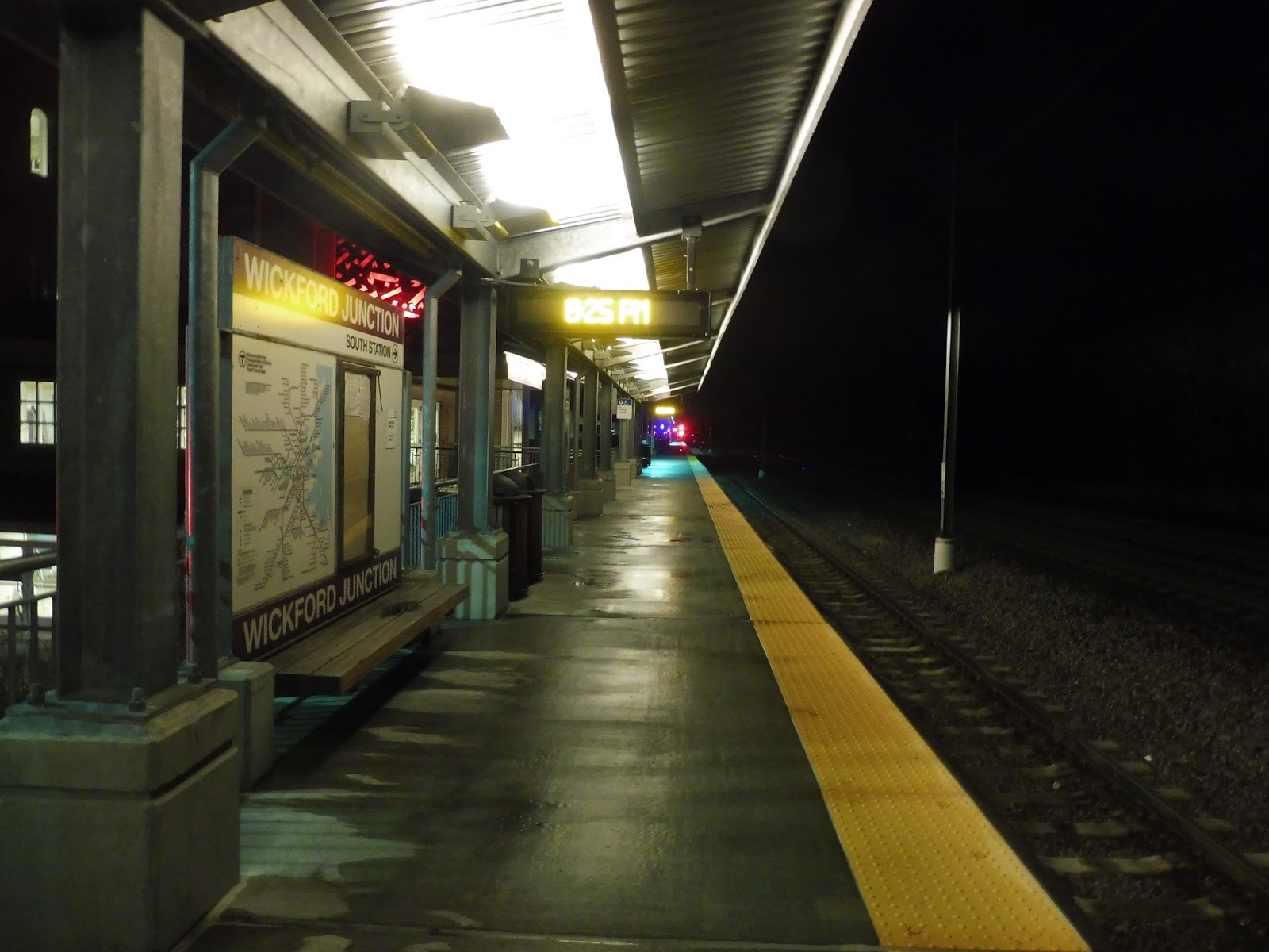 |
| The platform. |
Wickford’s platform is surprisingly underwhelming, considering everything else. It’s what you would expect with a modern Commuter Rail station: the whole thing is high-level, and there’s a shelter next to the main building entrance with benches and wastebaskets underneath. The platform extends further out, and there’s a connection to the other end of the parking garage a ways down. Well…this was an anticlimactic ending.
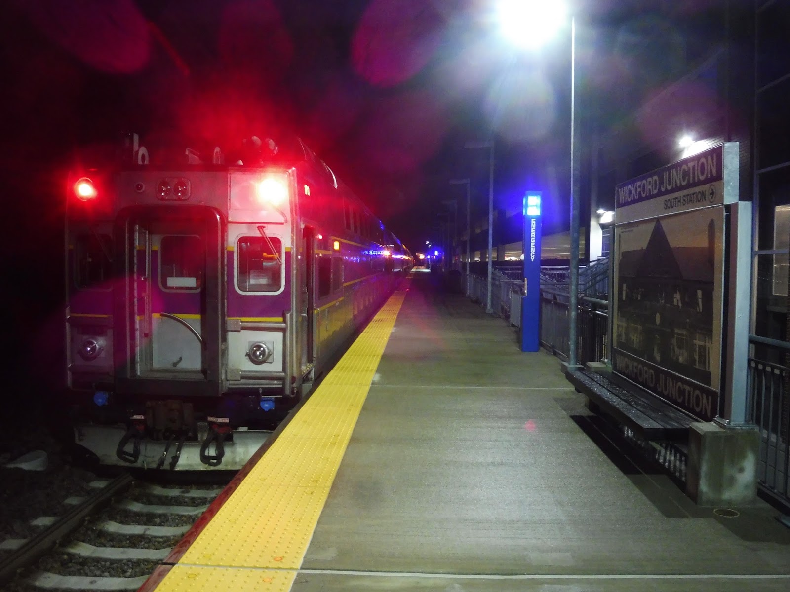 |
| This is the furthest from Boston this train can ever get, at least in revenue service! |
Station: Wickford Junction
Ridership: Alright, the most recent projection for ridership here (cited from a 2005 prediction, though) is 3,386 riders by 2020! Well, with those lofty aspirations, I’m sure Wickford Junction has to be very close to that amount. Let’s see here…on July 5th, 2017, the station got 353 riders. And that was right after Rhode Island started offering free train service from here to Boston. So even when the service is free, ridership is a tenth of the projection. Mm-mm, fantastic numbers right there.
Pros: Well, hey, the station itself is excellent! In its efforts to make it a welcoming place for Commuters, Rhode Island really did build themselves a fantastic train terminal. The platform is standard, but the building has a ton of awesome amenities, including vending machines, indoor waiting areas, and bathrooms.
Cons: Aside from the minor quirks I’ve mentioned above, Wickford Junction just has the little problem of being a huge boondoggle. It’s such an unnecessary station! There’s already extremely fast bus service from here to Providence, and hey, it’s free with a Commuter Rail pass! And good luck doing the 100-minute commute from here to Boston – have fun paying that $12.50 Zone 10 fare! Also, you gotta love that 10 trains per day, weekdays-only schedule. 3,386 riders per day indeed.
Nearby and Noteworthy: Walmart? Staples? Home Depot? There isn’t much around here…
Final Verdict: 8/10
Well, I’m here to review the station, not the service. There is no denying that Wickford Junction is a fabulous station. Also, I can at least imagine people commuting to Providence from here, since the $3.50 fare is very reasonable, but geez, who’s going to Boston from here? Honestly, Rhode Island would probably benefit more from its own commuter rail with closer stops – let’s let the T just go back to Providence, okay?
Latest MBTA News: Service Updates
203 (Narragansett Flex)
So…why is there a Flex service down here, exactly? Within the 203’s Flex Zone, we have two fixed routes that run daily service and cover most of the zone. Plus, RIPTA has extensive paratransit service throughout the zone that uses the same reservation system. So basically, the 203’s target audience is people who:
- Are under age 60
- Don’t have a disability
- Can’t use a fixed route for some reason
- Are willing to call in advance, or get on the bus at a timepoint, which only happens four times per day
 |
| Just hanging out in the parking lot, I guess. |
 |
| The pictures only get worse from here… |
 |
| This is basically my only picture of something. |
It was more trees and houses until we turned onto Galilee Escape Road. The 66 takes a slightly longer route, since it goes to serve another beach, so we were once again solo. After running through marshland, we turned onto Great Island Road, coming past the many docks and fish markets of Galilee. “Sorry about making you come down here,” Sam said to the driver. “Eh,” he grumbled. “It is what it is.” He let us off at the Block Island Ferry Terminal just as the 66 home was leaving, so we wandered around the empty roads of Galilee waiting for the next one to finish its hour-long layover.
 |
| A minibus in Galilee! |
RIPTA Route: 203 (Narragansett Flex)
Ridership: Well, clearly there’s no one at 6:00! Just based on the character of the route, I’ll bet this thing doesn’t get many people.
Pros: Huh…I have to say, there isn’t much I have to say here.
Cons: This is just such a niche route! I mean, there are just so few people who happen to be travelling to places fixed routes don’t go, and don’t qualify for RIde service! Hey, at the very least, the 6:00 timepoint could be eliminated.
Nearby and Noteworthy: Well, gee, nothing that’s not already covered by fixed routes.
Final Verdict: 1/10
I see no reason to keep this thing around. It seems to benefit only a tiny amount of people, and I’m sure many of them could just switch over to RIde instead. Narragansett is well-served by fixed routes, particularly the 66, and the 203 just feels pointless and redundant.
Latest MBTA News: Service Updates
RIPTA: 65x (Wakefield Express Park and Ride)
Welcome back to the RIPTA! We’re heading down to southern Rhode Island on the rush hour-only 65x today.
 |
| Well, this is an odd picture… |
The bus does the Downcity Loop like the other expresses, but Sam and I got on at its last stop, Kennedy Plaza (or Exchange Terrace, which is where the route actually boards). From there, it was a right on Francis Street and a left on Memorial Boulevard, which led us straight into a highway interchange. Express on I-95 time!
 |
| Bam! |
We curved around the west and south sides of Providence’s downtown before entering a really industrial area. The highway went past warehouses and factories and the like, but as we curved southwestward, houses lined a parallel road on one side. We passed Roger Williams Park, crossed over the Commuter Rail and Amtrak tracks, and entered Cranston.
 |
| Some houses near an exit. |
We came in between two streets in a neighborhood, then there was a section of woods as we crossed the Pawtuxet River and entered Warwick. There was another industrial area interspersed with more woods, as well as the highway connector that leads to TF Green Airport. We merged with I-295, and it was mostly woods after that. Once we entered East Greenwich, we merged onto Route 4, taking a course due south.
 |
| I think this is back on I-95, but…oh well. |
Woods, woods, woods. Hey, farmland! Woods, woods, woods. We finally left the highway at Exit 6, which took us around onto Route 2. There was a small park-and-ride right by the interchange, and a good amount of the riders got off here. We continued down Route 2 from there, which had spurts of industry and retail as we entered North Kingstown.
 |
| Farewell! |
We did a little deviation onto Ten Rod Road in order to serve Wickford Junction Station. And believe it or not, the bus is two minutes faster from Providence to here than the train, and Kennedy Plaza is more centrally located than Providence Station! Once that deviation was completed, we actually returned to the highway, zooming south through the woods.
 |
| Yup. |
Route 4 turned into a regular road soon enough, but it still had long sections through forest with no other intersections. We merged with Route 1, and there were a few houses at that intersection, but nope – back to woods very soon. There was an interchange with Route 138, an uncompleted highway, and there started to be more human signs along the road: houses and farmland.
 |
| Seen here in a very blurry photo. |
There was some suburban retail near the intersection with Bridgetown Road, just over the border with South Kingstown. Along with a connection with the 64, we did a really sad little deviation into a park-and-ride and back out. Save for some really sparse houses, it went back to being almost entirely woods as we continued south with just one other person on the bus.
 |
| In the little park-and-ride. |
We finally got a spurt of development in the form of The Village at South County Commons, a “lifestyle center” combined with apartments. We started to see more frequent houses along the road after that, until…oh, we’re at the Wakefield Mall? Alright, route over!
 |
| I guess it’s just going back to Providence now… |
RIPTA Route: 65x (Wakefield Express Park and Ride)
Ridership: Ridership wasn’t bad! There were about 15 people on board, which is fine for an express route.
Pros: The 65x is a good express route to the southern part of Rhode Island, and it offers a decent speed increase over the 62 and 66, since it skips most of their deviations. The route has more trips than typical RIPTA express routes, with service every 15 minutes in the morning rush (six trips) and every half hour in the evening rush (five trips, spread out over a longer time period).
Cons: My trip may have just been an exception, but only one person to Wakefield Mall? That’s pretty bad. There’s also a random evening rush trip that runs as far as Galilee, but the schedule has no information about how long it takes – they might want to provide that. It’s also strange that there’s no morning equivalent from Galilee, which seems like a better way of getting people to use the service.
Nearby and Noteworthy: Honestly, most of this route is in the complete middle of nowhere! The Wakefield Mall is pretty underwhelming, too.
Final Verdict: 7/10
It’s an express route that carries a good amount of people to their park-and-rides to return to their rural homes – seems good to me! It has more trips than normal RIPTA express routes, which is a plus, and its only problems don’t affect the riders too much. Well…okay, a morning rush trip from Galilee seems like it would make sense, though.
Latest MBTA News: Service Updates
Wellesley Square
For its busiest stop and its downtown, you would think Wellesley would ensure that Wellesley Square is as nice of a station as possible. A valid thought, but a wrong one…
 |
| One of the station’s parking lots. |
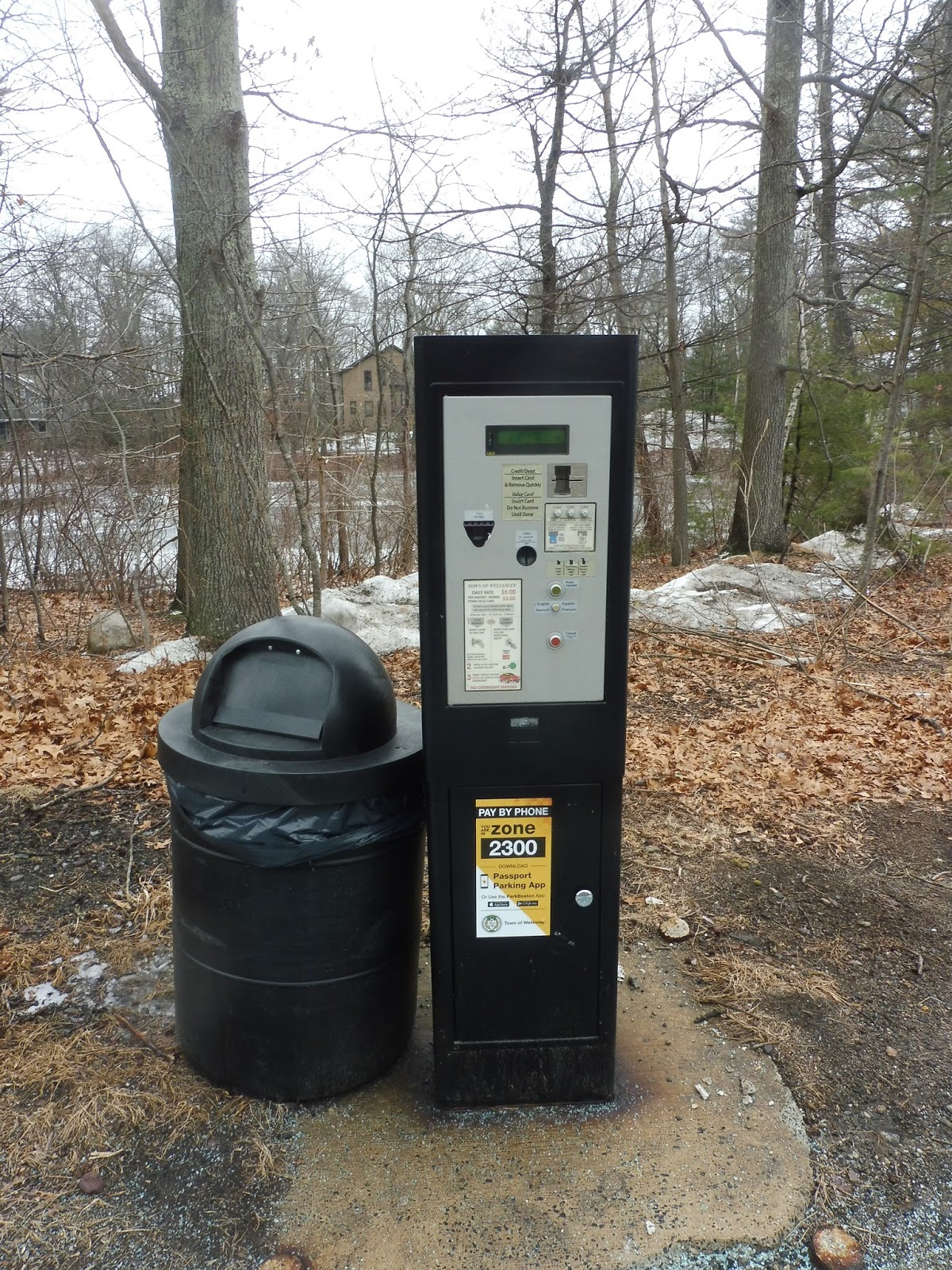
For a downtown station, Wellesley Square’s 224 spaces of parking are great. They’re split between two lots, and like the other Wellesley stations, you’re in luck if you’re a resident – parking is a buck fifty cheaper! Once again, we have strange vending machines that don’t seem to work, as well. There’s an MWRTA bus stop sign for the 8 on Crest Road over the station, and it’s…fine.
 |
| Ohhhhhhhh noooooooooo… |
Oh man, this is a bad platform. We’ll start with the outbound side, which has a few ads, a wastebasket, and a few bike spaces. Cool. The inbound side, meanwhile, features two benches, a wastebasket, some ads, a map and schedule, and a dingy old bus shelter. Wait, that’s it? No building to make up for how awful the rest of it is? Well…shoot.
 |
| That’s a bright light! |
Station: Wellesley Square
Ridership: This is by far the busiest of the Wellesley stations, with a cool 804 inbound riders every weekday.
Pros: Like the other Wellesleys, Wellesley Square is integrated pretty well with the neighborhood around it. It also has a good amount of parking.
Cons: If there’s one thing I hate about in Commuter Rail stations, it’s bus shelters. And the bus shelter here is so dingy! At least the other Wellesleys had a building to liven up the station a bit, but Wellesley Square? Nope, you just get a bus shelter. As usual, it’s not wheelchair accessible, and I would really like it if there was better signage to the station from around the square.
Nearby and Noteworthy: Wellesley Square is really nice! Sure, it definitely has that “we’re a really rich town” vibe, but it’s still a great little high-end commercial district. A great thing about it is how big it is – it takes about seven minutes to walk from one end of the downtown to the other.
Final Verdict: 3/10
Sorry, Wellesley, but your stations all blow. This is the worst one, since it doesn’t even have a nice building to redeem it! It doesn’t help that this is by far the busiest of the three.
Latest MBTA News: Service Updates
Wellesley Hills
Wellesley Farms didn’t score particularly highly with me. Will the next station, Wellesley Hills, be an improvement? Let’s find out.
 |
| The station…from above. |
There are two ways to get into this station. The first one is a staircase from Cliff Road, and it does its job fine. The other entrance is via the station’s parking lot, which has 51 spaces, and once again, residents of Wellesley get a significant discount. There are some newspaper boxes, bike racks, and a payphone at the parking lot entrance.
 |
| Down on the platform. |
Well, the outbound platform is a sign, an ad, and a wastebasket. Nice. Crossing over via a weird boardwalk, we get to the inbound platform, which has everything on the outbound, plus…a bench! Okay, there’s also a station building that has a café in it, and that’s pretty awesome.
 |
| What have we here? |
Oho, what’s this? A bus stop? Well, I do usually talk about bus connections in my reviews, so let’s see what kind of complex infrastructure the MWRTA 8 has here. The Woodland-bound stop is fine, but the Natick-bound stop is…problematic. AS IN THERE ARE PARKING SPACES IN ITS WAY! They really couldn’t eliminate just one or two to allow a tiny minibus to pull in on its awful terrible deviation-filled ridiculous route???????? I hate the 8, and I hate this stop!
 |
| Choo choo! |
Station: Wellesley Hills
Ridership: This is the second-busiest Wellesley station, but it only beats Wellesley Farms by four people! Yes, this stop gets 562 inbound riders per weekday, compared to 558 at Wellesley Farms.
Pros: The building is nice, and I love that it has a café in it. The weird boardwalk makes it easy to cross over the tracks, and the station is well-integrated with the neighborhood around it.
Cons: This is a drab and pretty awful station. The outbound side gets nary a bench for people to wait on, so tough luck there, but it’s not like the inbound side is much better! I can imagine a ton of people huddling under the tiny shelter provided by the building during rainy morning rush periods. Of course, the station isn’t wheelchair accessible because of the low-level platform. Also, that bus stop…geez, that’s an awful bus stop.
Nearby and Noteworthy: There are some nice businesses along Washington Street. It’s nowhere near as awesome as the commercial center of Wellesley Square, but it’s something.
Final Verdict: 4/10
I’m not a fan of this one either. It doesn’t provide enough amenities considering the number of passengers it gets, and it just feels bleak. And of course, we have a strong contender for “worst bus stop ever,” from the good ol’ MWRTA!
Latest MBTA News: Service Updates
Wellesley Farms
Well, that station name is misleading. I don’t see any farms, just a ton of huge houses!
 |
| Coming down Croton Street. |
There are a few entrances to the Wellesley Farms inbound platform. One of them is a staircase from Glen Road – pretty standard. You could also use the Croton Street one, which feels super old-timey in the best way possible. It’s a wooded, windy road with an old station building along it! What’s in the building, though?
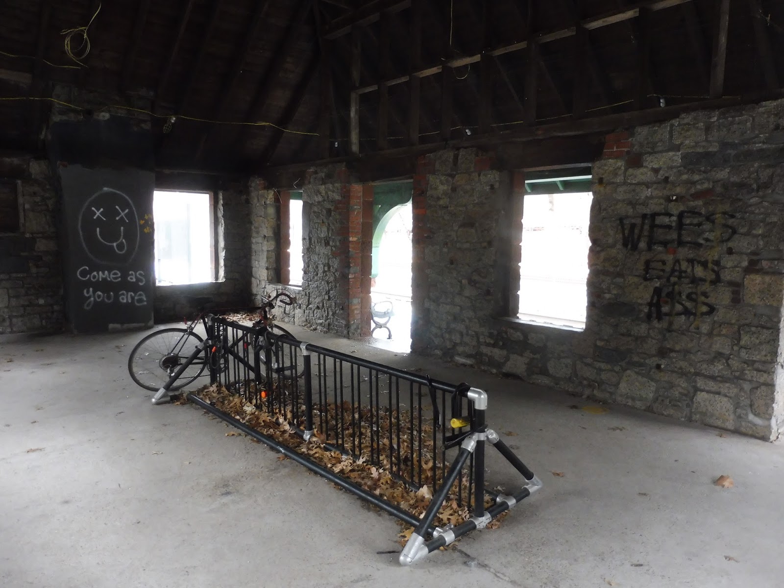 |
| Uhhh… |
Oh…wow, this is…this is unlike any Commuter Rail station building I’ve ever seen. It’s entirely dedicated to a bike rack, but the eye is drawn to some prominent graffiti instructing visitors to “Come as you are.” There’s also a fake owl up in the rafters…? Okay, there has to be some strange Wellesley Farms cult that meets in this building!
 |
| This just looks really out of place. |
Of course, Wellesley Farms has car parking too, with a lot next to the inbound platform. The station has a total of 199 spaces, and they can of course be paid for with the Pay by Phone system. HOWEVER, there’s a proper payment machine here as well! Granted, I couldn’t get it to work – the only response I got from it was a loud beeping noise if I pressed the cancel button.
 |
| The outbound “entrance.” |
You’ll notice that all the entrances I’ve been talking about have been on the inbound side. That’s because there’s just one way of getting to and from the outbound platform, and that’s via a little cut to Hundreds Road. You know what that means? If you parked your car here, you have to spend literally six minutes (according to Google Maps) walking up to Glen Road and making your way around to the parking lot wayyyyy over on the southern end of the other platform! Nice.
 |
| The inbound platform. |
Okay, so the outbound side is just a bench, a wastebasket, and a few signs, so that wraps that up. As for the inbound platform, it has some benches underneath the Wellesley Farms Cult building, and some other ones that aren’t sheltered. There isn’t much here, but the sparseness of the station almost adds to its charm. Not only is there a lovely pond right next to it, but this woodsy station with nothing much aside from an old building almost feels like we’ve been transported back to the golden age of railroading…

 |
| …and then Amtrak comes in and remind us that the golden age of railroading is very much over. |
Station: Wellesley Farms
Ridership: Possibly because it’s so close to Wellesley Hills, this stop gets pretty low ridership, at least for Worcester Line standards: 558 people travel inbound from here every weekday. That makes it the least-used station in Wellesley, although Hills is very close behind.
Pros: Atmosphere! It’s super pleasant to wait here, what with the woods, the pond, and the charming old building…well, as long as you don’t go inside. I think the parking lot has a good amount of spaces while being non-obtrusive to the neighborhood around it. Finally, since this isn’t really a pro or a con, I’m just gonna put it here: the parking normally costs $4.50 per day, 50 cents above the typical Commuter Rail fee, but Wellesley residents get a huge discount at only $3.00 per day. This is such a Wellesley thing to do…”We can’t have any non-Wellesley SCUM parking in our lots! Hmph!” But offering a discount to residents makes sense, I suppose, so it’s not really a bad thing.
Cons: The crossover here is really annoying. It is such an inconvenience to go from the outbound platform allllllll the way around to the inbound side to get to the parking lot! Also, for goodness sake, what the heck is up with the inside of that building? I wouldn’t want to be in there at night! The parking vending machine doesn’t seem to work, and as you’ve probably figured out by now, Wellesley Farms is not wheelchair accessible.
Nearby and Noteworthy: Wellesley Lower Falls is somewhat close, and it has some nice restaurants in a somewhat walkable area. Hey, it’s a 15 minute walk – the equivalent of three trips from the outbound platform to the parking lot, GEEZ, that’s annoying!
Final Verdict: 4/10
Ehhhhhhh, it’s pretty bad. I mean, the only thing it really has going for it is atmosphere, and that’s about it. What else is there? A long walk to the parking lot, zero accessibility, and a building where a group of bikers come in every night at midnight to pray to the fake owl in the rafters. COME AS YOU ARE.
Latest MBTA News: Service Updates
Islington
This is Endicott. It’s just Endicott. Cool, can I end the review now? Okay, okay, fine, we’ll look at Islington.
 |
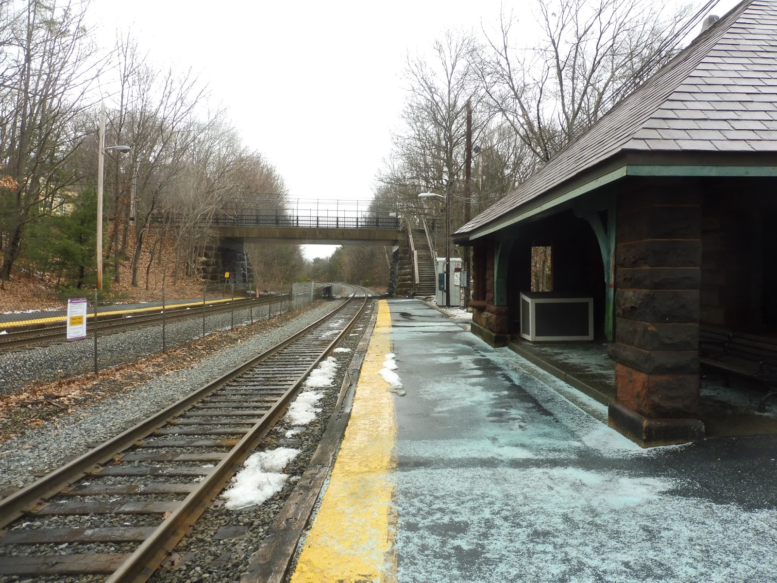
| The entrance. |
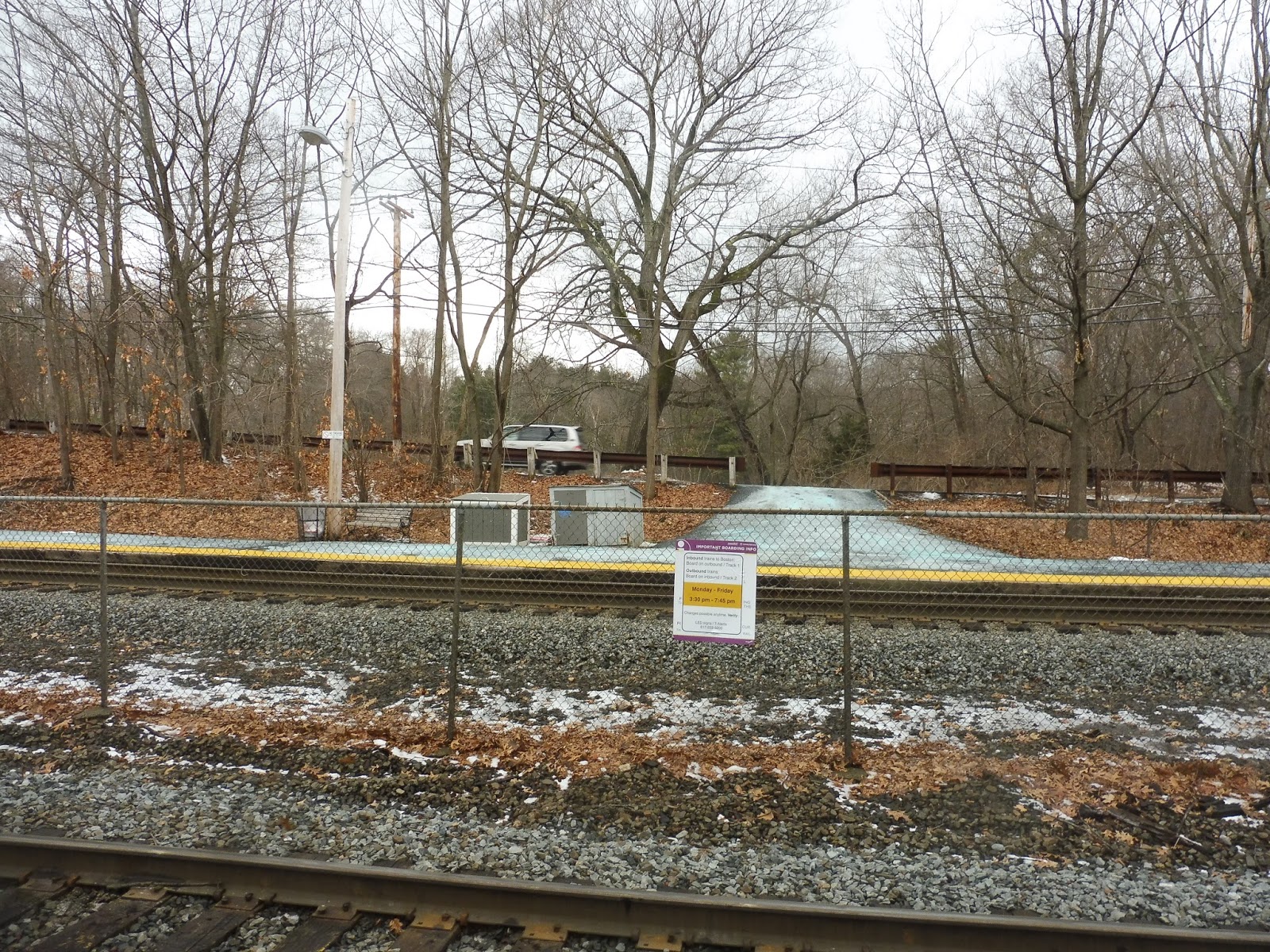
Okay, one thing I’ll say about this stop is that it has a really unassuming entrance from Carroll Ave, and that’s kinda cool. It feels like you’re walking into someone’s driveway! The only indication that there’s a Commuter Rail station here is one of those tiny purple “Commuter Rail station” signs with an arrow on it that you often see on major roads. There’s another entrance on the other side of the station via the tiny Grafton Ave as well.
 |
| This is it. Literally. |
The platform really is that short. The outbound side is just a sign and a wastebasket. The inbound side is a bigger sign, an LED board, a shelter, and…another wastebasket. Cool! Islington is flanked on either side with little parking lots, adding up to 39 spaces. There are also two bike spaces on each platform.
 |
| The shelter. |
Station: Islington
Ridership: This station is tiny, I’m sure it only gets…844 inbound riders per day???? Okay, that’s gotta be a typo. Yeah, I think it is – the Blue Book claims that, but the CTPS counts from 2012 say the station just got 80 inbound riders per day. My guess is that the Blue Book accidentally added an extra 4 to the end of the number, because ridership definitely didn’t go up by over 1000% in a year! So…around 80 per day.
Pros: I mean, it does its job, I guess. Look, the inbound side has a shelter! Look, there’s parking! Look, there are bike spaces!
Cons: This is a very niche station, shall we say. It almost exclusively serves the neighborhood around it, especially since Dedham Corporate Center with its big park-and-ride is insanely close. Also, why wouldn’t you drive the extra five minutes to Dedham Corporate Center – it’s in Zone 2, while this stop is in Zone 3! I’m sure most Islington riders just walk, but it seems silly for anyone to drive here when they could go for five more minutes and save almost 30 bucks every month. Finally, why the heck isn’t this station a flag stop? Come on, we’re talking about 80 people per day here.
Nearby and Noteworthy: There are some businesses down on Washington Street, as well as a bus connection with the 34E.
Final Verdict: 2/10
This is like the West Gloucester of the Franklin Line. Islington is exclusively for the neighborhood around it and nothing else, and there’s seriously no reason to use it unless you’re walking to it. The station itself is barebones, and I get that, but there’s very little to like about it aside from the really pleasant atmosphere waiting on it. I mean, if you’re looking for a neighborhood station with a ton of atmosphere, just go to Silver Hill! A car is recommended…
Latest MBTA News: Service Updates
Norwood Depot
Apparently two minutes of train time makes a big difference. Contrary to its southern neighbor, Norwood Depot is actually quite pleasant!
 |
| Approaching the station. |
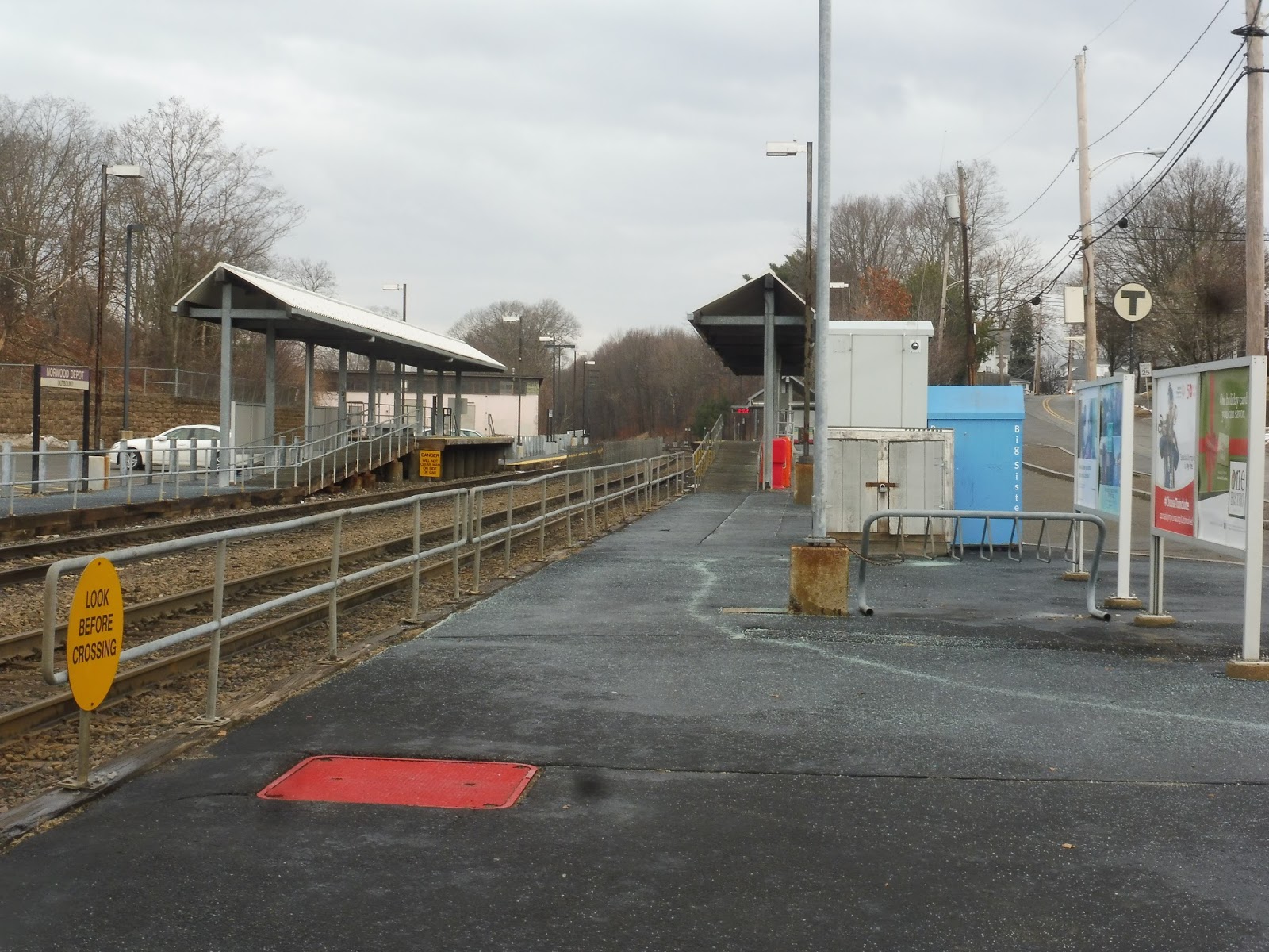
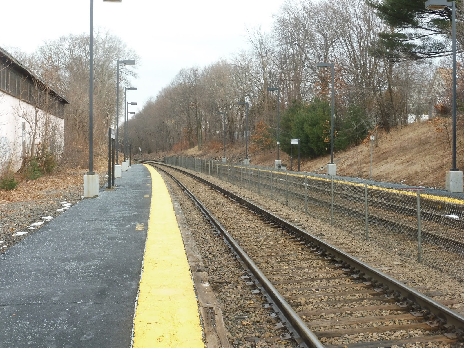
This station is in a much nicer neighborhood than Norwood Central, with some pleasant TOD apartments right across the street. It’s flanked by some small parking lots amounting to 219 spaces, and there’s also a bike rack with 8 spots. Interestingly, there’s a low-level platform before the mini-highs, and people can walk around them if they so wish.
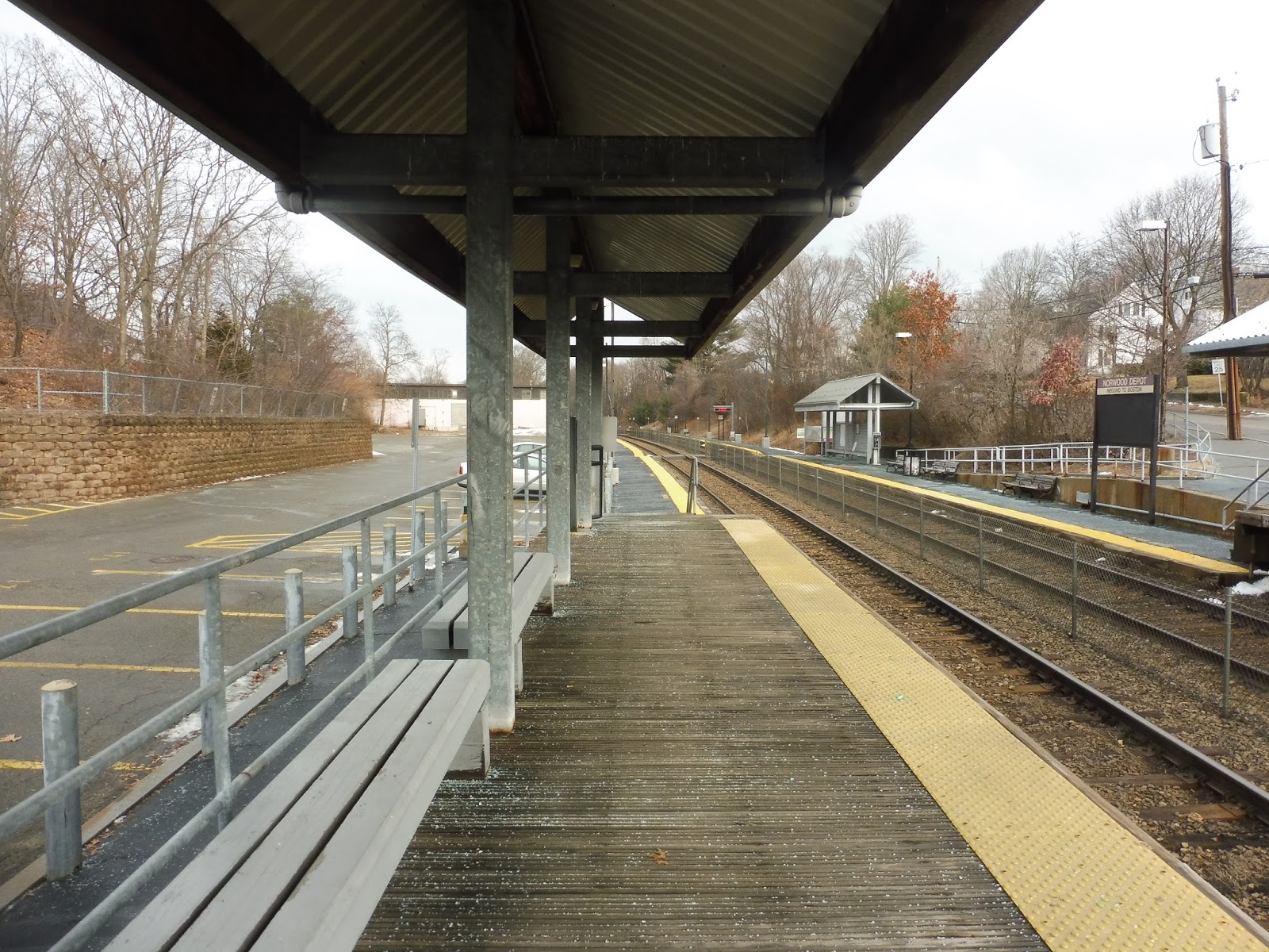 |
| Looking down the platform from the mini-high. |
Well, would you look at that? Benches on the mini-high. What a revolutionary idea! The low-level portion of the station is mostly bare, but there’s one more shelter on the inbound side. It’s just a typical modern Commuter Rail shelter, but it does its job. The platforms extend into the woods before eventually ending.
 |
| Just ignore that one building to the left. |
Station: Norwood Depot
Ridership: The station doesn’t get great ridership for Franklin Line standards, but hey, 632 inbound passengers per weekday is still nothing to sneeze at! Honestly, I’m amazed it gets so many people considering how close it is to its neighbor.
Pros: This is a really nice little station! It has a fine parking lot integrated with the area (more or less), and the platform is charming. Also, benches on the mini-highs!
Cons: These stops are too darn close together! That being said, Norwood Depot clearly does hold its own with ridership, and some rush hour trains skip by it, which I think makes sense. Also, this isn’t too annoying since the times are still the same, but the station has a really old MBCR schedule posted in the inbound shelter.
Nearby and Noteworthy: Well, this stop is just about as close to “Norwood Central” as Norwood Central is, and this is a much nicer one to get off at!
Final Verdict: 7/10
Norwood Central has way more parking capacity than Depot, which is probably why more people use that one, but if I had the choice, I would absolutely board here. It’s far more charming, and inbound passengers actually have a place to sit on the platform where they’re supposed to board! Wonderful.
Latest MBTA News: Service Updates
Norwood Central
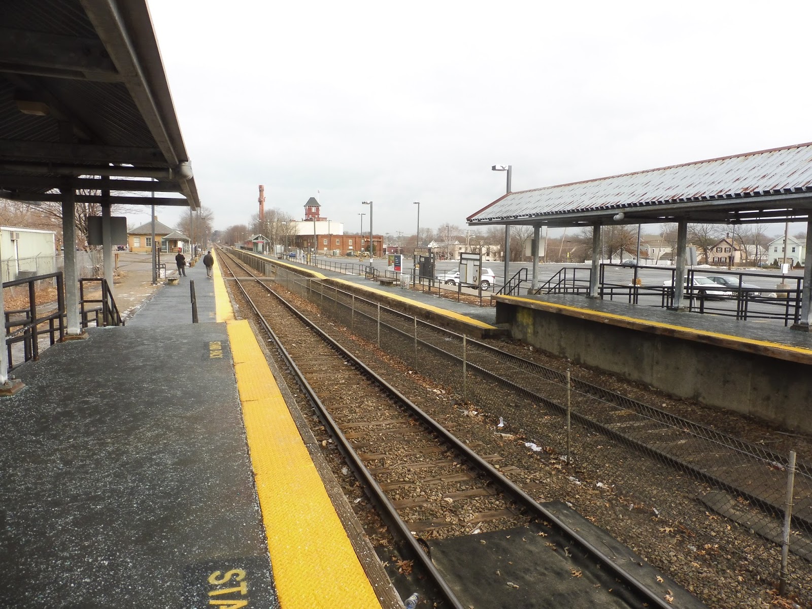
Oh, nice, so Norwood Central is in a downtown or something? That’s awesome! Maybe it’ll have a Needham Center-type feel where the station is literally integrated in the town center. Or maybe it’ll be in the middle of a wasteland of parking lots and industrial buildings! Yup, it’s the second one…
 |
| Yum. |
This is a lameeeeee platform. The mini-highs have shelter, at least, but there are no benches on them, even though they have plenty of room for at least one! The low-level portion is more or less bare, save for some benches, wastebaskets, and decrepit signs, until you get to some shelters way at the end. On the inbound side, it’s just a typical modern Commuter Rail shelter, but on the outbound…
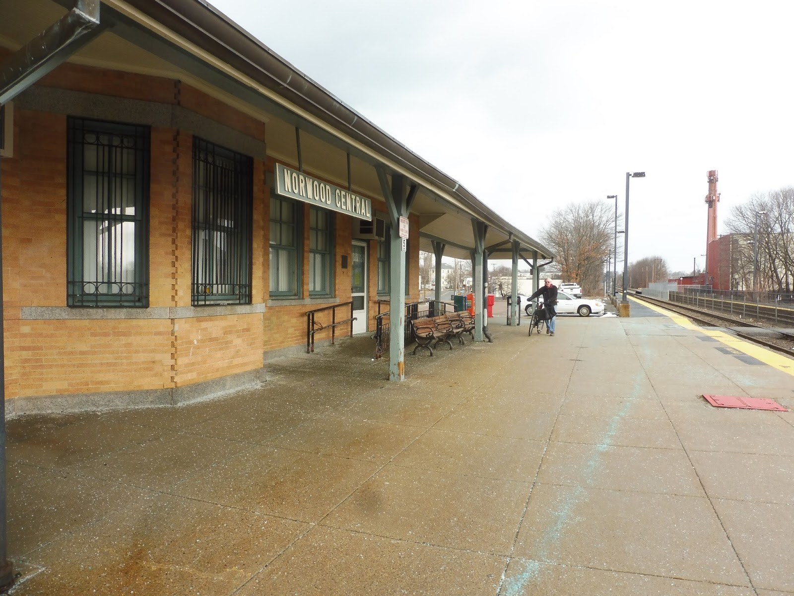 |
| Oho! |
Yes, there’s a building! And it’s on the outbound side, which isn’t uncommon, but it is annoying. There’s a small waiting room with a bench in it, but there wasn’t much indication of whether or not it ever opens. Based on how basic and empty it is, I half-wonder if it’s just locked all the time. UPDATE: Ryan Norton in the comments says it does open up, but it’s literally just a bench. Finally, I’ll briefly mention the station’s parking: a whopping 781 car spaces, and 27 bike spaces.
 |
| Single track until the end of time… |
Station: Norwood Central
Ridership: Believe it or not, this unassuming wasteland of a station is the 11th-busiest on the Commuter Rail! That’s right, it gets 1,185 inbound riders per day, and I have no idea where they’re coming from! Maybe they’re all town residents? Of course, Norwood Depot is two seconds up the line…
Pros: The station’s name is pretty misleading, but there’s no denying the station is in the middle of a dense town. This attracts a lot of ridership to its nice, big parking lot!
Cons: This station is just gross, man! I don’t know what it is, but it just has this desolate feeling to it. The mini-highs also have no benches, which is really annoying.
Nearby and Noteworthy: “Norwood Central”, as it were, is within equal walking distance of this and Norwood Depot, but there are a ton of businesses there. It also has the 34E, and it still baffles me that a T bus comes out this far!
Final Verdict: 4/10
I think with this one, you have to have been there to understand why my score is so low. The place is functional, absolutely, but I just really don’t like its location and the experience of waiting there. Also, the lack of benches on the mini-high is even more inexcusable when you find out how many people use this stop!
Latest MBTA News: Service Updates
If you haven’t seen TransitMatters’s regional rail report, I recommend you take a look! It’s super interesting and a fantastic long-term vision of our current Commuter Rail system.
GUEST POST: West Natick
Here’s another one from Mike N. Enjoy!
In my recent review-writing spree, I wanted to do some more Worcester line stations. Coming back from my dentist appointment, my mom let me hop out of the car for a few minutes at West Natick and I reviewed the station.
Starting with the station’s only entrance, it is very presentable. It has a nice drop off area, a pay phone, and a shelter. Under the shelter there are benches.
Down the inbound platform, it is completely bare aside from a few trash cans, until you get to the mini high. It is fully accessible, with a bench and shelter. The outbound side has the same setup.
Once we get to the outbound platform, it is also completely bare, with trash cans, a map for the system, and a decrepit sign. Too bad I can’t put a picture up. Also, there is a level crossing for people to get in between platforms. It doesn’t make it timely, because it is a long way from the mini highs.
Now, onto the parking lot. It is a nice parking lot, but it doesn’t have enough spaces. I have heard that this lot fills up by 6:30 A.M, despite is proximity to Framingham. This is one of the busier stations on the Worcester line, so add some more parking!
Station: West Natick
Pros: It’s accessible, gets heavy ridership, has proper benches and shelters, and even though the mini highs are small, it kind of adds to the hole in the wall, small town feel of the station.
Cons: Aside from the mini highs, the platforms are completely bare, and it doesn’t make me feel good. Also the decrepit sign. The station also lacks parking. This is a very busy station, and the lot fills up by 6:30 A.M!
Final Verdict 6/10
It’s accessible, the mini highs were nice, it has shelter, and it has a nice, small town, hole in the wall feel. However, the MBTA needs to add some benches along both platforms to make sure that they aren’t completely bare. Also, the level crossing isn’t in the most convenient place, either. Also, add some more parking! The station lot gets filled up by 6:30 am, for heaven’s sake!
Four Corners/Geneva
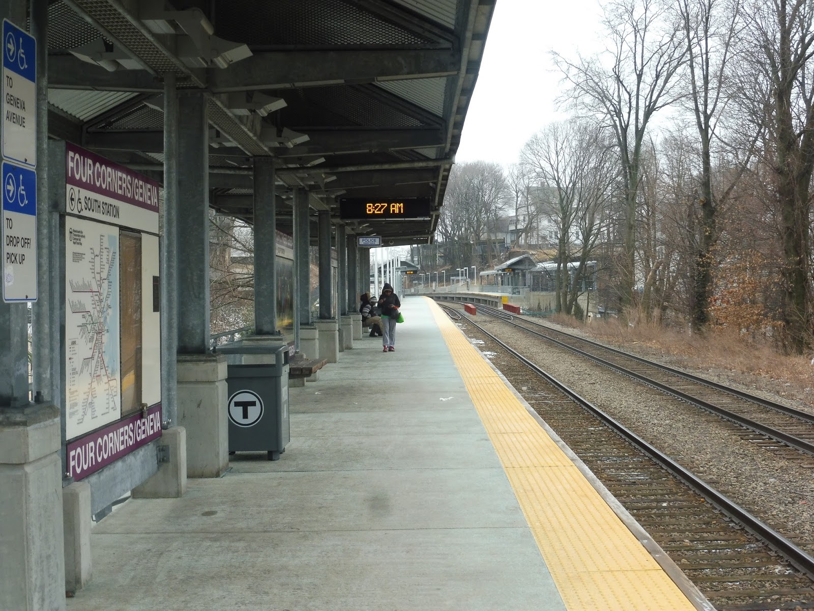
Our final Fairmount Line station is a pretty cool one! Four Corners/Geneva is full of ramps and passageways, and the long staggered station platforms span quite a large distance. Let’s dive in.
 |
| Gazing down the outbound platform. |
The station has that classic Fairmount Line feeling of being in the middle of the woods, even though you’re in the city. The only indication that we’re in an urban environment is the fact that every shelter that originally had glass has, well, no glass. That’s right, you can just step into them from any direction you want! That’s probably not optimal…
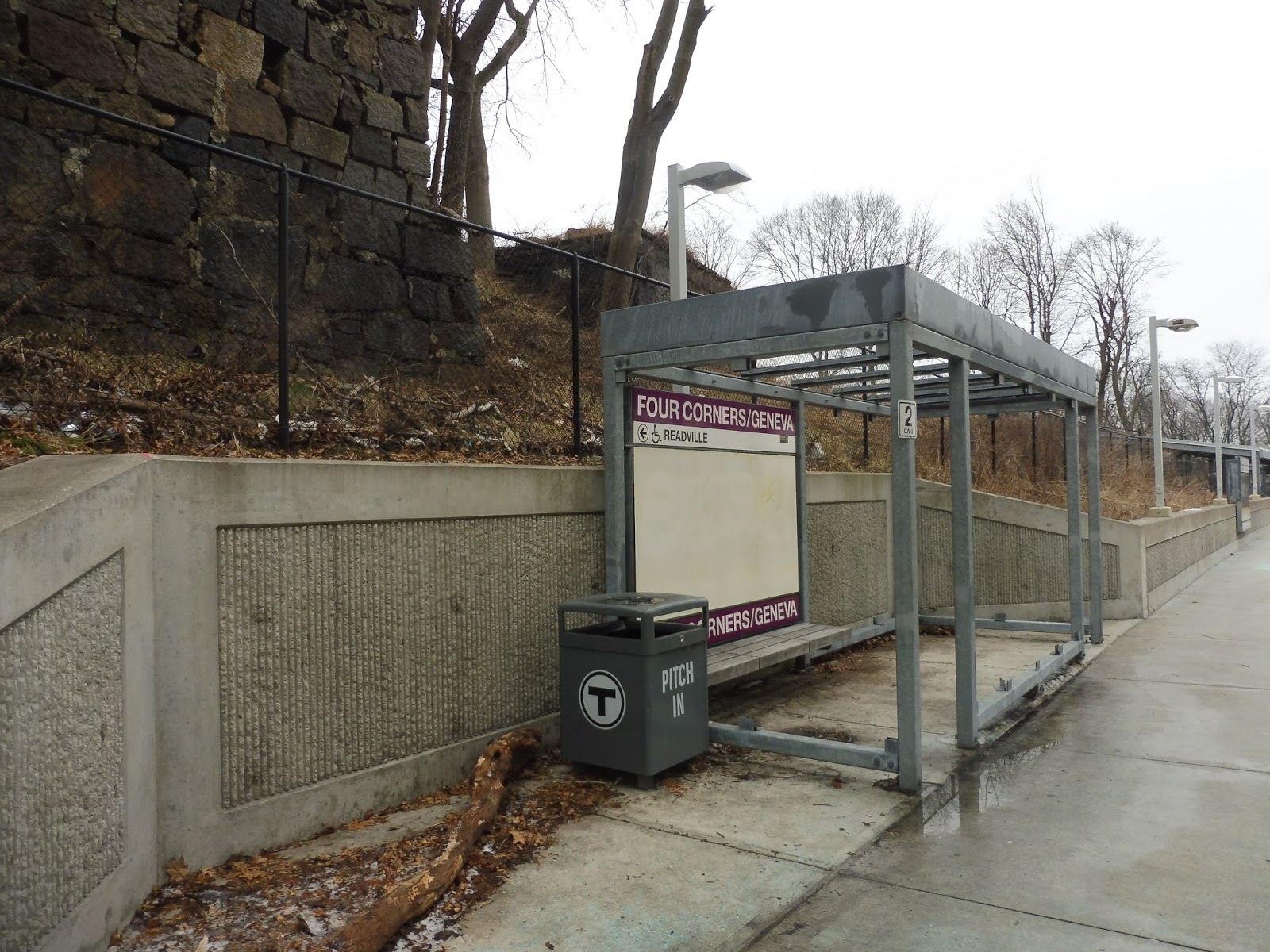 |
| This isn’t gonna do a good job sheltering anyone! |
Of course, the platforms are entirely high-level. Since the glass shelters are basically useless, the only ones worth using are the modern-style Commuter Rail shelters elsewhere along the platforms. There are two on each, and they do their job well, housing benches and wastebaskets below their roofs.
 |
| This is complicated! |
The exit from the outbound platform to Washington Street is entirely sheltered, and it features both stairs and a ramp. They snake around each other until a “mezzanine” of sorts with a bench, and from here, a direct ramp leads to Washington Street. The station has great signage at street level, and there are shelters for the 23 in both directions.
 |
| Woah! |
After crossing over the tracks on a great bridge with quotes on it, we arrive at the inbound entrance. There are a few standard amenities here, like a station sign and a bike rack, but we’ve also got a small parking lot! I think it might just be free station parking, honestly, but there are only four spaces, so first come, first serve.
 |
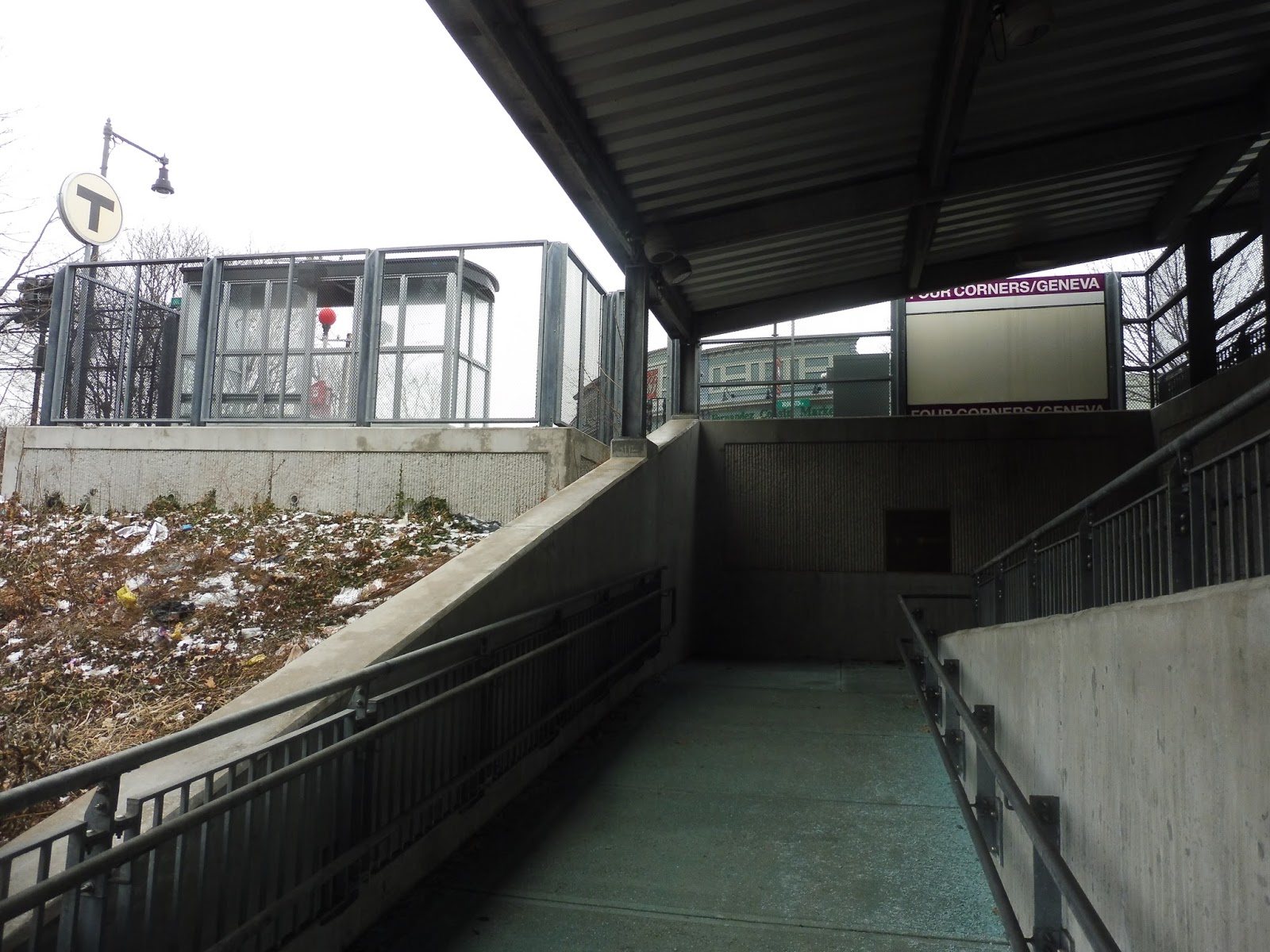
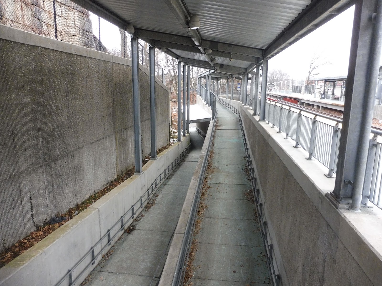
| This is a longggggg ramp… |
Like I mentioned, the two platforms are staggered, so it takes quite a while to get to the inbound side, which is much further north than the outbound platform. I guess this long ramp method was the best way to provide access to it, and it works, I guess. There are some shelters and benches along the way, and it eventually leads you down to the platform. Eventually.
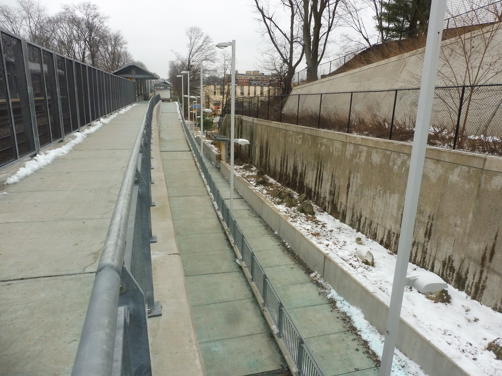 |
| Gosh, this is a very ramp-heavy station! |
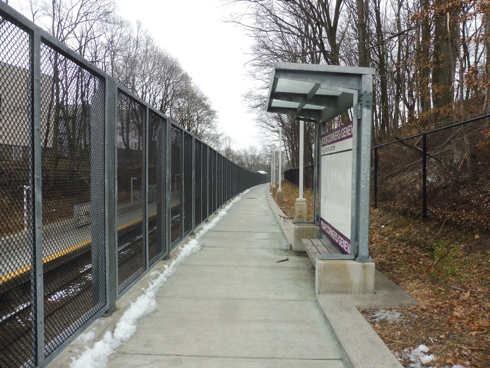
Once you get down to the platform, you’re at Geneva Ave, so we need another exit to get down there. Unfortunately, the only exit provided is a long winding ramp that goes down quite a long way and twists on itself a lot. It has some shelters and benches along its route, one of which has some ornate yellow things on it. Pretty un-Fairmount shelter, I must say!
 |
| Looking across to the other ramp. |
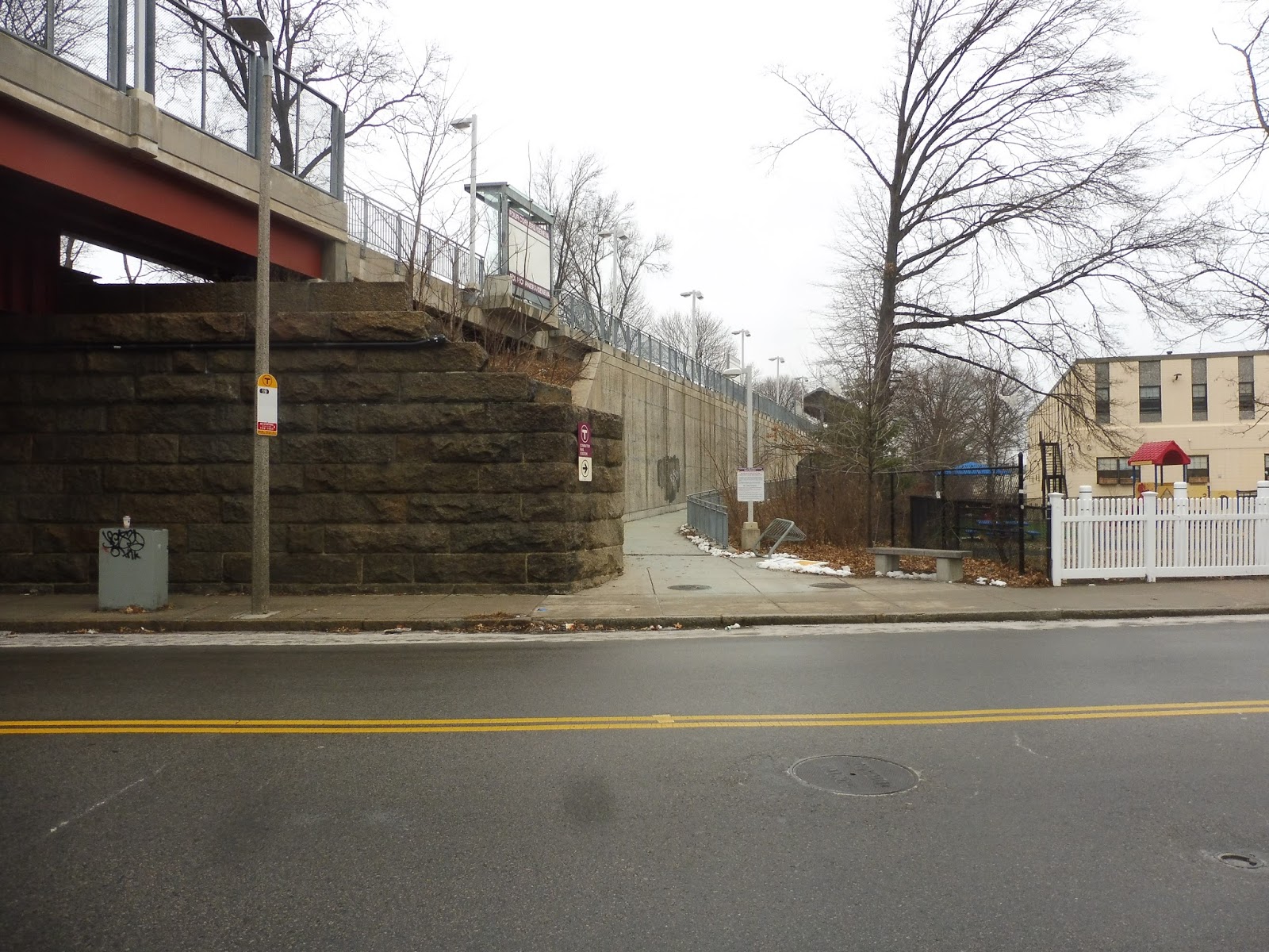
Down here on Geneva Ave, there’s another small parking lot with a few spaces! The inbound side has a second ramp that runs from the other side of the street to a more northerly section of the platform, but annoyingly, there’s no crosswalk here. The second ramp is pretty standard. Also along Geneva Ave are some bus stops for the 19.
 |
| Goodness! |
The outbound exit to Geneva Ave is even crazier, though! It’s all sheltered, which seems to be an outbound-only feature, and it consists of a long ramp leading up from the street. With this one, though, there’s a nice staircase alternative once you get close enough to the platform, which I appreciate.
 |
| The inbound side. |
There are a few more things to note about the platforms. For one thing, they feature a ton of historical information about the neighborhood, as well as some art pieces done by local artists – that’s very nice to see. Also, the station has the “old” style of MBTA map, and the maps show Newmarket, Talbot Ave, and Blue Hill Ave all as “under construction.” Talbot Ave opened before Four Corners, I might add!
 |
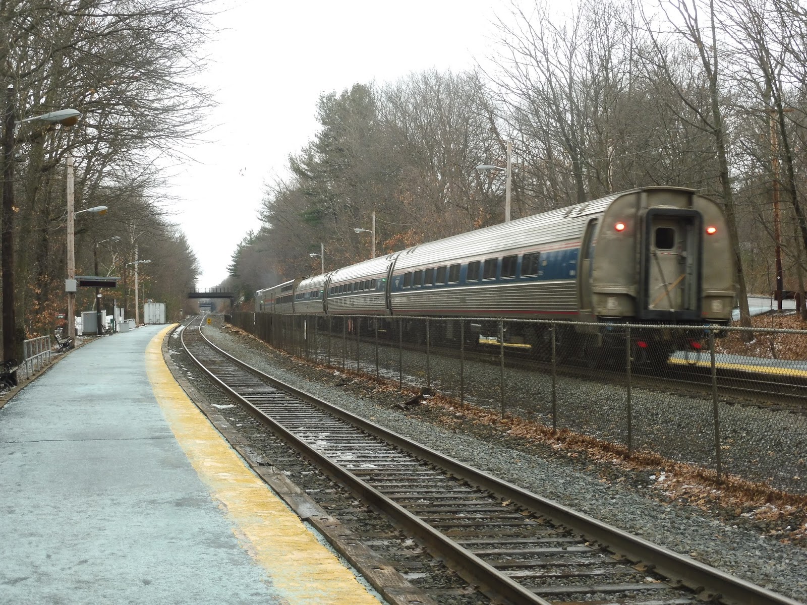
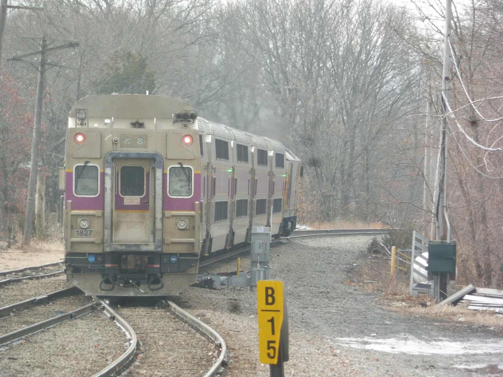
| A train heading out to Readville. |
Station: Four Corners/Geneva
Ridership: The Blue Book predates the opening of Four Corners, so I have no idea what the numbers for this thing are. It’s not like a Saturday morning is a great time to assess Fairmount Line ridership, but there were a few people who got off on my train and a few people who were waiting for one going the other way.
Pros: For a Fairmount Line station, this station is really unique! It has so many passageways and entrances and exits that it ends up being much more interesting than any other station on the line. In terms of functionality, the platforms are all high-level and have everything one would need at a Commuter Rail station.
Cons: I gotta say, the outbound platform is way better than the inbound one. The inbound side can only be accessed by ramps, and they’re not sheltered, unlike on the outbound side. Also, the staggered platforms are pretty annoying, although I understand that the right-of-way is narrow to the point that they needed to be built like that.
Nearby and Noteworthy: You’ll find lots of businesses on (somewhat) nearby Blue Hill Ave. There’s also some retail right on Washington Street near the station.
Final Verdict: 7/10
This is a quirky station, and some of those quirks no doubt lead to cons. After all, the inbound platform is far worse than the outbound side. That said, this is still an interesting station, and I kinda like how weird it is. Aspects of it aren’t great, but it overall equals a good Commuter Rail stop!
Latest MBTA News: Service Updates