Broadway
I wanted to head down to Quincy Center, but the first train that had come was an Ashmont train. Rather than just wait it out for the next Braintree one (in ten minutes), I decided to just get on the Ashmont train. I didn’t want to have to change trains at JFK/UMASS, though, because it would be freezing. And I would have a few more chances to go to Andrew because there are some buses that terminate there. Broadway it is, then!
 |
| I love this platform! |
The bulk of Broadway’s platform is really awesome. It’s a bunch of white pillars lined up, and each one has four different colored tiles. Each of those tiles has a different image on it – 200 in all, done by school students. The platform does have random pipes, but an effort is made to hide them. Take that, Prudential!
 |
| An old sign on the wall! |
The MBTA even left an old Broadway sign on the wall when they renovated the station in 1985. Speaking of the walls, this may sound weird, but I really like them! They’re just white squares, but, I don’t know, they make the place seem brighter or something. I can’t say I’m really a fan of the dingy ceiling, though you can’t see it when you’re standing between the columns.
 |
| The “dodgier” end of the platform. |
But there’s another part of the platform. I believe this is where they extended it for six car trains, because it looks like they really didn’t care about aesthetics when they built it. The columns turn from bright white to a blood-red color. Also, the ceiling stops trying to hide its dinginess and random pipes, while the walls turn from white to “gross tunnel gray.” I think I’ll head back to the nice part, okay?
 |
| Some really cool artwork. |
Leaving the platform and turning around, there’s some excellent artwork above the stairs. It’s a bunch of steel sculptures of “domestic objects” that look fantastic. As for the stairs themselves, they also have an upward-only escalator to go along with them.
 |
| The mezzanine. |
Alas, the mezzanine is a bit of a mess. Long and thin, it stretches between the staircases to both entrances. The white tiled walls are nice, but the ceiling is low and ugly (random pipes galore). And if my memory serves me right, there are only fare gates on one side of the mezzanine and none for the other entrance. That’s just ridiculous.
 |
| The secondary entrance. |
The western entrance of Broadway is in this weird island in the middle of what becomes the Broadway Bridge. The entrance itself is nice, with glass and a T symbol facing an intersection. The weird thing about it is the sheltered bench on it. There aren’t any buses that stop here – why is this set up like a stop, then?
 |
| A rather tight place to take a picture. |
The main entrance makes itself obvious, with a larger-than-average “Broadway” sign on the outside. Although somewhat cramped, this one also has glass, as well as some newspaper boxes and a wastebasket. There’s also a sheltered bench, but you know, buses actually stop at this stop. Broadway’s connections are pretty slim, though, with only the 9 and 11 to City Point, and the 47 to Central Square, Cambridge.
 |
| My camera didn’t seem to like Broadway, so it gave me a bunch of blurry pictures. |
Station: Broadway
Ridership: This is one of the lesser-used Red Line stations, with only about 5,250 riders per day. This can probably be attributed to the lack of bus connections, as well as the fact that the station has mostly industrial surroundings. The exception is to the east, where there are apartments and businesses.
Pros: I love the main part of the platform. From the art to the colors to the old station sign, this is really nice. Also, the entrances are pretty good.
Cons: The extended part of the platform is kind of dumpy and dark, though. The mezzanine is quite bad, and this station doesn’t have too many bus connections.
Nearby and Noteworthy: The Red Line’s Cabot Yard is to the west of the station, and you can get a good view of it (as well as of the Boston skyline) from the Broadway Bridge.
Final Verdict: 6/10
This is one of those “meh” stations that has good elements to it, but isn’t worth seeing because of the other bad bits. Broadway has a great platform, as least the main part of it, and the art in the station is great. But the platform gets much worse at its extended portion, and the mezzanine is terrible. The station doesn’t get much ridership, either – it’s one of the lowest-ridership Red Line stations, in fact.
Latest MBTA News: Service Updates
I feel bad for not being able to report about the MBTA of the past week. Um…well, basically, snow + old MBTA trains = bad things. Pretty much.
69 (Harvard/Holyoke Gate – Lechmere Station via Cambridge Street)
I’ve taken the 69 a fair amount of times before writing this review. Most of those times have admittedly just been from the Cambridge Rindge and Latin school to Harvard Station (only a few blocks), because I’m lazy and sometimes miss the 68. However, I also took more than half the route about a week ago to get to a friend’s house. But the ride I’m talking about today is the one I took during my awful commute home – beginning to end.
 |
| A 1400! Too bad it’s nighttime. |
There were two 69’s that came into the Lechmere busway at the same time (bunching…uh-oh). The front one was a normal New Flyer diesel, while a new 1400 Xcelsior was behind it. I, of course, wanted to ride the new one, but everyone else was heading for the diesel. A few had gotten on that bus when the driver of the 1400 got out. “Hey,” he said to the other driver, “I’ll take these guys.” Yes! We all filed onto the 1400 while the diesel drove off.
We swung around to the Monsignor O’Brien Highway, turned onto Third Street, and took a right onto Cambridge Street. It was a mixture of businesses, houses, and apartments, though the houses were gone after a little while. We crossed over a single railroad track, which I believe the MBTA wants to convert into part of the Indigo Line, and passed the King Open School.
 |
| Another blurry nighttime picture, this one at Harvard. |
After that, it was mostly businesses with apartments on top, though we also passed a big apartment building. We reached Inman Square soon after, which had a bunch of businesses, as well as a fire station. It turned to houses after that, but there were also two big hospitals.
 |
| Ah, much better. This was time I took it to my friend’s house. |
We then passed the massive Rindge and Latin school, where there were also some businesses frequented by students. Unexpectedly, we made a hard left turn onto Felton Street, then onto Broadway, joining the 68. We turned onto Quincy Street, passing Harvard Yard and a bunch of university buildings. Curving around to the south side of the yard, we arrived at Holyoke Gate, and I made the snowy trek to Harvard Station.
 |
| Another one at Harvard. |
Route: 69 (Harvard/Holyoke Gate – Lechmere Station via Cambridge Street)
Ridership: This is a pretty heavily-used route – there were about 30 people who rode on my trip, during a Saturday night. Many of them used it for local service along the route, though a few actually took it from beginning to end. It’s a great crosstown route, after all.
Pros: As I mentioned, the 69 is a quick link from Harvard to Lechmere, scheduled at 17 minutes. Of course, it often takes longer, but we’ll get to that. For such a short route, the 69 serves quite a lot, cutting right through Cambridge on a street of the same name. Its schedule is mostly great, too: every 10 minutes during rush hour, every 20-25 minutes weekdays, and every 20 minutes Saturdays.
Cons: But every 40 minutes nights and Sundays is really bad, especially for a route with levels of ridership like this. Another problem with the 69 is that it has a habit of being late – in fact, it’s late so often that it’s sort of become infamous within Cambridge. And it evidently bunches, even on Saturday nights…
Nearby and Noteworthy: Here I am thinking I’m familiar with Cambridge Street, but now I can’t think of a single business on it! Shoot…
Final Verdict: 6/10
I can think of a few people who would want me to go lower. But ultimately, the 69 is still a route with a decent schedule that serves a lot. It does have some big flaws in terms of lateness and bunching, and that Sunday schedule is awful, but it’s still an important route that a lot of people use.
Latest MBTA News: Service Updates
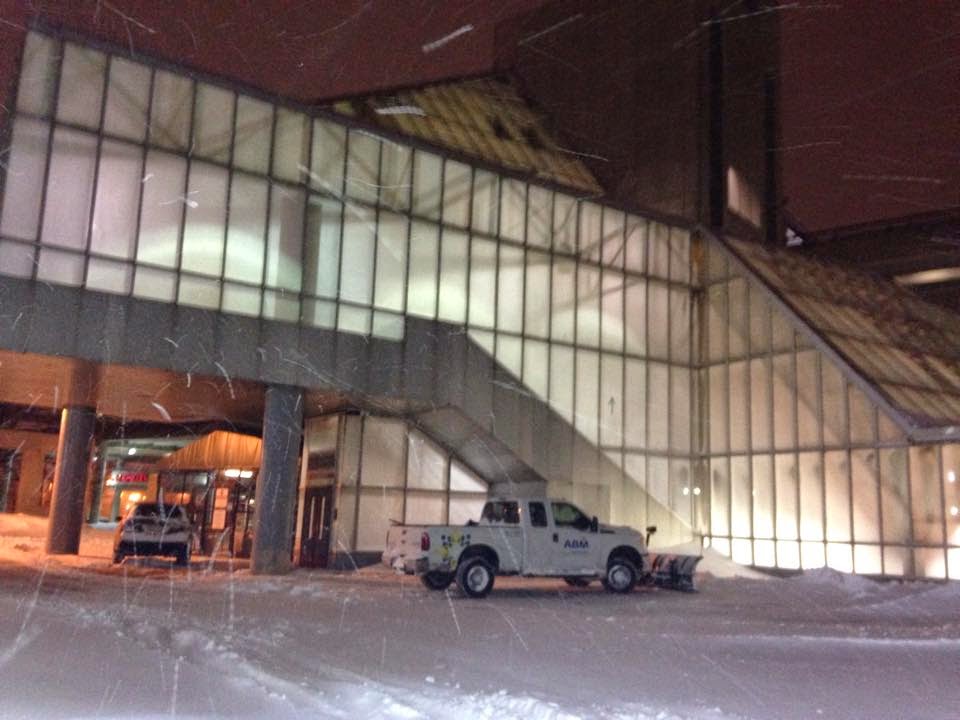
236 (Quincy Center Station – South Shore Plaza via East Braintree and Braintree Station)
I went to the South Shore Plaza many times when I was younger. My nana would always take me, and I have particularly vivid memories of riding the glass elevator up and down, over and over again. Visiting the Plaza again on the 236 was certainly nostalgic, and it was an interesting ride, too.
 |
| The downside to riding buses in the winter is the salt on the windows. Ugh. |
Leaving Quincy Center Station, we headed down Hancock Street, going by lots of businesses. When I say “going by,” I mean going by at a snail’s pace, because there was so much traffic. The intersection with School Street had a light that just wouldn’t change. We were sitting there for at least 10 minutes in traffic waiting to make the turn onto that street.
 |
| Come on! Hurry up! |
After that, we turned onto Franklin Street, still going by the businesses of Quincy Center. But after the street curved to the left, we became independent from other routes, and it got full-on residential. When it became Commercial Street and we entered Braintree, it started to feel more suburban in character, with large houses and front lawns. Of course, the street was much more narrow than usual due to some heavy snow buildup from the blizzard.
We crossed over a single railroad track, then turned onto Elm Street and crossed the same track again. Elm Street had slightly smaller houses that were closer together. After a small industrial section, we turned onto Middle Street, going over the Greenbush Line tracks and back to more houses. The street made a left turn, and snaked around south again.
 |
| I think there’s a river somewhere down there… |
We turned onto Union Street, going by a police station and the National Guard, then crossed over a river that was hidden by the snow. There was some traffic on a big rotary going around a Route 3 interchange, but it certainly wasn’t as bad as the School Street Red Light of Doom. Right after the rotary we went up onto an elevated road that curved around to the Braintree busway, where lots of people were waiting to get on.
 |
| Not the same bus – this is the one I took back, seen at Braintree Station. |
We headed down Ivory Street for a bit, then turned onto Pearl Street, going by malls named after both of those. There were a few normal businesses at South Braintree Square, after which we turned onto Franklin Street, which was once again residential. Soon we reached Five Corners, which had some retail, and merged onto Granite Street. We then turned onto a road that led past a small office park, and then ended up at the South Shore Plaza.
 |
| The bus at the Plaza. That one behind was a 240 heading up to Ashmont. Since when does the 240 go to the South Shore Plaza? Was it a faulty destination board? |
Route: 236 (Quincy Center Station – South Shore Plaza via East Braintree and Braintree Station)
Ridership: There were about 20 people on my ride there, though a whole bunch of people were waiting at the mall – the bus left it with a pretty full load (this was a Saturday). This route seems to be split up into two: the section from Quincy Center to Braintree, for people going to the residential areas between those points; and the section from Braintree to the South Shore Plaza, which is a considerably shorter section, yet it seems to get more ridership.
Pros: This route is a fast link from Braintree to the Plaza – it’s scheduled to take 8 minutes. This is one of only two routes to serve the Plaza, the other being the 238, which isn’t nearly as quick. The 236 is also the only route to serve much of Braintree.
Cons: The schedule, for one thing. The route runs every hour weekdays and Sundays, and every 70 minutes on Saturdays. Every hour on weekdays sort of makes sense, since this is mostly a shopping route, but come on – every 70 minutes on Saturdays? Also, this route seems to be late a lot – our bus was at least 15 minutes behind schedule, and the one coming back arrived 10 minutes after it was supposed to. This could’ve been due to the Red Light of Doom, or perhaps the snow, but it was still annoying. Oh, and for those who work at the South Shore Plaza, sorry, but the 236 doesn’t go there in the morning.
Nearby and Noteworthy: The South Shore Plaza is huge, with lots and lots of stores to choose from.
Final Verdict: 4/10
If you need to get from the Red Line to the South Shore Plaza, then this is the bus for you. Just don’t miss one, because the schedule’s awful. And don’t use this if you work at the Plaza, because it doesn’t go in the morning, Also, don’t expect the bus to be on time, because it’s late a lot. But, you know, it’s great otherwise.
Latest MBTA News: Service Updates
Random Photos: Speedy Commuter Rail Train
While waiting for the Red Line at Wollaston (this is all kind of building up to a review at some point), a Commuter Rail train came speeding by. It kicked up snow as it went along, and made for some pretty cool photos.
 |
| The back of the train (but technically the front). |
 |
| The locomotive (which was the back of the train in this context…man, that’s confusing). |
Random Photos: Tickets in Chinese
There’s a small Chinatown around Wollaston Station, and so the MBTA decided to cater to that. Inside the station, they have a ticket chart in Chinese!
 |
| I wonder if this is the only one on the system. |
Random Photos: Driver Change?
I forgot to post this one earlier. At Green Street, when our train came in, it stopped at the end of the platform. The driver then opened the front door, got out, and was replaced by someone else. Is this regular protocol? Do train drivers just do this randomly? Oh, well, it made for a cool picture.
 |
| It must be so scary jumping that gap… |
Transit Tales: I Just Wanna Go Home!
It all started at South Station. The driver announced over the loudspeaker that we would be standing by due to some issue with the train doors (or something). After about a 10 minute wait with constant reassuring announcements of “It’ll just be a little, little, little, little bit longer”, we finally left for Downtown Crossing. Once we got there, the driver announced that we would be standing by again. And a few minutes later, they made the announcement that the Red Line was experiencing moderate delays. But it wasn’t because of our train – no, there was apparently a medical emergency.
This was about the last straw for me, so I left the train and walked to Park Street via the Winter Street Concourse. I then went to the Green Line and took that up to Lechmere, from which I got a 69 to Harvard (review on that coming at some point). Once I got there, I figured the train might be running fine now, so I headed down into the station. The countdown clock said there was a four minute wait until the next Alewife train. “Okay,” I thought, “I can handle four minutes.” So I went to the platform.
Then all of a sudden, that four minutes turned to eight minutes for no reason. They then made the announcement that the Red Line was still experiencing moderate delays…because of a disabled train at Kendall. What?! When did the reason for the delays change? This was when I left the platform fed up, and decided to just take the 77 instead. It dropped me off on time (unlike some transport modes I know), and I made it home 70 minutes later than expected. Ugh.
 |
| Park Street was a bit of a mess… |
Green Street
After taking the 41, we had two options: take the 39 down to Forest Hills, or make the 10 minute walk to Green Street. I figured I’d have plenty more chances to go to the former, whereas the latter is no longer served by any buses. So after a walk through a nice residential neighborhood, we ended up at Green Street Station.
 |
| The station’s headhouse. |
The station’s entrance is, unsurprisingly, on Green Street. Outside there are a few sheltered bike spaces, as well as an essay and poem about the neighborhood on a plaque. The headhouse is pretty nice, made of brick and glass.
 |
| The mezzanine. |
The station’s mezzanine is very big and spacious. There’s a big area even before the fare gates with a few benches and fare machines. Speaking of the fare gates, five of ’em is definitely more than needed here, which is great. Also, there’s weird art spread throughout the station – you have to look around to notice it, but it’s basically colored shapes suspended from various places. Pretty cool stuff.
 |
| The platform, looking down the middle. |
After the fare gates, the station becomes pretty much the exact same thing as Roxbury Crossing (and the other Southwest Corridor stations in general). There’s a staircase, an upward escalator, and an elevator that all lead down to the platform. And aside from a cool light fixture at the northern end of the platform, it’s the same thing as Roxbury Crossing. You can still hear – but not see – Commuter Rail and Amtrak trains going by (it happened here with an Acela), there are still pointless shelters in an already sheltered area of the platform, and the place is still tranquil, even more so than Roxbury Crossing. So even though we had to wait 10 minutes, it wasn’t that bad in the almost empty station.
 |
| A train coming in. |
Station: Green Street
Ridership: This station’s tranquility can probably be credited to the fact that it has the lowest ridership on the entire Orange Line, with about 3,600 riders per weekday. Most of these riders are probably locals from the surrounding area – large houses to the west, and smaller apartments to the east.
Pros: This is a really nice, quiet station. I love little neighborhood stations like this, with mostly small side streets around them. It’s busier than, say, Shawmut, but certainly still has that quiet element to it. The station is clean, and I like the art installations throughout.
Cons: Of course, this station suffers from the same problem as the rest of the Southwest Corridor: bland, 80’s architecture. And once again, those weird bench shelters are pointless.
Nearby and Noteworthy: There are some businesses to the immediate east of the station, including a café right across the street. And about a half mile to the west is Jamaica Plain Center, with lots of retail and a few bus connections (Green Street itself has none, though the 42 is three blocks to the east).
Final Verdict: 8/10
Having seen two Southwest Corridor stations, I think I like this one more. I can’t say I’m too sure why I’m more of a Green Street fan over Roxbury Crossing, but perhaps it’s because of how relaxed it is. It feels even more tranquil than the latter, though they’re about the same in most other regards.
Latest MBTA News: Service Updates
41 (Centre and Eliot Streets – JFK/UMASS Station via Dudley Station, Centre Street, and Jackson Square Station)
Okay, so even if I made fun of the angry driver of the 8, he did help us out a lot. If he hadn’t dropped us off back at JFK/UMASS, we wouldn’t have been able to catch the 41 to Jamaica Plain Center. I still don’t understand the driver’s “book writing” analogy, though…
 |
| Looking at the bus straight on. |
Leaving JFK’s busway, we made our way up to Columbia Road, which went over the Red Line tracks. There were a few gas stations and a church at the intersection with Dorchester Ave, then a short residential stretch. At the intersection with Mass Ave, there were some more businesses, which turned back to houses as we followed Columbia Road to the left.
Soon after we reached Uphams Corner, where the first proper businesses came up, lining the road as we turned onto Dudley Street. We were running with the 15 now as we passed Uphams Corner Station. After that, the road became lined with apartments with a few businesses scattered here and there.
This continued until we reached Dudley Square, then continued down Malcolm X Boulevard. We passed one of a few schools on that street, then unexpectedly made a sharp uphill turn onto Roxbury Street. Going by a middle school, Roxbury Street became Centre Street, which had a mix of houses and apartments – these phased into just houses.
Centre Street merged into the very wide Columbus Ave, from which we entered the Jackson Square busway. We continued down Centre Street from there, passing an apartment complex and then closely-spaced triple-decker houses. As we approached South Huntington Ave, these turned to retail buildings, and we were soon joined by the 39.
There was yet another school, but Centre Street mostly consisted of apartments. The businesses got denser and denser as we got closer to JP Center – eventually they lined the road. The last stop of the route is at Centre and Eliot Streets, right next to the Soldier’s Monument. However, we accidentally got off one stop earlier, at 775 Centre Street! That’s seven seconds of the route that we missed! I’ve failed you all.
 |
| The bus laying over. |
Route: 41 (Centre and Eliot Streets – JFK/UMASS Station via Dudley Station, Centre Street, and Jackson Square Station)
Ridership: There were about 25 people on our trip in total – not bad for a Sunday. This route goes through areas where lots of people use the bus, so it gets fairly high amounts of passengers overall – almost 2,250 riders per day on weekdays. That number drops to about 1,000 on Saturdays and about 550 on Sundays, but the 41 ranks pretty well overall.
Pros: The fact that it goes to JFK/UMASS is a definite plus. This route forms a direct link from JP to the Red Line – indeed, it’s one of the only bus routes to serve JP anyway. The 41 also has a few parts all to its own, most notably the section on Centre Street from Jackson Square to South Huntington Ave.
Cons: The schedule is all-around pretty bad. Every half hour during the day is decent, but having those same headways during rush hour is pushing it. It gets worse on weekends, with buses running every 50 minutes Saturdays and every 45 minutes Sundays. The route also suffers from bad service spans – the last bus is at 9 PM on weekdays, 8 on Saturdays, and 6 on Sundays.
Nearby and Noteworthy: One stop along the route was announced as a “mansion.” No mansions could be found.
Final Verdict: 5/10
I would call the 41 a pretty mediocre route. The ridership is decent, but the schedule is pretty terrible. Even the ride itself is mediocre – it’s interesting enough, but there’s nothing noteworthy about it. That said, it does provide a link from JFK/UMASS to JP, so it does have some use.
Latest MBTA News: Service Updates
MBTA trains have been…smoky lately, with two smoke-related incidents occurring in two days.
Random Photos: Alewife in the Snow (With Diamonds)
My friend Lucy (who took the photos) and I were taking a little walk in the snow, and ended up at Alewife Station. Surprisingly, a few of the doors were open, but the station was deserted, there being no T service at the time. When we were on the balcony over the mezzanine, for some reason the departure bell started ringing and we could hear a train leaving! I assume it was non-revenue, but why would they be running a non-revenue train in the first place? Oh, well, the pictures were cool.
 |
| The huge building. |
 |
| The busway was deserted, of course. |
 |
| The fare machines were still on. |
 |
| The totally empty mezzanine. |
Random Photos: Don’t Go Looking For the 48
The 48 bus went to Green Street station before it was brutally cut from the system. Of course, instead of replacing the sign at the station, the MBTA just took out their roll of duct tape…
 |
| Why didn’t they just tape up the whole thing? |
Random Photos: Low-Flying Plane at Beachmont
Logan Airport’s influence spreads quite far. All the way up in Revere and one can still see the planes flying low overhead.
 |
| The plane. |
 |
| Looking out over the station. |
Random Photos: View From Lynn Parking Garage
I found a batch of random photos that were never published, so I’ll be putting them out. The first one is the decent view from Lynn Station’s parking garage.
 |
| Looking over downtown. |
 |
| And towards Nahant. |
 |
| The birds circle above an interesting-looking tower on a hill. |
8 (Harbor Point/UMASS – Kenmore Station via BU Medical Center and Dudley Station)
It’s not often you miss the last stop on a bus. But once we reached the last stop of the 8, the driver decided to drive away before yelling at us. Thus, for all intents and purposes, my friend Jason and I missed the final stop of a bus route. What an accomplishment…?
 |
| This came out surprisingly well, considering the amount of salt on the bus window. |
 |
| This one at Kenmore will have to suffice. |
64 (Oak Square – University Park, Cambridge or Kendall/MIT via North Beacon Street)
I never really gave the 64 much thought until I read Jordan King’s guest post about it. The route sounded interesting, and I figured I’d have to give it a try at some point in time. Then a few of my friends, with no interest in buses at all, told me I should ride the route. Well, now I had to do it!
 |
| The bus on Green Street in Central Square. |
The 64 starts at University Park, a little east of Central Square. We (my friend Jason came along “for moral support” – his quote) didn’t get on all the way over there, and like everyone else boarded at the Magazine Street @ Green Street stop. After everyone got on, we headed down Western Ave, going by lots of houses. There were a few apartments and industrial-looking buildings at the intersection with Memorial Drive, then we crossed over the Charles.
 |
| Nice view. |
After the bridge, we turned onto a road paralleling Storrow Drive, We then turned onto Cambridge Street, heading over an exit of the Mass Turnpike. There was a view of…really just industrial wasteland. There wasn’t even a skyline view on the other side!
 |
| Still, industrial wasteland looks kind of pretty in the snow. Kind of. |
There were some apartments on the other side of the bridge, but also a few auto shops and gas stations. We were joined by the 66 as we went over the Mass Pike again, and then after an industrial area, we stopped at Union Square, Allston. Here we went solo again, turning onto North Beacon Street.
The route would normally take a short detour from North Beacon Street via Arthur Street, Guest Street, and Life Street, but there was construction. So, we stayed on North Beacon, which was pretty darn industrial. We went by Market Street, as well as that really cool TV station, and soon after it got more residential.
Crossing under the Turnpike again, we were greeted by some fast food restaurants with huge parking lots. It got more parky, luckily, and there was a nice view of the Charles from North Beacon Street. We soon turned onto Brooks Street, crossing the Pike for the last time, and then the fun part of the route started.
 |
| I guess the river wasn’t frozen out here. |
Unexpectedly, we turned onto Hobart Street, going through a nice-looking residential neighborhood. But this street was tiny, and we could barely fit between the parked cars. I would’ve loved to have seen a car try to go the other way, but unfortunately the road was quiet. We turned onto Falkland Street, and then the much wider Faneuil Street.
There were a few businesses at Faneuil Square (where the last 64 terminates on weekdays and Saturdays), then more houses. These eventually turned into apartments, and after passing a park, we arrived at Oak Square. The driver kicked us off and the bus looped around to head back to Central Square.
 |
| Huh. It says “no Beacon Street,” yet I’d swear the route went on Beacon Street! |
Route: 64 (Oak Square – University Park, Cambridge or Kendall/MIT via North Beacon Street)
Ridership: On our ride, there were about 25 passengers in total. For a Sunday, that’s not bad. There were about 10 people who got on at Central, and the others fed on at various stops. In terms of rankings, it’s about halfway down the ridership list at places 70, 77, and 83 for weekdays, Saturdays, and Sundays, respectively.
Pros: This route has a good chunk of northern Brighton all to itself. Also, a person sitting in front of us vouched for the fact that the route provides a speedy link from Central to Union Square, which it does indeed. During rush hour, the 64 is extended to Kendall, presumably for commuters to the area, which is great. The route runs pretty often during that time, too, every 15-20 minutes.
Cons: That’s raised to every 35 minutes during the day, and every hour at night and on weekends. The Sunday schedule is particularly brutal as the last trip that day is at 6:35 from Oak Square. Those are horrible service hours! A nitpick is that the University Park routing is annoying, but it’s not that bad.
Nearby and Noteworthy: Aside from Oak Square, which seemed nice, the 64 goes by the very first Staples store, in Brighton! I’m gonna be honest, it looked like just a regular Staples, but it’s still kinda cool.
Final Verdict: 7/10
This is overall a pretty good route, in that it serves a lot. It also provides a speedy link from northern Brighton and Union Square to Central Square. The schedule is the only real con for this route – every hour on weekends is bad enough, but the service span on Sunday is terrible. Still, for folks in Brighton, it’s better than nothing.
Latest MBTA News: Service Updates
The MBTA isn’t running today because of the blizzard. Yes, I know I’m really late.