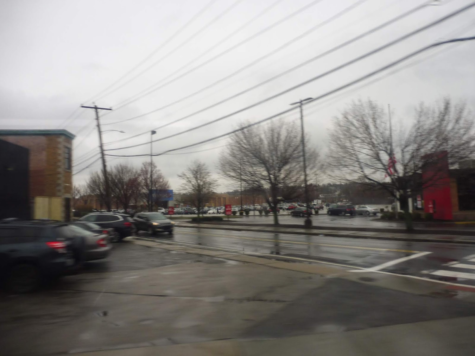
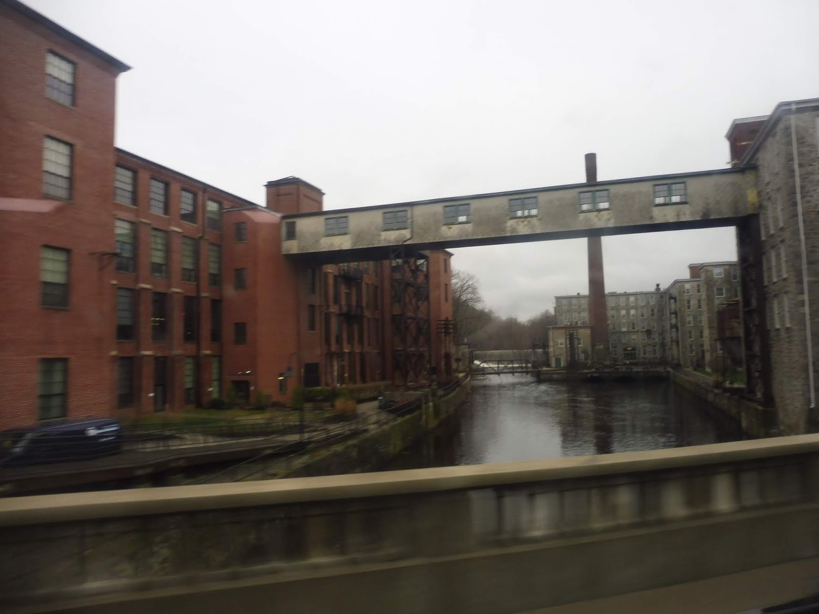
45 (Broad-Oregon to Center City)
What better SEPTA bus route to start out with than the infamous 23/45 combo from South Philly all the way up to Chestnut Hill? Once the world’s supposed longest streetcar route, it got replaced by motor vehicles in 1992 and became just a really really long bus route. But its on-time performance was abysmal, so SEPTA hatched another plan: split it into two! So now, we’ve got the 45 from South Philly to Center City (a generally short trip) and the 23 from Center City to Chestnut HIll (still a really really really long trip). For now, let’s tackle the southern section of the route, the 45.

Laying over at Oregon.
We began at Oregon Station on Broad Street, but we instantly turned onto Oregon Ave. Once we got past the boundaries of Marconi Plaza, there were row houses on both sides of the road and many businesses. Also, Oregon Ave has a median, and in South Philly, that can only mean one thing: the whole thing was covered with parked cars!

Ignoring the angle of the spaces, parking in the median past the light, and parking in the crosswalk…this is South Philly in a nutshell.
Suddenly, we turned off the wide Oregon Ave onto the very narrow one-way 11th Street. The two-story apartments along here were generally austere, with flat fronts and not too many porches. Most intersections had at least one corner store. Also, each intersection with even a semi-major road (about every 500 feet) had both a stop sign and a bus stop. Progress was slow.

A very narrow side street.
After what felt like forever, we got to Snyder Ave, the next stop on the Sub three blocks away. It was more row houses from there, save for a Catholic high school. Suddenly, 11th Street ended at Passyunk Ave, which we merged onto. This street was dotted with lively businesses and restaurants, part of the fantastic East Passyunk neighborhood.

An awful picture of a plaza in East Passyunk.
A block before the famous Cheesesteak Corner with Pat’s and Geno’s, we turned onto Reed Street, going by an ACME supermarket with a big parking lot out front. We curved around onto a new 11th Street outside of an industrial building. This 11th Street was wider: it was two ways, with perpendicular parking and three-story apartments instead of two.

Crossing Washington Ave.
There were many businesses at the intersection with the wide Washington Ave, and beyond there, the apartments got more diverse in height and style. They also started to get more charmingly old, and eclectic businesses were popping up at every corner. 11th became one-way again at Bainbridge Street, and once we crossed Locust Street, another change occurred: we were now very much in Center City, and the buildings got taller and taller, with many more businesses. Even though the route goes a few blocks further north, I got off at Market Street to transfer to the 23 – it seemed like a fitting place to do it.

A decent amount of people stayed on for destinations north of Market.
Route: 45 (Broad-Oregon to Center City)
Ridership: Since the route is so short, it’s not a huge surprise that ridership is on the lower side for SEPTA’s City Transit routes: 4,299 passengers per weekday, lower than other routes that are less frequent. Still, my Saturday morning ride got 29 people, which is pretty darn good – clearly, people are using this.
Pros: Like most core Philadelphia routes, the 45 takes a nice direct path through the city. In this case, it covers the 11th and 12th Street corridors. It also runs super frequently, with service every 10 minutes or less on weekdays, every 15 or less on Saturdays, and every 20 or less on Sundays. Night service starts at every 20 minutes around 8 and gets down to every half hour by midnight. It has a pretty good span – buses run from 5 AM to almost 3 AM.
Cons: The 45 is plagued by the problem that almost every SEPTA bus route has: too many stops. Now, in the 45’s case, it’s not as bad because almost every intersection in South Philly has a stop sign. There wouldn’t be much time savings from stop consolidation unless the intersections were changed, so the frequent stops feel a little more tolerable here. It’s also worth noting that the route has a surprisingly low farebox recovery ratio, at just 18%…perhaps service could be running more frequently than it necessarily needs to be? But finally, here’s my biggest problem with the 45: the free transfer to the 23 didn’t work on my Key card! Is it not supposed to work with Key? Because the schedule says that cash and token users can request a paper transfer, implying that the transfer should happen automatically with Key! Yeah, I’m really mad that SEPTA got an extra two bucks out of me.
Nearby and Noteworthy: The 45 serves a ton. The East Passyunk neighborhood is trendy, with lots of hipstery stores and restaurants, while closer to the city, the route passes the intriguing Philadelphia Magic Gardens. Plus, there are tons of cute corner businesses sprinkled along the whole thing.
Final Verdict: 7/10
I can’t believe they charged my $2 for that stupid transfer. I’m going to hope that that’s an outlying case, because other than that, I like the 45. Since it was split off from the 23, it has seen a dramatic improvement in on-time performance, and from what I saw, it didn’t seem like too many people were actually doing the transfer to continue north. The route is slow from stopping all the time, but with the stop signs, there isn’t much that can be done about that. And even if service is running “too frequently” to have a good farebox recovery, I’m not going to dock points for too much all-day frequency on an urban route. That said, they could probably take a few buses off on weekdays and it wouldn’t cause too much trouble. But no matter – the 45 is a great connection from South Philly to Center City, and possibly beyond if the darn transfer would work!!!!
Latest SEPTA News: Service Updates
SRTA: New Bedford Terminal
Boy, that Fall River Terminal sure was nice, huh? Yeah. What a great terminal that was. Well, anyway, it’s time to look at their other terminal. It’s a lot worse.

Ech.
Yup, modern this terminal ain’t. There are uncomfortable wooden benches that meander through the middle of the room that feels like it should be filled with depressing cubicles, while a lone ticket machine stands on the opposite end from the human ticket offices. There is but one bathroom here, and it’s disgusting. Also, it has space for four users, even though it’s only meant to be used by one at a time.

Oh dear!
On the side of the building is a ramp that leads down to…”Snack Bar.” What is this mysterious door? Well, apparently nothing, because it looks like this snack bar has been closed for years. I also found another closed door, this one leading to the parking garage. It turns out you need a monthly pass to enter the lot. Oh well.

The boarding area.
The Fall River Terminal may not have had labels for its berths, but at least it had berths! Here, the buses just line up in this dingy boarding area. Which one is yours? Who knows, better check them all! Let me tell you, this place can get chaotic. Incidentally, coach buses to Boston board on an island platform, and that’s how Sam and I finally got home from a very long day of bus rides!

Two island platforms? Seems like they could do berths here…
SRTA Station: New Bedford Terminal
Ridership: I can’t find an exact figure for SRTA’s New Bedford ridership, but I know that it’s pretty high for an RTA. This terminal was quiet by the time we got here around 8 PM, but it’s usually busier during the day.
Pros: Well, it’s a place to wait inside for the bus. That’s nice.
Cons: It’s so ugly! And the bathroom is awful! And the boarding process is chaotic! AND THE SNACK BAR IS CLOSED!!!!
Nearby and Noteworthy: Downtown New Bedford has a few really nice parts of it that are close to the terminal. To the east (and a little south), you’ll find cobblestone streets, museums, and interesting shops.
Final Verdict: 4/10
I don’t have much to add here. This is a bad terminal, but it’s not bad in a funny or interesting way, it’s just…bad. Yeah, I think that’s about it.
Latest MBTA News: Service Updates
Oregon (BSL)
Wow, it looks like our first Broad Street Line post is actually taking us to another state! I knew SEPTA went to New Jersey and Delaware, but Oregon is quite a trip! What? It’s just in South Philadelphia? Oh, okay…not nearly as exciting, but South Philly is cool, too.

Looking down the center platform.
This station was opened in 1973, huh? Yeah, I’m not surprised. I couldn’t help feeling like I was in some sort of Eastern Bloc state when I was down here. The platform is clean and all, but it’s very utilitarian in its design. Big metal pillars, simple colors, and exposed pipes are all hallmarks of Oregon. The station, not the state. Argh!

Another hallmark of Oregon? Excessive water damage, apparently!
Despite the ugliness of the platform, the actual waiting experience is pretty good. The station has plenty of benches and wastebaskets, and there’s great signage saying where each exit goes and what buses stop outside of each one. Also, there’s just a random black carpet at the bottom of the main exit stairs. Uhhhh…okay…

I sense a waste of space!
Well, this room looks nice! We’ve got a gorgeous wall with some form of actual style, there’s a wastebasket and a recycling bin, and there are plenty of exit-only turnstiles. But…how do you get in? Oh…this big room on the north side of the very wide and difficult-to-cross Oregon Ave is…exit-only? Arahghhsaghsasglasgag…

The bus stop on the north side from across the street.
The exit-only side does have the best of Oregon’s many bus stops. There are benches lined up under the building, so it ends up providing the most shelter of any of the stops here. This particular one serves the westbound routes 7 and G, as well as the southbound 68 (not that that route really has a consistent direction – it’ll be a fun one to review).

Into the elevator.
Pro of Oregon: it’s accessible. Con of Oregon: the elevator is awful. I like that it’s glass (especially since it means you can see how slowwwwwwly you’re going), but the thing smells really bad. Also, what’s the deal with the buttons? For some reason, every button that you have to push has its metal covering withered away, so all that’s left is the gross stuff beneath the cover. This isn’t on any buttons that you don’t have to push, such as the door open and door close ones; it’s only for the ones that call the elevator, and the ones for each floor. Why???

The other exit.
That elevator takes you up to the main exit, as do a set of stairs and an upwards escalator. And…huh, more carpets up here. Okay? Well, anyway, although there are a million exit-only turnstiles here (as usual), this is not only the main exit, but also the main entrance. Yes, there are fare gates here! Let’s take a look at those.

The mezzanine…?
Oh, okay, I guess the faregates lead from outside into the building. I don’t think I’ve ever seen something like this in a subway station, but it works. There’s a makeshift mezzanine on the plaza outside the station, complete with wastebaskets, a map, some nice plants, and about 20 bike racks stretching around the side of the building, contrary to SEPTA’s assertion that “no bike racks are at this station.” There’s just one problem: only one fare machine. Why only one? Is there not room for another?

WHAT?
Oh…there is a second fare machine…on the other side of the building from the fare gates. Okay, why? Why put it here? Why have a random fare machine that’s completely isolated from the mezzanine? Sure, SEPTA could always replace the exit-only turnstiles with fare gates (which would be very nice) and make a second entrance here, but something tells me that’s not on their dance card. So…okay! Just one random fare machine. Sure.

Another one of the station’s bus stops.
The only other bus stop here worth dedicating time to is the one for the eastbound 7 and G, since it’s the only other one with a shelter. What other stops are there? We’ve got one on the west side of the intersection of Oregon Ave, this one for the 68; a southbound one on Broad Street for the 4 and the Broad Street Owl; and two separate stops running north on Broad, one for the 4 and BSO, and one for the 45. All of those stops are just signs. And yes, it is confusing that there are so many.

A train zooming in.
Station: Oregon (BSL)
Ridership: Oregon’s ridership falls around the middle of the Sub’s South Philly stations (the Sub is the BSL’s alternate local name, since it’s almost entirely underground): the station gets 3,514 people per weekday. Aside from the many residents that probably use the station, I would imagine many of those people make bus connections, particularly to the 7 and the G, which together create a pretty frequent route down Oregon.
Pros: Once you find the right entrance, this is a very straightforward station. It’s super easy to navigate, especially when you factor in the fantastic signage within, and the whole thing is clean. This is also a big bus hub with five regular routes (the 4, 7, 45, 68, and G, plus the Broad Street Owl at night), which is a ton for a South Philly station.
Cons: Gosh…I’m so entranced by the awful fare machine layout that I can’t think of Oregon’s other cons! Oh wait, I remember now. First of all, the bus stops are really complicated, and although the signage within the station is great, it disappears once you leave. Some sort of map of the stops around the intersection would be a big help with navigation. Also, there’s the fact that the headhouse on the north side of Oregon is exit-only, even though there’s plenty of room to make it an entrance – no further explanation needed there. To round it off, there’s the bad elevator and the generally dismal aesthetics of the platform.
Nearby and Noteworthy: Marconi Plaza is a big ol’ park with a playground, baseball fields, and lots of paths and benches – fun for the whole family! The station is right on the north side of the park. Also, I’ve been told that Pop’s has among the best water ice in Philadelphia, so give that a shot. It’s right near the station on the north side of Oregon Ave.
Final Verdict: 5/10
Oregon’s layout really blew me away in its stupidity. I mean, the exit-only headhouse? The one random fare machine? Who designs a station like this?? It’s at least straightforward and wheelchair accessible, but come on, this place isn’t worth more than a 5. Heck, even the straightforward thing only applies if you’re catching a train – it all falls apart if you’re trying to get a bus!
Latest SEPTA News: Service Updates
SRTA: NB 9 (New Bedford/Fall River)
Question 1: why is this considered a New Bedford route when it connects both Fall River and New Bedford? Question 2: why does it have to be called the 9 when there’s also a Fall River 9 that boards from the Fall River terminal but does something completely different? Question 3: why, of all trips, did I have to get the one that does additional deviations? Grrrr…we’ll get to that.

Boarding at the Fall River Terminal.
Upon leaving the terminal at Fall River, we zig-zagged our way around to get onto Pleasant Street. By the time we got there, it didn’t feel like “downtown” anymore, with a lot of parking lots and suburban businesses lining the road. That said, it actually started to feel more urban the further we got, as dense houses, apartments, and businesses started to pop up.

That’s a lotta houses!
Eastern Ave was a very confusing place where the NB 9 and the FR 9 intersect, but the latter goes north on Eastern while we turned south. This was a wide road with a grassy median, and it was also the last road for quite a while that would feel at all urban. Once we crossed I-195, there were some office parks as we turned onto Martine Street, which then ran on a narrow isthmus in between two ponds.

Crossing 195.
We entered Westport, the street became State Road, the isthmus ended, the road widened, and the scenery got ugly. Suburban businesses, anyone? We went through a semi-cloverleaf interchange with Route 88, where there was a brief forest break, then it went back to the suburban businesses again, plus a few houses on tiny dead-end streets.

This place looks popular!
As we curved around Noquochoke Lake, we entered Dartmouth, but nothing changed about the scenery. Suddenly, outside of a Walmart and a shopping center with a Target, we turned onto the residential Cross Road. Where were we going? Next, it was a turn onto Old Westport Road, then Ring Road, and…ohhhh, it’s the UMass Dartmouth campus! We pulled into the campus center, opened the doors, and the bus got busy.

A blurry photo of campus.
We came back from the deviation the same way we had gone in, except instead of going back onto State Road, we continued forward on Cross Road. What was going on? Well, a few trips on the 9 do some of the deviations that the 10 does to provide reverse commute service when that route isn’t running. And we were on one of those trips! Hit me with deviations! Let’s go!

Wow, the scenery changed a lot!
Cross Road was just suburban houses, although we did also go by an apartment complex called Cross Road Apartments. Finally, we reached Faunce Corner Mall Road, where the suburban businesses returned. Unfortunately, while the 9’s morning trips additionally serve the 10’s deviations that occur north from here, the evening trips only go south, meaning we just got to experience one additional deviation: the one to Ann and Hope Plaza.

Coming out of the plaza.
We returned to the main road, but it was nary two minutes before we performed another deviation. Unlike Ann and Hope Plaza, which didn’t have anything that seemed deviation-worthy (Christmas Tree Shops, anyone?), this deviation was to the Dartmouth Mall, which is a legitimate indoor mall. Even regular 9s deviate for this one!

The front of the mall.
Okay, now we could return to State Road, which featured more suburban businesses, a few houses, and a golf course. Once we entered New Bedford, the road became Kempton Street, then it split into two one-way sections. This was more like it: it was dense houses with retail on a few corners. It was like this up until we curved around onto 6th Street, and that led us straight to the New Bedford SRTA Terminal!

Aww…not in service.
SRTA Route: NB 9 (New Bedford/Fall River)
Ridership: As the main connector between Fall River, New Bedford, and UMass Dartmouth, this route gets a ton of people. It can get as many as 24,000 per month (about 900 per day), so even though the subsidy per passenger is higher than usual because the route is so long, it’s clear a ton of riders are using this.
Pros: This route connects the SRTA’s main two cities, and it does it frequently, running every half hour for most of the day on weekdays, with hourly service mornings, evenings, and Saturdays. Additionally, its span of service is great – buses run until 10 PM, at least on weekdays (service ends at 8 on Saturdays).
Cons: I’m not sure why it runs hourly during the traditional “morning peak”, but maybe there just isn’t one down here. I also can’t help but notice that the bus ride takes an hour while it only takes around 20 minutes to drive between the two terminals, but that’s because the bus takes local roads and deviates to UMass and the Dartmouth Mall (both important places). I can’t get behind the additional deviations to cover for the 10, though. For example, why does it only go north to serve the Hawthorne Medical Center on the morning trips, but it doesn’t do it for the evening trips? Also, why do these trips get the same running time as normal ones, despite the long deviations from the route? Also, why is the one journey that gets a longer running time the last trip on weekdays? That doesn’t even make sense! Oh, and finally, no Sunday service. Argh.
Nearby and Noteworthy: I mean, just the two cities! And the Dartmouth Mall. And UMass. So, actually, quite a lot.
Final Verdict: 8/10
I like this route a lot, and I’m so glad it exists. It has many problems, from the fact that it’s called the 9 when it should be given a unique number so it doesn’t get confused with the FR 9, to the lack of Sunday service. At the end of the day, though, if I were forced to pick a route on the SRTA that’s “most important”, I would choose this one. It is a very necessary service.
Latest MBTA News: Service Updates
37th Street (Trolleys)
For any Bostonians who have ever ridden the Green Line: you have it good. I was like everyone else, thinking that nothing could be worse than the screechy, unorganized, crazy Green Line. Then I rode the SEPTA Subway-Surface Trolleys. Oh, how wrong I was about Boston’s maligned rail line. Let’s look at perhaps the most distinctive SEPTA trolley station, 37th Street, and find out what makes the trolleys so insane.

This isn’t the crazy part.
We begin with the entrances to the westbound platform. They’re as basic as they could possibly be, although at least they have screens above them. These mostly show ads, but they also display the system status of each trolley line. If service is normal, it says “Normal”. If something is wrong, it says “Alert”. What is the alert? What exactly is going on? Ha! Sorry, you’ll have to find out the details on your own, because the screens tell you nothing.

Looking down the long set of stairs.
The other important feature of these entrances (and every subway entrance on the trolleys) is the ubiquitous blue light that signifies that the trolleys are terminating at 40th and Market on Sunday nights. Boston people: it’s like if the Green Line had surface tracks to Back Bay and terminated there. See what I’m getting at when I say the trolleys are crazy? Also of note is that there’s no mezzanine at this station, so the stairs go a longgggg way down directly to the platform.

I love this!
Remember how I mentioned that 37th Street is SEPTA’s most distinctive trolley station? This is why. It has a fantastic eastbound entrance modelled after the old Peter Witt trolleys that trundled through the UPenn campus at surface level! Now, of course, the trolleys run underground, and the old tracks have been paved over to form the beautiful Locust Walk. As much as I love the Walk, I can’t help but think how awesome it would be if trolleys screeched through campus every few minutes. I might be alone on that one…

The front of the car. I imagine it’s labelled as the 56 because it was donated by the Penn Class of 1956, although the 56 actually was a streetcar in North Philly until the 90s.
The trolley even has an inside! Due to construction around it, it’s hard to get into right now, but you can do it if you wiggle around some dirt and jump up a step. It’s just a few benches and some controls up front, but that’s a darn good novelty for a transit entrance. Due to the construction (probably), there’s some random stuff lying around in the trolley that definitely defeats some of the atmosphere, but I guess it’s as good a place as any to store a random box and some gloves. Right…?

It’s worth talking about the other eastbound entrance, because it’s in a rather sorry state at the moment. Normally, this would be a great exit to get far into Penn’s campus, but because of the construction, all it leads to is a big blue fence. There’s a tiny opening with a miserable excuse of an asphalt path that just…leads back towards the trolley replica entrance. I guess if you want to have a picnic at one of the haphazardly placed tables here, though, this is the entrance for you.

Down on the platform.
Boy, talk about basic. What have we got on this platform? Two benches, a wastebasket, a phone for emergencies…is that it? No, like, fare machine? That’s not important? How about, I dunno, cell service? I have Verizon, so it works at most SEPTA locations, but apparently not the independent section of the trolley tunnel. Is AT&T any better here?

Think fast!
This is as good a time as any to talk about the process of boarding a westbound trolley in the tunnel. So you’re standing there, right? Let’s say you’re waiting for an 11. So you’re standing there, and suddenly, there’s a headlight. It’s coming closer, but you can’t see the number because the headlight is so bright. Man, this thing is going fast! Closer, closer…it’s an 11! Okay! Flag it down as wildly as possible so you can make it on! Flag harder! Harder! Aw, and there it goes speeding through. Bostonians: the Green Line sucks, but it’s leagues better than these darn trolleys. I rest my case.

A different trolley leaving the station.
Station: 37th Street (Trolleys)
Ridership: There is NO PUBLIC RIDERSHIP INFORMATION FOR ANY OF THE SUBWAY-SURFACE TROLLEY STATIONS. Sure, every insignificant street-running stop on the 101 Suburban Trolley in Media has ridership information, but this rather substantial subway station gets nothing? Makes sense! Well, I’m sure the ridership here is pretty good, though, since this is basically the station for UPenn. This and 36th Street.
Pros: That trolley entrance is great. The other entrances are fine. The platform is…clean? I think I’ve run out of pros.
Cons: Here’s a good question: why are there no fare machines here? Seriously, one on each platform would suffice. I cannot believe that this is a subway station with no fare machines! Having to pay onboard is also a pain, but that’s less easy to solve, since you would need to create makeshift mezzanines at the bottom or top of each entrance staircase. Of course, the ridiculous boarding procedure for westbound trains gets a mention here as well, as it will for every other subway-surface trolley review.
Nearby and Noteworthy: UPenn, baby! Bam! Also, a ton of food trucks are always lined up here on Spruce, so this is a great place to go if you’re looking for that kind of meal.
Final Verdict: 4/10
37th Street Station is basically just a hole in the ground with hardly any amenities, no cell service, and a really stressful way of boarding westbound trains. Normally I would give it a 3, but I’ll throw in an extra point for that awesome streetcar entrance. In other words, this is one of the best subway-surface trolley stations on SEPTA!
Latest SEPTA News: Service Updates
SRTA: Fall River Terminal
This terminal is pretty brand-spanking new, having been built in 2013. But…does new mean good in this case? Spoilers: yes.

And there we go!
The main waiting area is bright, shiny, and spacious. We’ve got benches galore, schedules galore, and…just one ticket machine. Well, we can’t have everything. Other attractions include ticket offices, a mural, a great water fountain (the kind with the bottle-filler), and some really nice bathrooms.

Woah…
Okay, this was a surprise. A set of stairs and an elevator lead down to an underground parking garage…with 30 spaces. Yes, they built a whole underground parking garage for a whole…30 spaces. I mean, it’s something, I guess. The garage is open whenever the terminal is (Mondays-Saturdays, 6 AM to 10 PM), and there is also parking for up to ten bikes down here.

Outside in the boarding area.
Sweet, the boarding area has seating too! It’s not as much as what’s inside the building, but two shelters is two shelters. There are no designated “berths” here, so buses seem to just pull in wherever they want, but it’s not a huge problem, since it’s not a big terminal to begin with. It shouldn’t be hard to find your bus when there are only a few berths to begin with. The “boarding platforms” just being lines on the asphalt is pretty bad, though.

Two buses of two different companies.
SRTA Station: Fall River Terminal
Ridership: According to this article, the SRTA transports 3,500 Fall River passengers every day. I’m not sure what that translates to as far as terminal ridership, but probably a good chunk of those people start or end their journeys here.
Pros: This is a nice, simple terminal! It has every amenity you would want, and it’s laid out very well.
Cons: It mostly comes down to the berths. Organized berths would be great, but more importantly, the boarding areas should at least have curbs so the step up to the bus isn’t as big.
Nearby and Noteworthy: The station is only a few blocks away from South Main Street, which has some interesting businesses along it if you search.
Final Verdict: 8/10
Not much else to say! This is a good bus station, and its only real problem is boarding the buses from the ground. Other than that, nothing too big to complain about. It’s a good terminal.
Latest MBTA News: Service Updates
Millbourne (MFL)
Yes, I fully admit it: I’m getting a fun one out of the way early on. There is no other SEPTA rapid transit station quite like Millbourne, from the fact that it’s at ground level and outside of the City of Philadelphia (two qualities shared only by its neighbor, 69th Street) to its strange, abandoned tranquility. Or how about the fact that the borough of Millbourne is just nine short blocks long and, at most, two blocks tall? This might be the only place in America where an entire town can be within walking distance of one subway station!

Here we are!
Alright, here we are on the platform. As you can see, there isn’t all that much to it. The westbound side is practically bare, with only some wastebaskets to keep its riders company. That said, as the penultimate stop on the El, I imagine the number of people boarding here to go to 69th Street is practically nil.

No other station like it!
Also on the westbound side is what looks like a big abandoned parking lot that’s slowly being reclaimed by nature. There are some staircases from the platform that go to this wasteland, but they’re marked as “Emergency Exit Only,” and I wasn’t about to get arrested on only my second review. Still, these emergency exits are the only way to leave the station from the westbound platform; otherwise, you have to use the footbridge, which features another one of Millbourne’s quirks.

On the footbridge.
So, stairs and an elevator lead to the footbridge. Simple enough. But…there are actually two footbridges. The other one is accessed via an exit-only turnstile from the outbound platform, and it leads straight to the exit. The question is: does the elevator also take you to and from the unpaid footbridge? It has a button for it and doors and everything. I tried calling it from up on the unpaid footbridge to see if it was possible to get a free ride to 69th (it isn’t), but I never tried to actually use it the normal way by taking it up there from the westbound platform. Man, I need to get my priorities straight here…

The station…from above.
I’ll briefly touch upon the eastbound platform, but it’s not all that different from the westbound. Wanna know the difference? It has two whole benches near the entrance! Okay, and that’s it. At least the exits from the eastbound side actually go somewhere, though.

The “mezzanine”, as it were.
Millbourne’s strangeness continues. There’s not really a mezzanine here, just a sales agent with two faregates, each accessible via their own separate fenced area. But, you might ask, where’s the ticket machine? Look closely, see if you can spot it. Aha! It’s at the entrance to the unpaid footbridge! Yeah, that makes a ton of sense! You probably could walk across there and get a free ride to 69th, since the fare machine there just beckons people to do that! Oh wait, but there are exit-only turnstiles blocking the way to the platform. Okay, okay, SEPTA thought this through…

Looking at the building.
And now we get to Millbourne’s multitude of exits. Yes, five out of the borough’s twelve streets get direct access to the station, two of which are covered by the Sellers Ave exit. It’s the simplest one, just a short path from the mezzanine to the street, and it’s also the only wheelchair accessible exit. When you’re leaving, you walk by a nice station sign with feather art all around it, and you also go by the single bike rack at the entrance.

Up close and personal.
The rest of the exits are accessed by a set of stairs (or exit-only turnstiles from the eastbound side) leading down to a path. When you’re walking along here, you’re quite literally in people’s backyards. For example, I can tell you that at least one of the houses along this path has a cute dog, because I could see it bounding around the yard as I walked by!

One of the staircase exits.
Soon the backyards get replaced by a wall, but it is plastered with awesome murals! Yes, this might just be the most art-heavy station on SEPTA, because the murals go all the way down the path once they start showing up. There are two exits along this section that are just staircases going up to the end of whatever street they’re serving.

Woah, really up close and personal!
Ah yes…the path is also running right next to the tracks. That means that you get a fantastic view of trains every time they come by – it’s probably the only place on the El where you can be at ground level next to them. Anyway, the last exit is at the end of the path, and basically, the path just ends at Park Ave next to Millbourne’s police department. Nothing too fancy here, especially compared to the rest of the station’s quirks!


Two trains leaving in opposite directions.
Station: Millbourne (MFL)
Ridership: Every weekday, there are 323 trains that stop at Millbourne. What is Millbourne’s daily ridership? 391 people. So, factoring in that a lot more people probably get on here at rush hour, there are a heck of a lot of trains that stop here without getting any passengers. However, it is worth noting that Millbourne’s total population is 1,159 people, meaning that about a third of the borough’s residents take transit! Yes, I know there are non-Millbourne residences that are also close to the station so the percentage is probably smaller, but it sounds like a neat fact.
Pros: I can say with almost complete certainty that this is the most pleasant SEPTA rapid transit station to wait at. It feels absolutely nothing like any other station on the system, what with the abandoned tranquility of the parking lot to the north and the charming dead-end streets to the south. Millbourne also has some fantastic artwork and a lot of it, and the access to the surrounding neighborhoods is top-notch.
Cons: Here’s a little Millbourne tip: if you’re getting off here from a westbound train, board as close to the front as possible. Having to go over the footbridge just to get to the exit is made even more annoying if you have to walk all the way down the platform to get to it. The placement of the fare machine at the entrance of the unpaid footbridge is also very questionable. Finally, there’s the elephant in the room: very very few people use Millbourne to the point where during off-peak times, I would imagine stopping here feels like a waste of time. There’s obviously nothing that can be done about that (except for midday A-B skip-stop service…blech. This is a B stop at rush hour, for the record.), but it was worth mentioning. I still think every train should stop here anyway.
Nearby and Noteworthy: It’s predominantly residential around here, but there are some businesses down on Market Street. I came to Millbourne for its nearby Dollar Tree, hoping to find some crappy $1 headphones, but they weren’t in stock, so I bought $1 water instead.
Final Verdict: 6/10
I’ll say it one more time: there’s no station on SEPTA rapid transit quite like Millbourne, and that’s why I love it. Even at rush hour, it was super peaceful, so I would love to see what it’s like on, say, a Sunday morning. There are of course a number of functional problems with Millbourne, but I can’t help loving this weird little station.
Latest SEPTA News: Service Updates
SRTA: FR 1 (South Main)
So…how did Sam and I end up getting from Tiverton on the 61x back to Boston? Why, we took the SRTA, of course! Yes, we had to walk about an hour to get from the Fish Road Park and Ride to the terminus of the 1, but it was a surprisingly nice walk, and now, here we are on the SRTA for the second time! It certainly won’t be the last, either…

Shove Street? What an odd name!
Although businesses line the road closer to the Rhode Island border, the 1 starts a block north of that, where it’s a lot more residential. We immediately turned onto Broad Street, a very deceiving street, as it’s actually really narrow. Next, we turned onto Shove Street, as seen on the bus’s headsign, and we used this to merge back onto South Main Street, which had a mixture of dense houses, apartments, and businesses.

A blurry picture, but there’s the ocean!
Outside of a park, we curved onto Broadway, which was all dense houses. We turned onto Middle Street at a park, then it was a left back onto South Main Street. It was basically all retail up until we hit Fall River City Hall and I-195, where we turned onto Frontage Road. From here, it wasn’t long until we arrived at the Fall River Terminal.

Going alongside I-195.
SRTA Route: 1 (South Main)
Ridership: The most comprehensive SRTA ridership data I could find shows the numbers by month, which is a little awkward, but I’ll work with it. The route seems to get about 350 people per day, which is pretty good. My ride only had three people, but it was one of the later trips of the evening, and it was going inbound.
Pros: As I would come to learn about the SRTA, they like to run routes that are twisty. That’s why it’s nice to see that the 1 here is nice and straight, running mostly down South Main Street with a slight jog to serve Broadway. The route is also frequent, with service every half hour on weekdays and Saturdays; it even runs until around 9 PM during the week!
Cons: No Sunday service is always going to be a complaint for me when it comes to the SRTA. This is a route that serves a major corridor in Fall River, and I think it would get the ridership needed to support at least limited Sunday service, say, every hour.
Nearby and Noteworthy: Along South Main Street closer to downtown Fall River, there are some interesting restaurants, from ethnic food to plain ol’ hot dogs.
Final Verdict: 8/10
The 1 checks almost all the boxes: it serves a major corridor, it gets good ridership, and it runs frequently for an RTA route. The one problem? No darn Sunday service! I don’t think the system needs it on all routes, but this is definitely one where it would make a lot of sense.
Latest MBTA News: Service Updates
40th Street (MFL)
40th Street is a station of transition. For example, it’s the last underground stop on the Market-Frankford Line before it goes onto its elevated structure further west. It also marks the point where the tall college buildings of University City turn to the row houses of West Philadelphia proper. Finally, 40th Street is a big personal transition for me: this is my first SEPTA review. Why did I choose this specific station to start out with? Well…it’s the easiest and most convenient one for me to get to from my dorm. Yeah.

One of the station’s striking entrances.
I’ve seen enough SEPTA entrances during my limited time in Philly to know that these are awesome. There are four entrances to this station on the four corners of Market and 40th, and they all have this sleek, modern style. The staircases are like waves beckoning riders underground to the trains, while the elevators are…well, they’re normal elevators, but that’s fine.

Technically a picture of the “bus stop”, but it’s a little hard to see.
Before we head underground, though, let’s talk about the surface stops here, of which there are three: two on Market, and one on 40th. They’re all just signs with, as far as I can tell, no directional signage from within the station. Heck, I didn’t even notice that there’s a stop on 40th when I was here! Also, aside from the routes here that get signage at their stops (the 30, the 40, and the Market-Frankford Owl), this is also the terminus for Trolley routes on Sunday nights when they get diverted from their tunnel. Any information about that anywhere? Nah!

The Great Glass Elevator.
So, back to the main station. The staircases would be normal staircases were it not for an elegant “40” mosaic as they round a corner. Nice touch. As for the elevators, there are two of them, diagonally across the intersection from each other. They’re glass and they don’t smell that bad, so aside from their weird, hard-to-push buttons, I like ’em!

Down in the eastbound mezzanine.
When we arrive at the mezzanines (separate ones for each direction, so you can’t cross over), we find something that I am going to constantly harp on SEPTA about in my station reviews: they use the space terribly. The mezzanines are long and spacious, but there are only fare gates and machines on one end of them. That means that when you’re coming in from, say, the southeast corner of the intersection, you have to walk all the way across the station just to get in! I wouldn’t be complaining about this so much if there wasn’t so much space to use. Why not add some fare machines on the east side and convert those exit-only turnstiles into gates?

The platform.
Things get much better on the platform. This is a clean station, and even though a lot of the infrastructure like the ceiling is painted black, it doesn’t feel dingy. There are a bunch of benches and plenty of wastebaskets all along the station. Huge fans were set up on either end of the platform to make it a little cooler, an amenity that I’m sure is needed. There were a few quirks, like the brown liquid gushing out onto the tracks from a pipe, or the fact that the platform is about two full car-lengths longer than the average train, but it was great other than those minor issues!

Yeah, I found out about the car-length thing the hard way.
Station: 40th Street (MFL)
Ridership: This stop gets above-average ridership for the El (that’s what practically everyone calls the MFL, since it spends a lot of its route elevated – it’s a heck of a lot easier to say), with about 5,731 passengers per weekday. I was here in the evening rush, and it seemed to lean more towards local riders than commuters coming from UPenn and its various institutions around the station – that might change once school really kicks into gear next week.
Pros: This is just a nice station to wait at. The platform is clean, it has a ton of benches all along it, and there are gigantic fans to keep the place as cool as possible (which isn’t that cool, but they’re trying). The whole thing feels modern but it also has character, especially with the beautiful staircase entrances.
Cons: It mostly comes down to that darn mezzanine! That extra time spent walking over to the fare gates adds up, and there’s a ton of room to put new ones in. The bus stops are also super basic (I know SEPTA doesn’t have a lot of shelters in the city, but this is a major rail transfer! Come on!) and signage to them is practically nonexistent. Heck, the trolley signage is literally nonexistent!
Nearby and Noteworthy: As I walked to the station along 40th Street, I was fascinated by the storefronts; there are a ton of restaurants here, mostly geared towards college students.
Final Verdict: 7/10
Yes, I really am giving this rather nice station a 7. I know what the rest of SEPTA is like. I know what I’m up against. I’m prepared to give low scores if I have to (and a lot of the time, I will have to). What can I say? 40th Street is good, but it’s not that good. Is it better than most SEPTA rapid transit stations? Absolutely. But I have standards. I’m sticking to my guns. It’s a 7, and if I can’t find a single station that’s worthy of an 8 or higher, then so be it. Happy to be here, SEPTA!
Latest SEPTA News: Service Updates
RIPTA: 61x (Tiverton/East Bay Park and Ride)
The 61x takes everything you would expect from a decent express bus…and throws it out the window. You’ll see what I mean, but when an “express” bus is only 5% express, you know there’s probably something wrong.

The bus in Providence.
Sam and I boarded at the Rhode Island Convention Center, the start of the route’s Downcity Loop. That meant that we got to experience the whole local section, first running down Sabin Street and then turning onto Empire Street. Next, we headed up Weybosset Street, going by businesses this whole time. Also…the bus had luggage racks? Not as weird as the 59x using a tourist trolley, but it was definitely out there.

This is a thing, I guess!
Weybosset Street curved to the left as we went through a financial district with office buildings, and then we pulled up to Exchange Terrace Stop X – where all the express routes board. Now, the reason the stop is placed here is because it’s super easy for buses to pull straight out and get onto I-95. Does the 61x do that? No, it…loops around onto Memorial Boulevard, going in the opposite direction. Uhhh…

The good ol’ Providence skyline.
We made our way over to Washington Street, going over the Providence River before entering…the East Side Transit Tunnel? We’re really going through there on this express bus, huh? Because, you know, the 60 (which parallels this route closely) just goes straight onto the highway. No? Okay, tunnel it is.

Out on the East Side.
We came out amongst the many businesses of Thayer Street, but it turned to very nice houses as we made our way onto Waterman Street. A lot of the houses did have small offices in them, though. There was more retail when we hit Wayland Square, then it went back to being residential before we sailed over the Henderson Bridge into East Providence.

Going over the bridge.
We stayed on Henderson Expressway until its bizarre, incomplete terminus at North Broadway, onto which we turned. This was mostly residential, but when we got to the “bowtie” of what is more or less “downtown” East Providence, we got to take Broadway’s underpass instead of having to loop around! That was a true adventure, let me tell you.

On the other side of the underpass on regular Broadway.
After going under I-195, we turned onto Warren Ave for a bit before…oh, miracle of miracles! We took an on-ramp onto 195! It was time for an express section, baby! WOOOOOOO! WAIT, WHY ARE WE TAKING AN EXIT…oh, and now we’re just on Route 114, which is just a faster-than-average road, running with the 60. Why does the 60 have a longer express section than we do???

At least we got a nice view…
We were more or less in the woods for a while, with only a few random houses and industrial buildings appearing alongside the road. At some point we passed into Barrington and ran alongside the beautiful Hundred Acre Cove. Across from the Barrington High School, we stopped at the White Church Park and Ride. Sadly, it did not get a deviation, as a bus would likely not fit into it.

The park and ride, complete with a water view!
From this point, the road became more of a real road, with actual buildings along it. They started out as houses, but soon we passed some businesses in Barrington Center. They were a little too car-oriented for my liking, but Maple Ave, a side street, looked a lot more pedestrian-friendly. There were just a few more houses before we went over the Barrington River…and then the Palmer River! They’re very close to each other. Now we were in Warren.

That’s a bike path over there!
There were some dense residences, and then we were in Warren Center. This was awesome – there were tons of charming businesses along Main Street. Soon after the downtown, it was time for us to begin our independent section by turning onto Franklin Street. We went by the Warren Park and Ride (again, no deviation; very disappointing), and then it was mostly houses. Once we turned onto Metacom Ave, though, suburban businesses lined the road.

Another park and ride.
We entered Bristol, and in between a lot of houses lining the road, Metacom Ave just had whatever it wanted alongside it: more businesses, some industrial buildings, a gym. We even got to see some farmland before the street started to curve southwestward. There was a stretch of shrubby forest before we joined the 60 again at Roger Williams University, then we crossed over the BEAUTIFUL Mount Hope Bridge.

Amazing!
We curved onto the residential Boyds Lane after crossing the bridge, eventually going under Route 24 and finally deviating into a park and ride! And after that, there was an even better revelation: we left the 60 by curving onto a highway on-ramp! An express section!!! Even better, this one was for three exits instead of one! Wait…oh…that’s still not a very long express section, is it?

Another view!
At least we got to cross another beautiful bridge, this time crossing the Sakonnet River into Tiverton. We took the second exit on the other side, taking a left onto Fish Road. After about a second, we arrived at the Fish Road Park and Ride, the final stop on the route. How were Sam and I going to get home from this desolate park and ride in the middle of Tiverton, RI? You’ll have to wait and see…

Mmmm…artsy.
RIPTA Route: 61x (Tiverton/East Bay Park and Ride)
Ridership: So, the route got six riders in total. How many actually rode on the unique section? Just one. Hmmm…
Pros: Even though only one person rode to the Fish Road Park and Ride, the lot had a good amount of cars when we arrived on the first trip of the evening, so it seems like there’s some sort of market for a bus to Tiverton. Of course, the route only runs three times a day in each direction (three in the morning and three in the evening) with no weekend service, but the town probably doesn’t need anything more than that.
Cons: How useful is this route? Not very. In fact, unless you’re coming from the East Side (which two people on my trip did), it’s slower than the 60! Maybe the route is meant to serve East Side riders only, but it’s just hard to call it an “express” when it barely runs express at all.
Nearby and Noteworthy: I mean, it serves Warren Center, which is really nice, but…just take the 60! It’s so much more frequent!
Final Verdict: 3/10
It’s a decent way for East Side commuters to get down to areas served by the 60. Aside from saving those people a (admittedly hilly) walk, though, that’s about all the 61x does. Even if people are coming from Tiverton, they basically have to use the park and ride, but it’s only five extra minutes of driving to get to the Portsmouth Park and Ride, which is also served by the faster 60. And yes, that’s a small lot, but there’s plenty of existing parking space near it for expansion. This route isn’t useless, but it’s not all that useful beyond just a few people. Now, if it could be extended to Fall River, that would make it useful!
Latest MBTA News: Service Updates
VIDEO: Nathan’s Tour of the Beautiful Montachusett Area
Hi! Welcome to the new website! This is a work in progress, so feel free to give me feedback in the comments. But enough talking, here’s that video I promised. It was filmed a while ago, but I only recently got around to editing it. Enjoy!
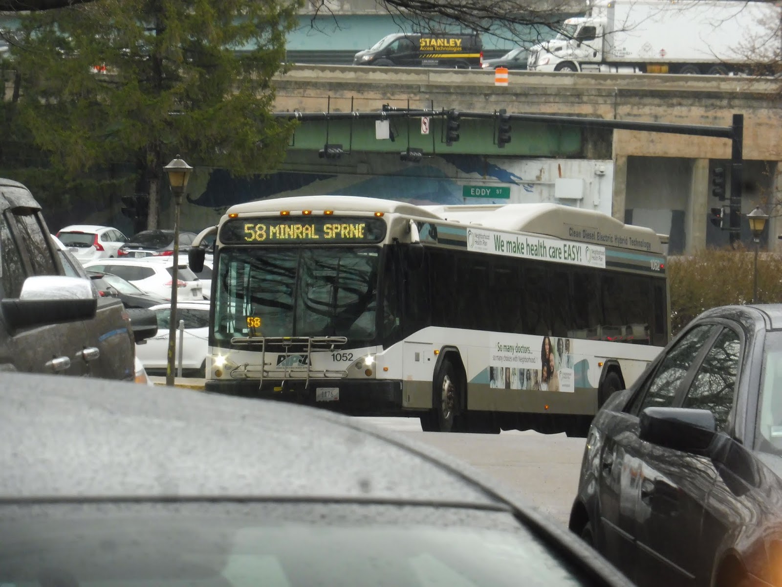
RIPTA: 58 (Mineral Spring/North Providence)
We previously reviewed one of RIPTA’s only crosstown routes. The 29 was a pure crosstown, darting in and out to serve as many places as possible while cutting across practically every southern RIPTA route. Now, this one is a little different. The 58 is trying to be a crosstown, but it’s also trying to be a radial route to Providence. It doesn’t work.
 |
| Peeking out from behind a car. |
Now, the 58 doesn’t actually begin at Kennedy Plaza. It starts south of the plaza, at the Rhode Island Hospital. This is a preliminary step to creating the Downtown Transit Connector, but that’s still pretty far off, so it’s just…a one seat ride to the hospital at the moment, I guess. The route was “detouring” to the building’s front door (although it usually doesn’t), and from there, we did a loop to get onto Eddy Street.
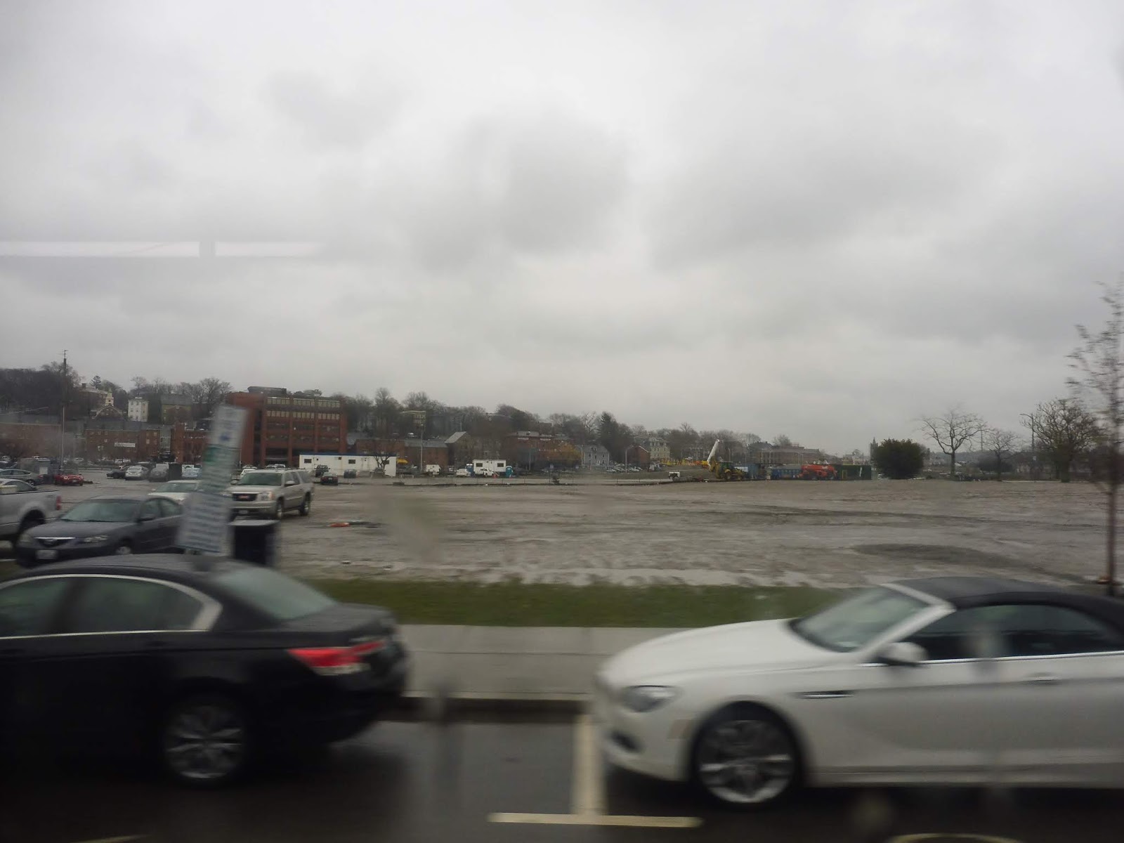 |
| A big ol’ parking lot. |
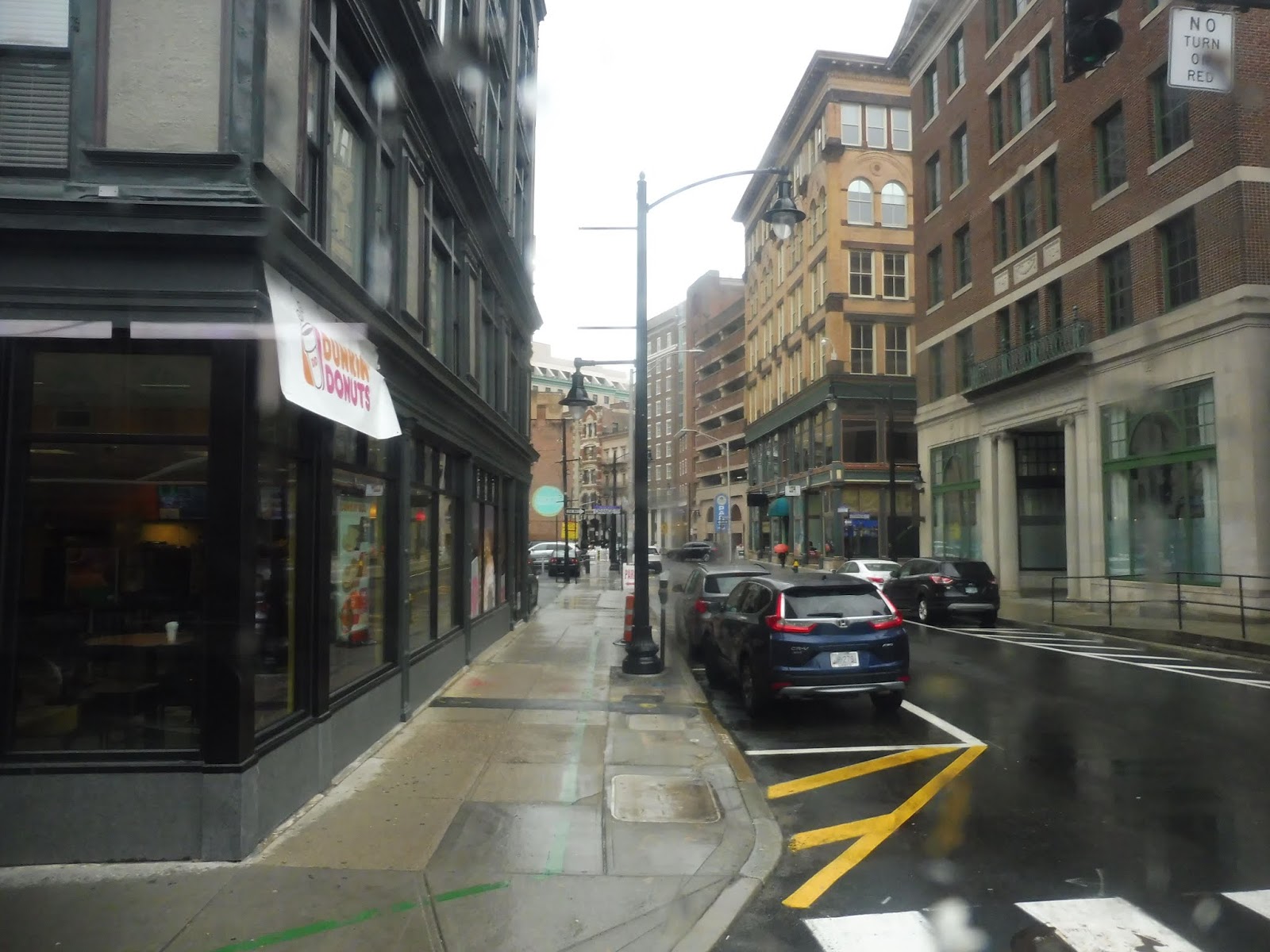
There was some undeveloped land for a bit after we went under I-95, but then we entered the up-and-coming Jewelry District. We went through another piece of vacant land north of that, then we turned onto Dorrance Street. This took us into downtown Providence proper, and we were soon picking people up at Kennedy Plaza.
 |
| When you’re alone and life is making you lonely, you can always go downtown. |
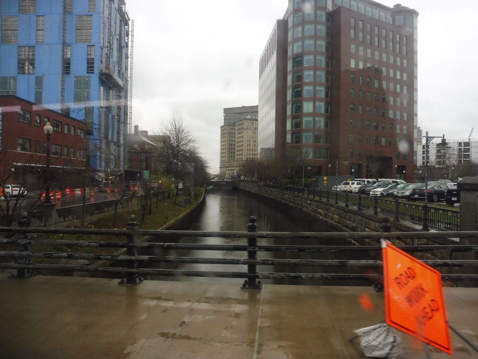
From the Plaza, it was a left onto Kennedy Street, and we crossed the Woonasquatucket River on this. After doing a very slight deviation to serve Providence Station, we headed out onto Park Row, going over the Moshassuck River. We were now on the East Side as we turned onto North Main Street, passing green space on one side and dense houses on the other.
 |
| Crossing a river. |
We went over the Moshassuck River a second time when we merged onto Mill Street, passing a few different types of buildings as the wide road split into two when it went under I-95. We passed a post office and went over the Northeast Corridor, then we went by some big box stores before the neighborhood turned to be mostly residential. At Hopkins Square, a triangular-shaped park, we took a left onto Branch Ave, beginning our independent section.
 |
| I can see Walmaht! |
Branch Ave went under Route 146, then it was mostly residential, but we also went by an old factory converted into shopping…sorta. Our independent section ended when we merged with the 50 on the industrial Douglas Ave. And, just like the 50, we had to do a wonderful deviation into Shaw’s via the residential Lubec Street.
 |
| Part of the Shaw’s shopping complex. |
Well, that was a great deviation. We came back onto Douglas Ave afterward, but we left it soon by turning onto Mineral Spring Ave, going independent again. It’s worth noting that we took a left on Mineral Spring, as most service does, but on one trip, the route takes a right and just kinda…ends at Route 146. Yeah, I don’t know.
 |
| Some suburban development. |
Mineral Spring Ave was suburban businesses for a while, and in the middle of that is where Saturday service just…kinda ends. Well, weekday trips go on for much longer, but the road became lined with houses instead of retail. At least, that was until Centredale, the downtown of North Providence. Weirdly, though, instead of serving the main street, we instantly used Centredale Bypass to get onto Waterman Ave out of the center. Oh well…better than deviating?
 |
| At least we got to see a few Centredale businesses. |
Waterman Ave was a little weird. There was reasonable density along it, but it tapered off almost immediately past the road, devolving into woods within two blocks or less on either side. Entering Smithfield, we came up alongside a huge old factory, turned onto Esmond Street, and crossed the Woonasquatucket River.
 |
| A typical street out here. |
Esmond Street consisted of more houses until it entered the woods for a little while. We left the forest by turning onto Putnam Pike, a road full of suburban businesses. It took us over I-295, and right after that, we pulled into our final stop: Smithfield Crossing, one of the more upscale strip malls in the RIPTA service area. Exciting.
 |
| Starting the trip back. Once again, a car blocks the bus. |
RIPTA Route: 58 (Mineral Spring/North Providence)
Ridership: The ridership on the 58 is most certainly low. There was just one single person who took the bus on one of its independent sections – everyone else could’ve used a different bus. That means that it’s basically just a whatever-comes-first situation, and the 58 is infrequent enough that it’s often not going to be the one that comes first.
Pros: I appreciate any efforts to create crosstown services in Rhode Island, because there aren’t enough of them. The 58 tries its best.
Cons: Unfortunately, that’s not good enough. The 58 is trying to be a radial route into Providence at the same time, and all that ends up doing is making it circuitous and duplicative of other routes. It doesn’t help that it only runs every hour, Monday through Saturday, especially when the routes it’s paralleling are much more frequent.
Nearby and Noteworthy: Hey, Smithfield Crossings did actually seem like a nice mall. The bus only goes there on weekdays, though!
Final Verdict: 3/10
I don’t see much value in the 58 as it currently stands. Instead of this pseudo crosstown service, why not have a real crosstown service? I think it would be great to have a route running down Mineral Spring Ave from Pawtucket to North Providence, and then on to Smithfield Crossing. That way, the 73 could also be eliminated and its resources could go somewhere else. Maybe something like this, although it might be worth it to, say, deviate into Shaw’s along the way. Just a thought.
Latest MBTA News: Service Updates
I’m sad to announce that the MBTA Jamboree is cancelled. We just didn’t get enough responses to be able to make it work. Thanks to everyone who filled out the survey, and hopefully we’ll be able to do something like it another time.
Join us for the MBTA Jamboree!
Many of you ride the T almost every single day. But you’ve never ridden it like this before. On Saturday, August 18th, we will be embarking on a huge tour of the entire system, and YOU can join us! Here’s the rundown: everyone will be split into teams, and we will all be given a list of challenges worth various point values. Some of them will be easy, like utilizing the Winter Street Concourse or riding the SL3 on its Chelsea busway section. Others will be harder, such as riding all five rapid transit lines in 30 minutes or maintaining a continuous hum between teammates on the ride from JFK/UMass to North Quincy. Ever wanted to sing “Sweet Caroline” in unison with other people at Park Street? That’s a challenge, too!
- Friday, August 10th – all form responses due
- Monday, August 13th – all participants are notified of their teams and everyone’s contact information. The list of challenges is released, and it is up to the teams to do however much preplanning they want to do.
- Saturday, August 18th – all participants will meet at 9:30 AM at Park Street. The day will finish at around 6:30 PM. We will have lunch in the middle of the day. If you don’t think you can stay for the whole day but you still want to come, submit a response anyway, and we’ll try to make accommodations.
RIPTA: 29 (Cowesett/Kent County)
Okay, so we have this bus system, see? It’s pretty good for getting into Providence, see? But what if you wanna get across to somewhere other than Providence? Let’s just create a route that runs across the entire system in the south! It’ll be a beast. It’ll take forever to do a trip. We’ll call it the 29.
 |
| And there it is! |
Okay, turned out it had to make a layover first. But it eventually came back, and it was time to go! We ran up Bald Hill Road through the woods for a tiny bit before turning onto Ginsu Way, then Quaker Lane. This served two purposes: turning the bus around after serving Cowesett Corners, and serving the Kent County Courthouse.
 |
| Waiting to make a left turn on Bald Hill Road. |
We returned to Bald Hill Road, although it was now called Quaker Lane, then we turned onto Cowesett Ave. This was lined with suburban businesses with parking lots, but there were dense houses once we turned onto Main Street (as well as some smaller retail buildings). We crossed the Pawtuxet River and passed more houses on the other side, but things were getting denser as we got closer to Arctic Center.
 |
| A hilly intersection. |
We came into Arctic Center proper, where Main Street became lined with businesses on both sides. We also joined the 13 here. The center was quick, though, and soon we were just passing dense houses again. Now, the 29 usually has a deviation right around here, but because of bridge construction, it became a jog instead. Yes, it’s time for a crazy detour route!
 |
| Some houses on a dead-end street. |
Thus, instead of just going right over the Pawtuxet River, we turned onto Maple Ave, a hilly street lined with dense ol’ houses. It reached its end and we turned onto Fairview Ave, which allowed us to go over the Pawtuxet River and arrive at Phenix, a little downtown centered around a common. What was the timepoint named after? The Phenix Hotel. Interesting.
 |
| An old factory getting redeveloped. |
We turned onto Main Street, which went by some industrial buildings, some businesses, and some houses (so basically everything!). Crossing the Pawtuxet River on the bridge we were supposed to take the other way (it was only open in one direction), we returned to the main route by turning onto East Main Street. We then went around a roundabout onto Providence Street, once again crossing the Pawtuxet River and going by a redeveloped factory.
 |
| Going over the river. |
After that, there were some houses, but it turned to suburban businesses quickly. We merged onto Toll Gate Road soon, then we turned onto Bald Hill Road. Yes, that’s the same Bald Hill Road that Cowesett Corners way back at the beginning of the route is on. Yes, what takes 25 minutes by bus is only a four minute drive. Wonderful.
 |
| Gritty Bald Hill Road. |
This huge street had a ton of suburban businesses with parking lots along it, and practically nothing else. It even got itself an unnecessarily wide median! We took this thing over the Pawtuxet River yet again, then under I-295. From there, it was time to deviate into the Warwick Mall. But wait…the Warwick Mall stop is way down at the opposite side of the parking lot. Would we have to deviate all the down there? Yes. Yes we would.
 |
| Stilllllllllllll going. |
After that mess, we came out from the mall and made our way back onto Bald Hill Road, heading in the opposite direction. We went under I-295 and over the Pawtuxet River again (for the last time!), then we had to deviate into the Rhode Island Mall. Turned out that was easier said than done, thanks to Bald Hill Road’s big median I mentioned before. We had to enter the mall parking lot north of the mall, then curve our way around to the actual stop.
 |
| Going through the mall. |
Were the deviations done yet? Nope, we now had to do one to CCRI! So we went down East Ave for a bit, then we turned onto the road up to the community college. After making the stop outside of the most brutalist building ever, we had to go allllllllllll the way to the end of the parking lot, then take a road down a hill through the total woods.
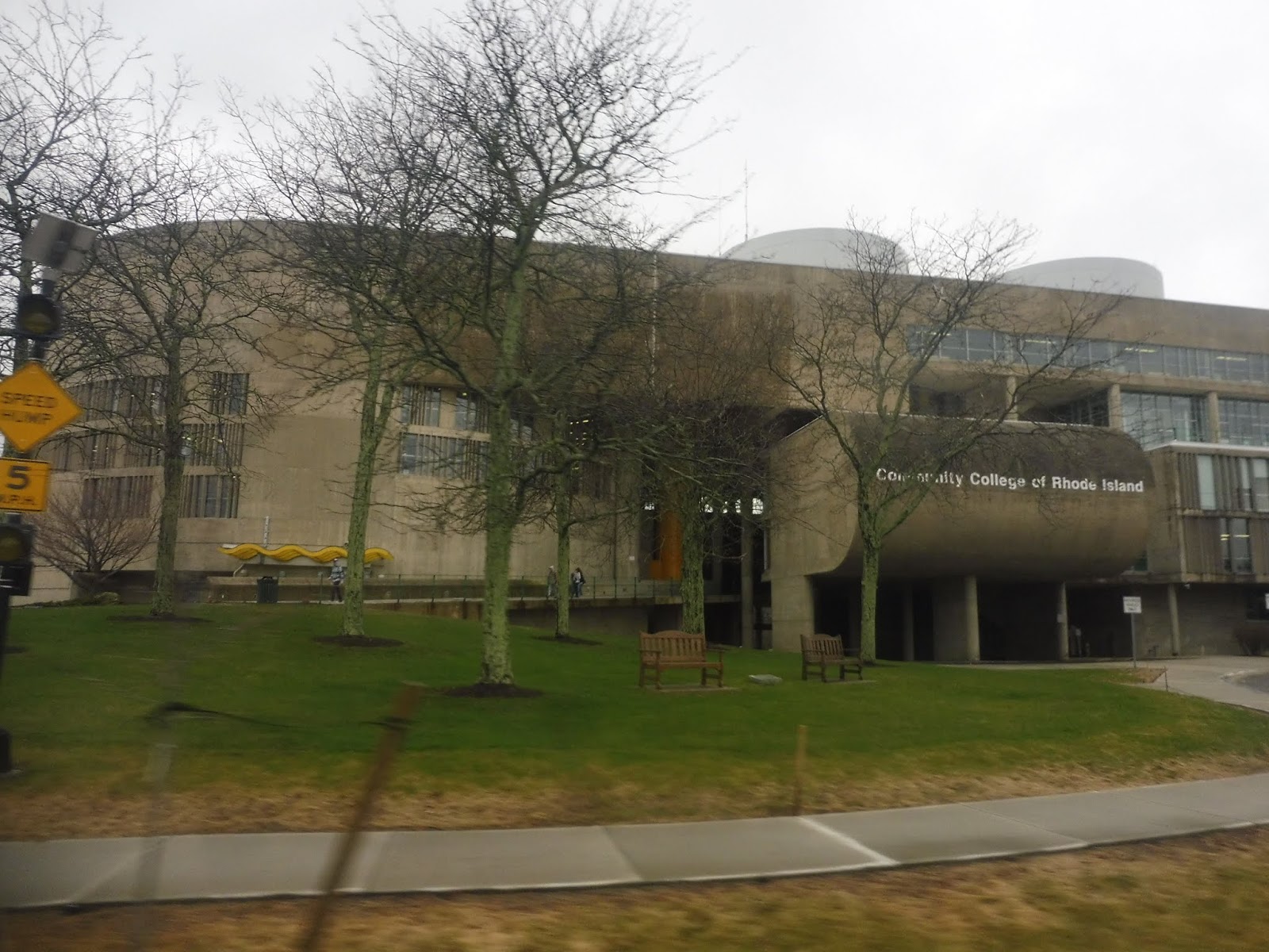 |
| Peak brutalism. |
We finally turned onto Commonwealth Ave, then onto…Toll Gate Road. The same Toll Gate Road we were on before all this deviating. So…from that point to here was quite literally 22 minutes by bus…or a 9 minute walk. And just for fun, let’s do it from Cowesett Corners to here! 53 minutes by bus…ten minutes driving. Even walking is faster, at 41 minutes! Yes, I know this whole area is ridiculously unwalkable, but I’m just saying, it’s faster than the bus.
 |
| Leaving the college. |
Luckily, the route would be a lot straighter from here. We passed Kent Hospital, and soon after, we went under I-95. There were some offices before we came to a roundabout, marking our entrance into the village of Apponaug. We looped around its “downtown” via Post Road, but I’ve never found it to be a very interesting place. It’s mostly just suburban businesses and houses.
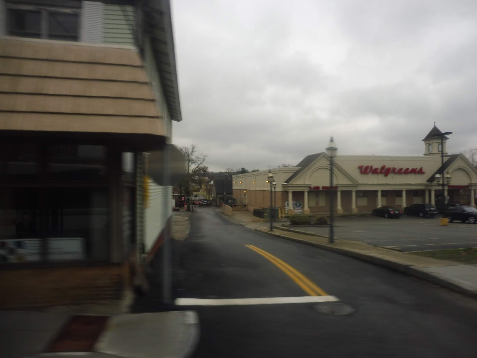 |
| Well, at least there’s a Walgreens! |
We merged onto West Shore Road, going under the Northeast Corridor and heading into a mostly residential area. It was houses galore until we hit some suburban businesses at the intersection with Buttonwoods Ave, a transfer point for…oh, the 8x! Interesting! We were joined that route for a bit as the scenery went back to being residential, but once the businesses came back, the 8x turned onto Strawberry Field Road. Meanwhile, we merged onto Sandy Lane.
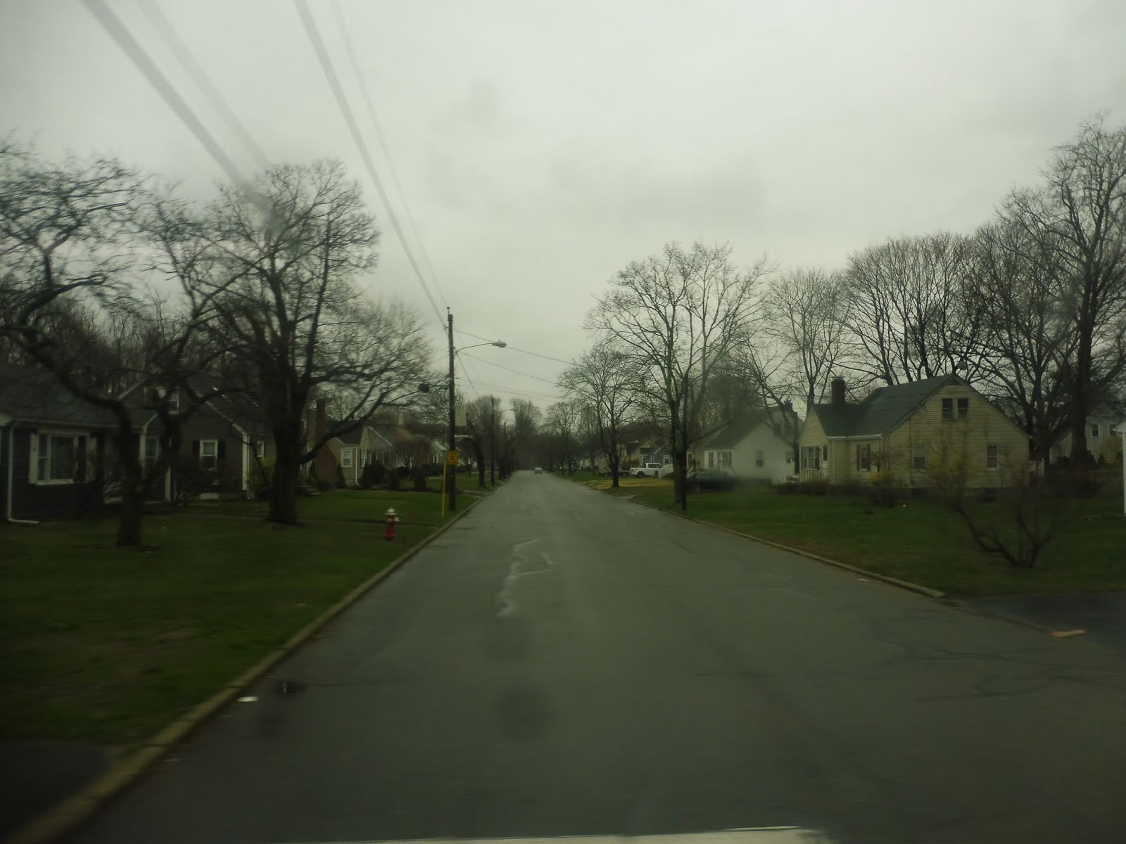 |
| A generic side road. |
There were a few apartments along here, but nope, it went back to being houses once again. This was until Warwick Ave, a commercial street that was also home to the 3 – excuse me, the 3B. We briefly joined it on Warwick Ave, but we left it on Church Ave soon after. This went back to being residential.
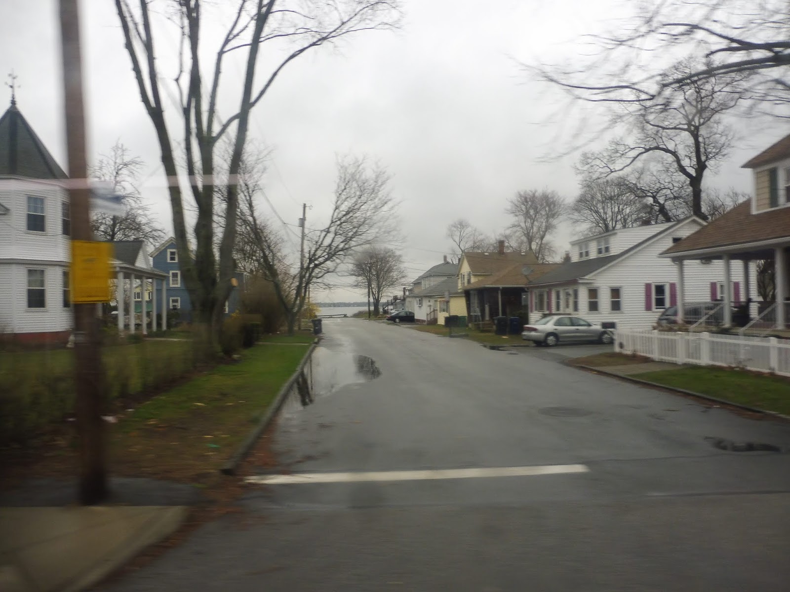 |
| Water! |
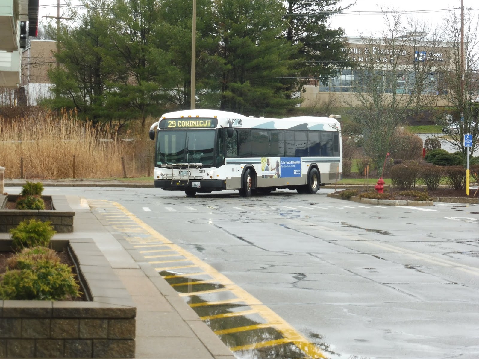
Church Ave ended and we turned onto West Shore Road, joining the 3A. It was still mostly houses, but there was some retail sprinkled throughout the neighborhood. We curved around toward Narragansett Bay, getting brief views of the water down the side streets. We were just entering a cute village called Conimicut when we turned onto Beach Ave, travelling for one block before reaching the final stop at a little park.
 |
| Out of service? Darn it! |
RIPTA Route: 29 (Cowesett/Kent County)
Ridership: According to that ridership report I found from ten years ago, the route got less than 100,000 people in 2008. Assuming it still ran six days a week like it does today, that’s about 333 people per day – not a lot of people. I actually think that’s somewhat similar to what the ridership is like now, though; my ride got 25 people, and based on the number of trips this route has per day, it would add up to around 300-350 riders.
Pros: Well, you certainly can’t say the 29 doesn’t serve a lot! This gigantic route cuts across West Warwick and Warwick, which is a much longer distance than it sounds like because Warwick is a gigantic town. The 29 is also one of RIPTA’s only crosstown routes, and they could honestly use more of them, but this is a start.
Cons: It’s…so…long! You saw my time comparisons earlier in the review! This thing goes all over the place! Also, because a one way trip takes forever, the 29 can only run so frequently – how does every hour and a half, Mondays through Saturdays sound to you? Pretty bad? Yeah, I agree.
Nearby and Noteworthy: Most of the places on the route like the Warwick Mall or Conimicut are already served by routes out of Providence. As for the places that just the 29 serves…well, they’re just not that exciting.
Final Verdict: 4/10
I gotta give it points for being a crosstown route in a very un-crosstown system, and the route certainly serves a ton, but that’s about it. It’s also infrequent and indirect, and those things count pretty badly against it. It’s just hard to use a route that runs every hour and a half and looks like that.
Latest MBTA News: Service Updates
RIPTA: 242 (West Warwick/Coventry Flex)
Gosh, it’s too bad the 13 and the 29 end so far apart from each other. Seems like the only way to take each of them from beginning to end is to ride out and back. Hang on…what’s this? A Flex bus in West Warwick and Coventry? And it connects the two routes together? Well, this is perfect!
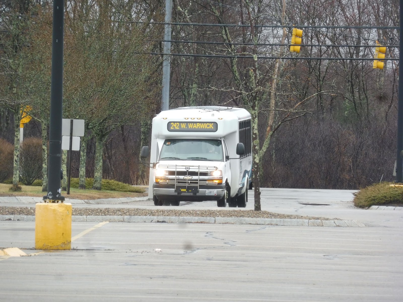 |
| Here comes the minibus! |
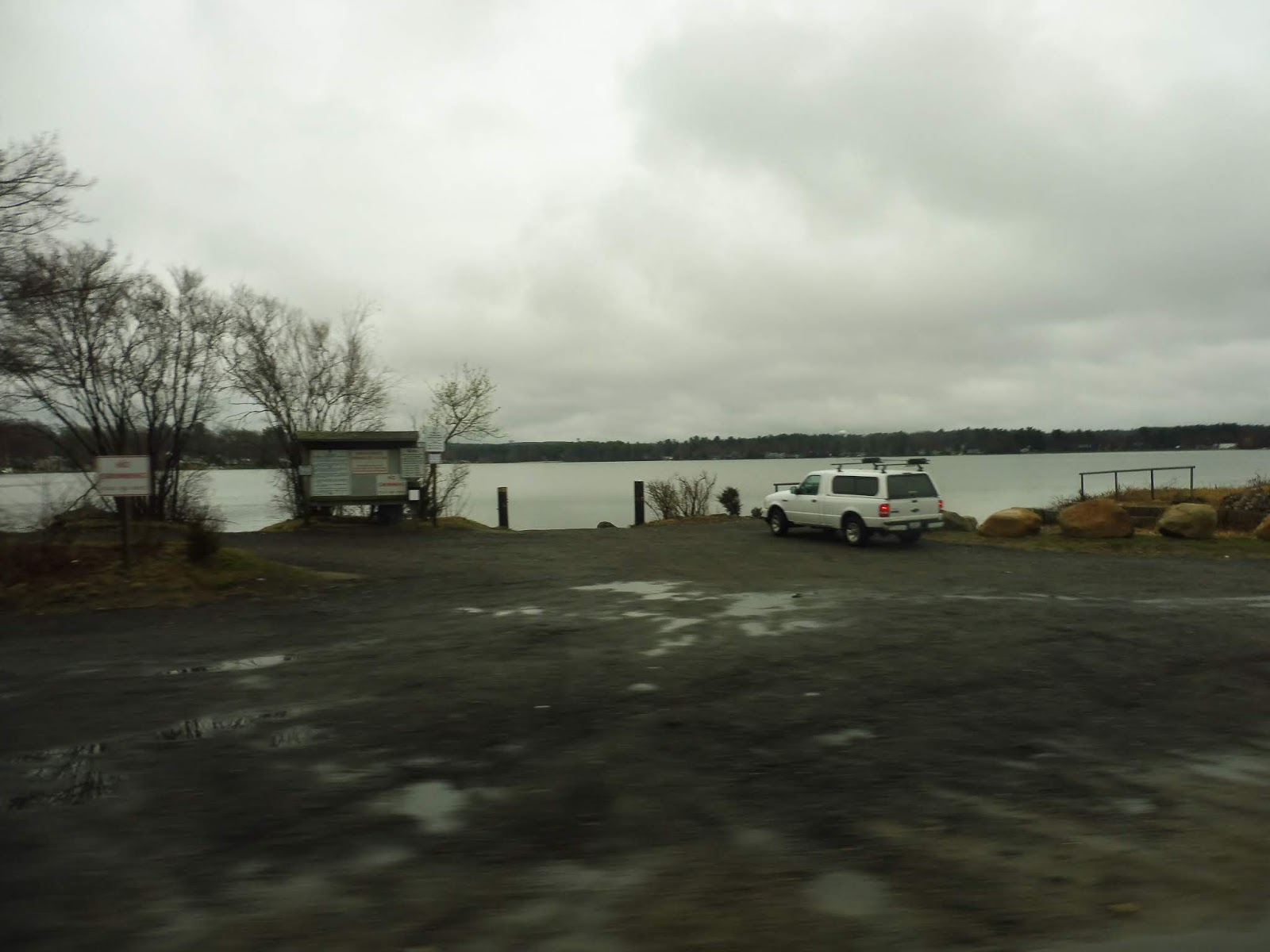 |
| Along the lake. |
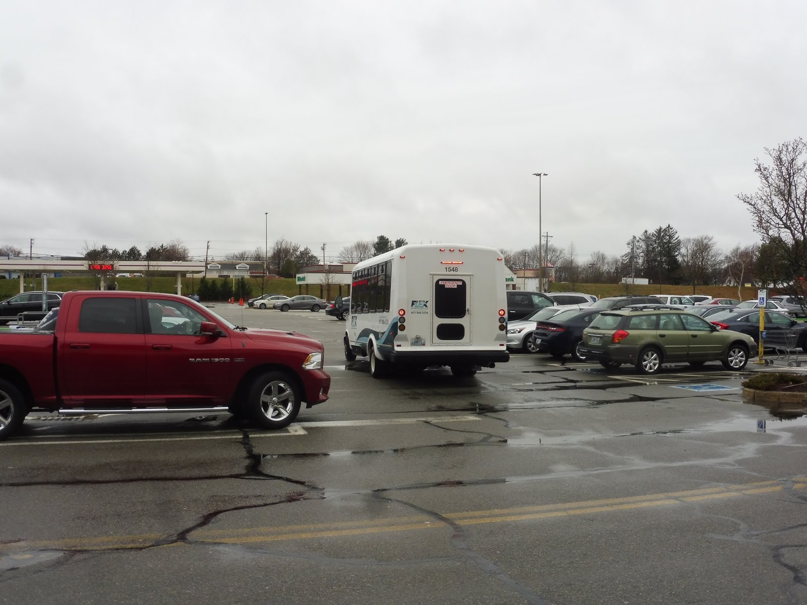 |
| Departing the parking lot. |