Random Photos: Tax Money
 |
| Notice the capitalization error. |
Random Photos: Pork, Anyone?
On the 426 bus in Lynn, I happened to see this ad (or public service announcement, I suppose) on the wall. It featured some very crudely Photoshopped pigs and a bad pun. It was pretty funny, but for all the wrong reasons:
 |
| Perhaps you can read the small print if you click on the picture. |
Random Photos: Abandon All Hope Ye Who Enter Here
 |
| I love how someone later added “EVER” to the sign. |
441/442 (Marblehead – Wonderland Station via Paradise Road or Humphrey Street, Central Square, Lynn, and Lynnway)
If you remember from my post about the 439, the bus driver of that route said that the 441 and 442 are the most scenic buses on the MBTA (and that’s saying something considering the views from the 439). My father and I decided to try out the route to see if the driver was right, and we noticed one advantage over the 439 instantly: the schedule. The 441 and 442 are coordinated (the routes are very similar), running every 15 minutes rush hour and every half hour during the day, Saturdays, and Sundays. Late night and early morning service runs are all 442 trips via Humphrey Street. There are also rush hour only express variants of the two routes, the 448 and 449. They follow the same route as the 459, serving the World Trade Center and Logan Airport, and then following the 441 and 442 up to Marblehead. That’s for another post, though.
My father and I decided to completely wing it, so we just rode up to Wonderland to take whichever bus came. We figured we’d take the other route going back. Looking at the schedule, we had about a 20 minute wait, so we decided to make a jaunt to Revere Beach. It was crowded there as we lay down in the sand. I checked the schedule again just to be sure. “Oops,” I said. “What?” asked my father. “The bus is leaving five minutes from now,” I replied. Turns out I had looked at the wrong column in the schedule, so we quickly ran back up to the station. As we were sprinting up the ramp, my father was saying that I was at the top of his list of annoying people who misread bus schedules. It didn’t even matter, though, because the bus was a half hour late! It was a 441, and I was surprised when about 50 people got on the bus. It was standing room only as we left Wonderland and turned onto North Shore Road.
The bus pulled off at Point of Pines where no one got on or off, and then went over the bridge I talked about in my 439 post. At the first stop after the bridge, about half the people on the bus got off to visit some big flea market. I guess that explains the unusually high ridership. I’ve noticed that on the routes on North Shore Road/Lynnway, everyone just seems to use the bus to get to Lynn. That definitely seemed to happen here, and on the 439. There were also a few people who got on at the flea market, but they were taking some time to pay their fares. Apparently someone else noticed, because he shouted out, “Come on! Just pay your fares and get on the bus!” However, this guy was later talking loudly on his phone about the drugs he was taking, so… yeah.
 |
| I wonder where this bus is going… |
Downtown Lynn was a major stop, as one would expect. The bus then turned onto Broad Street, which became Lewis Street. Once Lewis Street becomes Ocean Street and the bus enters Swampscott, the two routes split. The 442/449 goes onto Humphrey Street by the water, while the 441/448 turns onto New Ocean Avenue, which becomes Paradise Road. Our bus traveled on the Paradise Road route, which was a residential area with the occasional business. The bus then hits Vinnin Square, where there are some businesses and a mall, as well as a connection between the 455 and 459 to Salem. However, only a couple people got off here.
The bus then makes a sharp turn onto Salem Street and heads back towards the shore. It travels through a large golf course, and then meets up with Humphrey Street and the 442. There is a nice residential neighborhood, and then some business at “Beach Bluff.” Things are mostly residential from here until the bus reaches a major junction with Lafayette Street, and the two join as Pleasant Street. There are lots of businesses now as the bus approaches downtown Marblehead. There is a fork in the road, where the bus stays on Pleasant Street going towards the Marblehead terminus while Wonderland-bound buses go onto Elm Street.
 |
| I absolutely love this picture of the 441 in Marblehead. |
The two sides merge again at Washington Street, and then turn onto Franklin Street. The roads by now are tiny, and they probably make this a hard route to run. The bus ends right outside of the Marblehead Fire House, a cute little fire station that actually looks like a house. From here, my father and I waited for a 442 back to Wonderland. As the previous bus was a half hour late, our wait wasn’t that long. It was very pleasant, though: the bus ends in a nice, quiet neighborhood. There was an open house there, and everyone who passed us said hello. It was really quite pleasant, although the town will be packed come summer due to its coastal location and beaches.
 |
| The Marblehead Fire House. |
The 442 came, although it was five minutes late. I attempted to get on, but I was shooed off by the driver. He closed the doors, and we could hear him yelling at someone on the bus for some reason. He then let us on, and we were the only ones besides the person who got yelled at. Leaving the Fire House, the bus makes a tight loop on Selman and Front Streets. Even though it only takes about 15 seconds, it’s actually quite beautiful, as the bus passes right by the water, as well as a cute little restaurant called Barnacle that looked pretty good.
The bus passed through all of the places mentioned already, until it reached Salem Street. At this point, the 441 would go toward Vinnin Square, while our bus traveled right by the beach. Although it wasn’t as amazing as the 439 view, it was still amazing. You could see the waves, the sand, and you could just make out Boston way in the distance. There were also some houses, a few businesses, and a baseball field.
 |
| Nice view! |
We ended up getting off the bus in Lynn, because our bus arrived about 10-15 minutes late meaning it was only a 20 minute wait for the 431. The 431 is the shortest bus route on the system, making me really want to take it. However, after we arrived in Lynn…
- My father had some really terrible Chinese food so he could use the customers-only bathroom.
- The 431 ended up being over 15 minutes late.
- Because it was so late, the driver couldn’t make the loop back to Lynn because she would miss her break if she did.
- We decided not to take the risk on a one-way bus that only runs every two hours.
- Instead, we decided to take a bus back to Wonderland.
- That bus ended up being the 426, which was (you guessed it!) late.
- It was a nice ride (review coming at some point), and we finally made it back to Wonderland to take the train home.
- (The train was one minute early!)
 |
| The 442 in Lynn. |
Route: 441/442 (Marblehead – Wonderland Station via Paradise Road or Humphrey Street, Central Square, Lynn, and Lynnway)
Ridership: When I rode it, most of the people were going to the flea market. The rest were just residents of Lynn and Marblehead (nobody really got on or off in Swampscott). During rush hour, this is probably a commuter-heavy bus, as there is no Commuter Rail service to Marblehead. I’ve seen some very large crowds getting into the bus at Wonderland. I was surprised with the number of people that went all the way to the end on the 441; there were about five people who got off there. Some people besides us actually took this bus from beginning to end.
Pros: Although the views aren’t as great as the 439, the schedule gives this bus an advantage: people can actually take it. I recommend the 442 by the beach, but I loved going through downtown Marblehead. It has a nice, village feel to it. These buses are also the only public transit option in Marblehead, which is probably why they run so often (for a suburban bus, that is).
Cons: A half hour late? Are you kidding me? If this was because of traffic on a Sunday, then I’d hate to ride this bus during rush hour. If buses are always this late, then the route must experience bunching, which is never good.
Nearby and Noteworthy: Besides the Barnacle restaurant, there are a lot of small little shops and stores in Marblehead. However, there is also the Marblehead Rail Trail, a beautiful trail that starts in Marblehead and branches off to Swampscott and Salem. Although I haven’t tried it for myself, the pictures look beautiful and it looks like a nice walk. The bus goes quite close to the trailhead, too.
Final Verdict: 8/10
Let me just say one thing: this bus is not more scenic than the 439. However, a bus that runs every half-hour on Sundays is much better than a bus that runs five times a day, weekdays only. This route seems like the sort of route to experience bunching, based on the experience I had with it, and the streets in Marblehead are so tiny, it must be impossible to pass another bus. It’s a great route otherwise.
Latest MBTA News: Countdown clocks have been rolled out on the entire Red, Blue, and Orange Lines except for Charles/MGH and Orient Heights according to this article. There are shuttle buses replacing the Orange Line from Ruggles to Forest Hills this weekend (June 15-16). Also, on June 15, 18, and 20, shuttle buses are replacing the Orange Line from Sullivan to Oak Grove from 9 PM to the end of service.
Wonderland Update (Plus Pictures!)
I paid a visit to Wonderland again last weekend, and I thought I’d add a few things I noticed about it as well as post some pictures I took. First of all, in addition to fun little “Train Approaching” sign, there is also an old-fashioned bell that rings as the train is about to leave. Second, there seemed to be some sort of carnival going on right near the station. I’m not sure what it is, but I suppose that’s a noteworthy place near the station that’s not Revere Beach. Finally, we checked the bridge they’re working on, and it seemed like they made absolutely no progress on construction. It looks finished and ready to go, but it’s still fenced off for some reason. I’m quite excited for when they finish it, however.
 |
| Revere Beach! |
 |
| Here’s the bridge. Looks almost done, doesn’t it? |
 |
| I suppose Arrow Street is in charge of construction. |
 |
| The busway I raved about. |
The Latest MBTA News
As I said last night, my internet was not working, so here’s the news today. From June 9-June 20, shuttle buses are replacing the Orange Line from Sullivan Square to Oak Grove every Sunday through Thursday. This weekend (June 8-9), shuttle buses are replacing the Red Line from JFK/UMASS to Quincy Center. I know I’m very late with this, but here it is, anyway.
Wonderland
“Alice was beginning to get very tired of sitting by her sister on the bank, and of having nothing to do: once or twice she had peeped into the book her sister was reading, but it had no pictures or conversations in it, ‘and what is the use of a book,’ thought Alice ‘without pictures or conversation?’
So she was considering in her own mind (as well as she could, for the hot day made her feel very sleepy and stupid), whether the pleasure of making a daisy-chain would be worth the trouble of getting up and picking the daisies, when suddenly a White Rabbit with pink eyes ran close by her…”
 |
| I’m not entirely sure why I took this picture, but here it is… |
 |
| The view of a parking lot from the roof of the parking lot. The water looks nice, though. |
Station: Wonderland
London Underground Simulator
Yes, I am in fact posting about a computer game. It’s just that I’ve been having so much fun with London Underground Simulator, and I figure anything transit-related is fair game on this blog. I’m not sure if this particular type of feature will work, but tell me what you think in the comments section below. I might be able to cover other transit-related games in the future.
 |
| This is an actual screenshot from the game. From: http://london-underground-simulator.en.softonic.com/ |
Unfortunately, the people at Aerosoft (the company behind the game) don’t seem to want you to play it. In order to download it onto your computer (unless you get the boxed version, where you might not have to do this), you have to also download the impossible-to-find Aerosoft Launcher (trust me, this link will save you a lot of time). It’s a good thing I found it, because when I inquired about the matter to the customer service at Aerosoft, I got a completely bogus email response that said, “Duplicate.” Absolutely appalling service.
 |
| This is where you drive. From: http://spong.com/game/screens/11049457/London-Underground-Simulator-World-of-Subways-3-PC/354025 |
When you’re driving the train, it’s probably good to stay within the speed limit (although you don’t “lose” if you do it in Drive to Schedule). You also have to be very careful of red lights, because you instantly fail if you go past one in both Drive to Schedule and Missions. When doing a Drive to Schedule, you should also stick very close to the schedule. If you don’t, it will show in your final score. When I completed my first Drive to Schedule, I only got a 44% score. Apparently, I broke the speed limit (hey, I was behind schedule), didn’t line up my train perfectly at the station (that’s hard to do), didn’t let all the passengers get in the train (they were just standing there as far as I could see), and was late (I’m blaming that on the passengers that took too long to get onto the train). In my defense, it was my first completed route and I was driving at rush hour. But you should learn from my mistakes. My first time driving to schedule, I did the whole Circle Line perfectly, and then came into Hammersmith (the final station) too fast and crashed.
 |
| Some passengers in the train. From: http://londonsimulator.blogspot.com/ |
Unfortunately, the sound doesn’t work, although that’s probably just my computer. The characters glitch as well, and the time to load up the game can be torturous. The missions are also much too unforgiving, as well as your score at the end. The game also crashes periodically on my computer, but after restarting it, it works fine. Note that depending on your computer, the game can be dreadfully slow. On my laptop, the animation is very choppy, but I got used to it. It’s also a bit weird how your character is constantly lolling his head around, but again, I got used to it. Despite its flaws, the game is very addictive and fun (although probably not for people who aren’t transit geeks), and if you have the right type of computer (see link above), it can be a great time. Oh, and you might want to have a map of the system nearby. You’ll probably need it.
 |
| This is probably my favorite image from the game on the internet. From: http://www.aerosoft.com/cgi-local/us/iboshop.cgi?showd,,50211 |
111 (Woodlawn – Haymarket Station via Mystic River/Tobin Bridge)
The last two words in the post title is what made me really want to take this bus; one can see the Tobin Bridge from literally miles away because it’s so high. When I first saw the 111 on a map, my first thought was “A Key Bus Route that goes over the Tobin? Sounds good to me!” Despite running often, my father and I never really got a chance to take it for a while. Finally, we had a free Sunday, so we set off for Haymarket Station.
 |
| The 111 at Haymarket. |
Turns out it’s a good thing we rode this bus on a Sunday. There had to be at least 50 people at Haymarket waiting for the bus. If it’s like this on Sundays, what are the crowds like at rush hour? I’ve heard stories of the bus having to leave people behind because of its crowding. Being in the city, there are relatively tall buildings as the bus travels down North Washington Street. After passing a little tennis court, the bus goes over the Charlestown Bridge. Even this is a good view, but the best part is soon after. The bus turns off the Charlestown Bridge (called New Rutherford Ave at this point) onto Route 1, which becomes the Tobin Bridge. I can see how people wouldn’t like going over the bridge, as it’s extremely old and it feels like it’s going to collapse at any moment. It also provides an amazing view of a body of water and neighborhoods in Chelsea. I’m sure you get a great view of the city travelling towards Haymarket.
 |
| Nice view! |
The bus turns off Route 1 soon after and serves Bellingham Square. This is a major bus stop, serving two other Key Bus Routes and two non-key routes. It goes pretty close to the Chelsea Commuter Rail station, and then serves Cary Square. This is where the occasional 111 ends (it would be marked “111c”), while our bus turned to stay on Washington Ave. It’s still very urban here, but what was businesses and apartments is now just regular houses. The bus crosses over Route 1 and then turns onto Sagamore Ave and again onto Garfield Ave. Garfield Ave meets up with Washington Ave again, and the bus continues, paralleling Route 1. The bus turns onto Elm Street and reaches “Woodlawn,” just on the border of Everett.
Woodlawn is actually sort of in the middle of nowhere. My father and I were the only ones who stayed on until here, and there really wasn’t much. In the immediate surroundings, there’s a weird industrial building, Woodlawn Cemetery (hence the name of the terminus), and some houses. It’s actually rather uninviting, but there are some businesses quite close to the stop. We didn’t get to try any of them, however, as a 110 came (review coming at some point) and we continued our journey.
 |
| WHERE ARE WE (the 111 at Woodlawn)?! |
Route: 111 (Woodlawn – Haymarket Station via Mystic River/Tobin Bridge)
Ridership: Many, many people use this bus as a link from Boston to Chelsea. I mean, many people use this bus. Even on a Sunday, we were packed in like sardines. On our ride, almost everyone got on at Haymarket and slowly drained out as the ride progressed. By the time we reached Elm Street, my father and I were the only two people on the bus.
Pros: A great, frequent link from Boston to Chelsea. Absolutely wonderful headways: every 5 minutes rush hour, every 12 minutes midday, every 10 minutes nights and Saturdays, and every 14 minutes Sundays. The Tobin Bridge views are amazing, and the bus is worth taking just for that. It’s also a rather hilly route, which are always fun.
Cons: The crowding. This bus would greatly benefit from using articulated buses, although they might get in the way of traffic on the Tobin. Also, this bus might soon become unnecessary. See below.
Nearby and Noteworthy: I feel like I’ll be saying this a lot in posts to come: I’m sure there are many great things to see and do along the route, but I experienced none of them. The Tobin Bridge is pretty noteworthy, I suppose, but that’s all I got.
Final Verdict: 6
This bus offers amazing views, and it serves a lot of neighborhoods that need transit. But the crowding is simply awful. If it’s packed to the gills on a Sunday, then I’d hate to ride this bus at rush hour. Also, this bus won’t even be necessary in a few years if the MBTA decides to build the Silver Line Gateway. It would be a Silver Line to Chelsea that would probably reduce the crowding on the 111. I don’t entirely agree with the planned route, however. It would start in the transitway at South Station and follow the SL1 to the airport. However, it would skip all the airport terminals and then serve Airport Station. After that, it would go on to Chelsea. I just don’t see the point of making a connection the SL1 doesn’t offer, but not serving the airport terminals. That’s just my opinion.
UPDATE 9/1/19: Wow, old Miles, I disagree with your awful “opinion” about the Silver Line to Chelsea. Anyway, just came here to say that the 111 doesn’t serve Broadway and Park at night anymore.
Latest MBTA News: On Sunday and Monday (June 2-3), there are buses replacing the Blue Line from Suffolk Downs to Wonderland from 9 PM to the end of service. There are also buses replacing the Red Line from JFK/UMASS and Quincy Center on June 1-2 and June 8-9 from start to end of service. There are many bus service changes, but too many to list here. Use this link and scroll down to “advisories.”
Transit Tales: The Red Line Doldrums
Once, my father and I were taking the Red Line home. All was going fine, until we reached Central Square. There, the train just sat at the station with the doors open. One by one, people started getting off the train. I was trying to coax my father into getting off and taking the 83 home, but he wasn’t budging. He assumed it was some minor problem and we’d be moving soon. After about 10 minutes of just sitting there, the doors finally closed and the train started moving. We reached Harvard and again the train stopped and sat there. I was trying to tell my father that we could take the 77 home, but he didn’t want to do it. After another 10 minute wait, we left for Porter, where we – you guessed it – sat there for another 10 minutes. We could’ve taken the 77 from here as well, but I have no idea why we didn’t at this point. Of course the driver didn’t tell us what was going on over the speakers. None of us knew what was going on. Finally, we got to Alewife where we decided to have a word with the driver. We walked to the front of the train and asked him what was going on, and he told us there was a switch problem. Thanks, buddy! You could’ve told us all before over the speakers so we knew what was going on! Just saying!
SL1 (Logan Airport – South Station via Waterfront)
For a while, the only way you could get to the airport was the Blue Line to Airport Station, where you have to take a shuttle bus to actually get to the airport. Fairly recently, we got an alternative, the Silver Line SL1. Although it’s far from perfect, it’s COMPLETELY FREE when you’re coming back from the airport. No, that is not a typo. It is actually free, which makes it great in my book.
The bus starts out in South Station, in its underground transitway. Leaving here, the bus is already crowded with standees. Unfortunately, severe speed restrictions in the transitway force the bus to go only 10 miles per hour. Sitting near the front, I saw there was a machine that said how fast the bus was going (the driver was “going too fast,” apparently). The bus passes through the bells and whistles of Courthouse Station (the station with the second worst ridership on the system after Suffolk Downs) and World Trade Center Station. Heading toward the airport, one person got on at Courthouse and none at World Trade Center.
| That’s my favorite price! |
The bus then exits the transitway into the open air and goes to Silver Line Way. The only real purpose of this “station” is for the bus to change from electric to diesel power (which is actually pretty interesting). No one got on or off here, either, and then the bus was off to I-90. Unfortunately, traffic was heavy. At this point, I feel it’s worth noting that my personal definition of rapid transit does not include being stuck in a crowded bus in heavy traffic on an interstate highway. It was made more annoying by the fact that the announcement system was glitching (sound familiar?) and rattling off every stop on the line repeatedly. Perhaps the Silver Line should have its own bus lane on I-90? I suppose it would require some tunnel construction, but it would be nice…
Finally, the bus pulled off the highway and entered the airport. It was slow-going, since there was absolute chaos at each terminal; things are not calm when there are five different buses trying to pull into the same area. At Terminal C, there was even some bunching with another bus. At Terminal E (where my father and I had to get off), the bus driver opened the doors, so we started to get off. But it turns out he only did it to yell at a bus driver in the Silver Line bus we were bunching with. Finally, we got off the bus into the pouring rain.
 |
| It’s hard to tell by looking at the picture, but it was pouring rain. |
Each Silver Line airport stop has a tiny shelter that’s hard to find and a very inaccurate countdown clock. That is, it said that a bus was coming in four minutes, but when I checked again two minutes later, it said there was an eleven minute wait for the next bus. They also only show the countdown clock for two seconds at a time, since the clock cycles through the following: “The time is now xx:xx/Board here for Silver Line/Free, courtesy of Massport.” After all of those, it tells you when the next bus is coming for about two seconds.
 |
| Yeah, right. |
On the way back, the bus takes a mostly similar route, but with one difference: after exiting off the highway in Boston, it makes a stop right outside World Trade Center Station. Then it loops around back to Silver Line Way, and then goes into the transitway. However, this interesting routing can’t be helped because of where the highway exit drops the bus off. Overall, it’s a much more direct route than the Blue Line, which is even advertised on a poster at the airport. Oh, and did I mention it’s free?
| This is the SL1, I promise. This is at South Station. |
Route: SL1 (Logan Airport – South Station via Waterfront)
Ridership: People coming to and from the airport, obviously. Basically, everyone got on at South Station and then got off at various places in the airport. The bus was very crowded.
Pros: It provides a direct link from the airport to downtown Boston, unlike the Blue Line which required a shuttle bus ride. The route operates with nice articulated buses, and each one has a large luggage rack. Oh, yeah, it’s free, too.
Cons: The traffic on I-90 was absolute torture to sit (or stand) through. The countdown clocks are complete bogus. At Silver Line Way, the conversion malfunctions sometimes, forcing the bus driver to leave the bus to do it manually. This must be weird for tourists who have no idea what’s going on. There’s absolute madness at each terminal, as the Silver Line has to compete with other buses to navigate through the dense gridlock. The bus also doesn’t serve Airport Station for some reason. It might mess up the loop, but a connection to the Blue Line would be great. Also, if you have heavy luggage, you might have to perform the “Walk of Shame” (my mother’s term) from the train station. Or, if it’s pouring rain, that’s not pleasant, either. Although the walk could be eliminated by using a cab, the Silver Line is free!
Nearby and Noteworthy: The airport is really all there is on the solo portion of this route. But a free bus is pretty noteworthy, right?
Final Verdict: 8
Yes, I know I ranted about how bad the traffic is on this bus. Yes, I know I made fun of the countdown clocks. Yes, I know the cons section is much longer than the pros section. But it’s a free bus! What more do you need?
Latest MBTA News: The MBTA has officially approved the construction of a new Wachusett Commuter Rail Station that will expand the Fitchburg Line about 4.5 miles west of its current terminus. On May 28-29 and June 2-3, shuttle buses will replace the Blue Line between Suffolk Downs and Wonderland from 9 PM to the end of service. There’s also a diversion on the SL5 and many other buses on Sunday, May 26. On Memorial Day, there are a lot of bus diversions. Read about them here.
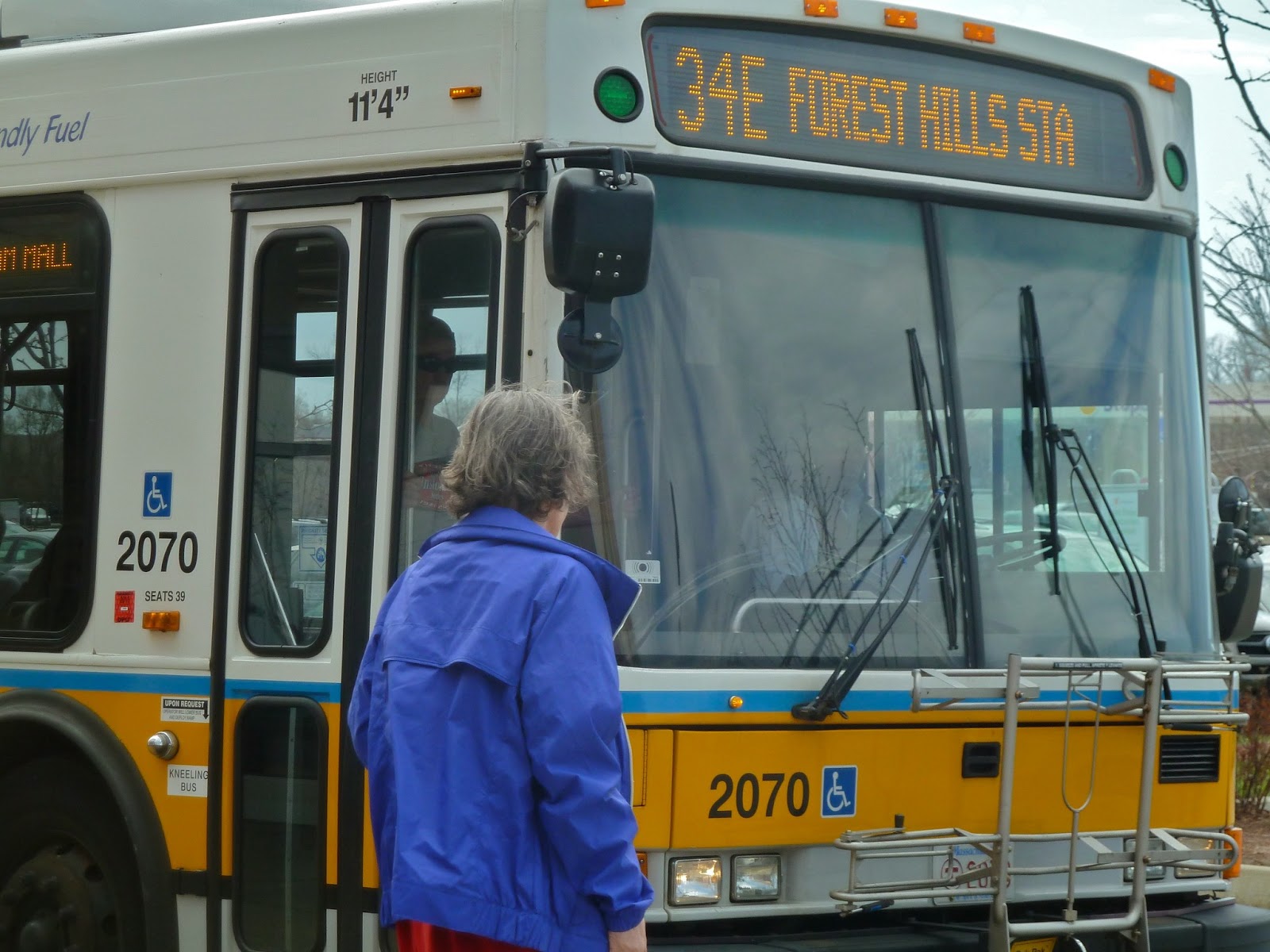
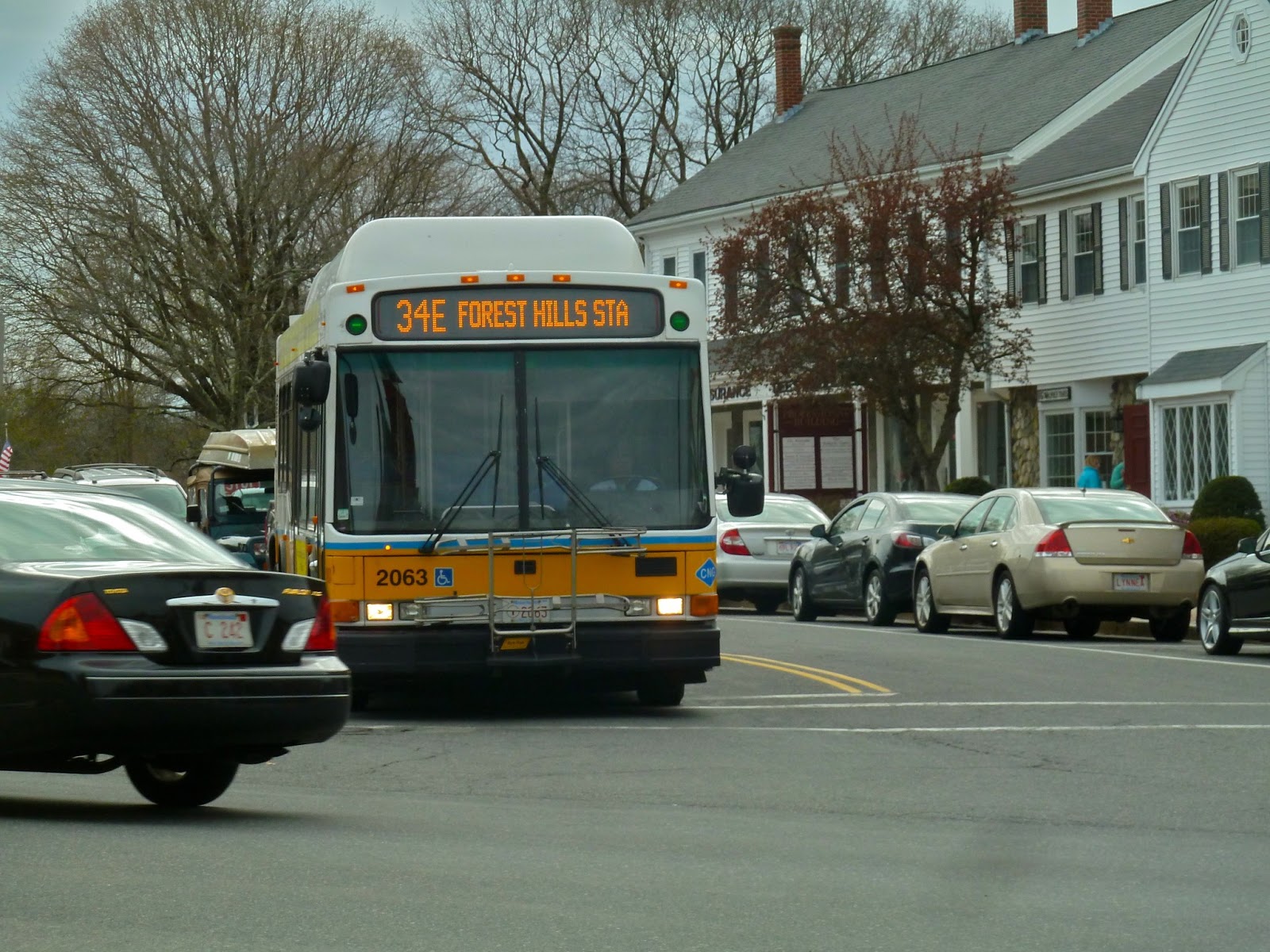
34/34E (Dedham Line or Walpole Center – Forest Hills Station via Washington Street)
When I first saw a map of this route, I thought it was absolutely hilarious. Why are there two routes that both have the same number, yet the 34E is 9 miles longer than the 34? Why is the 34E labeled “E” if it goes west? I don’t know the answers to these questions, but I do know that the 34E is a very interesting ride (I didn’t actually take the 34, but it’s basically a shorter version of the 34E).
The bus starts at Forest Hills and travels down the overcrowded Forest Hills-Roslindale corridor (seriously, nine bus routes on a single street?). After going through Roslindale, things get more residential. However, businesses start popping up again approaching Dedham. The 34 ends upon reaching “Dedham Line,” (which is little more than a bus sign) but the 34E continues, making two stops in the Dedham Mall, and then becoming the only transit option on Washington Street.
 |
| My rather squished picture at Dedham Mall of a bus going the wrong way. |
It then passes through the busy Dedham Square, but there are residences after that. It goes by Dedham Plaza and near Legacy Place (more on that later), but things are fairly quiet entering Westwood. There are mostly residences all through Westwood, with an occasional church or small business. It’s the same thing in Norwood until you reach Norwood Depot and Norwood Center stations where there’s a boom of businesses. The bus also travels very close to the Commuter Rail stations, about a block away from both Norwood Depot and Norwood Center. After that, there’s an elementary school and a middle school very close to each other, where I’m assuming there’s a lot of traffic on weekdays.
After entering Walpole, there are houses and a weird industrial building. Washington Street passes over a river, offering a nice view, and then the bus turns off onto High Plain Street. High Plain Street turns into East Street, and the bus passes another school. East Street then goes into Walpole Center, and the bus ends. This is only one variation of the bus, however; my father and I ended up on the route that goes via Walpole Street and Main Street. This route breaks off at Norwood Center onto Walpole Street. There are mostly houses along this stretch, although there is a baseball field and a small mall along the way. Once Walpole Street becomes Main Street, however, the businesses pick up and the bus goes by yet another school, a high school this time. You can catch a glimpse of Cobbs Pond through some trees as the bus passes by two other malls.
As our bus entered Walpole Center, however, my father and I were the only people on the bus besides two young women. The bus driver suddenly turned around and shouted “You’re gonna be going to the police station right now.” I was startled, so we instinctively got off the bus thinking the driver was talking to us. Turned out she was talking to the women: they wanted to get off at Legacy Place and the bus driver never told them when to get off. I don’t know what that has to do with the police, but we all got off anyway. Turns out there’s one more stop on the route, as the bus officially terminates at the Walpole Commuter Rail station. Not wanting to deal with the driver, though, we just crossed the street and waited for the bus to come back.
The women made it to Legacy Place, by the way.
 |
| A quaint little picture at Walpole Center. |
Route: 34/34E (Dedham Line or Walpole Center – Forest Hills Station via Washington Street)
Ridership: If you analyze the route, it seems it would be students and shoppers (the bus passes or comes close to 7 malls if you go via Walpole Street). On our ride, however, it just seemed like people were using it to get where they needed to go; there would never be a huge crowd at any particular stop, although that’s not to say the bus wasn’t crowded. About 40-50 people on a weekday isn’t bad at all (especially for half-hour headways). The 34, on the other hand, is a bus that I believe people mostly use as a Washington Street shuttle, based on its length. We saw 34 buses that were absolutely packed to the gills.
Pros: For the 34E, half-hour headways on weekdays and Saturdays is great considering how suburban it is. The 34 is even better, running every 8-10 minutes during rush hour (although it has the same schedule as the 34E at most other times). The 34E serves a massive area without adequate transit. Sure, there’s the Commuter Rail, but the 34E runs more often and is way cheaper. The Commuter Rail from Walpole to Boston is $7.25, while if you have a CharlieCard, the 34E is only $2.00 with a subway transfer. If this is your daily commute, the 34E can save you a lot of money (but it takes longer).
Cons: They both have pretty bad service on Sundays: every 50 minutes for the 34, and every hour for the 34E. But the real problem is the fact that we even have two buses with the same number on Washington Street. I understand that the MBTA wants to eliminate crowds by having separate bus routes, but here are my possible solutions to what I think is a rather annoying problem:
1. Change the number of one of the buses
This is the easiest solution: I don’t think two completely different bus routes should have the same number. Why not change one of them and make things a lot easier?
2. Extend the 34
“Dedham Line” is really not much of a terminus. Couldn’t the MBTA extend the 34 the extra half-mile to Dedham Mall or even Dedham Square? All I’m saying is that the 34 should have an actual terminus.
3. Merge the routes full-time to Walpole
This is the hardest, but it might work. If the MBTA just increased the schedule, they would probably be using the same amount of buses as they do now. The crowds might be a bit large, though.
Nearby and Noteworthy: I’ve already talked about the Dedham Mall in my 52 post, but this is the only bus that goes by a very nice mall: Legacy Place is an amazing outdoor mall (which is a rare thing nowadays) that feels like downtown in a small city. The problem is that you have to traverse some difficult crosswalks to get to it from Washington Street, although it’s worth it. The Showcase Cinema de Lux theater inside the mall is very luxurious. My father and I saw Jurassic Park 3-D there, and it was a great experience. Good movie, too.
Final Verdict: 8 (applies for both buses)
I personally prefer the 34E, but both buses are very good. The 34 serves as a (sort of) frequent shuttle along Washington Street, while the 34E goes way out into the suburbs and is much cheaper than the Commuter Rail. I do wish the buses had better service on Sundays, and it would be great if the MBTA went through with one of the solutions offered under “cons,” but it’s a very good bus route (sorry, two bus routes) overall.
Latest MBTA News: The state voted unanimously to add a new “Boston Landing” Commuter Rail Station in Brighton on the Framingham/Worcester Line. Read this article for more information. Ridership on the Fairmount Commuter Rail line is terrible, despite new stations, according to this article. Don’t forget, there are shuttle buses between JFK/UMASS and North Quincy stations on the Red Line this weekend. Some buses to the City Point area including the SL2 are experiencing diversions on Sunday (May 19). Read about them here. Finally, some buses in the Mattapan area are experiencing diversions on Sunday due to the Haitian Unity Parade and Festival. Read about the diversions here.
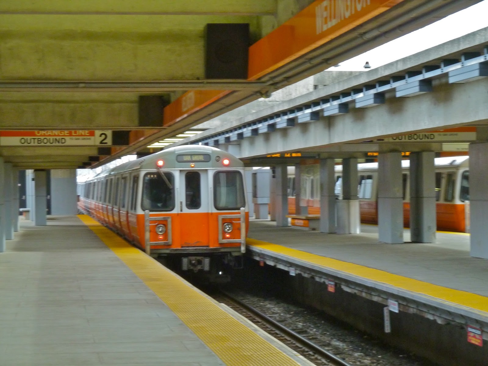
Wellington
I’ve seen Wellington many times by car: Route 16 goes on a bridge over the station. I know that it has a train yard in it. And yet, I had never explored the station before writing this review. In fact, I’ve only traveled on the northern arm on the Orange Line twice: once when I was on my quest to complete the system, and once for this review. Now that I’ve actually explored it, I’ve realized that it’s a nice station, although it has some flaws.
Situated at the border between Medford and Everett, the station itself is located in an interesting location. To the north of the station is residences and a radio station, to the west is a nice storefront and the Meadow Glen Mall, to the east is some sort of helipad and the Gateway Center Mall, and to the south is pretty much swampland, and in a few years, Assembly Square Station. Perhaps it’s because of the surroundings (except to the west) that Wellington is relatively low on the MBTA’s ridership statistics: 28th place. However, it does have a huge parking lot with 1,316 spaces accessible via a long walkway. My father and I decided to see what the trip on it was like.
 |
| Into the mouth of the walkway… |
The walkway offers an interesting view of the train yard, and it’s very high up. However, every time a train goes by, the whole thing shakes. That made me question the structural soundness of it, although it was still a nice walk. Eventually, we ended up in a little area with elevators. Wanting to fully explore the station, we took an elevator all the way up to the eighth floor. Stepping out onto the roof of the parking lot, there was an absolutely amazing view of the surrounding areas. You could see the Boston skyline, a windmill, a power plant, and a lot of houses. It was absolutely gorgeous.
 |
| I can see my house from here! Okay, I can’t. This is zoomed in, by the way. |
We then left the station from the parking lot to grab something to eat. The entrance/exit from the parking lot is a rather unassuming glass door. There aren’t any signs that say “Wellington” or anything, just a door. It might not even be obvious that you’re at a train station, since the station itself is so far away from the parking lot. After eating, we came back through the glass door and through the walkway again.
But the way we entered the station in the first place was from the busway, coming from the 110 (review coming at some point). Based on a quick glance, it seemed to offer some shelter, but not too much. Despite being a major bus hub with 9 MBTA buses and a contracted bus (a definite plus), the busway isn’t as much of a maze as other bus hubs are (I’m looking at you, Dudley). The buses here serve Everett, Medford, Somerville, and Malden.
And now to the platform itself. It’s actually rather ugly, with gray being the dominant color. However, Wellington does have the infamous Orange Line third track. It was meant to be an express track for a possible extension of the line to Reading, but it was never carried out. Now there’s just a random third track there that never gets used.
 |
| I was having absolutely terrible timing that day. I was pretty happy with the results of this picture. |
Station: Wellington
Ridership: Based on the fact that this station is almost surrounded by malls, shoppers. Also, its proximity to Everett and the fact that no trains serve that area means commuters probably use this station on weekdays. There’s not a huge parking lot here for nothing!
Pros: Offers some amazing views on the walkway and in the parking lot. It’s also close to many neighborhoods in Everett. It’s a major bus hub, and the busway is straightforward.
Cons: First of all, the platform itself is very drab. The station is quite far from the street, and you have to enter on the walkway (which must get really annoying if you use the station every day), unless you enter from the busway where you run the risk of getting run over by buses. The parking lot entrance is sort of disguised and signage at it is nonexistent.
Nearby and Noteworthy: Plenty of malls in relatively close walking distance: the Meadow Glen Mall, the Gateway Center, and Assembly Square Mall (although you have to walk a fairly long distance to get to these). My father and I ended up eating at Kelly’s, a fast food joint (sigh) located very close to the station. The food is okay, but I love how they have old photos of Revere on the walls.
Final Verdict: 6
I originally thought this station would get a higher rating. However, after looking back at the cons I had, I realized that there are actually some major flaws to Wellington. The walkway, interestingly, is the best and worst part of the station: it offers a great view of the train yard, but it’s annoying how you have to use it to get to the station. The view from the parking lot definitely is worth a look, and the busway is straightforward. (gasp!)
Latest MBTA News: From May 13 to May 18, there will be drain maintenance at the Hotel Commonwealth entrance at Kenmore Station. That entrance and the elevator from that entrance will be closed. Also, on May 11-12 and May 18-19, shuttle buses will replace the Red Line from JFK/UMASS to North Quincy.
52 (Dedham Mall or Charles River Loop – Watertown Yard via Oak Hill and Newton Center)
The 52 goes through some serious back roads. It goes by a farm, for Pete’s sake! It’s also on the chopping block, unfortunately, which means its schedule isn’t that great: every hour and a half, weekdays only (although it does go every 25-35 minutes at rush hour, which is decent for a bus on the chopping block). My father had been wanting to take this bus for a while, and we finally had a free weekday to do it. After a pleasant ride on the 71 (review coming at some point), we had to make the trek to the other side of Watertown Square. See, Watertown Square is separated into two busways: Watertown Square, where the 59 and 71 buses board; and Watertown Yard, the former yard for the Green Line “A” Branch, and now the terminus for the 502/504 express buses, the busy 57 (also reviewing that in the near future), and the 52. To get to the yard, you must cross a very busy crosswalk that has one of those “push to cross” buttons that doesn’t work and you’re forced to jaywalk across…
Anyway, enough ranting about buttons. There were about 5 people waiting in Watertown (including us) for the 52, one of whom seemed a bit… off. After laying over for a bit, the 52 finally came to the stop, and we got on. The route starts out following the other buses from Watertown Yard (not square) down Galen Street. There are some businesses and a few residences on this stretch, but it’s pretty urban, overall. Upon reaching the Mass Turnpike and Newton Corner, it makes a turn around the impressive facade of the Crowne Plaza hotel (yes, the same Crowne Plaza I stayed at in Orlando), and then heads down Centre Street. The 52 is the only bus serving this stretch, with the other buses turning on Washington Street towards Boston. The part of Centre Street just south of Newton Corner is much more suburban and residential.
After passing by a branch of Boston College, the bus crosses Commonwealth Ave and comes into Newton Center. It’s more urban here as the bus connects with the Green Line “D” Branch. Note that at this point, the bus splits into two routes: more often, it goes via Parker Street, while occasionally (and on our trip), it goes via Winchester Street and Newton Highlands station. There’s a nice view of Crystal Lake as the bus crosses the Green Line tracks and things get suburban again. Some businesses pop up as the bus enters Newton Highlands. Note that the 52 actually stops a block away from the station itself, while the 59 (also from Watertown, with a better schedule) directly serves it. After this, the 59 splits off from the 52 onto the more urban corridor of Needham Street, while the 52 goes on the suburban Winchester Street. The stops are very spaced out as the bus cuts through a country club.
As the bus turns onto Nahanton street, it goes by that farm I mentioned. It then turns again onto Dedham Street, meeting up with its Parker Street route. There are more residences as the bus turns again onto Wiswall Road, serving a little neighborhood as well as Mount Ida College. There’s a turn onto Walsh Road and again onto Saw Mill Brook Parkway. It goes by a little plaza before turning again onto Fredette Road, again onto Spiers Road, and finally back onto Dedham Street, now called Baker Street. There’s some cemetery cutting here, the only other MBTA bus route besides the 30 that cuts through a cemetery (as far as I know). Surprisingly, the bus is in Boston now, but based on the surroundings you wouldn’t know it. The route passes some small businesses and a power plant, crosses the Commuter Rail tracks, and turns onto Spring Street. At this point, some 52 trips terminate at the Charles River Loop. Our bus, however, was going to the Dedham Mall, so we turned again onto VFW Parkway. The bus passes by (but doesn’t stop at) some businesses, and VFW Parkway becomes Providence Highway. Finally, the bus turns into Dedham Mall and makes two stops: “Dedham Mall,” and “Dedham Mall at Stop & Shop.” Here, the bus lays over for a bit before making its journey back to Watertown.
 |
| The 52 in Watertown. The destination screen malfunctioned and showed nothing by the end of the ride. |
Route: 52 (Dedham Mall or Charles River Loop – Watertown Yard via Oak Hill and Newton Center)
Ridership: In this case, shoppers. A few people rode from beginning to end. There were some high school girls (being April vacation) who got on in that neighborhood where the bus breaks off of Dedham Street who were talking annoyingly loud. Overall, I’d say about 15-20 people rode, which isn’t a very good amount for a weekday.
Pros: Cuts through a huge part of Newton not served by other buses. It’s the only bus to serve Newton Center, which is a big plus. It also showcases a part of Boston you never knew existed.
Cons: The schedule, of course. Admittedly, not many people rode, but if the route had Saturday service, people might use it to shop at the Dedham Mall.
Nearby and Noteworthy: A lot of houses. The Dedham Mall seemed like a nice enough mall, but we only visited Five Guys Burgers and Fries. As you can probably tell from the link, it’s just a fast food joint, but the hamburgers are good.
Final Verdict: 7
Though the schedule is less than ideal, the 52 serves a lot of neighborhoods not served by other MBTA buses. There are some interesting things to see, like the farm. Just remember that the bus leaves from Watertown Yard, not Watertown Square. It’s easy to get the two confused.
Latest MBTA News: This weekend (May 4-5), there are Blue Line shuttles (scroll to the bottom of the linked page) between Airport and Wonderland. There might be some minor delays on the Orange Line in the coming months because of platform work at Oak Grove. Also, I’m taking a trip to the MBTA Control Center tomorrow! I hope I’m able to take pictures, as I want to write an extensive blog post about the visit on Sunday.
Transit Tales: The Only Time I Hate Riding Buses
If only I had read my own blog post. If I had, I would’ve realized that there were Red Line shuttle buses between Alewife and Harvard. Boy, you should’ve heard the curses when my father and I came to the Alewife station entrance only to see a sign that said the entrance was closed. We had to walk to the busway to catch the dreaded shuttle bus to Harvard. I’ve had bad experiences on shuttle buses: once, it was absolutely packed on Mass Ave at rush hour. There was traffic and red lights, and it was simply awful. Luckily, the bus wasn’t quite as full leaving Alewife, though every seat pair was taken.
 |
| Looks pretty crowded from the back corner of the bus. |
There were some standees as we left for Porter, going right through downtown Davis Square. This can be a pretty torturous part of the ride in terms of traffic. The bus turns onto Beech Street, following the 96, and then turns again onto Mass Ave. This is the absolute worst part of the ride, as anyone living nearby knows the sort of traffic one can find on Mass Ave. Stopping at Porter, we’re pretty darn full as we head for Harvard. After getting off at the busway, we enter the chaos known as Harvard Station while shuttle buses are running. The station already has huge crowds, and now the shuttle buses make them bigger. There was a huge mass of people leaving the station. So much, in fact, that the fare gates wouldn’t close with the crowds going through them! Nonetheless, I was honest and I tapped my CharlieCard anyway.
At the platform, there weren’t any trains coming. We waited for 15 minutes, which is a lot, even for a Sunday. Finally, a train came. You could feel tension in the crowd as the many people inside the train shoved themselves out. Then it was a mad dash for seats as everybody rushed in at once. Luckily, we got seats as the train left the crowded platform.
 |
| Say goodbye to the crowded deathtrap! |
After this ride, I decided I’d evaluate shuttle buses as a whole:
Cons: Let’s start with these, as they’re numerous:
- Much slower than the train
- Really crowded
- Chaos at the train station
Pros: They’re free. That’s actually really nice if you’re going between just the stations served by the shuttle, because who doesn’t want a free ride? And at least they’re numerous. You won’t have to wait long for one.
But what do you think? Say your opinion on shuttle buses in the comments (as you might know, I attempted to do a poll about the very subject, but my polls seem to be cursed or something; they never work!). Also, if you have any “shuttle bus stories,” leave a comment as well. They might be compiled into another post!