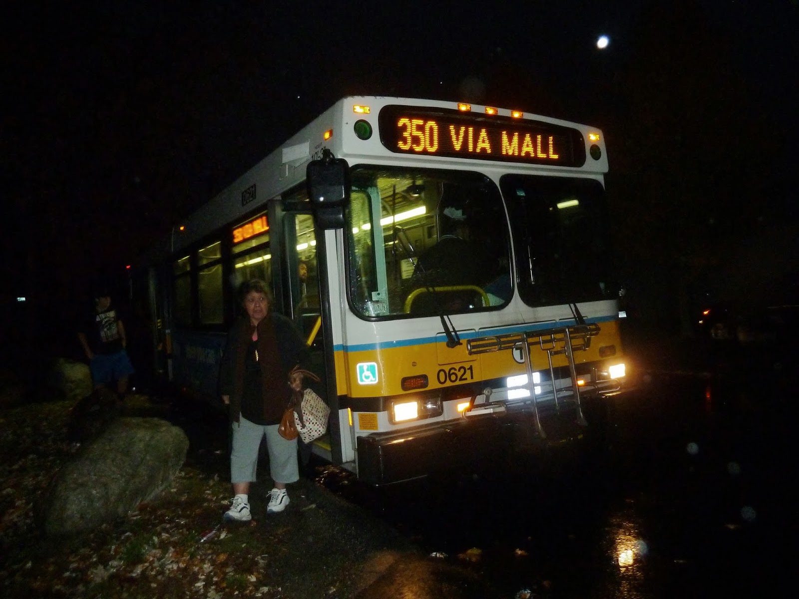
352 (Burlington Express – Boston via Route 128 and I-93) – also includes the 350 to the end!
You may recall how when I took the 350, I only took it up to the Burlington Mall. I knew, however, that I would be able to take it all the way after riding the 352, which ends at the same place. This wasn’t the reason I wanted to take it: I actually just wanted an excuse to get off at State Station, which is literally right in the Old State House. Unfortunately, I arrived 20 minutes late and planned on simply exploring State. Suddenly, I heard the noise of a bus. Rushing outside (without thinking about having to repay my fare), I saw a 352, the bus after the one I missed.
 |
| A really bad, blurry picture of the bus in front of the Old State House. |
I got on, along with maybe nine other people. The bus laid over for a bit in front of the Old State House, and then started to leave. The part of the route in Boston is very simple, surprisingly. It heads down Court Street, which turns into Cambridge Street, passing City Hall, Government Center Station, and the famous giant tea kettle. It turns at New Sudbury Street, the lone entrance to Bowdoin hiding just out of a rider’s view from the bus. It passes Haymarket Station, and then turns onto I-93.
It was actually very exhilarating, riding alongside I-93 (the exit ramp doesn’t physically connect to the highway until later) over the Zakim Bridge at the typical 75 miles an hour. Then the bus hit a snag – specifically, rush hour traffic (or not really rush hour – it was 4 PM). Luckily, the traffic was moving somewhat, and the slow pace gave me a chance to look at the lovely view. This is where 93’s northbound and southbound sides stack on top of each other, and the northbound side is on the top. There were some great views of the Bunker Hill Monument sticking up above small apartments and, if you turn around, a beautiful skyline view.
 |
| Unfortunately, there were raindrops on the bus windows, making this another really bad, blurry picture. Note the massive amounts of traffic on both sides of the highway. |
It gets industrial around Sullivan Square (which is kind of visible in the photo above), but once past there, the two sides of I-93 level out again and dense houses and apartments appear. Then the highway goes through a rather swampy area and then it gets industrial again. It’s fairly urban in Medford, but there’s a dense layer of trees on both sides of the highway, preventing people from seeing through. Then the houses go away and the highway just runs through a dense forest (keep in mind there’s still a huge traffic jam). After a while, office parks, less densely spaced houses, and massive superstores start appearing.
Here the bus turned off of I-93 onto the mercifully less trafficked I-95 South. It is mostly the same fare, with quite a few office parks lining the highway through the tree layer. There’s an interesting point where the forest clears away for a short time for some massive telephone wires to cross over the highway. It is also at this point where the bus turns off and heads onto Cambridge Street with the 350.
This is a little after the Burlington Mall, so this is also previously uncharted territory for me. The 350 and the 352 share the route from this point onward, so consider this the final part of the 350 as well (and I took the 350 back the whole way after this bus, anyway). My preconceived notion of the area north of Burlington Mall was mostly just spread apart houses. It turned out to be more office parks along the road, with houses dotted in between. The bus went through Burlington Center (there’s a Burlington Center? You learn something new every day), and after that there were some small commercial buildings with big parking lots.
There was a point where the bus turned onto Wilmington Road and then again onto Chestnut Ave. I was absolutely thrilled to see there was a shelter, as I had no idea when the next 350 was coming. I assumed this was the last stop, as the driver opened both doors and “kneeled” the bus down. No one got off, though, so he closed them again. I had no idea where we were going now, but the bus made a very sharp turn onto Cambridge Street. There was another stop here, and yet again he opened both doors and kneeled the bus. This time he said “last stop,” so I figured it was time to get off. The driver turned the destination board to “NOT IN SERVICE” and drove off to who knows where.
 |
| This is where the bus dropped me off. Not the nicest place in the world… |
As everyone went their separate ways, I wanted to get back to that shelter on Chestnut Ave (this stop on Cambridge Street was just a sign). This was easier said than done. First of all, Cambridge Street was full of reckless drivers, speeding by at 60 miles per hour. Luckily, there was a traffic light, so I pushed the button and crossed over. Despite being only a block from where I was, I couldn’t figure out how to get to Chestnut Ave. I ended up just going back to Wilmington Street and then going to the Chestnut Street bus shelter.

 |
| And this is where I had to wait. I’m thankful for the shelter, but geez Louise, what a dump. |
 |
| I had to save the best for last. This picture is so darn cool! |
Random Photos (Videos): Spastic Fare Gate
I was at Alewife Station (the smaller entrance) when I saw this weird fare gate. It was simply opening and closing repeatedly. Everyone was gingerly using the other one, and when I got back that afternoon it was fixed. Someone could’ve easily broken through without paying a fare, but no one did when I was there. Which is kind of nice, actually. You can also watch it on YouTube here.
Random Photos: Hey, Who Turned Out The Lights?
I was on the Red Line leaving Alewife. There were only three other people in the car with me, when the train stopped right after leaving the station. This happens fairly often, so I didn’t think much of it. Then the lights turned out. It was rather eerie just sitting there in the dark with only a few other people. I took out my camera and snapped a few pictures. Soon after, the lights turned back on and the train started moving again, without a word from the driver.

 |
| The pictures speak for themselves, really. |
558 (Riverside – Downtown Boston via Newton Corner and Mass Turnpike)
The 558 is one of many express buses in the 500s that travel on the Mass Turnpike from downtown. In this case, the bus goes to Riverside, although taking a very indirect route. It is also the highest numbered bus route operated by the MBTA.
It starts at the intersection of Federal and Franklin Streets downtown, about halfway between Downtown Crossing and South Station. My father and I chose to use Downtown Crossing, and were late for the bus as usual. Luckily, being an MBTA bus, the 558 was late as well, and we were able to catch it at the beginning of the route. From there, it navigates through heavily trafficked one-ways and stops at Otis and Summer Streets (remember that?). From there, it continues making random turns until reaching Surface Road, where it goes by the not-so-famous Boston Chinatown Gate, and then turns off onto the Mass Turnpike.
 |
| In all its glory, here it is. |
On the Turnpike, the bus goes fast. Like, 75 MPH fast. There was no traffic mid-afternoon on Columbus Day, so the bus just sped along the highway. It passes by the John Hancock Building (barely visible before the Turnpike goes into a tunnel)and Fenway Park before hitting a toll plaza. I was wondering what would happen here, and it turns out trucks and buses have their own special lane at the toll.
It gets pretty suburban by the time the bus takes the exit at Newton Corner. It follows the other “550” buses down Washington Street for a bit before turning off at Adams Street into a residential neighborhood. It turns onto Watertown Street (where there are a few businesses) for only a few blocks before turning again onto Chapel Street and going by a business center. Then it turns onto California Street and again onto Bridge Street, crossing over the Charles and entering Watertown.
It’s fairly industrial once the bus turns onto Pleasant Street right after Bridge. There are a lot of car dealerships and office parks in this neighborhood. The industry ends right about where the bus enters Waltham, and Pleasant Street turns to River Street (it’s not in Watertown for very long). There are densely packed houses, as well as an amphitheater-esque building. The houses turn to businesses as the bus comes into Waltham Center, connecting with the 70, a few other “500” buses, and the Commuter Rail.
It follows the other buses down Moody Street but shortly turns off at Crescent Street. This is more residential than Moody, but soon a massive factory pops up. Soon after the bus turns onto Woerd (pronounced “word,” I think) Ave, and yet again onto Rumford Ave, which is also pretty industrial. It then turns again onto Lexington Street back in Newton, where there are connections to a few other buses. Travelling down Lexington Street along with the 505, they reach Commonwealth Ave (imagine if the B Line went out here) and split off. The 558 goes right, leaving behind the minor businesses of the intersection for a more residential area.
Passing a Marriott, the bus crosses over the Charles River and then merges onto I-95. It’s not on it for very long, though, turning off at the very next exit onto Grove Street. It passes by the good ol’ Hotel Indigo, and then turns into the Riverside parking lot.
 |
| The 558 way back in downtown. Lovely picture, if I do say so myself. |
Route: 558 (Riverside – Downtown Boston via Newton Corner and Mass Turnpike)
Ridership: One thing’s for sure, no one took this from beginning to end. The ridership was sort of split into two chunks: Downtown to Waltham, and Waltham to Riverside. That being said, a fair amount of the people that rode it (around 20 for our ride) used it for just local service around Waltham.
Pros: Cuts out a nice route through Waltham that serves a lot. The express to Boston is fast, but probably not during rush hour. Ridership was decent, but not excellent.
Cons: The schedule is pretty darn terrible: the bus runs weekdays only, about every hour. On top of that, four out of the ten trips the bus makes in a day only run from Riverside to Newton Corner. I feel like it should at least have limited Saturday service. The bus is obviously not faster than the train – from Downtown Crossing to Riverside on the bus is about an hour, while the train from Riverside to Downtown Crossing (utilizing the Winter Street concourse between Park Street and the latter) is only 45 minutes. Finally, the bus is very curvy, although as there aren’t that many traffic lights (or traffic in general) along the route, it’s not nearly as much of a problem as it is for the 83.
Nearby and Noteworthy: Other than downtown and Newton Corner, not much. It was a mostly residential/industrial route. Fenway Park and the John Hancock Building were visible, but that doesn’t really count.
Final Verdict: 6/10
This is one of those buses that I don’t see what’s wrong with it until I actually do the post. The schedule was sort of a deal breaker in my opinion, although the Waltham area is pretty under-served in general, at least on weekends. But think about it: the 76 gets at least a pseudo Saturday service and it got about the same amount of riders as the 558. However, the impractical transit geek in me says it’s still a very fun ride. It’s also the highest numbered bus operated by the MBTA (not including contracted buses), which is kinda worth checking out, right?
Latest MBTA News: Service Updates
The MBTA is starting work on the Government Center Station rehabilitation project. This unfortunately means the station will be closed for two years starting spring 2014. Also, a lawsuit has been filed against the MBTA for displaying pro-Israel ads at various locations.
Miles on the MBTA in Boston Magazine!
I see some people have noticed a reference to Miles on the MBTA in the Boston Magazine article, “‘Transit Racer’ Will Attempt to Travel to Every MBTA Station In Record Time.” So yes, I will be travelling with Adham Fisher on his record breaking/setting adventure. In the meantime, here are some recommended blog posts for new readers from the article:
- The 459 – My first bus review wasn’t that great, but hey – it was the first.
- The 30 – My second bus review, and also one of my worst transit experiences.
- The SL5 – One of the blog’s only low-scoring routes as of yet.
- The 1 – An amazing crosstown route.
- The 31 – Scored a perfect 10!
- Science Park/West End – Has one of my favorite photos on the blog.
- The 439 – An amazing route that’s on its last legs.
- Bowdoin – Closed on weekends and evenings, insanely tight loop, door-open buttons…really weird station.
- The 441/442 – Sort of irrelevant now that the weather’s getting colder, but it was a fun ride to Marblehead.
- Minatur Wunderland – The best place ever is located in Hamburg, Germany.
- The MBTA Control Center – Definitely worth a look.
- The 71 – Trackless trolley. Period.
- The 4 – Great ride through downtown Boston.
- The 76 – A very weird route.
- All of the Service Change posts, wherein we ride non-MBTA transit systems, are worth a look.
Photos From Around Riverside
I am very late with my usual bus review (as usual), but here are the rest of the pictures I took around Riverside Station.
 |
| Sort of an overview of the station. The back of the 558 bus peeks in. |
 |
| Whoops! Missed that train! Looks nice, though, with the trees just starting to change color. |
 |
| A Boeing LRV train, retired from revenue service in 2007, now being used as a work car. I believe this one is usually stored in the central subway, but is at Riverside on this particular day. |
 |
| And another, this one orange. |
 |
| A lot of tracks and wires, as well as a few garages. |
 |
| A wider look at the yard. |
 |
| Why isn’t this work car operating, I wonder? |
 |
| And again. |
 |
| An old forgotten ticket booth at the far end of the station where no one ever goes. |
 |
| An old forgotten bus shelter in the same place. |
 |
| Whoops! I was planning to take that one! |
 |
| I love this staircase area! |
 |
| There seems to be another abandoned bus shelter to the lower right. |
 |
| I had to do this one again, I love it so much! |
Riverside
I’ve always found it funny how the C and E branches of the Green Line end more or less in Boston and the B branch barely makes it into Newton – but then the D branch stretches all the way out to the Weston border on its own amazingly fast right-of-way. The terminus of the D is Riverside, a massive complex practically in the middle of nowhere. I had been there a few times for fun, but had never left the station (I didn’t want to have to pay my fare again). Taking the 558 (review coming soon) out there, however, gave me the chance to explore, and I can now say that Riverside is like heaven for transit-lovers.
This is one of the only (if not the only) above ground Green Line station with actual CharlieCard gates and trains opening all doors instead of just the front. However, there seemed to be no employees on duty at the station when I went (around 1:30 on a weekday), and there was a random rolling chair sitting around that someone could’ve easily stolen. Riverside is also the location of Pluto in the Museum of Science Community Solar System. Finally, it has a massive parking lot with 925 spaces.
 |
| The parking lot. |
The platform has a bit of a inefficient layout. The outbound platform (i.e. trains coming into Riverside) is on the far end of the station, requiring commuters to cross over the inbound tracks to get to the exit. It’s pretty nice overall, providing a lot of shelter on both platforms (although who would use the center platform going back to Boston when it requires crossing over the tracks)? Something I found interesting on the platform was an “assistance box” with buttons for information and emergency help. Emergency help makes sense, but I don’t know why there would be tourists out at Riverside wishing to figure out “information” (or tourists in general, really). Also, the box didn’t seem to be connected to anything, and I wanted to see if it worked but there were some bees who had taken up residence in there.
 |
| The platform. |
The area with the fare gates is nice, with a rounded roof to one side and a staircase area to the other. There’s a concrete carving in the staircase area that says “RIVERSIDE.” It is also in this lobby area that the Museum of Science Community Solar System Pluto is located. Walking down the staircase and along a sidewalk, you can observe the drivers getting into their trains to leave for Boston. Going further, there’s a busway with a few regional coach buses, including Go Bus. The only MBTA bus to serve Riverside is the 558 express to Boston via Waltham. It used to also be served by the 500 and 555 express buses to Boston, but they were eliminated due to bad ridership (Taking a bus on crowded I-90 over the train? Sign me up)!
 |
| The fare area. |
At the busway, there is also a useless bike rack that’s been completely uprooted out of the ground (yet it had bikes attached to it, anyway – must not be very many thieves out here). There’s also a nice Go Bus building. Going inside, there are vending machines (a very convenient amenity), free coffee (fantastic) bathrooms (an amazing feature) and a lot of posters with pictures of New York on them (not as helpful). There’s also a desk with maps of Manhattan and the MBTA bus system. My father and I got into a long conversation with a nice clerk there.
 |
| Pretty swanky. |
As you get further away from the station proper, you can see some forlorn bus shelters that used to be served by the 500 and 555. There is also a massive work car on a platform (not connected to the yard, for some reason). There are some amazing views at this end of the station of some old Boeing LRV cars that were retired in 2007. I saw two that are currently being used as work vehicles. I don’t think people visit this end of the station much, because I was getting a lot of odd looks from people sitting in their cars for no reason. There is also a hotel right next to the station that I’ll talk about in a minute. Since I took so many pictures of the yard and the station, I’m also going to have to make a separate post for the bulk of them.
 |
| Beautiful! I love this picture! |
Station: Riverside
Ridership: This is a very commuter-heavy station. What with the massive parking lot, as well as the convenient location right next to I-95, this station screams “commuters.” In general, I think most people drive to this station even if it’s close by – that parking lot was packed.
Pros: This is probably the best above ground Green Line station there is. It actually feels like it could be a heavy rail station, especially because it has actual fare gates. This is also heaven for anyone who likes transit, vintage train cars, or just trainspotting. This is a massive yard complex, and you won’t be disappointed. I also really like the Go Bus office, as it makes Riverside one of the only MBTA stations with both food and bathrooms.
Cons: This station has an air of neglect to me. From the random rolling chair sitting around to the detached bike rack to the beehive in the assistance box, it seems like an employee hasn’t looked around the station in years. It also gets more and more forgotten the further you get from the station proper. The station proper is very nice, as I said before. Then you get to the busway, which has the excellent but slightly hidden Go Bus office, although no shelters. Then there’s a stretch of sidewalk and a big bin for recycling paper (a popular spot for bees) where it seems no one has gone since the 20th century. Then there are the forgotten bus shelters, the random work vehicle on a platform, and from there on empty asphalt sprinkled with sand…
Nearby and Noteworthy: No offence to anyone who lives out here, but Riverside is in the middle of nowhere. There’s a golf course to the east, housing and a small office park to the north, a massive highway interchange to the west, and the “Hotel Indigo” directly to the south. Now don’t get me wrong, $119 a night is insanely cheap and it looks like a nice hotel, but the website tries way too hard to hide the fact that it’s in the middle of nowhere. “…our Newton MA hotel is minutes from Logan International Airport…” Fantastic.
Final Verdict: 8/10 if you like transit, 5/10 otherwise
Bottom line, if you like transit then you should definitely pay a visit here. The yard is very interesting, especially if you poke around the more neglected parts of the station. That brings me to my next point: the station seems almost forgotten, and although the station proper is nice, the rest is pretty awful. And even the station proper has signs of neglect, such as the rolling chair.or the beehive. However, I do really like how this station has those fare gates; that’s a major plus for the Green Line.
Latest MBTA News: Service Alerts
New Red Line and Orange Line cars are being ordered! They could possibly have LED maps that tell you where the train is, “if the price is right.” I personally hope they’re implemented in the cars. Also, it’s official: the Silver Line is being extended to Chelsea! The extension should hopefully take pressure off the 111 bus.
MBTA BusTracker
As this is my first experience with any MBTA bus app, all I can say is…wow. I’ve never tried one of these for myself, so I was blown away with how easy it was to use; I had figured out what to do in about 30 seconds. Upon getting onto the website (it’s all online, which is nice since I don’t own a smartphone and could try it on a computer), there is a simple search bar asking you to type in a stop name. When you type in a street name (for example, Massachusetts Avenue), you get a long list of stop names back. You can either scroll through them all or just narrow it down by writing more of the stop name. If there are multiple routes at a stop, you can select the ones you want to appear on the map. You also have the option to save stops or specific routes at stops for quick reference (a fantastic feature).
There is also a button called “Find Stops Near Me.” This feature figures out your location and shows you all the closest bus stops. You can then click on individual stops to see when the next bus goes to them. There’s also a button at the top that says “Click Here City Center,” which takes you to Downtown Boston (although there aren’t too many buses going there).
I like all these features, but there are also unfortunately some bad things about the app. First and foremost, if you try to search for a train station (Harvard, for example) with or without bus connections, it says “There is no bus stop with that number.” I mean, if you type in “Harvard,” “Harvard Square Station” is the first thing on the list, yet it doesn’t lead to anything! There is no way to find out when buses get to stations like Harvard, so you have to use stops that are close to the hubs. A smaller annoyance is the fact how when you type in a station name, it sometimes deletes a few letters for no reason and you have to start over. Overall, though, it’s quite a useful app that I would recommend (as long as you’re not getting any buses from train stations)
Why I Haven’t Posted
If you’ve been following this blog for a while (or if you’ve looked at our Facebook page), you’ve probably seen me complain about my computer crashing at some point or another. Well, it crashed again, and this time I can’t get it working. I’ve emailed the folks at Google, but they haven’t responded. And when (or possibly if) I get my computer working again, I’ll lose all my pictures and I’ll have to upload them again (which is a pain, because Chromebooks can’t save pictures directly from SD cards, so I have to load them onto my father’s computer, then email them to myself). I don’t know how long it will be until I start full-length posts again, but I’ll try to finish the one I’m working on (Riverside Station) on my father’s computer if I can. If not, then I apologize for this rant and I’ll hopefully post again at some point.
Miles on the MBTA YouTube Channel!
Miles on the MBTA has expanded into the world of YouTube! Sure, most (or more likely all) of the videos uploaded will also be featured on the blog, but…you know, YouTube is special. Also, I don’t know how often I’ll actually upload videos (for me, the blog is top priority), but again…YouTube is special. Anyway, here’s the link.
Random Photos (Videos): Leaky Bus
When I was riding the 76, something I forgot to mention was that the bus had water dripping from the ceiling in multiple places. It wasn’t raining, so I don’t really know what was wrong or what would cause water to drip from the ceiling. I took a video of it, anyway:
76 (Hanscom/Lincoln Labs – Alewife Station via Lexington Center and Civil Air Terminal)
This is probably the craziest bus route I’ve ever taken. I had a free weekday with nothing to do, so I just moseyed on over to Alewife to grab the first bus that came. I was secretly hoping for a 76, and that ended up being the first bus to come! With about 20 people on it, the bus starts out fairly normal, making its way through crowded Alewife Brook Parkway traffic to Route 2. It makes a completely useless stop near the pedestrian walkway over the highway (although once those awful apartments get built near the stop, it might get more ridership), and takes the first exit off of the highway.
 |
| Darn, I hate getting pictures where the destination board says “Via.” |
Until I rode this bus, I wasn’t entirely sure how the “Route 2 buses” worked; I figured they just went along the highway as an express. However, it turns out that they make every exit off of the highway and make stops at each one (except for the 351, which is an express bus). The 76 also has the longest stretch on Route 2 (except, again, for the 351). It makes the long climb up to Park Ave, and then passes through Arlmont Village, a nice residential area.
Getting off of the highway for good at Exit 56, the bus got stuck in traffic in a forested area. The foliage broke at a massive farm with a store and parking lot. Soon after, the bus merges onto Mass Ave and the 62 bus (sort of a cousin to the 76). It runs along the by-now-suburban Mass Ave before coming into Lexington Center, which is a pretty major stop.
 |
| Down on the farm… |
Turning off of Mass Ave shortly after Lexington Common, the bus goes by a large athletic facility, as well as Lexington High School. It then turns onto Waltham Street, and again onto Marrett Road (where there is a small plaza with small shops). Passing a couple more plazas and the Lexington Reservoir, the bus crosses over I-95. By now, I’m the only one on the bus, the last person getting out shortly after Lexington Center.
| It’s just me, the driver, and those pieces of trash on the floor. |
After crossing over I-95, it starts getting crazy. This portion is very rural, with entrances to corporate buildings along the road. Marrett Road then turns into North Great Road, and the bus passes by some historical places, such as where Paul Revere got captured on his famous ride. The bus turns onto Hanscom Drive, and along this stretch is the westernmost portion of the MBTA bus system.
It enters Hanscom Field, and makes a loop around the parking lot. The tiny planes are visible beyond a fence. No one got on here, and the bus went back onto Hanscom Drive. Along the way, we had to stop to let a group of turkeys cross the road. From there, the bus turned off of North Great Road onto “Old Massachusetts Avenue,” and turned again onto Wood Street into a residential area. There is a clearing in the forest for a path for telephone wires, and then it gets suburban again.
 |
| Hanscom Airport. |
Coming off of Wood Street, things got very crazy. The bus went through a massive gate, as prompted by a crossing guard, and then got stopped at a security booth. The woman inside asked how many people were on the bus, and the driver responded, “I got one in the back.” The security woman then let us through, and the bus entered Lincoln Labs. It was obvious looking out the window that this was a massive complex. There were some fairly modern buildings near the road we were on, and industrial smokestacks could be seen in the distance. The bus made a loop around a parking lot, while I snapped a picture, and then we came to a sheltered bus stop with a few people waiting. There was a large sign on the shelter, that said (from what I can remember):
“THIS IS A RESTRICTED AREA. PEOPLE WHO ENTER WITHOUT PERMISSION FROM THE CAPTAIN…” – Or something like that; I remember the word “captain” being in there – “…WILL BE PROSECUTED BY LAW. NO PHOTOGRAPHY IS ALLOWED. THIS AREA WATCHED BY SECURITY CAMERAS.”
Whoops. Guess I’m not publishing the photo I took. There were around five people waiting at the stop who got on the bus. After laying over for a few minutes, we left again, heading back the way we came (with another interruption from turkeys crossing the road). The ride back was pretty much the same as the ride there, until we got close to Alewife Station. There was some pretty heavy traffic on Route 2 near Alewife Station, but luckily MBTA buses take the “Alewife Station” exit, rather than going around via Alewife Brook Parkway. We came into Alewife station and got off the bus to go our separate ways. Although the ride back wasn’t that crowded, I looked back and saw a huge crowd of people waiting for the bus back out to Lexington and Bedford.
 |
| Never seen the Alewife busway so crowded. |
Route: 76 (Hanscom/Lincoln Labs – Alewife Station via Lexington Center and Civil Air Terminal)
Ridership: There were about 20 people on the ride to Bedford, and they all got on at Alewife. There was not a single person who got on anywhere else. This also applied to a lesser extent on the way back to Alewife, with most people getting off there, although there were a few that got off in local neighborhoods. The bus was mostly commuters going home on the way there (it was the PM rush). The way back also had commuters though, going home from the Lincoln Labs.
Pros: It’s a fantastic ride, just because of the weird places the bus goes to. An airport for tiny planes, a super-secret lab, and two turkey crossings in one ride? Sign me up! Oh, and I suppose it also serves many areas that would otherwise not be served by bus, but that obviously doesn’t matter, right?
Cons: The schedule is not the best. It runs every half hour during rush hours, and it runs every hour during the day. On Saturdays, it technically runs, but with a combined 62/76 service that omits part of the 76 route. It doesn’t run on Sundays.
Nearby and Noteworthy: I love, love, love Lexington Center. It has a great suburban-center feel, it has a bunch of excellent small businesses, and is just a fun place to be in general.
Final Verdict: 8/10
This was definitely one of my favorite buses I’ve ever taken. I had so much fun going to the most far-out places (both literally and figuratively). It also serves a lot and seems to get decent ridership. Unfortunately, it has a terrible schedule, so I had to lower the rating slightly, but this was still a very fun ride.
Latest MBTA News: Service Alerts
Nothing much of note has happened, except that the winner of the MBTA map contest has been announced! Created by Mikheil Kvrivishvili, the new map is a major improvement over the old one:
 |
| Image Source |
Some Clarifications on the 34E
Y’know, I was planning to finish my bus review by tonight, but I had some issues: my computer crashed three times in a row and I lost all of the things I was working on. This would be fine (luckily, Blogger auto-saves), except that my computer is insanely slow and it would take forever to get all the tabs I need opened again. Since it’s almost 10:30, I’ve decided to call it a night and finish the post tomorrow.
In the meantime, here are some clarifications on the 34E from Joshua Wilkinson: “Hi Miles, I read your post on the 34E bus route and I live in Walpole. I can clarify some info for you. The odd looking industrial building on Washington street used to make cookies (no clue when it stopped), the school on East Street near Walpole Center is Blessed Sacrament School with the church right next to it. The school on the Main Street route is the Norfolk Agricultural School.” Thanks, Joshua!
An Ode to the E Line
4 (North Station – World Trade Center via Federal Courthouse and South Station)
I always get a surge of excitement whenever I ride a weekdays-only bus that was on the chopping block – and, coincidentally, the 4 is one of them! Frankly, I’m surprised this was on the chopping block, since it seems to have decent ridership. However, true to its former chopping block status, the schedule is typical weekdays, rush hour only fare.
It’s really too bad, as well, because this bus actually makes a very scenic loop around Downtown Boston. This is how I advertised it to my mother, and how I got her to take a bus. We were aiming to take the 3:46 PM bus, but the Red Line was experiencing delays, and the Green Line was exactly the same as it usually is (not a good thing) so we ended up missing the bus. We walked into North Station proper to try to find some information of when the next bus was. The person I asked had no idea and had to check a schedule of the 4, but luckily there was one coming in the next 5 minutes (although the 4 only runs rush hour only, it runs fairly often within the time frame).
We went back to the stop right outside North Station on Causeway Street and waited for a few minutes. Seeing a bus coming down Causeway Street from the other side, I pointed it out to my mother. She figured it was just going “the other way.” However, since the 4 goes only one way around the loop (in different directions, depending on the time of day), that obviously wasn’t the case. As the bus came closer, I saw that its destination board said “Tide Street/BMIP,” which was where we were going. We had to run to the bus, and luckily the driver was nice enough to let us on.
| Hello? Anybody? |
I was really mad that the sign at the wrong bus stop had said that the stop was served by PM service as well as AM, when it obviously wasn’t, but I shook it off once on the bus. Looking around, I saw that we were the only ones on, and I figured it made sense for the bus to be on the chopping block. We crossed North Washington Street/Charlestown Bridge, and Causeway Street turned into Commercial Street. The bus went by Old North Church, an athletic facility, and many docks and ports. Two stops after North Station, people started to get on the bus. It was usually about 1-2 people per stop until there were about 10 people on the bus.
Eventually, Commercial Street becomes Atlantic Ave, and soon after Interstate 93 goes into its tunnel with the Rose Kennedy Greenway above (the parks created after the big dig). The bus goes by that new carousel recently opened, and then goes by Aquarium Station, the New England Aquarium, Long Wharf, and Faneuil Hall. It also goes by the “Rings Fountain,” which is a circle of fountains that shoot up at different times. Then it goes right through the Financial District, with some of the tallest buildings in Boston. Once the bus gets down to South Station (where everyone got off and we were the only ones again), it turns onto Summer Street and goes over the Fort Point Channel, with the Children’s Museum and the milk bottle just visible.
There are a few more buildings, but then the surroundings drastically change to a more industrial vibe. Leaving the small cluster of buildings, the bus is suddenly surrounded by a huge parking lot. It then goes by the Convention Center, with Track 61 visible below the road. After that, it gets very barren and industrial (including a parking lot full of army trucks), and the bus turns off of Summer Street onto Dry Dock Ave, into the Boston Marine Industrial Park (BMIP). Here, it travels with the Silver Line SL2 up to the Design Center. It then turns onto Tide Street, then Northern Ave. At this point, the bus driver said “last stop,” and kicked us out at a stop where about five people were already waiting.
 |
| Not the nicest place to get dropped off. |
First of all, I was surprised that the 4 even had a last stop – I figured it just went around the loop over and over again. Second of all, the place we were at was a complete industrial dump, just like the surrounding neighborhood. I was annoyed, but luckily, the bus back to North Station came in a few minutes. The bus driver, however, seemed surprised that we were all waiting at the stop. Once everyone got on, he asked someone about where the buses usually lay over, as if he didn’t know the route. They talked for a few minutes before the driver finally started driving.
The bus then goes up Northern Ave, with Silver Line Way visible to the left, and that huge performance tent to the right. Buildings start popping up again when Northern Ave turns into Seaport Boulevard. The bus then turns onto Northern Ave again (a different one, I guess?), going by the late Anthony’s Pier 4, the ICA, Courthouse Station, the courthouse, and more massive parking lots. At the courthouse, the bus turns onto Sleeper Street, then Seaport Boulevard again. On Sleeper Street, there is a beautiful view of the financial district to the right of the bus.
 |
| A bad picture of the view from Sleeper Street. |
The bus enters the Financial District again, turning left on Purchase Street/Atlantic Ave and then turning right on Pearl Street. The bus comes into Post Office Square, and then passes the Old State House and Boston City Hall, the ugliest building in the city. Then the bus passes Haymarket, turns onto Causeway Street, and is back at North Station. Everyone who was still on the bus got off here (the others got off at State Station), and nobody else got on. My mother and I got off and headed for the Green Line.
 |
| The 4 at Tide Street. |
Route: 4 (North Station – World Trade Center via Federal Courthouse and South Station)
Ridership: I was surprised at how many people rode the bus – about 30. No one went to the industrial area, which makes sense since it was the evening rush hour, but many people came from the industrial area (as well as the Financial District) back to Boston, either to the subway or the Commuter Rail in a few cases. Also, these were some of the most hardcore riders I’ve ever seen – literally almost every single one of them had passes, so the 4 is obviously a major part of people’s commutes.
Pros: If you’re new to Boston, this is your bus. Although it doesn’t run that often, it goes by so many landmarks in Downtown Boston (more on that later). Also, although it only runs during rush hours, it runs often during those times. It also gets very good ridership for a bus that was on the chopping block.
Cons: Obviously, the schedule is terrible like all chopping block buses. Also, although I said this is a good bus for Boston newcomers, I would be very surprised if I were a tourist and I got dropped off in some desolate industrial wasteland in an unfamiliar city.
Nearby and Noteworthy: Old North Church; Faneuil Hall; the New England Aquarium; South Station; the Children’s Museum The Convention Center; The World Trade Center; the John J. Moakly Courthouse; the Old State House; Boston City Hall; T.D. Garden; and assorted small stores and landmarks. ‘Nuff said.
Final Verdict: 7
Like the 439, although this is a great bus, I have to lower the rating because of the schedule. You may say this one should be higher since its schedule isn’t as bad as the 439, but then you also have to consider that the 439 doesn’t drop you off in an industrial wasteland…
Latest MBTA News: Service Alerts
Two MIT students have developed the Sesame Ring, a CharlieCard that fits around your finger. It should be a convenient alternative over searching through your purse or backpack looking for your CharlieCard. I’ll probably only get it if it’s free, though…
$393 million has been given to the MBTA to construct three new stations on the Green Line: A new Lechmere Station, a station in the Brickbottom neighborhood of Somerville, and Union Square Station. Construction is due to start in the spring, and there should be service to Union Square by 2017 (hopefully).
Finally, the MBTA installed countdown clocks on the Green Line at Kenmore Station! These aren’t as advanced as the heavy rail countdown clocks (they only show which branch is coming next), but the MBTA expects time-telling countdown clocks on the Green Line subway and D Line stations by January.
 |
| Image Source |