Random Photos: A Visit to WardMaps

Random Photos: My First Panorama
I just discovered today that our camera has a panorama feature! I decided to try it out on a Red Line car, and here’s the result. I think it looks really cool, if I do say so myself.
 |
| As always click on it to make it larger. That should make it easier to see. |
121 (Wood Island Station – Maverick Station via Lexington Street)
If the 121 were to be eliminated, it would only add a three minute walk to people’s commutes. It runs three very small blocks away from the 120, only a tenth of a mile. Really useful. But, I like to be objective until the end of the post, so I will try to restrain myself.
I had been wanting to take the 121 for a while, because it looked so useless on the MBTA bus map (whoops, so much for being objective). I had the chance one snowy day, so I headed out to Maverick to take a ride. Checking the schedule at the station, it was due to leave at 3:20 to “Eagle Square,” whatever that was. In the morning, it runs to Wood Island Station, but in the afternoon it gets cut three tenths of a mile back to Eagle Square. For some reason.
I was planning to walk from Eagle Square to Wood Island Station, if the bus ever came. Most of the passengers waiting inside the lobby of Maverick (it was way too cold and snowy to wait outside) headed for the 116, 117, or 120, all major buses. I felt a bit left out, to be perfectly honest. At 3:25 or so, the 121 came, and an MBTA employee stepped out saying “Thanks for the ride” to the driver. The bus then looped around the station entrance and came to a stop a little further down Maverick Square.
I got on, along with maybe 10 other people. We headed down Meridian Street, and went over the portal to the now-closed Callahan Tunnel. We also passed some snowy parks, and a lot of different businesses. We soon turned onto Lexington Street, however, leaving behind the hustle and bustle of Meridian Street for a more quiet residential neighborhood and a small school. Bennington Street, where the 120 runs, was easily visible to the right.
We soon started climbing a hill. On occasion, there would be a car going the other way which, due to the narrowness of Lexington Street, would have to duck into a parking space as the bus swerved around. We started going downhill at a fairly steep angle, and dropped off the five people or so who were still on at Eagle Street. Now I was the only one on the bus as it began to get very industrial, i.e. wasteland with barbed wire fence. At Chelsea Street, we looped around a small parking lot and headed back. Large, ominous vats could be seen, holding who knows what?
I was expecting to be kicked off, but the driver just went back up Eagle Street. On the way back, we picked up six people, all of whom got off at Maverick. As the bus looped back around to do its 8 minute journey again, I headed into Maverick station to get back on the Blue Line.
 |
| Ah, but this picture is beautiful! |
Route: 121 (Wood Island Station – Maverick Station via Lexington Street)
Ridership: On the way there, about 11 or so people rode. Five got off on Meridian Street, so only 7 people used the solo portion on Lexington Street. On the way back, 6 people rode as I said, but three got on along Meridian Street. They all seemed to be residents, just using the 121 to get to the subway.
Pros: Um…hmm…you got me on this one.
Cons: First of all, this bus feels so unnecessary to me. It runs a tenth of a mile from the 120! What’s the point of this one existing?! And the MBTA seems to realize it’s unnecessary, because the schedule is abysmal. Every half hour, rush hour only! And it only runs that often because the route’s so short. And for some reason, it only runs all the way to Wood Island in the morning. Why shorten it to Eagle Square in the afternoon? It’s a useless connection between Maverick and Wood Island, sure, but you might pick up some extra riders by going all the way. That’s why they do it in the morning, right? They could definitely eliminate this bus – a three minute walk never hurts anyone.
Nearby and Noteworthy: There were a lot of interesting businesses along Meridian Street. I always like seeing unique, small businesses, and I don’t recall seeing any major chain stores along the route. I didn’t get to visit any of the businesses personally, but they looked pretty nice from the outside.
Final Verdict: 2/10
The only thing keeping this from a 1 is that people apparently use it. But I don’t think they would be very inconvenienced if they eliminated this route – none of the people riding were seniors or anything. And I guess the ride on narrow Lexington Street was kind of cool, but not enough to warrant a higher score. At any point besides rush hour, people have to use the 120, anyway. Why not make it full-time?
Latest MBTA News: Service Updates
Yeah, not much has happened in a day. Sorry.
Random Photos: A Foggy View
I was on the Red Line going between Kendall and Charles (one of the best views on the system, in my opinion). It was a very foggy day, and the skyline looked absolutely beautiful. The river was frozen as well…it just looked great. The picture doesn’t really capture it, but here it is:
 |
| I don’t even feel a caption is necessary. |
Reading (100th Post!)
“Miles, you don’t review Commuter Rail stations!” Well, I don’t usually, however I happened to be at Reading Station and I figured I’d write a review for it. And how did I end up in Reading? As usual, I had taken a bus for fun – the 137. I was going to just take the 136 back so I could do both buses in a single review (they follow very similar routes), but it turned out a Commuter Rail train was coming in 15 minutes. Since I take the Commuter Rail so rarely, I didn’t want to miss this opportunity. So I left the bus behind and waited for the train at Reading Station.
 |
| Nice view of the street and its Christmas wreaths (I was here a while ago). Keep in mind to “LOOK BEFORE CROSSING.” |
The station is essentially split into two parts. The majority of the platform is ground level and just concrete. There’s also a building on the platform that seems to have no useful purpose. There are some nice artifacts over here, too, specifically a Commuter Rail map that dates from around 2000. I don’t know why the MBTA still has it up, and as far as I remember it’s the only map in the station (someone correct me if I’m wrong). I feel it works here more than it does in, say, Park Street (where there are signs saying the E still goes to Arborway/Forest Hills) – I doubt Reading is likely to attract too many tourists.
 |
| I just noticed, you can see a bus in the background. |
The second section of the station is a wooden high-level platform. This is where passengers are required to wait to get on the train, and there were a fair amount that accumulated over time. When I first got there, there was no one except for a large group of swaggering guys shouting loudly to one another. As time went on, however, more people came to the station. There’s an interesting sign at the bottom of the stairs to the platform – it looks like it says “Will Not Cleap Man on Side of Car,” but I believe it actually says “Will Not Clear Man on Side of Car,” which…doesn’t make any sense, either.
 |
| I’m surprised I noticed it; it’s not very apparent. |
When the train came, I was excited to see that it was double-decker. The conductor was trying to get people to go into the back car, which had no one in it. It was also a single-decker car, so of course I opted for the more crowded one, on the top deck, of course. The stations are very close going down into Wakefield and Melrose. What I like is that they’re designated as “flag stops,” so if nobody wants to get on or off, the train skips right through them. It was dark by the time we got to North Station, but I really enjoyed the ride despite not being able to see anything in the night.
 |
| The platform, empty when the picture was taken. Note the pay phone – I wonder if anyone uses it? |
Service Change: South Florida, Part 2 – BCT Buses 11 and 22, the Tri-Rail and Roundabout Trolley Going Back, the Avis Shuttle Bus, and the Atlanta “Plane Train”
After arriving in Fort Lauderdale, we decided to walk down to the beach. What we didn’t realize was that it was a three mile walk – and a guy at the terminal told us it would only be a half hour. We walked down Las Olas Boulevard, which is the downtown shopping hub of Fort Lauderdale. It got suburban pretty quickly, and soon the buildings were far behind us with no beach in site. There’s a cool suburban neighborhood in view of Las Olas, where every street is on its own isthmus; there are also foreboding “Private Property” signs in front of each one. After a massive drawbridge over the Intracoastal, shops popped up again as we approached the beach. But you don’t want to hear about our walk – you want to hear about the bus ride back.
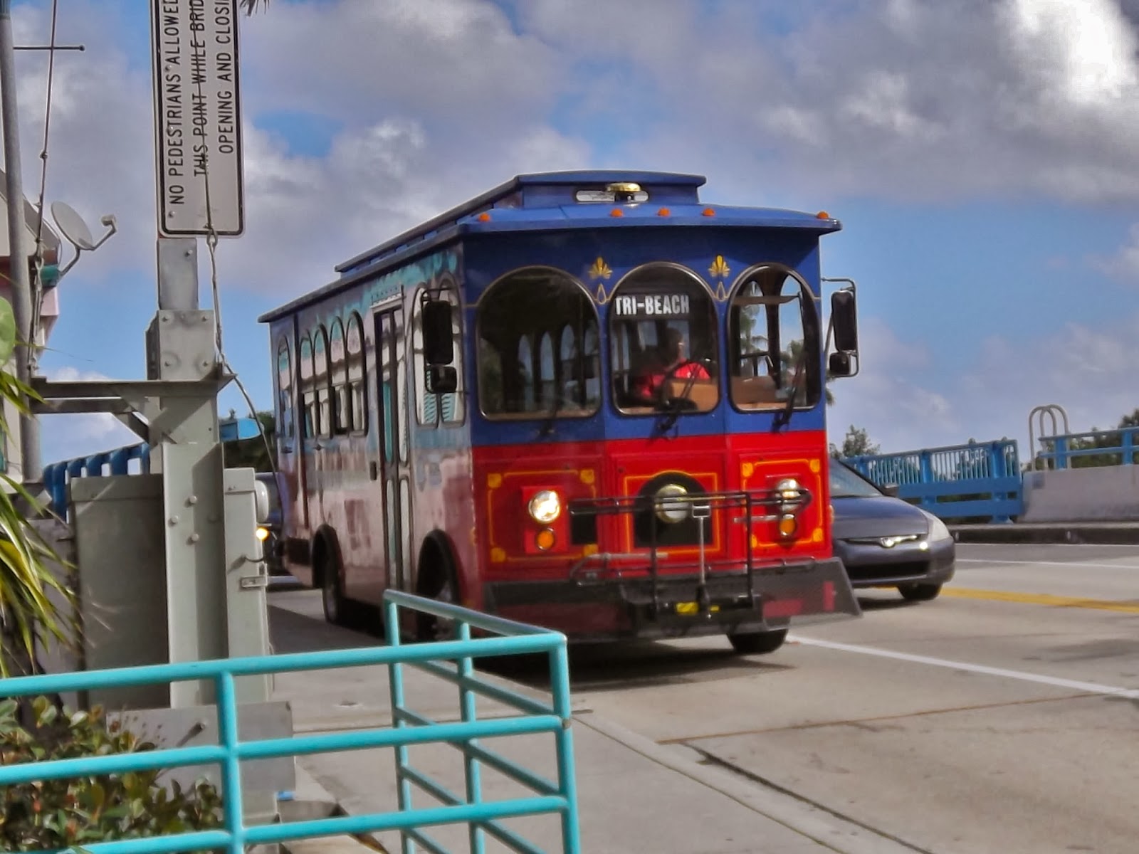
 |
| Not the exact bus we took, but I saw it on our walk. |
 |
| This is what a BCT bus stop looks like. |
 |
| A pretty bad picture, but I was excited to see the bus. |
Now, typical of not-quite-fully-modernized bus systems, the fares are strange, uneven amounts that you have to pay with exact change. In this case, it’s $1.75 per person – what are the chances of having three quarters in your wallet? As some people may say, “Ain’t nobody got time for that.” Luckily there were two of us, so it was a nice even fare of $3.50. As we were stepping into the bus, I tried to take a picture of the interior, but the camera was acting up and some guy was getting mad at me. What came out was a blurry mess:
 |
| Oh, this is the worst picture. |
The segment between the beach and the central bus terminal is actually only a small fraction of the entire route. It starts out north in Pompano Beach (which, incidentally, has a Tri-Rail station), heads down the A1A, turns onto Las Olas Boulevard (about where we got on), heads down to the Central Bus Terminal, and makes its way northwest to some mall called Sunshine Plaza. The whole route is over 20 miles, and that’s not even the longest one. One of the Palm Tran bus routes in West Palm Beach, the 40, is over 40 miles long!
The views from the ride were the same as described in the first paragraph of this post. The bus was reasonably crowded, with about 15 people in it (this route runs every 45 minutes on Sundays). I was excited to see that the buses had automatic stop announcements, though only at major areas. They also announce news about things like route changes. Interestingly, the announcements are first recited in English, then a Creole language. Something I liked was that they actually said what buses you can transfer to at each stop – here in Boston, all you get is the cryptic message of “Bus Connection.”
We got to the Central Bus Terminal in no time, and everyone cleared out (so much for Sunshine Plaza). The driver also got out, but it seems that the bus always lays over at the terminal for five minutes. Now our destination was the Tri-Rail station, and both the 22 and the 81 were at the terminal and were going to the station. My mother wanted to take the 81 because it left five minutes earlier, but I wanted to take the 22 because it was a newer bus model than the 11. I ended up winning the argument, and man, the bus was nice.
 |
| Sorry, 81. I will say this: that’s the most stylized “via” I’ve ever seen! |
 |
| Even the 22’s door is amazing! |
We found out upon getting on that the driver on the 11 had cheated us. It only costs 85 cents for students (random amount, but a discount is a discount)! We only had to pay $2.60! Luckily we spent the right amount of money for the 22. As we settled in, I realized I hadn’t even checked the Tri-Rail schedule to see when the next train was. Bad idea – the next train was in five minutes. Boy, did my mother get mad. We didn’t make it, obviously (it followed the same route as the FL1), and had to wait an hour for the next train. I was happy, though, that I got to try out the ingenious back door. Rather than shouting out “Back door!” to the driver, you can just push the yellow tape to open it up. Simply amazing.
 |
| A much better interior view. The bus had some other riders besides these, I was just one of the first people on. |
The 22, like the 11, goes much further than the section we took. It’s a little less extreme this time; it runs about 12 miles from the Central Bus Terminal to “Sawgrass Mills,” which is – what else? – a mall. It wasn’t too crowded, maybe about 10 people. One other person got off at the Tri-Rail and had to wait.
 |
| The 22 at the Tri-Rail station. |
The wait at the Tri-Rail station was really really boring. Looking back at it now, it didn’t take so long, but it felt like it took forever, especially since neither of us had books. Eventually, the train did come, and it was actually different from the one we took to Fort Lauderdale. It wasn’t drastic, but the seats were a little taller and thinner here. Evidently they were more comfortable, too, as I found myself falling asleep on the ride. It was much less crowded this time around, and probably set the example for what Sunday traffic usually looks like.
 |
| This was on the upper deck, of course. |
 |
| Our train leaving Delray Beach Station. You can see the vast expanse of nothingness ahead of the train. |
Once we got to Delray, it was only a short wait before a trolley came. I had wanted to take Palm Tran bus 80, but it drops you off fairly far away from where we were staying – it doesn’t even run on Sundays. I just wanted to take a Palm Tran bus to see what it was like, but all I have is this picture taken from the Tri-Rail:
 |
| This is Palm Tran bus 2, but you can’t really tell. |
The trolley was not a very pleasant ride. It started out alright – it was only us and another guy – but soon the driver asked the guy sitting in the back to close the window. He said he couldn’t do it. “Why don’t you just come back here and do it yourself?” were his exact words. Eventually the driver turned off of Atlantic Ave so he could stop the bus without disrupting traffic. He was actually going to go back there and close the window, but the guy managed to do it himself. As the driver navigated back to Atlantic Ave, the guy spent the rest of the ride shouting loudly about how he was able to close the window.
Okay, so this next one may feel a bit unnecessary, and it probably is. But I’m including it anyway, even though I’m not entirely sure of even what the route is. I’m talking about the Avis shuttle bus, a simple link between the Avis rental car parking lots and West Palm Beach Airport. I really don’t have that much to say about it. I just have a bunch of random tidbits:
- The driver helps you out with your luggage. There are also racks for them, which is nice.
- Buses run frequently, and they’re free.
- When going to the rental place, you tell the driver what space your car is parked in. You literally get dropped off right in front of it – when we were going there, he let the other two people on the bus get off, then literally drove a few feet and opened the doors again for us.
- I can’t remember the route, but it’s very twisty.
- When entering the rental car place, there are ominous “bus only” signs. If a car tries to go in, spikes cause significant tire damage.
- Overall, a convenient ride.
 |
| The bus at the airport. |
 |
| The interior – I think the seats are too comfy for a 5 minute ride. |
And finally, the Atlanta Plane Train. This one may feel unnecessary as I only took this airport shuttle two stops, and…well, it’s an airport shuttle. But considering that I went to the effort of taking pictures inside a really crowded train with a bunch of luggage, unable to hold on to anything with our plane departing in 20 minutes – well, I’m definitely gonna write about it. The Plane Train is an automatic (driver-less) people-mover serving the different terminals of Atlanta Airport (Hartsfield-Jackson). It’s the only way to get around the terminals, but luckily trains run every minute or even less. Of course, when you’re given a 20 minute layover between flights, it can be a little frustrating to have to use it, but I usually enjoy riding it.
 |
| It’s so crowded! |
Being the most used airport people-mover system (according to the Wikipedia page, anyway), the train was of course quite crowded. This made taking pictures very hard, considering I had to “train-surf” without falling into anyone. The above photo is the result. Anyway, the route is entirely underground, and it has eight stations in all. I said in my post about the Orlando Airport Shuttle that it uses the same rolling stock as the Atlanta Plane Train, but according to Wikipedia, it doesn’t. The Plane Train also features automatic announcements, which from 2006-2012 were apparently voiced by Susan Bennett, otherwise known as Siri (again, according to Wikipedia). I don’t know why they got rid of her, but I do know that the Plane Train is a useful, frequent, well-used shuttle in the world’s busiest airport.
 |
| It’s a blurry picture because we were scurrying up the escalator. |
 |
| These screens at each station tell you where the train is going. |
Service Change: South Florida, Part 1 – The Delray Beach Roundabout Trolley, The Tri-Rail, and the FL1 Shuttle
(This turned out to be published earlier than expected)
I really wanted to take some public transportation in Florida – as soon as we got there I began doing research on my mother’s iPad. My ultimate goal was to convince her to ride the Tri-Rail, the suburban rail system in south Florida. It runs from West Palm Beach in the north, all the way down to Miami via Fort Lauderdale. There’s a stop for Delray Beach, where we were staying, but it’s a bit out of the way. Taking the Tri-Rail was out of the question unless there was a way to get to the station.
And that’s where the Roundabout Trolley comes in. It’s a free (made sure to advertise that to my mother) shuttle between the Marriott, located by the beach, to the Tri-Rail station (although it’s supposedly divided into two routes, with Route 2 only going halfway from the Marriott, we only saw one Route 2 bus on our trip). It runs every half hour, with Route 2 supposedly running every 20 minutes. The trolley runs down Atlantic Ave, the main drag of Delray Beach, and then makes a turn at South Congress Ave to the Tri-Rail. We were staying at the other Marriott in Delray, located two blocks from the one on the beach. The trolley has a stop here, but I wanted to experience the whole route. It says on the website that you can flag it between stops, so I figured we could just flag one down if it came early while we were walking to the first one.
 |
| The trolley going down Atlantic Ave. |
As we were getting ready to go (on a Sunday), I had a frightening thought – it doesn’t start running until noon on Sundays. We asked the front desk to confirm this – one of the receptionists said it doesn’t, the other said it does. We figured we’d walk to the stop to see if it came, and we’d wait until noon if it didn’t. “There’s a trolley!” my mother shouted. “Where?” I replied. She said it was turning off of Atlantic Ave. Having seen them turn around by doing this, I got excited and figured it was coming back. We waited on the street corner for a few minutes, but nothing came. I got upset, figuring it wasn’t in service, when a trolley came out of the Marriott and headed back towards Atlantic Ave. I got into full flag-down mode, waving my arms like a loon and jumping up and down. The driver pointed ahead, signalling that he would stop a little further. I ran after it as it turned onto Atlantic Ave, the doors opened, and we were in.
 |
| The empty interior of the trolley. |
The trolley was very old-fashioned inside. There were charming (but uncomfortable) wooden benches to sit on, “stop request” wires connected to a bell, and a somewhat out-of-place wheelchair lift in the back. We started driving and we were soon over the Atlantic Ave drawbridge with a nice view. This is essentially downtown Delray Beach on the other side of the drawbridge, with shops and restaurants lining both sides of Atlantic Ave. Soon, the bus goes over a single railroad track (used for freight). After passing the “famous” 100 foot Christmas tree (which has some cute dioramas inside, including a small model rail track – although it looked pretty lame after Miniatur Wunderland) and the Cornell Museum (which features different exhibits every few months – they’re about Elvis and the ’60s and ’70s until February), we enter the rougher part of town (although there’s some cool public art approaching I-95).
 |
| The trolley on the drawbridge. |
We turn on South Congress Ave after crossing over the Tri-Rail tracks, and then we parallel them down to the station. After passing through some pointless stops, we pull into the station busway and all six of us get off (with us being the only tourists, surprisingly enough). Despite being a bit ticked off about the trolley actually starting much earlier than noon, I was happy that we made good time – a check of the Tri-Rail schedule we got at the hotel said that we had a half hour until the train got there. Soon, the trolley left the station with no one on it.
 |
| Pretty nice shelter. |
I was pretty happy with the trolley overall. Again, I didn’t like how they say it starts at noon when it actually doesn’t, and Route 2 seems to be all but nonexistent. I’m a sucker for free service, though, and I think the trolley’s a convenient way of getting around downtown Delray. In part 2 of this Service Change, I’ll talk about the ride back – it wasn’t pretty.
 |
| “Route 2” – ha! |
 |
| This is the busway used by local buses, Palm Tran. |
The Tri-Rail station (also served by Amtrak trains) was much better than most of our Commuter Rail stations, although it lacked character – it just felt really generic. We went into the station and entered the small ticket machine room. One of the two machines was out of order, so there was a small line. Now let me explain how the fares work, because it’s easy to pay more than you have to. On weekdays, the Tri-Rail uses a zone fare system, which would make it about $8.50 or so per person from Delray to Fort Lauderdale. On weekends, however, you can get an all-day pass for just five bucks! However, this isn’t apparent when using the ticket machines, and some people may just use the generic ticket option without knowing about the weekend deal. The Tri-Rail does seem to use an honor system (no one checked our tickets at all), but do pay your fare.
 |
| This is at Fort Lauderdale, but all the ticket machines look the same. They actually use the same dollar bill slots as our CharlieCard machines! |

 |
| Two views of the station. |
Soon, lights appeared in the distance. The train seemed to be 10 minutes early, although we actually had an outdated schedule! Luckily the change wasn’t too big. We got on, and found the train to be surprisingly crowded. Turns out there was a football game that day between the Miami Dolphins and the Patriots (woo!) in Fort Lauderdale, and many people decided to take the train. The train cars had the amazing combination of being double-decker and having forward facing seats!
 |
| The train approaching the station. |
 |
| It got more crowded as we went on. |
We originally sat on the left side of the train (on the top deck, of course), but then I remembered that the train follows I-95 on the left for most of the journey. This turned out not to be entirely true, but we moved to the right side of the train even if it meant sitting backwards. An announcer said the name of the next stop (no automatic announcements, but the speakers were clear), and we started to leave. The train ended up going pretty fast, but remained almost silent. The views leaving Delray run the gamut of bad stores, office buildings, gated communities, and the occasional shopping mall or industrial wasteland. There’s one particular section where the train goes through a deserted area with just low bushes, which was unexpected.
 |
| Nice view. |
We soon reached the first stop, Boca Raton. It had the exact same design as Delray Beach, except it was blue instead of red. And in fact, most Tri-Rail stations have the exact same design. After Boca, there were a lot more gated communities (including a trailer park!) and industrial wastelands than before. Occasionally, a massive hotel would pop up in the middle of nowhere, and I always wondered if anyone stayed there. There were some level crossings, often across unnecessarily wide roads. There were a few points where the train crossed over small creeks, which were always pretty cool. After a few stops, my mother had to use the bathroom. I gave her the camera and told her to take a picture. She came back with a disgusting description and this:
 |
| I didn’t even include the picture of the object in the corner of the bathroom – I’ll leave you at that. |
While she was in the bathroom, we came to Cypress Creek station, which is where things got a bit rowdy. People had steadily been coming into the train, but Cypress Creek was strangely very crowded. I was alone, as my mother was still in the bathroom and our across-the-table seatmate had left the train. Two women in sports jerseys sat in the seats across from me, while a large guy (also in a jersey) asked if the seat next to me was taken. I figure it should’ve been obvious, as my mother had left her purse there, but I said “Yeah, my mom’s sitting there.” This resulted in an “Ooooh” from many of the people sitting near me.
One of the many intelligent civilians riding was totally shirtless. One of the women across from me said “No shirt, no service!” to him as a joke. She then proceeded to throw a beer can at some guy behind her, clearly breaking the “no alcoholic beverages” rule. After my mom got back, she asked the people across from us what station they got on at. Seemingly unable to comprehend the question, they both said they didn’t know. One had the bright idea of looking at her ticket and said, “Oh, Cypress Creek, I guess.” Brilliant.
We soon arrived at Fort Lauderdale Station, and got off the train. This station actually looked exactly the same as Delray, even the same color. Noticing our train leaving, I told my mother, “Be right back!” and ran up the stairs to the pedestrian walkway. I wanted to get a picture of the train leaving from above. The picture was made even better with another train approaching the station on the other side.
 |
| I love this! |
 |
| The train on the other side leaving the station, this time from the platform. |
We wanted to take the 9, 22, or 81 Fort Lauderdale bus routes (called Broward County Transit), all of which serve the Tri-Rail station and go to the downtown bus terminal. As we left the station and went into the busway, however, there was a little shuttle bus waiting. My mother asked if it were going to the bus terminal, and the driver said “yes.” We got on the shuttle, although I made my mother promise we’d take a BCT bus back. Turned out the shuttle was free, and although I’m “a sucker for free service,” I wanted to see what the regular buses in Fort Lauderdale were like.
 |
| Not the most official-looking bus. |
 |
| Not the luckiest bus number… |
The bus felt a bit like the Kendall/MIT shuttle (I forgot to check for reclining seats, though!), both in terms of design, and the low ridership. One thing that was different, however, was the smell – it was absolutely disgusting in that bus. We drove out of the Tri-Rail station and turned onto West Broward Boulevard (say that five times fast!) – it’s the same route that the regular BCT buses take. We crossed over I-95, and this seemed like a fairly rough part of town, without the public art. We crossed over a small river with a lot of boats with the skyline getting ever closer. I was actually surprised to see all the buildings; for some reason, I was expecting Fort Lauderdale to be more like Delray. And these looked like legitimate office buildings, too, not just high-rise condos.
It still wasn’t a very nice neighborhood as the bus pulled over outside of the terminal (it didn’t go in), but the buildings were much closer now. And the bus terminal seemed pretty nice, again a lot bigger than I expected. It was, of course, an absolute pain to navigate, but there was a relatively helpful map at the front of the station. Not something you can consult when walking around it, though. It was basically split up into four sections, with a big crosswalk running through the middle. Something I really liked was that they had Walk/Don’t Walk signs. I think it’s pretty obvious when a bus is crossing over, but it was still a nice touch. Here are the pictures I took here, and this post will be continued…in part 2.
 |
| I love that walk sign! |
 |
| The bus terminal, with some pigeons and the 31 bus (I didn’t take it, but it just got in the picture). |
 |
| These weird, somewhat creepy signs are dotted around the terminal. |
 |
| The exit, with the supposedly disgusting bathrooms to the right (according to my mother, they were full of anti-Obama graffiti art). |
 |
| The very complicated system map. You can see the map of the terminal in the bottom left, as well. |
Don’t Expect a Post For a While
I was nearly done with part one of my Florida post – suddenly, Blogger glitched. I pressed SAVE and SAVED it, and then reloaded the page. When it loaded up, I had LOST EVERYTHING I WAS WORKING ON FOR THE WHOLE DAY. Don’t expect a post for a while.
Sorry
I’m back from Florida, but I’m late with my post as usual. I’m not making any promises for dates, as Service Changes take a while to write. Yes – I ended up taking a lot of transit in Florida, and a lot more than I expected. Look forward to that in the coming days, at some point.
I Won’t Be Posting For a Few Days
Yes, yes, I know I haven’t done a post in a few days, anyway. Nonetheless, I’m going to Florida and will be there until Sunday. Unfortunately, I’m not sure if I’ll be able to take a bus in Delray Beach, but we’ll see. Don’t expect a post until probably Tuesday, anyway.
Random Photos: Some Truly Ancient Bus Schedules
I was at Malden Center station waiting for the bus up to Reading (for fun, obviously), so I was looking at the bus schedules in the lobby. They have a big schedule rack here, designed to hold schedules for every MBTA bus. It was looking pretty barren on the day I went, with current schedules only for the 106, for some reason. They had plenty of other schedules, but they were a) covered by plastic panels and b) very out of date. I took pictures of the three oldest:
 |
| This is from early 1993 – 20 years ago! |
 |
| This one’s from early 1996. |
 |
| This seems to be a special schedule about the wheelchair lift capabilities of the “new” RTS fleet. |
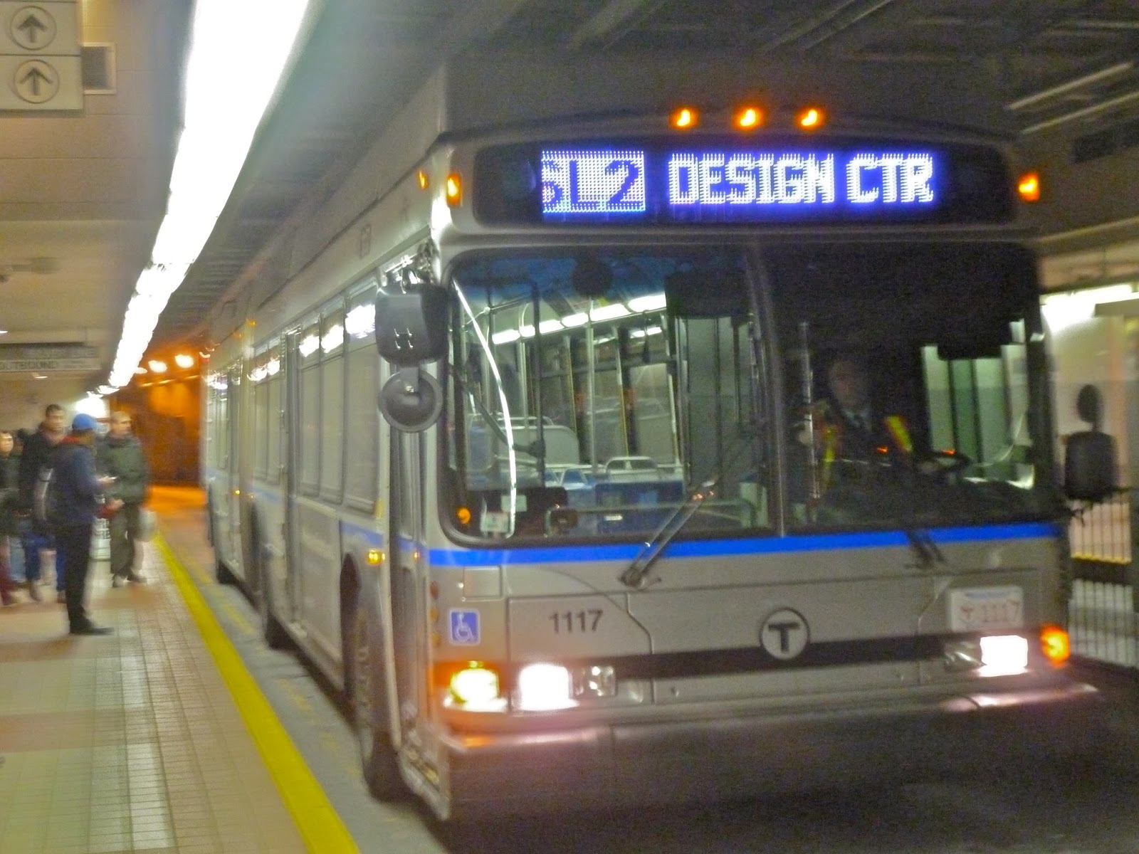
SL2 (Design Center – South Station via Waterfront)
The last line. This was the last line I had to take to be able to say that I’ve taken every line on the MBTA. The SL2 to the Design Center ended up being a very interesting ride, although also a very useless one… I got excited right off the bat, as the bus turned out to be one of the “purple destination board” buses – these are some Silver Line buses that have purple destination boards. It’s nothing really special, but it was nice to ride one. The SL2 starts out in the underground transitway along with the SL1. There were only about six or seven people on the bus leaving South Station. No one got on or off at Courthouse, obviously, and one person got on at World Trade Center. When we got to Silver Line Way, the electric to diesel transition took – literally – a few seconds. I was actually dumbfounded! They never make the conversion this quickly! Everyone got off the bus at the next stop, with only me left.
| Hello? Anybody? |
Shortly after Silver Line way, it gets very industrial. The bus turns onto Northern Ave (travelling with the 4 at this point) and enters the Boston Marine Industrial Park. Along here there are some small factories, as well as a surprisingly large parking garage. It then turns onto Tide Street and again onto Drydock Ave (going by an insanely pointless public toilet). The bus turns onto Design Center Place, right in front of the Design Center, and then turns again onto Black Falcon Ave (at least, I think it is – it appears as an unnamed street on Google Maps). The street makes a U-shape as the bus goes by parking lots and more industrial buildings, and then it turns back into Drydock Ave.
The bus got to the official “Design Center” stop, and the driver turned it off. He started to walk out, and then he looked back to see he had a passenger in the back of the bus. “Where are you going?” He shouted to me in a very angry voice. I decided to tell the truth and said I was just taking it for fun. “Oh, okay.” He said. “I leave in four minutes.” While the driver was outside smoking, I looked around at the scenery: a random parking lot, the Design Center, and the deserted cruise ship terminal.
The driver soon got back in the bus and we set off down Drydock Ave. On the left are even more random industrial buildings, and on the right is the massively long Design Center building – divided into separate buildings, apparently, as the stop names at this point are simply along the lines of “Building 55.” Drydock Ave soon turns to the right, and the bus goes by some impressive tanks. It then turns onto “unnamed street,” which runs only a few feet from the water with only a tiny fence in between. There was a lovely (kind of) view from here of some massive cranes. It’s only for a few seconds, however, as the bus turns onto another unnamed road inland.
 |
| This was taken a little before the bus turned onto the road by the water, but you can see how small that fence is. |
There’s actually a stop over here, and two people got on at it. It then goes onto Black Falcon Ave, a deserted, industrial road between the Design Center and the cruise terminal. There are no stops on this sequence until the bus turns back in front of the Design Center, and then makes its way back onto Northern Ave. One of the landmarks here that I didn’t notice before is the “Harpoon Brewery.” It looked fairly impressive, actually.
 |
| I mean, look at those massive tanks! |
It was charted territory from then, but at Silver Line Way, there was yet another five-second conversion! Simply crazy! After that, it was back into the tunnel with only a few people on the bus. World Trade Center and Courthouse were quiet as usual, and everyone got off at South Station. Having failed to get a decent picture of the bus, I actually crossed over to the other side of the station to get it going back to the Design Center. It was a pretty good picture, although I swear the driver looked at me funny.
 |
| I just realized why the conversions were made so quickly: it’s the purple headlights. They’re magic. |
Route: SL2 (Design Center – South Station via Waterfront)
Ridership: Like I said before, not many people were on the bus on a Saturday. I’m sure during rush hour, it’s full of people who go to work in the industrial area, and I’ll bet it gets its fare share of tourists coming from cruise ships (because nothing says “welcome to Boston” like a disgusting industrial area). On Saturdays – and presumably Sundays – this bus is empty.
Pros: It runs very frequently, however this isn’t necessarily a good thing…
Cons: Now I know I’m being a massive hypocrite here. I know I often rant about buses not running frequently enough. However, those buses had more ridership than the SL2. Therefore, I don’t see why the SL2 needs to run every 15 minutes on weekends and nights. Instead, run most of the buses to the airport (because they’re always packed), and maybe every half hour or even hour, a bus could go around the Design Center loop. There’s just no reason for so many buses to go to such a deserted area, at least on weekends. And it’s not even that long of a walk to Silver Line Way – just 10 minutes! Seems useless to even have this bus running. Nonetheless, on weekdays the current schedule can be operated, as I’m sure it gets decent ridership during rush hour.
Nearby and Noteworthy: Industry. Big long buildings. Parking lots. Cruise ships. Beer. That’s about it for this route.
Final Verdict: 3/10
Seems like the SL2 is the first “bad bus” featured on the blog! But really, it just feels so unnecessary. There is simply no need for it to run on weekends, or even exist, in my opinion. I’d imagine the sort of people who work down there can handle a 10 minute walk. The only thing keeping this from having a lower score is the fact that although it’s completely unnecessary, the bus does run quite frequently, which is nice. But pointless.
Latest MBTA News: Service Updates
The MBTA is extending late-night service! In Spring 2014, subway trains and Key Bus Routes will run until 3 A.M. Also, the MBTA broke a ridership record in October, likely due to the World Series. Finally, from December 9-13, you can help children or teens in need by donating toys to Fill a Bus With Gifts. More information can be found here, although it’s a PDF.
Random Photos: I Prefer Medium Rare
What we have here is a leak in the ceiling at South Station with no bucket to collect the water, so it’s just falling on the floor. They put down a caution sign, luckily, and made sure to put a traffic cone in it for extra emphasis. They were a bit short on caution signs that day, however, so they had to use the one with “Raw” written on it. I had to showcase the amount of attention this situation was getting. Good job, MBTA!
 |
| Simply amazing. |
Breaking the Record: An Account of the Biggest MBTA Adventure Ever
As most of you know, Adham Fisher and I broke the record for fastest time travelling through every MBTA station. This account, however, will most likely not be one of my best works. It may even be downright boring. The thing is, I can’t actually disclose the route in case someone uses it to break our record (if you want to break it, do it fairly). Sure, everyone knows we ended at Ashmont and Mattapan, since that’s where all the reporters were, but I’m not revealing anything else. Therefore, this account will be simply in line order.
Preliminaries: My father was nice enough to drive us to the first station, at the lovely hour of 6 in the morning. Right after he left us, we found out that Adham’s credit card didn’t work on CharlieCard machines, so we had to quickly find an ATM before starting.
Red (Main trunk portion, from Alewife to JFK/UMASS): It was at Davis that we met up with Steven Beaucher, the owner of WardMaps. He was with us for much of the journey, but not the whole thing. Other than that, there wasn’t much of note on this stretch (although Adham really liked the view from the Longfellow bridge by Charles/MGH. If you haven’t been over there before, I consider it the best view on the system).
Red (Braintree Branch): This was when we were starting to hear of the camera crews at Ashmont. Steven had been Tweeting about what we were doing, and Adham was making calls to lots of different journalists. A Commuter Rail train would’ve made the trip back to JFK/UMASS a lot faster, but our train was a few minutes late.
Red (Ashmont Branch): We were on the home stretch by this point. When we got to Ashmont, we were very surprised to see an entire film crew. Over the course of the the trip, not many people had actually asked us what we were doing. There were only about three or four people who did, including a guy who pointed at an article in the Metro and asked Adham, “Are you this guy?” This made the crew all the more surprising. Unfortunately, we still had the Mattapan High Speed Line to do, but everyone was taking pictures of Adham and interviewing us. The driver was actually getting mad at us, as the train was supposed to leave. We had to move to the station lobby. After missing two trolleys, we finally managed to get everyone onto one and head off to Mattapan.
Red (Mattapan High Speed Line): This portion of the trip was mostly spent doing more interviews. I did point out when the trolley was going through the graveyard, which is a very unique part of the line. When we got to Mattapan, Adham jumped out of the train and let out a moan when reading the stopwatch: 8 hours, 5 minutes, and 16 seconds. This was an hour and a half later than our original planned time. We were all satisfied, nonetheless, and I at least had had a great deal of fun that day.
Orange (South): Nothing of note, except for a long run going by some of the most infamous housing projects in Boston. They seemed fine when we went through.
Orange (North): We were planning to take a bus from Sullivan, but we were very behind and had missed it by a long shot. We were scurrying around trying to find schedules, and then chasing after buses that were only laying over for 20 minutes. We ended up getting on the right one, but we had wasted a lot of time running around that stupid busway.
Blue: At Bowdoin (BOW-doin, as Adham called it), we almost got to go around that really tight loop, but the doors closed before we could get in. Other than that, nothing much happened on this line. It was Adham’s favorite, though – he said he liked the “spaceship look” of the trains, as well as the stations, particularly Bowdoin and Maverick.
Green (Central Subway):
Adham [at Kenmore]: Wait, why is that train on the other track going our direction? [train on other track leaves] No! [another train on other track arrives] Great, what’s this?
Miles: We’re a B, the train that just left was a D, and that train is a C.
Adham: I give up!
Green (B Branch): This was, in my opinion, the deal breaker for the trip. The B was bunching, first of all. There were two trains in a row, then shortly behind was another two trains. We were the train ahead in the second pair, and it was packed. So much, in fact, that the driver was kicking people off, saying “there’s a train right behind us.” Adham also lost his gloves in the madness. To top it off, it was going insanely slow, a hallmark of the B.
Green (C Branch): The C went pretty well. The train wasn’t that crowded and it moved quickly down Beacon Street. Nothing much of note happened here, except for the longest, steepest, and overall worst run on the whole trip.
Green (D Branch): The D was quite fast, as usual. There were supposedly delays, although none that we could see. However, Adham dropped his camera right when we were about to get off. Somehow the off button fell out, but we had to leave it behind when the doors opened. The camera still worked, luckily.
Green (E Branch): The E was surprisingly quick. We unfortunately just missed one when we got to the station, though, and had to wait another 10 minutes or so. I was expecting the portion where it runs with traffic to be miserable, but it wasn’t that bad.
 |
| A few fans and me. |
 |
| Adham, me, and another fan. |
 |
| Steven and me – I look really weird in this photo. |
 |
| And finally, Adham and me. |
UPDATE: I can’t believe I made it through this entire post without a “weird hat” reference! Oops, too late.
WE DID ITTTTTTTTTT!
Adham Fisher and I have just broken the record for fastest time travelling through every MBTA station. We also had a lot of help from Steven Beaucher (co-owner of WardMaps, the best store ever). Our time was 8 hours, 5 minutes, and 16 seconds, and hour and a half later than our original goal of six and a half hours. I’m not allowed to disclose the route we took, but I’ll have an account of the ultimate MBTA adventure at some point. In addition, I see I’ve gotten a lot of new readers from all the news coverage that happened today. I suggest reading the “Suggested Reading” list published a few days ago.
 |
| Hopefully this will satisfy you readers for now. |