Click here for Part 1, click here for Part 2.
Our final part of the Scotland series takes us to the northern tip of Great Britain…and beyond. But we first begin in Inverness, the largest city in the Highlands (with slightly under 47,000 residents) and one with a pretty decent bus system.

Like all of the bus systems we’ll be covering today, Inverness’s local bus operation is run by Stagecoach. Their service is comprehensive, covering much of the city with at least half-hourly routes and a few fifteen-minute corridors. Of course, some of their services are maddeningly confusing, but we’ll get to that.

Inverness has a dense downtown with narrow streets, so Stagecoach is limited in where it can go. A proper bus terminal in the industrial area near the train station serves longer-distance routes, but local ones stop in the thick of downtown at two stops on two parallel one-way streets. They offer little more than some shelter and a departure board each, but there’s not a ton that can be done in such a confined area.

Stagecoach is a private company (as is the custom in the UK), so their rural services are often priced really high to cover for the higher expense of running those routes. So it was great to do one of their urban services, where it was just £3.70 for a day pass! My dad and I had gotten up early to just do a short round trip to experience the bus system before our train departure later, but even then, the day pass is still cheaper than buying two single tickets.

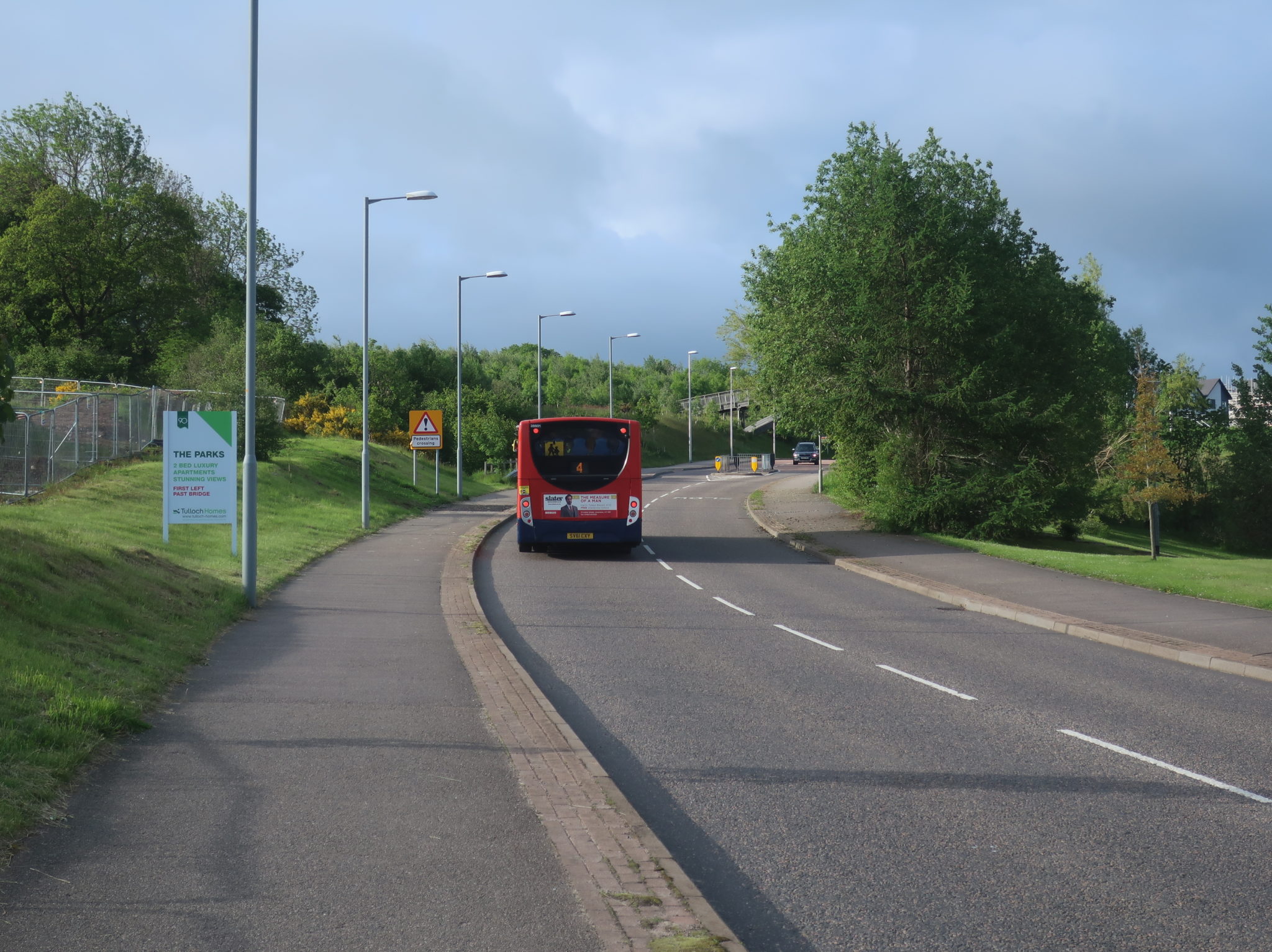
I had seen double-deckers on the route 4 previously, so that’s what we took. Alas, the bus was a single, but oh well – the 4 is still an interesting route that runs to a lot of important transfer points in the Inverness system. We had a jaunt through the town center before climbing up the hill to the south of it. It was still dense outside of downtown, but there was definitely a suburban feeling to the neighborhood.

We eventually deviated to the Raigmore Hospital, which is served by a bunch of other routes too. But there was a problem: we were supposed to leave at 7:18, but we arrived at 7:14. And it was just a little bus loop with no passing lanes. And we were stuck in a line of buses, but there was one behind us that actually had to leave. What ended up happening was a bizarre looparound where this parade of vehicles went out onto the main road and back into the stop to allow the bus behind us to leave on time. Unless it just happened to be a light day, they might want to change some schedules around…

Right after the hospital, there was another longer deviation to serve the UHI (University of the Highlands and Islands) Inverness campus. It was across a highway and totally surrounded by fields. We returned to the main route after that, running along a shopping center before entering a prefab residential area. My dad and I left the bus at Wester Inshes to make the short walk to the then-terminus of the 1B (it’s since been extended).
The 1 is one of the most frequent, but also “maddeningly confusing” corridors on the system. It has service every 15 minutes for most of the day, but only on the trunk: the route then splits up into the 1, the 1A, the 1B, and the once-a-day 1U. There was even a 1C with limited service when we were here, but I guess it’s been eliminated (good!). At any rate, you can imagine that with so many branches, the frequencies aren’t great – the 1B is every hour.

It also apparently uses electric buses, which was a real treat! But as for the route itself, it’s kind of a mess. All of the 1 branches are a bit meandering, but the 1B really takes it to the next level. We had to do a loopy residential deviation two blocks from where we would end up over ten minutes later after more winding around! Granted, it did get riders (most of whom knew each other), and the small bus had maybe fifteen commuters on it by the time we got into the city.

And now, for a complete change of pace, it was time to take the train up to Thurso, the northernmost town in Great Britain. The service runs four times a day. The trunk portion to Dingwall was territory already covered on our train from Kyle in Part 2, so I’ll start from there.

We were still in an area with plenty of human influence north of Dingwall, as the line hugged Cromarty Firth running past farmland. The stops were all in proper towns with dense houses and high streets, particularly Invergordon. The one exception on this section was Fearn, which was surrounded by fields, but there would be far more of that later on!

It started to get more rugged as we came along Dornoch Firth for a bit. The towns that got stations became smaller and smaller, first with Ardgay, then with Culrain and Invershin – those stations are on opposite sides of the Kyle of Sutherland, and it takes all of one minute to get between them. A fare between the two is just £1.60.

Okay, now we were in the middle of nowhere. With a few exceptions in the form of farmland, the hilly land was mostly untouched. Lairg Station serves a town of the same name, but it’s so far from it that we had no idea there was anything nearby. Rogart was a really tiny village. Golspie was in a sizeable town, though, while the next stop, the seasonal Dunrobin Castle, serves a seaside castle of the same name.

Now that we were running along the ocean, the land felt a lot more inhabited. The non-water side was all farmland, and the two stops along here were both in decently-sized towns. Right after Helmsdale, though, the line curved inland to follow the river named after the town. This section was woodsy for a while before breaking out into open fields.


The very northern tip of the line has a Kingston/Plymouth situation, except it’s one that makes a lot more sense and is done a lot better. Thurso and Wick are the two major towns up here in the Far North, but they’re almost 20 miles apart. So, trains reach a stop called Georgemas Junction, reverse to Thurso, reverse back and head down to Wick, and then do the process again for the return trip. While this sounds miserable, we’re dealing with zippy trains that can turn around in three minutes – it is annoying if you’re starting or ending in Wick, but this is probably the most efficient way to serve the two places, especially in such a remote area.


Thurso has a cute little shed of a station on the southern edge of town. There’s not much to it, but it has a sheltered part of the platform (with bathrooms!) and an indoor waiting room. An LED departure board is even there to announce arrivals for the very limited service here. And you know, for the northernmost station on National Rail, that’s a pretty good set of amenities.


The Far North Line may not have been a total slam dunk like the other two long-distance lines we had done, but it still had some awesome scenery. The seaside sections in particular were fantastic – I remember running past a beach full of seals lounging and swimming in the water. And of course, there were plenty of classic Scottish fields and farms, too!

Alright, time for another trip on Stagecoach! This section of it covers the Caithness region of Scotland, which is essentially Thurso, Wick, and all the areas in between. Most of its routes do have the “school bus that happens to be open to the public” vibe that many Stagecoach rural services have, but there is the 82, an hourly route between Thurso and Wick that seems a little more legit.

But we weren’t using the 82 – we were going to the Dunnet Bay Distillery, which is primarily covered by the 80. And conveniently, the 80 happens to be one of the few Stagecoach Caithness routes covered by the Spirit of Scotland pass! It’s more supposed to be used to get to John O’ Groats and its ferry terminal, but hey, you can use the pass to go anywhere along the route.

The 80 has a really weird schedule. It runs six trips between 12:35 and the last run at 5:35 PM, which would make you think it has an hourly service. But no…it’s three trips that each use two buses running alongside each other. For the 12:35 and 3:35 (the one we were on) trips, one of them short-turns at Dunnet, but it still makes no sense! What was even stranger was the difference in buses here: we were in a minibus, and the other bus doing a trip (and indeed, the one doing the short-turn) was a coach bus.

This route was less ultra-rural than the ones on the Isle of Skye had been. We left the urbanized part of Thurso quickly, but even as we entered open fields, there was a decent amount of settlement within them. We even ran through a small but urbanized settlement in the form of Castletown. The road ran along a huge but hidden beach before entering the small village of Dunnet.


As it turns out, you need to reserve in advance to get into the distillery. Which we hadn’t done. Soooooo, we had about 50 minutes in Dunnet before a bus coming back to Thurso would show up (and what do you know, there’s another one scheduled to show up fifteen minutes after it). We spent some time on the gorgeous beach and then returned to the road to flag down the approaching coach bus, which almost missed us because it was going so quickly.


We were heading to Wick the next day, but we would be going via Orkney, an island north of the mainland. Our original plan was to do a guided tour that would start at John O’ Groats, but it was sold out, so we decided we would see as much as we could with public transit instead. There is a bus between Thurso and the closest ferry terminal, Scrabster, but it runs there at random times that don’t actually connect with the three ferry trips a day. Rather than do the 42-minute walk with our giant bags, we decided to take a cab.

The Spirit of Scotland pass came in handy again here: it offers a 20% discount on Northlink Ferry tickets, which are already less than £20 for the 90-minute crossing. The terminal had a small lobby where you buy tickets, but then there’s an airport-like “Departure Lounge” once you have them. A long walkway leads down to the boat.

Okay…Northlink runs services to Orkney both on the short run from Scrabster and on an overnight cruise ship-like service from Aberdeen. Something I didn’t realize was that they use the same boats for both! So yeah…this may have been the best boat experience I’ve ever had.


Orkney’s bus system is run by, surprise surprise, Stagecoach. Of the rural Stagecoach systems we’ve dealt with thus far, though, the Orkney one is surprisingly the best. Many of its routes run consistently all day, including two that run half-hourly: the 4 from the main town, Kirkwall, to its airport, and the X1, a super-route across the entire island.


We were taking a very special bus, though: the T11 is a once-a-day route that runs only during the summer. It starts and ends in Kirkwall, running via Stromness and serving two out of the island’s three main tourist attractions, giving enough time at each one to experience them. The ticket to ride it is £15, which is really cheap compared to tours that see most of the same things, and the ticket works as a day pass on any other Orkney route.

As it turns out, though, that £15 ticket only applies if you’re starting and ending your trip at Kirkwall! We were going from Stromness to Kirkwall, meaning that you only have to pay the £3.45 single ticket. That is a fantastic exploit if I ever saw one!

Bizarrely, the T11 uses an open-top bus. That seems ill-advised in rainy Scotland, and indeed, 75% of the upper deck was essentially inaccessible on this trip. We headed out from Stromness and the town ended really quickly, leaving us on a double-decker bus in the middle of open farmland – that was cool. We eventually ended up at Skara Brae, the most complete neolithic village in Europe. They give you an hour and 25 minutes here, and you’re allowed to keep your stuff on the bus. The village was amazing, too!


From Skara Brae, it was a 15-minute jaunt through farmland to get to the Ring of Brodgar, a neolithic circle of giant stones. We got half an hour here, and as we headed down the road after, some passengers asked the driver if we could stop at the Standing Stones of Stenness, too. She obliged, and we got ten minutes at a really cool set of stones that are a lot more accessible and rugged than the ones at Brodgar. It was about 20 minutes to Kirkwall from there. The T11 is a fantastic service for tourists, and even if you spend the £15 pounds to do it from Kirkwall, it is totally worth it (but that Stromness exploit was totally unexpected and awesome).


Okay, it takes a bunch of context to explain just how amazing our trip back ended up being. Like I mentioned before, we were heading to Wick, which meant that the better ferry to take would be John O’ Groats Ferries from Burwick to John O’ Groats. It’s £21 for a crossing, but for £3 extra, you can take a shuttle from Kirkwall to Burwick. Also important is the fact that the T11 had let us see two out of three main tourist attractions, but not the Italian Chapel, a chapel constructed by Italian POWs using makeshift materials during World War II. Finally, it’s important to note that John O’ Groats Ferries happens to run the tour that we would’ve taken had it not been sold out.

So as it turns out, the shuttle bus is the same bus used on the tour – and the thing was packed with people who were on it. This meant, for one, that we got to listen to the fantastic narration of the tour guide as we drove through the island’s open fields. And two, the guide made an announcement: “We’ve got one more stop before the ferry, and that’s the Italian Chapel.” WHAT!!


So we ended up getting to see the Italian Chapel after all, and it was absolutely beautiful. And once again, this ended up being an unintentional exploit that let us see something for way cheaper than it would’ve been otherwise. While the tour is £66, we were able to see essentially the same things for just £42. So if you ever want a cheap, self-guided tour of Orkney, this is the way to do it!

Annoyingly, despite being more expensive (and a shorter trip) than Northlink Ferries, John O’ Groats Ferries uses a much smaller and simpler boat. Granted, we had been totally spoiled by the Northlink boat, but this thing was the same kind of ferry you would get in, say, Boston. It had a nice upper deck, though, and luckily the trip back was clear of rain!


And now we’re back to Stagecoach Caithness territory for a trip on the 77 from John O’ Groats to Wick, which happened to be covered by our passes. One other person was waiting at our bus shelter, and a couple of people were already on board the bus, which had come from Gills Bay (another ferry to Orkney departs from there). Once again, this was a coach bus that felt way too overblown for the ridership.


The ride was half an hour of just speeding along the ocean, with lots of fields, cows, and mysterious structures to see. An airport marked the beginning of Wick’s boundary, and soon after that, we got to deviate into a Tesco supermarket. It was mostly residential from there to Saint Fergus Road, where the main bus stop and last stop of the 77 is located: it was just a shelter, but it actually had a real-time screen inside!


The next day we were embarking on the two-seat, 8+ hour ride back to Edinburgh. Wick’s train station was near-identical to Thurso’s, except less charming (although we didn’t have time to see the waiting room – maybe it’s mind-blowing). The ride back to Inverness was the same as the way up, minus the bit where we had to deviate to Thurso thanks to the weird forked setup up here.


The service from Inverness to Edinburgh is more frequent than a lot of the other ones we’ve done, running every hour or two throughout the day. There was a tiny bit of suburban scenery after Inverness, but as usual, the middle of nowhere started quickly. This line has very few stops, though, so even some towns that seemed to deserve them we just flew through. Or flew over, in one case: Tomatin featured a gorgeous viaduct over the River Findhorn.

We ran parallel to the A9 for a while, soon making our first stop at the very tourist-oriented village of Carrbridge. The next stop was also in a touristy town, Aviemore, and lush valley scenery led us to the following stop at Kingussie. The stop at Newtonmore came soon after.


Our train skipped the station at Dalwhinnie, a very small village, and we got some pure mountains up to our next stop at the village of Blair Atholl. South of there, it was mostly farmland, with fairly regular stops at sizeable towns. And eventually, we got one in a proper city: Perth, where lots of people got on at the huge station.


A long 35-minute nonstop section through farmland (with lots of little villages in between) separated Perth and our next station, Markinch. By the time we got to the stop after, in the giant town of Kirkcaldy, the track began running along the Firth of Forth. This area was very populated, with a ton of towns dotting the shoreline (across which Edinburgh can be seen), but half-hourly local trains take care of most of the stops along here. We only called at Inverkeithing, where the other main line north of Edinburgh joins on.


Now, I knew what was coming after Inverkeithing, and I was excited. The Forth Bridge is one of the most incredible engineering accomplishments in history: the 1700-foot cantilever bridge was built in 1890, and it’s a marvel. Not only does it look distinctive and majestic, but it was the longest cantilever bridge when it was built, and still remains the second-longest. And the view from the train was magnificent.


It was about half an hour to Edinburgh after crossing the bridge, with the scenery consisting mostly of the city’s suburbs. We stopped at the three main stations: Edinburgh Gateway, near the airport; Edinburgh Haymarket, in the western part of town; and the main station, Edinburgh Waverley. And with that, this Scotland adventure is complete. Thanks for following along; I had a blast recounting it, and I hope you enjoyed as well!
Awesome post! Love the pictures. NO Shetland?
Ahhh, I would LOVE to go to Shetland. We kept saying if we ever go back, we would do Shetland – it looks incredible. And of course, if we ever ended up there, a visit to “Bobby’s Bus Shelter” on Unst would be a must! http://www.unstbusshelter.shetland.co.uk/